SGURR MOR - GM/NS-001 on 17th September 2016
GM/NS-001-10 on 40-20-60m QRO
SGURR MOR 1,110m
The sole 10 pointer in the Northern Scotland SOTA region
Staying at the Gairloch Hotel 9th to 19th September 2016.
Four activations: GM/WS-043; GM/WS-028; GM/WS-098 & GM/NS-001.
G(M)4YSS Unaccompanied.
SSEG Club-call GS0OOO/P & GM4YSS/P (the latter used for database).
All times BST (UTC plus 1hr, UOS)
For info - G4YSS GM/NS-001 Report 2005:
RADIO EQUIPMENT:
HF-QRO:
FT817ND HF/VHF/UHF 5W Transceiver without internal batteries.
MX-P50M, 50 Watt HF Linear Amplifier.
Link dipole for 80-60-40-(30)-20m Bands
Home-brew loading coils for 160m (not used)
Four section x 5m home-brew CFC mast with 1m end sticks
Unitone 'D’ shape ear-cup headphones.
VHF QRP:
Baofeng UV-5R 2m/ 70cm, 5W-VHFM H/H (recent purchase)
J-Pole for 2m-FM
Batteries:
One 5Ah Li-Po (Part discharged). No spare carried.
GPS:
Garmin GEKO-301
Pack weight:
10 kg (22 pounds) inc. one litre of fluids and a Pound Shop collapsible umbrella.
Also carried my fleece which would normally be worn in cooler conditions.
250ml of above fluids left at weir for use on return.
Introduction:
For general introduction, see GM/WS-043 Liathach report.
So far the activations of the Gairloch holiday 2016 (and there are only three) had been GM/WS ones. These were all new to me and all located in Torridon. While pondering on the likelihood of further reasonable weather and scratching my head as to what to do next, I suddenly thought about Sgurr Mor GM/NS-001. What a good way to finish - on a ten pointer.
On the plus side NS1 is no stranger to me as I’d put it on HF in 2005. Most of the paths, the ones I could locate at the time that is, were marked then and reloaded into my spare GPS a week before this holiday. At least I would have the confidence of knowing the way; well most of it at any rate.
On the down side this mountain is further to drive from Gairloch than Torridon; about an hour instead of 40 minutes. Also it is bigger than any activated so far in the week and a longer walk in. However, there was the advantage that I would be walking from an altitude of 277 metres instead of 20 to 40m for the Torridon activations. Nonetheless, since it is significantly further it would probably require more time.
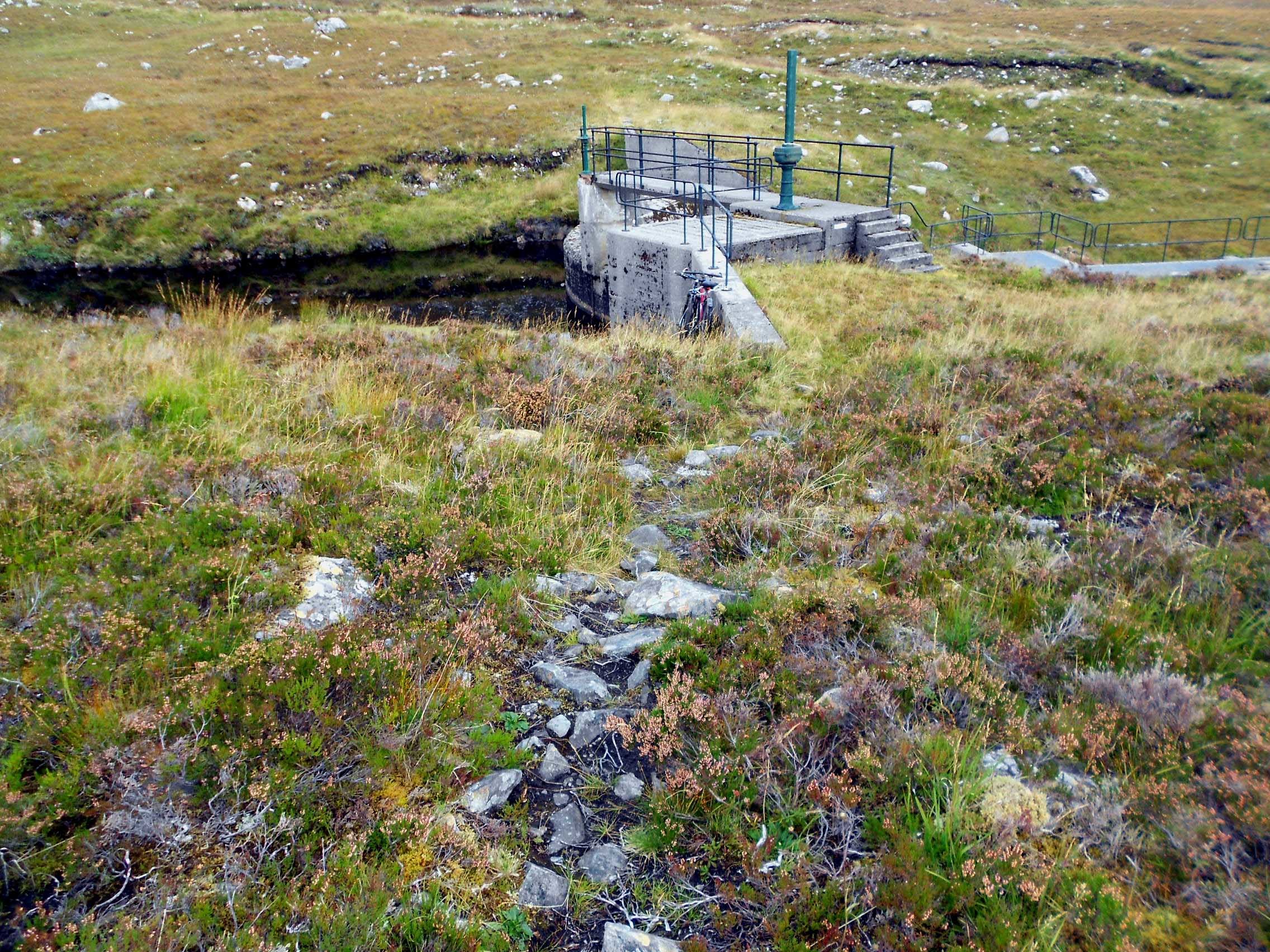
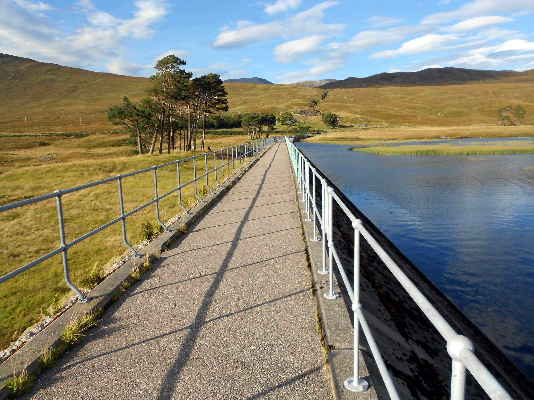
In 2005 I had set off from the A835 at a point NH 2374 7589 in order to access the path which runs alongside a stream called Allt a’ Mhadaidh to Loch a’ Mhadaidh, thence to Carn na Criche (961m) and Sgurr Mor. This time I would be heading for the recognized parking place just over a mile further east down the A835. This is at a dam which holds back the waters of Loch Droma.
The plan was to follow the Scottish Hydro Electric track to the Weir, then to try to find a path which I failed to find 11 years earlier when on my post activation retreat. Neither I nor an internet search could uncover any evidence of a path running from the weir up past Beinn Laith Mhor Fannaich (954m).
Just looking at the map and the way walkers (and stalkers) minds work, I have been convinced for years that a path linking these two points must surely exist. Nothing is more logical. I failed to prove it when I completed the round walk in 2005; instead getting amongst some seriously rough ground without sign of human activity. To be fair, I was going from Beinn Laith Mhor Fannaich down to cross the stream a few hundred metres west of the weir but finding nothing to help me along, I was left with this long running question mark, not to mention very sore ankles made worse by the technology of the time, namely lead-acid batteries! I was hoping that searching in the opposite direction might bring success today?
WX (MWIS):
I was relying on MWIS again. During a telephone conversation with Roy G4SSH, I had learned that this vital mountain weather forecasting service was under threat due to the possible withdrawal of funding. He sent me an email confirming it. Shocked and appalled, I was quick in signing the petition to keep it; thence passing the email on. I think it was Barry GM4TOE who posted a thread on the subject and his efforts have helped in bringing a reprieve to the service.
The MWIS forecast warned of increasing winds (15 mph morning and up to 35 mph afternoon); 20% rising to 70% chance of cloud-free Munros with a temperature at 900m of 7C. There would be a slim chance of rain. The same went for sunshine and it would be hazy. ‘I’ll take that,’ thought I.
Route and Execution:
For the first time I skipped the hotel breakfast which would have been at 08:00, having bought the last sandwich from the garage next door to the hotel on the previous afternoon. That was actually a contingency. We had intended to have breakfast, even arranging with the head waiter to start 15 minutes early but my XYL Denise, who suffers (amongst other things) from MS, was exhausted and needed a lie in.
Quietly making my way out, I hung the ‘Do Not Disturb’ notice on the door handle and left her to it; driving away at 07:31 and heading north. An hour later I was parking at the dam beside the A835 (NH 2538 7554) where there is space for about 5 cars. Gairloch to the dam wall is around 48 miles.
There were already two cars there and an obvious father and son, unloading mountain bikes and fishing rods. We had a chat about their destination which was Loch Sgeireach at the bottom of Corrie Gorm. I had this as a possible reserve route up to Beinn Laith Mhor Fannaich and we discussed paths. They had been there before and told me that almost no path existed or at least they hadn’t found one. Assuming that we’d meet again at the loch, they rode off with a plan to depot their bikes at the weir and I set off walking a few minutes later at 08:49.
The road along the top of the dam wall is protected by a gate but it’s not locked. Off to one side is a notice, ‘Deer in these hills are shot between 15th September to 20th October.’ I was not to spot this until my return to the car park later which was probably an advantage; I worry enough as it is.
A good track with only minor ups and downs connects the dam with the weir (NH 2303 7474). Here as expected, I found the angler’s bikes chained to some railings which surround the weir. After hiding a small bottle of electrolytes for the return I spied a path heading off in a promising direction (roughly south) with two sets of boot prints on it; one set of prints smaller than the other. I assumed that this would get the fishermen a little closer to their loch and also it might benefit me, so with an open mind I followed it too.
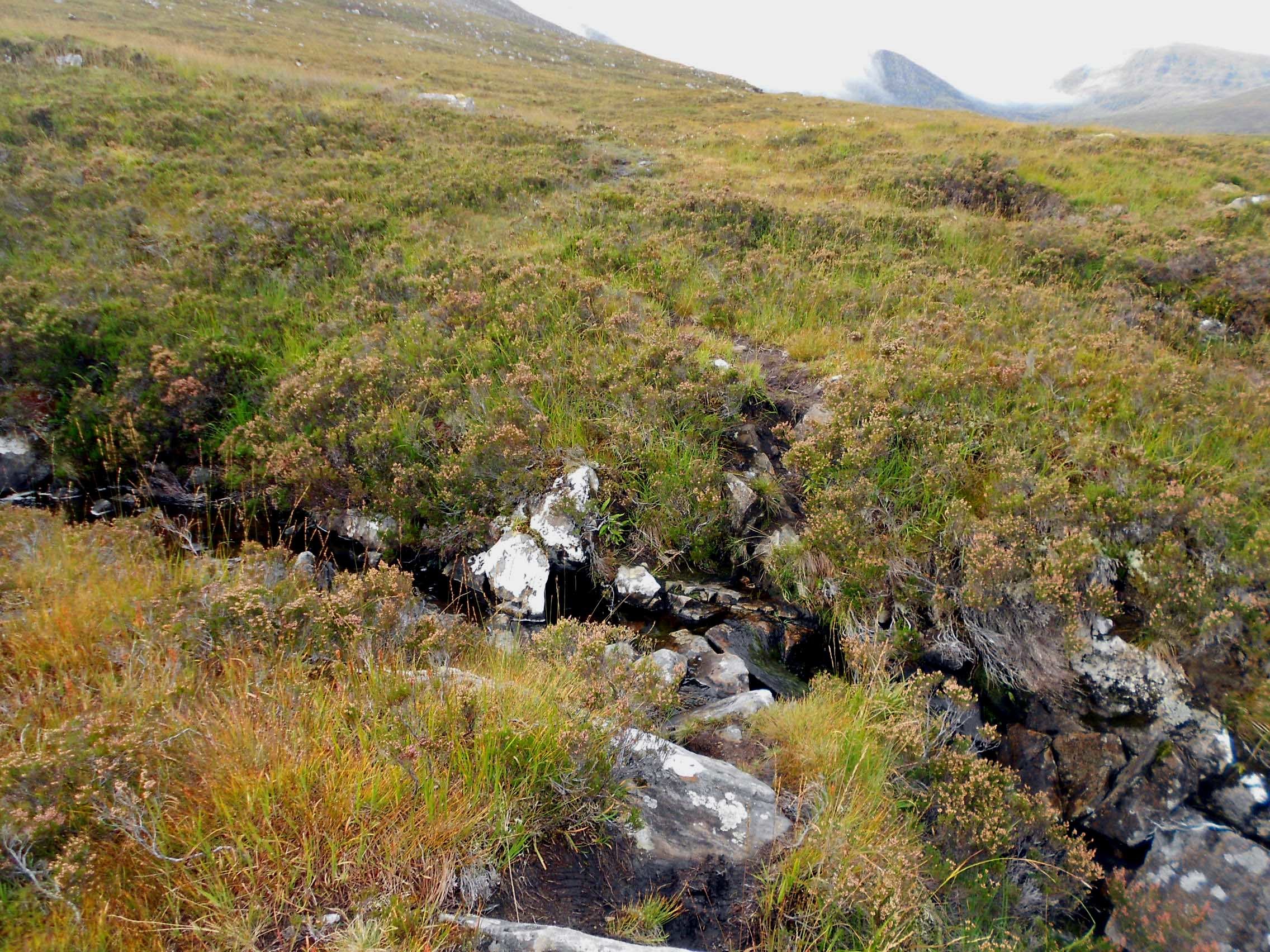
This is a boggy path on peat and not very wide. After 50 metres it turns right (SW) at NH 2306 7468. From there it climbs steadily up the flank of the hill through heather and grass.
Waypoints as follows:
From the weir to NH 2306 7468 (turn right (SW)); NH 2290 7446 (cross a small stream); NH 2264 7411 (the peat turns briefly to rock) and NH 2252 7375. One or two Keds were encountered here but they weren’t too annoying and there were no midges.
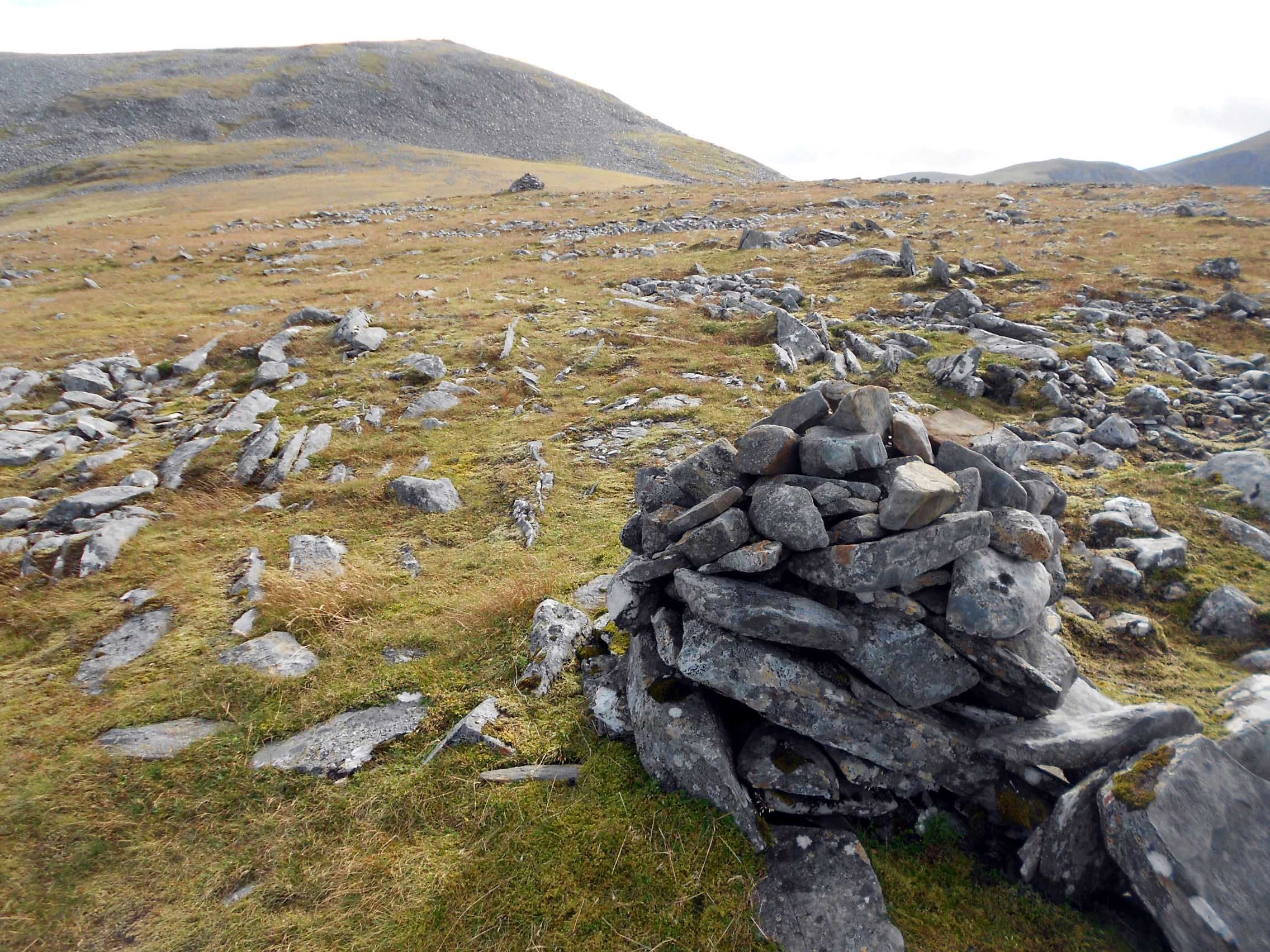
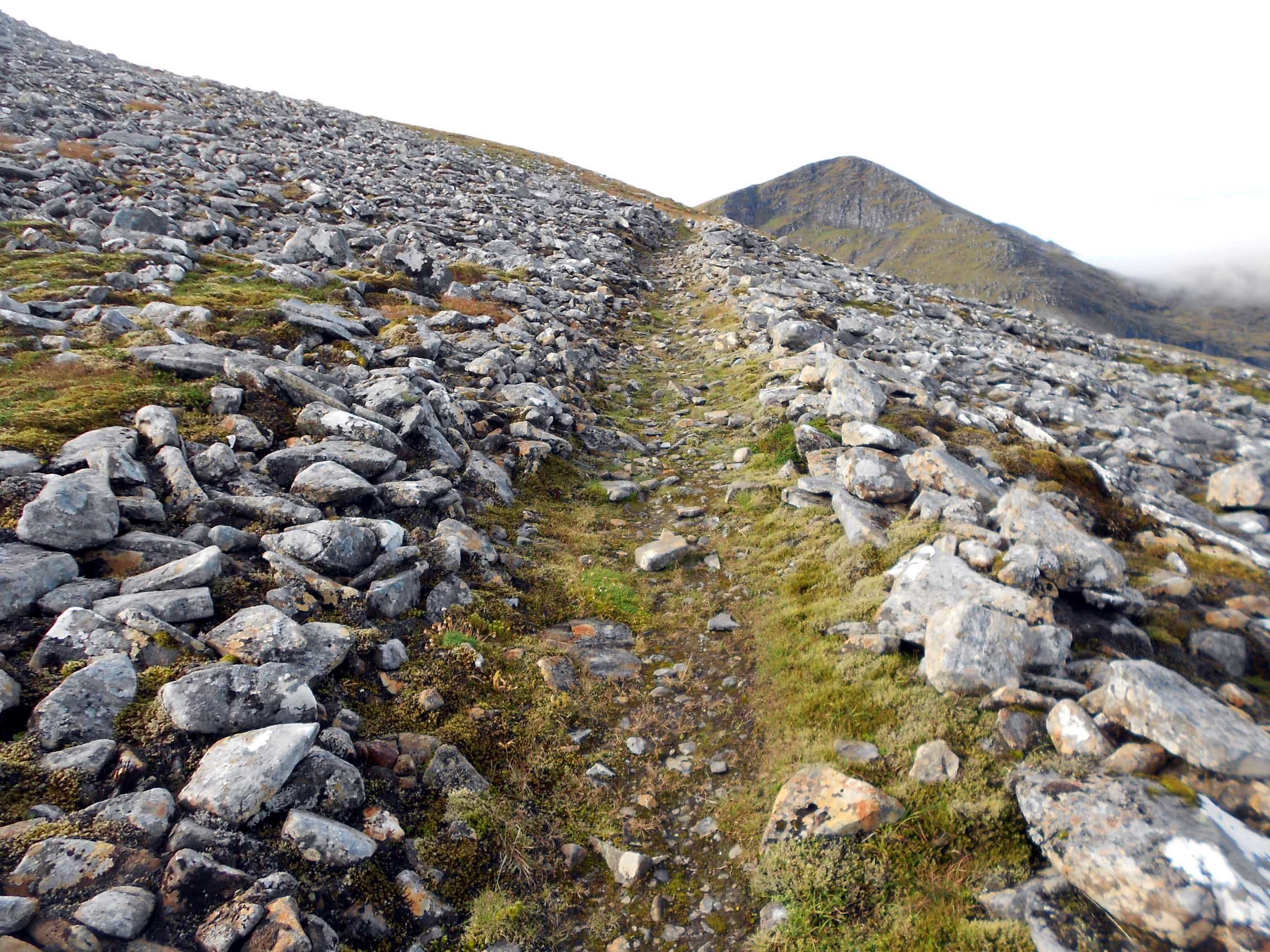
About 100m further on, I was finding the path increasing ill defined and hard to follow until finally I could locate it no longer. This is where the job got harder and I had to traverse moderately rough ground and at intervals, rock fields. However I remained faithful to the general direction that the path had been taking me in the hope that I might come across it again further up. That didn’t happen so I walked via NH 2223 7308 and eventually up to the ridge, later passing two cairns at NH 2201 7293 and NH 2200 7288 which seemed to be marking absolutely nothing.
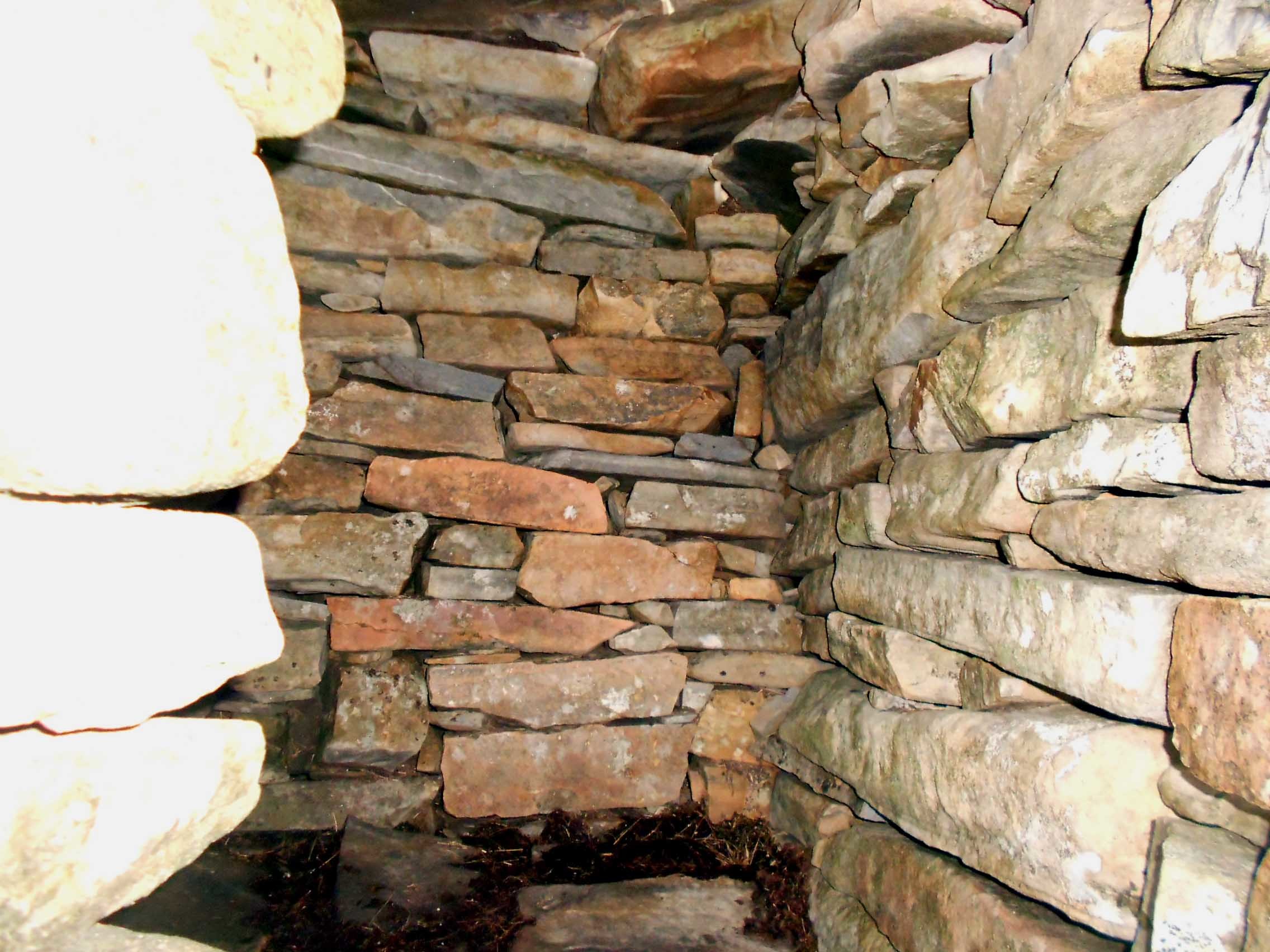
All the time I was aiming for a point where I knew a path existed as I’d marked it in 2005. This was at NH 2186 7253 and I was at last relieved to be on a well defined path which was familiar. From there the path skirts Beinn Laith Mhor Fannaich (climb it if you wish - I didn’t) leading eventually to an 845m col at NH 2162 7222. Follow in a roughly straight line via NH 2117 7177 and NH 2102 7170 to possibly the best mountain shelter I’ve ever come across at NH 20769 71618.
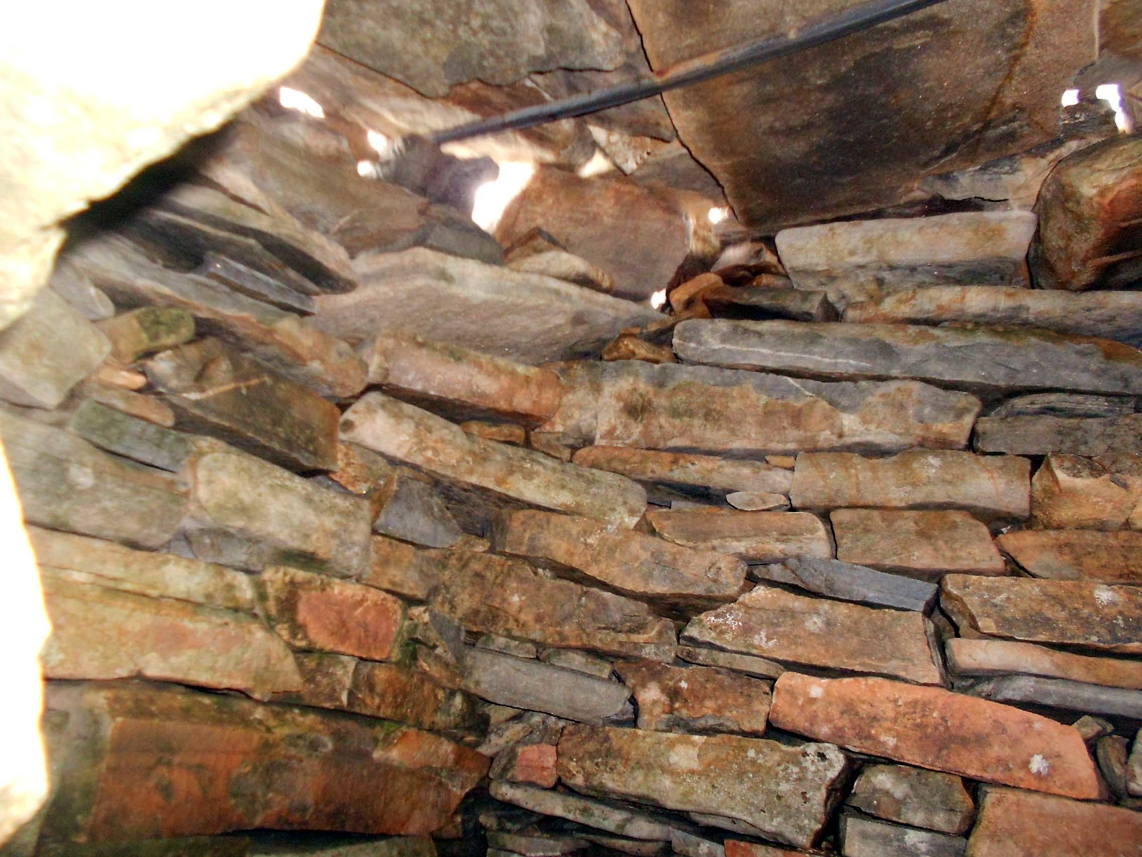
This is a fascinating and well built shelter with a stone roof, stone walls, stone floor and a porch. I passed it in 2005 in the snow, forgetting to take a photo at the time, something I made up for today. I think the ‘porch’ or at best windbreak has been added since. The shelter is tiny admittedly but nonetheless fascinating. Perhaps just two could cram in without rucksacks but it must be a welcome sight when you’re cold and weary up on this windswept ridge at well over 3,000 feet. This is by no means a summit shelter; there are still more than 500 metres of path remaining between here and NS1, along with a few more hundred feet of ascent.
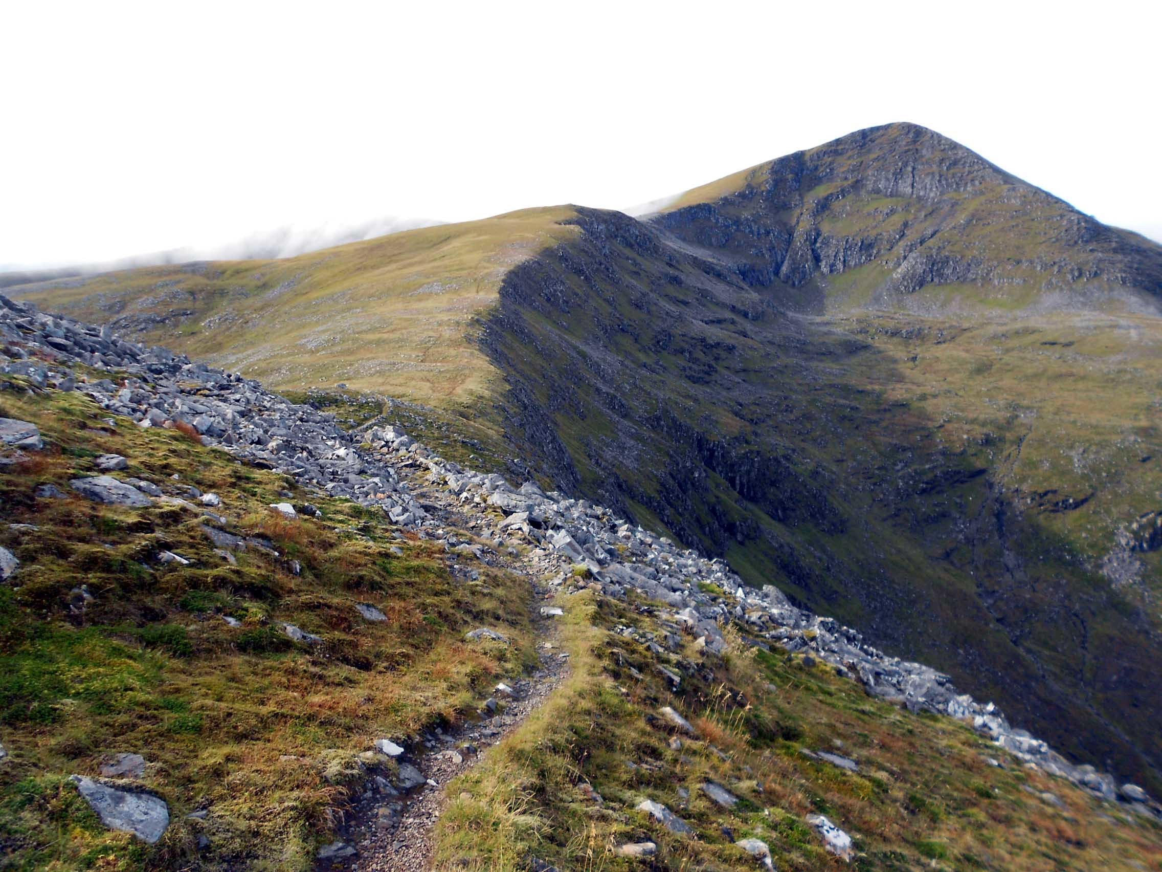
Both before and after the shelter the path can fade out, change direction abruptly or offer choices at times but I carried on with the aid of the GPS via NH 2064 7159 (junction - I turned right); NH 2049 7162; NH 2043 7165 and NH 2043 7165 to NH 2037 7167 where it changes direction to NW. From there it’s a simple walk via NH 2034 7175 to the summit cairn which is at NH 20332 71799 - that being an average between the location marked today and the one that I recorded in 2005.
After seeing what looked like a Ptarmigan, I summitted in scudding low-cloud at 11:25 and the top was deserted at that time.
SGURR MOR 1,110m (3,642ft), GM/NS-001, 6 pts: 11:25 to 14:55. 7C, 15 mph rising to 30 mph wind. Low-cloud for the first hour then overcast with brief bursts of sunshine. No rain. WAB-NH27. Large built cairn but no trig Point. LOC-IO77LQ. Reliable Vodaphone coverage at the summit and on some of the climb. Orange (EE) not tried.
In 2005 I set up away from the summit cairn but today the wind was blowing quite determinedly and set to increase. With a feeling that I was contravening my own unwritten rule and in the hope that there’d be no other visitors to the summit, I plonked my rucksack down in the lee of the very substantial cairn which might better be called a stack. It has getting on for vertical sides, is just over 6 feet high and probably wider than that. Partially clothed in moss, it is not merely a pile of rocks but has been carefully built.
I managed to ram the mast into some scant grass next to the cairn but it needed some probing to find soil deep enough for the end sticks. The mast would not have stood up on its own in such thin soil so I wedged one of the mast bungees onto the cairn to support it.
Because of the local geography, the wind direction and its speed, I ended up with a smaller than usual included angle in the dipole. Still, it usually works at any crazy angle you care to give it unless it is touching the ground of course. I was a bit unlucky with the back rest but at least I was completely sheltered from the wind and smug in the knowledge that by missing breakfast, I now had sufficient time for a thorough activation.
7.034.5/ 7.033.5 CW - 20 QSO’s:
As before, a Vodafone call to G4SSH got me an advance spot but finding a free channel was more difficult than I’m used to. Usually you can more or less breeze onto 7.033 and it will be clear but as this was a Saturday, the band was crowded. 7.033 had a ‘normal’ QSO going on it. My goodness, they were exchanging information about the weather and other important things on a SOTA frequency! Reminding myself that there are no channels which can be reserved by us users, I had to move right up to 7.034.5 to find a space. Will they find me here?
I called with 30 Watts and G4SSH responded in short order with a 599/ 559 exchange. Fortunately it is Roy’s habit to listen in CWW. Roy had told me that Mark G0VOF would also be looking for me so I called him but to no avail. A little later I heard him call in but for the life of me I couldn’t get back to him due probably to his recently increased local noise levels.
I went on to work DK3DUA but then a comedy of errors occurred on my part and I was in trouble. At the same moment that around ten stations called me, out of the cloud came half a dozen windswept Munro baggers with sweat and fog condensation dripping from their noses. This is when the guilt set in. I was hogging the only bit of weather respite on the summit. They didn’t seem bothered however, in fact they started asking questions about the aerial and what I was doing. I felt duty bound to satisfy their curiosity and after a while they went to find somewhere to sit overlooking a severe drop of around 1.000 feet.
When I did get back to the frequency it was just as busy as when I’d left it but I couldn’t seem to part the pack for long enough to get in my full call. I had little idea of what was happening as there was far too much going on and my Morse reading skills leave a lot to be desired. Without warning I heard the callsign OK/G4OBK/P. This was our good friend Phil on his European holiday but try as I may I couldn’t get through to him for all manner of QRM. That was a disappointment as I really wanted Phil to collect the ten points. Never mind you can’t win 'em all and looking up the history, I see that he logged this summit when Barry was up here in 2005.
I went off to find a clear spot one kHz down and worked a steady stream of callers: G3VXJ; DL3HXX; EI2CL; F6HKA; G0BPU; G4AFI; OK1KT; HB9AGH; PA0B; F6EAZ; MK0BKV; ON4FI; PA0SKP; PA7ZEE; G4POF; HB9CGA; HB9CLT and PA1AT.
I’m afraid my poor reading skills caused trouble again, this time for Damian MK0BKV. He kept calling but I thought I was hearing an OK callsign with the first dash either missing or lost under the pileup. As I have never worked an OK0 or even heard of their existence, time and again I was confused. Since there were so many calling I put the problem on the back burner making a mental note to sort it out later. Had I realized that this was Damien, the well known WAB chaser who was calling he would have been in the log far sooner.
The ‘K’ locator is something I’m not used to. Strange how the brain gets the wrong end of the stick and that situation cannot be shaken off. It happens when people write down the SSEG callsign, read their own writing and come back with the wrong combination of zeros and oscars such as GSOOOO/P, GS0000/P or any variation you can think of. Once they know what they think it is, it’s hard to put them right.
It was a pleasure to work EI2CL again. Mike, who is one of a small group of ‘Top Band heroes,’ has been absent for a year or two. I hope to hear Mike again.
Signals were good and I gave out a lot of 599’s. Most of the incoming reports were in the range 559 to 579 with the Europeans not hearing me quite so well as the G’s.
Good to see that the centre-biased toggle switch ‘CW key’ wasn’t sticking today. When filling up the car at the garage next to the hotel, I had run in a little diesel fuel into the switch to lubricate it. I was desperate not to repeat the dot-spraying farce which developed on Beinn Alligin. Power was 30 Watts throughout.
7.137 SSB – 19 QSO’s:
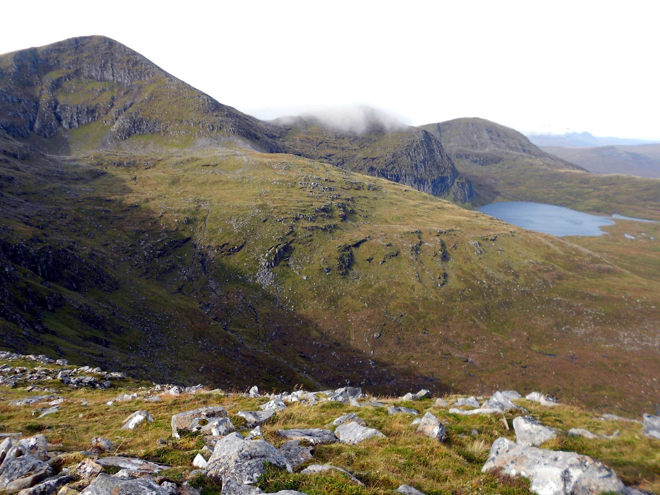
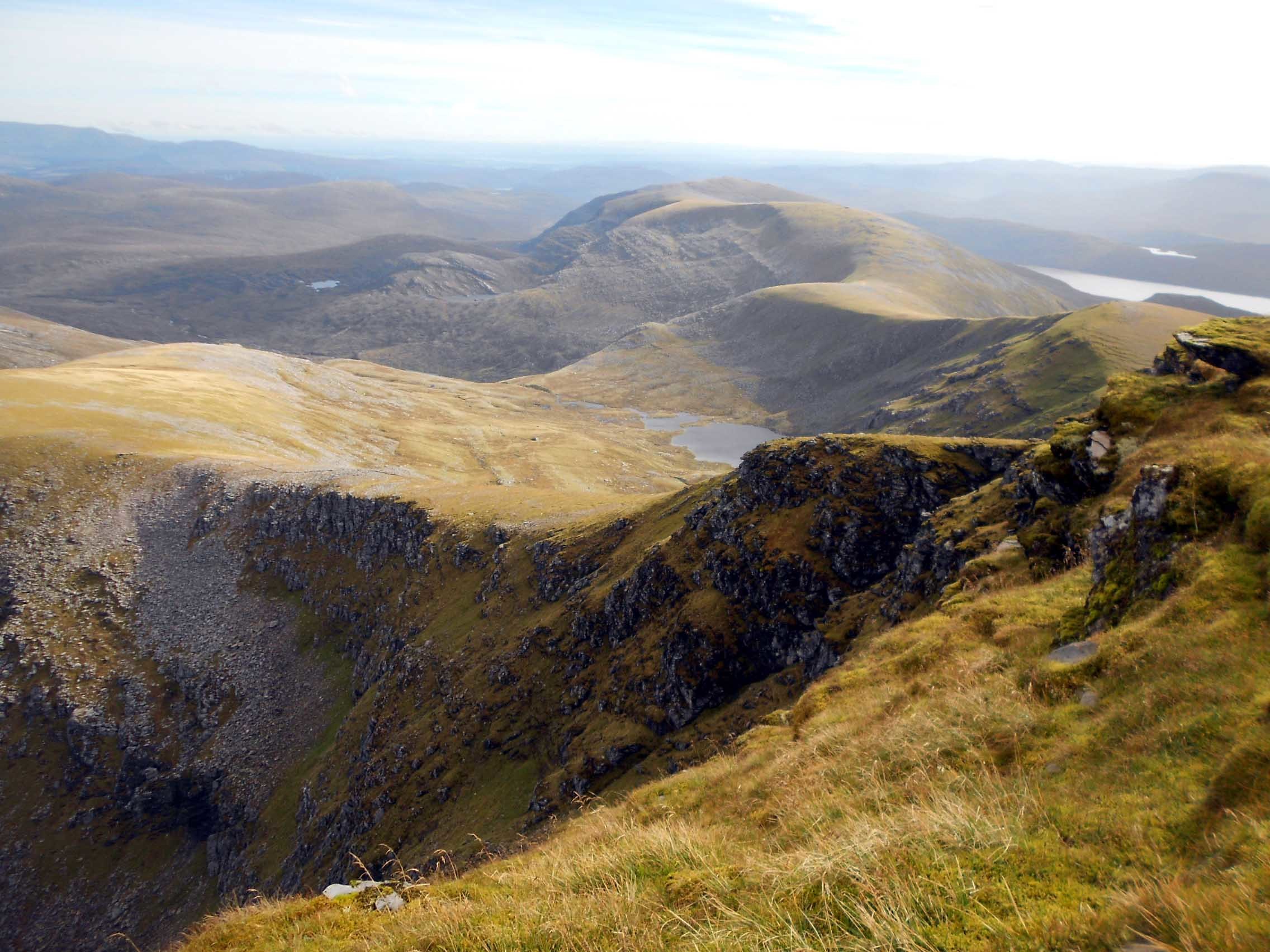
At some point during the CW session the low-cloud cleared away revealing some great views but it was still overcast and hazy at a distance. As usual, I went off to find the SSB QRG then relayed it back to Roy in CW for spotting.
First to find me this time was Karl M3FEH (57/ 55). He alerted me to a SOTA on 7.118 but I couldn’t go there immediately and clean forgot to try it afterwards. After what happened in the CW session I wasn’t about to desert the SSB chasers by going in pursuit of an S2S. It would be just my luck to be delayed.
The following stations were worked: G7BGA; G0BFJ; G4IAR; G8ADD; G8VNW; G6ENN; EA2CKX; G6UUR; G6TUH; G4SQA; HA5TI; G4AFI; PA7RA; M0MDA; M0JLA; G1YFF; G4TJC and 2E0GBK. Reports were mainly 57 to 59 with 52 coming from Spain and 34 from Hungary.
There were two ‘gottaways.’ Firstly Esther GI0AZA/P was calling me but I could hear almost nothing. I only knew it was Esther when advised of it by Dave G4SQA but maybe that’s what Karl had been conveying too? I couldn’t even tell whether there was someone on the frequency or was it just static linking up to sound vaguely like syllables in my head?
It wasn’t that there was QRM or QRN. As is mostly the case on hilltops, the noise level was miniscule but I still could hear nothing. After about five tries with help from Dave G4SQA, I gave up with regret. It seems that Esther was hearing my 30 Watts but if she was using QRP I wasn’t getting anything back. Not only that but GI was perhaps too close for 40m. We would have been OK on 60m perhaps but I would not be on there for another hour and a quarter. Esther would likely have been long gone by then.
Our SOTA mate of many years called in mobile. This was Mike G4BLH/M and he was about 55. I couldn’t get straight onto this as I was in the middle of trying to contact Esther but I did call Mike immediately afterwards. I tried several times but he didn’t come back. I tried again every few QSO’s to no avail. Crestfallen again, I hoped he’d not gone out mobile specially to work me in low-noise.
Lunch time: Four biscuits, some more photos and a few sparkly rock samples into the rucksack.
14.266 SSB - 14 QSO’s:
After just one QSO on 20m CW from Beinn Alligin two days earlier, I missed CW out altogether today. The only person desperate for NS1 or the square in CW (there was no trig point) would be RV9DC and I could easily switch modes to accommodate Sergei or any other request for that matter. In the event Sergei didn’t call in so he must have been having a busy weekend.
Stations worked with 50 Watts were: OH3GZ; EA2DT; SA4BLM; OE5FSL; F8AAB; II3PG; KI4SVM; SQ9RZA; OK4KOP; N1GB; SP9AMH; OE5AUL; KA1R and SP9DPM. I was giving out mostly 57, 58 or 59’s. Apart from two, reports coming back to me were in the 56 to 59 region. The exchange with SA4BLM was more tricky at 45/ 43.
I had a brief conversation with SP9AMH/ QRP while the conditions allowed and asked his name which is Mariusz. Though it would seem he is a SOTA chaser as well as a QRP enthusiast, I have often wondered because I cannot find him in the SOTA database.
I was both pleased and surprised to be called by no less that three stations from the USA, having brief chats with them all. KI4SVM Pat in South Carolina (57/ 54); N1GB George in Vermont (59 both ways) and KA1R Matt in Maryland (where my niece lives) 59/ 56.
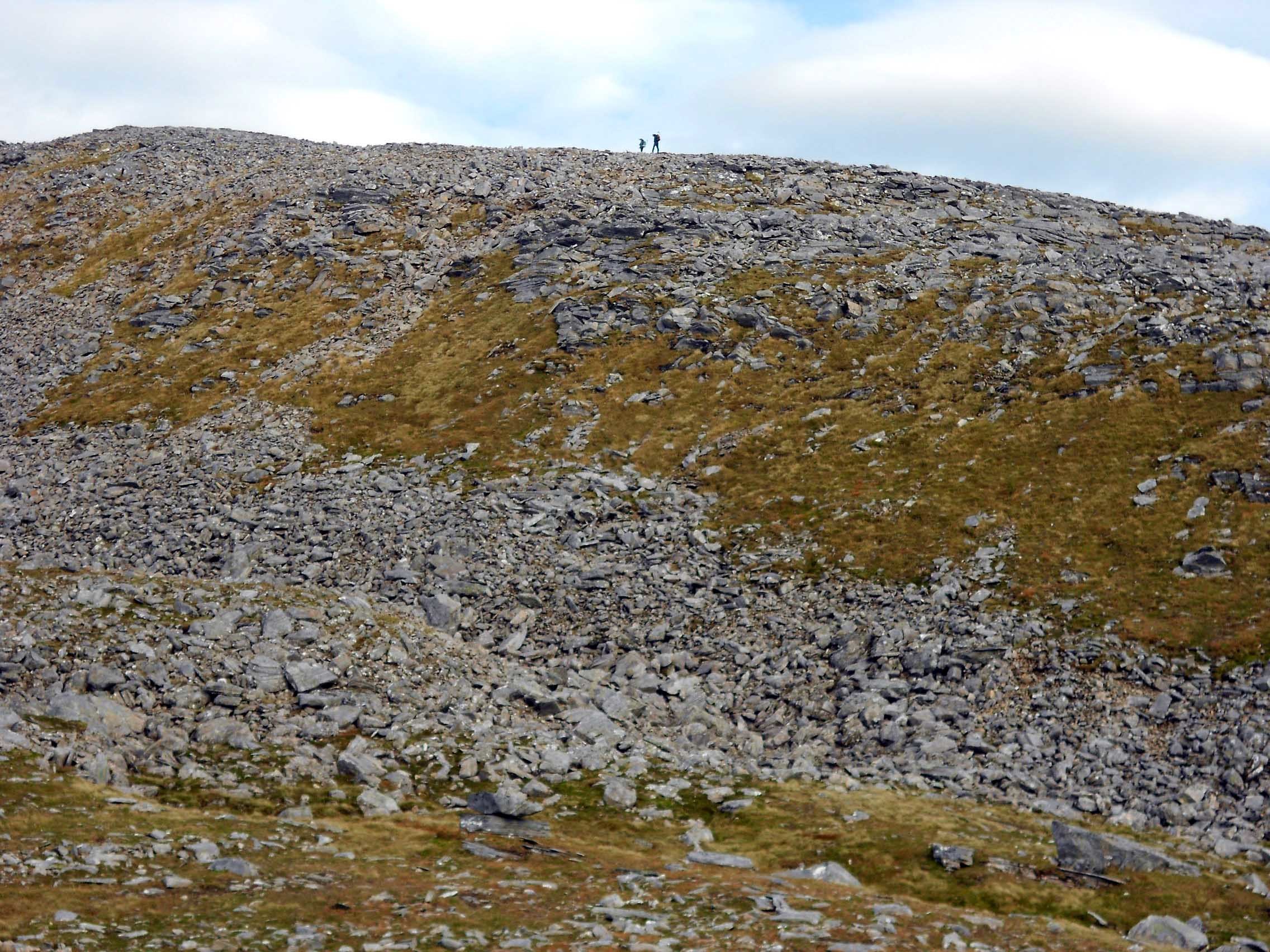
A young couple arrived and showed still more friendly curiosity. They asked if I was bagging all three, which I took that to mean Munros. I replied that I was just doing the one because of the amount of radio kit I was carrying. I saw them later at a distance, climbing Beinn Laith Mhor Fannaich which made me think it could be a Munro. Checking later I found that it is number 209. Had I realized at the time, I would have nipped up there as it would only have added 10 minutes to the return.
With the long descent in mind and knowing I wanted to try 2m-FM at the end, I was now starting to look at my watch.
5.405 SSB - 6 QSO’s:
After Roy spotted it, John G0TDM was first to work me on 60m ‘channel FM.’ The exchange was 58/ 51 but it depended as to where we were in the QSB cycle as to what report was ‘guessed at.’ Next came MM1MAJ/P with 59 signals both ways and Martyn was on GM/SS-244 giving me my only S2S of the day. I apologized for not being able to complete with Caroline a few days prior. LA5WNA followed with 59/ 55 and then G3RMD called in with 56/ 56. It’s always good to get Frank in the log and like Brian G8ADD, he’s often interested in the mountain he’s working.
I wasn’t to know it yet but the last two contacts of the day and therefore the holiday were GW4CQZ Martin 57/ 55 and EI3GYB Michael 58 both ways. I was glad I’d put on 60m for those that failed to hear me on the other bands. Once again to save time, I declined to do CW on 60. It was partly that I didn’t full trust the key after the embarrassment of WS98 two days earlier.
145.575/ 145.500 FM - Nil QSO’s:
After rolling up the dipole, I erected the VHF mast and J-Pole in the top of the cairn. Using 5 Watts from the FT817ND, I called CQ. There was nothing but dead air and it was the same on S20.
I went round the repeater channels to see how many could be opened from the summit of NS1 with 5W and a vertical. The answer was three and they were all full scale to me. They were located in Fraserburgh, Elgin to the east and on Lewis in the Outer Hebrides. I tried a call through Lewis (Stornaway) repeater in the hope of working Jon GM3JIJ but there were no replies.
Roy G4SSH had written the 2m-FM QSY in the notes of the 60m spot, so I went back to 145.575 simplex for a few more calls but it was all for nothing. No worries; I wasn’t expecting much from this remote northerly summit, high as it is.
The Descent:
Now for the return and a third attempt at finding that elusive path from the ridge all the way down to the weir if there was one? It is always a regret to leave such fine mountain summits and I hung back looking at rocks to add to my collection in the full knowledge that I already had too many in the rucksack. Resisting the temptation and buffeted by the strong wind which was ramping up by the minute, the journey was started at 14:55, just inside my deadline 3 o clock.
Again I stopped at the tiny shelter for more photographs. This unusually neat structure fires my imagination as to who built it and when but I did notice that there were a couple of square section steel tubes or bars supporting the roof stones. Holding the camera inside at arms length, I captured a few more images.
Two tiny figures could be seen climbing the side of Beinn Laith Mhor Fannaich as I approached the skirting path. These were the young couple I had met earlier and I could just make out their returned wave.
Just as expected, the path seemed to end abruptly at NH 2186 7253 and any continuation was far from obvious. All I could do was to continue in what I thought was the right line and by now the two young Munro baggers were descending from their latest acquisition. I stopped and looked over my shoulder to see which direction they would take and they were last seen aiming for the side of the hill at around NH 219728. They looked to be heading roughly NW. I didn’t see them again but 15 minutes later I looked back for them along the flank of the hill. That’s when I saw what looked like a line of cairns going downwards but these might have just been big rocks and the path or no path mystery was not solved.
I disturbed a flock of a dozen or more birds which took off from below me. It was hard to know for sure but they seemed to be about pigeon sized with white or a pale coloured areas on their wings. These things are easier if you’re not colour blind.
Even with the benefit of GPS, the top end of the path wasn’t easy to relocate and once found, easy to lose. There are one or two marker cairns here and there but they consist merely of two or three rocks stacked on top of one another and the path is faint at first; which is why I lost it on the way up.
Upon reaching the weir I retrieved my drink, noticing that the angler’s bikes were no longer there. Hopefully they caught some trout in Loch Sgeireach as that’s what they’d been going up there for.
I was back at the car early at 16:59 with what turned out to be 1.6kg of attractive sheeny rock samples. The 48 mile drive to Gairloch was completed between 17:03 and 17:58; plenty of time for a well earned bath.
The activating days were now over. What a sense of relief! Just one more day left - Sunday, which would be wet and a day of rest to spend with the XYL, before the 430 mile drive back to Scarborough on Monday 19th.
QSO’s:
20 on 40m CW
19 on 40m SSB
14 on 20m SSB
6 on 60m SSB
0 on 2m FM
Total: 59
Chronology:
Gairloch Hotel: 07:31
Arr. car park: 08:28 (A835-Dam wall)
Walking: 08:49
GM/NS-001: 11:25 to 14:55
Rtn. car park: 16:59 (A835-Dam wall)
Drive: 17:03
Gairloch Hotel: 17:58
Ascent & distance: 900m (2,953ft) ascent - 16km (10 miles)
Elapsed times. Walking times. Up: 2hr-36min. Down: 2hr-4min. Summit time: 3hr-30min. Gross time: 8hr-10min.
Observations:
GM/NS-001 was a good mountain to finish on. By a slim margin, I was the first to pin my callsign on it in 2005. Barry GM4TOE followed shortly after but in addition managed to activate the nearby GM/NS-002 on the same expedition. The latest was MM0DHY/P on 06 Aug 2011.
Surprisingly this activation gave me the best feeling of the four. I love doing ten pointers and visiting ‘old friends’ but it was also because this was the last SOTA sortie of the holiday with nothing further to worry about.
I probably missed out on a couple of Munros but the primary consideration is SOTA. If I pick up a Munro on the way, so much the better but I won’t go far out of my way to do it.
Though it was quite cold and windy at the summit, I had little reason to complain about the weather. In fact, despite a ‘shaky’ forecast for the period, I had struck lucky on this and most of the other activation days.
Thankfully, 40m band conditions held up for my last day of activating. Though I only did SSB, 20m was very good at around 13:00z when I logged no less than three USA stations with good reports both ways. 60m proved its worth once again in that it was a Godsend to half a dozen stations who couldn’t work me on the other bands. Despite the ASL, 2m was a disappointment but I only had 5 Watts and a vertical.
I was disappointed in not finding the continuation of the path from the weir up onto the ridge. The path that I did follow initially had two sets of boot prints (the anglers) but further up I did find another set. Where they continued to I will never know because the path became progressively fainter until it could not be detected at all. After that I had no choice but to traverse over steep and moderately rough ground including rock fields; much the same as on my descent in 2005. The same thing happened coming down, with nothing further learnt. That said, if I ever do this again (unlikely) I will go the same way.
Thanks to all stations worked and to those who spotted me, namely Roy G4SSH; MK0BKV; G4AFI and G3RMD. Without timely spots coupled with Roy’s help, I would be largely sunk. Thanks to Roy G4SSH for telephone liaison, alerts, spots band condition advice.
Final Comments:
EE (Orange) phone coverage turned out to be dreadful in this part of Scotland, not just at the summits but in the hotel at Gairloch and elsewhere. Thankfully I have a second phone which is kept permanently in the SOTA rucksack. Given to me by my son Phil G0UUU years ago after one of his upgrades, this is a Nokia 3210 and it is just about the smallest and lightest that phone design got down to before they started getting bigger again. I recently renewed the battery and this phone runs on the Vodaphone network. It worked from every summit and often part way up too. Hardly ever needed on English summits, it proved its worth on this trip, getting me up-to-the-minute band condition advice and the all important spots from Roy G4SSH.
Throughout the holiday I had fretted constantly about the weather and its effect on my activities. It was very mixed but apart from one night where the wind tried hard to blow-in the hotel’s sash windows (I had to wedge them with tea bag packets) and periodic rain, I seemed to mostly ‘get away with it.’ Only the bone chilling activation on the 11th September up on the exposed ridge of Liathach, WS43 was unpleasant. The other three sorties turned out fine.
The pattern throughout, governed partly by the weather, was to activate every other day with a single rest (plus XYL-tea & scones) day in between. For some reason I always slept badly the night after an activation and I would be secretly nervous immediately before the next one. Most of the time the weather was so changeable that the forecast you read the night before had significantly changed by morning. From this I learned never to say ‘go’ too early but to wait for the last minute forecast. I think this helped me psychologically too as I do struggle in that area.
What of the targets? In preparation, I had made about a dozen proposed GPS routes up different SOTA’s, including some one and two pointers, to give me choices should there be bad weather but I only activated four summits in a ten day holiday. Fortunately three of them were new to me and the subject of long ambition. Liathach-1 and 2 and Beinn Alligin-2 were satisfying achievements but I would have liked the Alligin-1 ‘scalp’ too. I toyed with the idea of going back there for the fourth activation but the choices were to either duplicate the same ascent route then extend it and back-track it, or go over the Horns with HF QRO gear. Nonetheless, I was more than satisfied with what I actually got done in the period, not least the final one; the ten pointer who nobody seems to have heard of - Sgurr Mor GM/NS-001.
After a dreadful summer, band conditions on 40m and also 20m improved sufficiently to make the modus operandi viable but it might have been a lot harder with QRP. 2m band activity in Scotland is either unchanged at ‘very low’ and that’s if I was unlucky, or it’s got worse in the past couple of years.
Thanks to all the chases and spotters and to Roy G4SSH for assistance by telephone. Thanks to my XLY for her tolerance, especially for the activation of 13th September; our 41st wedding anniversary and for the use of her car throughout.
73, John G(M)4YSS,
Also using SSEG GS0OOO/P.
(This summit will be entered under GM4YSS/P for SOTA purposes)
Continued…