LIATHACH (WS28-Spidean a Choire Leith) on 13th September 2016
GM/WS-028-8 on 40-20m QRO & 2m-QRP
LIATHACH (Spidean a Choire Leith) 1,055m; the easternmost summit of the two.
(See separate report for LIATHACH (Mullach an Rathain) WS43 on 11-9-16)
Staying at Gairloch Hotel 9th to 19th September 2016.
Four activations: GM/WS-043; GM/WS-028; GM/WS-098 & GM/NS-001.
G(M)4YSS Unaccompanied.
SSEG Club-call GS0OOO/P & GM4YSS/P (the latter used for database).
All times BST (UTC plus 1hr, UOS)
RADIO EQUIPMENT:
HF-QRO:
FT817ND HF/VHF/UHF 5W Transceiver without internal batteries.
MX-P50M, 50 Watt HF Linear Amplifier.
Link dipole for 80-60-40-(30)-20m Bands
Four section x 5m home-brew CFC mast with 1m end sticks
Unitone 'D’ shape ear-cup headphones.
VHF QRP:
Baofeng UV-5R 2m/ 70cm, 5W-VHFM H/H with loaded helical antenna & 1.8 Ah battery.
J-Pole for 2m-FM
Batteries:
One 5 Ah Li-Po (Part discharged). No spare carried
GPS:
Garmin GEKO-301
Pack weight:
9.5 kg (21 pounds) inc. 0.5 litre fluids, a light thermoball jacket and a black umbrella.
Introduction:
For general introduction, see the GM/WS-043/ 11-09-16 activation report.
Liathach has two Munro sized SOTA tops; GM/WS-028 and WS-043, the latter of which I had activated 2 days prior. WS28 had been activated just once in 2004 with five 2m band QSO’s. The activator - Andy GM0UDL had included WS43 on the same expedition, which is a significant undertaking. I was going for a more modest approach.
I planned that Liathach would be done in two halves, firstly because there was insufficient time for two multi-band activations between hotel meal times and secondly because there is also a long arduous walk to consider. Finally I wanted to avoid negotiating the intervening pinnacles carrying a pack full of QRO HF equipment with a sectional mast strapped to it. The down side to this approach is the requirement to climb a total over 2,000 metres over two separate outings as against approximately 1,325m for a one day round. It also doubles the amount of driving.
WS28; Liathach’s easternmost summit is the more difficult of the two because the path doesn’t ‘drop you off’ directly at the summit. Rather, there is an awkward ridge walk after the main ascent.
WX:
MWIS was predicting early rain, low wind speed and a summit temperature above 10C. There was also a threat of lightning but the probability was low.
Route and Execution:
After the hotel breakfast at 07:45, the start point in Glen Torridon was reached at 09:40. At NG 9360 5664 on the A896, there is a small layby suitable for parking about three cars. If it’s full there’s more space a little further west. The path leaves the layby, which is not signed as a passing place, at the grid ref given above.
While I was downing my litre of cold water, another car pulled in. We introduced ourselves and he floated the idea of going up together. His intention was to get as far as he could and turn back if necessary. I explained what I was there to do. His wife drove off intending to return for him at 5 or 6pm. Tony was from Wakefield and we set off together in a light drizzle at 09:57.
After a few yards the path gets seriously steep. Not knowing Tony’s walking speed, I was walking ahead trying not to get in the way but after a short while he stopped, saying, I’ll meet you up there.’ I left Tony adjusting his rucksack and didn’t see him again so presumably he turned back at some point.
It’s not often that I walk with anybody and it’s hard to judge the right speed. Too slow and you feel you might be holding them up; too fast and the rhythm is disrupted by waiting. I am a chatterbox too and though we started a good conversation, it became harder to breathe at the rate required for a Liathach ascent while simultaneously talking, especially with the noisy stream beside the path.
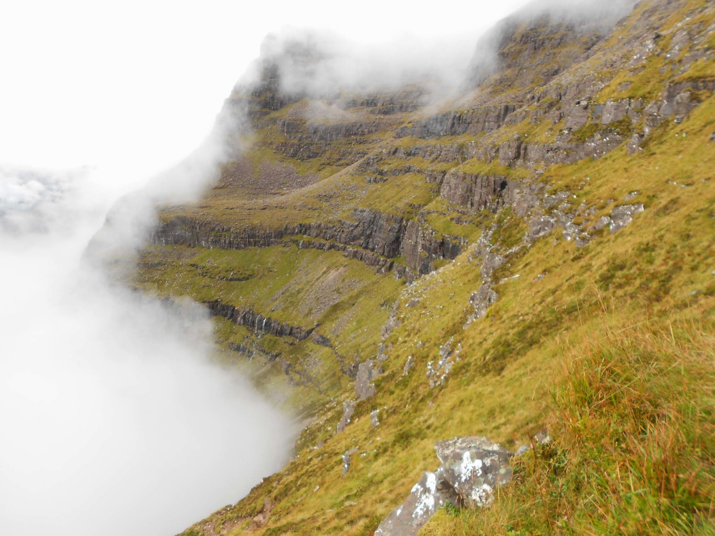
http://www.walkhighlands.co.uk/ provided a track upon which to base a GPS route but as usual additional waypoints were created as I went along, ‘Along’ is the wrong word. It was much more up than along. When you look up you can see tiny white fences at impossible angles, running along dangerous crags. There waterfalls on the left but water was not what I wanted to see when it was coming from above. A short time later however the weather dried up, just at the time predicted in the BBC forecast but now I had swapped the drizzle for low-cloud.
After beginning on a man-made surface of cobbles, the path further up changes to loose shale, sand and rocks, with grass and heather on each side. There are places where the gradient eases but it soon gets back to ‘normal’ again. Waypoints as follows: NG 9375 5701; NG 9387 5740 (path turns NW); NG 9369 5770 (path turns N).
Looking forward to NG 9370 5792 you think you see an impasse but the path turns sharply right, continuing up an easier line. The climb is still steep however and at NG 9383 5796 you have no choice but to negotiate a short scramble. It’s nothing to worry about if a little care is taken. There is minimal exposure. I thought it would be worse going down later in the day but if anything it seemed easier the second time round.
The path continues generally in a ENE direction, zig-zagging a little until it meets the ridge path at NG 9390 5806. Turn left (W) here and follow the ridge via NG 9373 5810; NG 9365 5816 to NG 9348 5819 where there is a wind shelter on a minor summit.
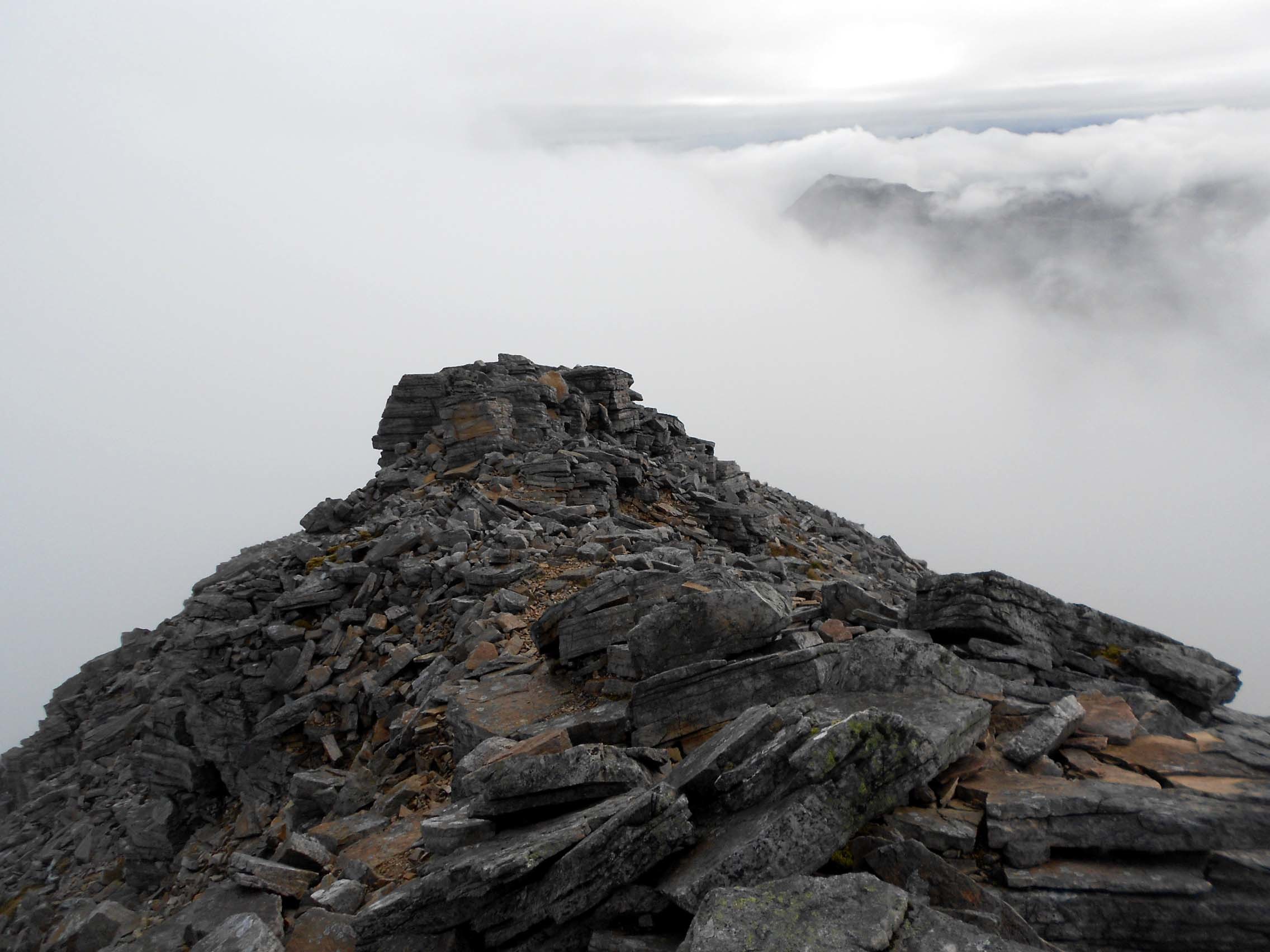
The ridge does not provide easy walking. In an attempt to avoid areas blocked by big rocks, the path darts unexpectedly from side to side, ascending and descending as it goes. Some is on grass but much of it traverses rocky outcrop. The last few waypoints are: NG 9336 5813; NG 9323 5802; NG 9306 5799; NG 9299 5798 and finally the large summit cairn which I GPS’d at NG 92937 57960.
Arrival time was 12:21 and partly because of the steepness of the climb to the ridge and the latter’s tedious nature, the journey had taken two hours and twenty four minutes.
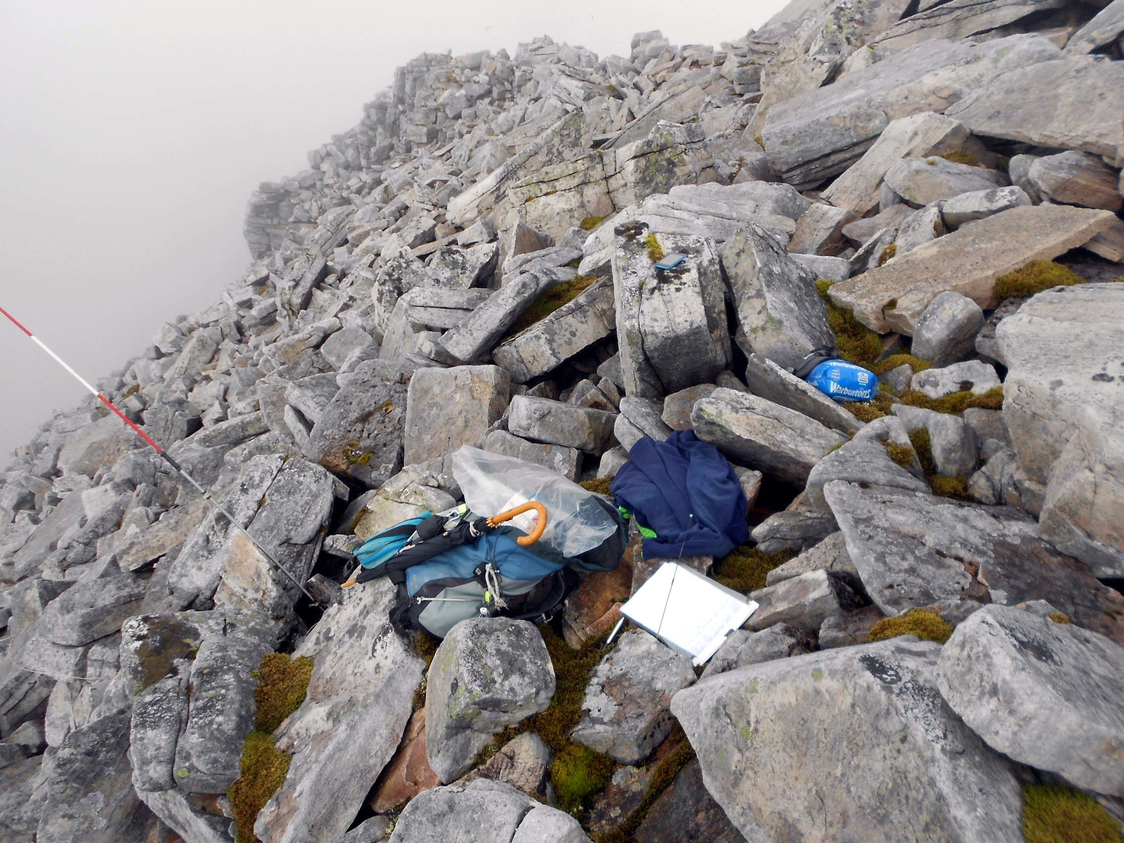
LIATHACH (Spidean a Choire Leith), 1,055m, GM/WS-028, 8 pts: 12:21 to 15:31, 10 deg C, No wind. No rain. Low-cloud. Midges. WAB-NG95 (No Trig), LOC-IO77GN. (Almost) no Orange (EE) mobile phone coverage at the summit but Vodaphone coverage most of the time.
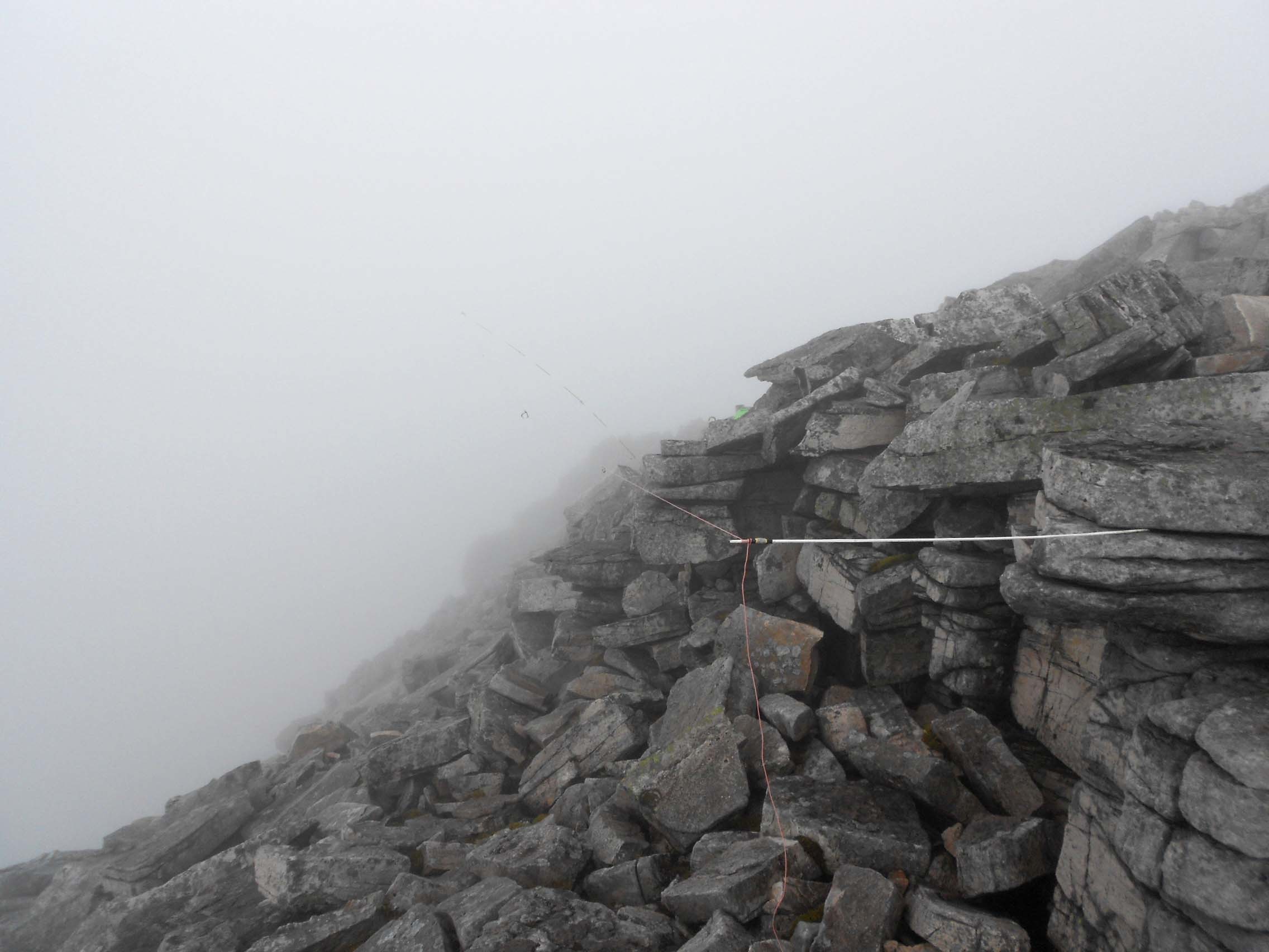
Like WS43 from 2 days prior, the summit was small with steep sides. Unlike WS43 there was no grass mixed with the rocks and many of the latter were substantial. It would take care and extra time to get the link dipole up and immediately I decided not to bother trying to erect the full 80m-band length with end strings. That band was not planned into the activation anyway.
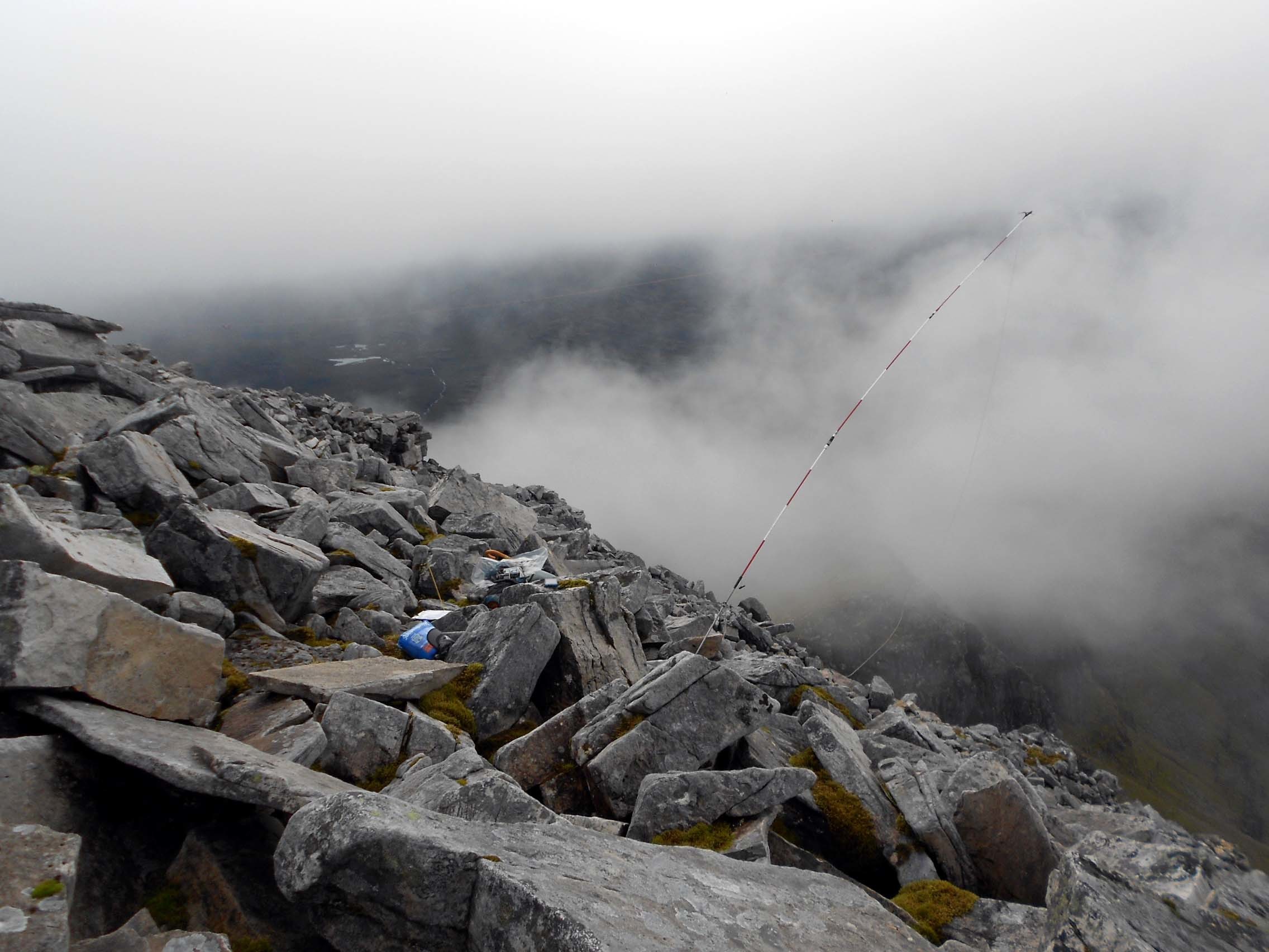
Overlooking the south side I started the tricky job but the mast ended up overhanging that side of the mountain at 45 degrees. One of the end sticks was horizontal and forced into a crack in a large rock. As intended, 80m was not useable but the bands 60m and below were.
I sat down on a rock the size of a small rucksack but it unexpectedly moved towards the equipment. Getting up again I heaved it into a position where it could do no damage and sat down again. Midges were already arriving. I wouldn’t say that they were truly vicious like the ones in July and August but they were a little more than annoying. Given the choice, I’d take the midges over shivering to death on WS43 two days before.
I managed to contact Roy on the spare phone – a Nokia on Vodafone which is always in the rucksack but even that was not straightforward. ‘You do not have sufficient credit to make this call.’ After wasting a valuable 10 minutes trying to top up with a debit card which I didn’t actually have in my possession but one that they already knew about, I was stumped at the final hurdle when the three digit security number on the rear of the card was requested. When the automatic voice offered to lend me three pounds worth of credit, I had to accept. This went right against the grain as, apart from a mortgage, I’ve never owed anybody anything but at least now I could contact Roy. As I had long forgotten how to text on this old Nokia 3210, I had little choice but to phone him.
7.033 CW – 19 QSO’s:
A spot duly followed and we were away with 50 Watts output. First in the log of course was G4SSH and signals were good, though Roy couldn’t hear me at all with the 5 Watts I use for VSWR checks.
Between 12:00z and 12:30z I worked the following: G; DL; HB9; HA; ON; F and OK. Incoming reports were mostly Q5 with a few 339’s and 449’s thrown in. Almost all were suffering deep QSB.
Buried under the big signals, I barely managed to hear Kurt HB9AFI but we got the S2S in the end. After logging Roy I worked my home town again in the form of Nick G4OOE but from the nineteen worked only four were ‘G’ stations. I hoped to make up for that with SSB.
7.127 SSB – 17 QSO’s:
After sending the SSB frequency to Roy in CW for a spot, Ken G0FEX was first to find me here and I worked a further six ‘G’ stations with good reports before HB9MKV called in.
Countries worked in SSB were: G; EA; PA; HB9; and GB2IWM Peter at the Imperial War Museum, Duxford. Once again the majority of stations worked were in the UK and reports showed that propagation was favouring shorter skip. Power was 50 Watts.
14.052.6 CW - 7 QSO’s:
This session actually started on 14.062 when I called Phil OK/G4OBK (579/ 549). This was as a result of a tip off by Roy G4SSH who phoned me on the EE phone that I’d left lying on a rock. I was astonished, as the phone had never offered to work since I came to Gairloch.
Afterwards I spent some time calling on 14.052.6 without result so resorted to SSB on 14.265. The moment I tuned there, I heard my own callsign coming out of the headphones. This was Sergei RV9DC eager for WAB square NG95. What better than for him to ask for it in CW also because that’s where I was supposed to be. We reworked the contact in CW on 14.052.6 and after that I got five more ‘customers’ from IZ; DL; OH; EA, finishing with UT5MB. 50 Watts again.
After feeling the effects of the initial symptoms of hypothermia 2 days before on WS43, I was enjoying sitting at three and a half thousand feet today in a shirt sleeve environment, albeit with midges.
Visitors:
I did get a couple of visitors to the summit and we had a brief chat after one asked me the oft repeated question about fishing. To be fair with the mast at 45 degrees over the side of the mountain this may have looked more like fishing than radio.
They had come along the ridge from the west, therefore from the summit of WS43 which I had activated separately two days before. I asked them how their traverse of the pinnacles had gone. One said that only the approach to the first one (presumably the westernmost) seemed exposed but otherwise not too bad. His companion agreed, offering the lack of visibility as the reason. ‘If you can’t see the drop you don’t worry about it.’ I could see his point.
145.575 FM - 2 QSO’s:
Using 5 Watts to the vertical J-Pole I just about worked Ray GM3PIL in Nairn but something was wrong somewhere. Ray was getting every word from me but he was coming in at only 31. After a contact 2 days prior from the western end of this mountain (SOTA WS43) using just my 5 Watt UV-5R handheld and its own supplied aerial, I expected much better with the J-Pole connected. Today I was higher and a few km closer. I thought this strange.
Andy GM0UDL called in from the Black Isle Inverness and we exchanged at ‘59 plus’ both ways. This was the very man who’d been the first and until today, the latest to activate Liathach. I congratulated him on his 2004 sortie in which he put on both Liathach summits in a single day, by going over the intervening pinnacles.
Andy suggested a receiver problem in my Baofeng UV-5R. The rig is new however and it seems to work as expected with its own antenna around home when compared with a UV-3R over the same paths. He could be right however. There has been some evidence in the past that my UV-3R didn’t like being plugged into a vertical J-Pole. Whether that has something to do with the DC short-circuit presented to the rig by a J-Pole, I wouldn’t know but a similar problem seemed to be occurring on Pen-y-Ghent last year when I was up there camping with my Grandson. I was working Sue G1OHH in Lancaster at the time and I thought it odd that I got a poor report from her and then no other answers to CQ’s.
Nevertheless unlike Ray, Andy was certainly coming in well so who knows? Though generally both east of me, these stations were in slightly different directions and therefore Ray could have been unlucky in catching a hill in between. Obviously this needs further investigation of the terrain, the rig and the antenna used.
In my haste to solve the problem I fiddled with the rig a little too much. Before I knew it Andy had disappeared briefly and the rig was telling me in Chinese that it had performed a factory reset and I was now on 137 MHz! With all my settings gone, embarrassed and a little annoyed with the Chinese lady (though it wasn’t her fault) I limped back up to 145.575, mentioning nothing.
The Descent:
With all that tedious rock work ahead of me, I needed to be earlier off this one than WS43 so I packed up and left at half past three, quickly selecting some small bits of rock before I did so.
The walk down was necessarily slow but I was back at the car for 17:15, precisely the time for WS43 two days before, then back in the Gairloch Hotel by 17:57 after a 30 mile drive.
QSO’s:
19 on 40m CW
17 on 40m SSB
7 on 20m CW
9 on 20m SSB
2 on 2m FM
Total: 54
Ascent & distance: Approx 1,100m (3,609ft) – 6 km (3.75 miles).
Elapsed times. Walking times. Up: 2hr-24min. Down: 1hr-44min. Summit time: 3hr-10min. Gross time: 7hr-18min.
Observations:
The ascent figure is difficult to get accurate due to the nature of the ridge with small ascents and descents that cannot be represented on a map. I don’t completely trust the GPS track data as it can lose signal at times. There are also choices of exactly which line to follow.
Liathach consists of two Munros and two SOTA summits the first of which I activated two days before on 11-09-16. Today’s effort completes the set but at a cost of a combined ascent of over 2,100m by doing it in two halves. Walking the full round in a day would have been a lot less than this. Similarly, the distance walked is half a mile further than if I’d done a 1-day round. It was done this way to avoid carrying HF gear over the infamous pinnacles and so that each sortie fitted nicely between hotel meals.
In stark contrast to the WS43 activation, which was the equivalent of being locked in a fridge with a big fan for three and a half hours, the WS28 weather was totally benign once the rain had stopped. The only thing to complain about on that score were the midges and the low-cloud which unstintingly spoilt the views from the summit.
This was the second time I had been blessed with good 7 MHz band conditions with both inter-G and continental propagation in force. This time 14 MHz was substituted instead of 10 MHz and that enabled Asiatic Russia to be worked, though there was no sign of the USA.
2m-FM added two contacts to the total but I’m still not sure why I could barely hear Ray GM3PIL when he was reading my 5 Watt signal at 54. I was pleased that Andy GM0UDL called in as I haven’t worked him for a few years. Luckily he just happened to be at home.
In a bid to save a bit of weight, my failure to pack the 160m coils cost me an almost sure Top Band contact when Andy offered but it couldn’t have happened anyway. On the one hand, the HF antenna had been packed into the rucksack before erecting the J-Pole and I had also run out of time. Beside that, to make a 160m band antenna out of an 80m dipole using my coils, the antenna must be fully deployed. In this case to do the job quickly, there wasn’t really enough space; the end sticks had been just outside the 60m band break points.
Thanks to all stations worked. Thanks to Roy G4SSH for telephone liaison, alerts, spots and band condition advice. Thanks to Ray GM3PIL and Andy GM0UDL for the 2m-FM QSO’s.
73, John G(M)4YSS,
Also using SSEG GS0OOO/P.
(This summit will be entered under GM4YSS/P for SOTA purposes)
GM/WS-043 already posted. GM/WS-098 & GM/NS-001 reports to follow in due course.
Photos: 11-14-24-29-33-35-44-46-66-74-75-80-87 (all ‘a’)
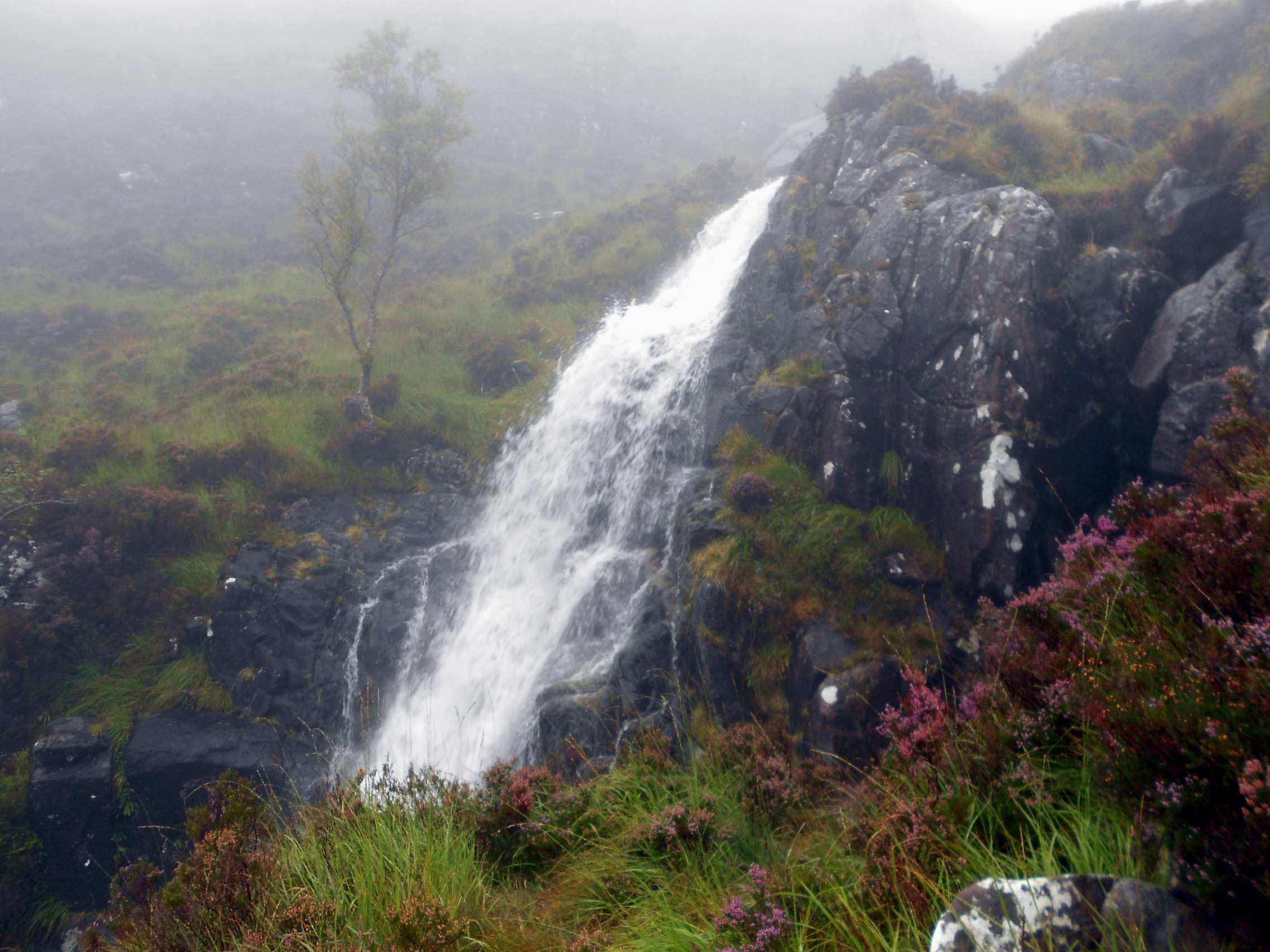
Above: Waterfall obscured by low-cloud a little way up the WS28 path
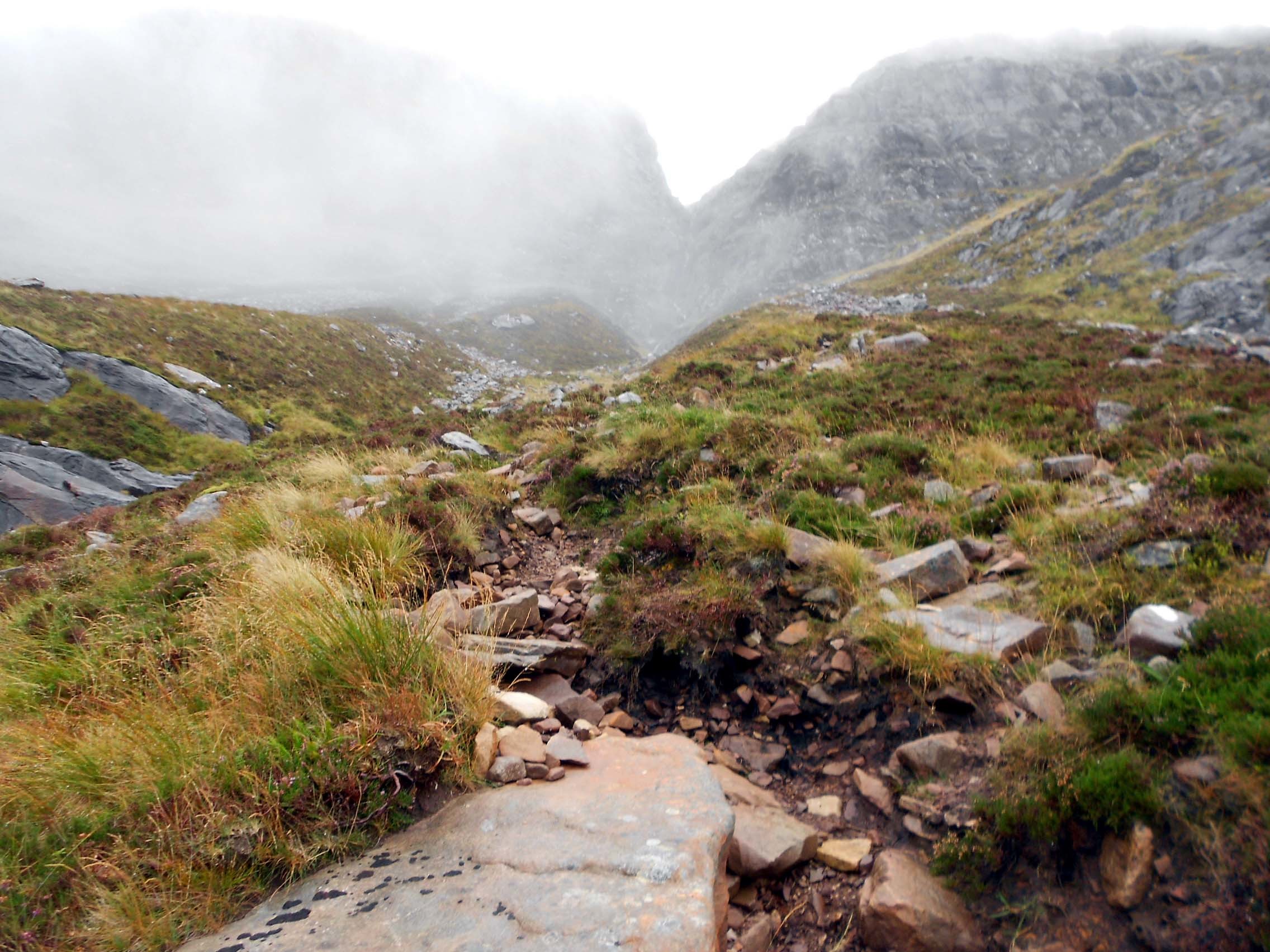
WS28 path looking up towards the cliffs. The path turns right just before reaching them.
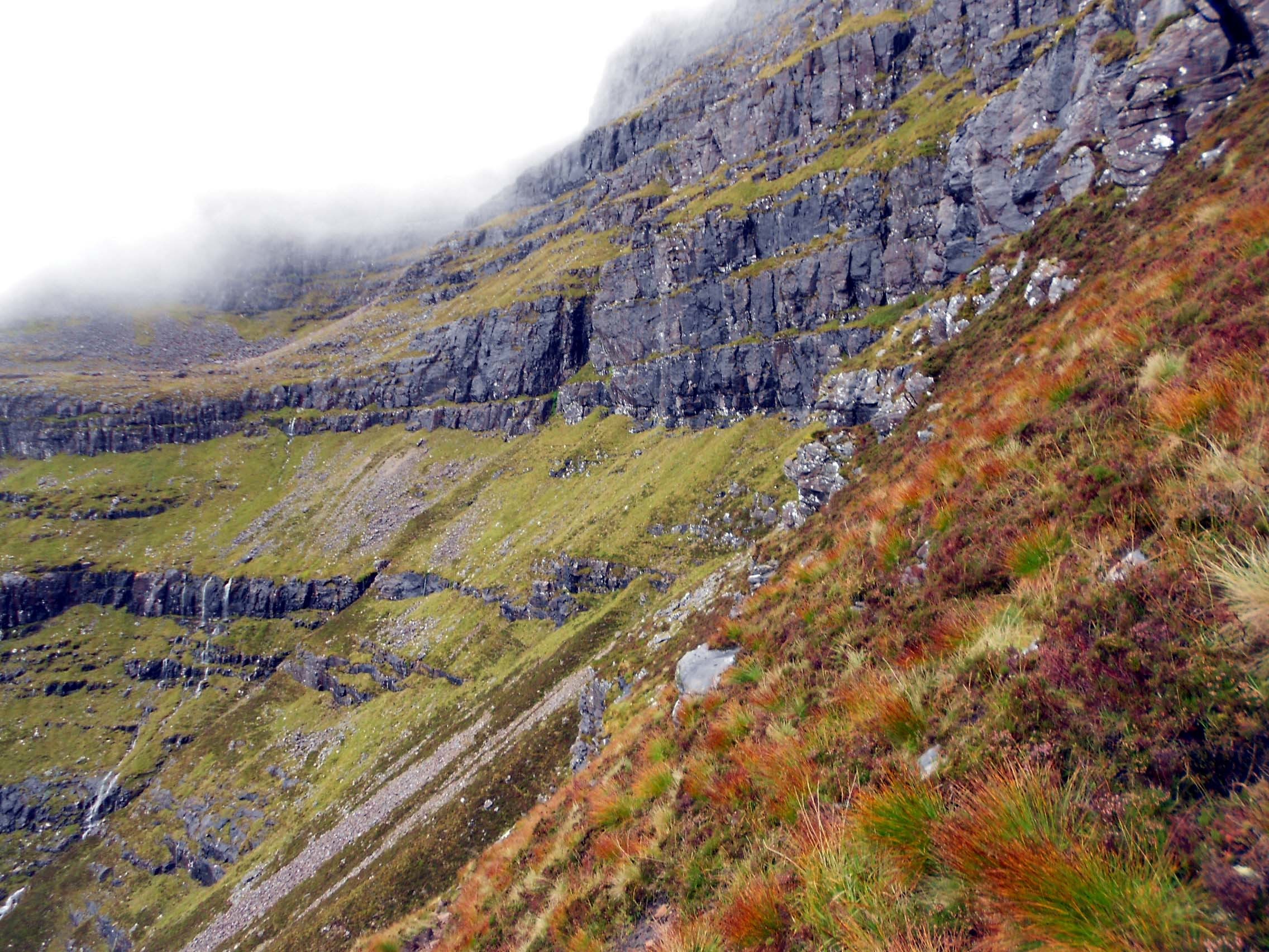
Above: Higher up the WS28 path looking roughly NW

Above: Looking back down towards the Torridon Valley
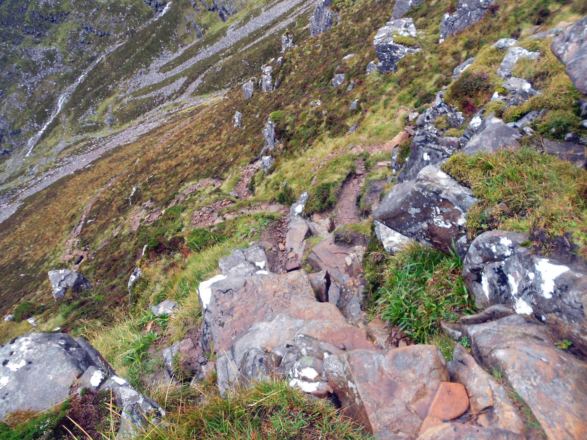
Above: Looking back at the minor scramble at NG 9383 5796 and zig-zag path below.
Above: Still higher on the WS28 path looking roughly NW
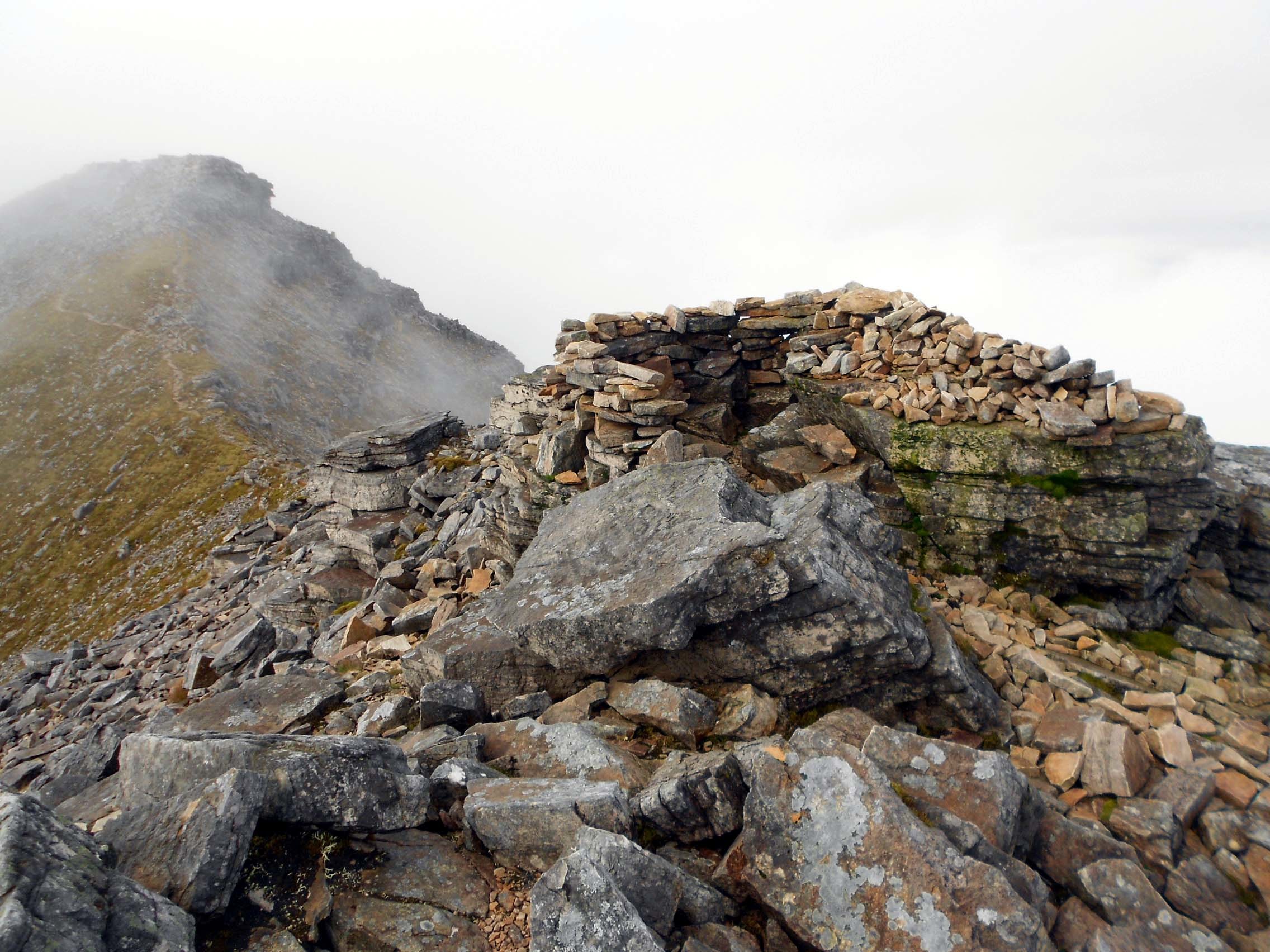
Above: On the WS28 ridge path. Shelter at an intermediate high spot NG 9348 5819.
Above: On the WS28 ridge path looking back.
Above: Summit of GM/WS-028 Liathach. Activation on 40m-20m-2m. Erecting the dipole.

Above: Summit of GM/WS-028 Liathach. Activation on 40m-20m-2m. Mast & dipole.
Above: Summit of GM/WS-028 Liathach. Activation on 40m-20m-2m. Mast at 45 degrees overhanging south face.
Above: Summit of GM/WS-028 Liathach. Activation on 40m-20m-2m. Looking roughly east in a rare partial clearance. Mast & dipole.
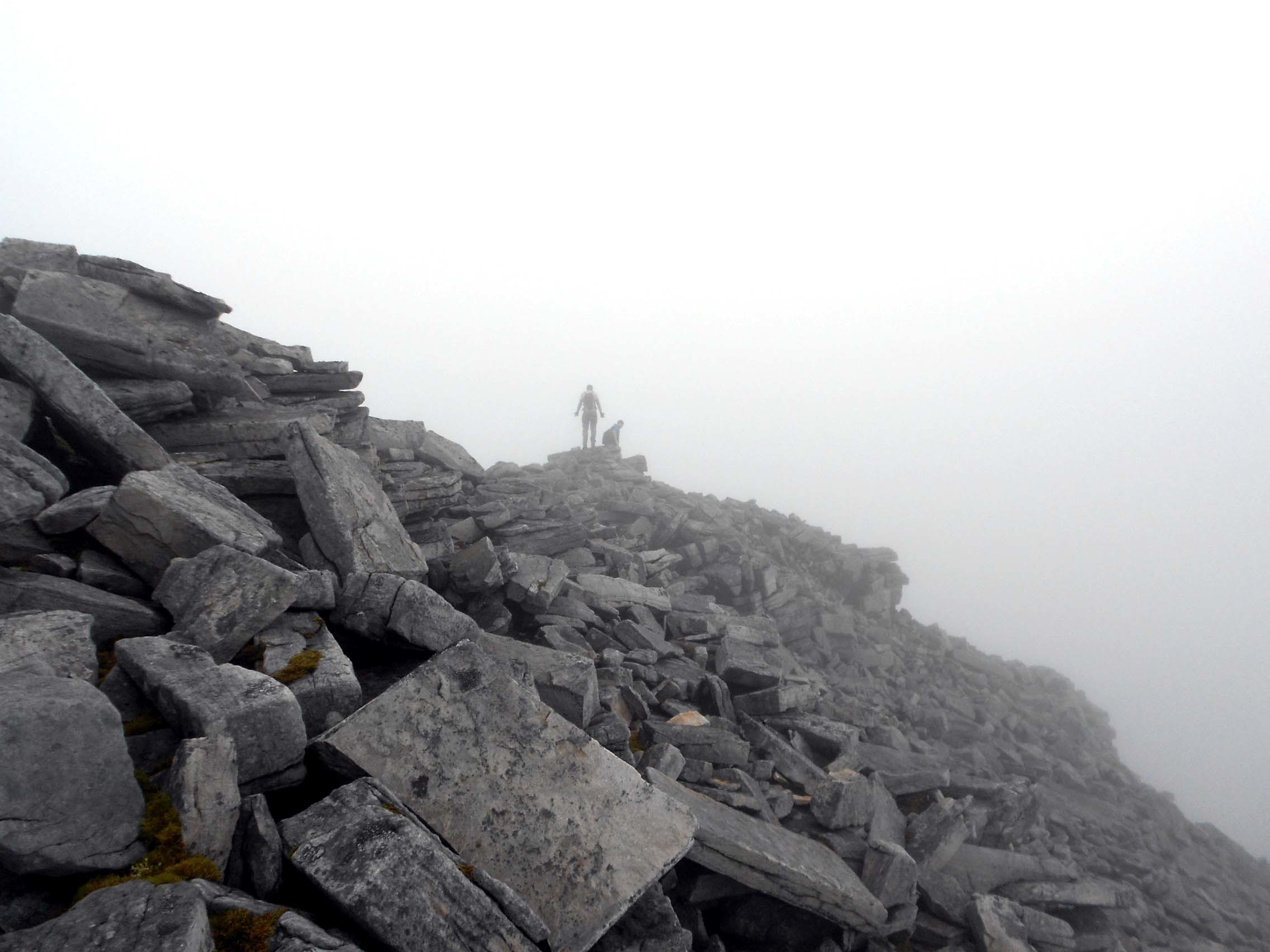
Above: Summit of GM/WS-028 Liathach. My only visitors departing eastward.
Above: My ‘popupdesigns’ reminder of Liathach. A thoughtful gift from my XYL.