BUACHAILLE ETIVE MOR on 10th September 2015
GM/WS-044 on 40-30m QRO & 2m-QRP.
G4YSS Unaccompanied.
SSEG Club-call GS0OOO/P & GM4YSS/P (the latter used for database).
All times BST (UTC plus 1hr, UOS)
RADIO EQUIPMENT:
HF-QRO:
FT817ND HF/VHF/UHF 5W Transceiver without internal batteries.
MX-P50M, 50 Watt HF Linear Amplifier.
Link dipole for 80-40-(30)-20-10m Bands (CT3 Dipole)
Four section x 5m home-brew CFC mast with 1m end sticks
Unitone 'D’ shape ear-cup headphones.
VHF QRP:
FT817ND HF/VHF/UHF-5W Transceiver.
Reserve Rig: IC-E90 4-Band, 5W-VHFM H/H (not used).
3-element Sotabeam for 2m-FM.
PVC mast ext’n for use with sotabeam on FM (vert) atop the lower two mast sections.
Batteries:
One 6Ah Li-Po (Part discharged)
One 2.2 Ah Li-Po (Not Used)
GPS:
Garmin GEKO-301
Pack weight:
11.1 kg (24.5 pounds) inc. 1 litre fluids
Introduction:
I first saw Buachaille Etive Mor from the rear seat of VKY139; my Parent’s Ford Anglia 105E while driving through Glen Coe, en route from Bradford to Fort William in 1962. I was a mere boy of 12 then but I couldn’t help being struck by the mountain’s classic looks. Since then I must have passed by a score of times without ever climbing it, so today I had finally come to set the record straight. Better late than never.
My 66th birthday had recently been and gone and the event had brought this mountain to the fore. A friend William, who has accompanied me on a goodly number of SOTA activations in the G/LD region, sent me a birthday card with a stunning photo of this mountain on the front. As a result of this and a desire to climb Ben Nevis again, the Fort William holiday was the one booked.
Our base was the Lochs & Glens Highland Hotel, Fort William; part our Ruby (40th) Wedding Anniversary. At 28 GBP pppn (self drive) it was a gift and the eastern end of Clen Coe is just 40 minutes drive away. ‘Training’ for this one took place on Ben Nevis two days prior. Though I was barely free of the after effects of that horrible Nevis descent but with only half the ascent and distance, I should have little problem getting up WS44. At first glance it looked rough and difficult but after some internet research my fears were somewhat allayed. It would be possible but I would need to take care getting onto the Bealach. An advantage could be readily gleaned from the map. There are two Munros on this mountain but the highest point and single SOTA summit is closest to the A82 road. That fact would allow an activation to fit neatly between breakfast and evening meal at the hotel, as I had little interest in bagging the second 3000 footer just for the sake of it. After all, I see my first duty as SOTA activator rather than a Munro bagger.
WX:
The ongoing period of high pressure promised good weather for the Munros with some sunshine and summit temperatures in the higher single figures. However, that was as far as the good bit extended. The MWIS forecast also warned of possible gusts of up to 50mph!
Route and Execution:
After the hotel breakfast at 08:00, the start point was reached by 09:30. Pausing for the customary litre of cold water, I was on the way, crossing the footbridge at 09:49.
Credit goes to http://www.walkhighlands.co.uk/ for the GPS route used and I marked a few additions on the way. Today’s start point was at the end of a short dirt road going south from the A82. This is a rough track so care is needed but I parked out of the way at NN 2216 5612 within 30m of the River Coupall footbridge at NN 2217 5610. If you prefer not to risk your suspension, there are parking places beside the A82.
After the footbridge you walk via NN 2212 5601, passing a white cottage with propane cylinders round the back, then fork right at a path junction - NN 2217 5577. From there it’s just a case of following the Allt Coire na Tulaich burn initially keeping to its left, after entering the Coire at NN 2202 5539. At NN 2196 5521 the path makes a rough crossing of the burn from left to right after which you are taken increasingly higher up the right hand (west) bank.
After passing a natural rock wall the path (much of it stepped) continues up via NN 2182 5487; NN 2174 5464; NN 2177 5456; NN 2167 5436 to NN 2159 5425 at which point it veers to the left (going SE) to gain the bealach at NN 2163 5416. The final 100m or so needs some care, both with ‘micro’ navigation and the fact that it is steep and loose underfoot. There are minor variations in approach but I ended up climbing the central shaley gully onto the col. Perhaps the better option, which I used for descent, is slightly further to the west.
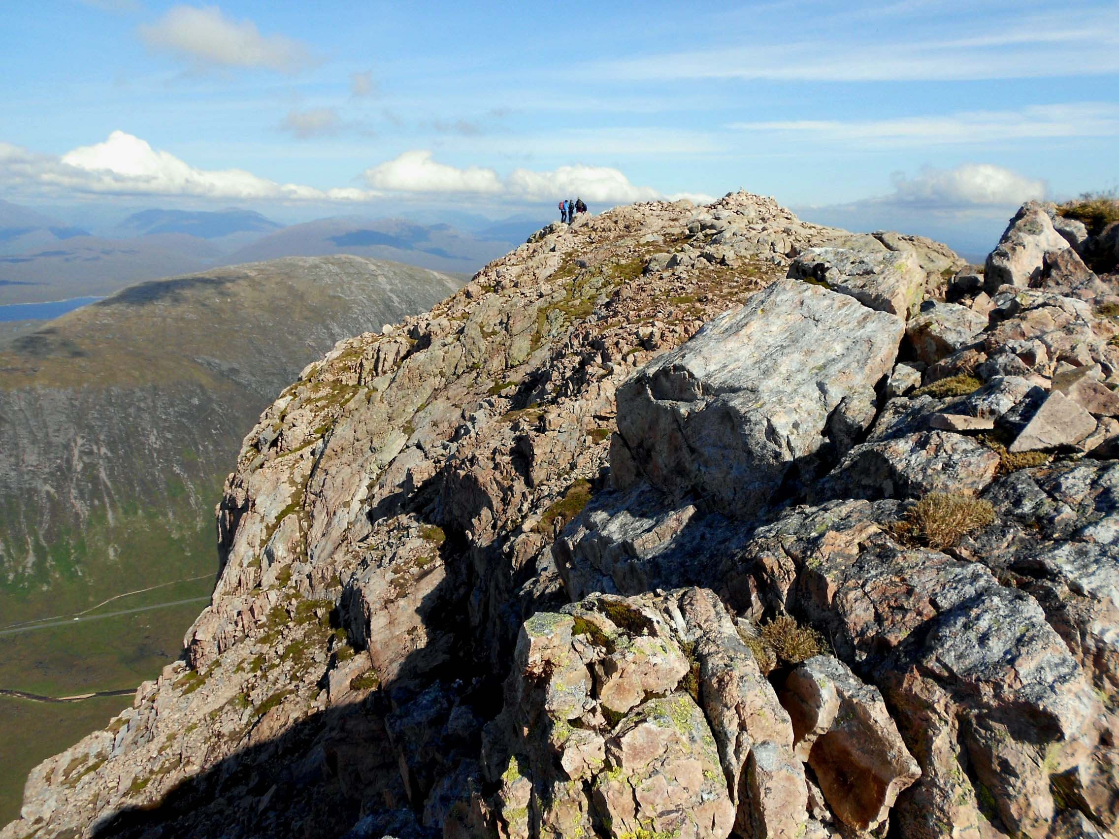
After the bealach it’s a simple ridge ascent with a path to follow via NN 2179 5412 and NN 2208 5413 onto the SW end of Stob Dearg. Arriving at the summit cairn in low-cloud at 11:26; I GPS’d the latter at NN 22369 54315. There is a shelter a couple of metres away where I had a word with one of two occupants; a man in his forties. The other temporary resident was an impressive looking Raven which didn’t seem to mind you getting in close for a photo. After meeting the Ben Nevis Raven of two days before, one could be forgiven for thinking that all mountains around these parts have their own summit custodian.
BUACHAILLE ETIVE MOR, GM/WS-044, 8 pts, 11:26 to 15:23, 9 to 12 deg C, 20mph - later 3 mph wind/ midges. Sunshine after brief low-cloud. WAB-NN25 (No Trig), LOC-IO76NP. Orange (EE) mobile phone coverage at summit and along all of the route.
Backing off the summit about 100m, I set up the dipole clear of the path at NN 2229 5428, just fitting it between two high points on the ridge which overlooks the A82.
5.300 CW/ USB: - Nil QSO’s:
After some good fortune on 60m from Ben Nevis, it seemed the obvious band to start on. However because I skipped breakfast for WS1, there were more than a two hours difference in timing and I probably missed the boat for that reason. Whether I was too late or it was merely down to daily variations in propagation, I couldn’t say but despite Roy G4SSH alerting 60m on sotawatch, nobody heard my invitation. After trying for 10 minutes on 5.300 with both CW and USB, I put out CQ’s on the old FE and FM channels, all without the desired result. I would have to wait to qualify.
7.031 CW – 14 QSO’s:
A phone call to G4SSH sorted out the situation when he spotted me on 40m-CW. Roy was also first in the log with an exchange of only 559/ 229. Power for this session was 30 Watts and I went on to log: G3VXJ; G4OBK; PA7ZEE; ON6ZQ; G4CMQ; G4FGJ; PA0SKP; DL1FU; DK7ZH; OK1ZE; PA0B; DJ5AV and EA2DT. Signals were mostly registering 579 to 599 on my S-meter with return RST’s up and down in QSB between 439 and 599. PA was slightly down on G and EA further down still; the latter 559 both ways.
7.163 SSB – 21 QSO’s:
With band conditions as bad as they have been for weeks now, it’s not often that you hear a WAB net running on 7.160 but there are listeners. Sooner than complicate matters finding an alternative, I gave a call on there and was answered by Ken G0FEX. I could hear other activity so migrated 3kHz up for the SSB session which was run at 50 Watts. Knowing I had to be back at the hotel for evening meal at 6pm today, I was less concerned about battery longevity compared with Ben Nevis where I’d stayed for almost seven hours.
After Ken came: G7BGA; M0EDY; M1ACB; G3ADZ; M0ZOL/M; G7HFS/P; M0BKV; M0IML/M; G4WSB; M0MDA; M0NTC; M1DBB; M3FEH; G4VCJ; MM3PDM/M; 2E0TVV; M0WBG; M3FEW; G3RDQ. The final QSO was with another mountain, namely Val G6MML/P S2S on G/LD-046 (Longridge Fell) for which we were treated to some deliberate QRM - utterly ignored at the time of course!
Reports were mainly good with lots of 57’, 58’s and 59’s going back and forth (including a ‘59 plus 20dB’ from Karl M3FEH) but QSB was present. The most difficult were the mobiles but we got the job done without too much trouble. Strangely after working several on CW, no overseas stations were logged on 40m-SSB. Now was the time for a relaxing lunch break but that was slightly marred by midges.
10.118 CW: - 8 QSO’s:
Since few overseas stations had hitherto been worked, the next obvious choice was 10MHz. It was to be hoped that band conditions on there would be better than two days prior but it was not the case. Nonetheless, the following stations managed to get through to me: YO2BP; S52CU; F6EAZ; DL1DVE; OE7FMH; LA3NGA; DL7URB and EA2DT. Signals ranged between 559 and 579 incoming and 539 to 599 outgoing. There were two 599’s coming from OE5FMH and LA3NGA but were they just being polite? Judging by the QSB these could have been entirely accurate. Power was 30 Watts.
The next session would have been 144.300-SSB but due to a total lack of any success on all beam headings from Ben Nevis, this was simply deemed time wasting and omitted. Pity but apart from one or two well known stalwarts, it seems that we are all to blame for this situation.
145.575/ 145.400 FM – 2 QSO’s:
For this the 3-ely was set vertically using an RF-neutral mast extension on the lower two sections of the carbon HF mast. It’s still annoying that the coax feeder is forced to pass through the field of the antenna but despite that, it still seems to work very well.
After a successful sked (set up using email) from Ben Nevis with Ray GM3PIL in Nairn on the 8th, I hoped I might work him from here also. However, this is not the highest mountain around and we knew it would at best be a struggle. With Ray in mind I started on the Inverness area frequency of 145.575, pointing the beam that way and calling with the maximum 5 Watts available. Ray never did properly receive my signal but at least Bob MM3ZRF came up from Alness to confirm I was getting out in that direction. The exchange was 59 both ways. Ray (41 to me) heard Jim and joined in with the benefit of some QSP’s from Jim.
Sadly Ray could just about tell I was there but no more. He gave me 22 but I was unable to get my report across. There was nothing further that could be done. If I’d been blessed with the IC706 with its 50 Watt output, I know I would have succeeded. If I hadn’t already packed up the dipole and also left the 160m loading coils in the car boot, I would have tried Ray with 50 Watts on 1.8MHz CW. Too many ‘ifs.’
After saying 73 to both, I put out a few more CQ’s on different headings. Nothing was heard so finally pointing the beam south, I was answered by Jack GM4COX in Carluke - 25km south of Glasgow. The exchange was 59/ 57 after which we had a lengthy chat until the deadline for leaving was reached.
The Descent:
The walk back to the car wasn’t too demanding and non too sweaty either as much of the route down Coire na Tulaich was in deep shade. The initial section down from the bealach did prove a little slow and tedious. The descent was complete by 16:44 which got me back to the hotel with half an hour to spare at 17:30.
QSO’s:
0 on 60m CW
0 on 60m SSB
14 on 40m CW
21 on 40m SSB
8 on 30m CW
2 on 2m FM
Total: 45
Ascent & distance: 735m (2,411ft) – 7 km (4.4 miles).
Elapsed times: Walking times – Up: 1hr - 37min. Down: 1hr – 21min. Summit time: 3hr-57min. Gross time: 6hr-55min.
Observations:
A long time ambition is now fulfilled. My first ever climb of WS44 is behind me and benign weather made it reasonably easy. What happened to the 50 mph gusts, I will never know. No more than breezy at first, the wind dropped below 3mph inviting midges to have a go at me. On the strength of the mountain forecast, deemed not required, the midge net was removed from the rucksack before starting along with the Top Band coils and some water to save weight. Fortunately these late season bugs; merely irritating are less vicious than the mid summer versions.
The views were tremendous all day long. For the activation I sat facing the A82 and could see most of the lower part of the ascent route including the car parked just 1,800 metres away and made more distinct by its own shadow. At a range of 18km, the overpowering bulk of Ben Nevis made its presence felt by towering over intervening and lesser mountains. One or two who passed my QTH were on their way down the ridge to the other high points. I was just grateful that the low spots on the way were all shallower than 150 metres and I would not have to follow.
Because the SOTA is the closest point to the road, this mountain turns out to be easier to activate than it first looked and could probably be done in half a day. Though the final incline to the bealach is a minor scramble, the route is not as challenging as you might believe looking from the road; in summer at least. However, if you want more excitement you can always try the buttress route which I’m told exists to the NE of the summit but it’s not something I will be investigating.
As was the case from Ben Nevis, the QSO tally was somewhat disappointing but it wasn’t for the want of trying or a lack of power. If I’d had more time, I might have tried 20m despite being told that band wasn’t up to much either.
Thanks to all stations worked and to those who spotted me, namely Roy G4SSH; G0UUU; M1ACB and RBN Gate KU6J (DJ9IE). Thanks to G4SSH for telephone liaison, alerts & spots.
73, John G(M)4YSS,
Also using SSEG GS0OOO/P.
(This summit will be entered under GM4YSS/P for SOTA purposes)
Photos: 140a-10a-42a-57a-79a-87a-94a-100a-114a.
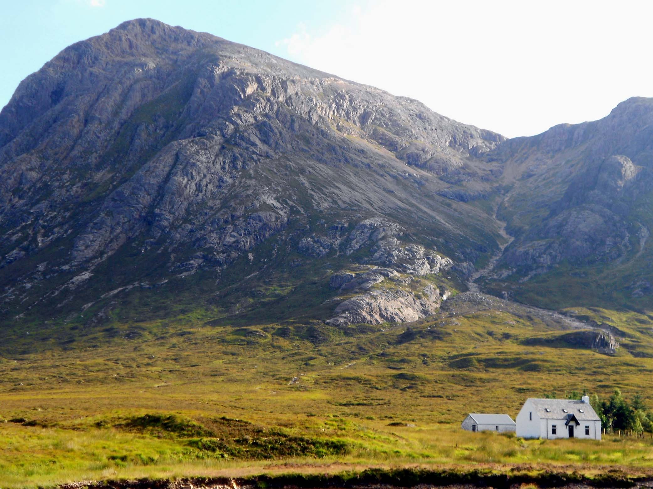
Above: Photo (taken from car after finishing).
Buachaille Etive Mor at left.
Route up Coire na Tulaich to bealach at right.
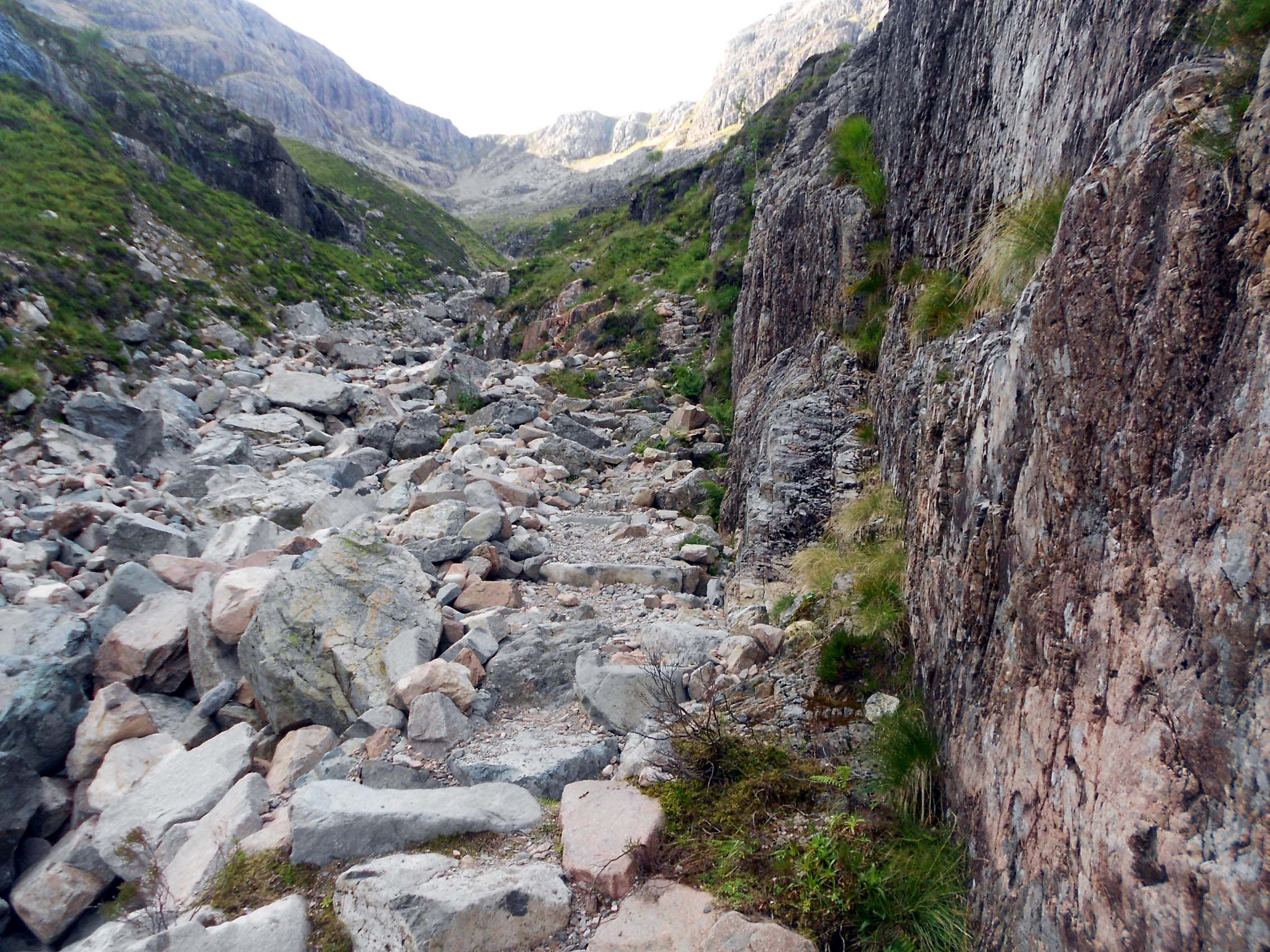
Above: View looking up Coire na Tulaich.
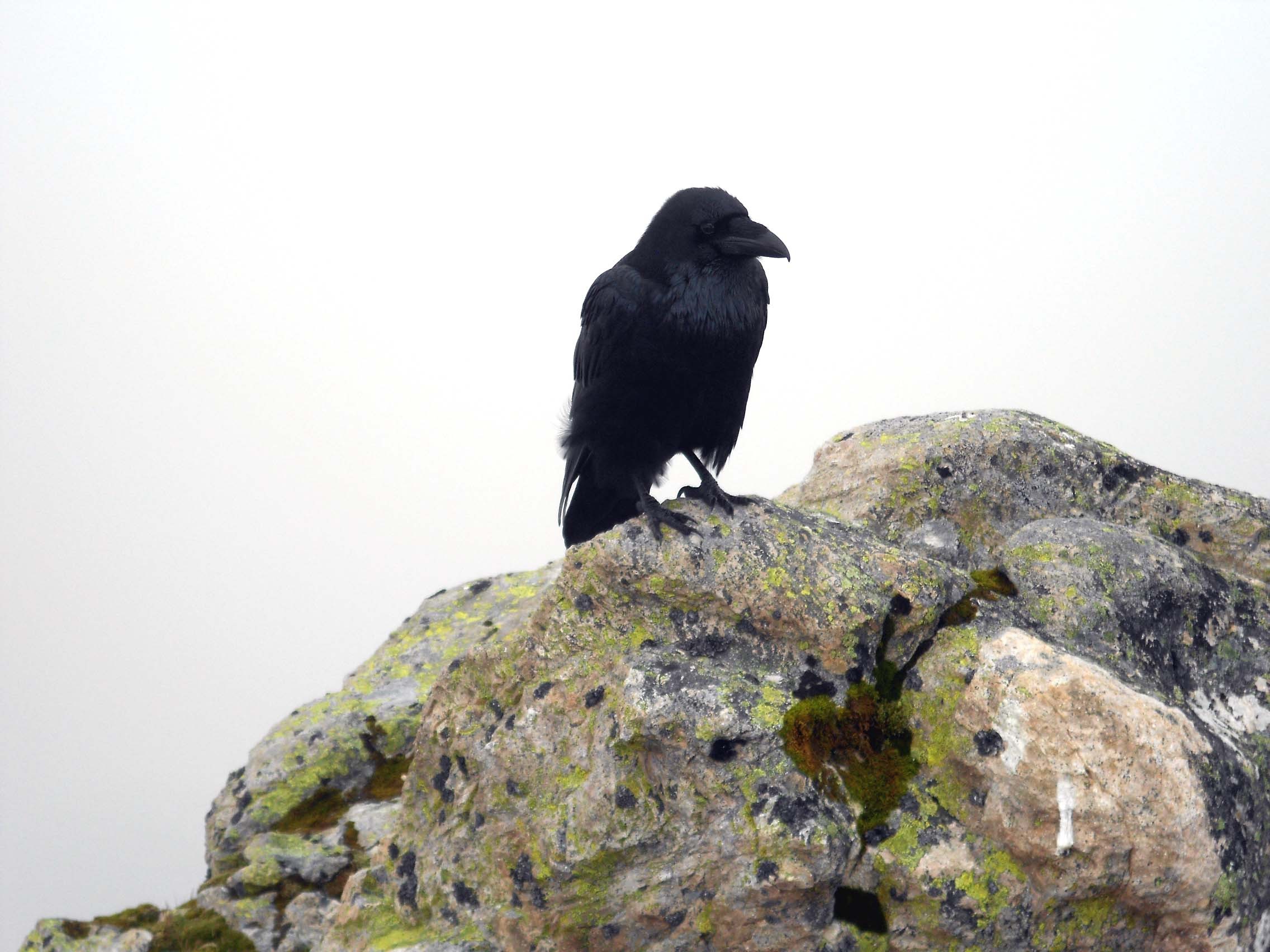
Above: Buachaille Etive Mor summit and Raven.
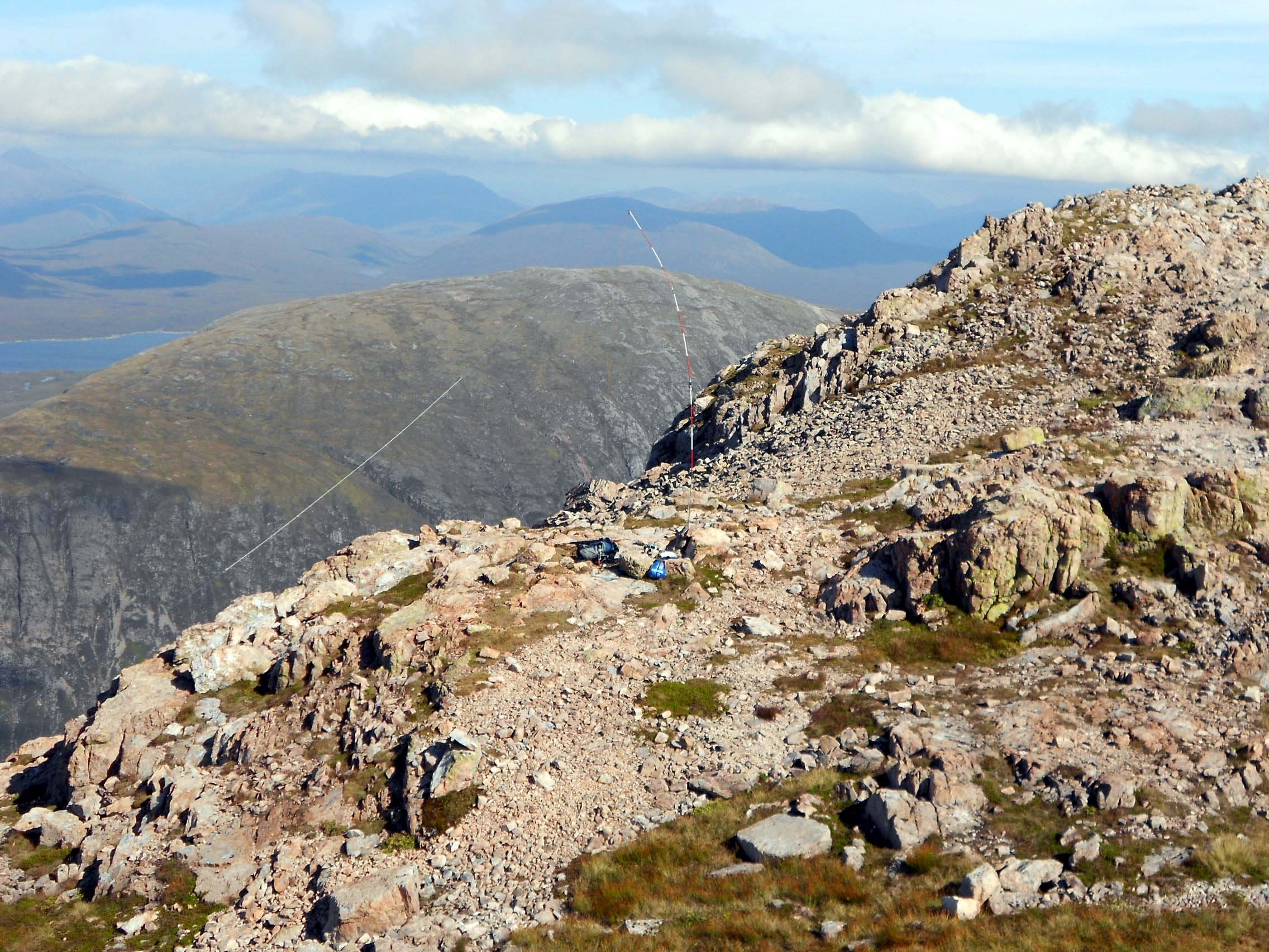
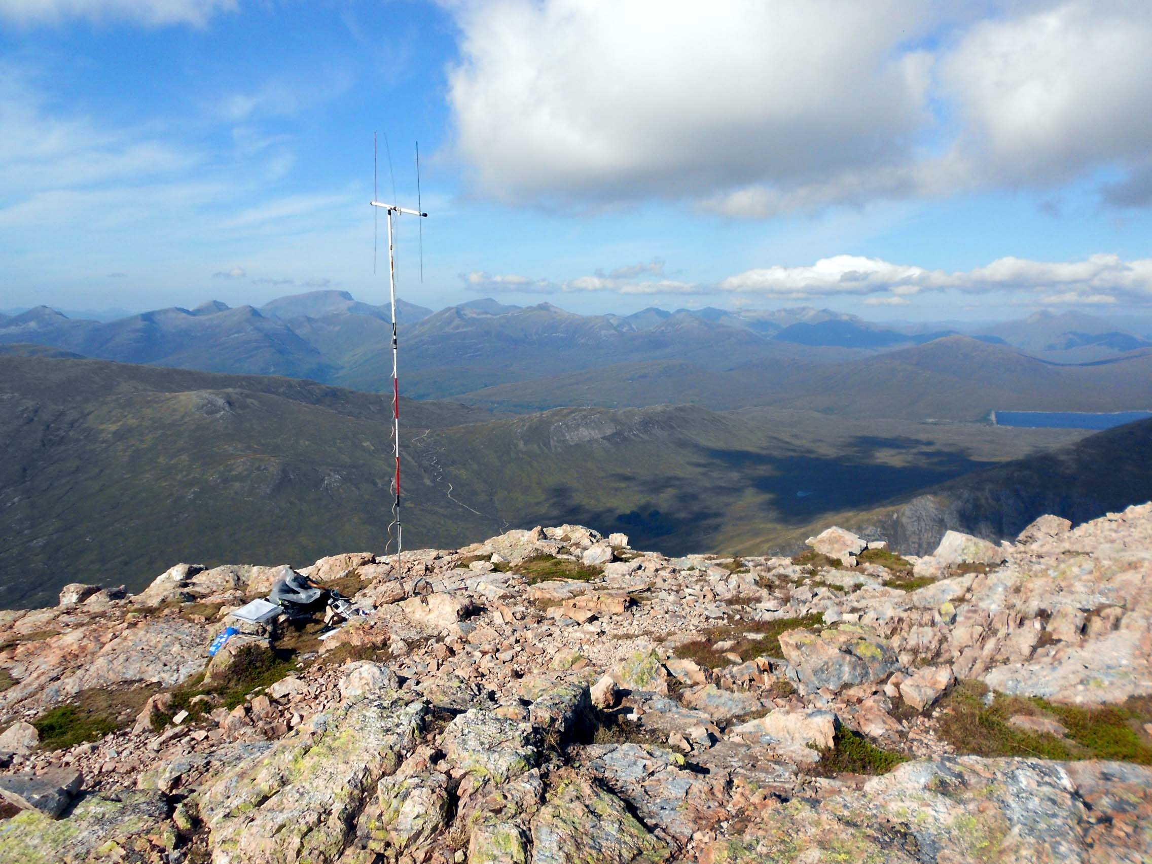
Above: Buachaille Etive Mor HF Activation.
Above: Buachaille Etive Mor summit from activation QTH.
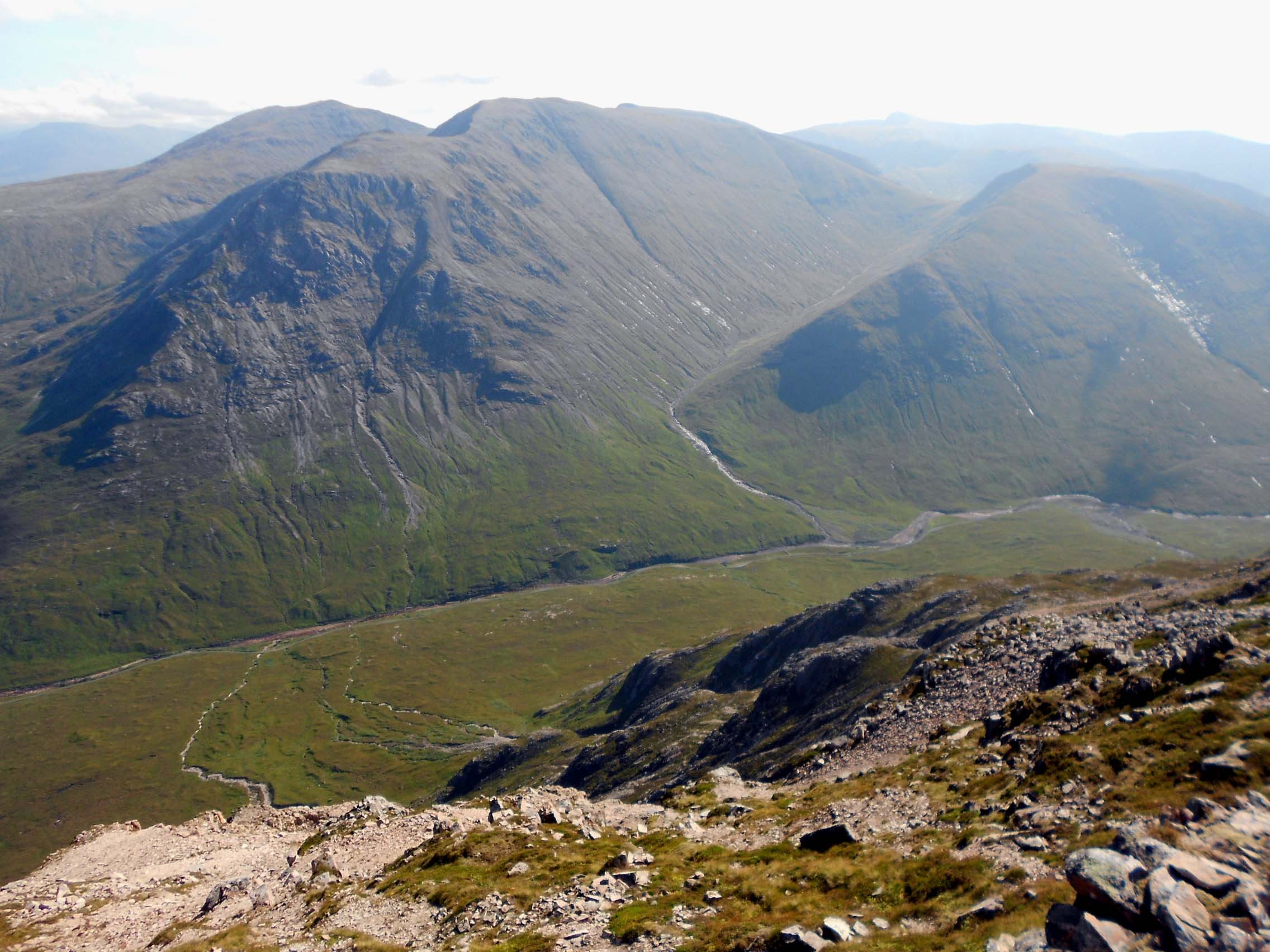
Above: Looking down to the River Etive from Buachaille Etive Mor.
Above: Buachaille Etive Mor VHFM Activation.

Above: Looking down on A82 and parked car from Buachaille Etive Mor.
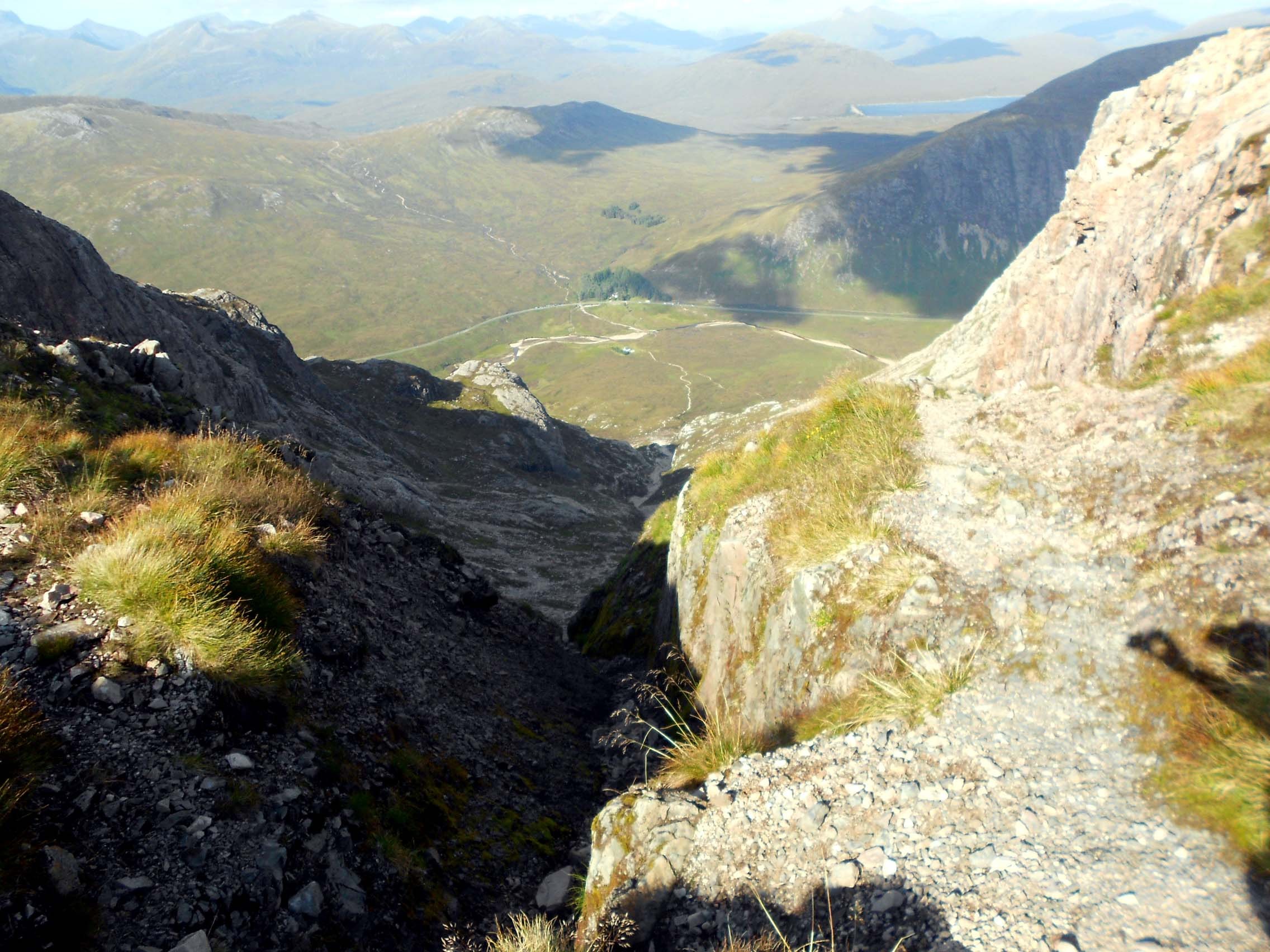
Above: View looking down Coire na Tulaich from the bealach.
GM/WS-293; GM/WS-007; GM/WS-002 Reports to follow in due course.