G4YSS: GM/SS-016 & GM/SS-020 on 16-06-23
Issue-1 (Pse rprt errors)
Activation of BEINN NARNAIN and BEN ARTHUR (The Cobbler) on 16-June-2023
G4YSS using GM4YSS/P
VHF QRP on 2m-FM only
All times: BST (UTC plus 1hr, UOS as ‘z’)
EQUIPMENT:
Vertex (Yaesu) VX150 2m/ 5W mono-band handheld with its 6 AA Ni-Mh Battery Pack
J-Pole for 2m-FM on short 2-section mast
Reserves:
Baofeng UV-5R 2-band, 5W VHF H/H (not used)
Baofeng UV-3R 2-band, 2W VHF H/H (PMR use)
Pack Weight: 8kg (17.6 pounds) inc. 1.5 litre drinks (1.25 used)
INTRODUCTION:
This was the forth and final SOTA activating day of this year’s trip to GM/SS based at the Ardgartan Hotel from 8thth to 16th of June 2023. Previous Activations: SS27 on 10th June; SS18 Beinn an Lochain on 12th June and SS32 Stob Coire Creagach on 14th June 2023. All the above with 2m-FM QRO and a beam.
Neither SS16 nor SS20 would be new to me. I activated SS20 in 2020 and again in 2022, from Succoth when SS16 was added. I was looking for something close to the hotel so what better than SS20? At 3.2km, The Cobbler can be clearly seen from the hotel window and vice-versa. Putting on the Munro next-door - SS16 Beinn Narnain while I was up there seemed like an opportunity not to miss. In fact I would be aiming for that one first.
The chosen start point would be the one I used in 2020 to access SS20, following information gathered from a chance meeting with some dog walkers. It is located on the A83 half way up the hill to Rest and Be Thankful at NN 2427 0598. These two mountains are normally done from Succoth but that is at sea level whereas the alternative specified is at 170m ASL.
Due a misconception on my part and a certain amount of muddled thinking, I ended up doing more work than was strictly necessary. When I got the information from the dog walkers I took it that they were sending me up a path at the South side of the burn which runs down from Bealach a’ Mhaim (NN 2617 0710 - 673m ASL) and under the A83 next to where you park the car.
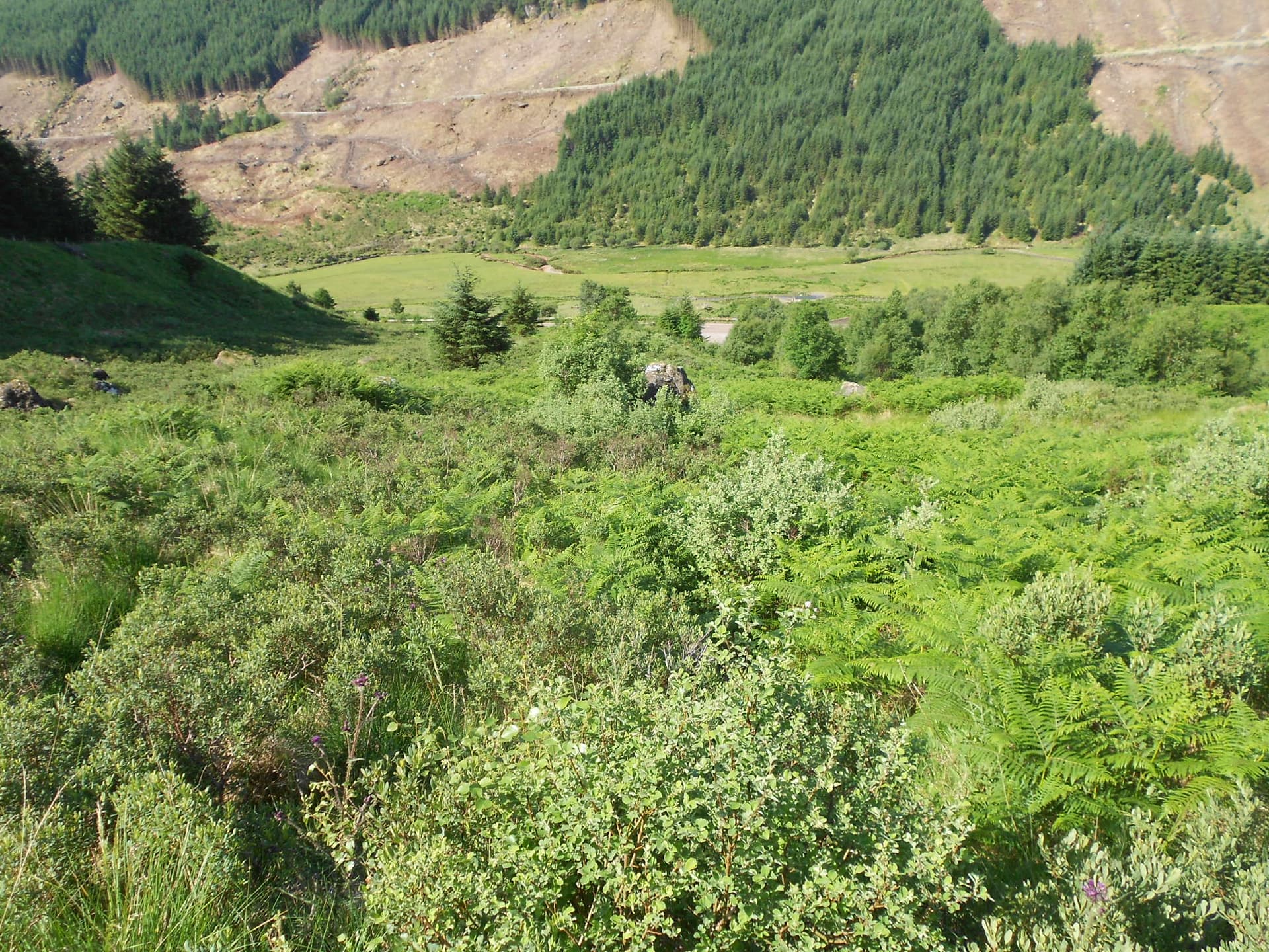
I used this in 2020 and found it to be one of the worst excuses for a path I’ve ever had the displeasure of walking. It is at best poorly defined and at worst non-existent. It runs through bushes, bracken and bog myrtle at the start, whilst higher up there is long grass, sudden direction changes and hidden trip hazards. By that point you will have lost it several times and wasted a lot of time and energy trying to regain it. I know because I’ve been either up it or down it three times now but never will again!
In 2021 I activated Beinn Luibhean SS25 using the first part of a better path which runs up and along the north bank of the burn after first crossing it on a metal bridge. I confirmed on the way back today that this continues up towards the Bealach but whether it gets there or not will need to be the subject of further study if I ever go back. It certainly goes as far as the dam and probably quite a bit further but my guess is that it might fade out before the Bealach?
EXECUTION and ROUTE:
The earliest hotel breakfast option was 08:00 and the evening meal time, preferred by my XYL was 6pm so this would have to fit between those times. Since I intended to do two summits, depending on energy levels etc, I would have to travel light. When packing the rucksack, my Moonraker M270M 25W rig, the big Pye filter and the 3-ele beam gave way to just an old VX150 and the J-Pole but the reserve rigs remained the same. However, more fluids (1.5 litres) would be required than in previous single activation days.
Hotel to parking place is only a 5-minute drive which enabled a 09:28 start. I nearly crossed the metal bridge (I really should have done) but then doubled back to take the path on the right, accessed through a 3m wide gap in the fence. In a heatwave that was now at least 8 days old, I knew that I was facing a hydration challenge. There were 1.5 litres in the rucksack including electrolytes and I had a 2-litre bottle of water which stays in the car. Trying my best to get through the latter before starting, I could only manage about 1.2 litres before baulking at the rest.
Once underway it became immediately obvious that this was not going to be an easy day. Already bushes and tall vegetation were impeding progress. To cut a long story short I tried to follow or more appropriately ‘detect’ the path running parallel with the southern bank of the burn as best I could. I won’t be listing waypoints for the rare occasions I found it because I wouldn’t want anybody to go this way. Below are the instructions and waypoints for a better path that goes along the NORTH bank of the burn and which I marked on the way down.
What I should have done:
Leave the car at NN 2427 0598 (room for 3 or 4), cross the steel footbridge at NN 2428 0603 and turn left. A track curves steeply up via NN 2424 0605 to NN 2443 0624 where a path takes over from it. Judging by the work being done and a new surface of pegged-down hessian, all the signs are that this track is intended to go much further – perhaps right up to the dam? Follow the path up and parallel with the burn and above its north bank via: NN 2448 0628; NN 2471 0645; NN 2486 0660; NN 2510 0668 and beyond?
I can’t vouch for it too much further up because I didn’t walk that section today and have never walked it. If you remember I was walking on the south bank of the burn and I did eventually find and cross the main path about 400m S of the Bealach at NN 2621 0671. From there I went a short distance uphill on grass to find a good stepped path up Beinn Narnain which runs east via: NN 2636 0671; NN 2655 0669 (turn NE); NN 2663 0685 (turn SE); NN 2671 0675; NN 2686 0664 (east again); NN 2706 0664 (thru’ a minor rock-field) to the summit of Beinn Narnain at NN 27174 06643.
The walk took 2 hours 40 minutes which is much longer than the 2 hours 6 minutes from Succoth in 2022. This was partly due to the heatwave but much more the rough terrain on the south side of the burn.
BEINN NARNAIN - GM/SS-016: 926m, 6 pts, 12:08 to 13:21. 20C+. 5 mph breeze with sunshine. No midges. Vodafone 4G coverage. LOC: IO76OF, WAB: NN20, Trig: TP-1224
The summit area of Beinn Narnain is flat, rocky and unspectacular. It was deserted on arrival but presently a cheery young lady arrived as I was photographing the trig point, introducing herself as Julia from Glasgow. She told me that she uses the Oban or Fort William bus service to get to Arrochar which is around 1km from her Succoth start point. Apparently it only takes about 75 minutes. I think the buses must travel a lot faster than the ones where I live. Either that or they stop less often.
Setting Up:
The J-pole mast was poked into the top of a large cairn about 100m west of the trig. There was a small stone there with a name painted neatly on it. ‘Kirk Allan 14-02-01 to 25-07-20.’ I was careful not to disturb this miniature but obviously sad memorial but at the time I didn’t know how sad. A Google search days later revealed a truly terrible story!
145.400 FM - 8 QSO’s:
Using the VX150 with a self-spot to help, my 5-Watt CQ was answered at 11:34z by MM7DIR – Neil in Longridge who gave me a 57 and a local temperature of 21C. There was plenty of time for that to increase; afternoon temps in the glens had been consistently 26C in previous days. Neil’s signal was 59 but the meter on the VX150 said 57. Having not used it for 10-years or more, I had forgotten about the lazy S-meter.
MM7SWM - Stuart called in from Glasgow but he was only hearing me 47. Next in the log was Peter GM0VEK – a third ‘regular’ from the week gone by and also located in Glasgow at 59/ 54.
Continuing with regular chasers, the qualifying QSO with MM7DKY – Stu’ in Wemyss Bay with 57/ 44 was logged followed by our friend in Greenock MM0XPZ Steve who gave me an ‘end stop’ report. Steve mentioned his regular pool visit for the morning along with a plan to go shopping in the afternoon. I hoped he’d be back in time to work me on The Cobbler should I decide to do it later on.
S2S:
This took me by surprise as I hadn’t worked too many summits on weekdays after several successes from Ben Donich with QRO and a beam on the Saturday. MM7TXV/P and MM7AJE/P Kevin & Paul called me from Corse Hill GM/SS-236 south of Glasgow in the middle of a Wind Farm in Whitelee Forest. Despite us both using 5W and their rubber duck antenna, we exchanged 59’s over a distance of 69km (43 miles).
They were using a Chinese rig with a name starting with ‘Q’ a make I’d never heard of and didn’t write down but the audio was good. Internet research later uncovered the manufacturer ‘Quanzhou?’ This was Kevin’s first ever SOTA activation and only Paul’s second so I made time to welcome them and we passed it back and forth for a while.
Ken GM0AXY supplied the final SS16 QSO from Edinburgh with 59/ 57. ‘Is GM4YMM there?’ Ken replied that Christine had gone to meet her friends to do some quilting.
SS16 to SS20 Route:
In 2022 I’d had no plan to add SS20 and no knowledge of the path. I made my way off in fog then without a GPS route to help and got slightly lost in the process. Today all I had to do was retrace my steps to the low point between the two summits and climb the initially steep but well defined path from NN 2612 0659 which is the Cobbler ascent path junction.
The path goes up SS20 via NN 2603 0640; NN 2602 0611 and NN 2605 0596 (where incidentally a steep path descends eastwards to join the main valley path near Narnain Boulders). Continue up via NN 2597 0590 to the summit which today was deserted, at least at first. The journey took an hour and six minutes, a bit quicker than last time due to a more direct path down SS16 that I failed to find last time.
Four Doctors:
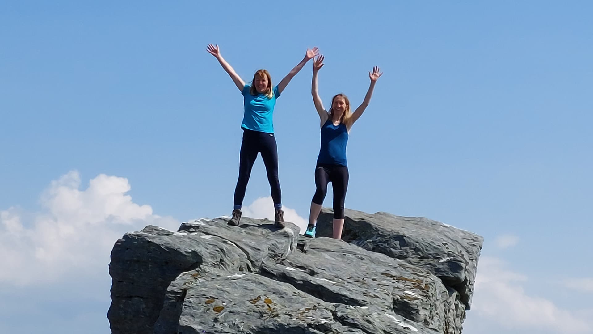
I spoke to a few people on the way up. A man on his way down told me about 'four young lady doctors who had made their way across up from Rest and Be Thankful’ mainly without the use of paths it would seem. They were still at the summit when I arrived and I found out later that their car was parked adjacent to mine. Possibly they could best be described as a ‘bubbly quartet’ and they were certainly game for adventure and a laugh. Two of them were especially brave. See the photo featuring them standing fearlessly on top after ‘threading the needle.’
BEN ARTHUR (The Cobbler) - GM/SS-020: 884m, 4 pts, 14:27 to 15:31. 20C+. >5 mph breeze with Sunshine. No Midges. Vodafone 4G coverage. LOC: IO76OF, WAB: NN20 - No trig.
The mast would barely penetrate the soil but after some effort I settled down on the edge facing south.
446.00625 FM -1 QSO:
I worked my XYL using a pair of handhelds – mine was ‘yoked up to’ the 2m J-Pole. She was inside the Ardgartan Hotel which was clearly visible at the edge of Loch Long 3.2km below. Signals were strong but replies short. I think she may need further training particularly in the use of PTT but we managed to get the information over, mainly my intended descent route and ETA.
145.400 FM - 7 QSO’s:
After a self-spot and CQ , Steve MM0XPZ came straight back with the second ‘end stop’ report of the day. ‘Ah you got back from the shops in time then?’ 2M0ROT Stuart from Port Glasgow was next, followed by MM7SWM Stuart in Glasgow and 2M0DKU Stevie located near Cloch Lighthouse, Gourock.
Next I heard a familiar callsign but failed to guess the when and where. I soon cottoned on when GM3YTS Rob reminded me of our meeting on GM/WS-003 Aonach Beag in September 2021. He was activating it with Gavin GM0GAV at the time while I was doing the same on different HF bands. Gavin’s quest is to activate all the Munros and Rob informed me that he only has about 30 to go. What an achievement that will be!
Cloth Ears or What?
I was then called by someone who sounded slightly disgruntled. This was GM8JUY Bob who told me that he’d been calling me for some time both on .400 and during my periodic returns to .500 when the frequency dried up but I’d never responded on either. I certainly would have if I’d heard him. If I hear more than one caller I almost always say so and most times acknowledge them with their callsign or part thereof if I didn’t get it all. I then normally ask them to QRX and work them in order. I couldn’t blame noise either. Unlike the last time I was here, there wasn’t any. I don’t know what could have happened but I did apologize.
If that wasn’t bad enough a chap then came over from the path to ask me a question in what sounded like an urgent voice, ‘Which of those two mountains is Ben Ime?’ This was at the very moment that Bob gave his QTH and handed it back to me but all that registered was the word ‘airport.’ I pointed to the subject mountain for the walker and blurted out some basic instructions about how to get there. It took maybe 10 seconds but then from the radio came; ‘You’ve disappeared again!’
I apologized to Bob for the second time after explaining the distraction then went on to tell him that I’d ‘Worked someone from near Glasgow Airport from a summit a few days ago.’ Back came the retort, ‘No no I live near Prestwick Airport, not Glasgow.’ ‘A place called Dundonald.’ That further confused my tired brain because I could have sworn Dundonald was in Ireland though I know for sure that Prestwick is in Scotland unless there are two of those as well. Of course I didn’t pursue that one but at one stage I was left wondering if I’d heard ‘GM’ or was it ‘GI’ or even ‘EI?’ Too scared to check we chatted for a while and he gave me 59++ before we parted apparently the best of friends.
Now we come to the final SOTA QSO of the holiday in the form of a ‘regular’ Doug MM7DCD in Glasgow 59/ 53. I didn’t know it then but I was to briefly work Doug the following day while heading south down the M74 from Glasgow on the way home to Scarborough. He came in to wish me a safe journey and thank me for the SOTA’s.
All reports on this activation were 59 both ways, except Doug, with an on-air time of 25 minutes. If they were already in the earlier SOTA logs, I thanked them for all QSO’s.
Final Descent:
I packed up and left the summit at 15:31 after speaking to two fellows from Edinburgh who’d just arrived. They were eating pork pies which they’d bought on their way through Callander (a bit ‘round the houses’). I remember doing the same in 1962. They asked me which way I’d be going down and I pointed out the ‘short cut’ so here’s the description:
After descending the main path north off the summit for about 300m, head down the 1km long slope via NN 2599 0605. A burn runs NW down this valley. Pass small cliffs at NN 2593 0607; NN 2573 0621 and NN 2559 0630. Beware 'cos it’s a bit rough and certainly pathless. Head down past NN 2541 0644 and cross the burn at around NN 2536 0667 to join a reasonably good path which runs WSW along the north side of the burn to the parking place. Waypoints for this final section are given under the title ‘What I should have done.’
Just before crossing the burn I spied the four female doctors walking down the north side of the burn as they appeared from the right. An animated group, they were so busy talking that my catching up startled them. Turning around they said, ‘Hello again.’
I asked them why they’d decided on this particular and little used route. The reply from one, ‘That’s my cousin’s fault.’ I was not the only one who had been succoured into walking up on the wrong (S) side of the burn. They’d done it too and our experiences were similar. They couldn’t find much of a path either.
They’d obviously come down The Cobbler via the accepted route passing near to Bealach a’ Mhaim whilst I’d cut the corner. I regret that I forgot to ask them about the state or existence of a path higher up. Now I will have to go back and check that unknown 1km from NN251067 to the 637m Bealach or the 628m spot height half a km further south.
I arrived at the car (A83) at 16:38. After removing boots and sorting the car out for the long journey south the next day, the lady doctors arrived at the only other car in the pull-off, still in high spirits. ‘Which of you four threaded the needle?’ I congratulated the brave ones. knowing that I wouldn’t have had the ‘bottle’ to do it.
We had ‘enjoyed’ a Scottish heatwave since arrival on the 8th but a little more than an hour after returning to the hotel the heavens opened. Thunder, lightning the lot. I was lucky!
ASCENT & DISTANCE (Start point at 170m ASL):
Ascent 1,030m (3,379ft) / Distance 9.2km (5.8 miles)
CHRONOLOGY:
Drive from Ardgartan Hotel: 5 min
Walk from A83 (1 mile W of SS20): 09:28
GM/SS-016: 12:08 to 13:21
GM/SS-020: 14:27 to 15:31
Returned A83: 16:38
Drive back to Hotel: 5 min
Walking times:
Ascent to SS16: 2hrs-40 min
SS16 to SS20: 1hr-7 min
Descent from SS20: 1hr-7 min
Total: 4hrs-54min
Summit times:
SS16: 1hr-13 min
SS20: 1hr-4 min
Time Car to Car: 7hrs-10 min
QSO’s on 2m-FM:
SS16: 8
SS20: 7
TOTAL: 15
COMMENTS:
In spite of the continuing heatwave, this was a successful day out. From the start point used to activate this pair, the walk was only around 9km instead of about 12km for the 2022 approach from Succoth. Because of the higher start point of 170m instead of 4m ASL, total ascent was only 1,030m as against 1,288m for the Succoth route.
The price? Negligible or non-existent paths for over 3km of the total took their toll in terms of energy and time but having confirmed a good path along the north bank of the burn, things would be different if I were to go back. Only the higher reaches of the route up to or near Bealach a’ Mhaim remain unknown.
With QRP to an omni, the QSO count was relatively low compared with 25W to a beam I’d been using all week but I couldn’t face carrying a lot of weight around two summits in hot weather when extra fluids were more important.
The Vertex VX150 handheld did a great job as in the past but it hasn’t been out for over ten years that I can remember. One-banders hopefully have better filters but the battery of six AA cells, makes it heavy. I bought a Li-Po for it recently but as yet nothing’s been done about integrating it. My IC-E90 was sent to ML&S for repair a month ago but nothing heard due to their declared workshop backlog. I’m just hoping it’s not going to be deemed BER.
I hope we’ll be back one day to do a few more SOTA’s in the Arrochar Alps but who knows? A lot can happen in a year. Events pushed us into June this year when normally we’d go up in May or September to avoid midge season. Having said that I wasn’t troubled by them on mountaintops, where there was normally a breeze, or on the approaches but I did see some down at the hotel on one or two days. A small number penetrated as far as the lounge but I can’t say I was bitten at any time in the holiday. These weren’t as vicious or determined as I’ve known them later in the season but I wouldn’t risk going after the end of May if I could help it. I’m relieved to report that I didn’t pick up any ticks either, despite walking through grass, bracken or long grass at least some of the way, on most days.
Accommodation:
Opened in 2010, The Lochs & Glens’ Ardgartan Hotel has a wonderful location and the multi-national staff are all very friendly well trained and spot-on efficient. The room sizes vary and I paced ours out at a massive 12m x 5m! WiFi can be a bit fickle but there are two to chose from.
The grounds are beautiful especially in the good weather that we had this time. The Cobbler looms large from the rear windows and Loch Long is near the front. The food is very good with adequate choice but because the system is aimed at short-term coach holidays, the menu repeats every 4 or 5 days. We put two of these units together to make 9-nights at a cost of £1,168 for self-drive for the two of us. It works out at £64.89 PPPN, which I’m told is very competitive and there is adequate parking if not outside the front entrance, a short distance away.
No Ben Lomond again:
I have been looking to tick-off SS11 for several years now. From where we usually stay (Ardgartan or Tarbet) the ferry is possibly the best option as it would take 70 minutes to drive around Loch Lomond. Having driven round you’re not guaranteed a parking place at Rowardennan and if it gets too busy up the narrow road I hear it can be closed to further traffic. On the plus side, a walker on SS27 told me that there is now an over-spill parking area about 300m short of Rowardennan but I can’t confirm that.
The ferry option with 'Cruise Loch Lomond (01301-702356), costs £18 return (2022 prices). It leaves Tarbet at 08:45 arriving Rowardennan at 09:30. The return journey is from 16:45 to 17:30 but it’s a weekend only service which would make Ben Lomond even more crowded. Also there’s the slight fear of missing the return boat should something not go to plan. In my case I’d miss the hotel breakfast by about 15 minutes too which is another nail in the coffin. One day maybe?
THANKS:
To ALL STATIONS worked, for their good operating skills and friendship.
To Walk Highlands for route info and to my XYL for the use of her car.
For the SOTA spotting App.
73, John G4YSS
Using GM4YSS/P
Summary of Five Activations on four separate days from 10th to 16th June 2023:
10-06-23, GM/SS-027 Ben Donich: 603m (1,978ft) / 7.4 km (4.6 miles)
12-06-23, GM/SS-018 Beinn an Lochain: 690m (2,264ft) / 5km (3.1 miles)
14-06-23, GM/SS-032 Stob Coire Creagach: 645m (2,116ft) / 4.2 km (2.6 miles)
16-06-23, GM/SS-016 & GM/SS-020 Beinn Narnain & The Cobbler:
1,030m (3,379ft) climbed / Distance 9.2km (5.8 miles) walked
TOTALS (5-SOTA’s): 2,968m (9,737ft)/ 25.8km (16.1 miles)
Miles Driven: 718
Photos SS16/ SS20:
2a-6-24-28-32-34-46a-51-59-68-76-77-87-88-347p-032p-97-100a-103-109a-341p-113a-123p-143p-124-126-132-136-147-153-160. Hotel: 917p-322p-444p.

Above: Just left parking place. Turned right thru’ gap in fence. Very bad path. Better to go over steel bridge on left and up N side of burn
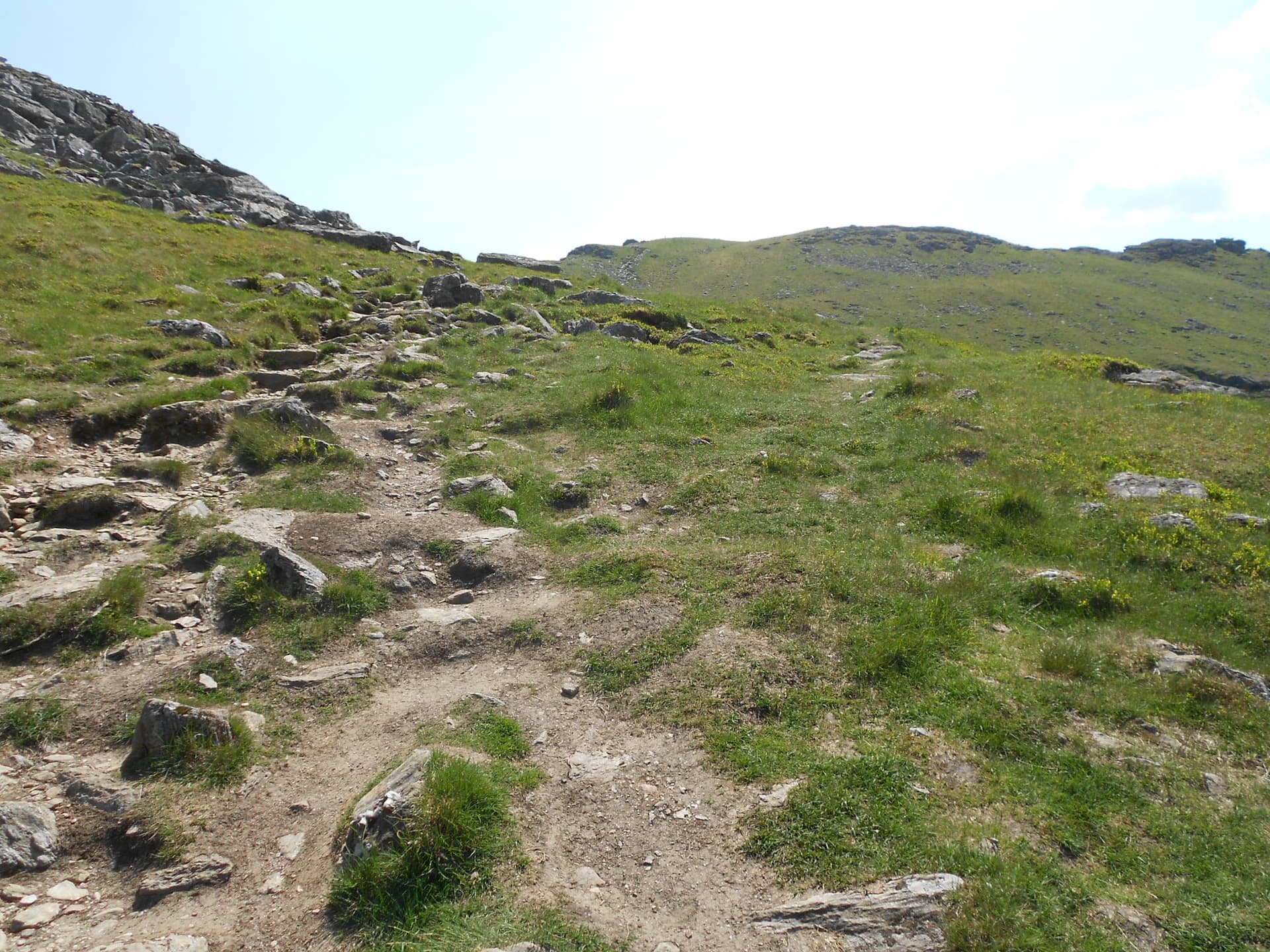
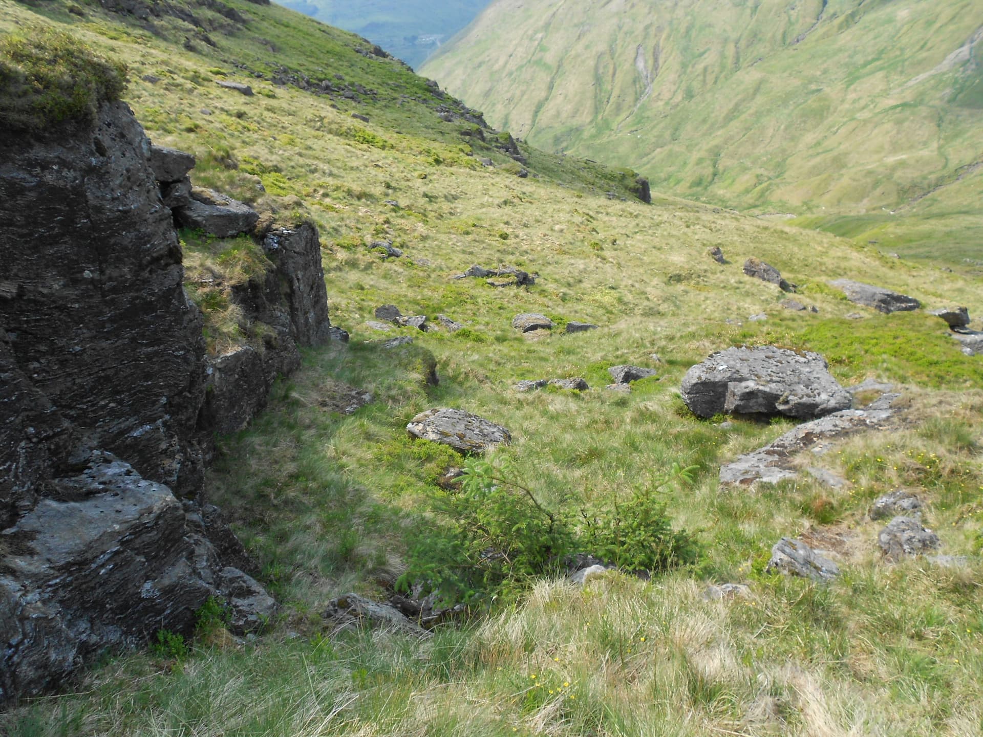
Above: Looking back the short distance to the A83. Overgrown path - lost it three times already!
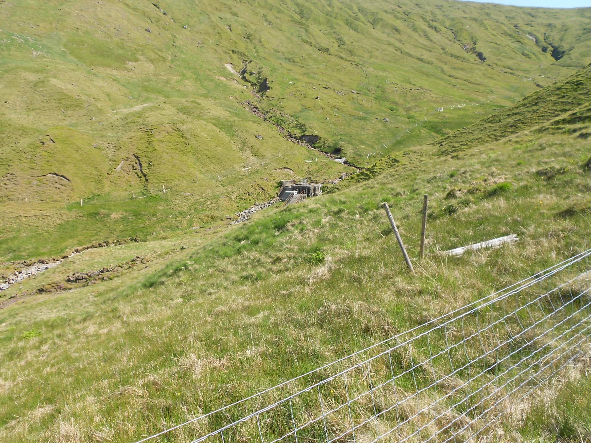
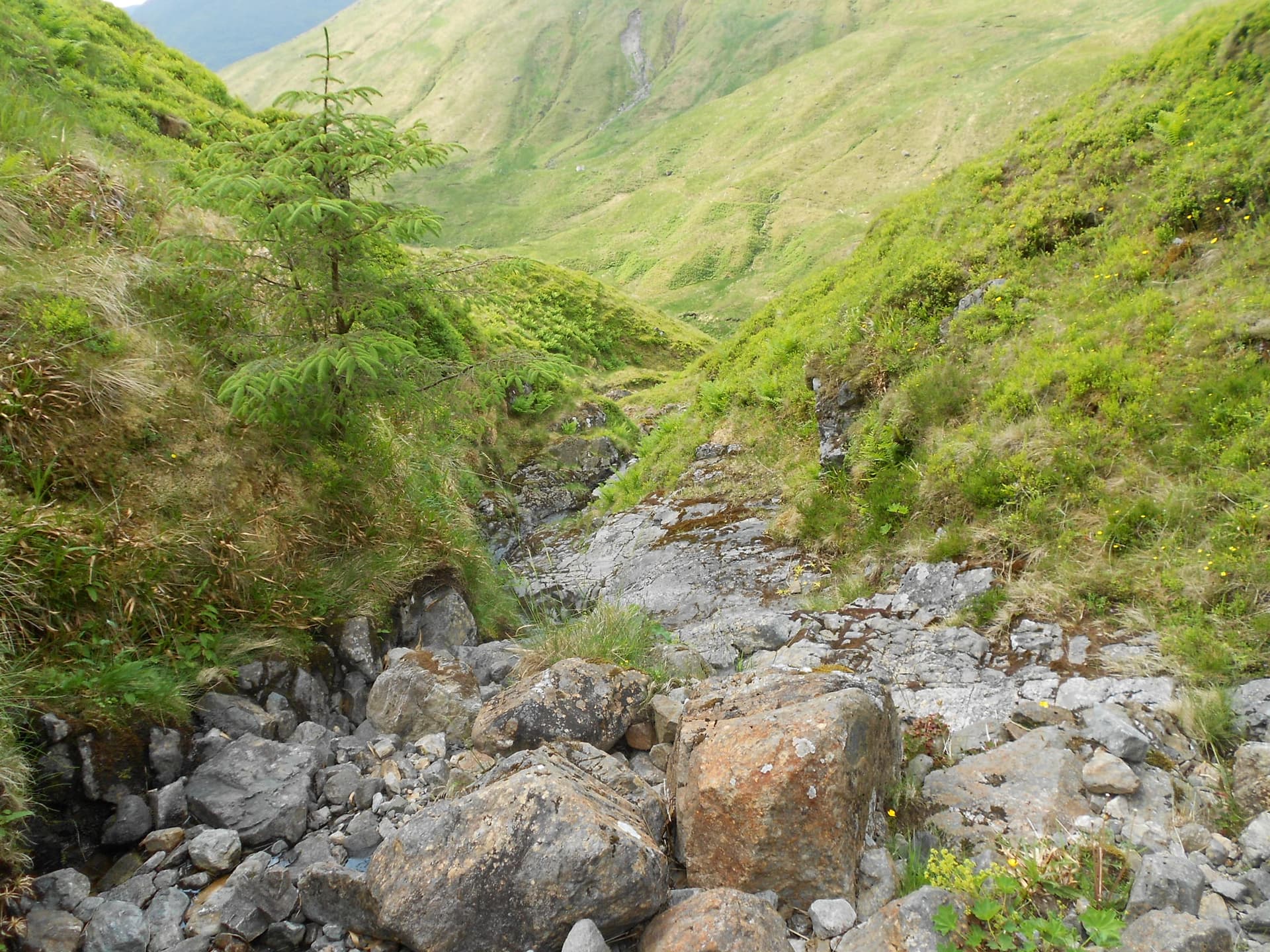
Above: A lot further up. The dam

Above: Crossing a side valley
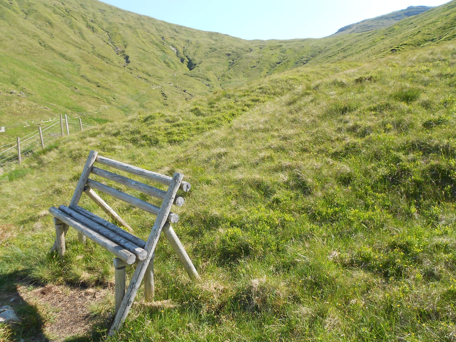
Above: A lonely seat in the middle of nowhere and further rough ground ahead.
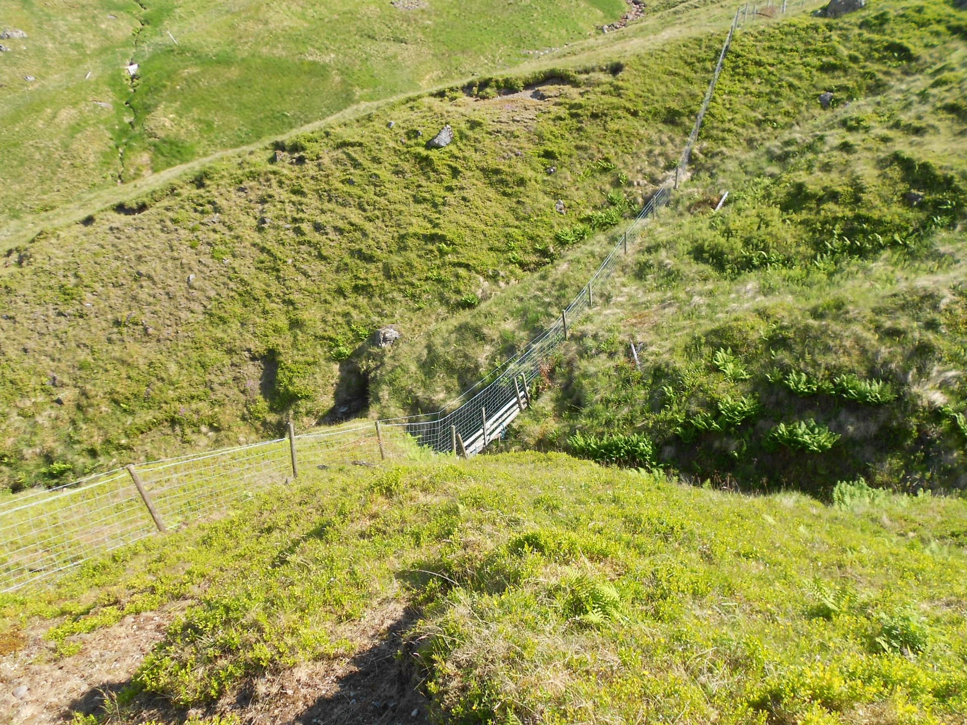
Above: Another side valley to cross
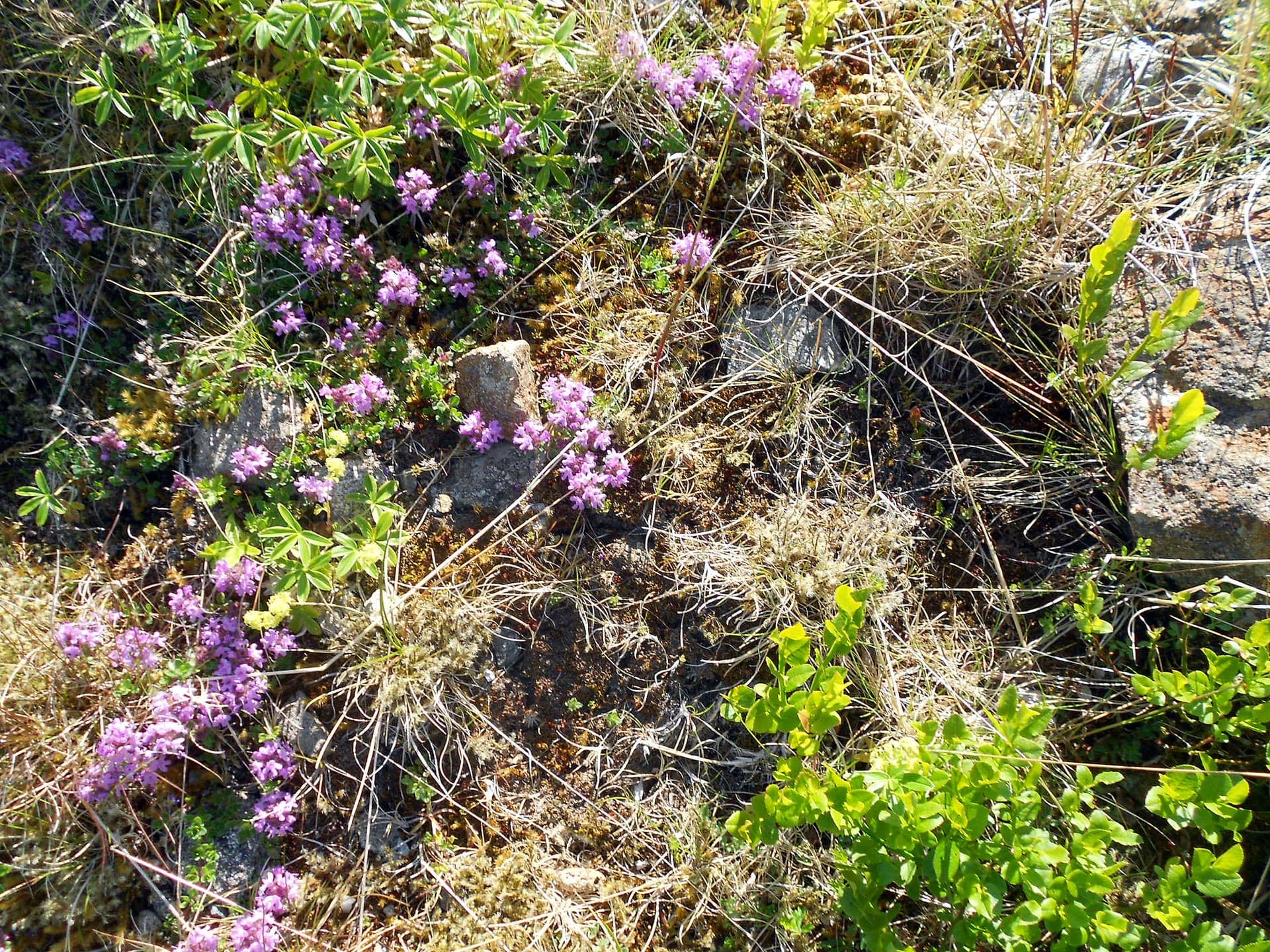
Above: Three different plants. Don’t know their names?
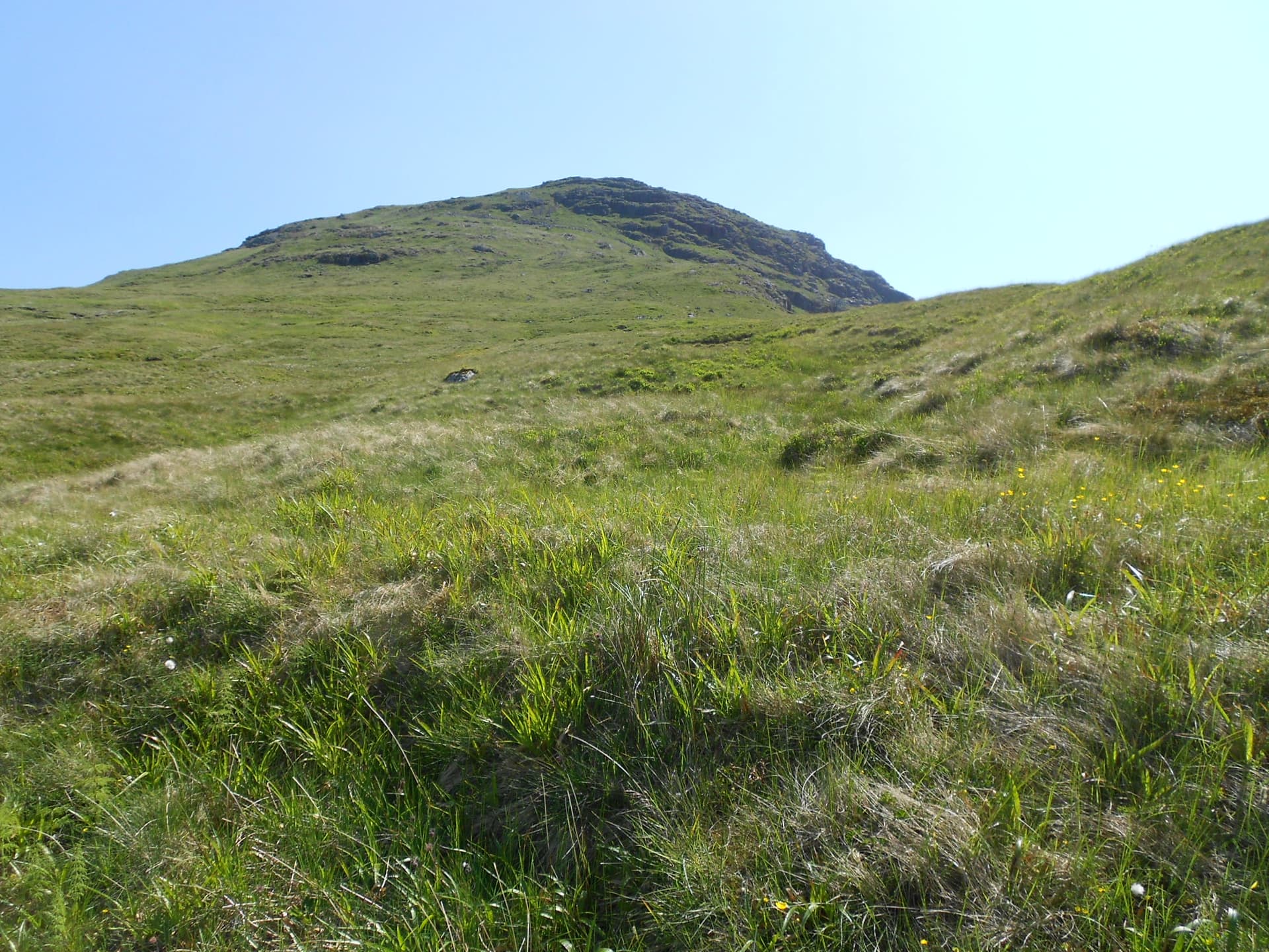
Above: Still more rough ground but target-1 (SS16) ahead
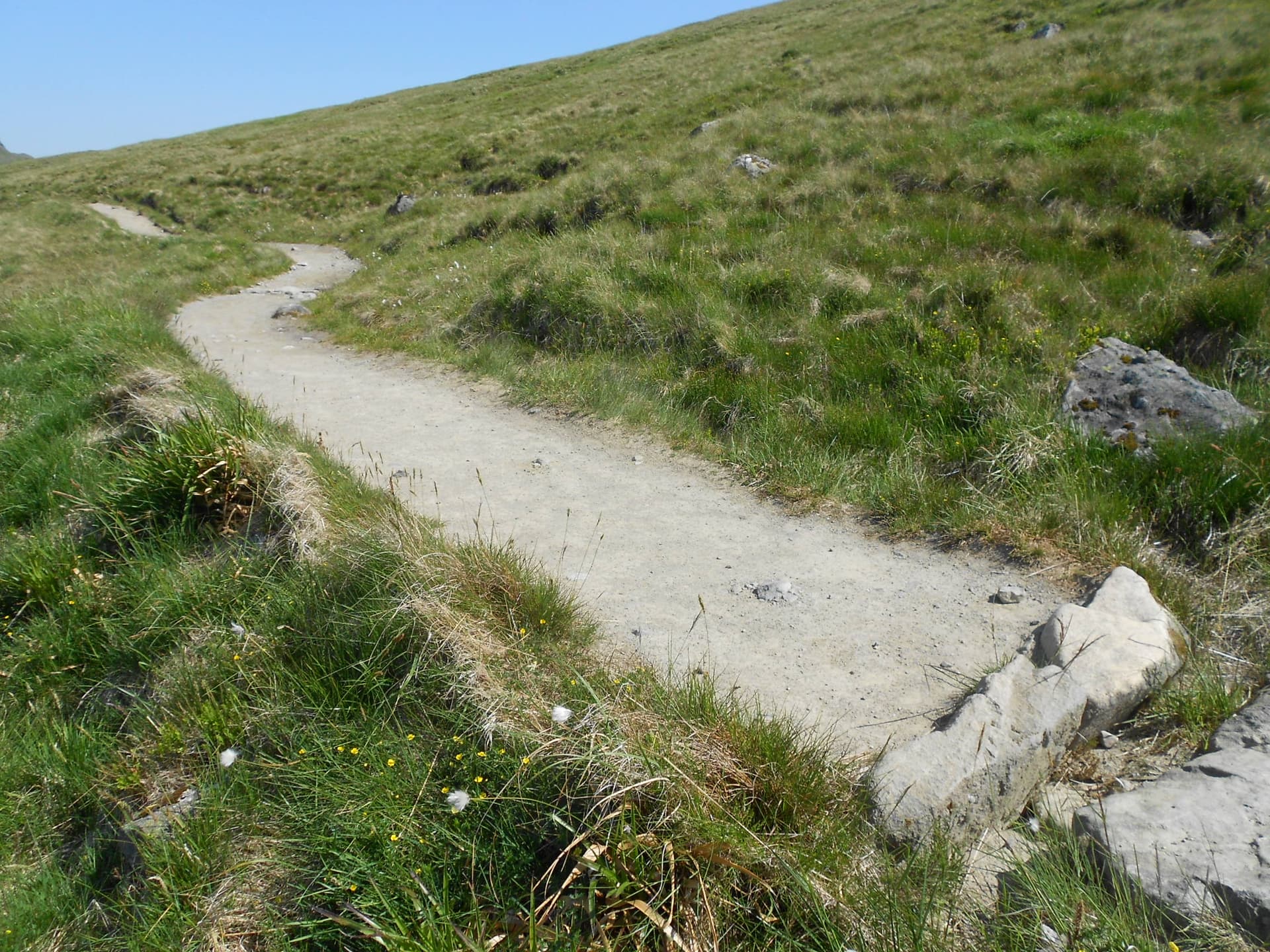
Above: Crossing the main Beinn Ime-Succoth path at last
Above: Now on a good path up Beinn Narnain. Cobbler in the background
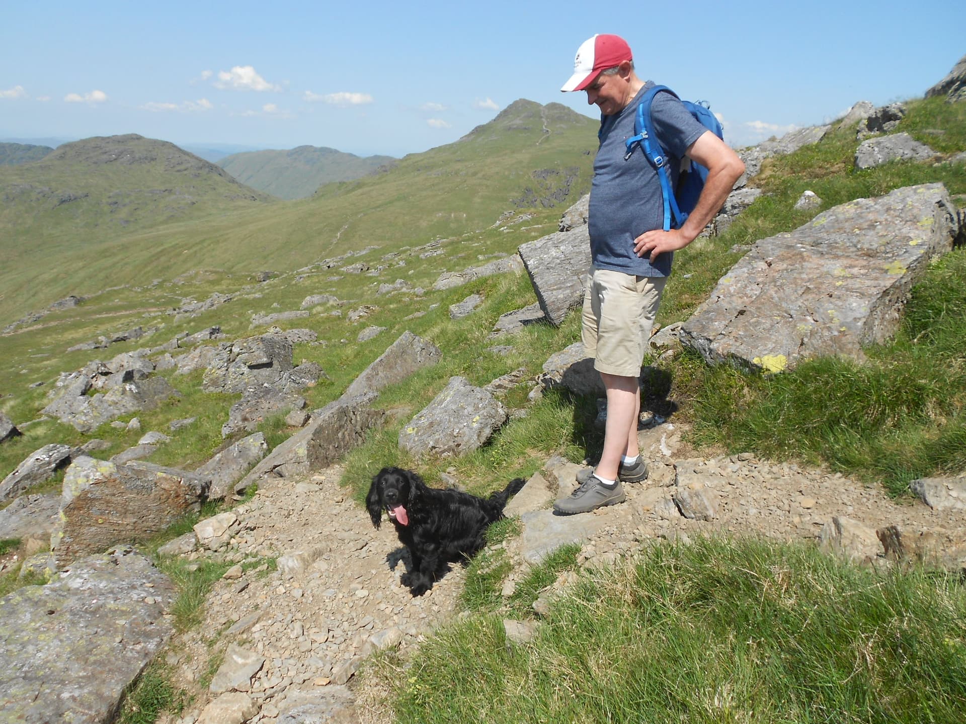
Above: The dog’s name was Bramble

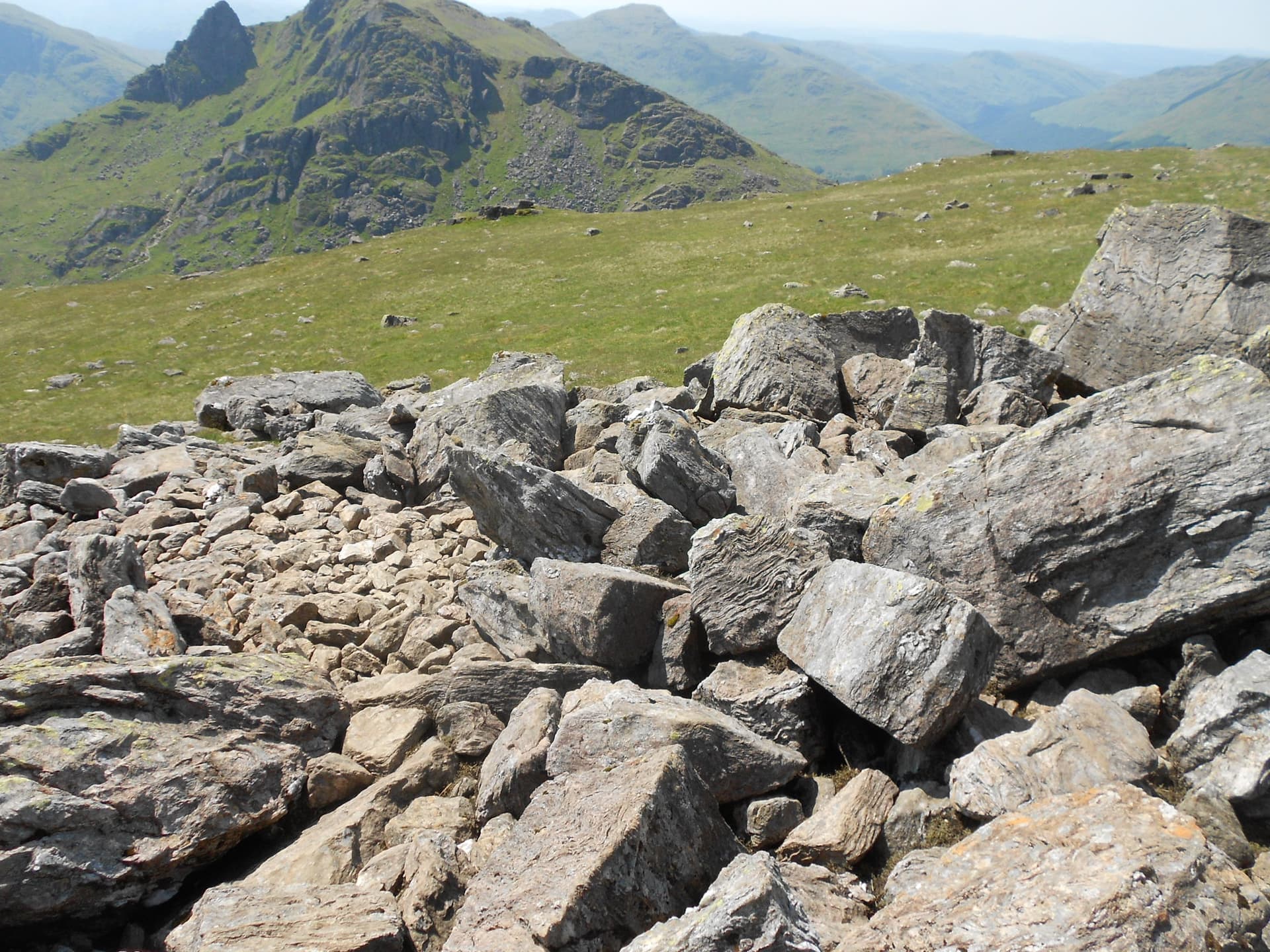
Above: A minor rock-field guards the summit
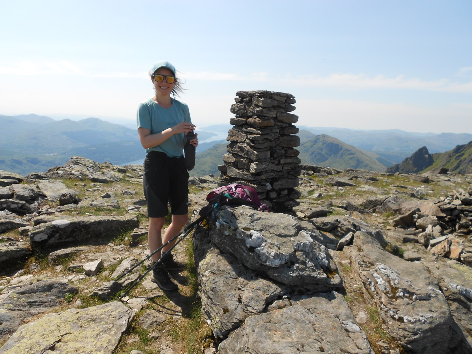
Above: Julia travelled by bus from Glasgow in 75 minutes and walked up from Arrochar

Above: Kirk Allan remembered. A shocking story!

Above & below: Activation of GM/SS-016 Beinn Narnain on 2m-FM using a Vertex VX150 mono-bander with 5W to a J-Pole

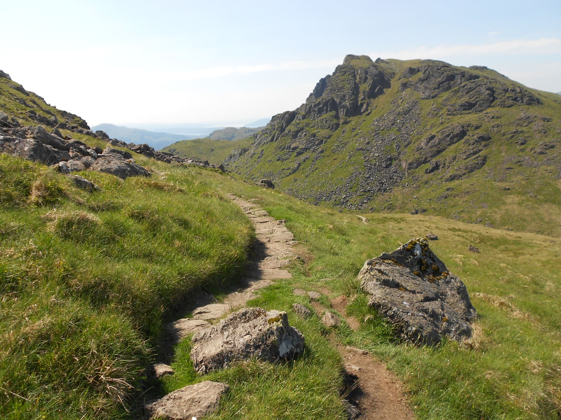
Above: Crossing Beinn Narnain’s rock-field again on the way to The Cobbler SS20 ahead
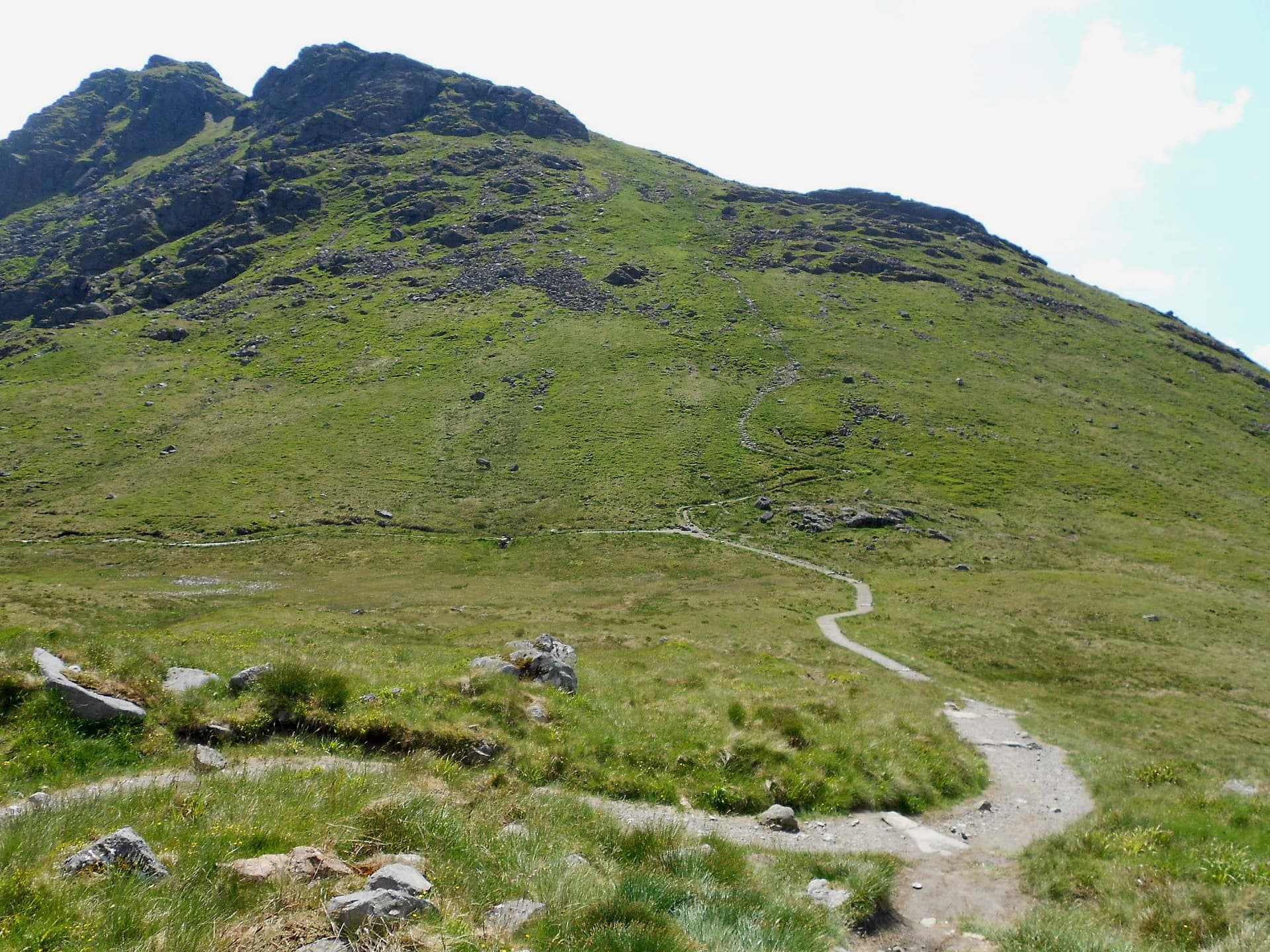
Above & below: The path up Ben Arthur - The Cobbler

Above: Almost up Ben Arthur SS20. Looking back towards Beinn Ime
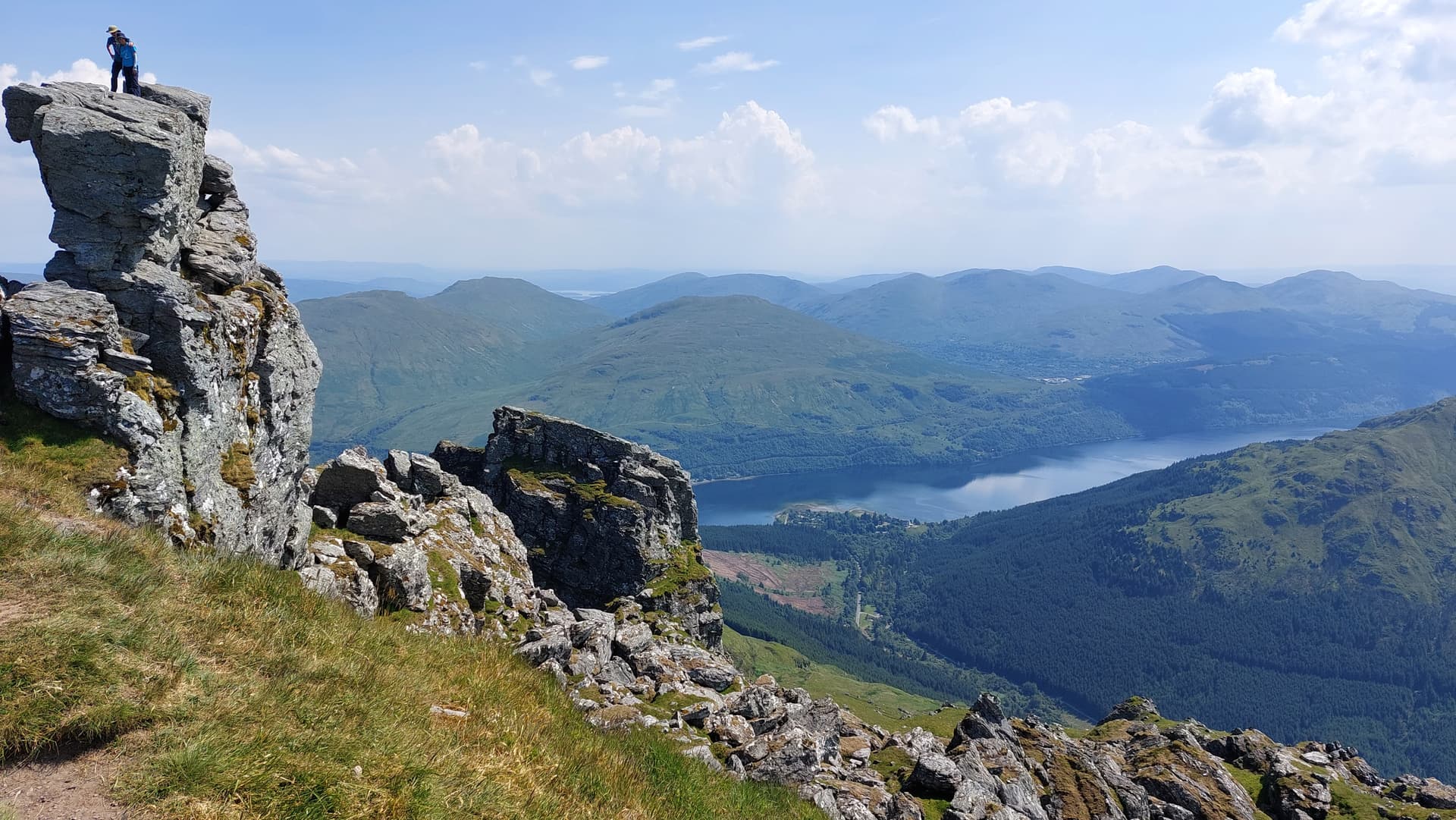
Above: Summit of GM/SS-020 Ben Arthur aka The Cobbler. View down to the Ardgartan Hotel on the shore of Loch Long (just rt of ctr)
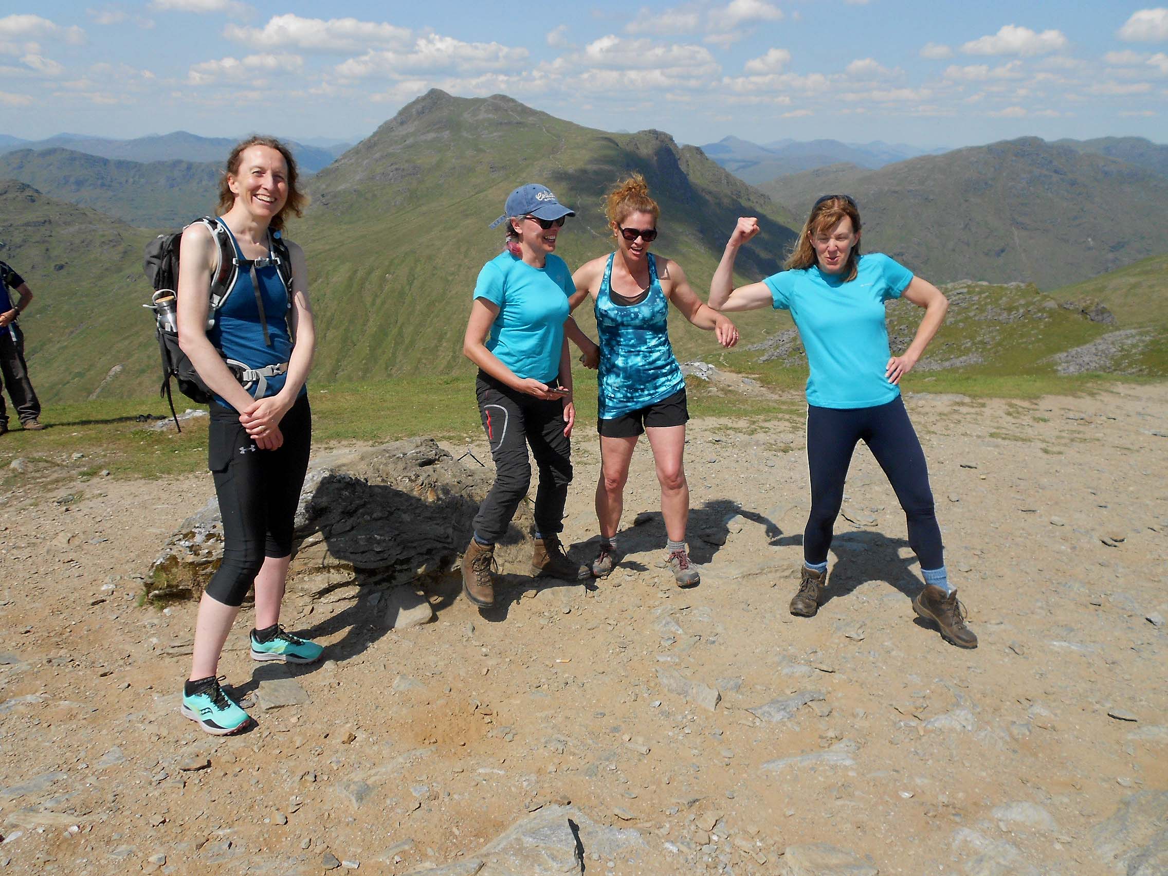
Above: Four very bubbly doctors on SS20 The Cobbler

Above & below: Brave girls! Not for me I’m afraid
Above: On the way down The Cobbler. Turning left down the short cut. Rough going - no path
Above: Nearly down the steep valley but too far to the right. Got myself down into this rocky burn which runs NW to the main burn

Above: The main burn that runs WSW to the A83 parking place. The party of four doctors ahead having just walked down from the Bealach.
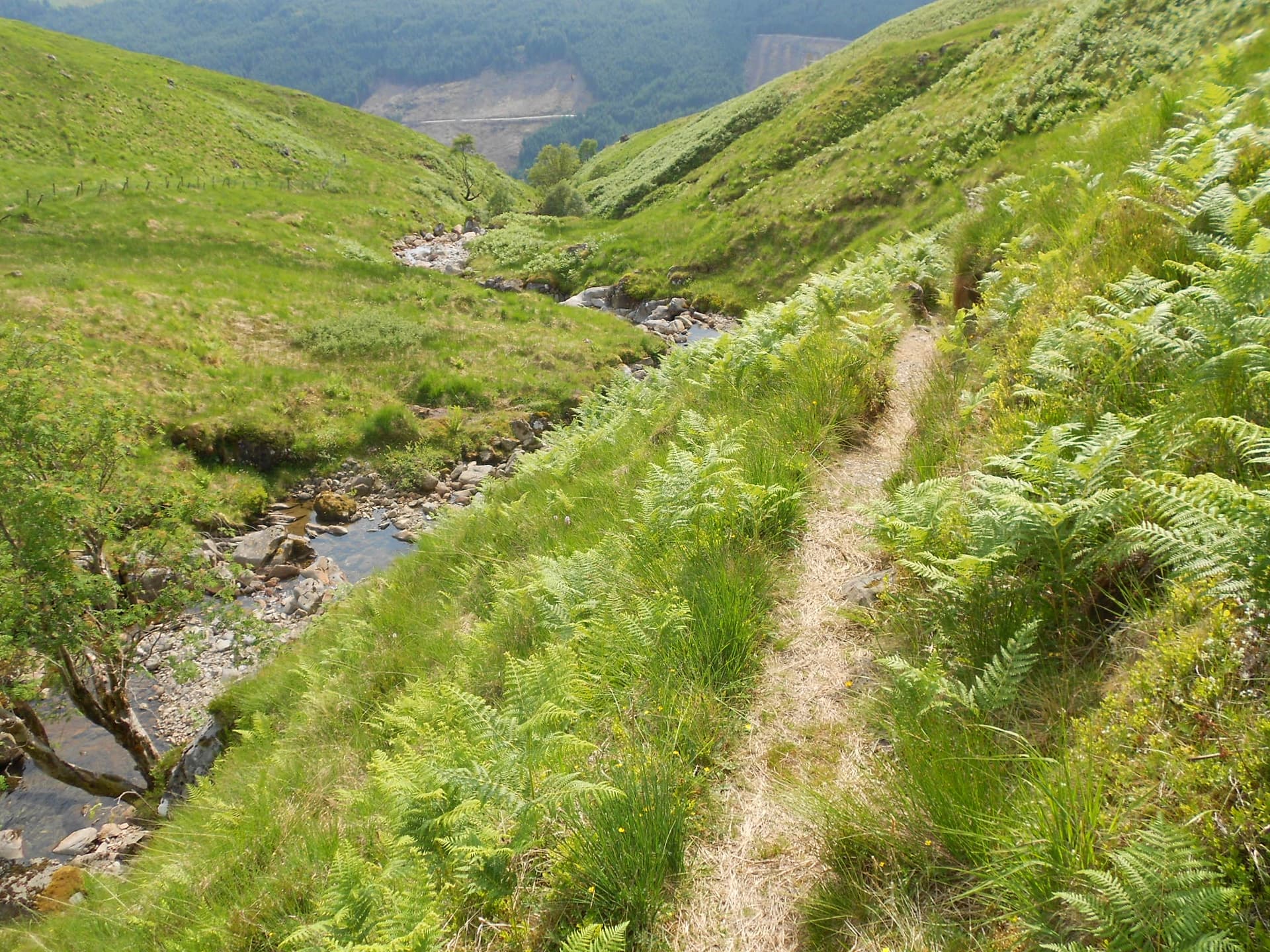
Above: The good path on the N side of the burn. I should have gone up this way in the morning.
Above: The path gives way to a hessian covered (pegged down) track under construction lower down.
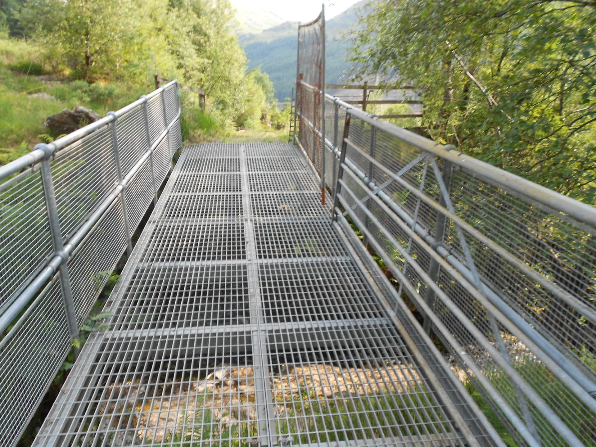
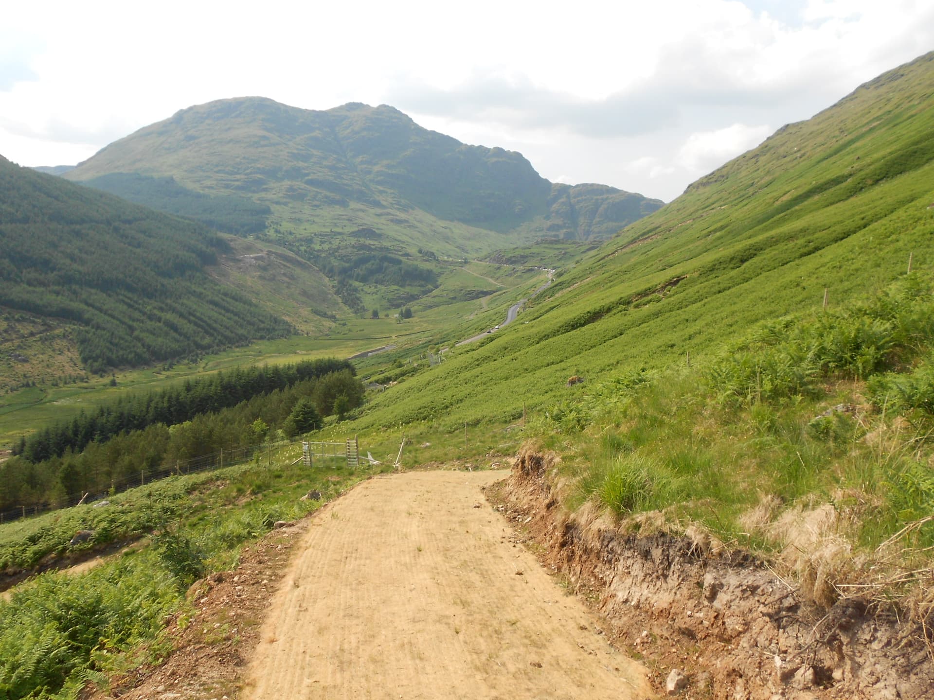
Above: Over the steel footbridge and back to the car

Above: Shortly after reaching the hotel the weather broke.

Above: SS20 Ben Arthur/ The Cobbler from the hotel window in good weather
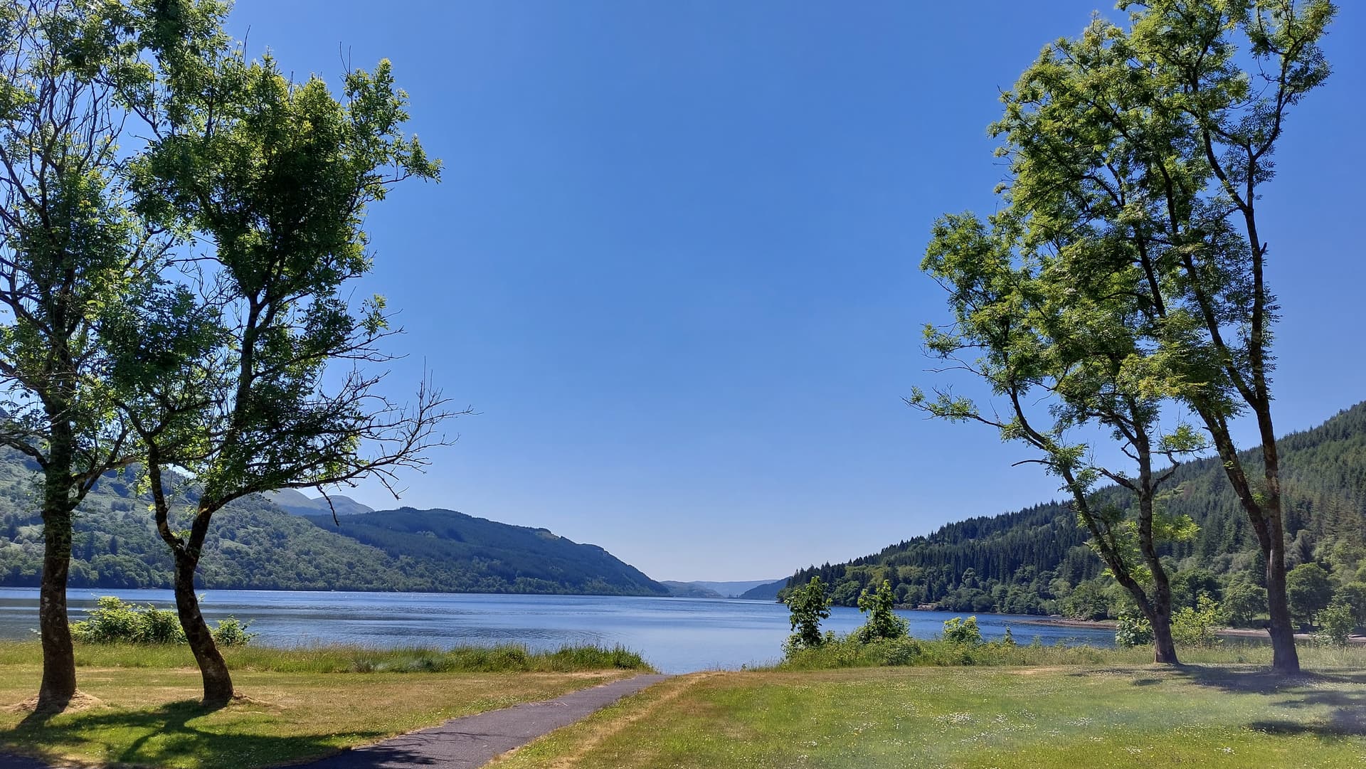
Above: Loch Long from from the hotel grounds

Above: Ardgartan Hotel Reception. Jackie