G4YSS: GM/SS-006; Beinn Ime, 14-09-17
Issue-1
Activation of BEINN IME - GM/SS-006 - 8 points
GM4YSS/P and SSEG Clubcall GS0OOO/P
HF - QRO on 40m & 80m. QRP on 2m-FM
All times: BST (UTC plus 1hr, UOS as ‘z’)
First SOTA in the September 2017 holiday based at the Tarbet Hotel, Loch Lomond.
For Ben More GM/SS-001, see the link after the photos at the foot of this report.
EQUIPMENT:
FT817ND HF/VHF/UHF 5W Transceiver
MX-P50M, 50 Watt HF Linear Amplifier
Link dipole for 80m thru’ 20m on a 5m CFC mast with 1m end-sticks
Home-brew tunable loading coils for 160m (not used)
5 Ah Li-Po battery (no reserve)
J-Pole for 2m FM
Reserves:
IC-E90, 4-band, 5W VHF H/H (used for 2m-FM contacts)
QRO pack: 9.7kg (21.4 pounds) including food, umbrella, Primaloft jacket, 0.75 litre drinks.
INTRODUCTION:
This was the first SOTA activation of this year’s trip to GM/SS. My XYL booked a 10-night holiday at Shearing’s Tarbet Hotel from 8th to 18th of September 2017, at a cost of 298 GBP per person for half board. This was the first time of staying there and I must say, the place is very good and the staff exceptionally friendly and efficient. I only had three GM/SS summits to my name so it was high time to do another.
The drive from Scarborough is a mere 280 miles which took 5.75 hours net with enough time left for two 1-hour stops on the way. We know how to do leisurely nowadays. This compares with day drives of 409 miles for Dornoch and getting on for 450 miles for Gairloch; our destinations to access GM/NS summits.
Unfortunately no SOTA’s were advisable for most of the first week due to a throat infection on my part which caused mild asthma. Poor weather forecasts and dire HF band conditions also came into the equation.
The mountain weather forecast wasn’t too inspiring. 30mph winds, 3C and showers of rain or sleet were the risks. My infection was in the final stages of getting better but it had been like that for days. The terrible HF band conditions that had prevailed for many a week would have to be accepted. The fallback would be VHF.
EXECUTION and ROUTE:
There was no question of skipping the hotel breakfast, earliest option 08:00. The chosen start point was just a 10-minute drive away. I set off walking at 09:40 in breezy conditions and overcast.
At the planning stage, routes for ‘The Arrocar Alps’ summits of interest; namely SS16, SS20 and SS6, were created. All these had Succoth in the east, as the starting point with SS6 Beinn Ime the longest walk at about 7.2km one way. Worse still from this direction, almost every metre of Beinn Ime’s 1,011 metres would have to be ascended; Succoth being close to sea level. The only things that the Succoth route had going for it was the likelyhood of a well-trodden path resulting in easier navigation but those very things would make it a busier option.
A glance at the map suggested the alternative of approaching SS6 from the west but investigation showed that no path existed from there and the ground was rough. On the plus side if the less than ideal surface could be accepted, a start could be made at 250m ASL at a forest gate (NN 23127 08445). This is on the right hand side of the A83 road going north from Rest and be Thankful, just after passing a lochan on the left. Apparently, the more popular start point is further north at Butterbridge but that is not as high.
A short forest track runs NE from the gate and the thinking was that a flying start, albeit a small one, could be made by following the track to its end. At the end of this track were piled dead trees and branches with a bad section of steep ground ahead. From here I had little choice but to plough on over rotten tree trunks while crossing minor burns but it wasn’t too long before I encountered a second track. This didn’t help as it was not in the direction of travel.
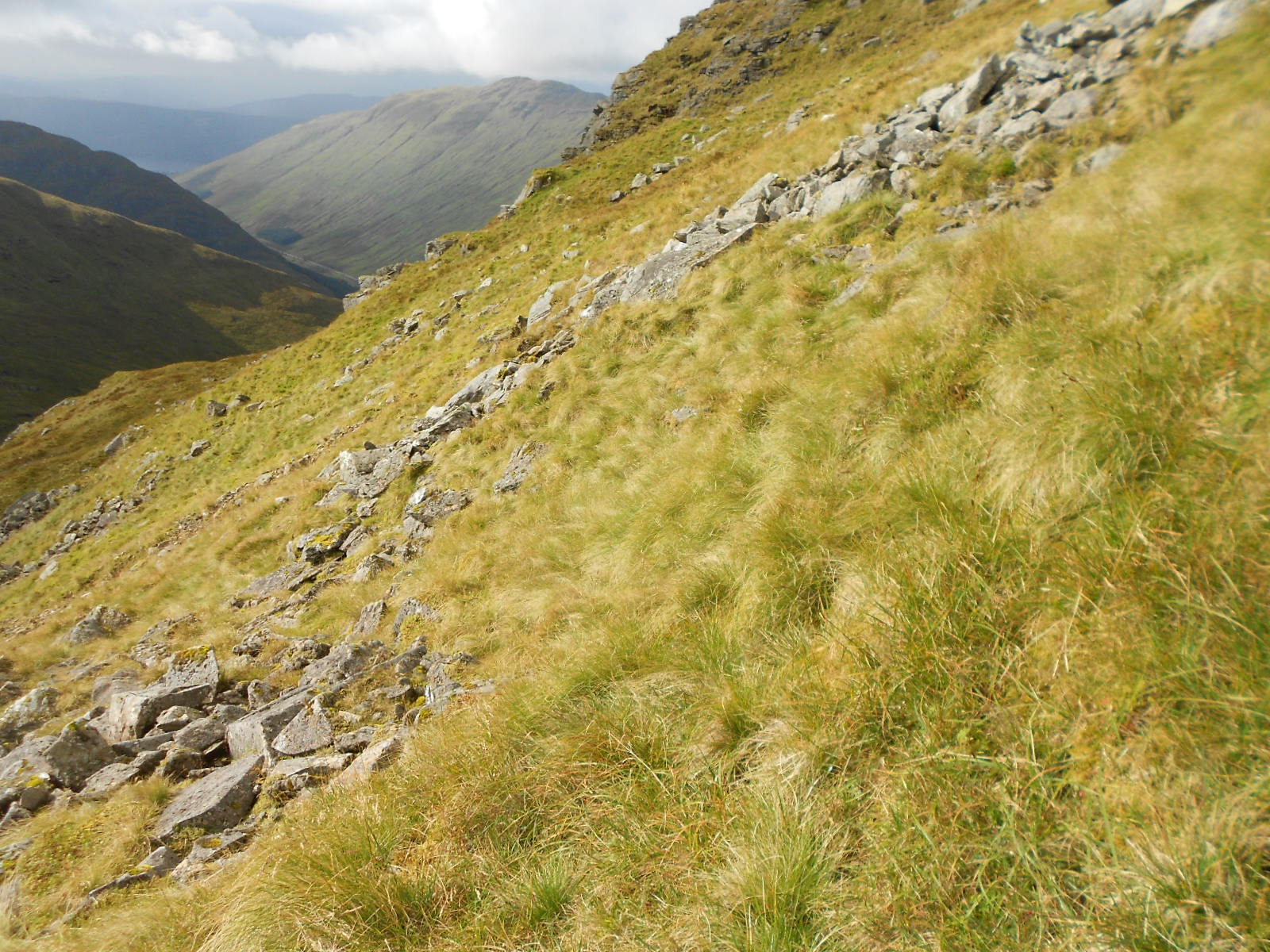
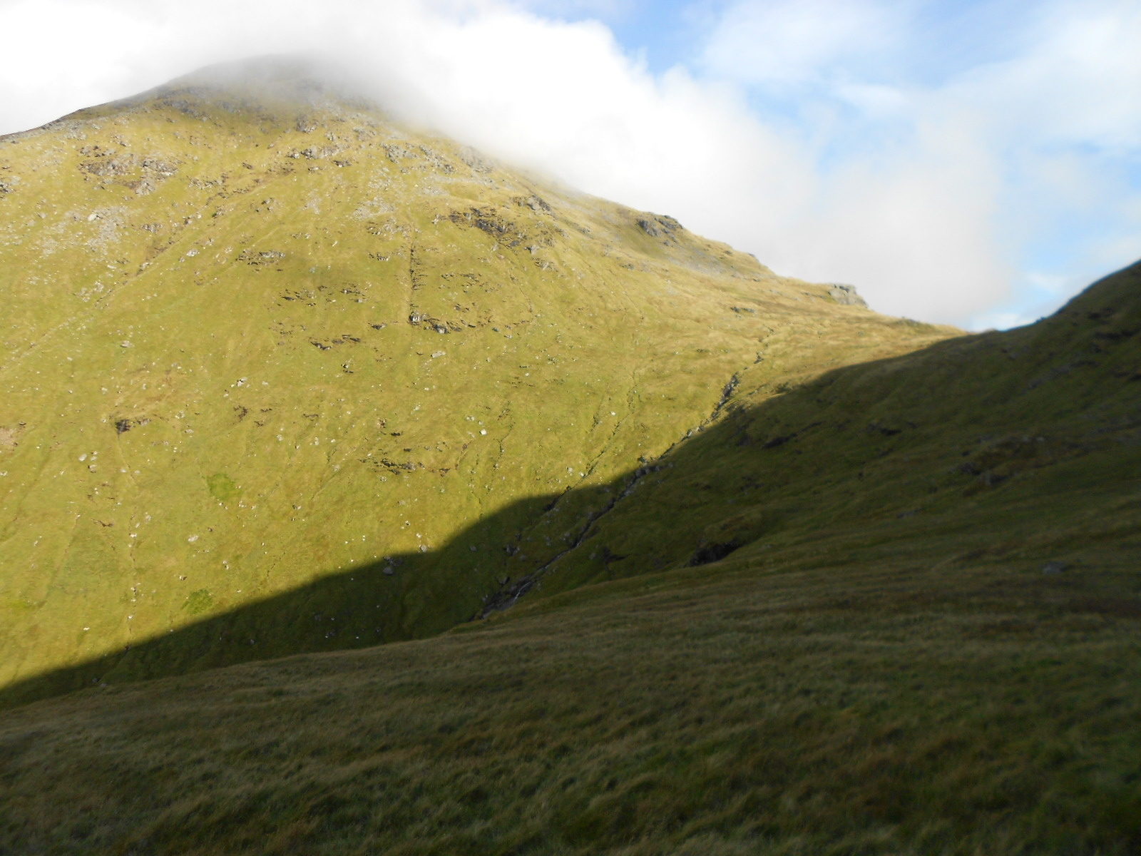
I climbed high onto the NW side of Beinn Luibhean (incidentally GM/SS-025), rounding the corner at its north ridge and into the corrie, heading for Bealach a’ Mhargaidh (665m ASL). The going was steep, rough and tussocky all the way causing a strain on the ankles when traversing under the NE face of Beinn Luibhean whilst trying not to lose height. A right-ankle injury, sustained on Fountains Fell in March, was woken up here and I really did feel like turning back. Progress was very slow and I began to wonder if any time would be saved, by taking this route over the Succoth one.
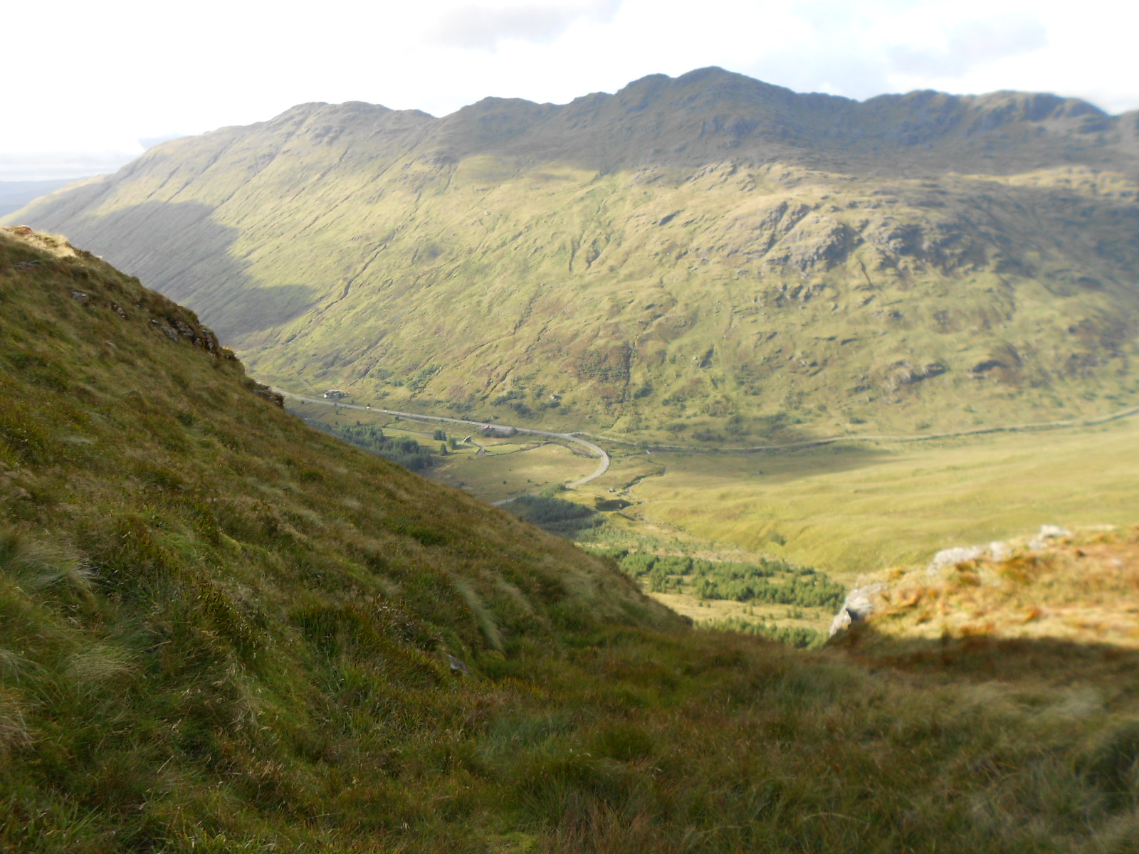
On reaching the bealach I was faced with continued pathless climbing and a further height gain requirement 346m to the 1,011m summit. In fact I did find a couple of sheep paths but they were of little use before darting off in unhelpful directions. There are crags here and the odd rock field but these can be mostly dodged on grass. After much labour, Beinn Ime’s SW ridge path was finally reached and it provided easy walking for the final distance of 200m. Thin low-cloud was encountered at this stage, as were some walkers on their way down to Arrocar.
Though it can’t really be called a route as such, because of the lack of paths, the waypoints for this walk are listed below:
NN 23127 08445 (start); NN 23563 08623; NN 23897 08600 (climb fence); NN 24269 08552 (turn the corner); NN 24354 08382, NN 24538 08220 & NN 24754 08119 (traversing). NN 24968 07925 (Bealach a’ Mhargaidh). The return took a slightly more northerly line. Had this been followed on the way up, the traverse would have been at a lower level and a little less painful.
From bealach to summit:
NN 25365 07988; NN 25456 08031; NN 25491 08194 (short animal path); NN 25548 08209 (a shallow cave – room for one person); NN 25639 08345 (turn left on the NW ridge path to the summit).
The pointy-shaped cairn is surrounded by a low wall on three sides but the expected trig point, marked on my 1:25,000 scale OS map, seemed to be absent. A few stumps of angle iron remain at the base of the cairn so perhaps the trig has been removed and the cairn put in its place. I will leave it to the WAB organization to deem whether these remains count as trig point TP-10122 or whether they think it should be deleted. My own opinion is that it should remain but please refer to the photos. (Note: WAB do not recognize these remains as a trig point.)
I arrived wearily at 12:04 after 2 hours and 24 minutes of walking. The GPS gave a reading for the summit of NN 25499 08481 at 1,013 metres ASL.
Setting Up:
The dipole was set up a few metres from the summit cairn, behind a 3ft natural rock wall. Unfortunately this didn’t afford full shelter from a brisk NNW wind at 5C but the views were good when the cloud cleared. Since the ground was sodden from recent rain, I was forced to sit on an slightly uneven rock.
BEINN IME - GM/SS-006: 1,011m, 8 pts, 12:04 to 15:26. 5C. 25 mph wind. A mix of sunshine, overcast and low-cloud with two 10-minute rain showers. 0% EE and 50% Vodaphone coverage. LOC: IO76OF, WAB: NN20 (Trig: TP-10122 but does not qualify)
I tried to put on an advanced alert for this summit but the hotel Wi-Fi wasn’t having it at the time. A ‘7.033/ 12:00z’ one was kindly put on for me by Roy G4SSH following a good old-fashioned phone call; borrowing the XYL’s vodaphone for the purpose. My EE phone didn’t work at the Tarbet Hotel either.
7.033 CW - 9 QSO’s:
Neither my calls to G4SSH nor CQ’s got any response. Since the EE phone was as useless here as it was at the Hotel, I phoned Roy on my tiny Nokia, which is on Vodaphone. ‘Can you hear my dots Roy?’ The reply, ‘Not a sausage’ but Roy’s dots were 59 to me. I wasn’t alert enough after the long climb to discover my error and I did the entire 40m CW session with the linear amp’s output filter selected to 80m! Only a trickle of RF would get through this arrangement and I was about to see how just how efficient that filter was.
Following the spot from Roy, I could hear chasers waiting for me. With a lot of difficulty, which at the time I put down to ongoing poor band conditions, I managed to work G4SSH Roy at the peak of the QSB; G4FGJ Gordon; M0BKV Damien; HB9CGA Ulrich; OM1AX Vlado; YO6CFB Lacy?; DL3HXX Lothar; DL2HWI Dietmar and F6EAZ Chris.
The session took a full 20 minutes and although my power was set to 50 Watts, I was probably leaking out no more than a Watt or two; the rest going to heat up the MRF-186 output device that I have recently gone to the trouble of replacing. Scatterbrain!
Understandably in the circumstances I got mainly readability 3’s and 4’s with only two 5’s; one from Damien and at the end from Chris, who seemed to copy me easily with 579 both ways. The skip distance must have just right. Before announcing the QSY, I went off to check that 7.160 was clear before informing Roy of the fact in CW.
7.160 SSB (WAB frequency) - 42 QSO’s:
Roy’s spot certainly was noticed and I soon had a very unexpected pileup. For whatever reason, I now noticed the problem with the wrong filter and corrected it during the first SSB QSO, which was with Karl M3FEH. My signal must have shot up but the relief was tinged with regret when I though about the ‘might have been’ CW session. Those who couldn’t work me with Morse, would have to rummage in their shack drawers to locate their dusty microphones and judging by the callsigns logged, quite a few did just that.
Stations worked are too numerous to list individually but it seems that the WAB organisation did me proud here. Of course that was to be expected; I was on their preferred frequency! I didn’t feel too guilty about that on this particular occasion, as conditions have made it rather dead on there for the past few months.
Amongst the UK stations, ranging from G to GI, GW and GU, I worked the following overseas chasers: HB9DHA Ray; PA0INA Frans; ON5DDG Daniel; OV1JF/P Jens; HB9AGH Ambrosi; SP6BBE; DL2EF Frank; DD5LP Ed; LA9FG Nol; EA2CKX Pedro and PA0B Rob.
The 40m-SSB session took a full hour with outgoing signal reports mainly in the range 57 to 59. Coming back were from 53 to 59 with a 45, a 33 and a 31. Conditions must have been good with rare short(ish) skip combined with something for the continental stations. Power was 50W throughout. (5W from the FT.817ND into the amp, which was apparently still functioning after its ill treatment).
A few asked for the trig point number but I dared not give out TP-10122 for fear of causing confusion. As mentioned earlier the map-marked trig point has either eroded away (unlikely) or been mostly removed. (Note: Trig ‘destroyed’ & therefore not valid)
3.760 SSB – 8 QSO’s:
During the course of the 40-SSB session, I was aware of a weak station that I eventually realised was MM3PDM. I tried several times but Peter didn’t hear my returns, being too close (Peterhead). Dave G4SQA politely suggested that we try 80m and Brian G0BFJ also expressed interest in collecting NN20 on that band.
A quick sortie (well maybe not so quick, as I was by now a little stiff) to adjust the dipole links got me onto 3.760 in order to call Peter, who by now must have been rather frustrated. 80m did the business immediately with 58 both ways and Peter no doubt went away happy at last.
After MM3PDM/P there quickly followed: G0BFJ Brian; G0VWP Terry (York); MM0XPZ (Steve); GI4ONL Victor sounding hoarse; GI0AZB Ian; G4IAR Dave and EI2KD Rod. Sadly Dave G4SQA (a clear 51 signal to me) was not copying well enough for a QSO on this band.
Power was 50 Watts until the final QSO when the rig cut out but after switching it back on, I completed with Rod using about 10 Watts. As expected, signal reports were well down compared with 40m but all incoming ones were R5 except for Brian in Huddersfield who sent a 33. I gave out 55’s to 59’s with a 52 for Brian in Huddersfield.
145.575 FM - 2 QSO’s:
Primed via email a couple of weeks prior, GM3PIL Ray was called first on the Inverness frequency but there was no response. If Ray was monitoring, Nairn was too far away for my 5 Watt signal or there was high ground in the way.
Recourse to 145.500 brought in GM4COX Jack (59 both ways) and MM5AEK Alan in Glasgow (59/ 56).
For this session, after clearing away the short wave station, I moved up to the summit proper which was deserted apart from a Munro bagger and his beautiful black Retriever dog, just leaving. The dog was on her 40th Munro. No slouch was she! Missing Sasha, who I walk daily at home, I could not resist a stroke.
In the absence of people I set up the VHF vertical J-Pole quickly without much consideration due to the fact it was now 3pm and it’s a long way from Succoth. Unfortunately three further parties totalling 6 people arrived during the first QSO which distracted me almost 100%.
The newcomers were very friendly and talkative but the station, unusually for me, was partly blocking access to the cairn, so I was embarrassed. I was also weary by now and worried about the forthcoming rough descent to say nothing of the time, so the 2m-FM session did not go too well.
Apologies to Jack and also Alan, who’s QTH I just couldn’t catch at first. I’m afraid a broad Scottish accent takes some following. I sometimes only get 50% of what’s said and I’m ‘reading back’ and listening for key words like you do with CW. Also as you get older your audible frequency range drops and that further hinders intelligibility.
Descent:
A start was made at 15:26 but it took an hour and forty minutes to reach the car and what a journey. A goodly amount of ‘bite-the-bullet’ was needed. The umbrella was required as a walking aid all the way. Where it wasn’t steep it was rough and I already had a sore right outer ankle from the traversing on the way up.
Paradoxically, I find that the pain comes only when the tendon is in compression. When contouring across a steep slope, which is high on your right side and low to your left, it really hurts. Fortunately the contouring was of the opposite sense on the way back but I still had to be careful. A lot of the corrie is rough and the final drop to the car is over deepish vegetation and slimy rotten tree trunks.
There are three problems when using a furled umbrella as a stick. Firstly it has high windage. When you swing it forwards in readiness for the next step in a headwind, like on this occasion, it blows back and after a while your arm aches. Secondly, when it does sink into a bog, it sticks and is difficult to extract as you move forward. Thirdly if you do subsequently need it for shelter (there was a sharp shower on the way down today) the gathered filth drips off the spokes.
I did rediscover the second track that runs a little further up the hill from the road but to give it the term ‘track’ is being generous, though you might get a quad up it on a good day. As is often the case, the car was a sight for sore eyes and in this case sore ankles too, as I arrived there at 17:06.
I’d promised to be back at the hotel by 18:00, and I was half an hour early due to allowing too much time for the descent. A good day but quite a hard one.
ASCENT & DISTANCE (Start point at 250m ASL):
Ascent 790m (2,592ft) / Distance 7.2 km (4.5 miles)
(There is minor re-ascent both ways).
CHRONOLOGY:
Left Tarbet Hotel: 09:10
Parked: 09:22 (in a position clear of the gate)
Walk started: 09:40
GM/SS-006: 12:04 to 15:26
Returned to Car: 17:06
Drive back to Tarbet: 17:30
Walking times:
Ascent: 2hr-24 min
Descent: 1hr-40 min gross (inc 5 minute stop for rain shower).
Summit time: 3hrs-22 min
Time Car to Car: 7hrs-26 min
QSO’s:
9 on 7.033 CW (wrong filter)
42 on 7.160 SSB
8 on 3.760 SSB
2 on 145.575 FM
TOTAL: 61
Battery Utilisation: 4.9 Ah
COMMENTS:
This was my first SOTA activation for two and a half months, which got delayed by a lengthy throat infection and the weather. With band conditions as they have been, the wait concerned me less than it might have done.
Starting in the west, the route was chosen because it is shorter and the start point higher compared with Succoth but it’s not the normal way in. How many times have I fallen for a route just because it looks good on a map? Too often and this was no exception.
The ground was steep and rough. The contouring hurt my ankle and I was slow. The use of this route resulted in anxiety both in the planning, on the ascent and during the activation when contemplating the return. Actually, the descent was not quite as bad as first thought. Also the final push from Col to summit on the climb seemed to take less time than envisaged. As for the rest of it, I wouldn’t recommend it as a solution to the problem of SS6 and its long route in from Succoth. Also, if you wanted to add Beinn Narnain or The Cobbler you would need to come in from the east.
40m:
Propagation on this band, along with most of the other HF ones, has been pretty abysmal throughout the summer. Only a handful of times has it carried inter-G communications, at least to my knowledge. For some reason; maybe I was due some luck, it performed faultlessly just when it was needed and a fair number of chasers, both SOTA and WAB, collected the 8 points and NN20 grid square on 7.160 SSB.
The band likely would have been shown off to an even greater extent, had I noticed the wrong filter selection before, rather than after the CW session. I used to have an MX-P50A which has automatic LPF filter selection from the FT817 but on the MX-P50M, it’s manual, which saves weight on relays. That’s no excuse however but I haven’t used this setup for three months.
The use of the WAB frequency is an advantage that often leads to a greater QSO count. The down side is that it is blocked for use by mobiles, in this case for one hour. Perhaps long weeks of inactivity due to an almost closed band put a few mobiles off anyway and I heard none call in today.
Certainly, while motoring around, I myself have called CQ on 7.160 MHz every day for the previous week signing /M but worked no WAB. Evidenced by the absence of GM callers and the fact that skip was long enough to bring in 16 continental stations, there was a skip zone of perhaps 100 miles. This wouldn’t help the situation and it didn’t help Peter MM3PDM either.
2m-FM:
VHFM was really an afterthought following a successful HF activation. However, I do have a slight fascination for VHF and where it will go, albeit this was merely simple FM.
Not to get Ray GM3PIL (Nairn over on the other side of Scotland and well north of me) was a disappointment as I almost always work him when I come up to GM but Jack and Alan made up for it. As well as VHF, Ray has often facilitated Top Band SOTA in the past but mostly when I’ve been on GM/NS summits.
General:
The QSO count of 61 was quite pleasing under the circumstances and the WX was better than forecast. The views were good too but you get understandably chilled when sitting in a brisk air stream at even 5 degrees C for 3-hours or more. In my case, I start to think more slowly so I hope chasers will forgive my errors and make allowances.
I also spent some time fighting with the log in sudden gusts, especially when turning it over. This apparently simple process can take several minutes under certain circumstances as I often take the precaution of photographing it before unclipping. Though I lost my map case once in a 50mph wind and have also had to descend 200 feet to retrieve an umbrella, I haven’t lost a log yet but it does happen.
Once the battery is depleted the rig shuts down. It did before this activation but investigations found that the FT817 was doing so below the safe voltage for a, 11.1V, 3-cell Li-Po. Since then, as a precaution, I have added three 1N5404 series diodes in the rig’s positive supply line to bring shutdown within limits.
As mentioned earlier, I had to replace the MRF-186 mosfet output device in the linear a few weeks ago. It blew at some point during my Lake District holiday in June. I hope that transmitting into a wrongly filtered output has not done further mischief although I have further spares. It’s not too difficult a job to slice through the connecting foils with a Stanley knife and unsolder what remains of them after removing the screwed-down device. As far as I can tell, there is no high VSWR shutdown on this cheap but effective amplifier.
THANKS:
To ALL STATIONS worked. To G4SSH for his on-air and telephone spotting Service.
73, John G4YSS
Using GM4YSS/P (on VHF) & Scarborough Special Events Group Club call GS0OOO/P.
Photos: 4-8-21-30-34-47-55-60-65-74-76-89-90-96
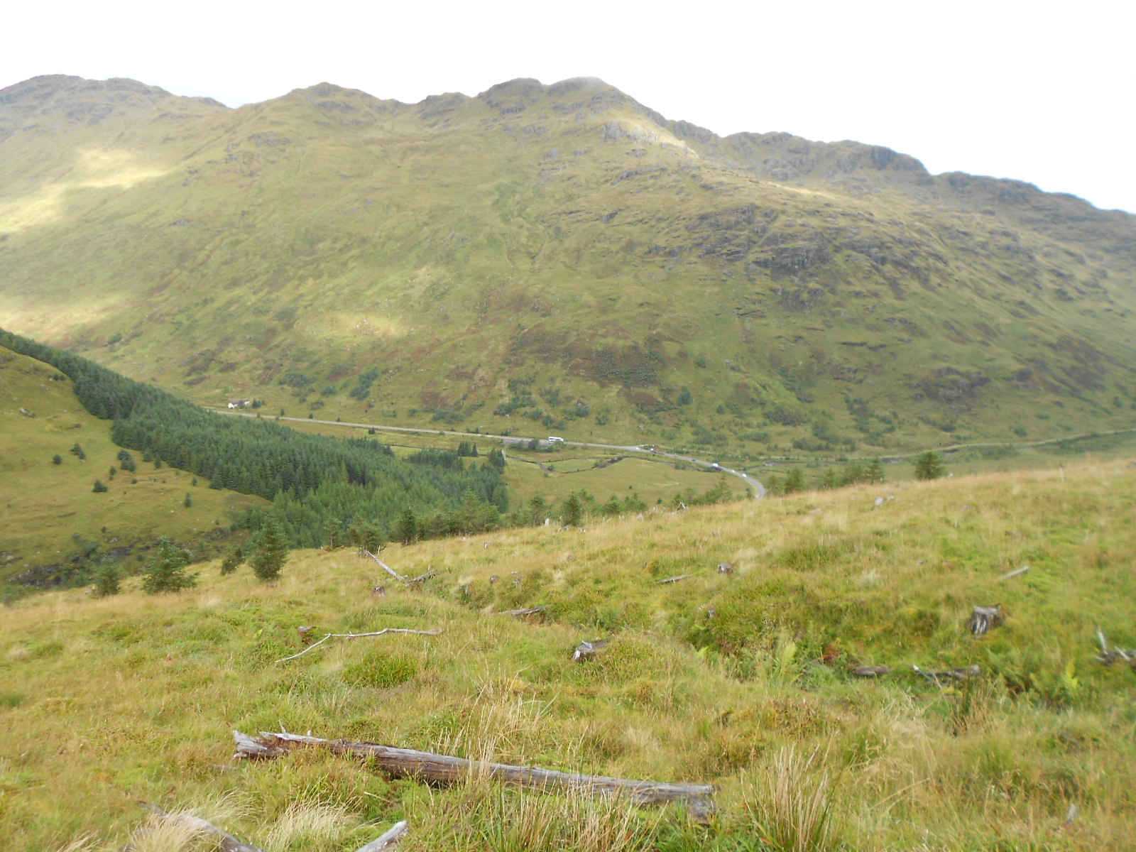
Above: Looking back to the start point (hidden to left)
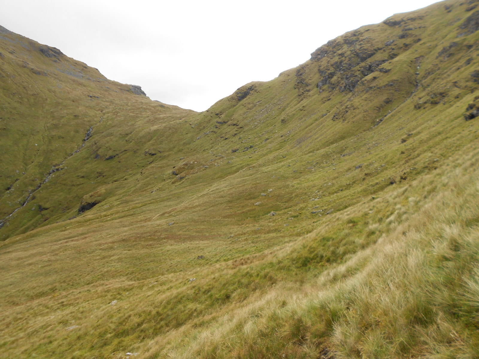
Above: Round the corner into the corrie towards the bealach
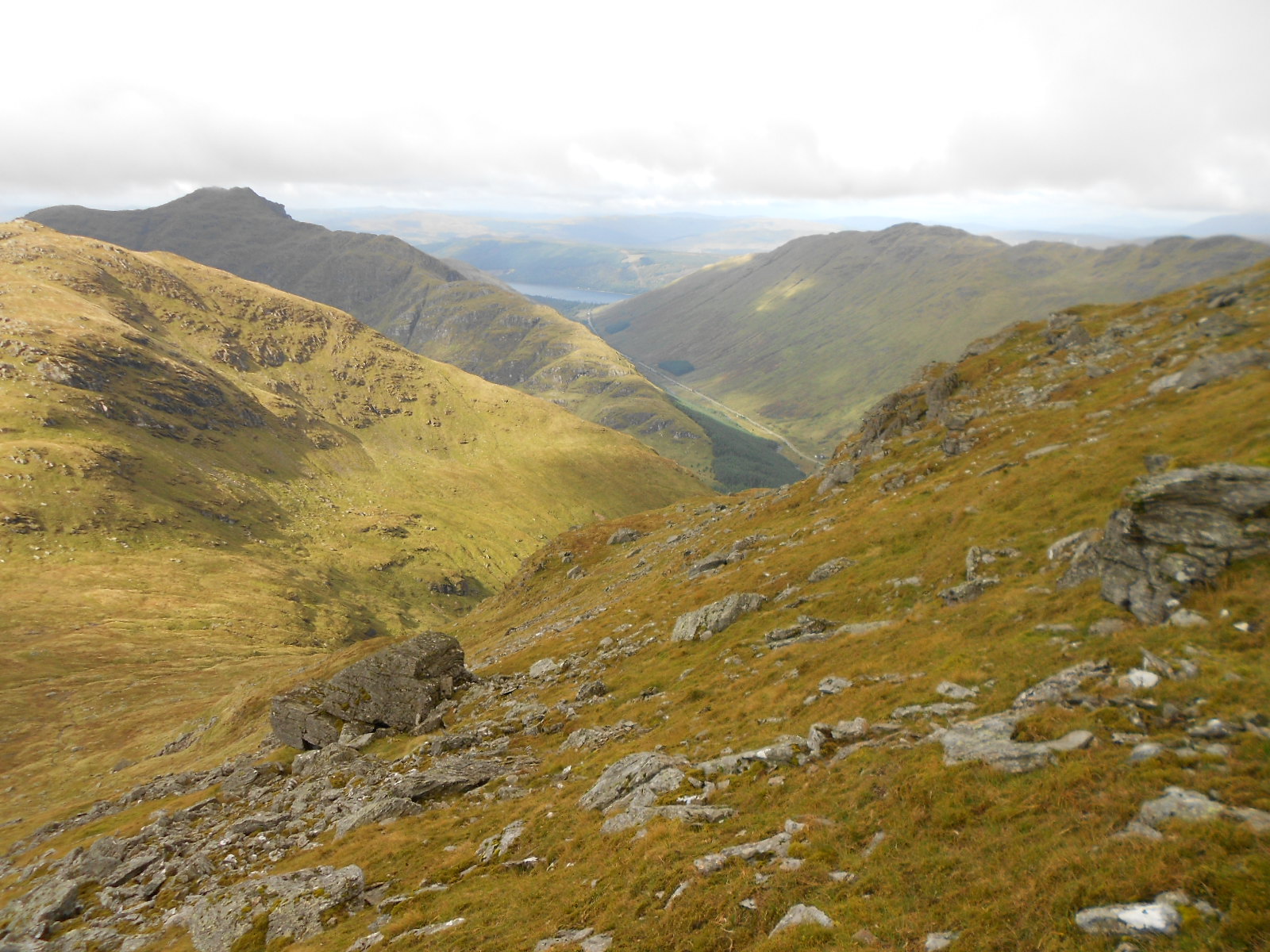
Above: Looking down towards the bealach from the slopes of Beinn Ime
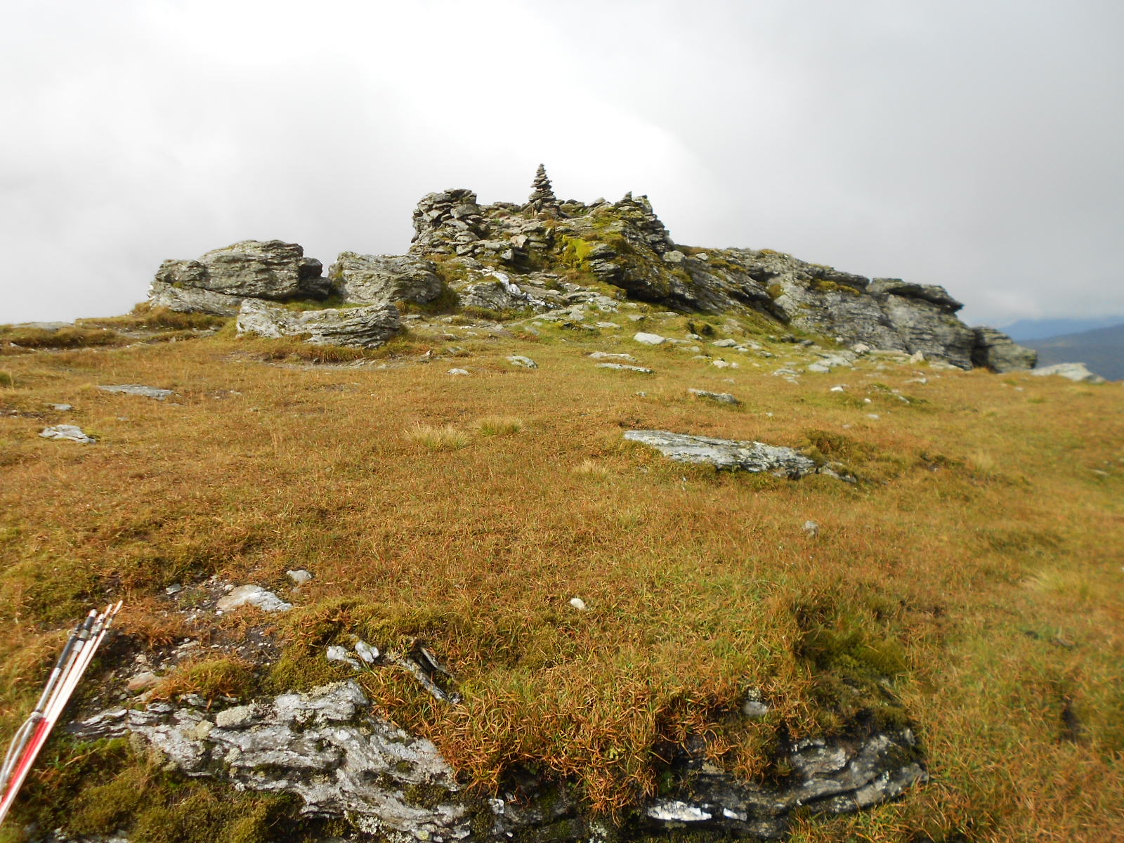
Above: Summit of GM/SS-006 Beinn Ime
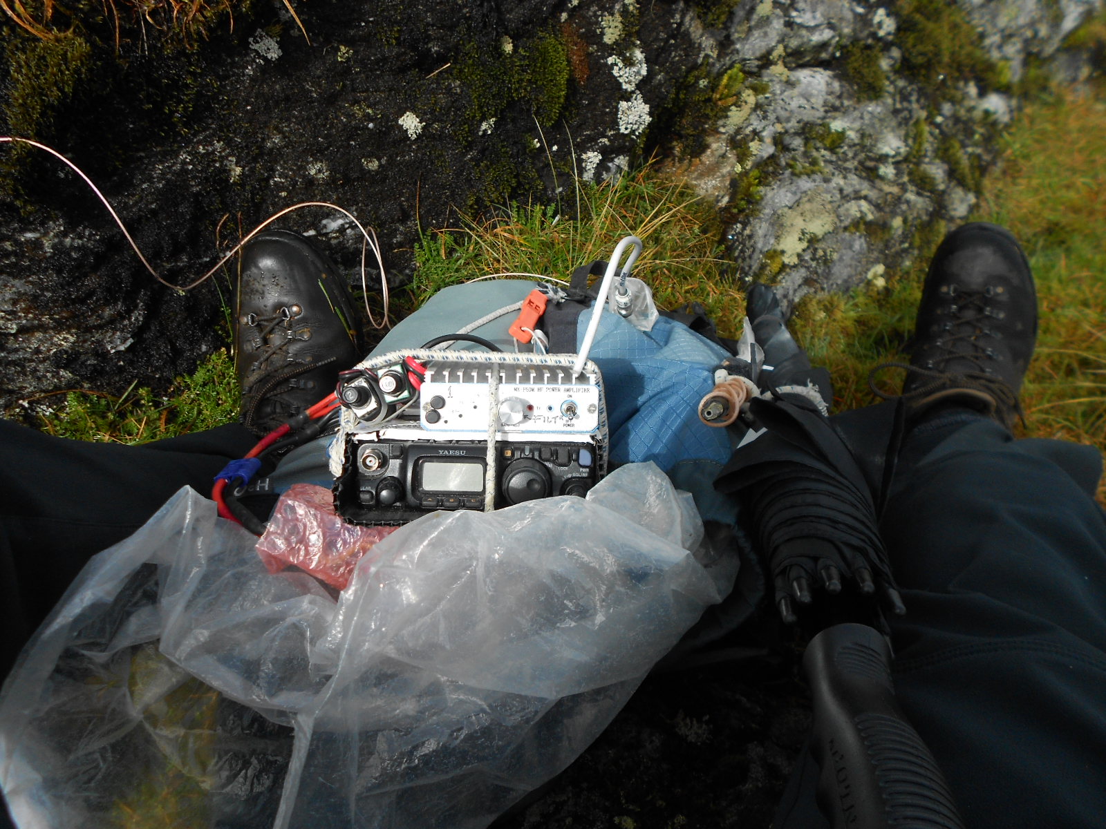
Above: Activation of GM/SS-006 Beinn Ime (on 40m with filter selected for 80m!)
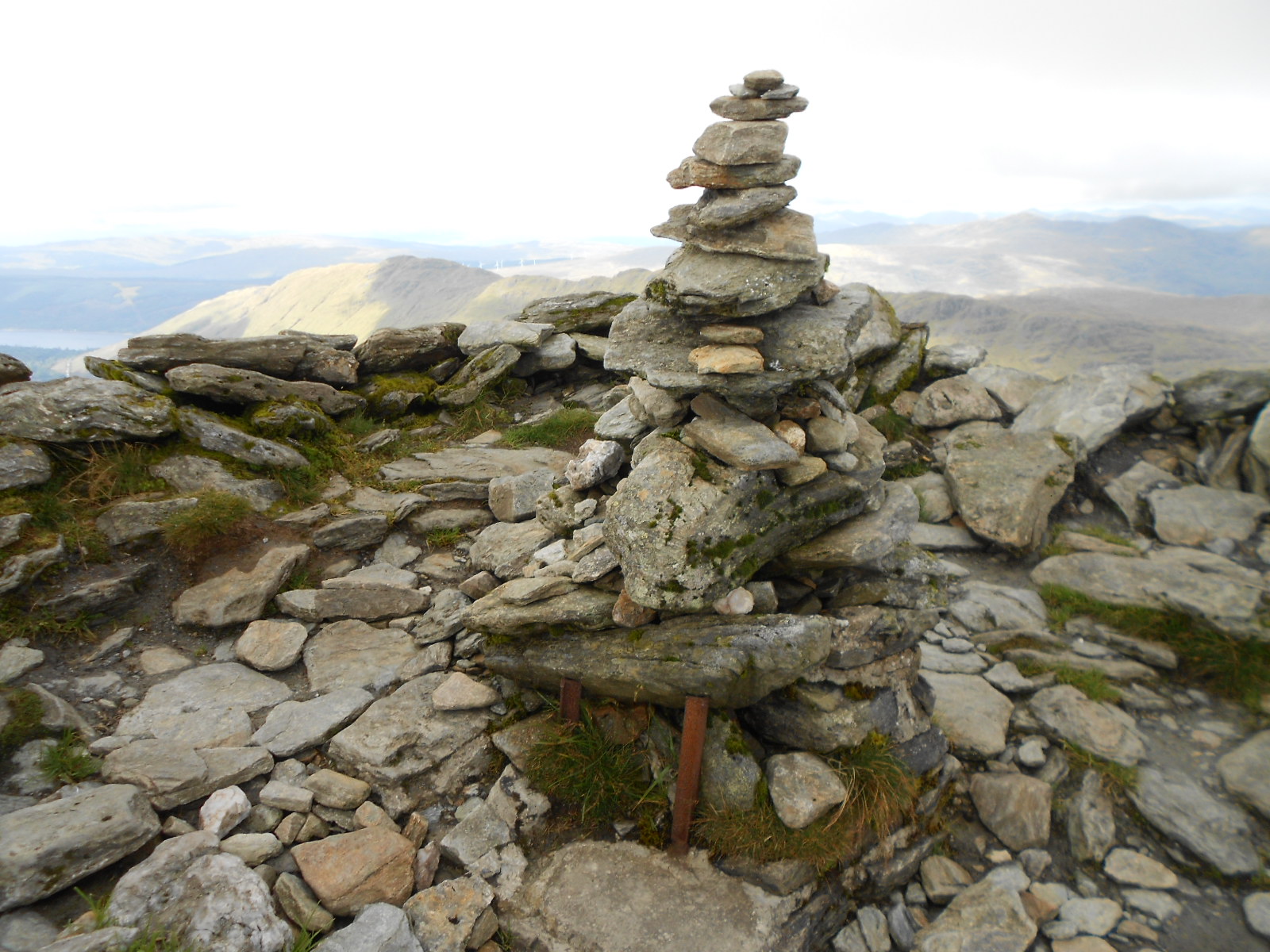
Above: Summit cairn of GM/SS-006 Beinn Ime. Are the metal bits part of a former trig point? Research req’d.
Above: Activation of GM/SS-006 Beinn Ime with dipole in background

Above: Munro bagger dog with 40 to her name! GM/SS-006 Beinn Im

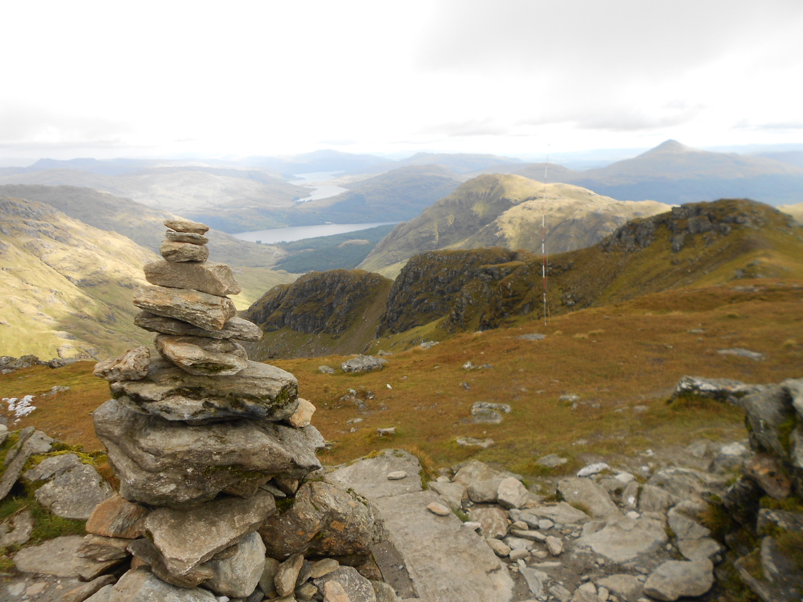
Above: Most of the route back down GM/SS-006 Beinn Ime with SS25 behind
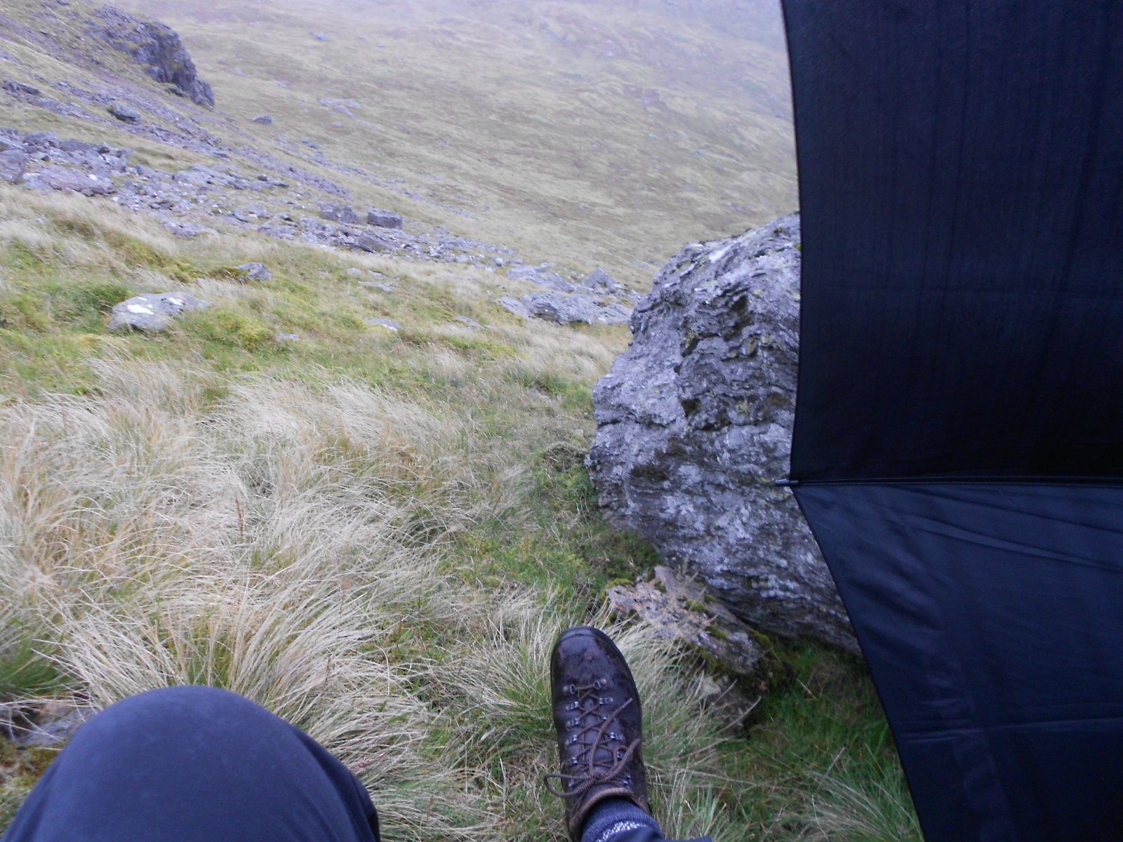
Above: Waiting out a rain shower, slopes of Beinn Ime
Above: Beinn Ime. Steep and moderately rough descent
Above: Beinn Ime. A longing look back at the summit
Above: Rounding the corner from the corrie
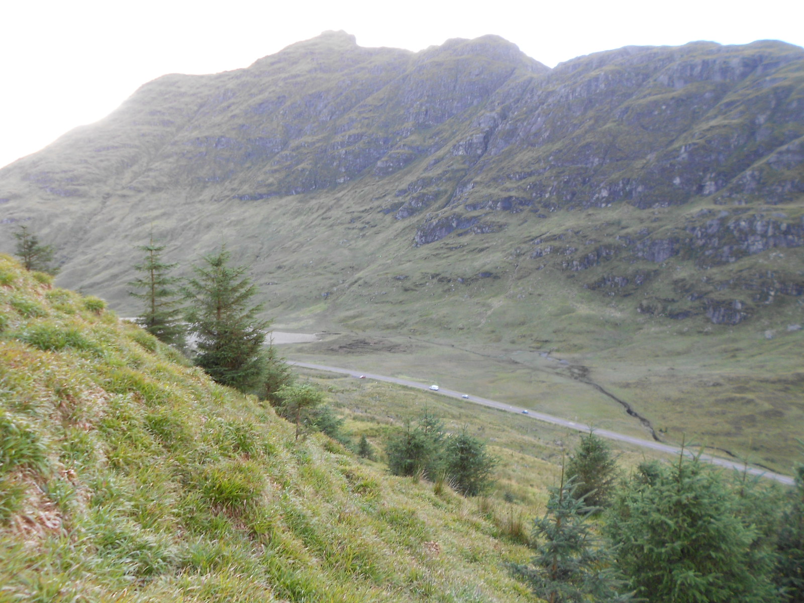
Above: Road and parked car in sight but still difficult ground ahead. SS18 beyond the road.
Ben More Report 17-09-17:
