G4YSS: GM/NS-038, Cranstackie & Mosquito DZ486 on 12-05-17
Issue-1
Activation of CRANSTACKIE - GM/NS-038 - 4 points
Also Mosquito DZ486 crash site (1943)
GM4YSS/P & SSEG Clubcall GS0OOO/P
40m-80m-20m QRO & 2m-FM QRP
All times: BST (UTC plus 1hr, UOS as ‘z’)
Second SOTA in the May 2017 series of three based at the Dornoch Hotel:
GM/NS-065 Creag Mhor
GM/NS-038 Cranstackie (this report)
GM/NS-107 Ben Horn
EQUIPMENT:
FT817ND HF/VHF/UHF 5W Transceiver
MX-P50M, 50 Watt HF Linear Amplifier
Link dipole for 80m thru’ 20m on a 5m CFC mast with 1m end-sticks
Home-brew tunable loading coils for 160m
5 Ah Li-Po battery
J-Pole for 2m FM on 1m pink carbon stick
Reserves:
2.2 Ah Li-Po battery (used for 80 & 20m)
Baofeng UV-3R; 2W-FM VHF/ UHF H/H, 130gm H/H (not used)
QRO pack:
9.4kg (20.7 pounds) inc. food, thermoball jacket, compact umbrella & 0.75 litre fluids.
INTRODUCTION:
This was the second SOTA expedition of this year’s trip to GM/ NS, mounted from the Dornoch Hotel (now run by Bespoke) where stayed from Monday 8th to Monday 15th of May 2017, (441 GBP for DBB x 2).
Cranstackie GM/NS-038, is a long way from Dornoch, being at the opposite side of Scotland and served much of the way by a single track road with passing places. The distance is 70 miles one way, a journey that is reckoned to take up to two hours. The mountain was first activated by Robin GM7PKT/P on 22nd of May 2006 with 19 QSO’s including 8; 6 & 5 respectively on 60m, 40m & 2m but it hasn’t been on the air since.
EXECUTION:
As before a basic breakfast was arranged, this time at 05:40 and supplied by the night porter. I managed to get away for 06:00. The drive north via A9, A839, Lairg and the A838, passing Loch Shin and Laxford Bridge, took a total of an hour and a half. I worked Ray GM3PIL on 2m-FM before 7am, from the banks of Loch Shin and we confirmed arrangements with regard to the Top Band attempt.
I set off walking at 07:57 in a strong cold breeze and dull overcast but there was no sign of low-cloud on any of the mountains around. As always, I walked along wondering how the day would pan out. This part is not easy for a pessimist. There were no DAB broadcast stations receivable, so I reached for the MP3 player to provide the necessary distraction.
ROUTE UP:
There is space to park four or five cars in a roadside pull-off at NC 3300 5902. From there you must walk 300m along the A838 in the direction of Durness (NE) to reach the access point at Carbreck, NC 3325 5920, which is the private track down to Rhigolter Farm.
Walk down the farm track, crossing a gated bridge to reach the Farm after about 25 minutes. The track stops abruptly at a gate (marked at NC 3412 5716). If you can find a path after this it’s a bonus. I walked up through read beds and over rough grazing land, only finding a path between NC 3439 5695 and NC 3451 5678. Just beyond at NC 3462 5672, I crossed the Allt Chalbhach Coire burn to gain access to the slopes of Cranstackie.
The accepted method is to follow the burn up into the (reputedly) boggy Chalbhach Coire and climb onto the 560m high bealach, between Cranstackie and Beinn Spionnaidh, at NC 3568 5625. Once there, turn right (SW) to follow Cranstackie’s NE ridge to the rocky summit. Only found on the way down, there is a path of sorts for the lower part of this final section but nothing once the rocks are encountered. I can’t vouch for any of the rest.
Today, in order to locate the wrecked aircraft, my route was much more direct. Some friends had been there about 20 years ago, so I knew where to look. At the time the position was given as Beinn Spionnaidh so two visits were needed from them, two years apart. More of that later (see ‘Comments’).
From the burn crossing, today’s course went on grass via NC 3468 5613 to NC 3490 5601, where I found part of an aircraft elevator. After this it is steep, inclined rocks all the way through the debris field (see Comments) to the NE ridge which was attained at NC 3512 5565. Approaching the ridge, the angle was such that some of the rocks, both large and larger, were precariously perched and/or wobbly. Each small advance had to be carefully tested before committing or re-directing, making the process both strenuous and tedious.
Once on the ridge, it was just a 100m walk to the substantial, 6 foot high summit cairn, the top of which was GPS’d on arrival at 10:46. (Cairn NC 35058 55573 / 804m ASL). Due to a strong, gusty southeasterly wind, care was needed on this ridge section and the summit too, especially considering the northwest drop-off, which is rough and precipitous. The summit area consists of large individual rocks stacked at all angles as far as the eye can see and there is no trig point.
Setting Up:
The first priority was to find a place which would afford some protection from the wind. One option was a fissure between rocks at NC 3505 5557. The wind was blowing more along this than across it, so it wasn’t perfect. Worse still, it was right on the edge and a loose 100kg rock first needed attention. Since I couldn’t come up with anything better after searching around, I dropped the rucksack down and set up the dipole more or less parallel with the drop-off but with an included angle to counter the wind.
Walking around unreeling 40 metres of wire on that kind of surface is bad enough but with strong gusts occurring unpredictably, it was hard to stay upright. The VHF J-Pole was set up more easily just to one side of the ‘shack’ from which I had a clear view of the entire ascent route.
CRANSTACKIE - GM/NS-038, 801m, 4 pts, 10:46 to 14:53. Constant 8C. 30 mph wind with strong gusts. Mostly sunny. No lying snow. Reliable EE phone coverage at the summit and most parts of the route. LOC: IO78OK, WAB: NC35.
Like NS65 two days before, I intended starting on the WAB frequency of 7.160-SSB. Before going there, I worked Roy G4SSH on 7.033 to tell him that battle was about to commence (589/ 339).
7.160 SSB (WAB frequency) - 43 QSO’s:
With power set to 50 but later 30 Watts, I called Dave G4SQA who had just finished working SM6CNX. Dan was next in the log. The frequency was then handed over to me but if I could have predicted just how many stations would call, I would have dived off to the side somewhere to start my own channel. As it was I became almost overwhelmed with callers; common sense going out of the window. Apologies to any mobiles that tried to use the channel including Peter MM3PDM/M in North Uist and further apologies for saying I’d bring him in first then forgetting to.
In the log are: G4SQA Dave; SM6CNX Dan; GM3PIL Ray; G0FEX Ken; MW0IML/P Barry S2S GW/SW-006; G3OKA John; G0VWP Terry; G8VNW Nick; G4AFI Andy; M0JCQ James; M6HMK Helen; G0OFD (ex-VP8CED) John; G0RQL Don; PA0INA Frans; M0JLA Rod; G3RMD Frank; G0GWY Geoff and MM3PDM/M - Peter in NF96 N.Uist.
Next: G4ZRP Brian; G7BGA Geoff; G0NES Don; EI9GLB Jim; EI6KO/M Albert; HB9AGH Ambrosi; EA2CKX Pedro; G6WRW Carolyn; G3RDQ David; PA3DIP/P; DJ5AV Mike; G4LTH John; 2E0PCL Garry; EB2JU Jose; G4RGV Jon; PE1PIC Kees; G4PIJ Jack; MW6WMW Mike; G4WHA/A Geoff; SP6BBE Zbigniew; SA4BLM Lars; GM0AXY Ken; 2E0KVJ Dave; DJ9BX Mike and MM0AUP/P Peter.
And the ones that got away: M0HZP and G0FVH apparently lost me in QSB.
Outgoing reports were mainly in the range 57 to 59 at first but as the stronger ones were worked the average went down. There was plenty of QSB but this was the best day of the holiday as far as 40m was concerned. I received 56 to 59 reports mostly but a few 55’s, 44’s and 33’s crept in later. The session took 49 minutes which is not bad considering the station details need to be repeated every few QSO’s, unlike when you are being run down a net.
7.033 CW - 12 QSO’s:
Scarborough station, Roy G4SSH was already in the log from earlier but Roy called in again to give me a better report of 579 as against 339 an hour prior. There followed: G4RGV Jon; EA2LU Jorge; LA1ENA Aage; PA1BR Pascal; DF5WA Bert; SM4BNZ Rolf; DL2DXA/P Bernd (SX-268?); ON4FI Karel; G0BPU Mike; F6EAZ Chris and ON7MD Mike.
Power was about 30 Watts and signals were again mainly good. More than half were 579 to me but there was QSB. Nevertheless, there were no readability reports less than 5 either way, apart from DL2DXA/P who gave me an R4.
145.575 FM - 3 QSO’s:
As always, GM3PIL Ray in Nairn was first in the VHF log with a 59/ 58 exchange. Power was 5 Watts from the FT817ND to the vertical J-Pole and Ray was using his colinear, which he says is not particularly high. Also worked were GM0GTU Stewart in Nairn, tenuous at 55/ 44 and later after my brief spell on 80m but mentioned here, MM6OEC John on the Isle of Lewis with 55/ 52. John was using a 4-ely beam which was, ‘Only two feet off the ground in a screened corner of the garden and pointing the wrong way.’ Still, there was little between us but sea and we were able to chat unimpeded.
Now for the main attraction. Would Ray and I make it on 160? Sadly the answer would be, ‘No.’
1.832 CW - Nil:
It was alerted the day before but the real time QSY to 160 wasn’t spotted by Roy G4SSH because I failed to tell him about it. Roy can often read my mind but not when he doesn’t hear from me for ages.
Ray GM3PIL was coming in to me at 51 to 53 on the meter with QSB but he heard nothing coming back. Neither was there a spike on his Flex 6300 radio display. Power was 50W to the loaded dipole using the reserve 2.2Ah battery. I tried a few CQ’s without any expectation but you’ve got to try. Just a hiss.
1.843 SSB - Nil:
If Ray couldn’t hear me in CW , he wasn’t going to on voice so I put out a CQ or two then gave up in favour of trying 80m with a view to saving face.
Dropping my pencil, I watched it disappear into the dark recesses below me. No chance of ever seeing that again let alone retrieving it, so I broke out a new one. This time a bright blue one instead of black. My ‘shack’ was well appointed; it had a little shelf for pencils.
3.760 SSB - 5 QSO’s:
At 12:40z, using 50 Watts, Ray and I exchanged with 53/ 33 followed by Stewart, who couldn’t copy much at first. Eventually he made it into the log with a 58/ 33 entry.
Next came the unexpected: M3FEH Karl in Cornwall; G0VWP Terry in York and G4WHA/A Geoff at the shop in Penrith, with all its computer generated noise and furthermore using a poor antenna. All incoming reports were 33 apart from a 34 coming from York but noise levels seemed low. Then again, they usually are on a summit. Well done 80m!
14.052.6 CW - 6 QSO’s:
I said my goodbyes to Ray on 145.575-FM which is when John MM6OEC heard me (see above). Time was tight; my self imposed deadline already past but temptation got the better of me. It takes such a lot of effort to climb these mountains and goodness knows whether you’ll ever be there again, so I phoned Roy for a final spot, this time on 20m. He did a great job. As soon as the links were opened, I heard callers.
Compared with a poor showing two days earlier, 20m showed a bit more promise. Power was 50 Watts to the dipole and in seven minutes, I logged: OK2PDT Jan (SOTA’s top activator) 579 both ways; K5QR Andy (Texas) 599/ 559; G4RMD Frank 589/ 559; EUSMM Vlad 589/ 599; G4FGJ Gordon 589/ 559 and EA2DN Jorge 599/ 569. Considering the good reports, there perhaps should have been more but I was more than satisfied with the selection. UK to USA with Czech-Rep, Belarus and Spain in between. My time was up.
Descent:
After some careful and tedious packing up near the big drop in a high wind, I retreated down the rocky NE ridge starting at 14:53 but it took over 20 minutes to reach the bealach. To be fair, it wasn’t even that far because I bailed off left at NC 3531 559, some 500m before getting to it. I was intent on having one final look at the Mosquito wreckage in the hope of finding more. Contouring along to it from here via NC 3527 5600, was easy enough on a grass and rock mix.
I did re-locate the elevator but the afternoon was warm and sunny with little wind reaching the sheltered side of the mountain. I was too lazy to climb up and for what purpose anyway? Time was a factor and also an unknown, so I pressed on down, over the burn passing two dead sheep both with lamb’s heads projecting from their rears. Poor animals. Where’s the help when you need it? The farmer can’t be everywhere at all times and Scotland is a rough, tough country especially if you’re a sheep or a deer.
The walk from the farm up the track to the A838 parking place is a bit hard on the psyche but after 25 minutes of this, the car was a sight for sore eyes. It was now 16:36.
On arrival and before driving off (in this instance at 16:45), I try to do a few things such as remove radio logs, battery’s, any damp coats and the GPS from the rucksack. These have to be processed or dealt with before the next expedition.
If I’ve used a handheld, I swap it for a charged one and put some fresh water, biscuits and Li-Po’s in for next time. All this and more is an attempt to avoid that sinking feeling of having forgotten some vital bit of kit the next time you go out. I also remove rock samples. Twice I have carried added weight to the top of the next mountain. Not good!
After a very pleasant drive in sunshine past the stunningly beautiful racehorses (especially if you’ve seen them from their tops) Foinaven and Arkle (NS23 & NS42), I arrived back at the hotel for 18:10.
ASCENT & DISTANCE:
Walk in: Ascent 785m (2,575ft) / Distance 4.8 km (3-miles)
Return: Ascent 55m (180ft) / Distance 5.3 km (3.3-miles)
Totals: Ascent 840m (2,756ft) / Distance 10.1 km (6.3-miles)
Driving from Dornoch: 2 x 70 miles
CHRONOLOGY:
Left Dornoch Hotel: 06:00
Parked: 07:30
Walk started: 07:57
GM/NS-038: 10:46 to 14:53
Returned to Car: 16:36
Drove back to Dornoch: 16:45 to 18:10
Walking times:
Ascent: 2hr-49min (inc. 30min+ at Mosquito crash site)
Descent: 1hr-43min
Summit time: 4hrs-7min
Time Car to Car: 8hrs-39min
Gross time Hotel to Hotel: 12hr-10min
QSO’s:
43 on 40m-SSB
12 on 40m-CW
3 on 2m-FM
0 on 160m-CW/SSB
5 on 80m-SSB
6 on 20m-CW
TOTAL: 69
Battery Utilisation: Approx 6Ah
COMMENTS (In two parts):
Part 1) SOTA:
Cranstackie was long overdue for attention but that’s hardly surprising with it being so far north. It turned out to be an exceptional day. Despite there being few paths beyond the farm track, the mountain is quite good to approach. However above about 600m it gets increasingly steep and rocky. The summit comprises over 99% rock with very few plants in between. Though the recommended route is via the bealach, I think I would use the direct approach via the aircraft again, though care is needed because it is steep and some rocks are unstable.
The climb down towards the bealach (col) on Cranstackie’s NE ridge was a slow one and this was due to the rocky terrain combined with high winds. Views were good but there was haze at a distance. Apart from a strong, gusty wind on top, the WX couldn’t have been much better.
40m:
The 7 MHz band was working exceptionally well today. It was by far the best option for SOTA this far north, netting a total of 56 QSO’s in the two modes used. Two stations got lost in QSB but the reports were mostly good and the QSO rate brisk.
The use of the WAB frequency is an advantage but I regretted using it today. MM3PDM/M was kept waiting for 50 minutes which is not a good thing. If my WAB square had been rare, like the ones on Creag Mhor two days before, it would have been justified but NC35 has roads in it. One caveat is that it is so very far north and therefore might be quite rare for that reason alone. Certainly there were plenty of WAB stations working me.
20m:
Not a huge quantity of QSO’s on here, only six but I was able to pick up the USA, which could well be the first time that country has been worked from NS38.
160m:
Not even Ray GM3PIL in Nairn could work his magic this time and the summit remains without 160m contacts. Ray maintains that his receiving antenna is no longer available and we have a polarization incompatibility but neither am I able to state with confidence that my transmit system is working as it should.
It’s almost impossible to carry a half decent Top Band station on to a mountaintop and efficiency must be dire. In daylight it relies on lines-of-sight and though most of the intervening SOTA’s are to one side of a line between us, we were at opposite sides of Scotland. The 2m signal attracted a 58 report from Ray whereas it was 59 when we had success from NS65 two days prior. That said, we were destined to fail again from NS-107 two days after Cranstackie.
2m-FM:
Three contacts on 2m-FM is more than satisfying from the top left hand corner of GM, especially considering the final one, MM6OEC John, who found me purely by chance. I used to work Jon GM3JIJ (Stornaway) on VHF from NS summits a few years ago not recently.
80m:
3.5 MHz unexpectedly brought in five stations with best DX Cornwall again but when you consider the incoming reports - nothing better than readability 3, it does beg the question, was the linear working properly? If not, could that explain the 160m failure? A test is required.
When I showed them to him, a friend told me that the rock samples brought down from the summit of Cranstackie were metamorphic gritstone. Just like the other summit activations this holiday, no other walkers were seen.
…
Part 2) MOSQUITO DZ486:
de Havilland Mosquito Mk.IV, DZ486 is the very first entry in my copy of High Ground Wrecks by David Smith, published around 1976. This listing, one line for each of several hundred aircraft, deals with wrecks in the UK hills from top to the bottom of the country. The first entry reads as follows:
9/ 36-57-; Ben Spionnaidh; Mosquito; DZ486; 618 Sqdn; 5-4-1943; Engines & U/C
‘9’ refers to the Landranger map number and is followed by the grid ref. which in this case is incomplete, putting it somewhere within a 1km square on Beinn Spionnaidh which is the wrong mountain. Nobody knew that at the time and I can readily imagine the disappointment of my three friends in their futile search of Spionnaidh in 1998.
They returned a couple of years later with new information, finding the wreck on Cranstackie after what must have been another long search. They identified ten areas inside a square box with 450m sides, where wreckage lay but I wasn’t intending to visit all of these waypoints.
This twin-engine bomber crashed on 5th April 1943 while on a bombing exercise from Skitten near Wick. It may have been there to test the new Barnes Wallace anti-shipping bouncing bomb but the bombing range was Loch Striven near Bute; a goodly distance from this crash. The bombs were concrete filled for the tests. I cannot conjecture further. I found nothing resembling a bomb case or concrete but it is true that 618 was a squadron was specially formed to deliver the Highball from Mosquito aircraft.
As you’d expect when an aircraft hits a rocky mountain, the crew members rarely survive. In this case there were two fatalities: F/O Donald Pavey the pilot, aged 21 and Sgt. Bernard Stimson Nav/ bomb aimer aged 28.
Looking at the map, I could see that I wouldn’t have to go very far out of my way to investigate at least some of these waypoints. The conflict was whether to activate Cranstackie and look for the Mosquito or to forget the aircraft and try to get Beinn Spionnaidh on the air as a second SOTA. The choice wasn’t difficult. NS46 would have to wait. This way, there would be time to look at the aircraft and also to do a better job on the Cranstackie activation.
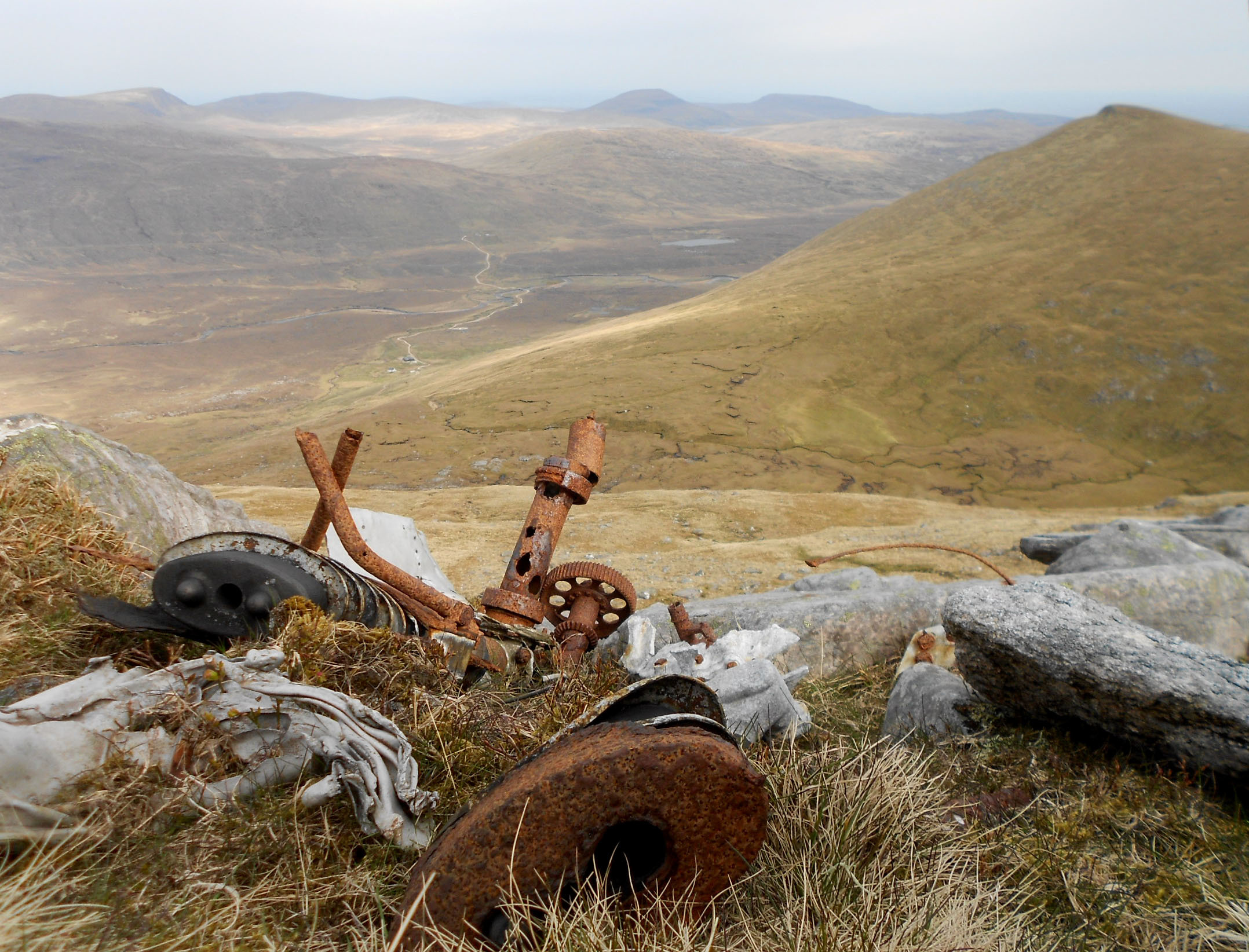
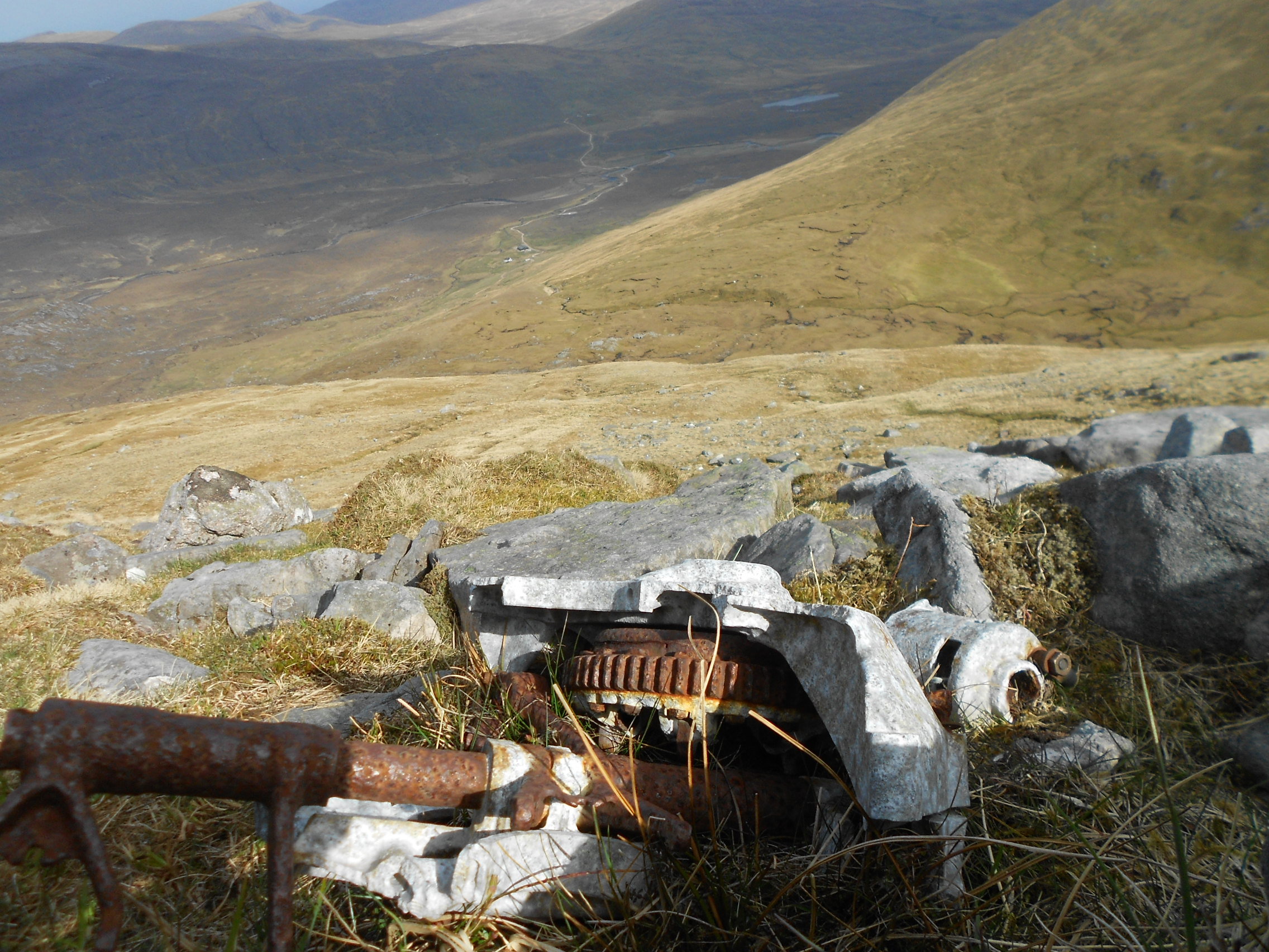
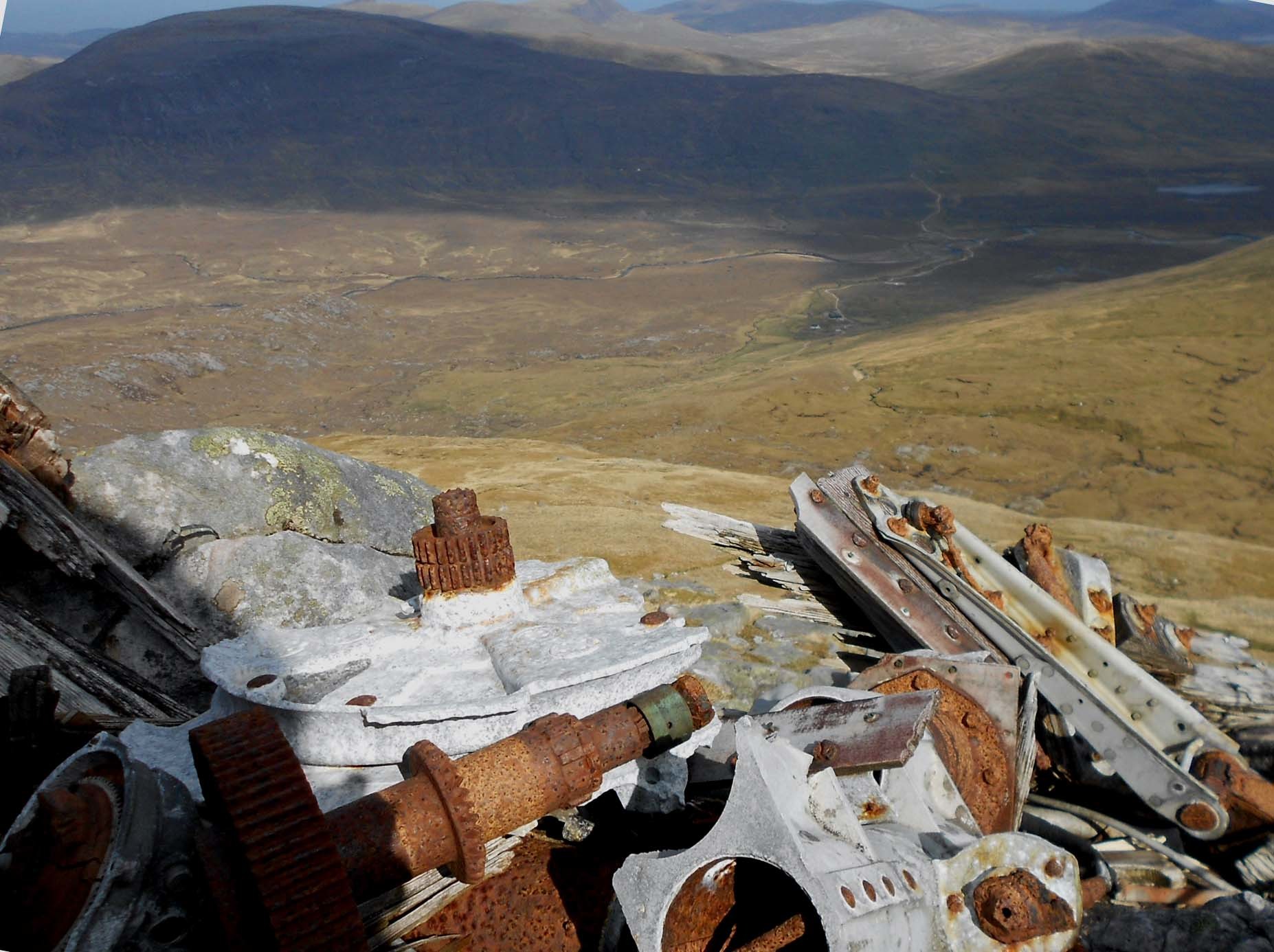
After finding the elevator parts on grass at NC 3490 5601, I contoured another 100m east, finding nothing. Turning to head SW and up onto rocks, I found an undercarriage at NC 34954 55955 and a second one at little higher up at NC 34954 55947. Climbing higher still revealed another area at NC 34969 55926 which included parts of a supercharger. My hobby before amateur radio was looking for WW2 aircraft on Britain’s hills so it was good to be back on the case again.
Cranstackie was an experience I won’t forget in a hurry but it would be good if one day I could go back for Beinn Spionnaidh.
THANKS:
To ALL STATIONS worked and sorry about the two that got away. To G4SSH for spots via SMS text, telephone or on the air. Thanks to Ray GM3PIL for monitoring 145.575-FM. Thanks to the WAB organization for the use of 7.160 MHz and apologies to mobiles.
73, John G4YSS
Using GM4YSS/P (database) and Scarborough Special Events Group Club call varied for Scotland - GS0OOO/P.
Note: GM/NS-107 Ben Horn report to follow in due course.
/////////////////////////////////////////////////////////////////////////////////////
Photos:
5-15-19a-35a-41-50-54-62a-66a-74a-84a-104a-107a-129-134a-147a-169-177a-179a-200-208-214a.

Above: A dull morning on the Rhigolter Farm track with Cranstackie behind.
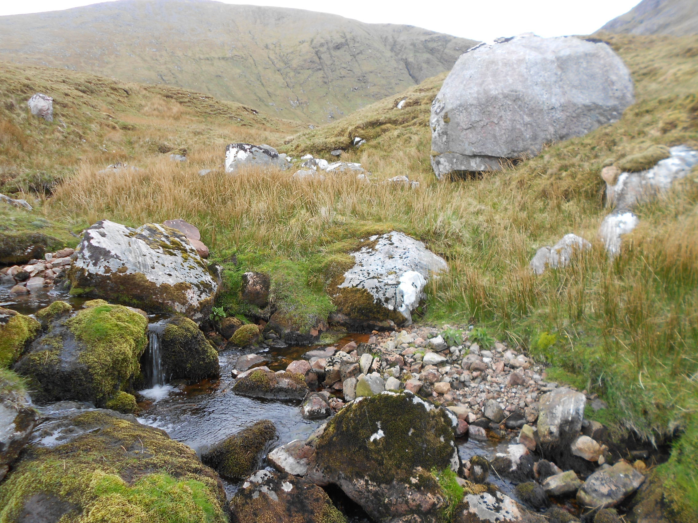
Above: Crossing Allt Chalbhach Coire burn at NC 3462 5672 with GM/NS-046 Beinn Spionnaidh behind.
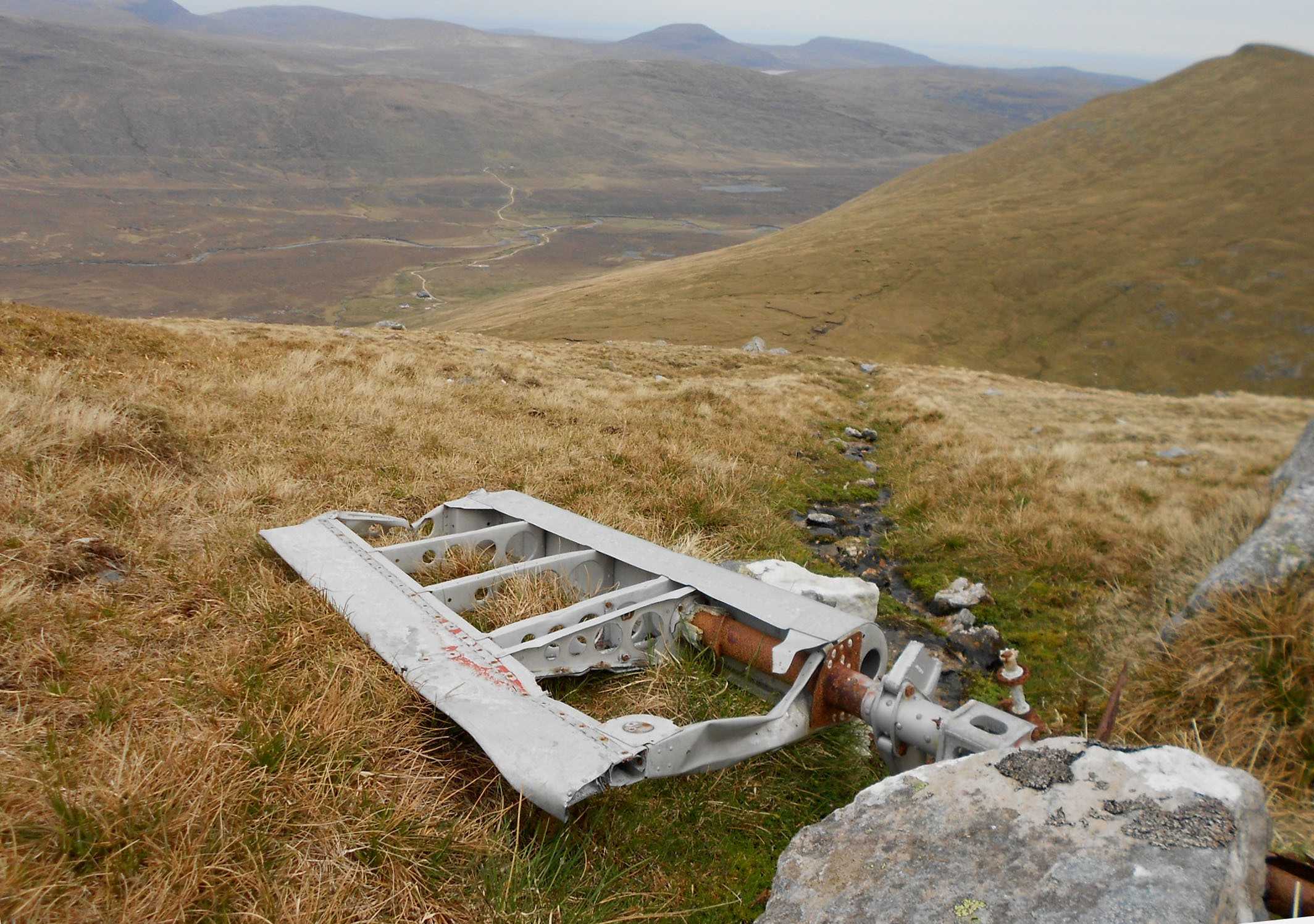
Above: Mosquito elevator assy at NC 3490 5601. A838 start point and farm track in distance.
Above: Mosquito undercarriage parts at NC 34954 55947.
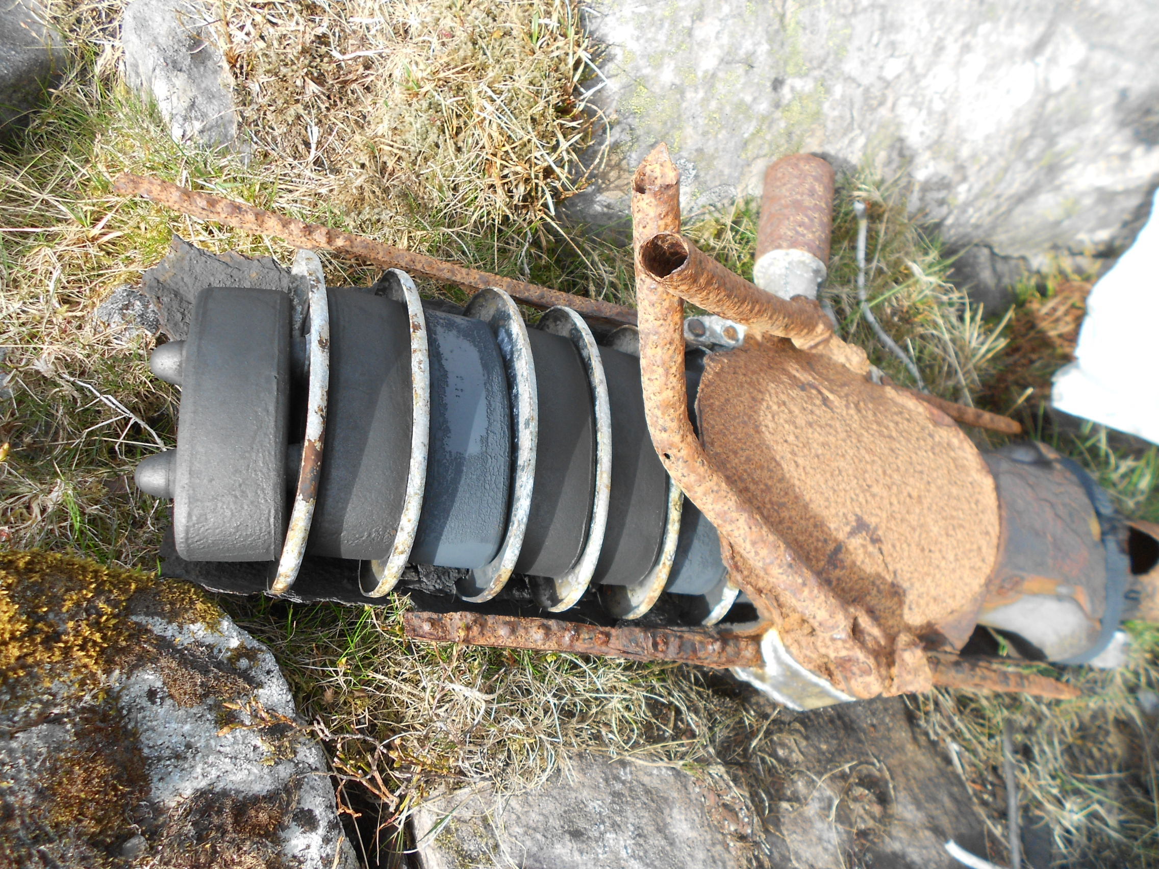
Above: Mosquito undercarriage rubber dampers at NC 34954 55947.
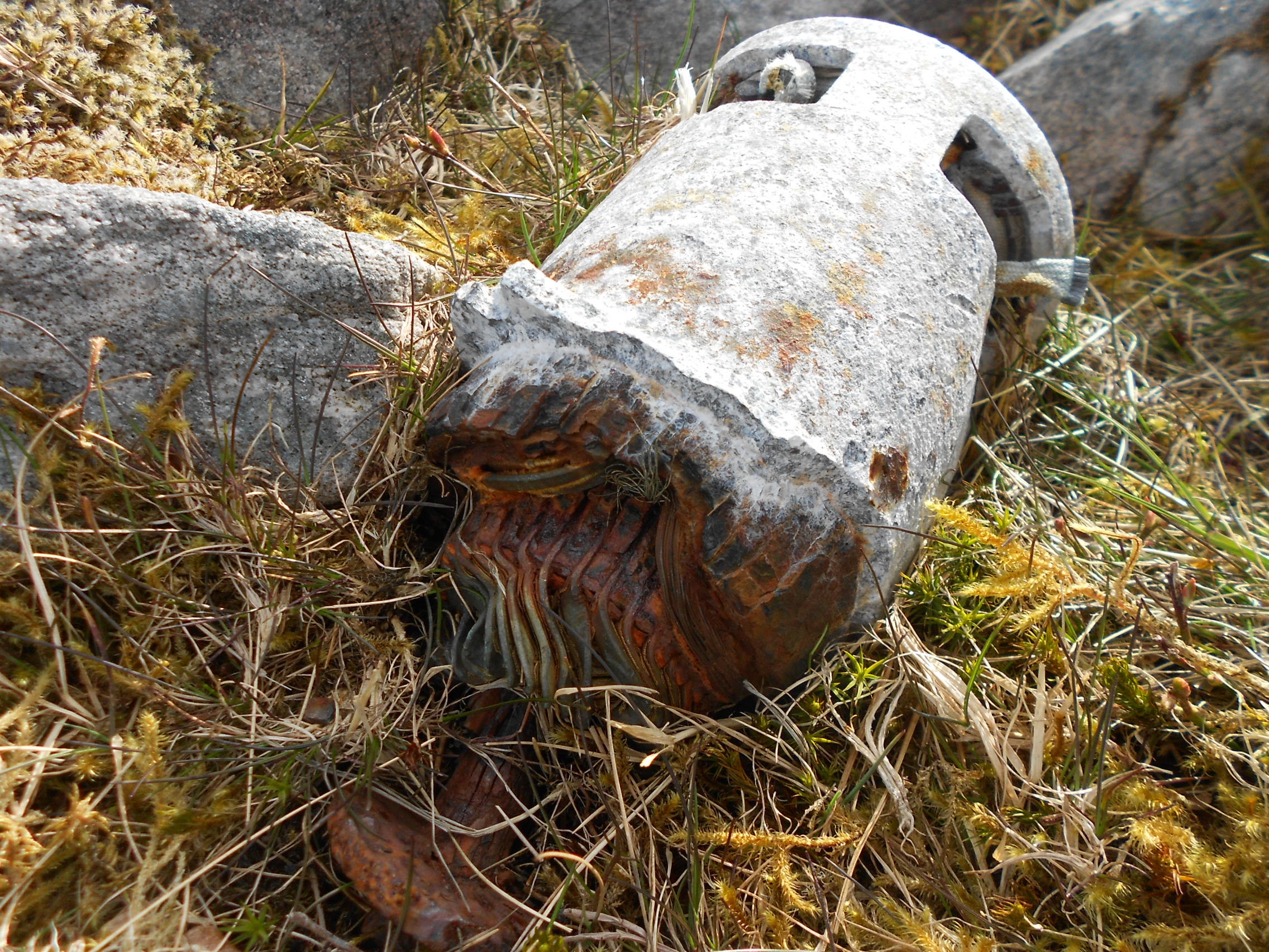
Above: Mosquito generator at NC 34954 55947.
Above: Mosquito parts inc. generator (right) at NC 34954 55947.
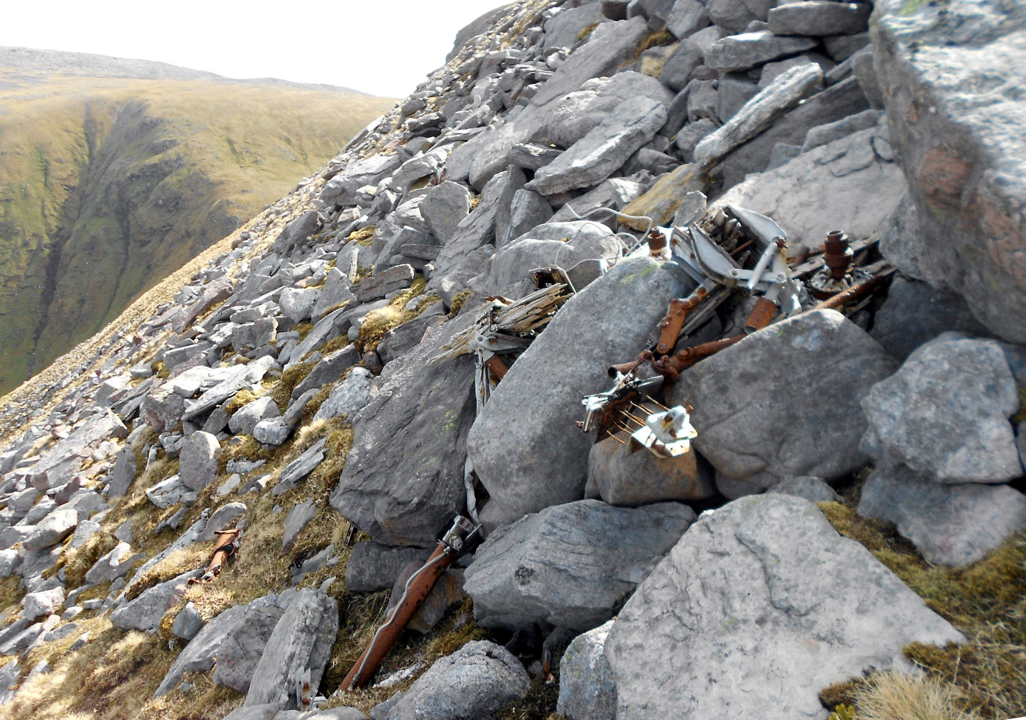
Above: Mosquito parts inc. supercharger at NC 34969 55926. (1)
Above: Mosquito parts inc. supercharger at NC 34969 55926. (2)
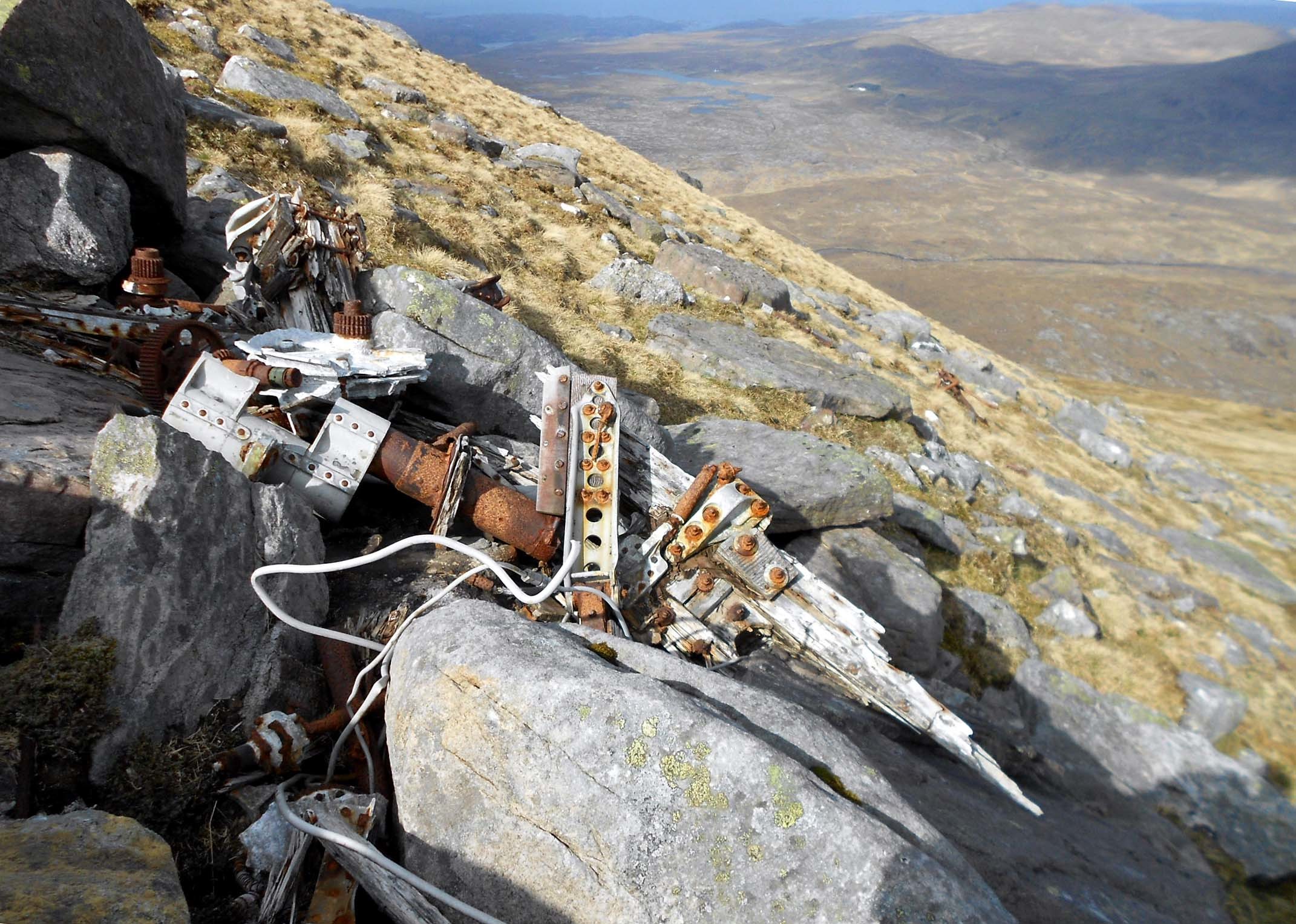
Above: Mosquito parts showing wooden construction at NC 34969 55926.
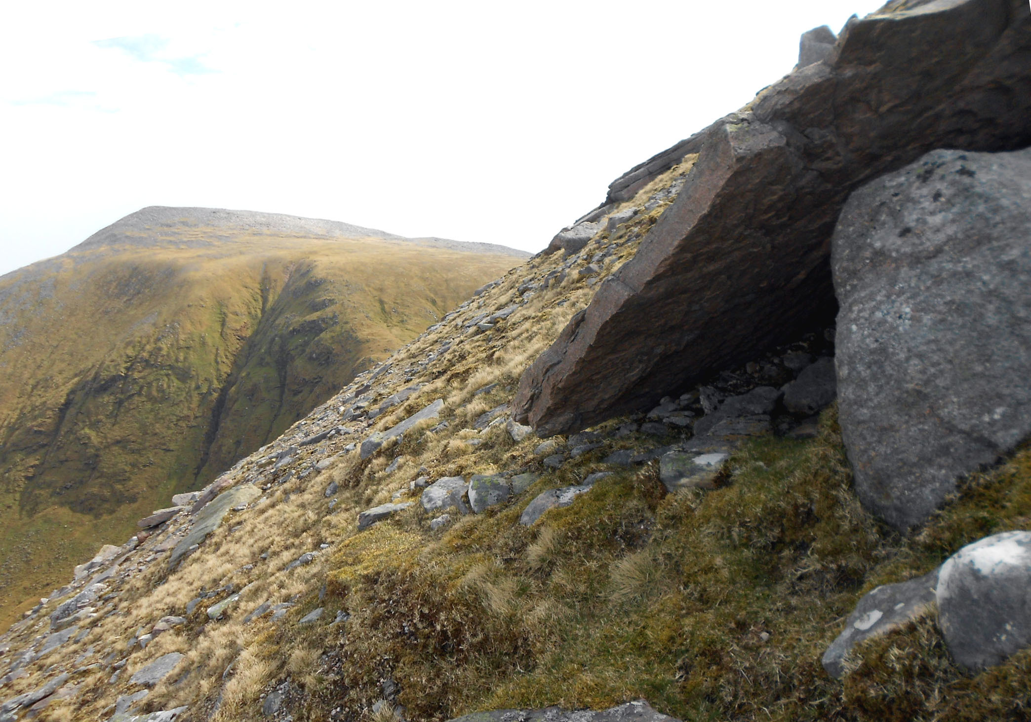
Above: Great shelter, if only it were at the summit! NC 3497 5590.
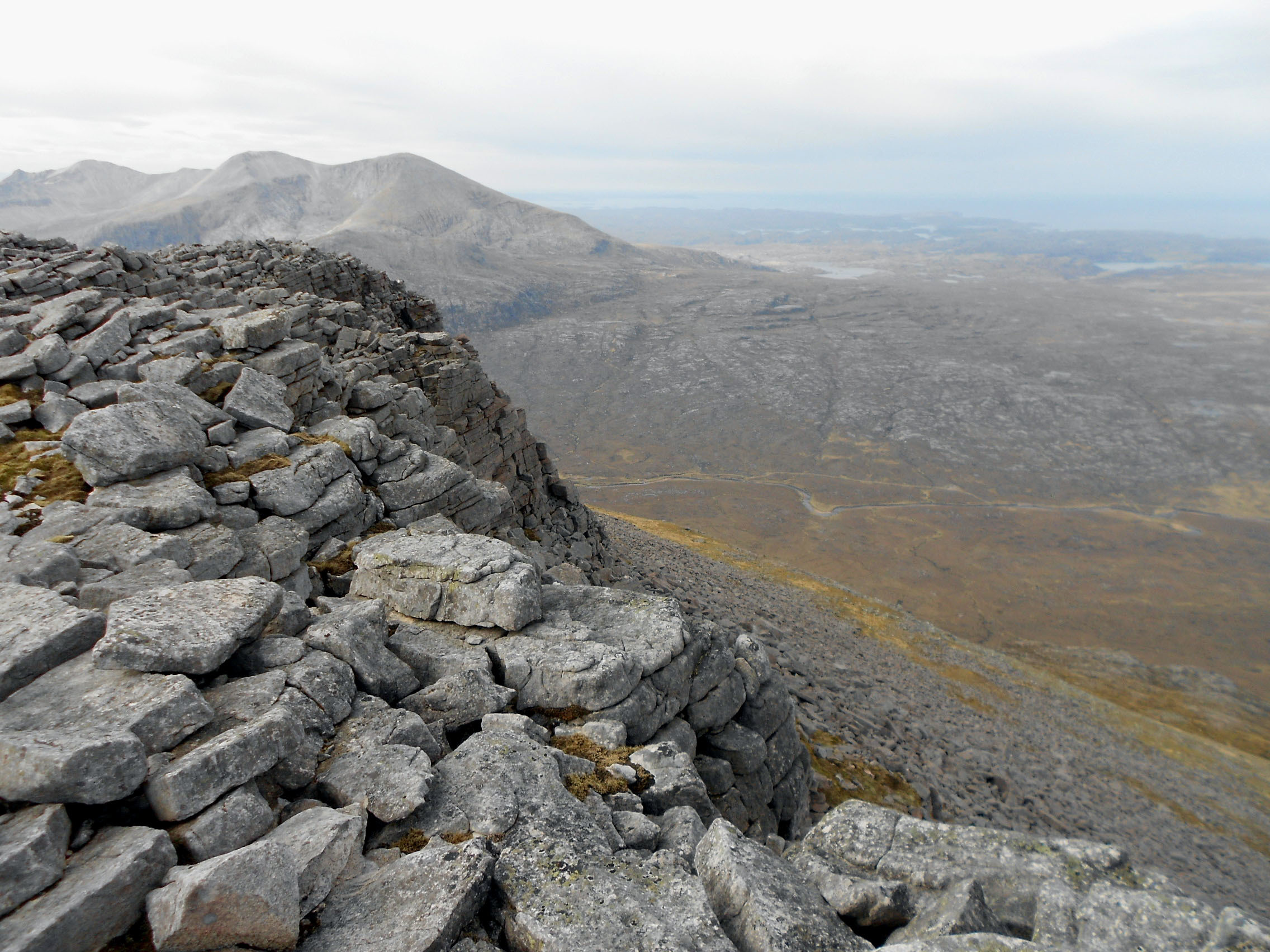
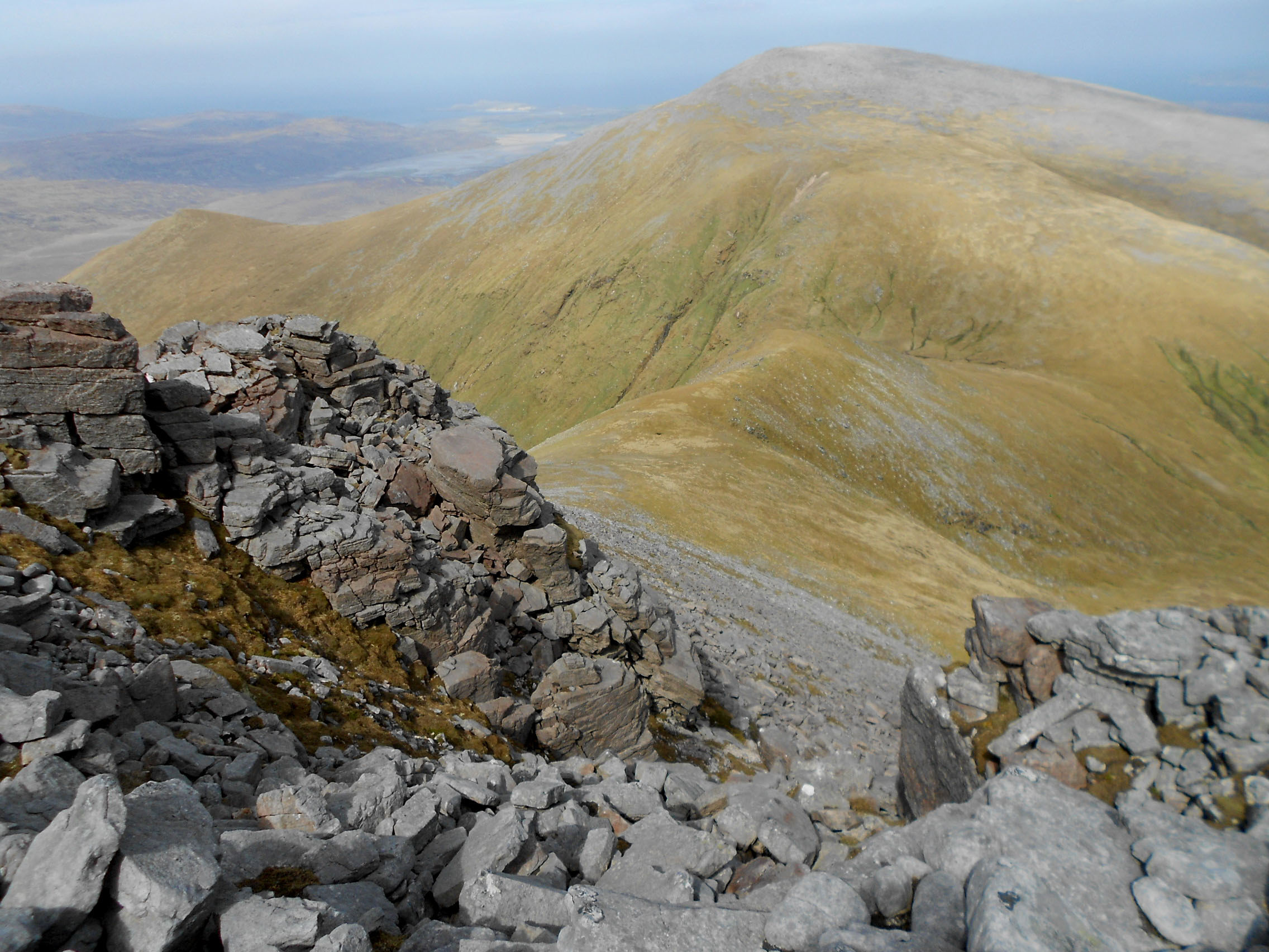
Above: GM/NS-038 Cranstackie summit looking SW with GM/NS-023 Foinaven in background.

Above: Cranstackie summit cairn looking N with Kyle of Durness in background.
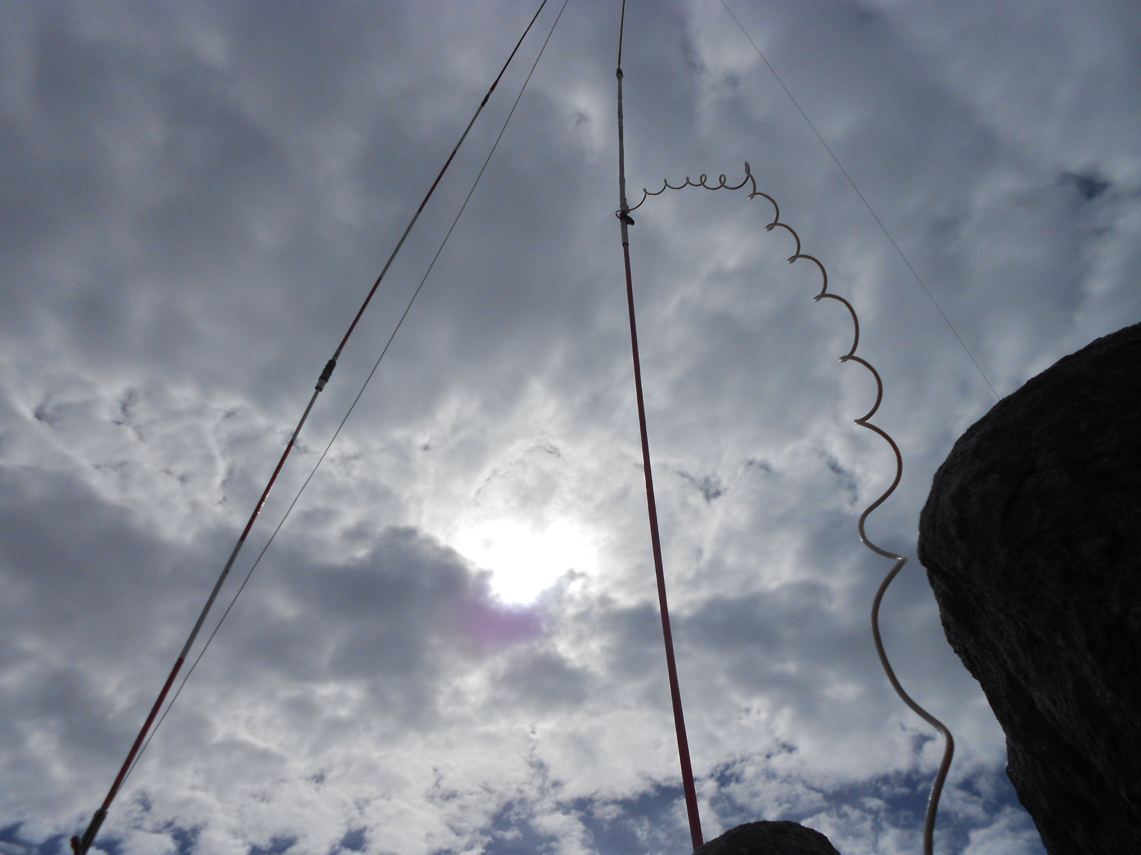
Above: Cranstackie activation. HF (left) & VHF.
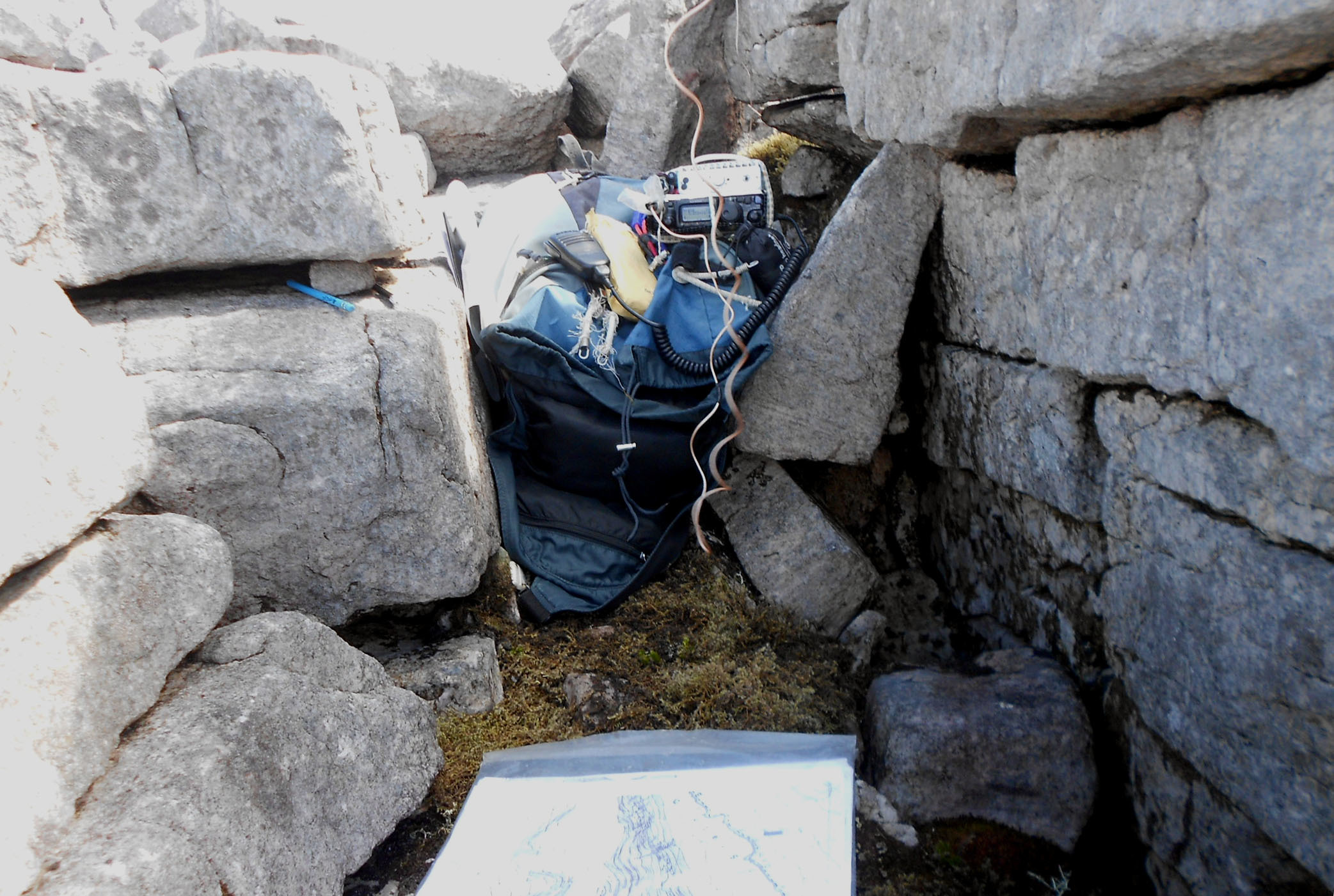
Above: Cranstackie activation. The ‘shack.’
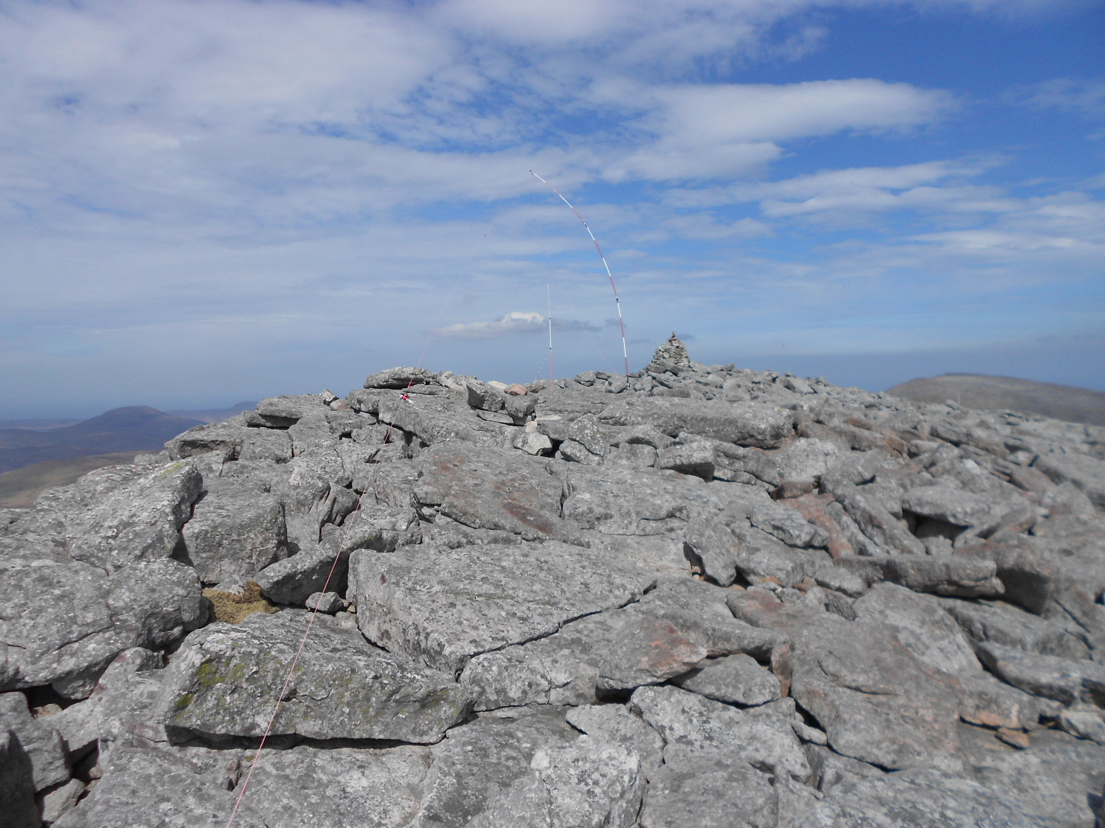
Above: GM/NS-038 Cranstackie activation. HF & VHF antennas.
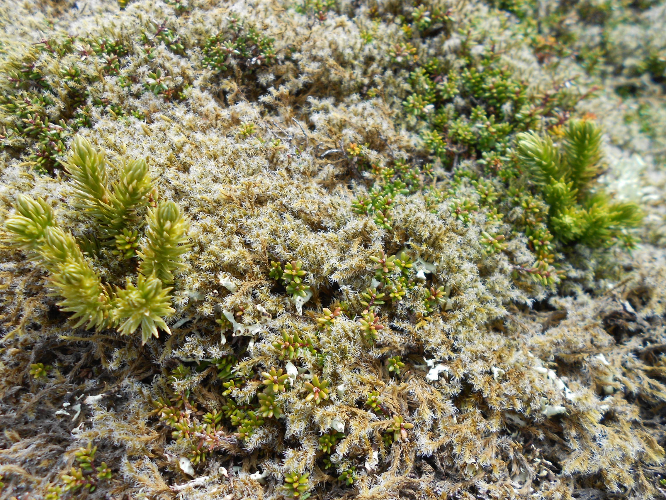
Above: Cranstackie summit flora.
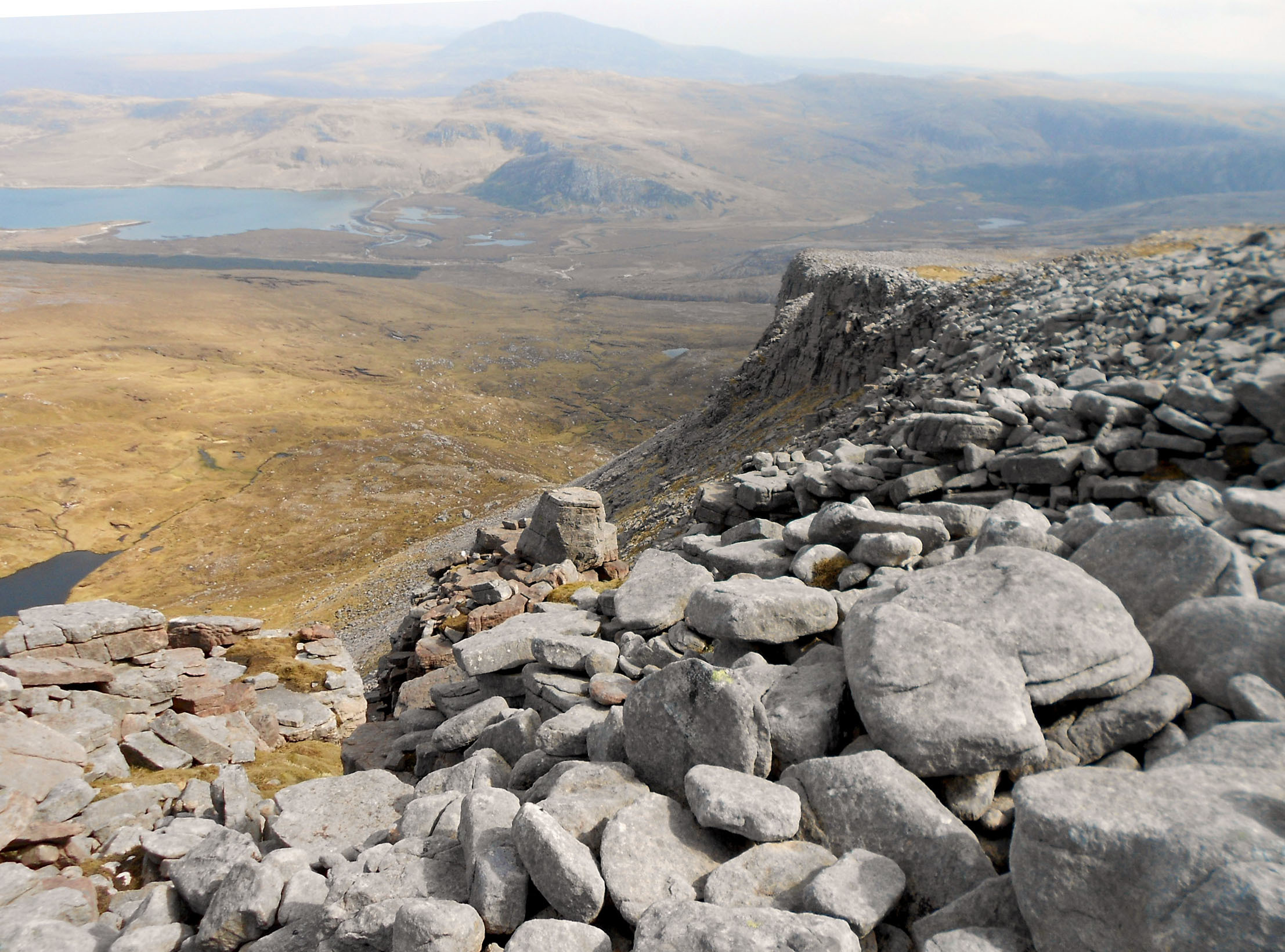
Above: Loch Eriboll ESE from NC 3522 5567 on Cranstackie NE ridge.
Above: Bealach & GM/NS-046 Beinn Spionnaidh, NE from NC 3522 5567 on Cranstackie NE ridge.
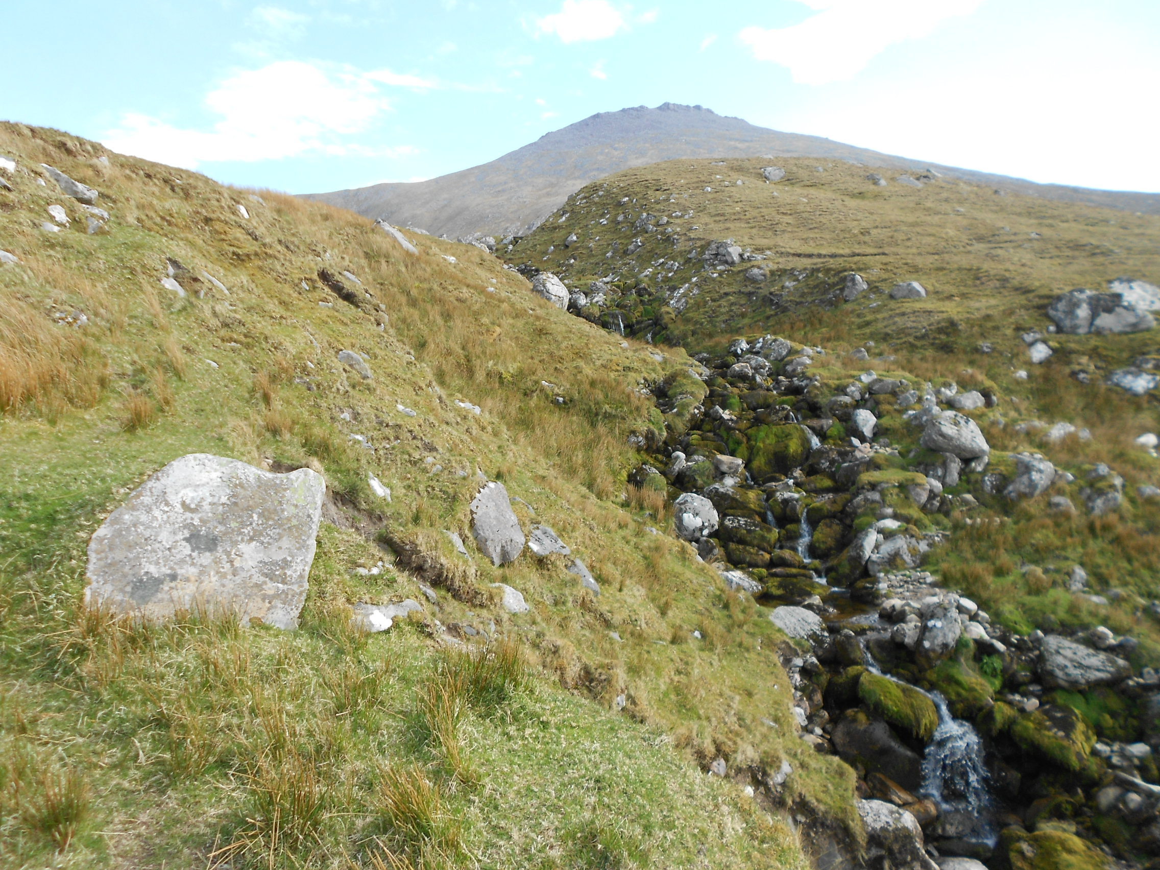
Above: Allt Chalbhach Coire burn at approx. NC 344 570 with Cranstackie behind.
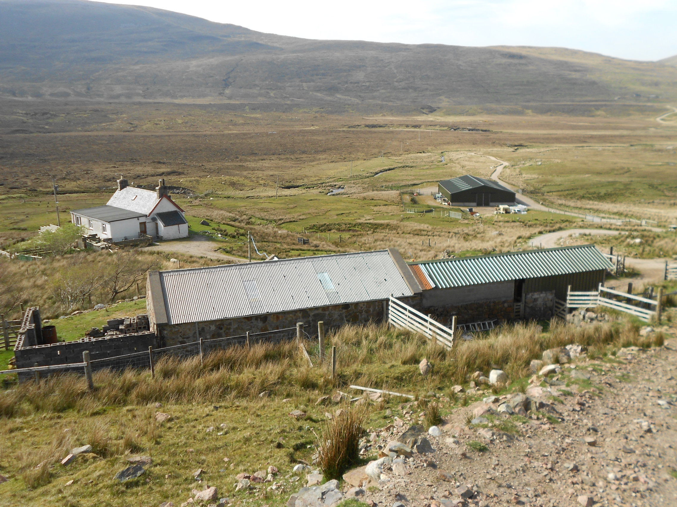
Above: Rhigolter Farm and track back to the A838.
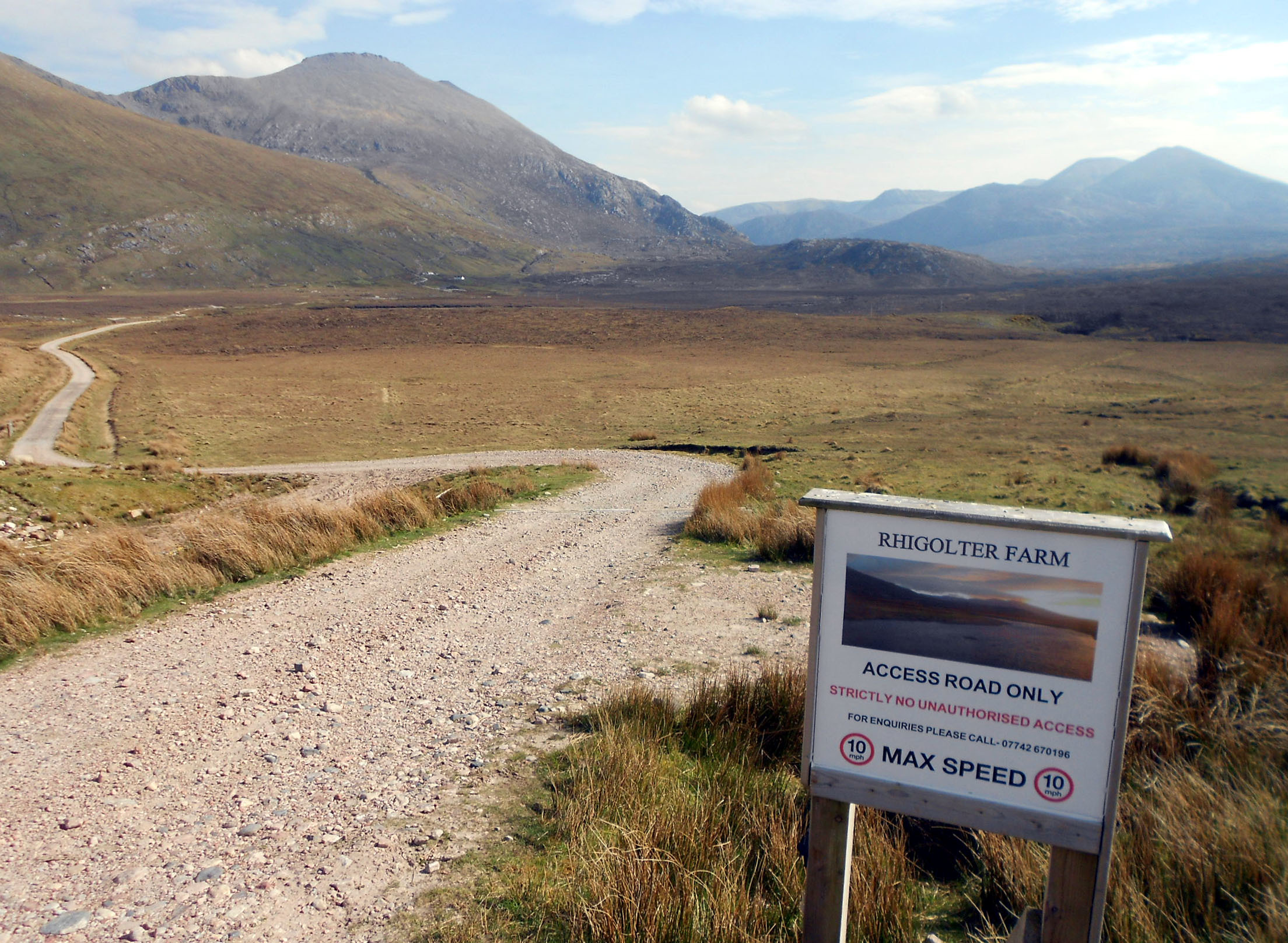
Above: GM/NS-038 Cranstackie (left) and GM/NS-023 Foinaven from the A838/ Rhigolter track junction at Carbreck.
