G4YSS: GM/CS-100 DUN COILLICH, 26-09-23
Iss-2 added alt’v route detail
(pse rprt errors)
Activation of DUN COILLICH GM/CS-100-2
26th September 2023 using G(M)4YSS. Unaccompanied
HF - QRO on 40m CW-SSB
All times: BST (UTC plus 1hr, UOS as ‘z’)
This was the second activation during our nine-night break at Lochs and Glens Loch Tummel Hotel from 23rd September to 2nd October 2023. It had to be another little hill because I still can’t get a full day of good weather. An Atlantic front was scheduled to come in around noon.
EQUIPMENT:
FT817ND HF/VHF/UHF 5W Transceiver
MX-P50M, 50 Watt HF Linear Amplifier 80-10m with 160m capability
Link dipole for 80m thru’ 20m on a 5m CFC (carbon fibre composite)/ alloy mast
1m CFC end-sticks
5 Ah Li-Po battery
J-Pole for 2m FM (not used)
Reserves:
IC-E90, 4-band, 5W VHF H/H with extendable 2m set-top helical for 4m FM (not used)
QRO pack: 9.7kg (21.4 pounds) including umbrella, Primaloft jacket, 0.25 litre drinks.
INTRODUCTION:
The forecasts said more bad weather so what could be achieved? The answer; one of the smaller hills that I prepared weeks ago in case I couldn’t go high. I had until noon. After that I’d be getting wet. Too lazy to get up early and miss my nice hotel breakfast at 8am, I would be in danger of that anyway. At least this was a second hill close to where we were staying at the Loch Tummel Hotel. I had never heard of it but maybe I should have. On it’s NE slope lies the geographical centre of Scotland.
EXECUTION and ROUTE:
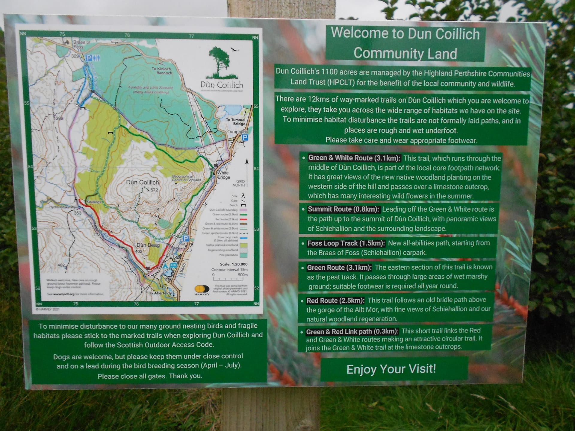
As per CS107 two days prior, McMole supplied the intelligence for CS100 in a report on Walk Highlands entitled: Dun Coillich – with a wet sock!
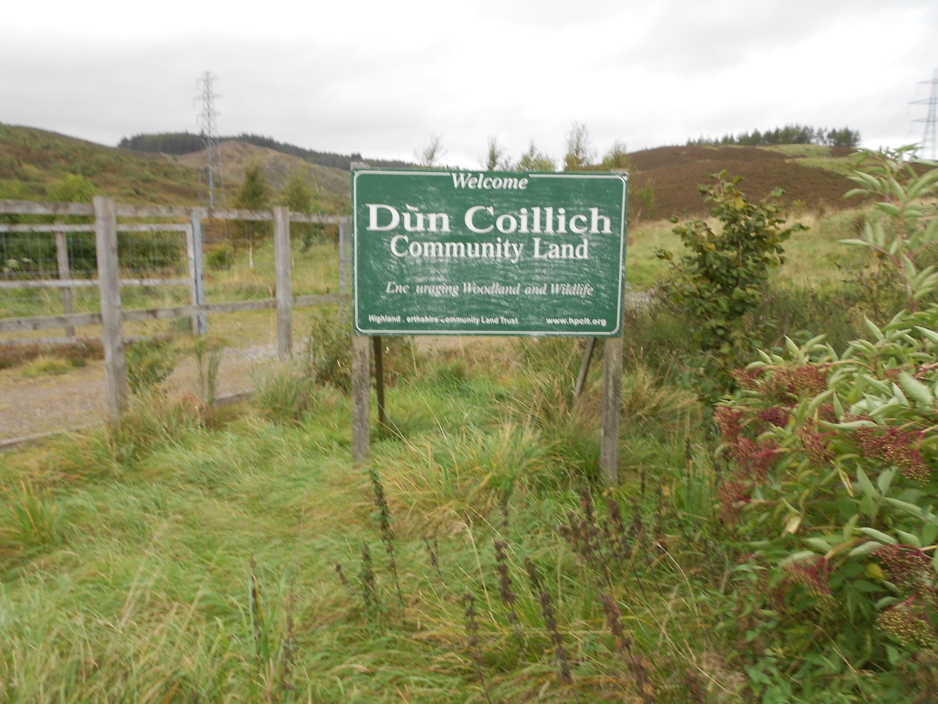
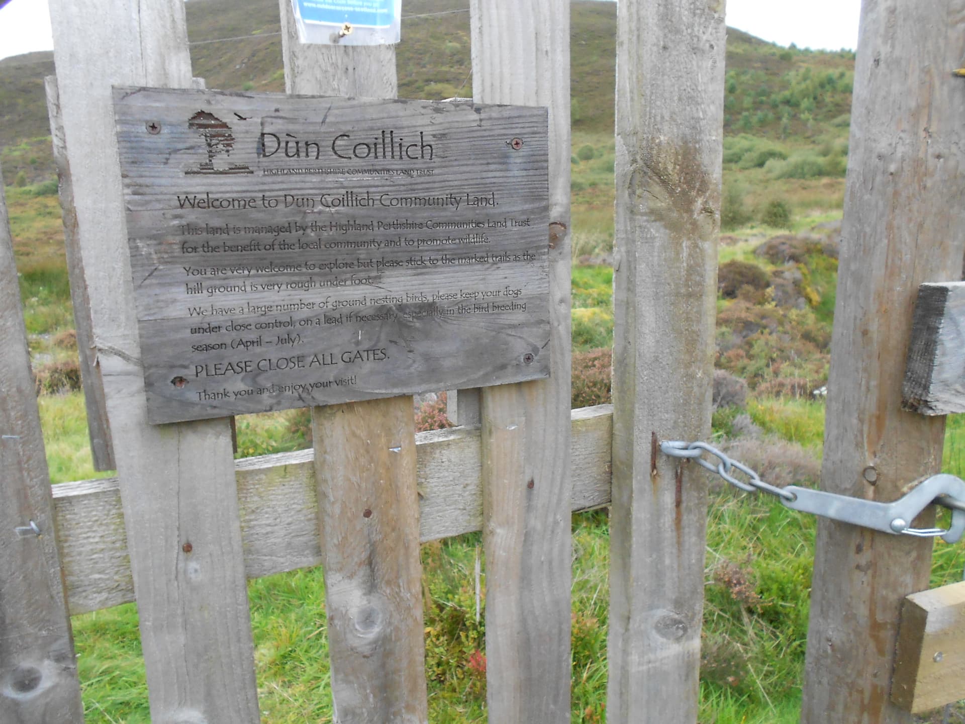
Park just off the B846 at NN 7736 5400 – White Bridge. Pull off the road and open the gate to drive through the deer fence onto a level area big enough to park a goodly number of cars. Don’t forget to close the gate behind you. There are reminders on all the gates.
I set off walking at 09:40. There is a narrow gravel path which heads out of the parking area to another tall gate in a second deer fence and over two small wooden bridges. You pass a notice board with a container for ‘brochures.’ These are supplied by the Dun Coillich Highland Perhshire Communities Land Trust and describe all the routes around this hill. A few yards (metres) further on you come to a ‘T’ junction at NN 7729 5401. Take the path going right. It’s well defined and easy to follow between high vegetation and marked by green-topped posts, so I don’t need to supply too many waypoints: NN 7705 5414 and NN 7684 5410 apply.
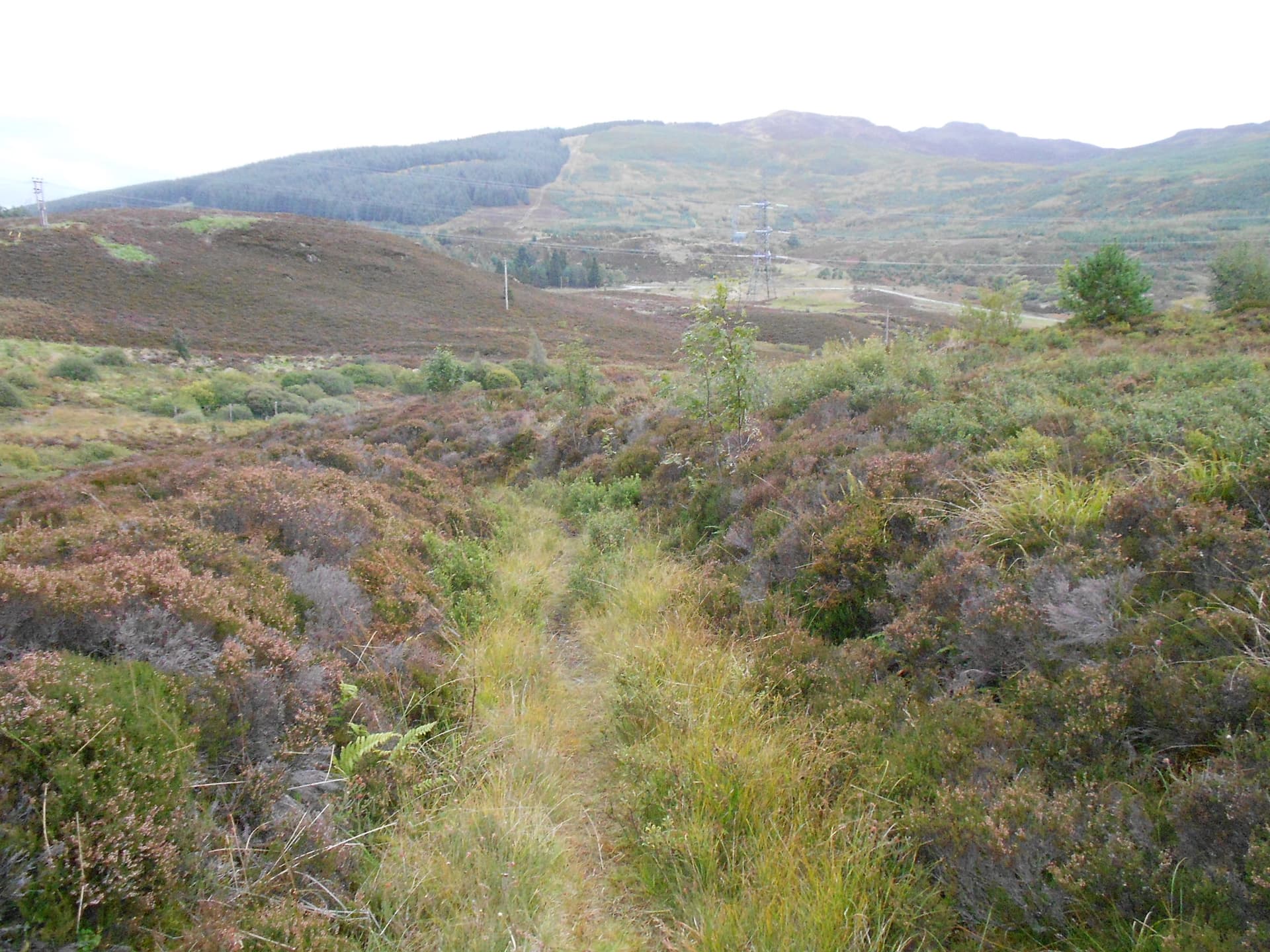
By the time I got to a post marked ‘14’ at NN 7667 5411 (450m ASL) I decided that the path couldn’t help me further. Not only was it now starting to pass the summit rather than head up towards it, after this point it starts losing altitude also. I think it goes on to circumnavigate Dun Coillich at a relatively low level. I turned left off the path here and made my way up what looked like a heather-clad track but it really wasn’t, though it certainly was a linear feature of some description.
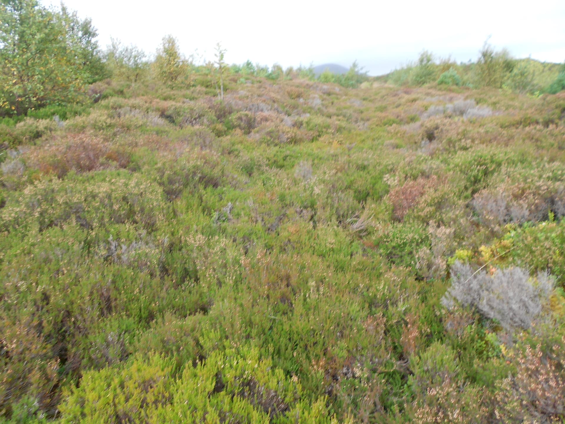
After ‘fighting’ my way up this as far as NN 7657 5411 I came to a more grassy area in well-spaced young trees – Rowan and conifers. Things looked better but not for long. This final 680m up to the summit from the path was quite hard work. I found no path of any kind and whilst it had taken me just 21 minutes along the path this wild section took a further 28 minutes to the top. The trees are soon left behind but it’s tussocky grass, interspersed with Crow Berry, Bilberry and heather all the way.
There are hidden water courses and it was more by luck than good judgement that I didn’t get my foot in one. I was saved a few times just by the sound of running water. There is boggy looking ground too but despite a lot of recent rain, that could have been much worse so I arrived with dry feet. It didn’t rain on the way up. That would come later. There is no trig point. A cairn, GPS’d today at NN 76252 53643, marks the top.
Alternative Route – Please Note:
The Dun Coillich brochure shows a route coming in from a car park further south along the B846 at NN 7689 5290. This gives access to the accepted route up CS100 but it involves greater ascent than ‘my’ route due to a lower start point, so it may take a little longer? Just off this car park there is a WC and two store rooms used by the Trust. I met a Trust employee called Fred there and he filled me in about the hill in general and this route in particular.
A path leads off west, initially downhill to the Allt Glengoulandle watercourse and up through a gate. Follow it uphill but not to its maximum height. When you see a post with a white circle on it this is where you turn right onto the summit path. My best guess of the location of this turnoff is NN 7604 5308.
DUN COILLICH - GM/CS-100: 572m, 2pts, 10:29 to 12:26. 11C. 15mph, later 25 mph southerly wind. Dull overcast but no low-cloud. Rained near the end of the activation and drizzled on the way down. Vodafone coverage 4G. LOC: IO76XP, WAB: NN75 – No Trig.
7.032/ 7.034 CW - 10 QSO’s:
After setting up the dipole a little way down the lee side, I listened on 7.032 then put on a self-spot. Very shortly afterwards that got me HB9CBR Bruno in Meikirch and G4EHT Bill in Uttoxeter. I heard an ON7 calling me; there was an ‘M’ in his suffix but every time I tried to clarify his call I was hit by a wall of QRM. Whether this was caused by ops calling me I don’t know but I did hear a CQ on there at one point as well.
After several tries – I was determined to get the ON7 into the log but he was overwhelmed. I decided to ‘cut and run.’ 7.034 was clear so I re-spotted for that, mentioning the ON7 in the notes as encouragement. I did work him in the end but not until the SSB session over half an hour later. His call turned out to be ON7ZM. Maybe I just didn’t listen long enough and the freq was actually in use when I started? Apologies if that was the case.
Next in the log:
MW0KXN Kevin in Cardiff; G4AFI Andrew - Hants; HB9CEV/P Arthur S2S HB/SG-018; GI0AZA and GI0AZB Esther & Ian in Londonderry; GM4COX Jack in Carluke S.Lanarkshire; GM0AXY Ken – Edinburgh and F6BBQ Jean (John) – Flandres.
Power was 50 Watts throughout and the session spanned just under half an hour. Outgoing reports were mostly 599 with one 579 for G4EHT and an (optimistic) 559 QSB for a difficult S2S. RST’s coming back were all in the range 559 to 599.
7.160 SSB (WAB frequency) - 18 QSO’s:
Flicking up the rig’s memories to the WAB channel, I came across a mobile station calling CQ. This was Mark M0XIC/M in Weston Hall and having come to the end of a half-hour session with no further takers, he kindly gifted me the frequency.
Without even having to take the trouble to CQ, Ken G0FEX called me from Leicester. M0ICR Carl – Three Rivers followed then G0GWY Geoff in Scunthorpe and G0UUU/M my lad Phil at Throxenby Mere, Scarborough using an FT857D to a slim whip on a mag-mount.
Continuing: MM3PDM Peter in Peterhead; G8VNW Nick in Threshfield; ON7ZM Jean in Goesnes; G4WHA Geoff at his work QTH in central Carlisle.
Next an S2S with Alex DJ5AS/P on DM/RP-463 then GW0RQC Robert - Cardiff; G4IAR Dave - Loughborough; G1PIE Mark in the newly promoted ‘City’ of Preston; G3ABG – the WAB clubcall operated by Steve G4HPE from TL34 Royston.
A party of four people plus a baby in a backpack and two dogs, arrived at the summit. I shouted a greeting but it was too windy to carry on much of a conversation. I gathered that they’d come up another way from the car park further south along the B846. As mentioned earlier this route, which may well be superior to the one I used, is shown on the map in the Dun Coillich brochure. Its final approach to the summit is from the south.
While thus engaged I heard Karl 2E0FEH calling from Saltash. He thought some massive QSB event had seen me off for good but Steve explained the situation. The people didn’t hang around at the summit for more than two minutes. It was too windy for that and just then the rain, light at first, reached CS100. Only SOTA activators are stupid enough to sit around and suffer but radio takes your mind off the worst of it and a brolly helped.
After working Karl, M0RWX called in from Malmesbury followed by MM6DBT John in NS88 Falkirk.
Jack GM4COX provided the final QSO of the day and we were able to have a brief chat. Apparently he’d done this hill after activating Schiehallion CS5 on the same day in 2012. Quite a trek!
Descent:
The rain became lighter for the time it took to pack up and walk down to the car, arriving at 12:53. From then on it increased and set-in for a good two hours. On the drive back I made a slight detour to the Schiehallion car park. Like the Ben Lawers one, which I sussed out the day before, it costs £3 for the day - Pay & Display.
ASCENT & DISTANCE:
Ascent 222m (728ft) / Distance 2 x 1.7 km (2.1 miles)
Start point at 350m ASL
CHRONOLOGY:
Drive from/ to hotel: 9min (app. 4 miles)
Walk started: 09:40
GM/CS-100: 10:29 to 12:26
Returned to Car: 12:53
Walking times:
Ascent: 49min
Summit time: 1hr-57min
Descent: 27min
Time Car to Car: 3hrs-13min
QSO’s:
10 on 7.032 CW
18 on 7.160 SSB
TOTAL: 28
COMMENTS:
CS100 was not far to drive and not very demanding. Perfect for a half-day. The rain, forecast to come in at noon duly arrived – at noon. The plan was to QSY to 20m afterwards but sorting your gear out after a good soaking can be rather work intensive. The rig got slightly wet as it was so no 20m I’m afraid.
Two S2S QSO’s provided a bonus as did working Phil G0UUU/M. The WAB freq came in handy again and a few collected NN75 after Mark left me the frequency.
The walking was easy until it became necessary to leave the path. After that it was hard. Coming down the bad section seemed disproportionately easier and quicker than on ascent.
There is an alternative and more accepted route for this hill involving greater ascent. See earlier in the report under ‘Alternative Route – Please Note.’
THANKS:
To ALL STATIONS worked and for the SOTA phone spotting service. Also I was spotted by Carl M0ICR so thanks to him. Thanks to Walk Highlands and McMole for route guidance again. Finally many thanks to the Dun Coillich Highland Perhshire Communities Land Trust for their hard work in improving and maintaining this lovely hill.
I hope the weather will become more reliable later in the week. If so there should be some more SOTA on offer but it could be VHFM only.
73, John G4YSS
Photos: 3-2-4-5-7-8-12-14-16-24-26-30-32-39-47
Above: The parking place I used for CS100 is through the gate to the left
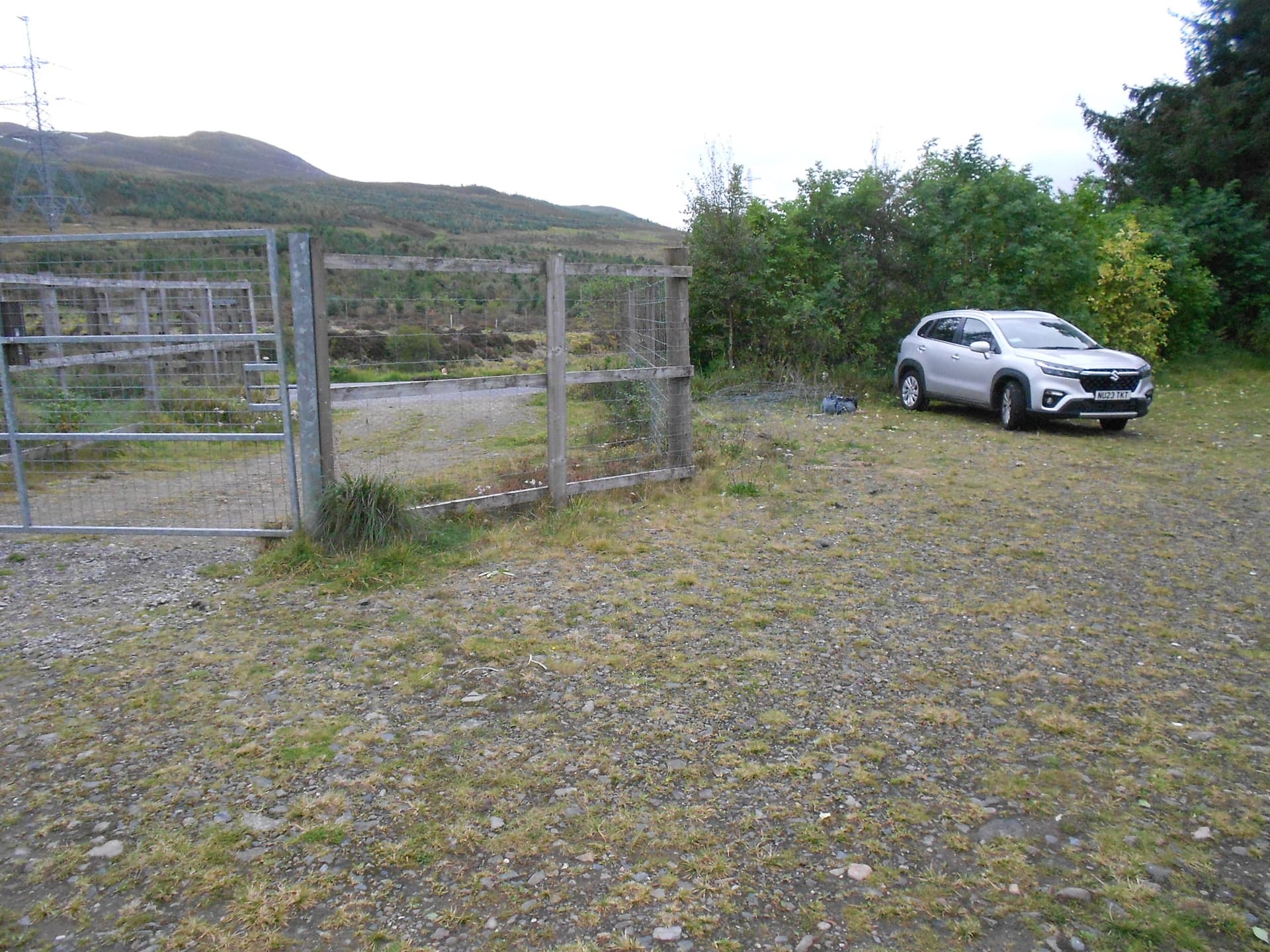
Above: Space for plenty of cars
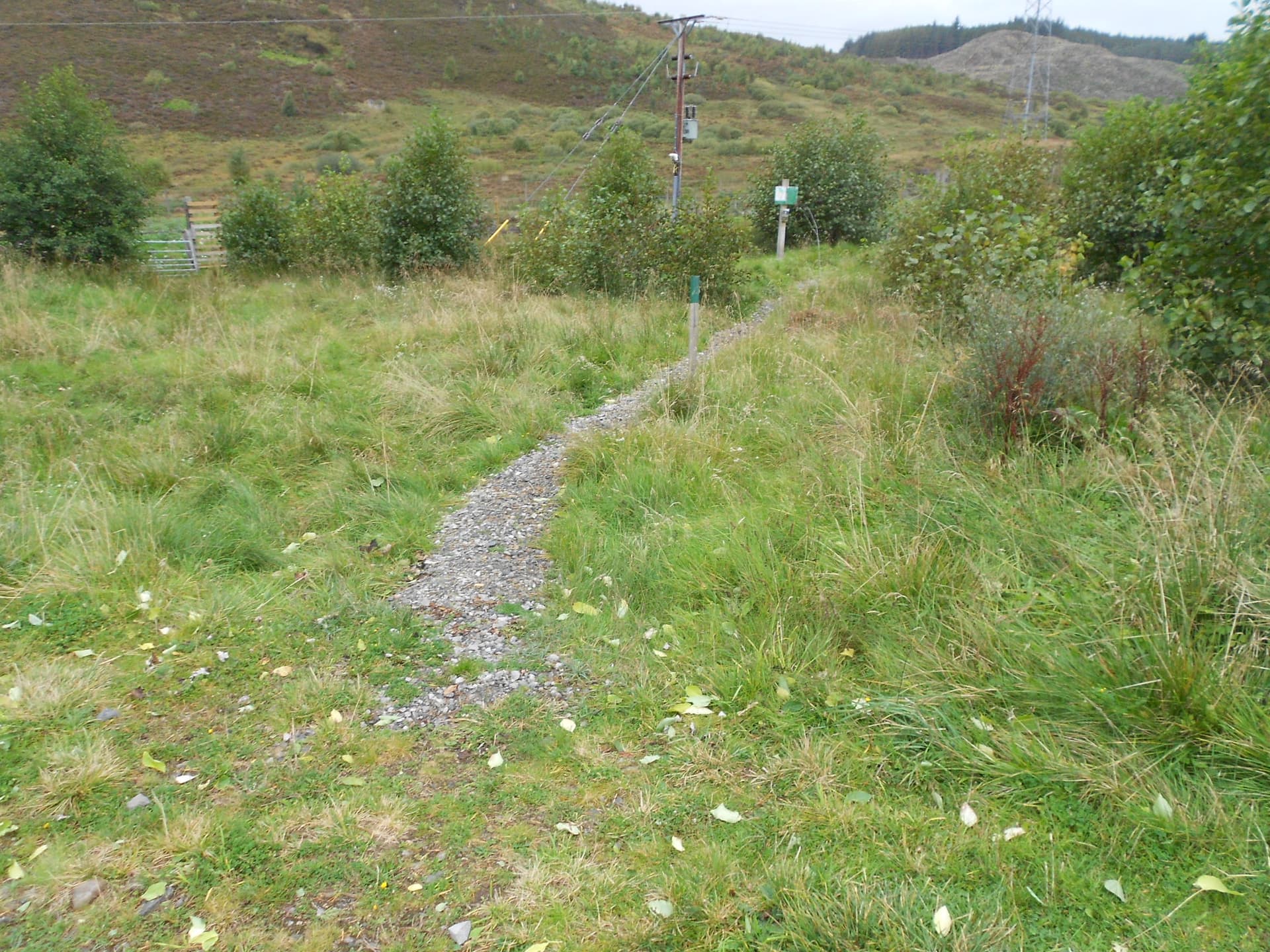
Above: A gravelled path leaves the parking area towards a gate
Above: The highland Perthshire Communities Land Trust notice board. Copies of this information are available in a box to the left side
Above: Pass through the gate to cross two burns on a small bridges then take a right at the path ‘T’ junction
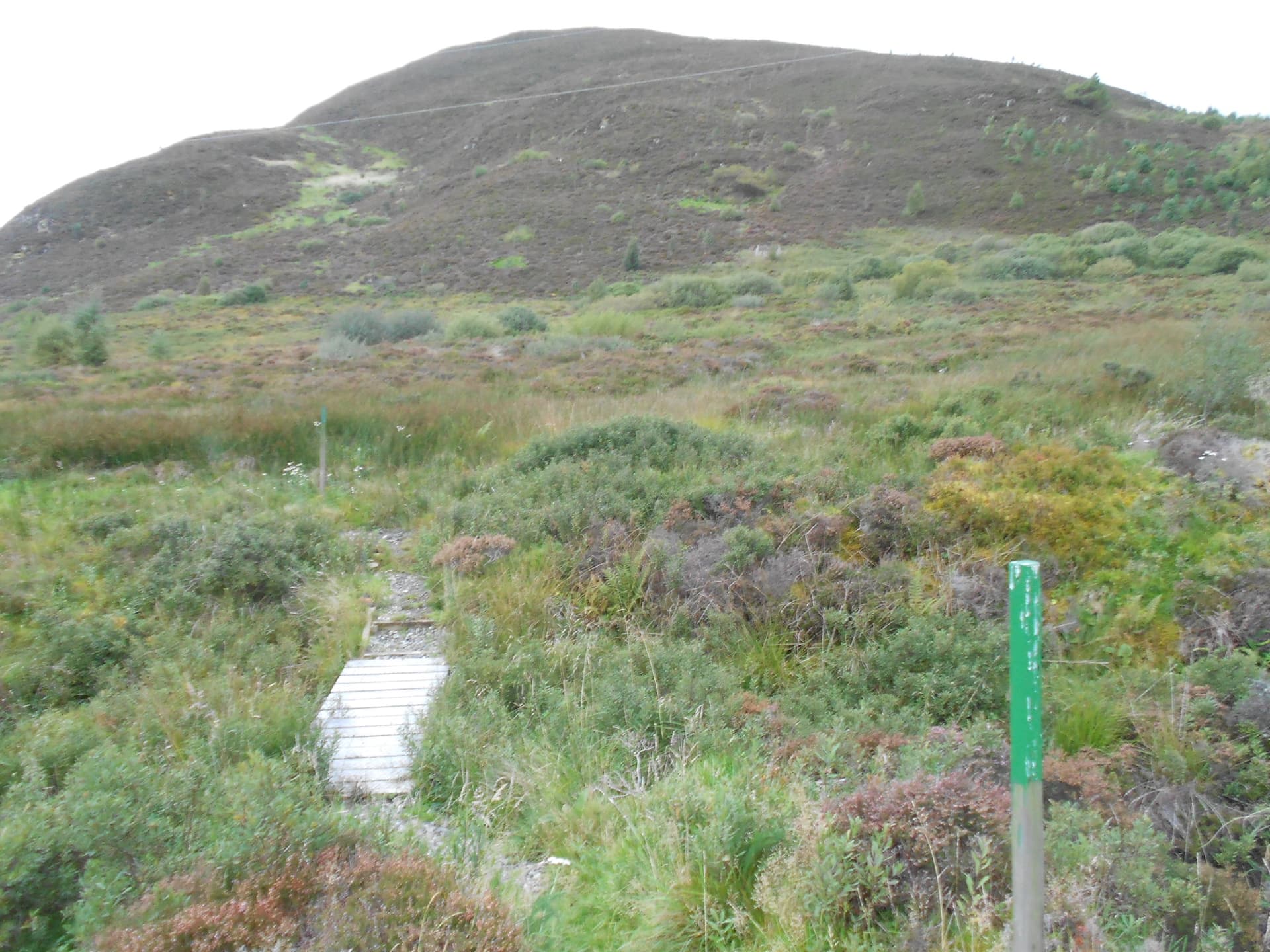
Above: One of the wooden bridges
Above: The ascent path looking back towards the start
Above: Turned left off the path when it reached maximum ASL by the green-topped post No14. I walked up this linear feature but there may be better ways!
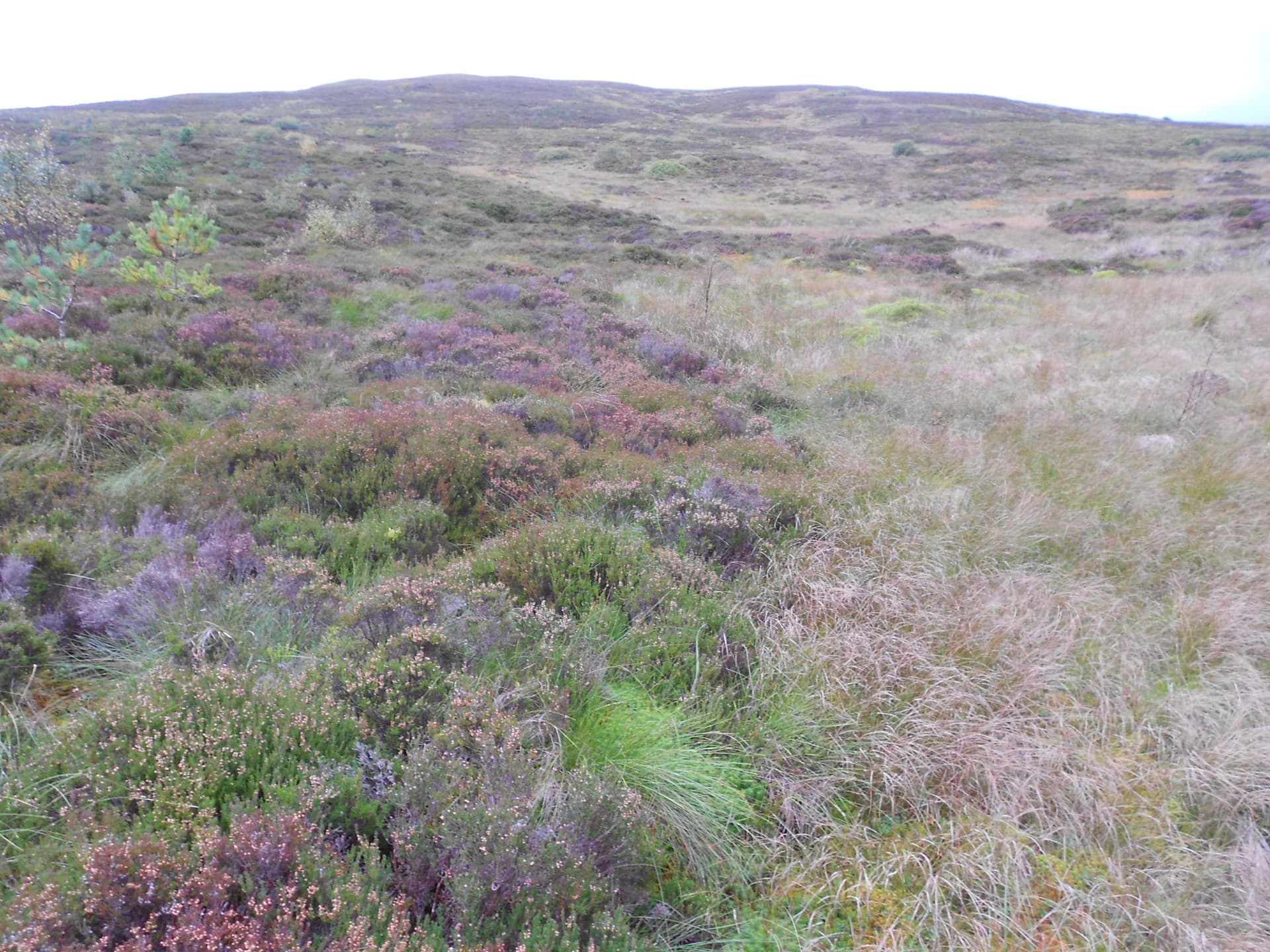
Above: Over 600m of this terrain to the summit took 28 minutes after leaving the path
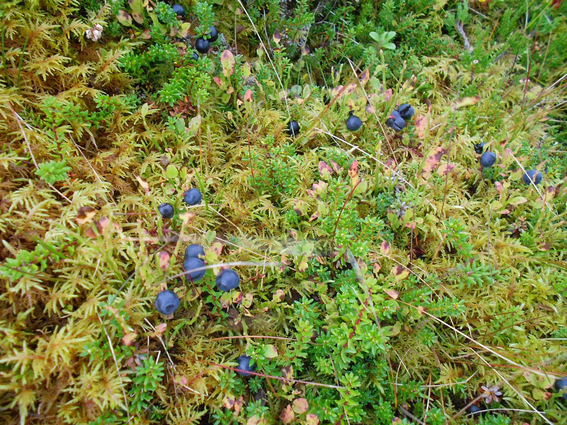
Above: A few stops to eat very late Bilberries and Crowberries. The first sweet but the latter no so
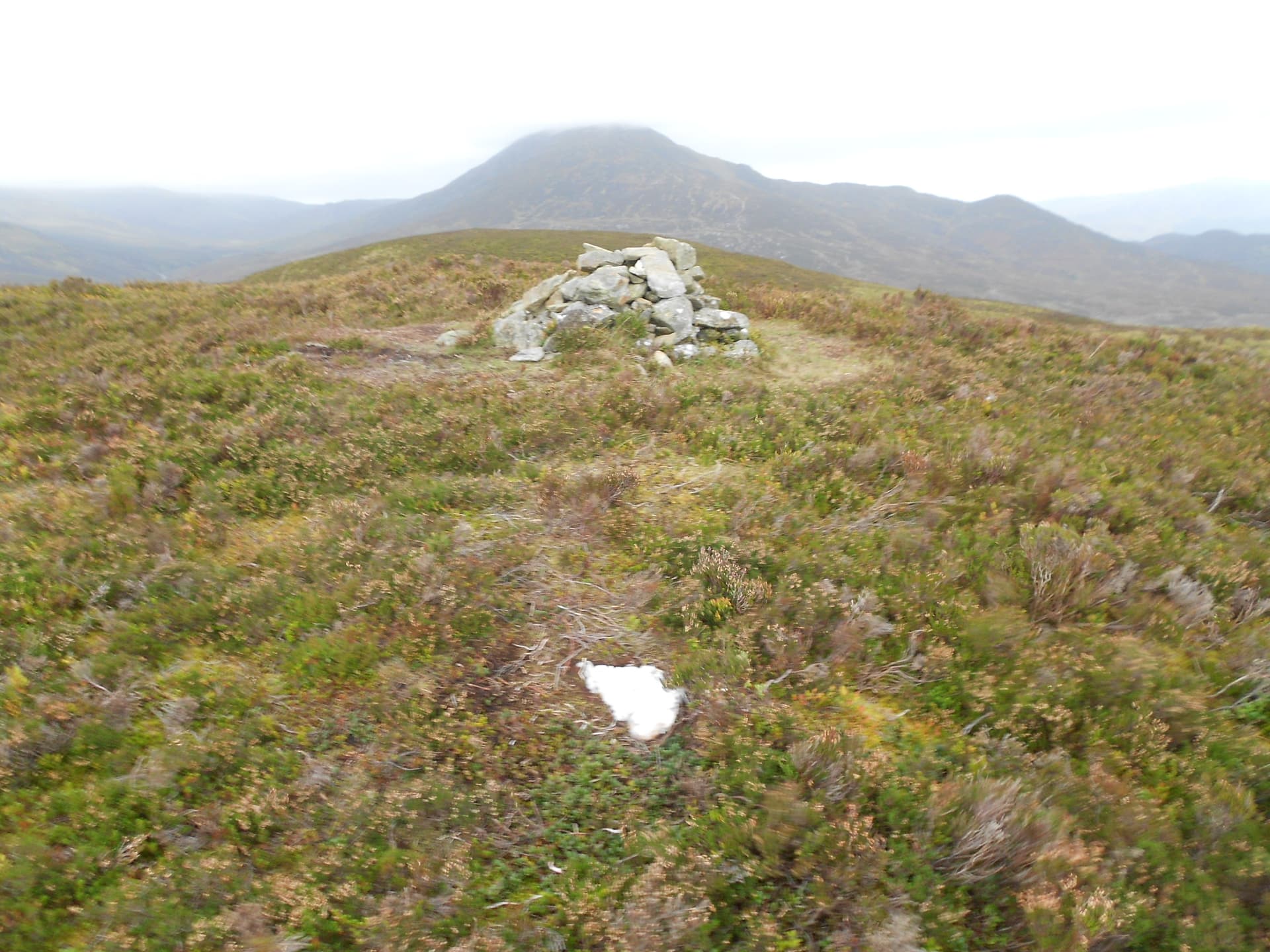
Above: GM/CS-100 summit cairn at NN 76252 53643. Schiehallion GM/CS-005 behind
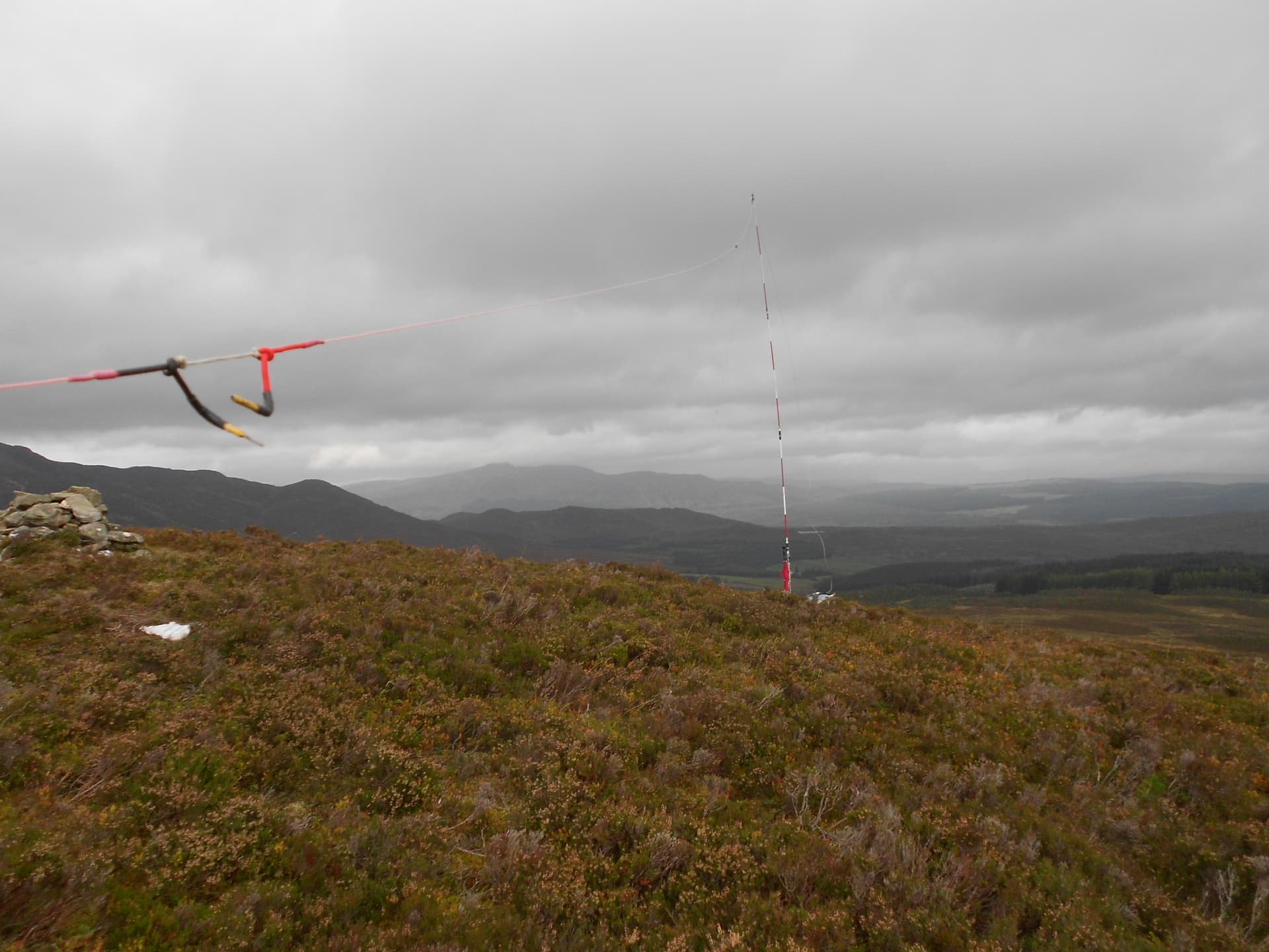
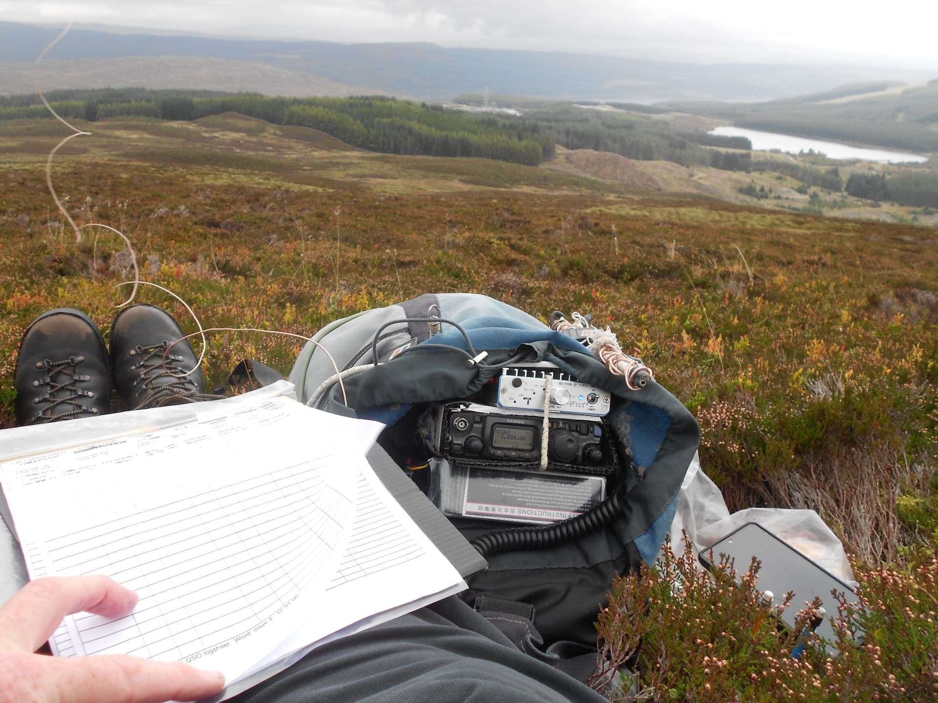
Above: Activation of CS100 on 40m CW/ SSB and view back down towards the start point
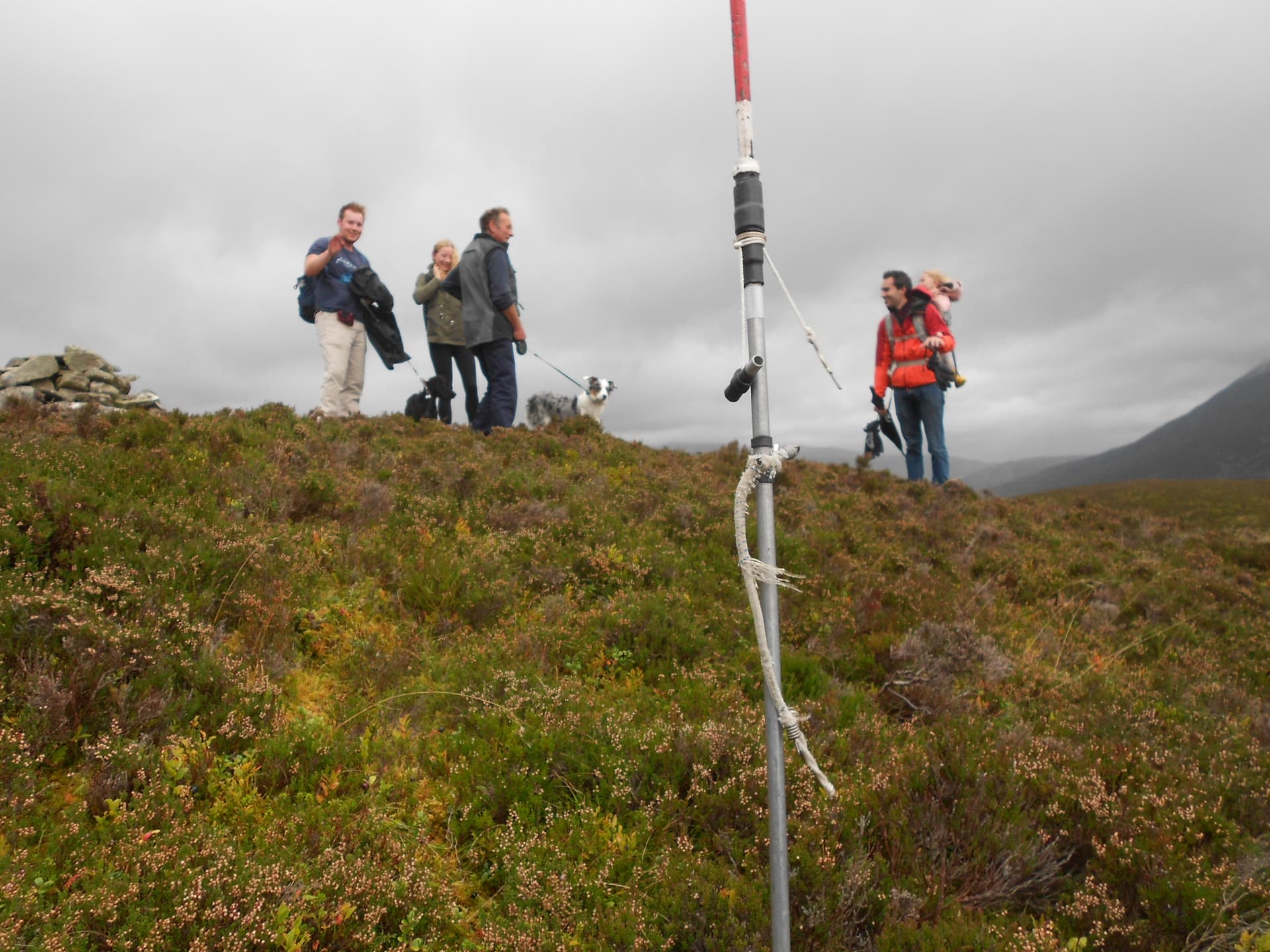
Above: Unexpected visitors arrived just before the rain started. They had come up from a car park approx NN768528 to approach from the south side of the hill. A more accepted route perhaps?
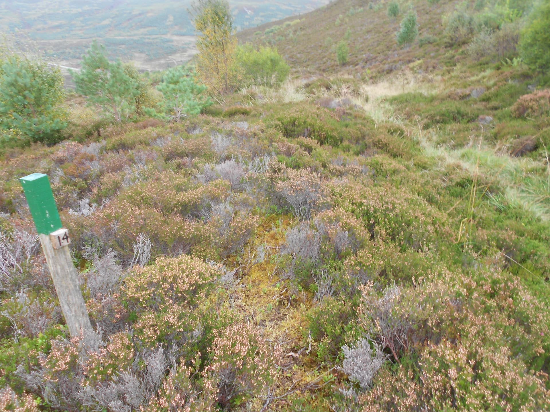
Above: Back down to join the path at marker post 14 then an easy walk to the car.
Photos poor due to low light levels