I intend to be on Hutton Roof Crags G/LD-052 around 11am UTC (+/- traffic).
Hoping to spend a couple of hours on summit with 23cm (FM) , 2m (SSB and FM) and 70cm (FM- SSB on request).
I’m not sure what 23cm activity is around the area, but theres one way to find out.
@G6GVI - I seem to have become unsubscribed from the 23cm NW group (probably something I did when I was trying to clear a bouncing error), but feel free to paste this info in there if of interest.
G/LD-52 is my second closest SOTA summit (18 minutes’ drive) and a regular dog walk.
G/LD-58 (Arnside Knott) is my closest one (10 minutes’ drive).
I’m free tomorrow at noon (BST) so I can go to A.K. for a 23cm FM QSO with you. Being 10km line-of-sight due west of you should made for an easy contact if I can find a take-off to the east not obliterated by the trees.
Nick @G0HIK and I recently tested that my newly-acquired ‘linear amp’ PTT cable [FT817 to SG-Labs 23cm transverter] is working correctly in SSB mode. I’m still to test for CW and want to do so before doing 23cm FM/SSB/CW at the SOTA Lake District event on the 18th.
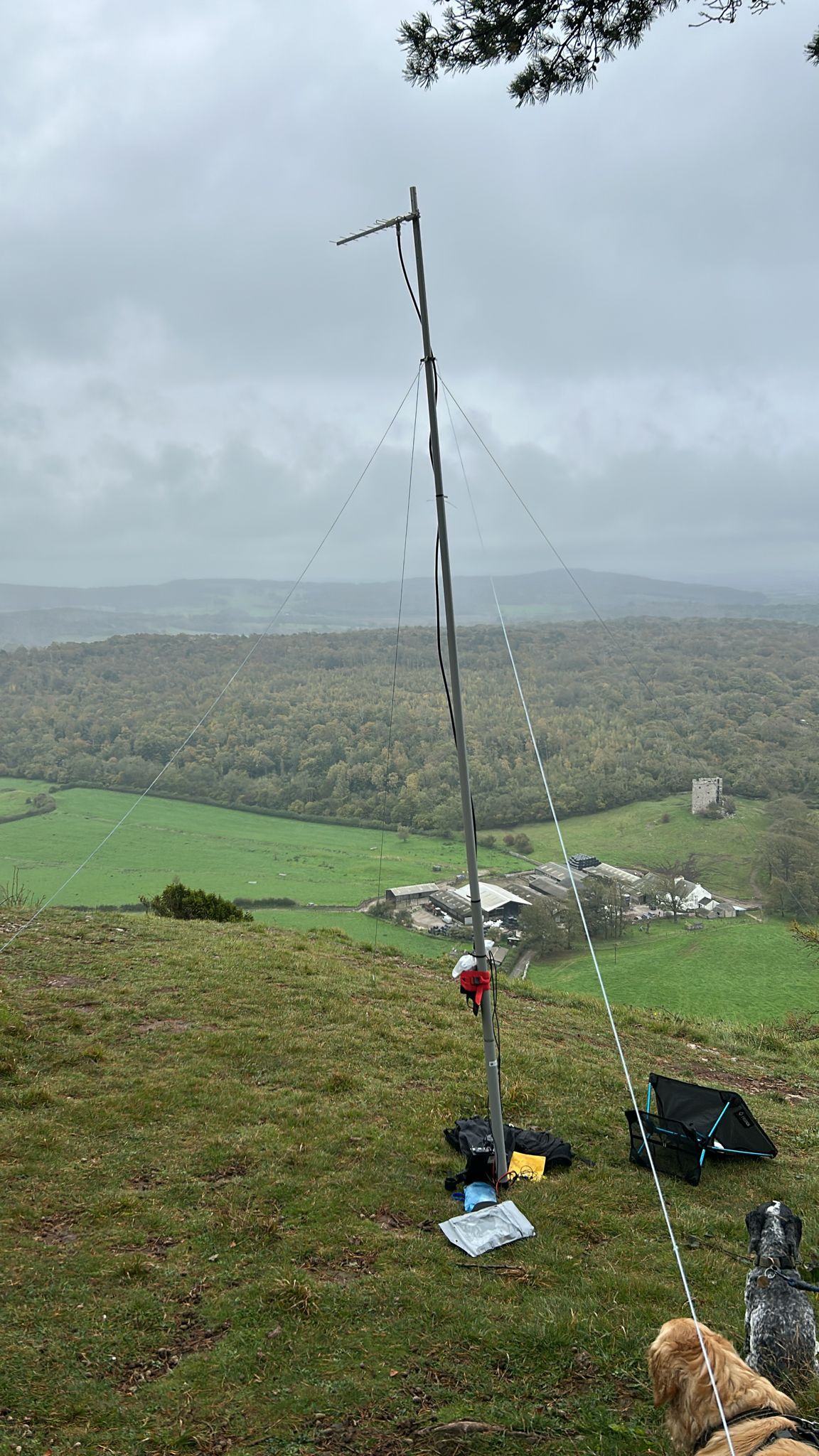
So, I’ll do an activation so we can have a 23cm FM S2S and I hope others will be around for 23cm SSB and CW. I’ll use a horizontally-polarized 8-element Yagi on a 4m pole. I’ll probably monitor 145.500 FM in case someone wants me to change the Yagi bearing.
Andy G8CPZ
Info:
HRC G/LD-52 54.19142, -2.68044
AK G/LD-58 54.19019, -2.83503
I’ll be out tomorrow on Buckden Pike G/NP-009 but I won’t have 23cm. Hopefully we’ll get S2S on 2m FM or even 70cm. My main activity will be HF CW. Hope also to work Andy.
I wasn’t going to do HF tomorrow as my activation is mainly to test my 23cm PTT is working for CW.
However, as I have the FT817 and paddles anyway, I’ve just added my 30m EFHW to the rucksack. 49km to Buckden Pike is a bit far for 5W of 10MHz ground wave. As the EFHW will be on some low tree branches, we might get some NVIS.
It doesn’t appear to be line of sight from Buckden Pike thanks to some other hills so it will be interesting to see how well 2m or 70cm works. We seem to have worked many times before on HF CW over obstructed paths where NVIS shouldn’t work e.g. Rombald’s Moor G/NP-028 to Red Screes G/LD-017 on 28MHz (12/7/24).
I’ve always been fascinated about how to make HF contacts beyond the expected ground wave coverage but still in the skip zone, which led to my interest in NVIS, especially living and operating in very hilly terrain like G/LD where the HF ground wave doesn’t get very far.
Thanks to both Ian and Andy for S2S on 2m FM. Despite hills in the way it was 55 both ways to Andy on G/LD-058 and around 57 to Ian on G/LD-052. So you can make contacts even when it shouldn’t be possible. The 2m antenna wasn’t even as high as normal - I had bungeed my 4m pole to the fence and put the flowerpot on top of that so that I could use the 6m pole for HF.
Quite a good day out despite some issues with navigation and a bit of dampness.
I wasn’t expecting the weather to be great, but dull and dry seemed to be the order of the day. Half right, it was dull and wet. Not due to any rain, but the summit was in cloud for most of the activation.
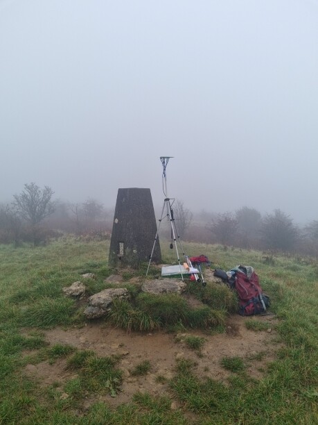
Parked at the quarry and chose the middle path. I wish I had chosen the right hand path now. The leaves in the wooded area had obscured any paths, so I just headed uphill with the idea of figuring it out once I was out of the wooded area. Slogged upwards through dampness and bracken until I found a wall and further up another wall with a sign saying “Hutton Rood Crags - SSSI”. I must be on the right track …. nope. Now in the mist and visibility being around 10m to 20m I navigated using the aprs tracker and a map and found I was too far to the east. Cutting across west (more dampness) to a better track, I followed this until it started going downhill . That was odd. Checked the map, I was too far north. Turned around and went south. Once again , after a short while, it started going downhill. I had walked right past the summit trig point (along a parallel path I presume). After 1.5 hours of trudging, stopping to check the maps I finally found the trig point and setup for 23cm (picture below). 1w from an Alinco handheld into a pcb log periodic.
Only 1 qso with Andy G8CPZ on Arnside Knott. With the back and forth I had lost all sense of direction so I had no idea where I was pointing. Turned out that Andy was 59 on the back of the beam.
2m was deployed (handheld + 3ele yagi) and a further 6 worked including Richard G4TGJ/P on Buckden Pike.
Around 13:30 the cloud stared to lift and could get my bearings again and worked out which path to leave by. About 30 minutes back to the car (stopping to take some pictures now there was something to see) arrived a bit damp but a change of clothes soon sorted that. Now to dry everything else out.