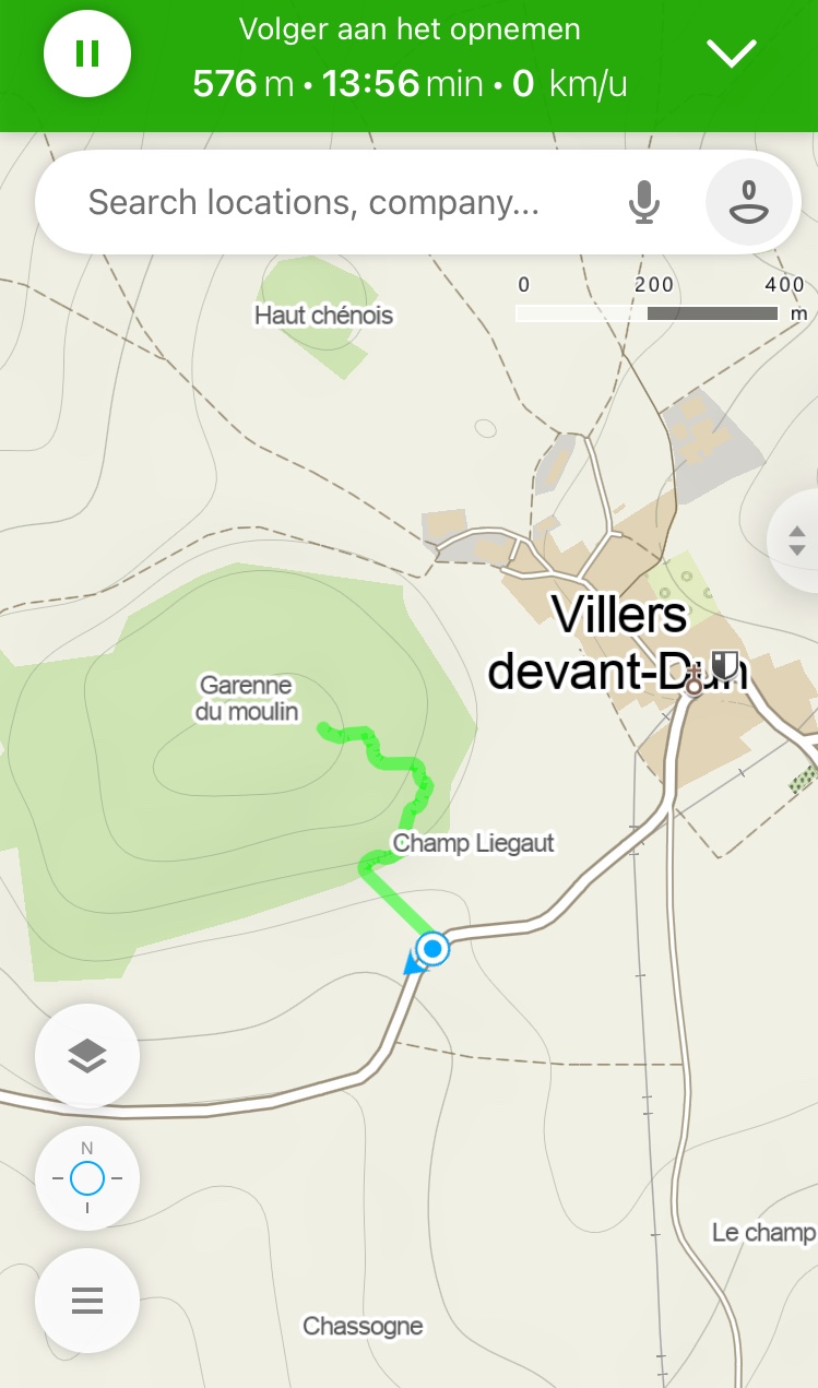
04/04/23. Garenne du Moulin, FL/NO-145. Driving from Bouillon (Belgium), it’s a trip of +/- 60 km. No problem to find some war memories along the way. After all, from Villers-devant-Dun to Verdun, it’s only 20 km…
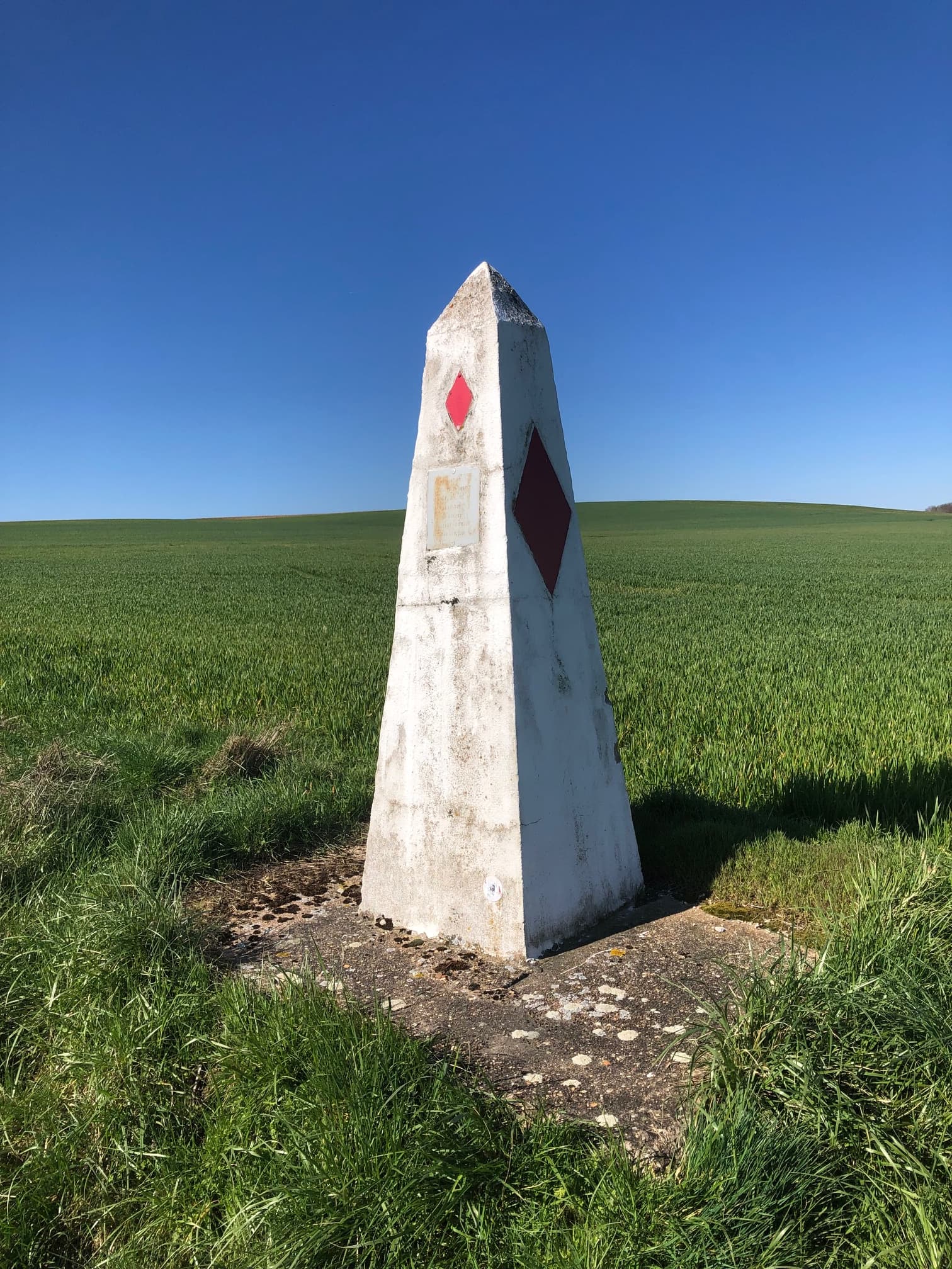
Argonne demarcation stones

Photo from: history.army.mil
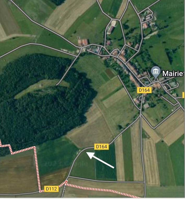
It’s easy to find the summit, when you make the approach from the D164 (see marker on photo / cartesfrance.fr).
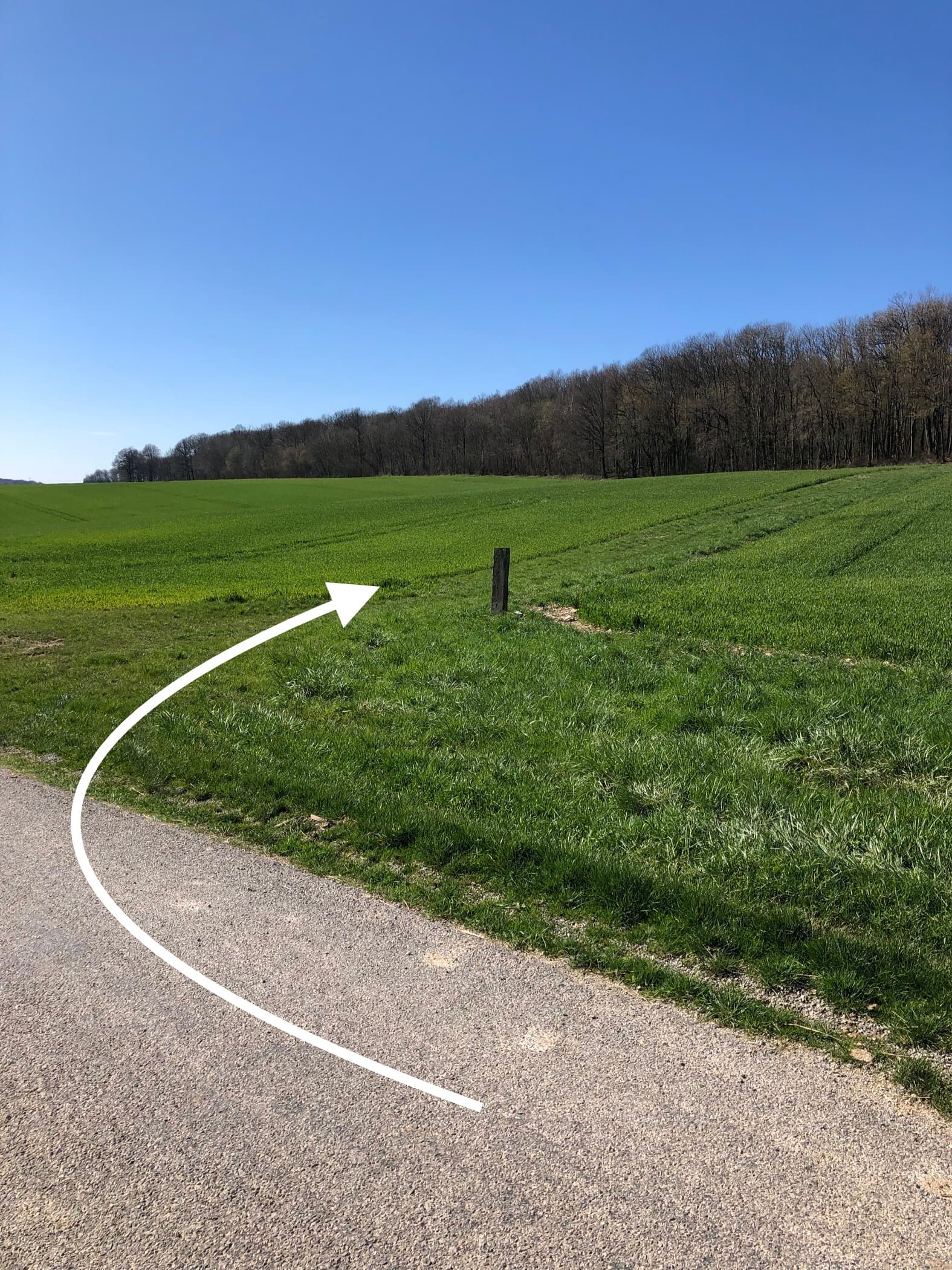
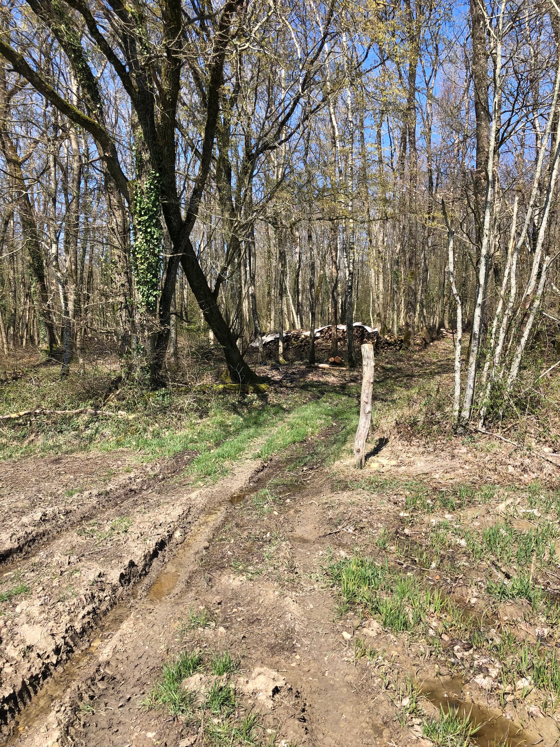
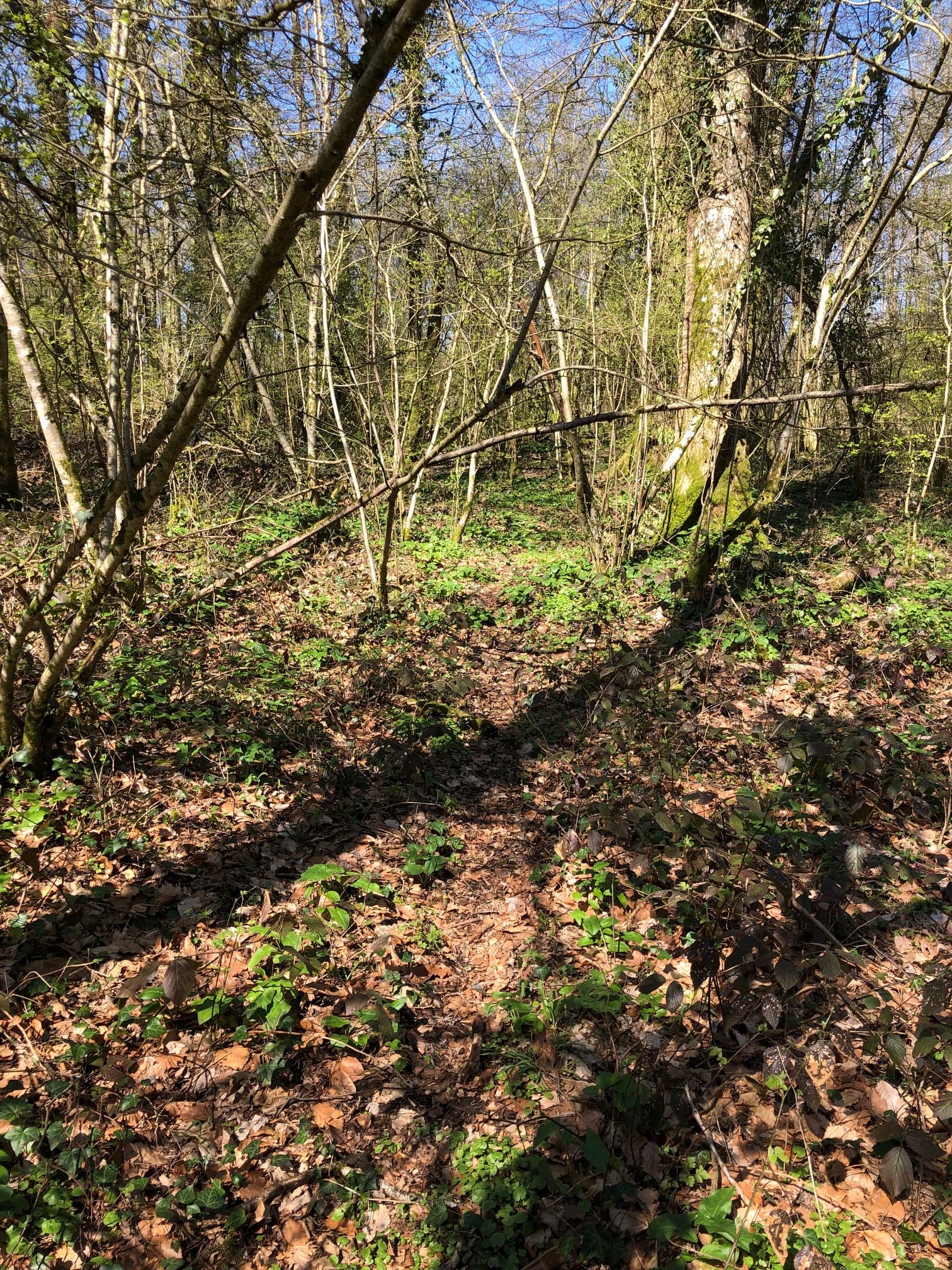
There is a bumpy field road (for forest workers) between 2 separated meadows. In a rainy period, boots are welcome! When you enter the forest, be patient for some thornbushes around you, until you find a more “clothing friendly” environement. No problem to find some trees for the antenna.
Google Earth: 49,388300 - 5,109437
I’ve made 12 QSO’s (4 on the 20m. band - 8 on the 40m. band / 3 S2S QSO’s). My equipment: Icom 705 + PA500 (project: DL4KA / limited to 20w.) + homebrew End Fed antenna (project: @ON7DQ).
When I’m on a summit, I’m always curious. So this time I found:
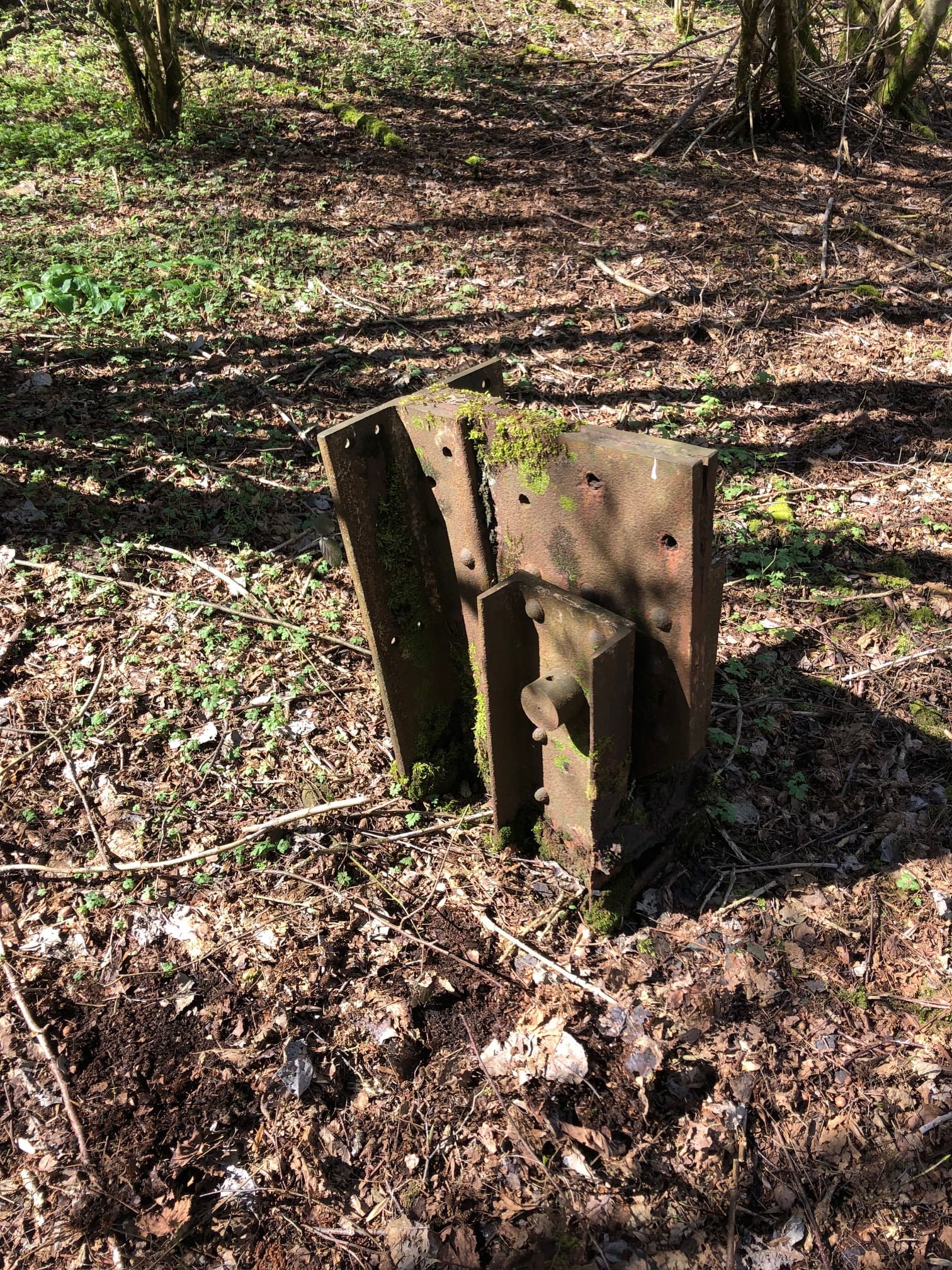
An “artefact” from WW1?

Photo from: history.army.mil
Coming back, all the trees looked the same… You have no reference point. I was a little bit suprised that I could’t find my way back with the snap of a finger…
“All’s well that ends well”. Thanks to all the hams for the efforts to make a QSO with me. The weather was beautiful, but the conditions on the band were not so good. It was very noisy on 20 and there was a lot of QRM on 40.
73, ON4ROB