Hello,
It all begun some weeks ago looking at the list of unactivated summits in my OE5 region. Two summits in the Salzkammergut area near Gosau caught my attention. With good weatherforecast for Friday and Saturday I decided to give it a try.
The challenge was routefinding as this summit has no trail marked at the official maps. Also OpenStreetMap and OpenTopoMap don’t have any information. The only lead I found was a report from a skitouring accend.
So I decided to give it a try. To have enough time my plan was to bivac at the Seekaralm area hoping for a water source there.
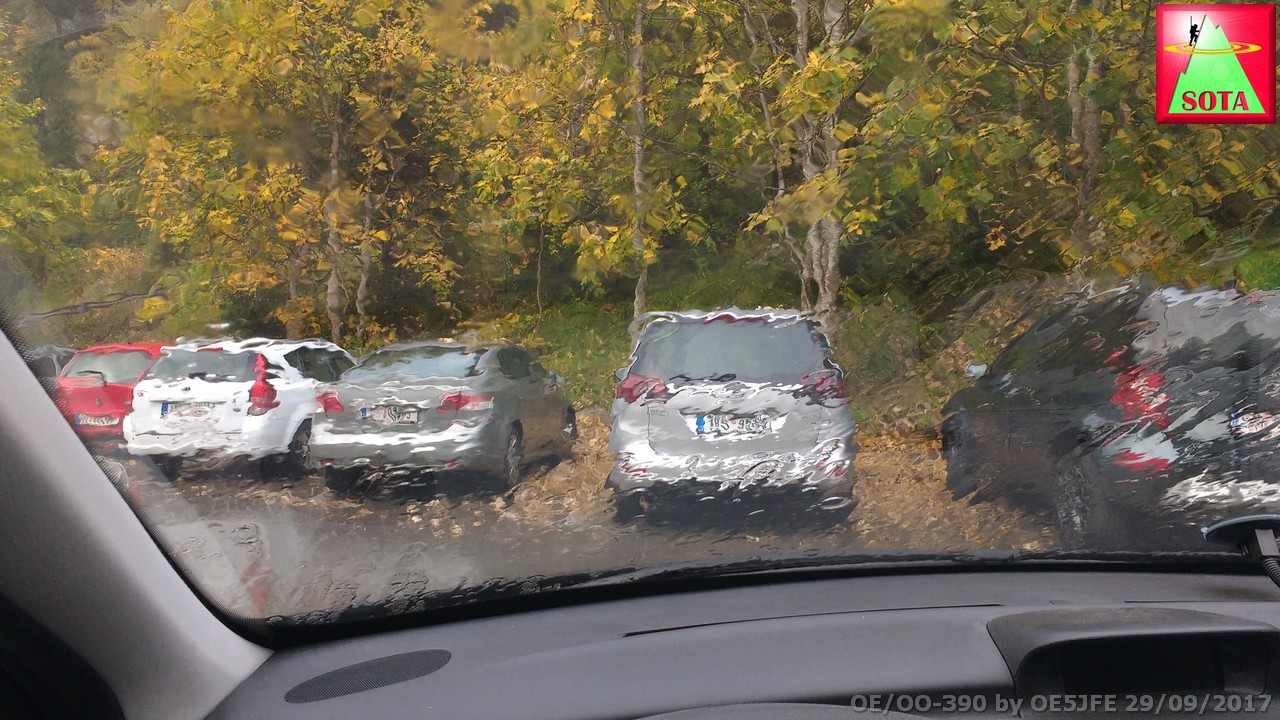
Arriving Friday afternoon after work I was welcomed by pooring rain but 15min later it looked a lot better.
Reaching after 1 hour the so called Ebenalm (mountain hut) asking for information about water sources and if there is a way to the summit. Here I learned that the way is marked by little cairns (locally called “Dauben”).
So I continued about 1 hour more to reach the Seekaralm.
To my surpise the sheperd named Sepp was around. He was up at the hut because of sheep droving planned for the next day. I setup my tent after asking for permission and started to prepare dinner (Spagetti with pesto).

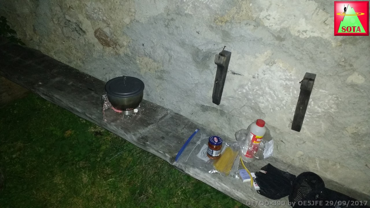
Call me lucky but got invited for a beer
 . The warm oven help to dry my sweaty cloth.
We had a nice chat about amateur radio and I learned more about sheeps and work up here. It sometimes takes a little adventure to get unexpected hospitality.
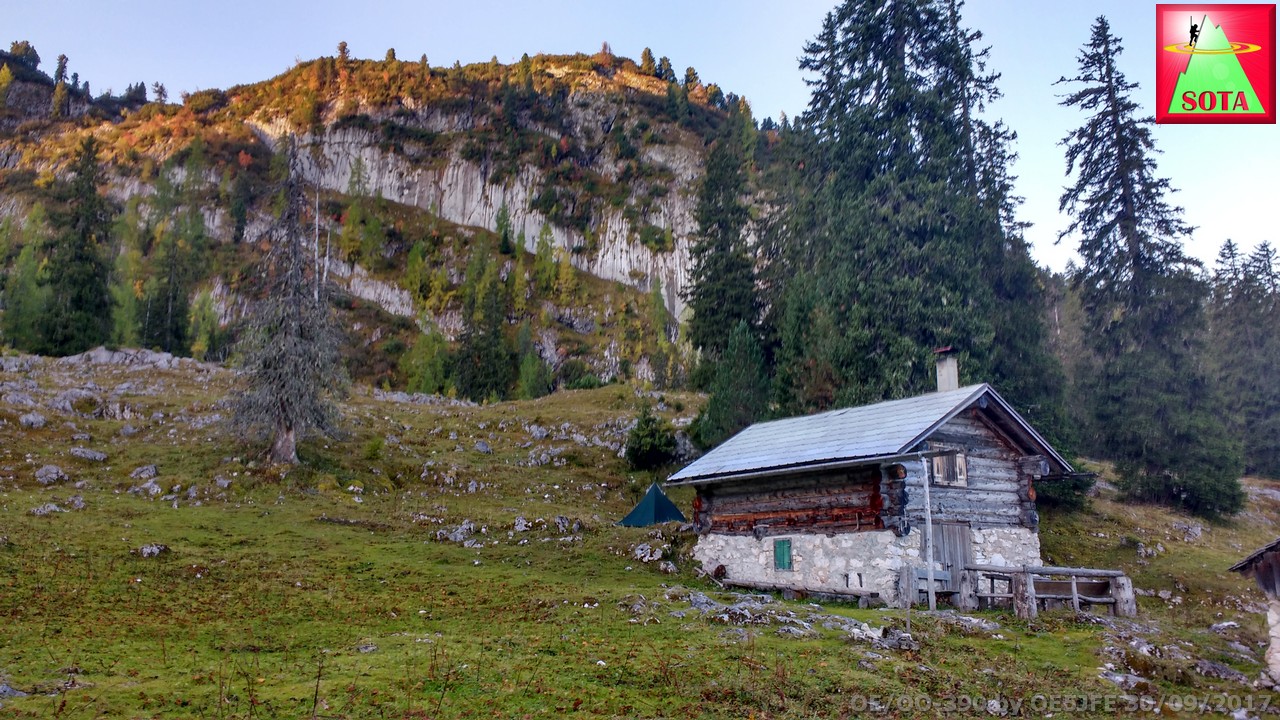
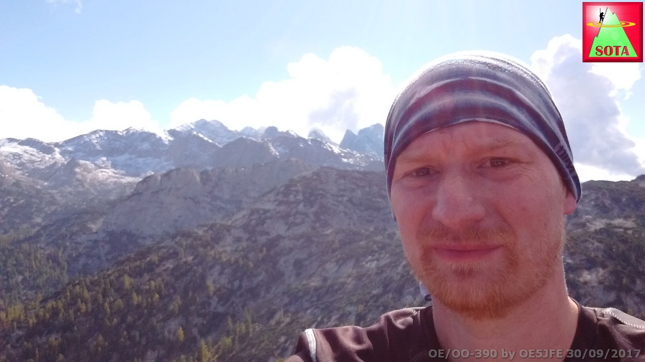
Next morning sunlight woke me up. My sleeping bag managed well at temperature that probably went down to about 2 °C. And got rewarded with that view:
Following the advice looking for the little stone cairns found the entry to the labyrinth of mountain pines and rocks. Sometimes it is just one rock on top of another that leads the way. Of course tracking everything with my GPS watch.
One time the path splits and both have cairns and red dots. Of course I followed the wrong one. Looking at the GPS and map went back and took the correct (rightward) path.
After 20 minute found a sign. What a relief.

About 15 meters east from that sign the accent path to the summit begins. Red dots mark the way.
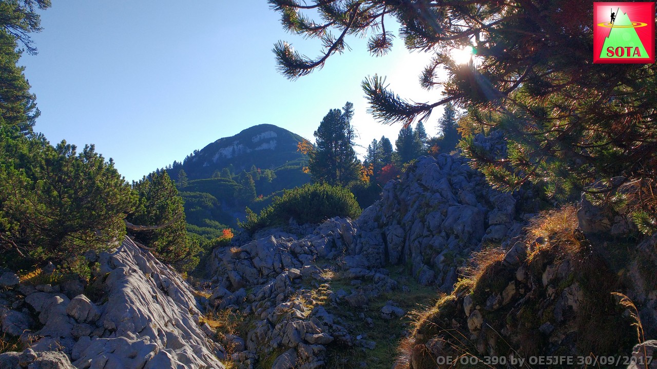
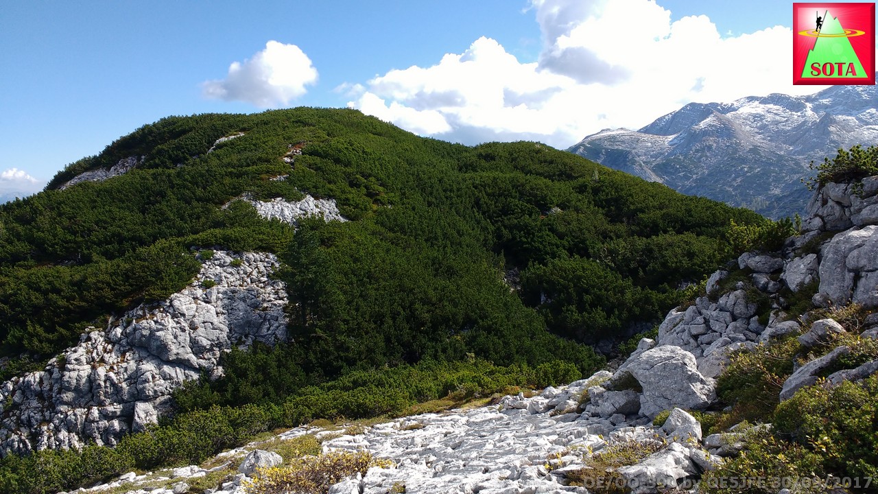
From the pre-summit view to Großer Schwarzkogel:
And finally reaching the summit. The cross was already down when I got there. Looked like the wind took it down.
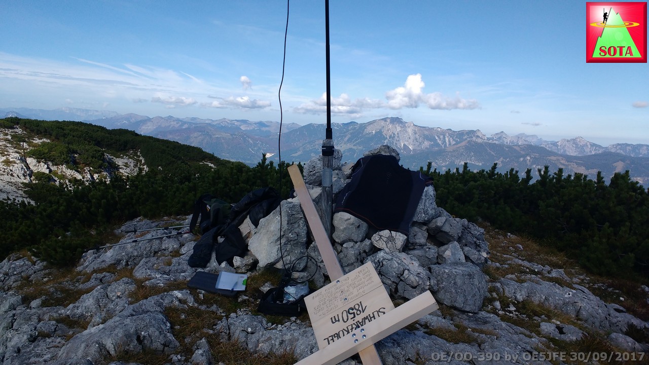
Setup telescope pole and started on 2m using a J-Pole antenna and spotted myself (3G coverage).
S2S with Peter @OE5AUL and Sylvia @OE5YYN on Viehberg.
More contacts on 2 m (also later) Gerhard @DO1GER, S2S with both Peter @OE5PSO and Andreas OE5LAZ on Großer Höllkogel
On 20m got spotted by @EA2LU. Thank you Jorge
Thank you to all the chasers that followed. Conditions apart from QSB and a lot of activity on the band were especially good to Spain and Portugal. Longest call today: @CT1BQH with close to 2000km
Time	Call	 Band	 Mode
09:32z	OE5AUL/P 144MHz	FM
09:33z	OE5YYN/P 144MHz	FM
09:37z	DO1GER	144MHz	FM
09:50z	EA2LU	14MHz	SSB
09:53z	G3FEH	14MHz	SSB
09:54z	EA2DT	14MHz	SSB
09:55z	EB5AG	14MHz	SSB
09:56z	G0RQL	14MHz	SSB
09:57z	EA2BD	14MHz	SSB
09:58z	PA1BR	14MHz	SSB
09:58z	EA2IF	14MHz	SSB
09:59z	CT1BQH	14MHz	SSB
10:02z	SV1RHL	14MHz	SSB
10:03z	EU1FY	14MHz	SSB
10:04z	OH6JYH	14MHz	SSB
10:10z	MM0VPY	14MHz	SSB
10:15z	OE5PSO/P	144MHz	FM
10:33z	OE5LAZ/P	144MHz	FM
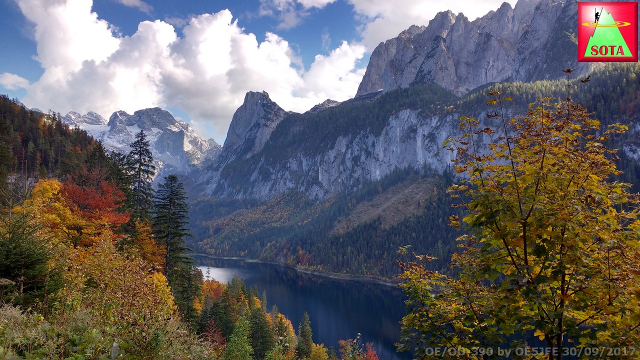
And on the way back to Vorderer Gosausee where I parked got rewarded with that view:
Accent in total: 4 hours
Descent about 3 hours
GPS Track cleaned and uploaded to SOTAmaps with some information in the track description.
Summary and warning: A good sense for directions and orienteering in mountain terrain is needed. You should definitly use a GPS with trackback function and have the available GPS track loaded. In fog or poor visibility conditions this summit is definitly not suitable for hiking beginners.
Potential variations: Use mountainbike / e-mountainbike to reach the area just before Seekaralm and hike from there.
73’s
Joe

