SOTA took us on a great family adventure in the wilderness. After my daughters First trip to Yosemite this spring she got excited about trying to go backpacking. When I realized that the ridge behind my favorite spot in Yosemite (Ostrander lake) had never been activated, we had a great excuse to get away for the weekend. Years ago I had been to the summit of Horse ridge in winter making the approach on snowshoes so I knew that it would be possible as well as challenging.
Horse Ridge is a striking granite escarpment surrounded by broken granite fields with several crystal clear mountain lakes. Easiest access to the summit is from Glacier Point Road in Yosemite from either the Bridalveil Campground or the Ostrander Lake trailhead. We started at the Ostrander lake trailhead in the early afternoon on Saturday Aug. 9, later than we had hoped because our friends were delayed on the long drive up from Southern California to join us. (An old gradschool friend and his daugher joined me and my daughter for the weekend.)
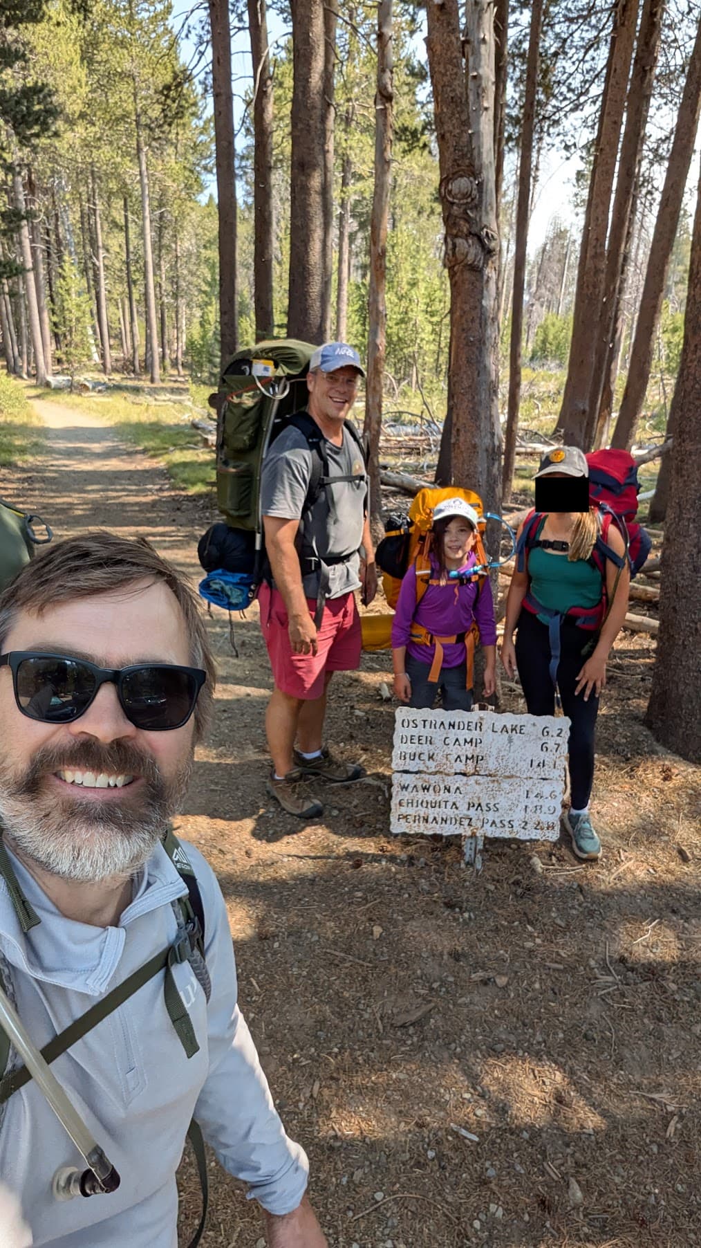
The Ostrander Lake trail is 6.2 miles with ~1600’ of elevation gain, and is very well marked. Blazes, yellow rectangles, sit ~12 feet up trees to be visible in even the deepest snow. The first 2.5 miles are flat and wind through forest and meadows/marsh that were full of wildflowers even in August, as Ostrander is the a year-round water source and headwaters Bridalveil creek that the trail follows. Next four miles of the trail climb 1600’ quite steadily. The final climb is a straight stretch lasting about 3/4 of a mile up a ridgeline that we dubbed “The Heartbreaker”, and our team earned the name “The Hearbreakers” which became our cheer for the rest of the trip.
After the heartbreaker the trail enters a mixed, undergrowth free, conifer forest with a gentle climb to the highest point on the trail before a gentle descent to Ostrander Lake. The first thing you see is the Ostrander Ski hut, which is open for reservations in the winter months and a great destination. The only downside is the trial in (on skis or snowshoes) is at least 11 miles in winter because Glacier Point Road closes at Badger pass once the snow starts.
Beyond the hut is Ostrander Lake and the broken granite north face of Horse Ridge. There are a series of primitive campsites sprinkled around the lake, many of which have official fire rings. Fortunately there were no fire restrictions in place when we made our trip.
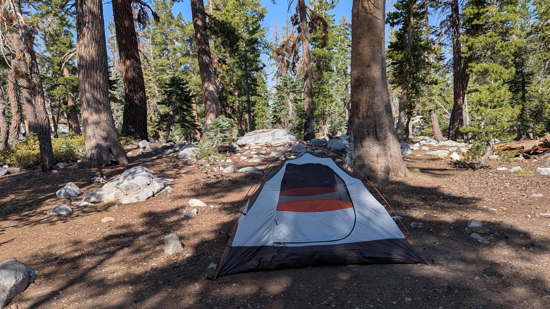
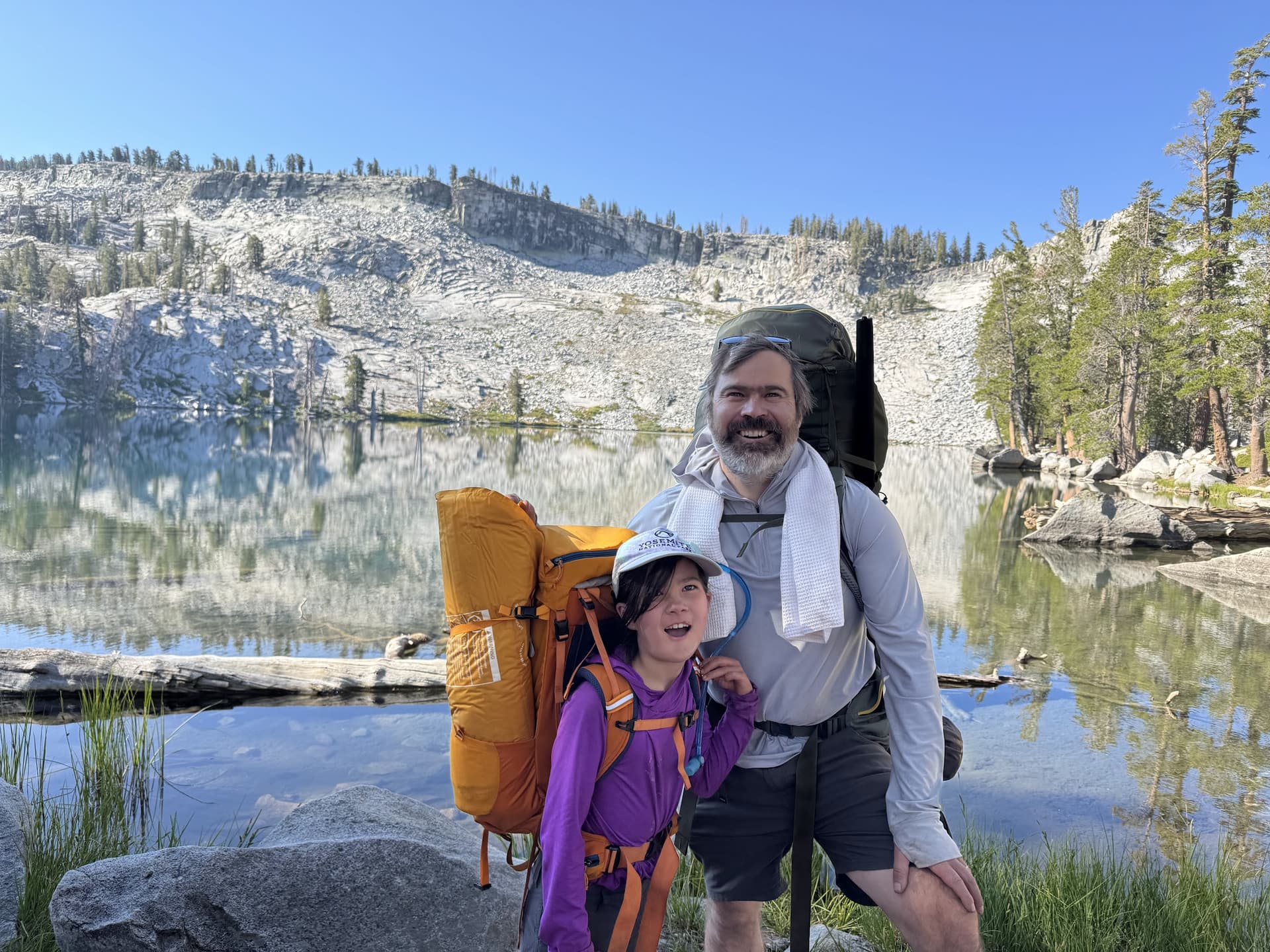
We reached camp with about a half hour of sunlight left and were completely exhausted, taking the first open spot we found, a little back from the lake but otherwise excellent. After setting up camp, eating a quick dinner, and a tiny camp fire, and getting everything locked down for a night in bear country, we collapsed into bed.
The next morning was clear and beautiful and after a quick breakfast we set off to summit, the kids unburdened with any gear and the Dads with stripped down packs. There are no marked trails to the summit, so we plotted a route using our USGS maps to contour around the western end of the ridge until we reached a gentle ridge leading up to the summit from the southwest. As soon as we left the cover of the trees about 1/4 mile from camp it became clear that the going would be harder than anticipated. When I had crossed this area in winter there had been very deep snow, and the terrain was fairly easy to pass. In summer the entire western flank was covered with broken granite boulders ranging in size from basketball to bus sized.
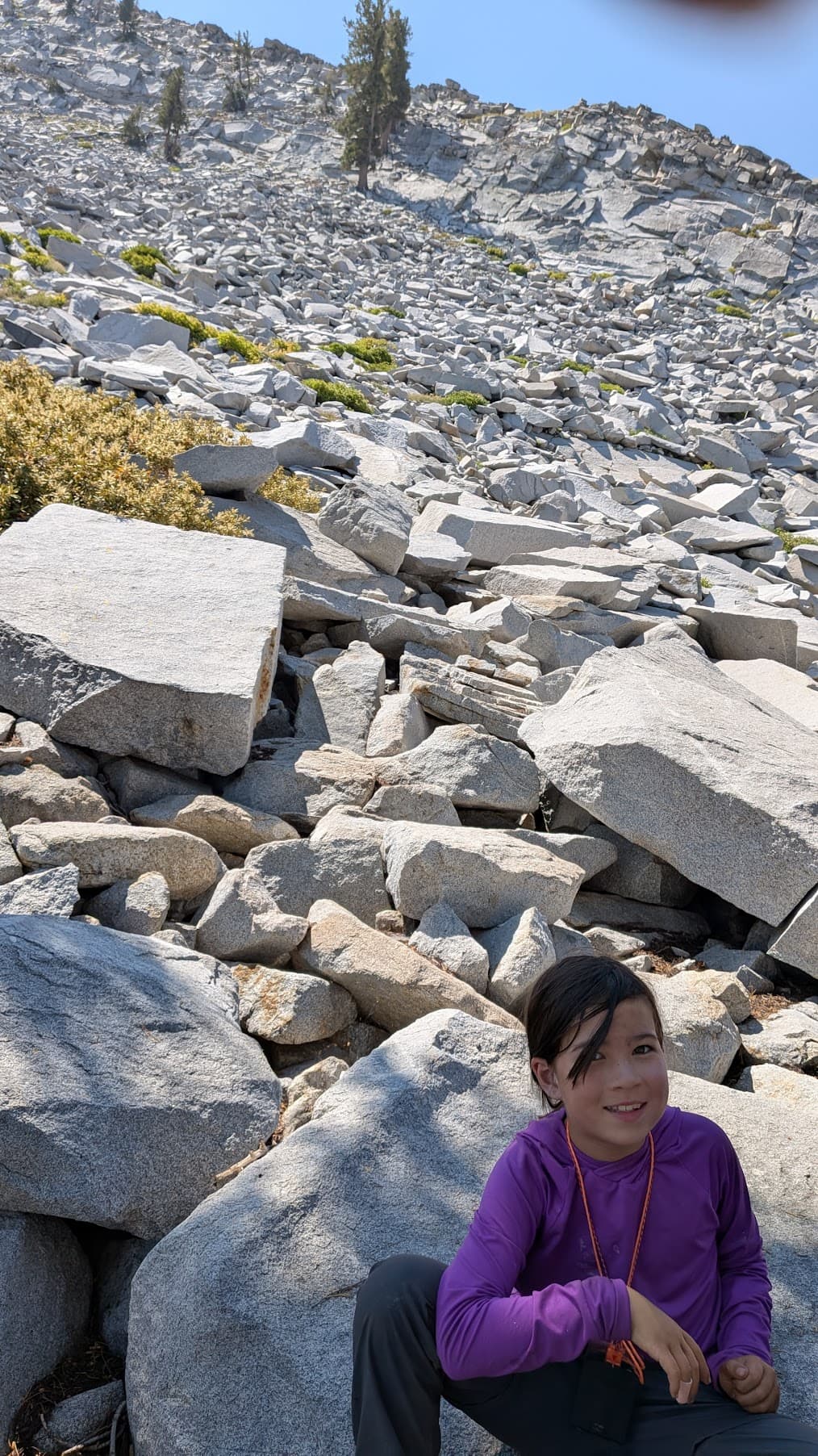
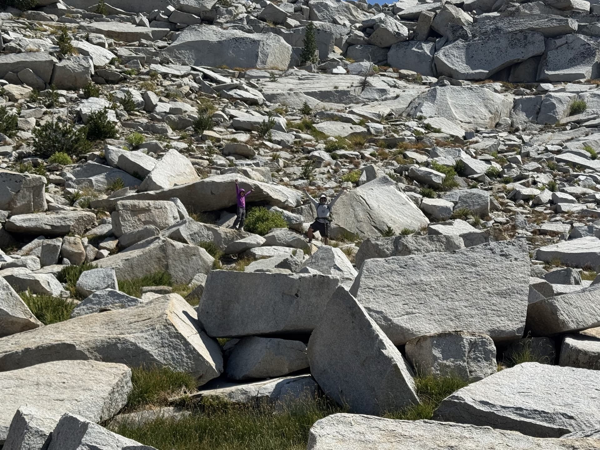
For the first 1/2 mile we made decent progress, even though it took us an hour. However, once we rounded a spur leading to the north west there was more vegetation mixed into the debris field and we were pushed up-slope and were forced to double back more than once. We covered less than a quarter mile in 40 mintues and the kids were starting to get frustrated. We could see the target ridge across the valley but it was clear that our route to get there would be too slow. We saw that at the center of the gentle valley the boulders were much gentler and the section out of the valley to the ridge-crest seemed passible so we changed course from across to up. As soon as we got out of the broken rocks we were able to significantly increase pace and going was easy if a bit steep until we reached the very end of the valley and the slope averaged 30 degrees for about 50 meters. The slope was a mix of trees rock and loose soil and while the ascent wan’t too scary with the kids, it was clear that route would not be safe for descent.
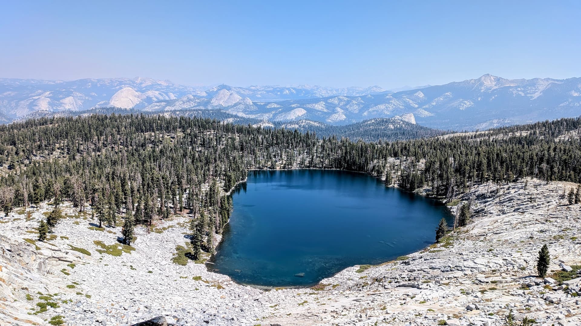
As soon as we reached the ridgeline of a spur we were greeted with a spectacular view out over the crystal clear Ostrander lake.
After a break to recover from the exertion, we made one last moderate climb to reach the true ridge. The ridge is wedge shaped, running very gently away to the south and abruptly cut away to the north with a modest cliff running most of the way along the ridgeline. Once on the ridge proper it was extremely easy going and we made our way to the summit with relative ease. However the trip to the summit, even though only ~1.7 miles had taken almost three and a half hours and was much longer than expected. While we had food and water, we were all a bit tired from the backpacking trip up the day before and were worried the kids wouldn’t have the energy for the broken boulder fields on the way down.
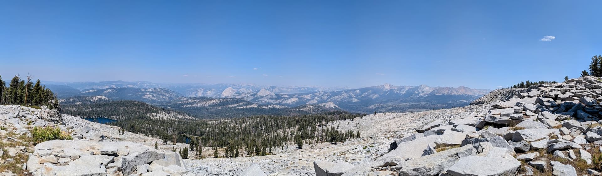
We chose an activation site just to the west of the true summit where there was a nice place to set up in the shade with good places for the kids to sit and have lunch and relax while I ran the activation. The view from the summit is incredible, with clear views of the Clark Range, and the east end of Yosemite Valley including the back of Half Dome and well beyond to what I believe is twin peak and Mount Warren.
I set up my KX2 with an EFHW and a ~5m fishing pole, running the antenna north-south. This was my first time trying to use SOTAMAT and a SOTACAT I had built, and it seem that it was not 100% successful. I’m not a great CW operator and several times I was clobbered by a contest that was going on that day, apparently with responses to stations I could not hear. I was having some technical difficulties where SOTACAT would not complete the FT8 transmission and even once had to reboot the radio, making QSY’s more cumbersome than I would have liked. Looking back at the SOTA-watch it appears that only one of my spots worked.
I want to apologize for any callers I failed to work. I was doing my best and was occasionally confused/confounded by calls that were not for me that came in over weak stations attempting to call me, and honestly I am not that skilled an operator.
The first logged QSO on the summit went to W0MNA, followed by W2WC, and W0ERI and I appreciate all of you for your patience! After that I was clobbered again and QSY’d but received no calls on the (unspotted) new frequency. Eventually I began hunting and responded to KD7DTS hopping on the end of a call, and did’t realize he was active on White Mountain (the downside of tail ending a call, but I needed a fourth QSO!) so failed to make the S2S. His signal was a crystal clear 599. I later heard him call CQ SOTA several minutes later and was too sheepish to call back with the info ![]()
I finally switched to SSB and completed a 5th QSO with W0YKS which happened to be a park-to-park.
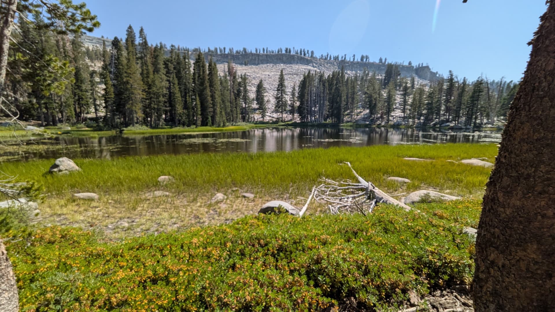
At this point the kids were ready to leave, and we wanted a lot of time to get back to camp in case we couldn’t find a better way down. On the hike up, we had seen what looked like a possible decent route immediately next to the summit. After the activation, we carefully made our way along the rim of the ridge and it was clear that there was a very passable slope down the face of the ridge to a fairly clean foliated section of granite to return to the late. Descending this face took 15 minutes, it was a straightforward if careful descent, and bootprints indicated that it was commonly traveled. After the descent we followed a ridge line that started north from the summit curving west toward Ostrander lake as it descended. Re-entering the trees we passed several more beautiful lakes before return to our camp site.
Ultimately our route was 3.6 miles with ~ 5.5 hours of travel time (including short breaks)
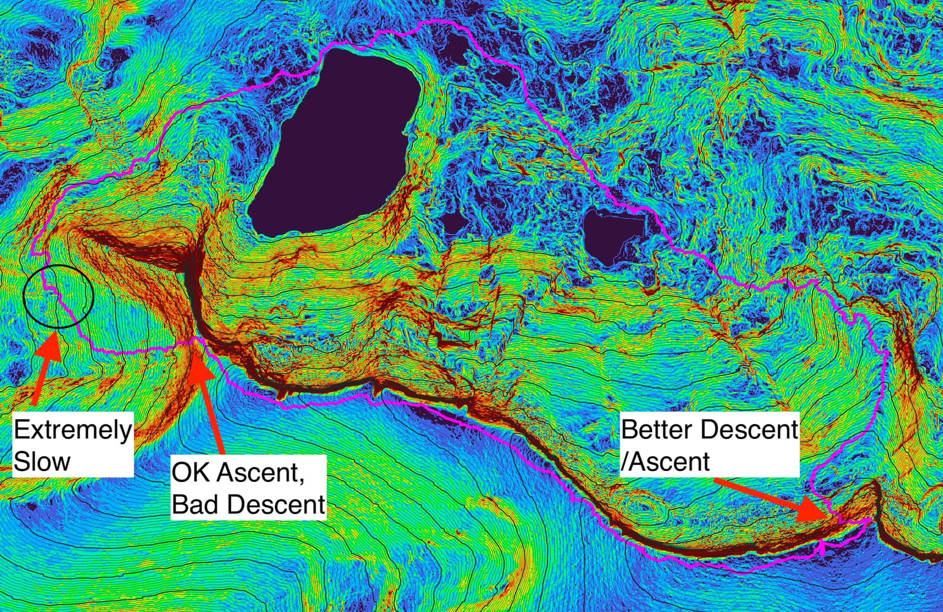
I wish I had spent more time playing with the USGS LIDAR point cloud data shown here, (false colors are slopes, route shown in magenta, 2m contours rendered, with 20m bold) as it is much more granular than the 40’ contour topo, and and creating a slope layer reveals structure not captured by contours.
For anyone else doing the summit, I would recommend either following the route of our descent, which would be a fairly strenuous approach, or if passing around the west, to follow a considerably lower contour which looks like it would have missed the worse of the broken terrain and allowed a gentle ascent up the south-western ridge line.
We got back to camp around 4:30 pm, and were rewarded with a brief but immensly refreshing plunge into the lake. I usually like cold water but I think after the days exertion I cooled quite quickly. But just a dip in the lake soothed muscles and refreshed us. For those looking for other activites, other campers at the lake reported good success fishing, catching several brown trout. We also heard that Heart lake had even better fishing. We finished up the evening with dinner and smores before trying to see some shooting stars at the beginning to the Perseids. Between our exhausion and the moon full, so we only saw one meteor before crashing ourselves to bed.
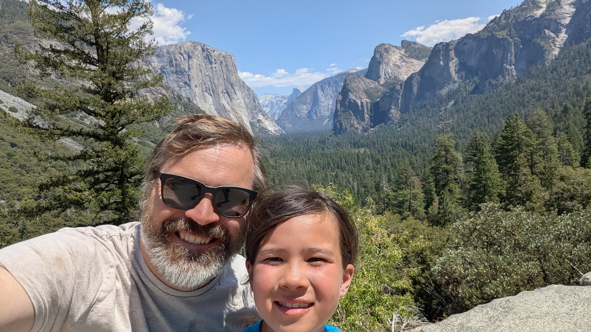
Next morning we broke camp and returned to daily life, taking the opportunity to get my daughter her first stop at Tunnel View on our way home.
This will be a great summit for any adventurous winter activators. With the ski hut open there is a great place to stay (provided you win the reservation lottery!) endless back country skiing, and many of the rough patches that slowed our trip will be smoothed over if there is a decent snow pack. Typically January has a snow water depth of 10"-20", or ~100-200" of snowfall. By march, the number are 30"-60" water equivalent!
Thanks for taking the time to read about our trip and thanks to all the chasers!
'73
Tony (KM6AM) and Alice