If you chased me on Tidbits Mountain, W7O/CM-089, on August 19, 2013, you should delete the 4-point log entry from your database information. The reason is explained in:
I have had to delete the activation information, too. The short version is that my activation turns out to have been from an historically correct, but false summit next to the real SOTA defined summit. I am sorry, but that is the way it is. We checked this with the MT as well.
It was a beautiful hike, but not a summit activation.
I am not familiar with the area, but could the wrong summit still be inside the activation zone of the correct one? They do not seem to differ that much in height, and seem to be quite close to each other.
I am not familiar with the area, but could the wrong summit still be
inside the activation zone of the correct one? They do not seem to
differ that much in height, and seem to be quite close to each other.
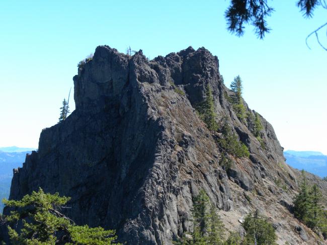
Looking at the photo of the true summit in his blog:
the activation zone is probably just the pinnacle, although the surrounding area might be within the 25m vertical limit, it’s difficult to judge scale from the photo.
In reply to G8TMV:
This was the first thing we looked at but, unfortunately, the col between the two peaks is about 61m/200ft. So the activated peak was not in the Activation Zone of the correct SOTA peak. Still a nice day for a hike…
The activation zone is just the upper reaches of the pinnacle. It doesn’t look possible to just hike up there - technical climbing is necessary. It’s a very cool mountain and a nice hike to get there, however. Maybe someone will want to try the climb someday.