I had hoped to complete the first activation of EA1/CR-040 Pico da Garita today but the route finding was too difficult for me and I adandoned the attempt.
But I thought I would post a report anyway as it may be useful to anyone who wants to try again. I will apologise now for including a few photos which may not be strictly relevant but it is a gem of a summit in terms of location and deserves to be activated! You can see it at the bottom of this map.
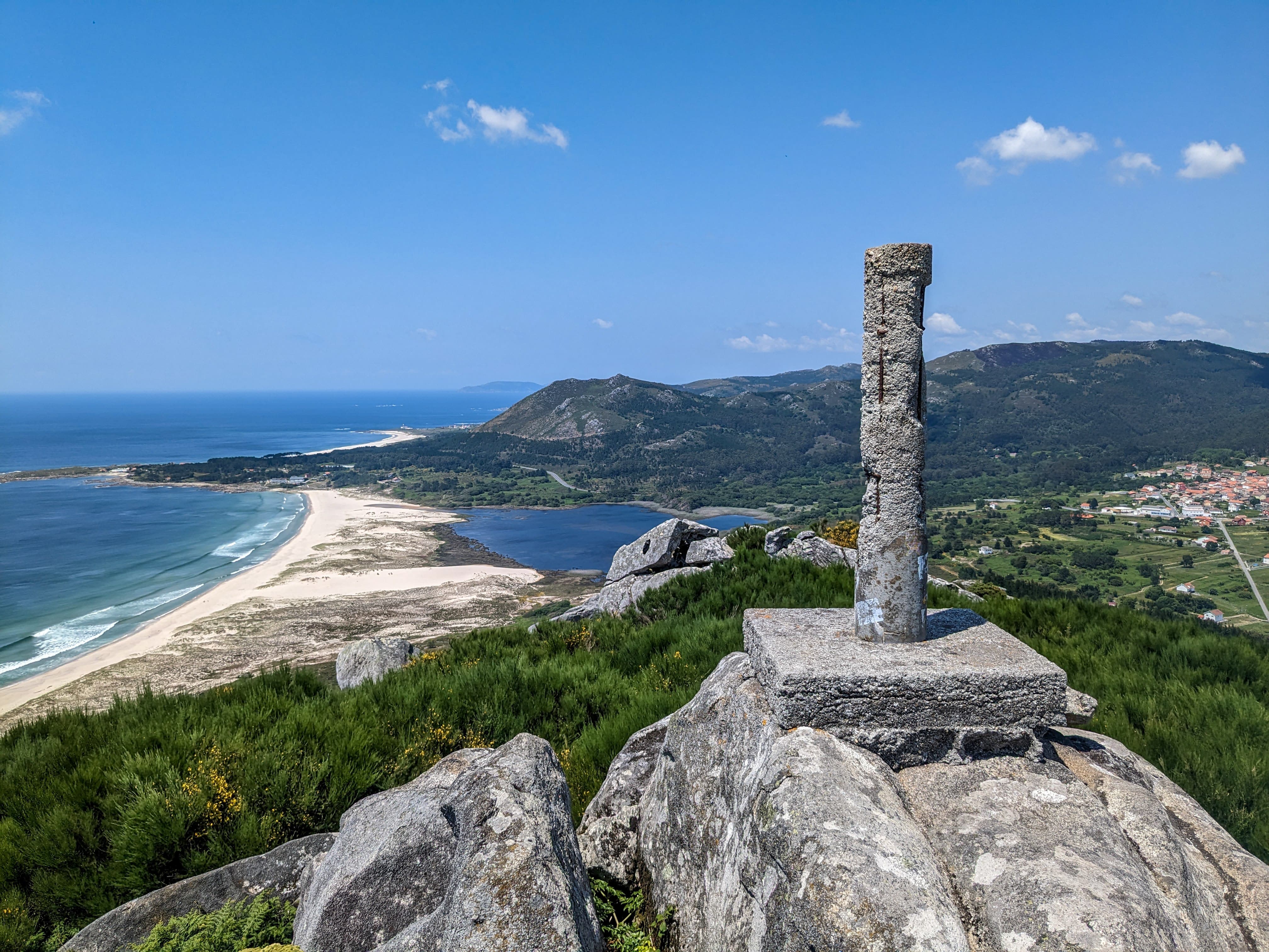
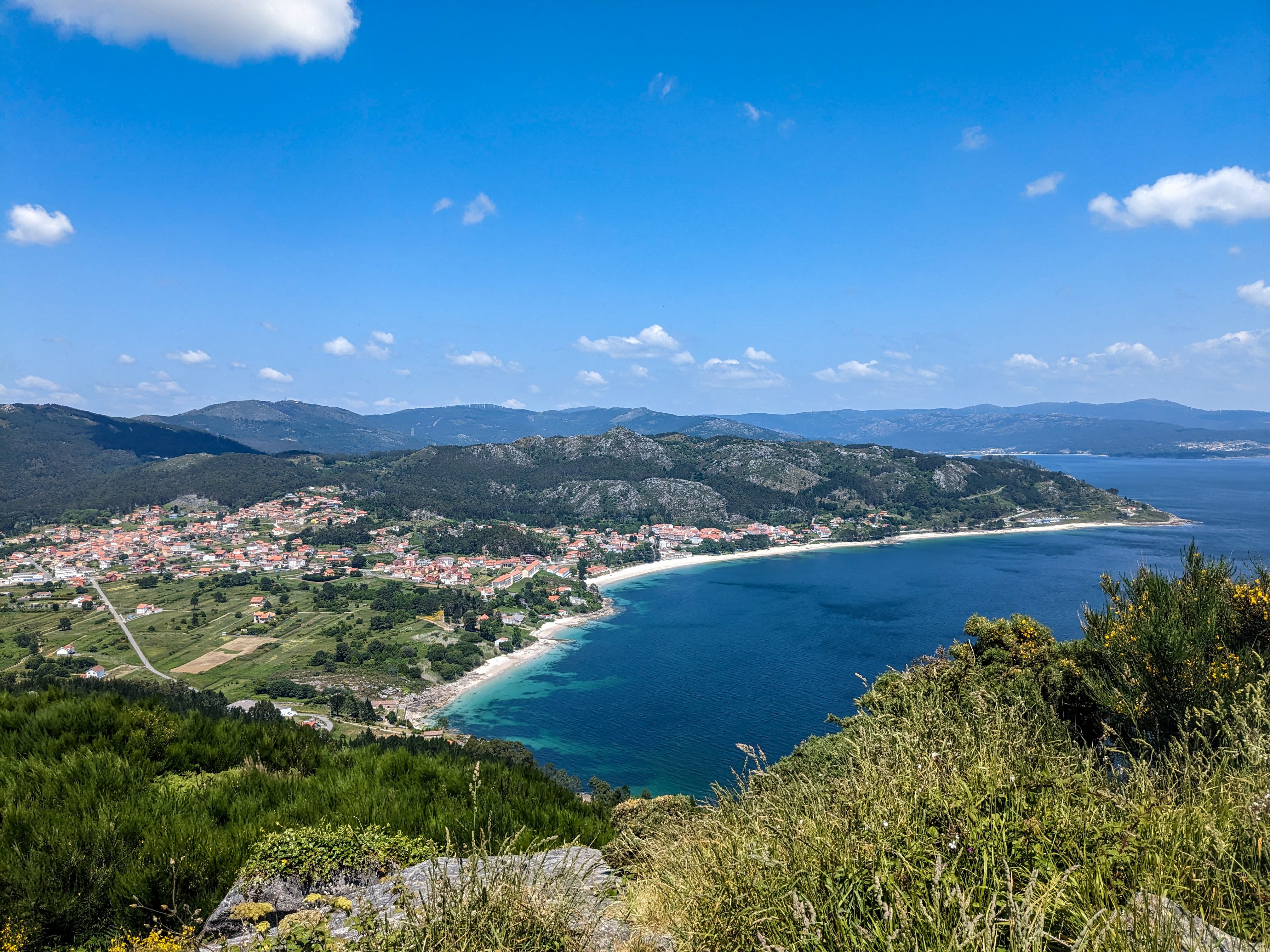
The summit is surround by the sea on three sides and overlooks the Rías de Muros, the most northerly of the four rias (flooded valleys) which make up the Rías Baixas region of Galicia in north west Spain.
This is the view looking from the east side.
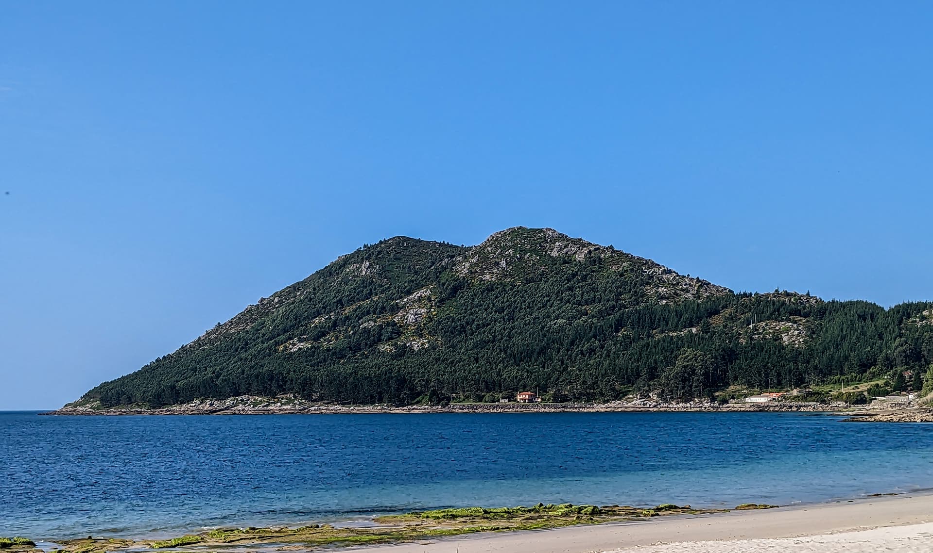
There are two summits, Pico de Garita is on the left and Monte Louro, which is as far as I got today, on the right.
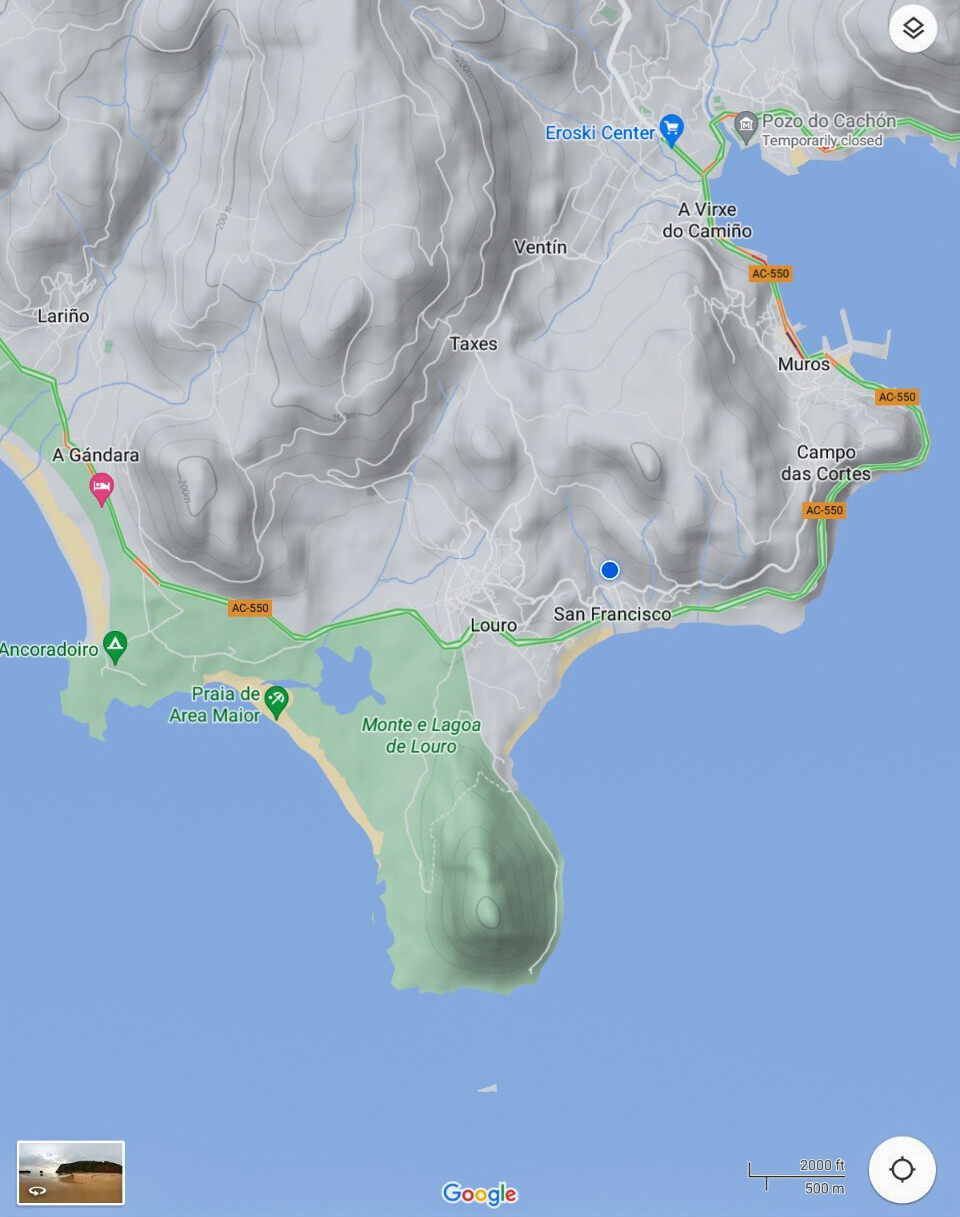
This is the Locus Map app view of the summits.
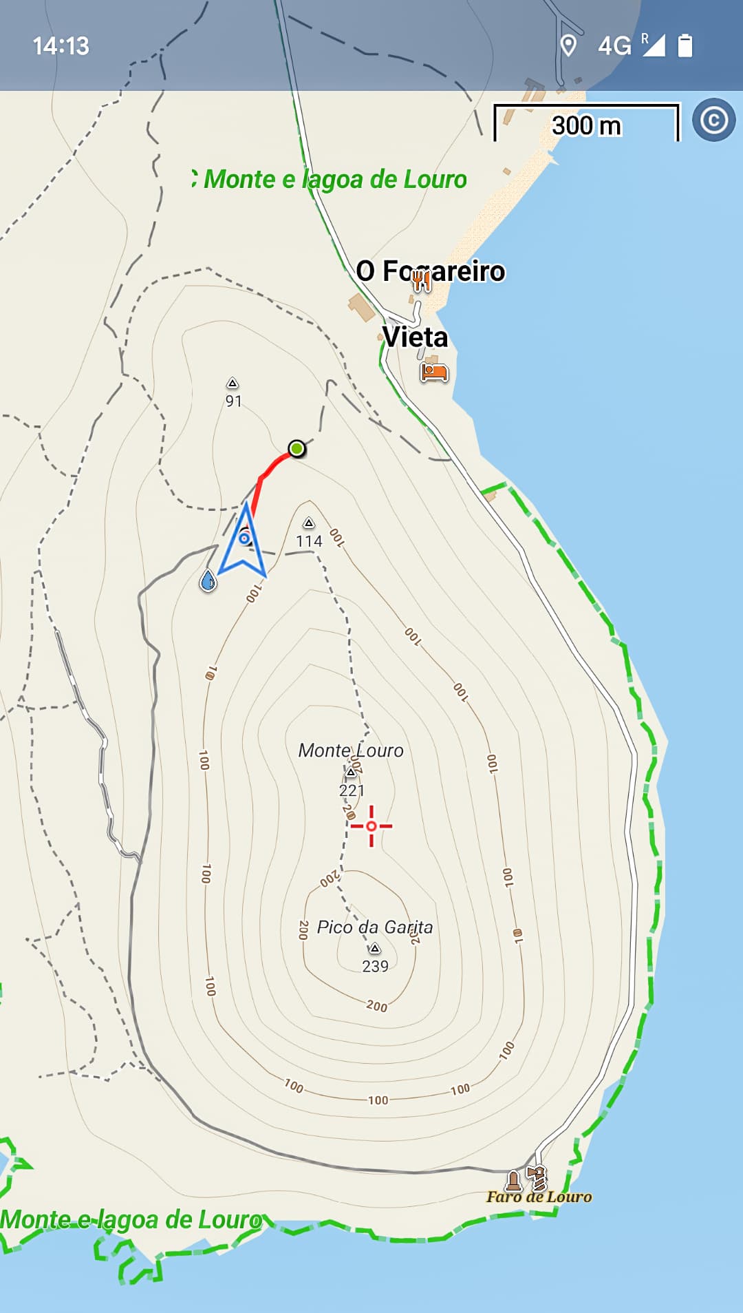
A road runs down the east side of the peninsula to the lighthouse and halfway down, just south of where “Vieta” is shown on the map, a track branches off which you can follow to just south of the 114 subsidiary summit which has mobile phone masts on and a few microwave dishes.
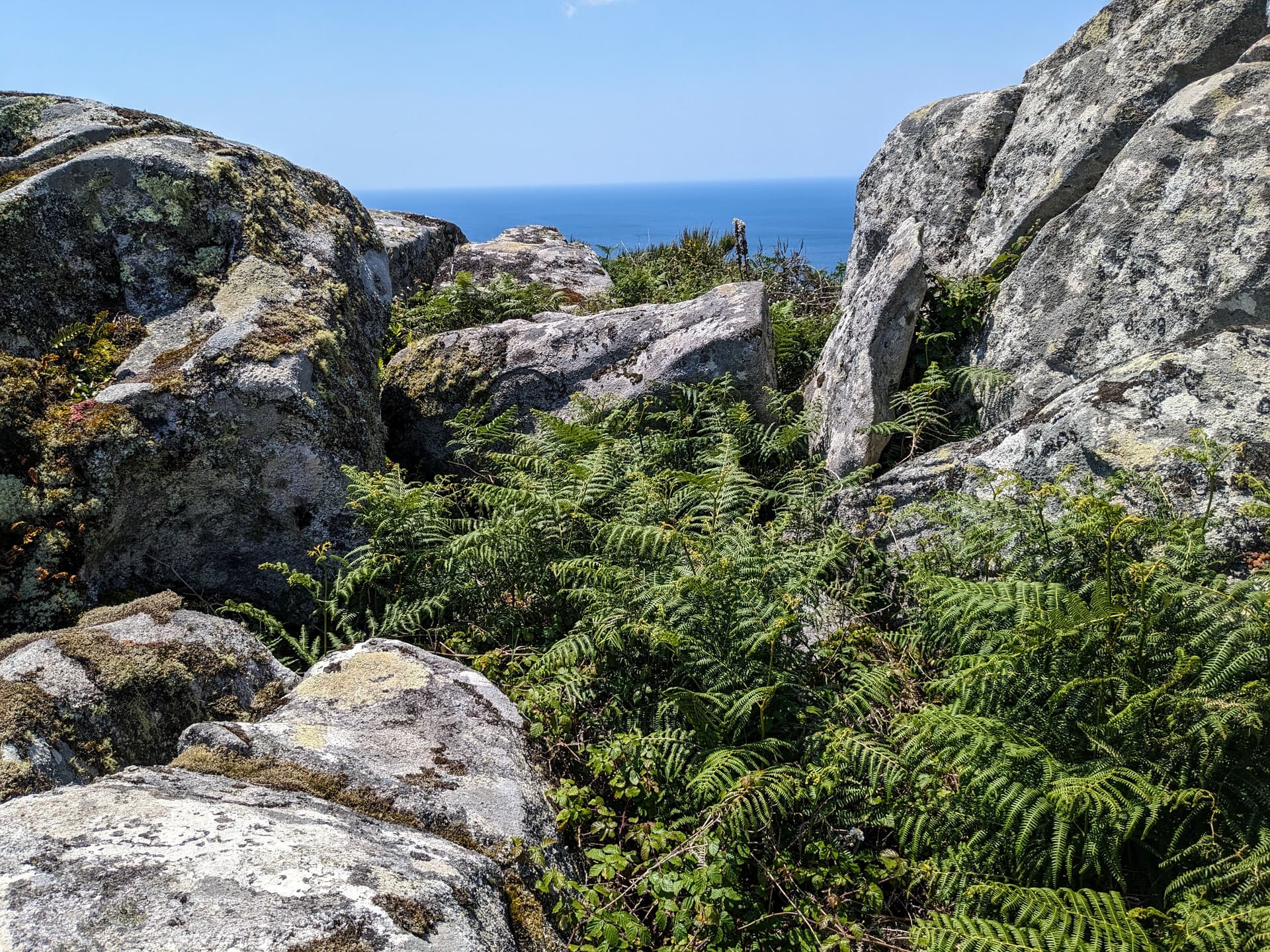
The route south from there is a path, and a challenging one in places.
Overgrown.
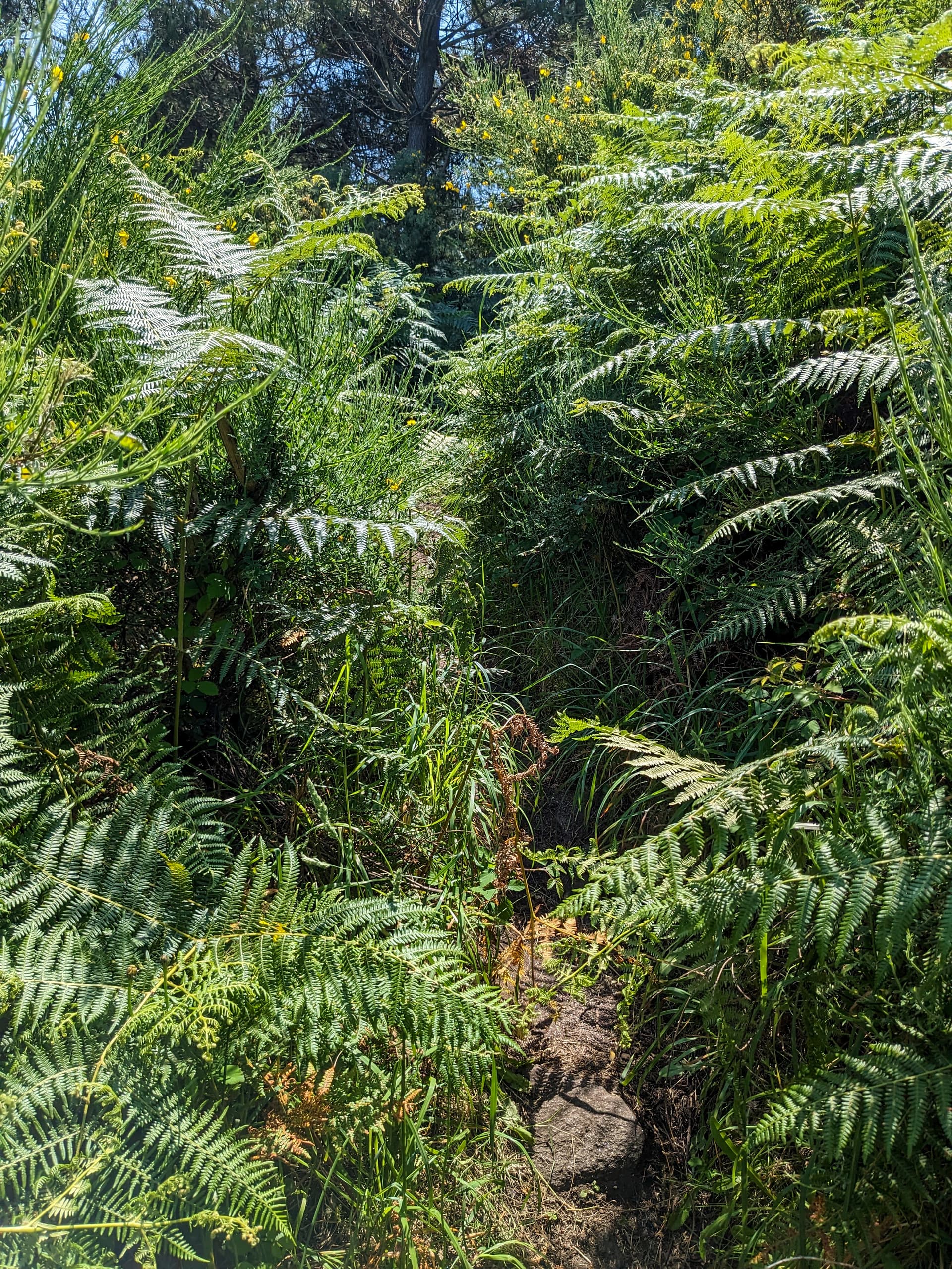
With some scrambling and a few metre high steps and boulders to overcome. ![]()
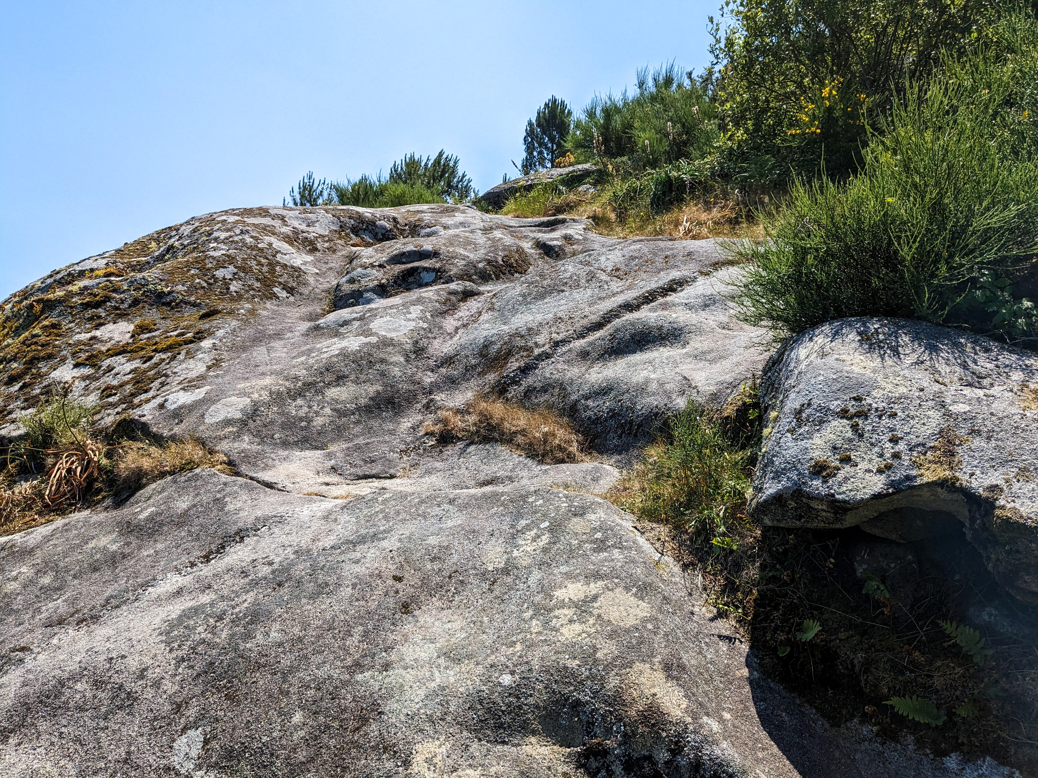
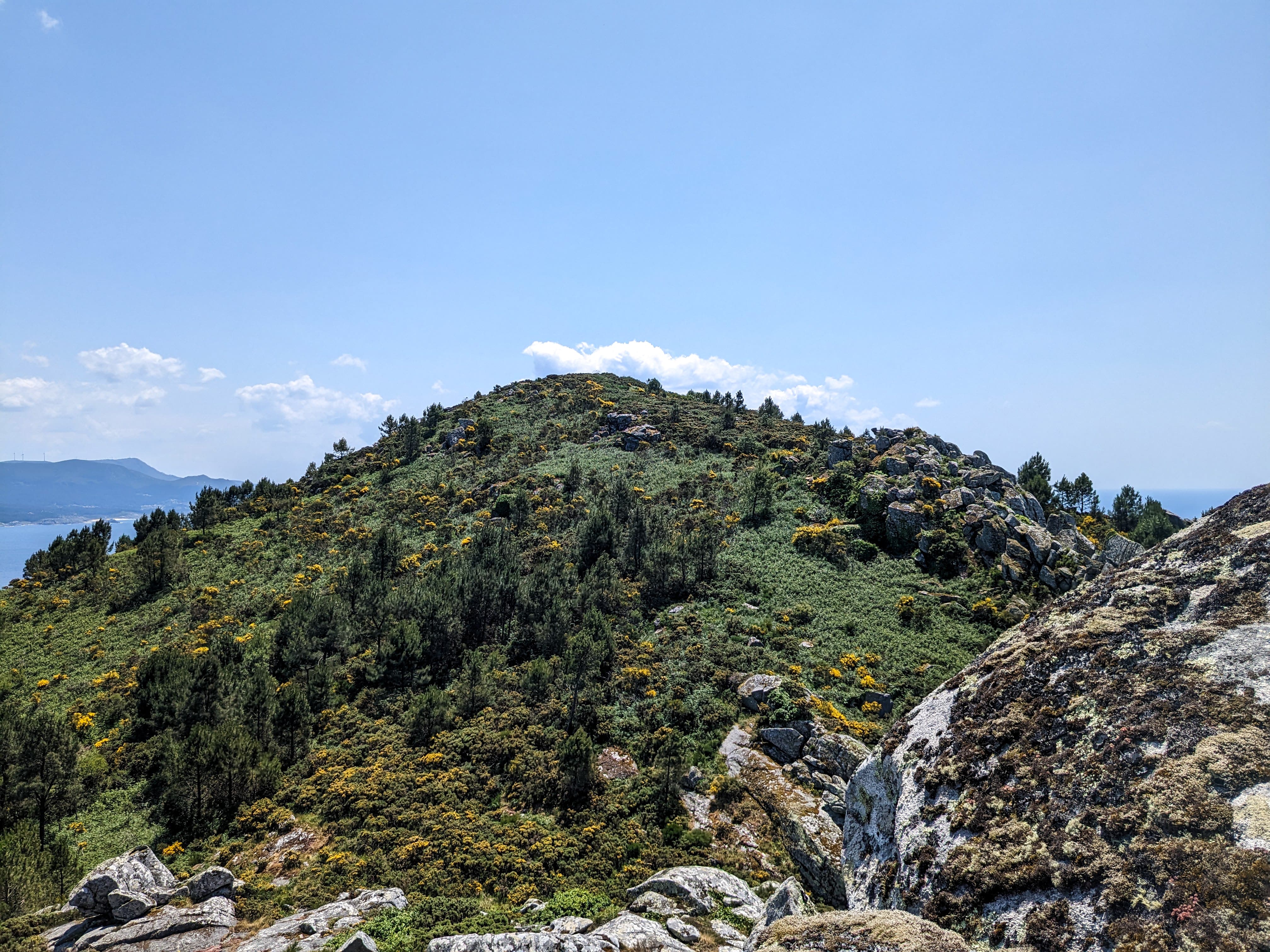
The path is not way-marked by any signs but is not hard to follow and after some effort it took me to the summit of Monte Louro where I could look back.
Pico da Garita was not far away.
On Google Maps a path is clearly visible. It run down the middle of this image.
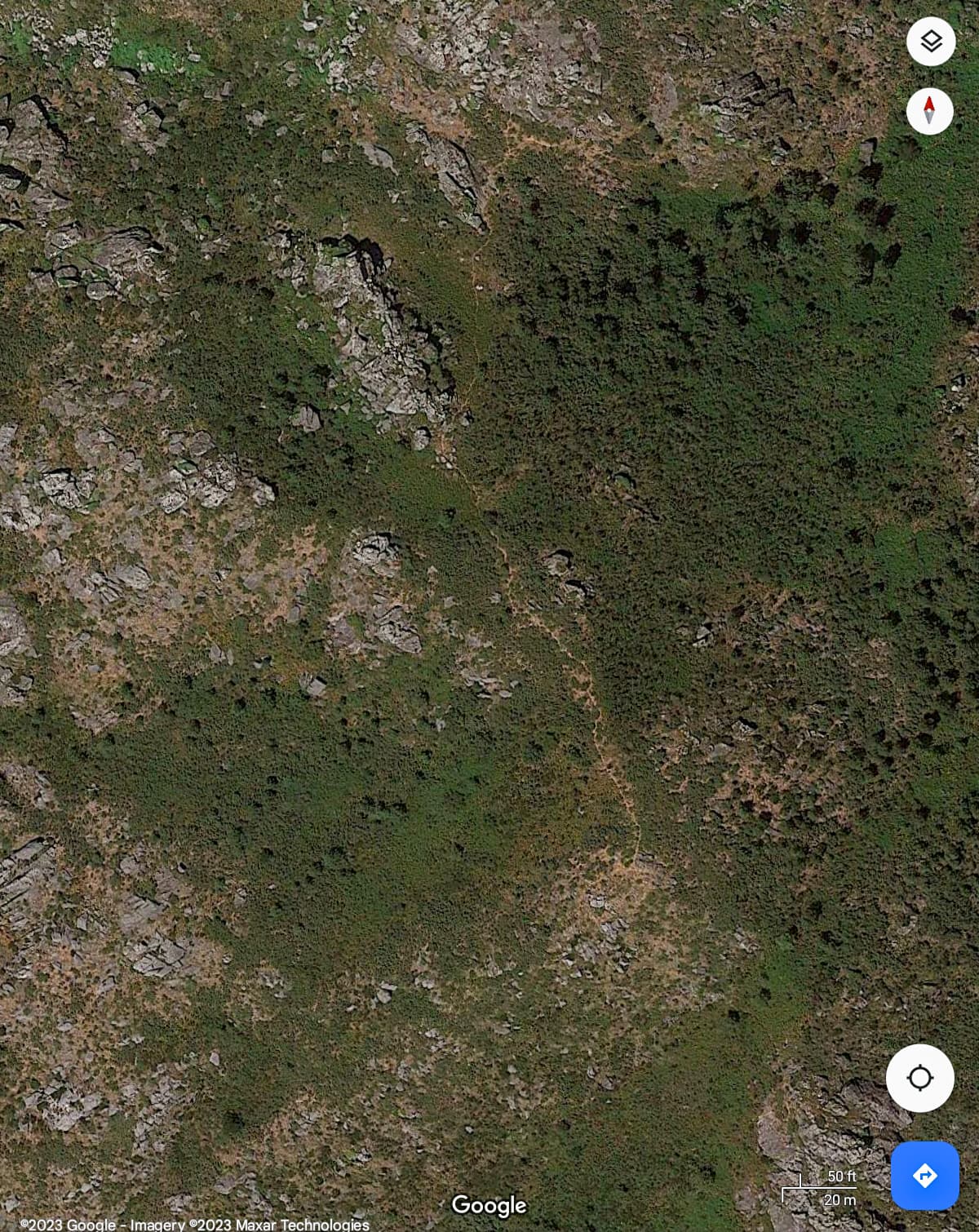
But I couldn’t find the start of it. ![]() I suspect the Google Maps photograph was taken a few years ago and in winter when the bracken had died back.
I suspect the Google Maps photograph was taken a few years ago and in winter when the bracken had died back.
I found what looked like the start of two paths, one led me into a boulder field with deep gaps between the stones and after some scrambling I retreated. The other just seemed to stop at a two metre drop with no obvious path below it.
Looking at the view of Pico da Garita above I can almost make out a line running through the bracken from the bottom right to the summit but the challenge was finding the start of the path!
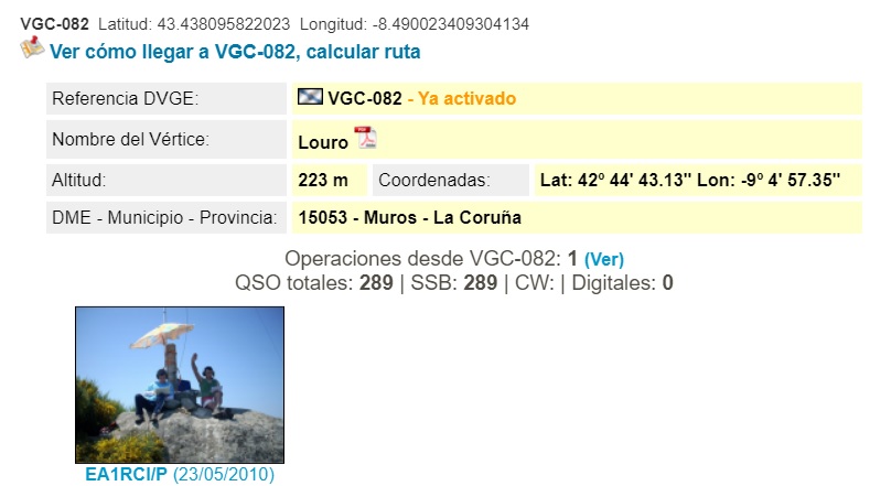
But it’s still there and still unactivated. It is also in an unactivated POTA park as an added bonus. I suspect the vertice on Monte Louro is also unactivated if you collect Spanish trig points. ![]()
By the time I got back to the campsite* I had been walking for two and a half hours and was ready for a shower and an early beer. ![]()
*Camping San Francisco - recommended!