Failed Activation - Claife Heights G/LD-053

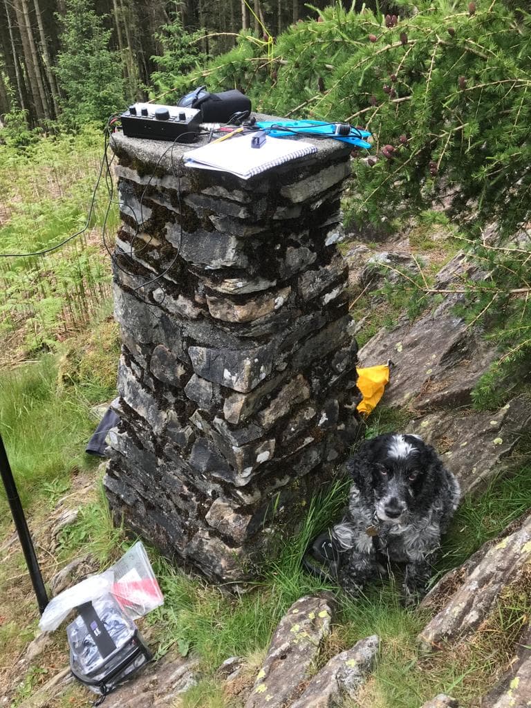
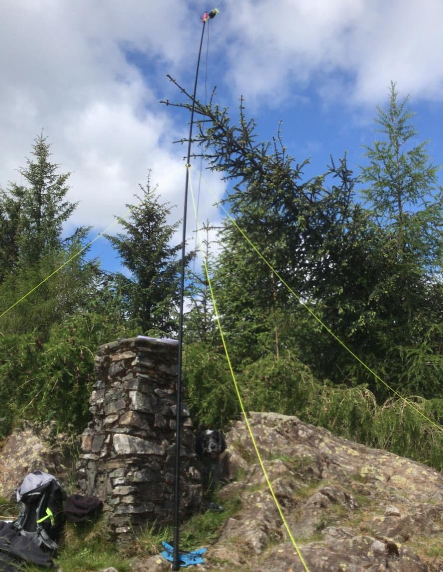
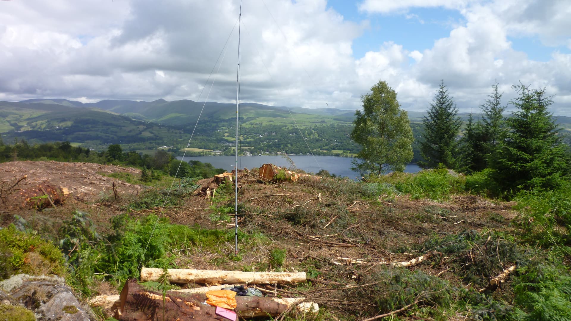
Many of you will know it, the whole area around the summit is a densely-packed mature conifer plantation. Even at the small clearing at the summit trig point the very tall trees all around means G/LD-053 has an indifferent VHF/UHF take-off. You even have to get creative erecting an HF antenna in the space - my 40/30/20 EFHW was okay in the past.

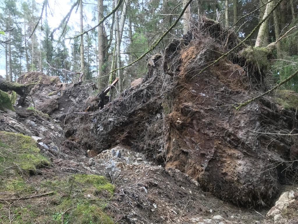
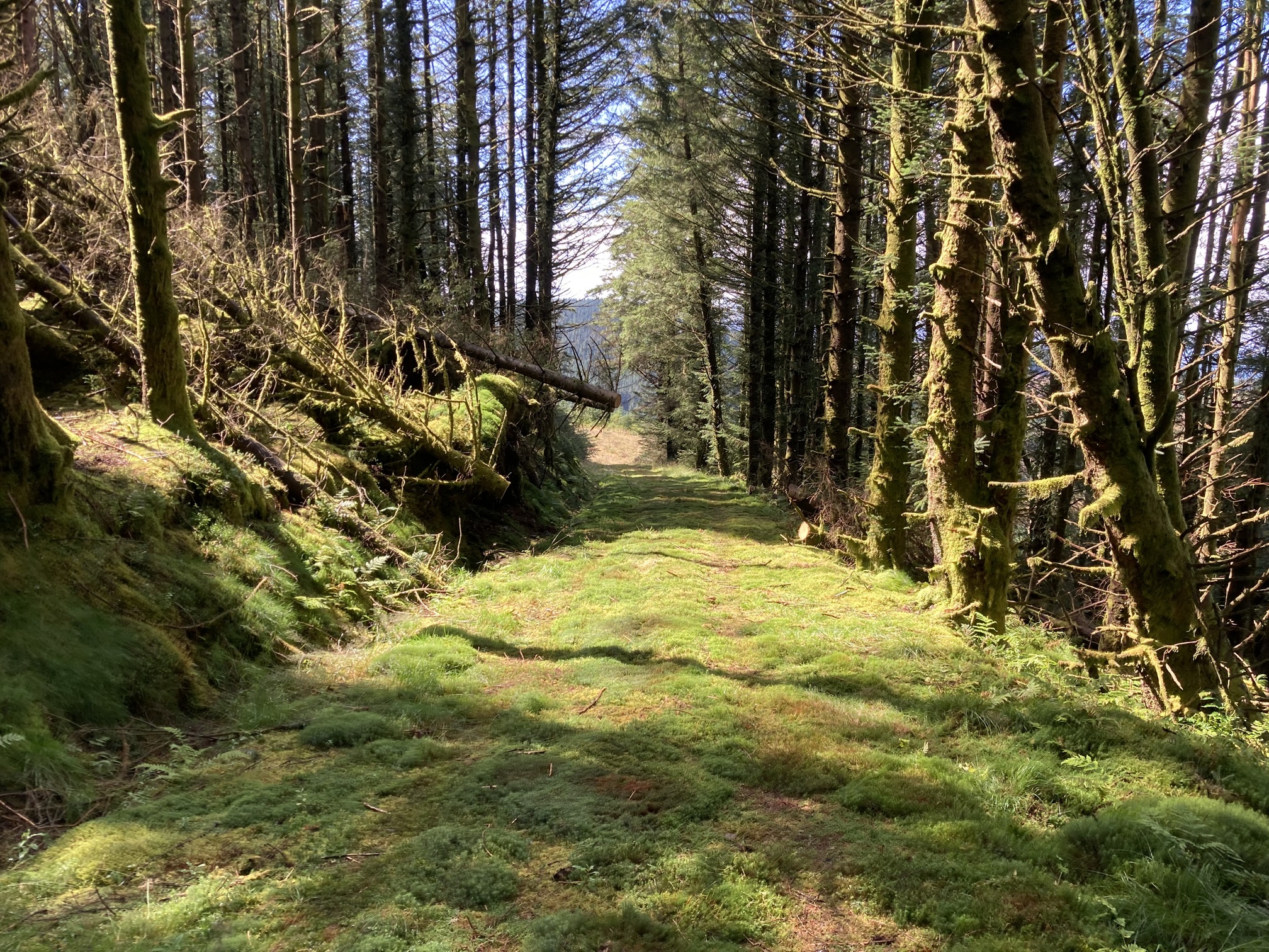
I have activated Claife Heights 3 or 4 times before; it’s usually a pleasant one-hour walk from Far Sawrey [to the south] albeit a bit boggy in places and with views overlooking Lake Windermere to the east. Today was very different. There has been widespread devastation of woodland and forests in Cumbria this winter and again a few weeks ago with the triple storms.

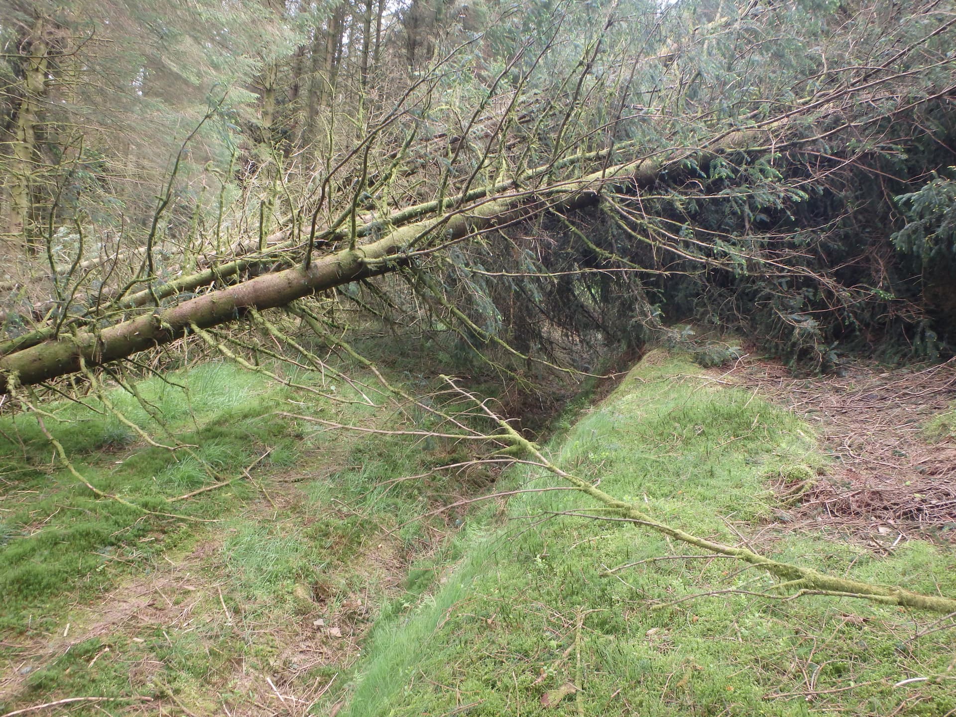
On previous activations this usually meant ducking under the tree trunks or making a small deviation around the fallen trees. Indeed, it started off that way but soon, not only the path and sides were covered in massive fallen trees but the whole hill side. It was totally impassable.


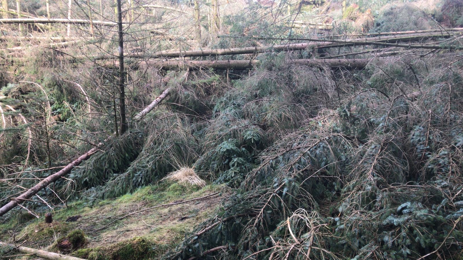
The path is somewhere under that carpet of downed trees

The map shows the final part of my usual route in green.

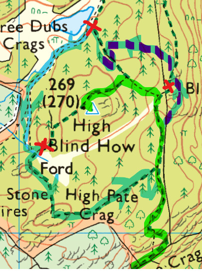
© Ordnance Survey 2022

My little dog and I had to clamber over a drystone wall and bushwhack east then north across an area of smaller trees, very unpleasant and a bit dangerous trying to walk across the brash (mainly moss- and grass-covered old branches) left by the foresters when they cleared the area for planting the saplings. Then re-entering the main forest area was also very unpleasant stumbling between closely-planted conifers.

This took me ages [on the map, the blue/purple route 3 to 12 o’clock round the summit area] before I met the public path coming from the opposite direction. I headed towards the summit but my hopes were soon dashed again encountering more large fallen trees everywhere.

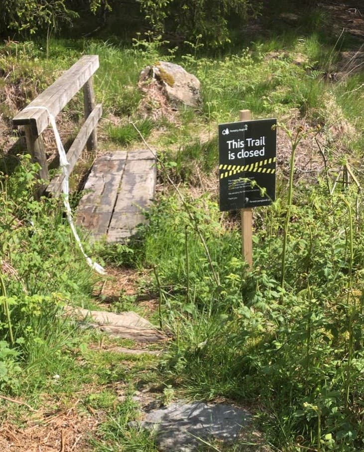
I came across some signs saying the trail is closed (red crosses on the map). No help for me [for the first two] as I came from the ‘wrong’ side of the signs. Fortunately I encountered nothing blocking the forestry road and public footpath (to the west and south respectively of the summit) – blue on the map - and was able to re-join my original (green) route to go home.

I’m phlegmatic about carrying all my radio gear over rough terrain, getting close to the summit but not getting to activate it. But hey, the weather was sunny and dry, the non-bushwhacking parts of the walk were nice, and I had my wife’s home-baked banana cake to eat. Claife Height will still be there and the F.C. should get round to clearing the trees in a month or so [I’m sure they have higher priority emergency clearance jobs to do elsewhere]. Suggest you might want to postpone any planned outing there too.

Sorry to anyone who was hoping to work G/LD-053 today.

Regards, Andy

12 Likes

I’ve just received the new licence

©Crown copyright 2022 Ordnance Survey. Media 041/22. The licence is valid until 31 December 2022.

1 Like

Thanks for the heads up Andy,

Claife Heights was on my list for Friday as a cw op. As u say it will be there later in the summer.
Looking at the contours you must have been close to that illusive AZ.

Regards
Old cloth ears
David
G0EVV

2 Likes

Congratulations on the first use of “phlegmatic” on the SOTA reflector.

8 Likes

After the storm-felled trees blocked access to the summit on my last visit in mid March, I see two others - G4ERW and @M1CGB - have activated G/LD-053 so I assume the Forestry Commission have cleared the paths. So here’s hoping for tomorrow (Sunday) mid morning.
image
regards, Andy

1 Like

I had a similar experience with VE2/MA-123 this week, i made it trough but it was extremely difficult. Very frustrating navigating trough all the blowdowns…

We were really disappointed we couldn’t get to the actual summit. We made our way through the cleared area to get to within the qualifying zone. Once confirmed that it’s accessible again it would be good to know for our next visit to the lakes. It was a very challenging day and took a few hours to make the necessary contacts, A memorable day for all the wrong reasons.

Once bitten, twice shy? Nah!

Hi Martin, I didn’t read your reply until I was sitting in the car about to drive off for the activation. I decided I would try it anyway.

A farmer repairing a drystone wall reckoned nothing has changed since my last visit over two months ago and it turned out he was right. The ‘police stop’ tape and ‘trail closed’ signs were still there. I decided to take the clockwise path going west on the south side of the summit [see map in my original post].

My SOTAgoat app said the summit is 214m from this point but it might as well be on the Moon if the path is not accessible.

I entered the devastated woodlands with massive conifers strewn about like a pile of matchsticks.

The root systems of these large conifer trees when ripped out of the rocky ground and rotated by 90 degrees are 3-4m high in many cases. A sad end for these living giants. It took some going often on hands and knees under tree trunks and I was lucky to get to the trig point.


Trig point makes a convenient operating ‘desk’

As I was setting up for HF, I heard Mark @M0NOM on Pike of Blisco G/LD-024 calling on 2m FM: 5/9 each way for this S2S. After a chat we worked four chasers in tandem explaining each time that we were on different summits.

Mark suggested we try for a 40m CW S2S so I hurried to erect my 40/30/20 EFHW on my 3.2m pole. Pegging guy strings is often difficult on G/LD summits with thin soil over impenetrable rock. Fortunately, I could tie two of the guys to a fallen tree next to the trig point.

Due to lack of antenna height at the pole end, I didn’t want to slope the EFHW to ground and was able to tether the far end to about the only tree in the open using 3-4m of spare ‘extension’ string. I worked Mark on 40m and then a few other stations on 40m and 30m.


(C) Google Earth 2022, ADIF Processor courtesy M0NOM
Local 2m FM contacts


(C) Google Earth 2022, ADIF Processor courtesy M0NOM
40m & 30m CW contacts

I would not recommend activating G/LD-053 anytime soon. I think it will take a massive resource in manpower and money to clear the hundreds [thousands?] of fallen mature conifers and clearing the public footpaths will be a low priority. And this is just once of many forest sites in G/LD where winter storms have wreaked havoc.

Thanks to all chasers.
Regards, Andy

5 Likes

Good effort Andy, you don’t think you’re going to have to resort to hands and knees on a SOTA activation, do you?

I thought there might be more luck approaching from the West, but looking at the map that only gets you to the same trail which runs from about 500 yards South before the trig point area - I suspect it is the same story from that direction as well.

You were doing well with VHF from there though - I’ve failed to activate the summit before due to lack of VHF contacts.

Regards, Mark.

3 Likes

Very well done Andy. A huge effort for the single point and potential safety issues for the unwary. At least you’d had a practice run!

If the clearance is going to be anything like up in Northumberland, the authorities are talking about sometime in 2024 before they get most of the forest routes open. Having seen the devastation in Thrunton Woods near Rothbury, I think they might be somewhat optimistic. :hushed:

2 Likes

I activated GM/SS-082 (Capel Fell) then went to GM/SS-142 (Scaw’d Fell) following the Southern Upland Way (SUW). The SUW part of the route had been cleared but the section to Scaw’d Fell has not been cleared.I was able to squeeze under the trees in the drainage ditch on the side of the forest road.

Here are a couple of pictures.

A view from Croft Head GM/SS-100 looking toward Capel Fell. The SUW runs in the valley bottom.

The trees accross the path to Scaw’d Fell

The route up Capel Fell through the forest from the fish farm was OK.

So if you are activating in the Southern Uplands be aware becasue there are lots of forests to get to the summits.

73 de

Andrew G(M)4VFL

2 Likes

I came across my first windblown trees on Sunday since the big storms. The classic route to Beinn Each GM/SS-034 starts from the A84 layby at Ardchullarie More. Quite a few trees across the path. There were some well worn paths around them so they could have been down for much longer.

1 Like

Yesterday I successfully climbed and activated Claife Heights G/LD-053 in relative safety.
I walked North from Far Sawrey and avoided the remaining lying trees. The only difficulty being the brash on the final ascent hillside following the harvesting. I have put my route on the Claife Heights Info page. It will be some months yet before the area will be clear of fallen trees and the trails fully open. Large harvesting machines on the move are an added hazard. It will be many years before the area is clear of brash.

David
G0EVV

1 Like

Glad you made it through the fallen trees and brash to the summit, David @G0EVV Thanks for the (groundwave) 40m CW contact (from my home) and the 2m FM contact in the afternoon when I was on Red Screes and you were somewhere /M (on your way home I presume).

Re your photo - since I was there a month ago - it seems they have cleared not only the fallen trees but most of the standing ones too. I’ve never seen such a good view of Lake Windermere from Claife Heights before. It’s probably improved the VHF takeoff too.

Andy G8CPZ