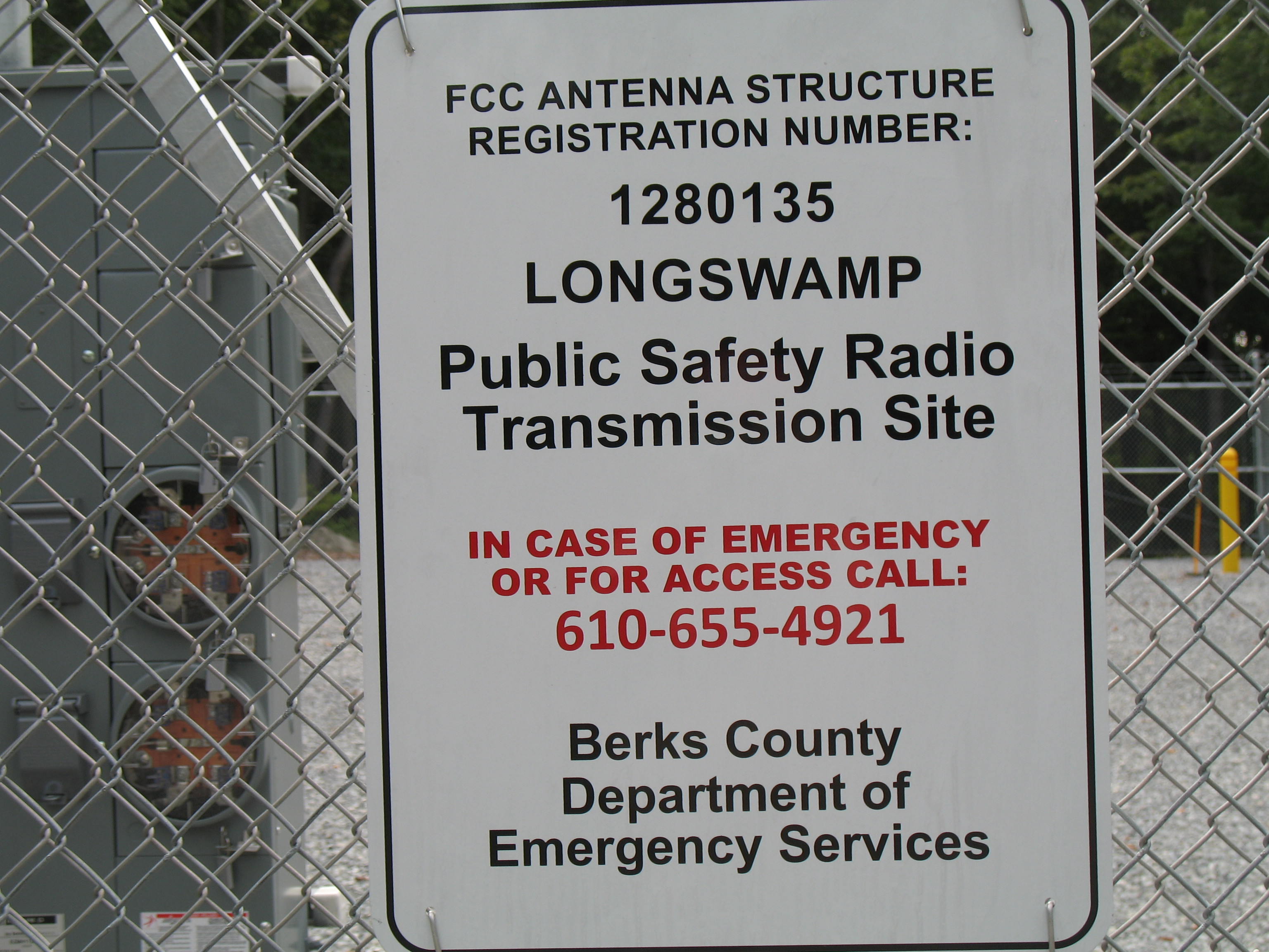
Prior to setting foot on Topton Mountain North W3/PH-003, an aerial view hinted to the existence of a primitive summit driveway. An improved gravel driveway to a Public Safety Radio Site on top was a surprise. Estimates place that radio site here little more than a year before the first activation. The SOTA database summit coordinates of 40.4775°, -75.6839° are inside the site fence. That gravel driveway is routed from an existing NO TRESPASSING posted private drive directly off of Tower Road. Permission and a gate key could make this an easy drive up summit. One service truck and then one hunter’s vehicle have been observed on top. I don’t have connections here, so I need a hiking plan.
Topton Mountain is flanked to the north by the Topton Watershed. There are Geocache listings there that provided parking coordinates for the watershed. Those cache listings point out the wisdom of sticking to the watershed trails, because there are posted private fields within the watershed boundary. At least one property owner had taken some action to protect their property rights. There are also legal ramifications for tampering with watershed Infrastructure. Just an FYI, not having any concern a SOTA activator would do that.
Topton Pennsylvania is close to the eastern diamond tip of Berks County, thus it is easily accessible from nearby portions of Lehigh and Montgomery Counties. My road access to Topton is State Route 1010, picked up off of PA Route 73 (Park Road) in Blandon. From there SR1010 runs east through Fleetwood and Lyons, entering Topton as West Weis Street (East Weis Street if entering from the opposite direction). PA Route 222 (Kutztown Road) is offset to the north, running somewhat parallel to SR1010. It can take you to Kutztown to then make your way south to Topton.
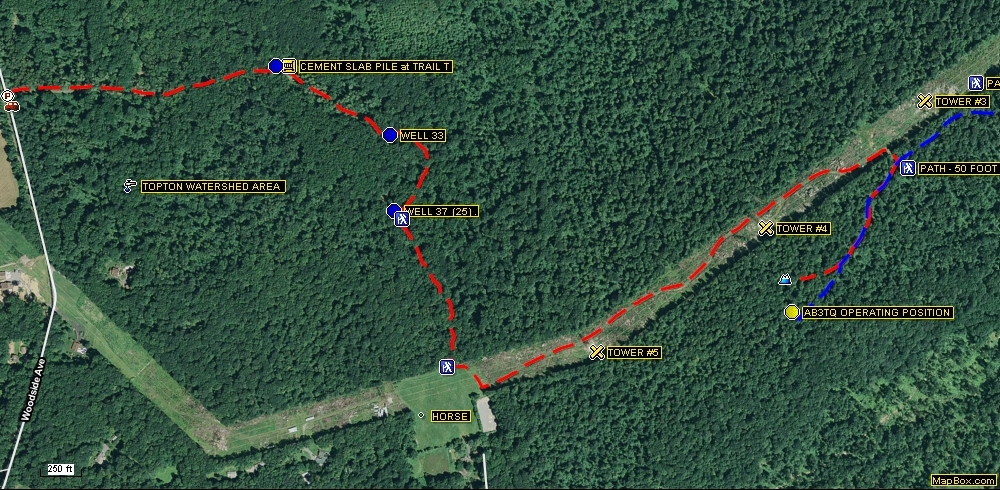
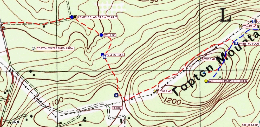
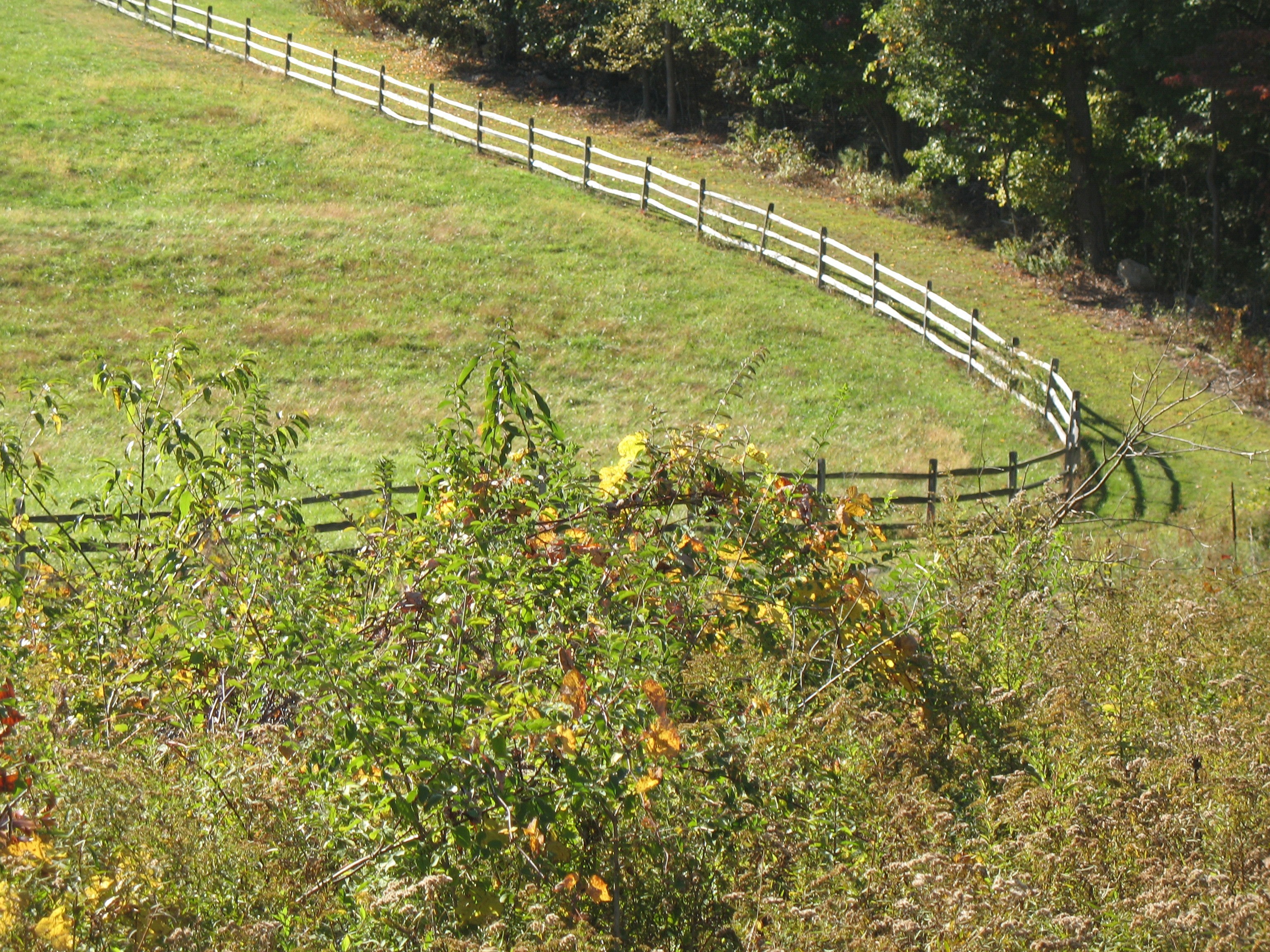
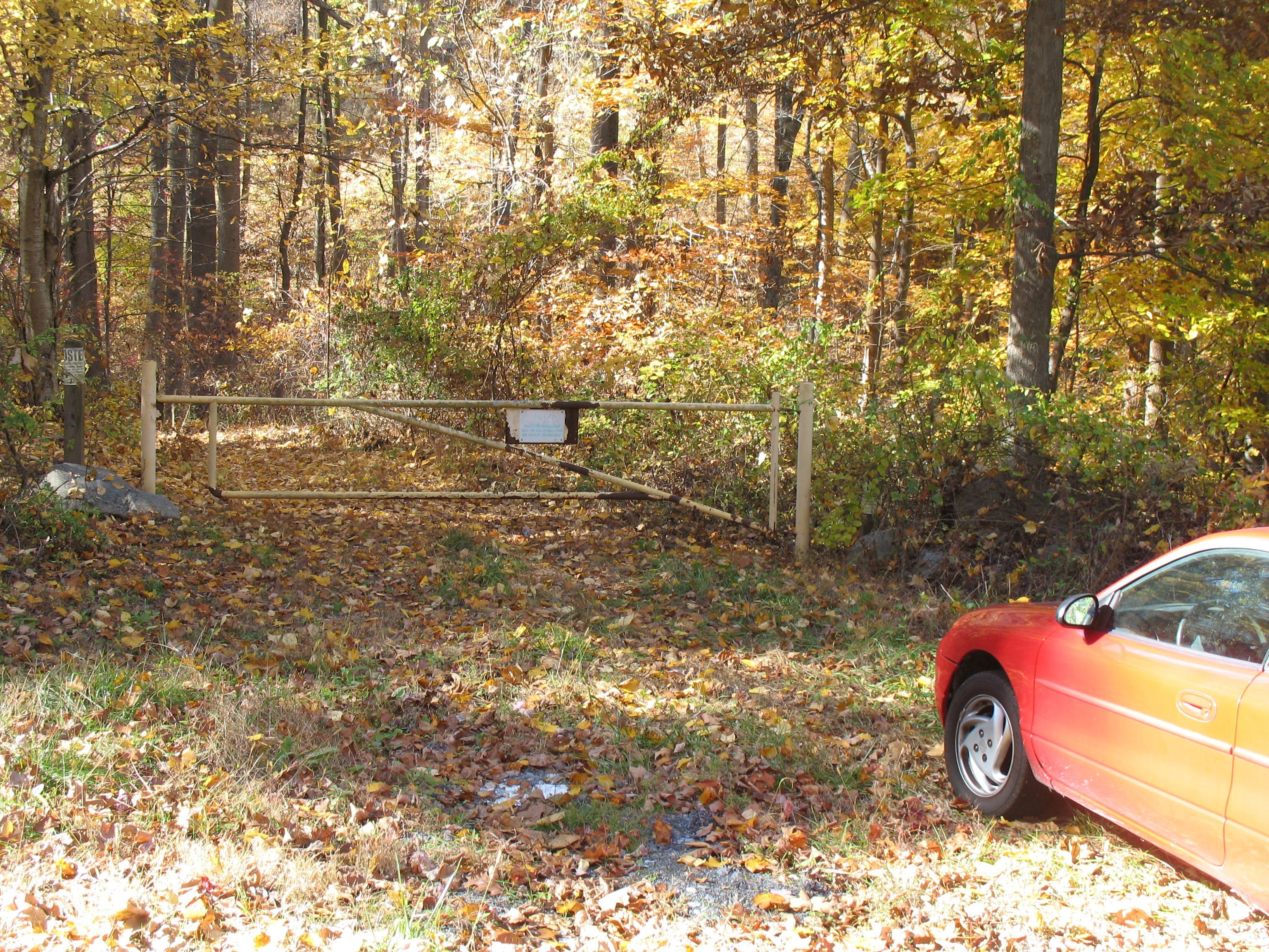
Heading East on West Weis Street, turn RIGHT on Henningsville Road, which changes to Woodside Avenue at the STOP sign. The best watershed parking area on Woodside Avenue is at coordinates 40.4805°, -75.7005°. From the trail gate, a fair at best hiker (me - not in any particular hurry and not slowed down by any gear), can be on the summit in an hour after a total hike of about 1.6 trail miles. The altitude gain will be about 350 feet.
I offer no guarantee that there is not a better way to the summit. I have explored other routes not mentioned here. I did get there, or got back down OK. But from my experience to date, these are my recommendations.
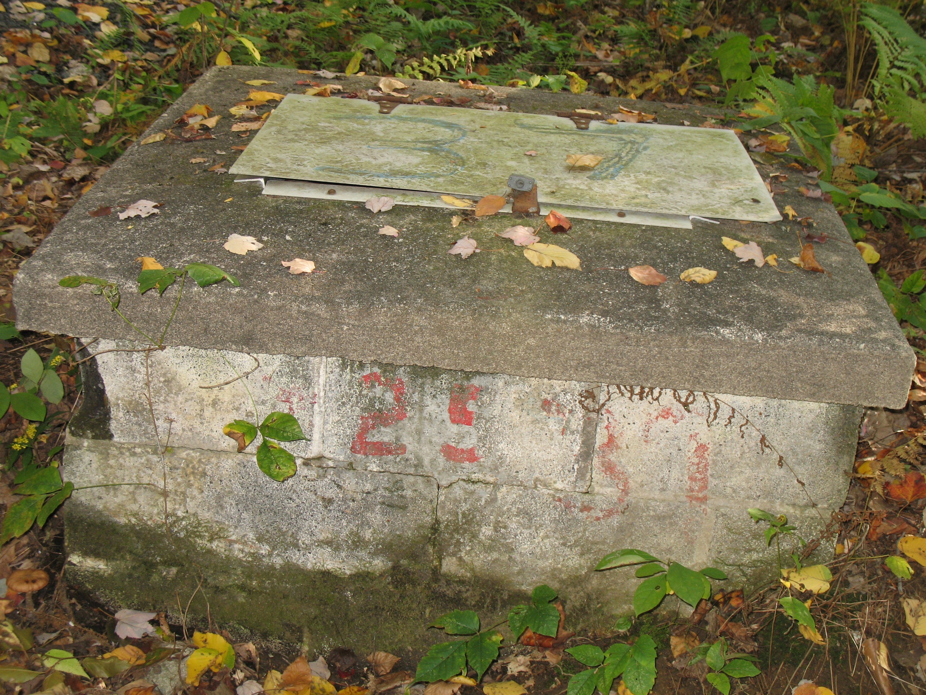
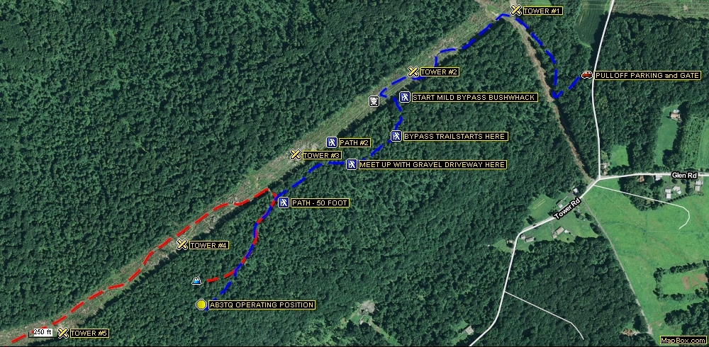
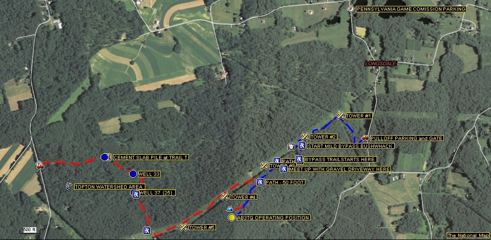
Beyond the trail gate, follow the vehicle width path EAST for nearly a THIRD of a mile to a “T”. About 60 feet before the “T” you will see Well House #VP on the left. A pile of waste concrete slabs are dumped right at the “T”. Take the path to the right, following it about .14 miles SOUTHEAST. There you can see Well House #33 on the right. Continue for another EIGHTH of a mile, averaging a SOUTHERLY direction by following the clockwise curve of the path.
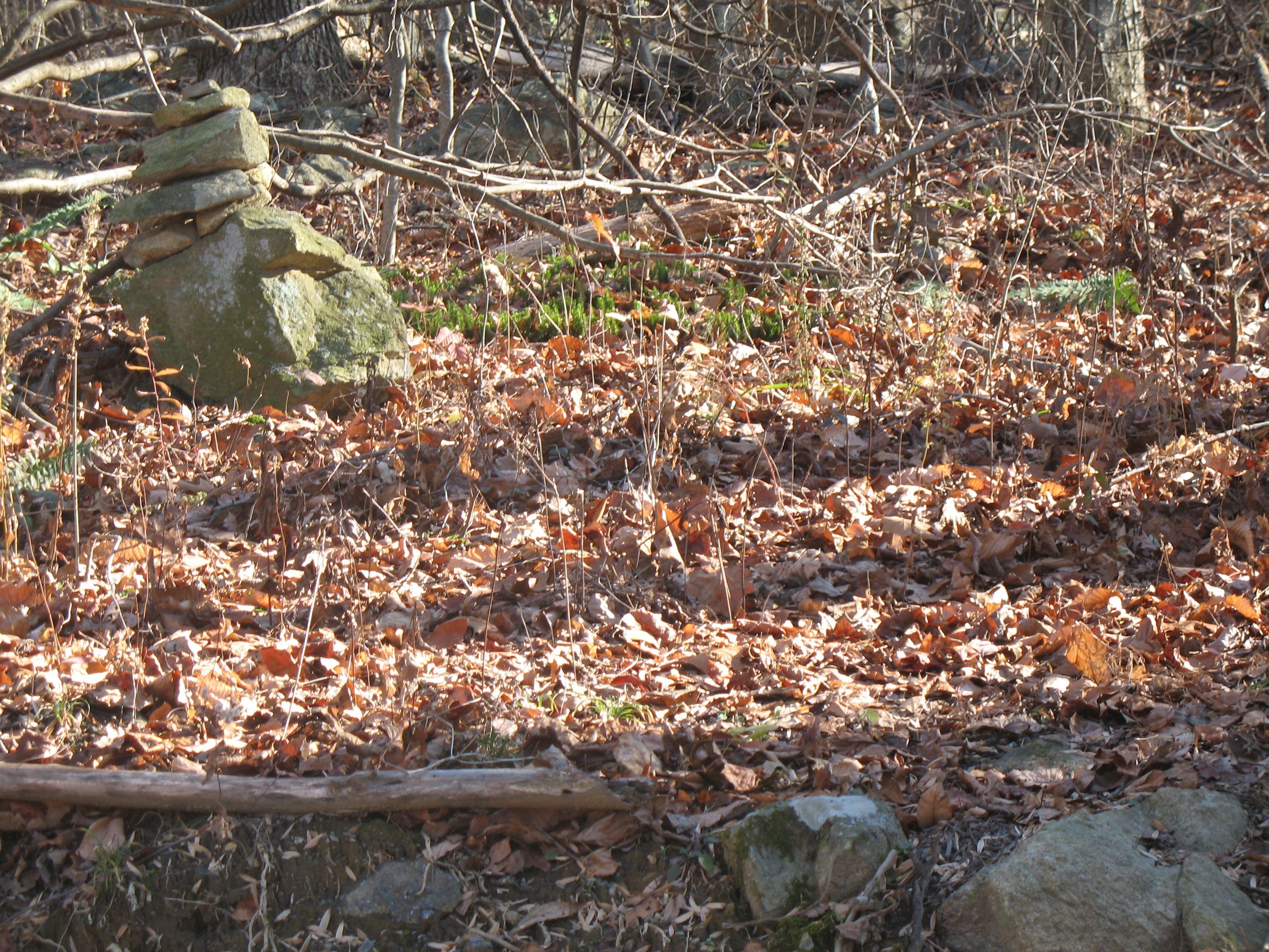
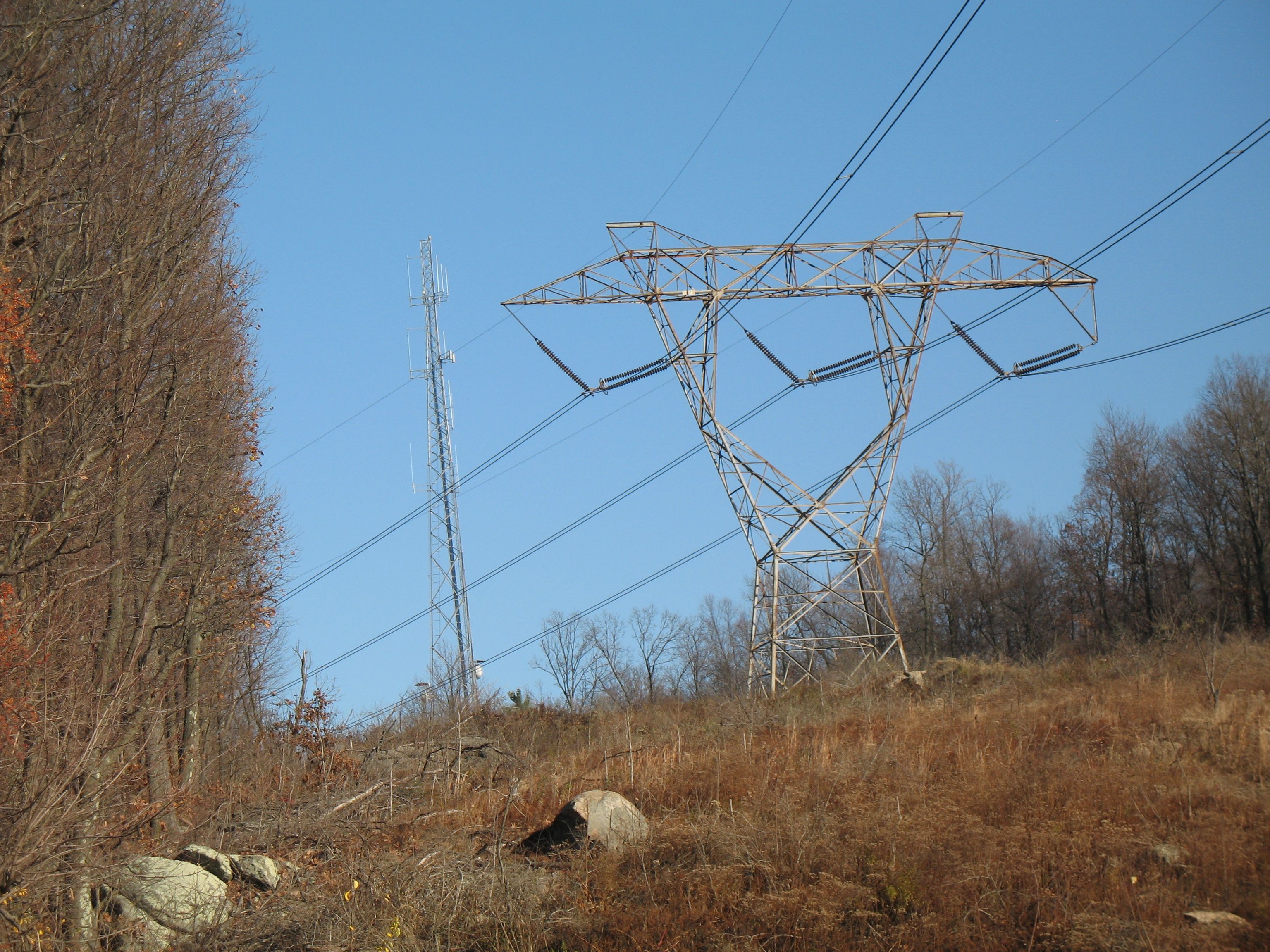
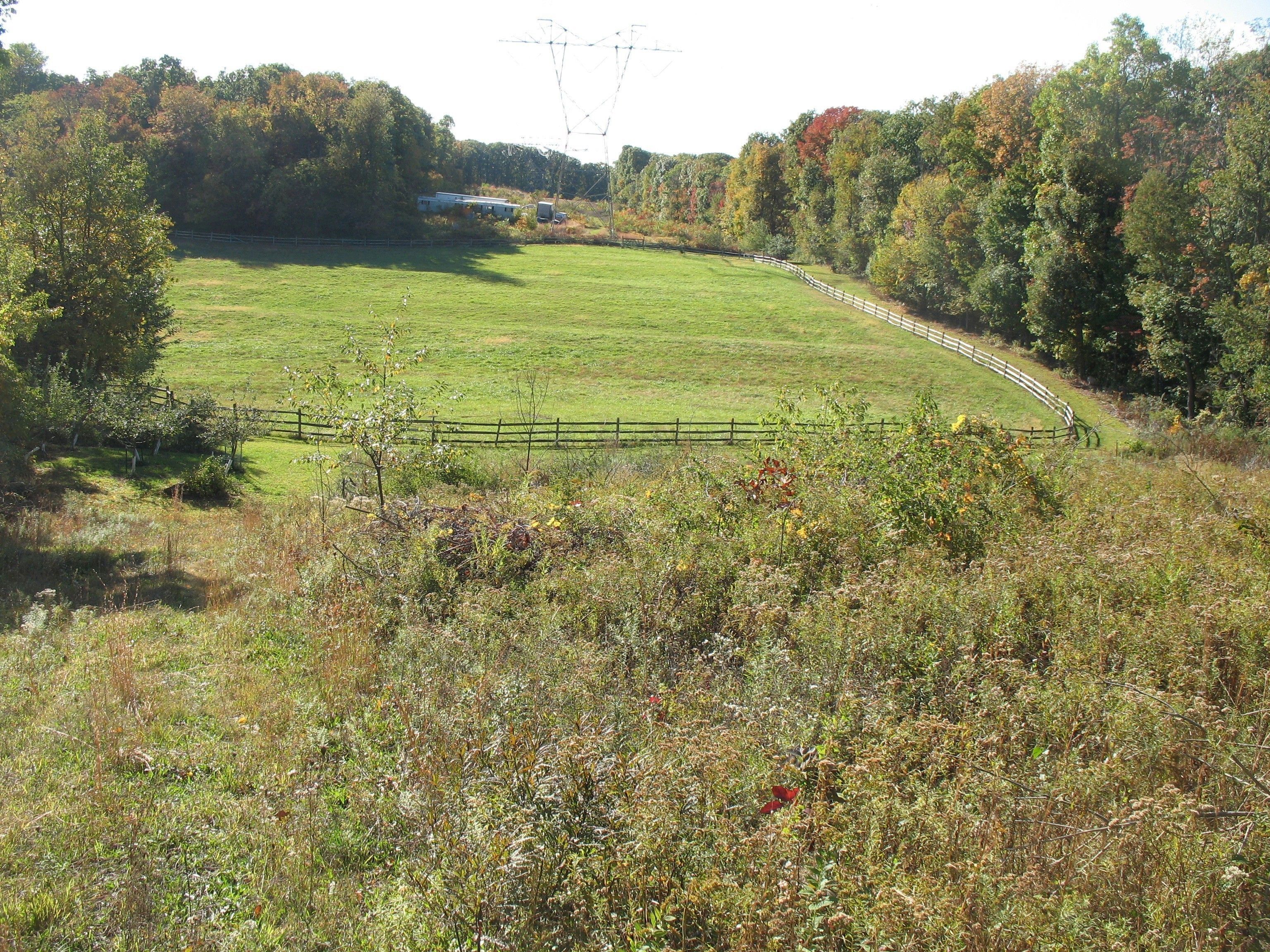
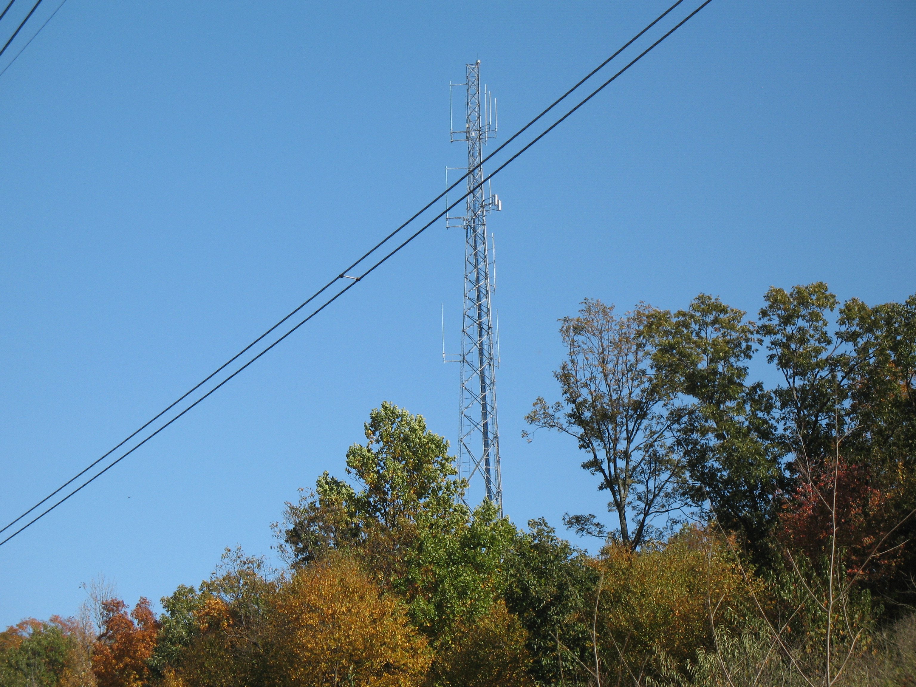
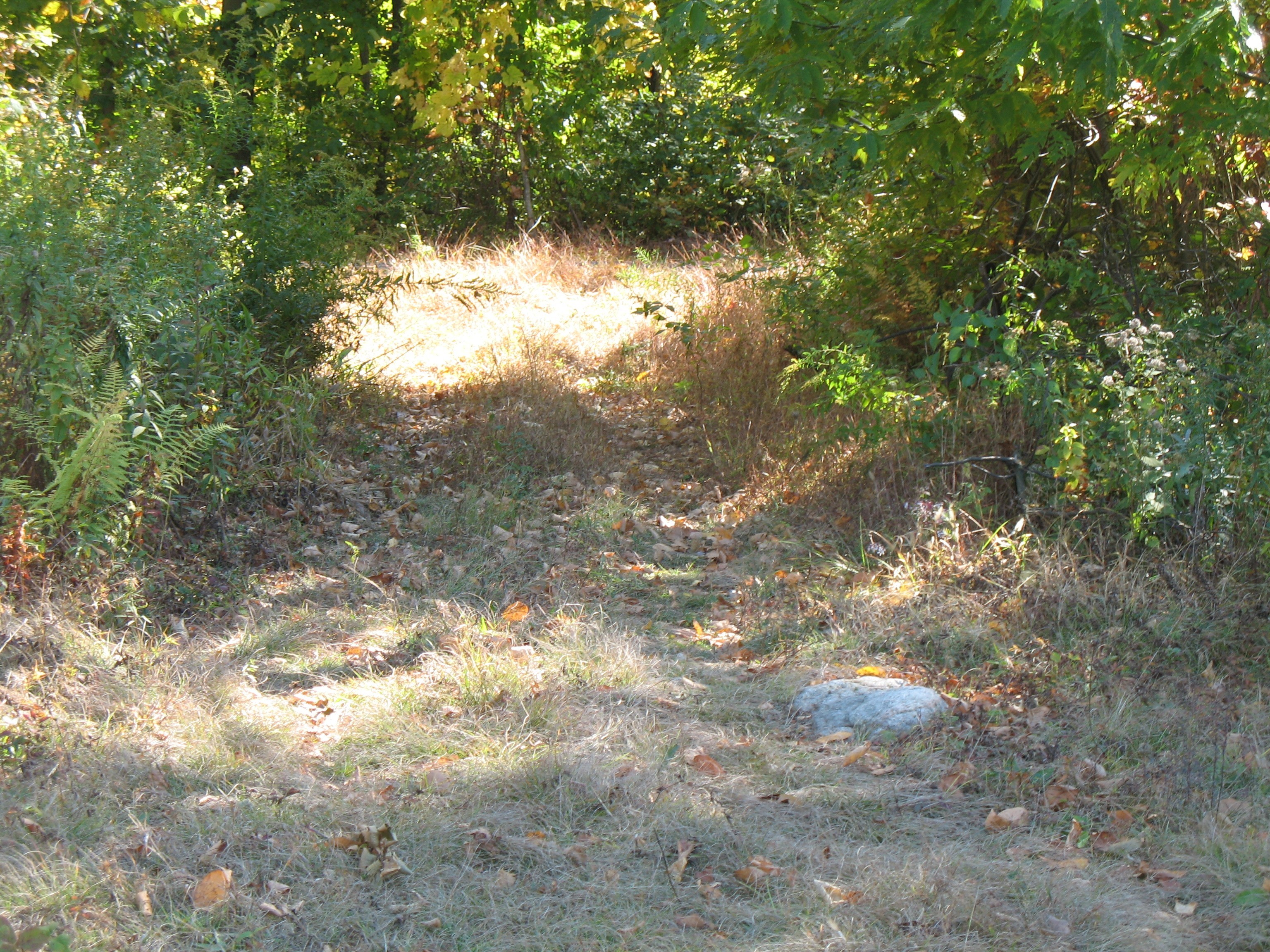
When you have reached Well House #37 (at one time #25??), you have also reached the end of the vehicle width path. Look up grade from there for a cairn on the left side of a pedestrian width trail. This trail provides a noticed altitude gain in a SOUTHERLY direction for about a FIFTH of a mile. You come off the trail at a Power Line Cut directly beside a sizeable fenced horse enclosure. High tension power line wires run through that area. I was greeted here by what seemed to be a very friendly white horse. Not being a horse person, I only spoke to it for a moment and moved on. At this point you can now see the radio antenna tower off in the distance, rising above the summit trees to the east.
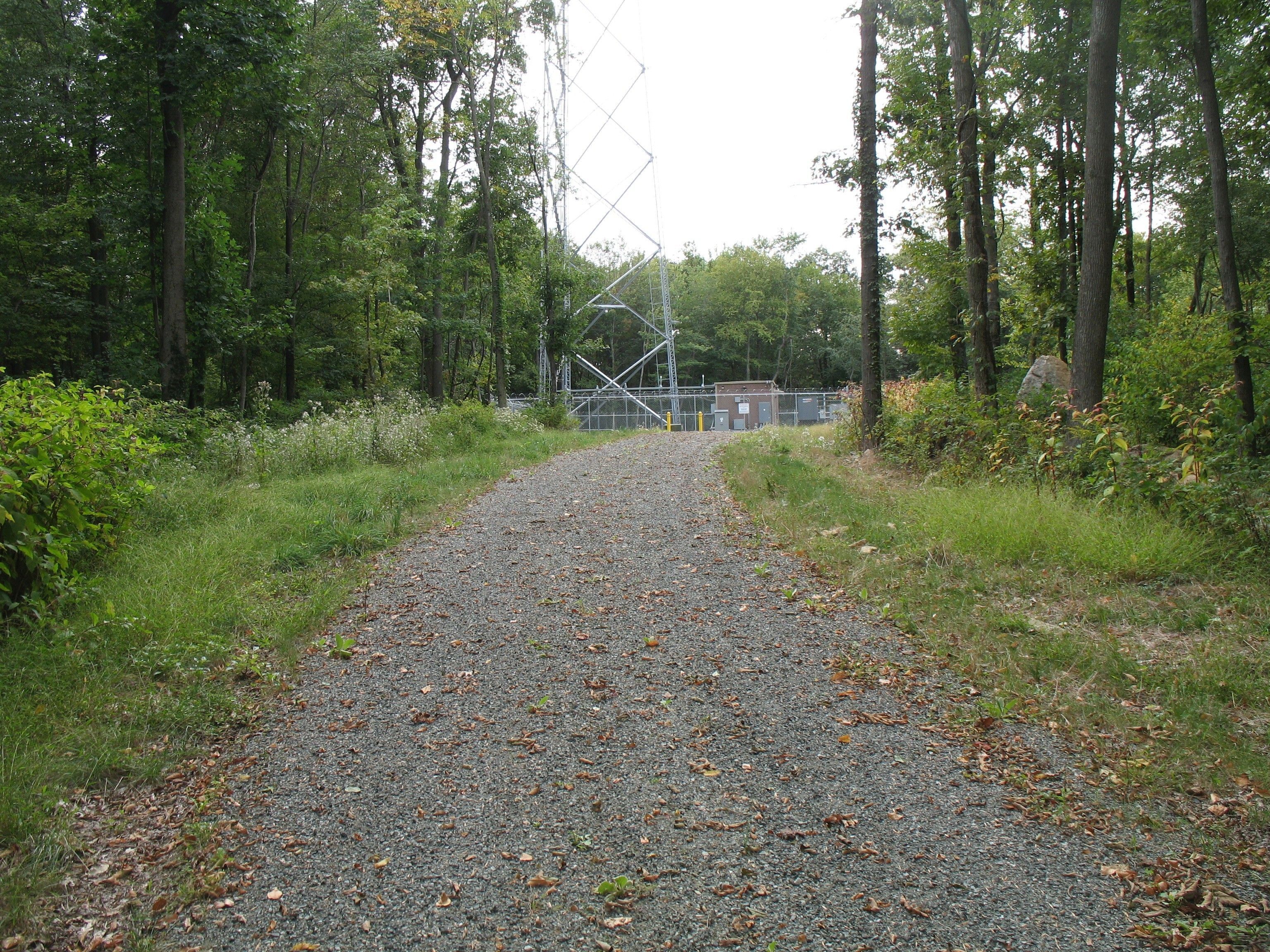
Turn left and follow the horse fence around to the tree line on the other side of the Power Line Cut. Pick up a path there to gain more altitude while heading NORTHEAST. When you have reached the High Tension Power Line Tower #5 at the higher plateau, you will have covered about 1 total mile of hiking path/trail. Continuing NORTHEAST you will see a 50 foot long side path on the southern (right) edge of the cut at about the 1.4 mile mark (coordinates there are roughly 40.4796°, -75.6817°). That 50 foot path connects to the previously mentioned gravel driveway for the final FIFTH of a mile SOUTHWEST ascent to the 1252 foot elevation summit. That trail connection is the easiest access point between the Cut and the Driveway for this approach direction. An earlier more direct bushwhacking option (straight up from Tower #4) then requires you go over or work around big rocks holding back the earthen edge of the summit site.
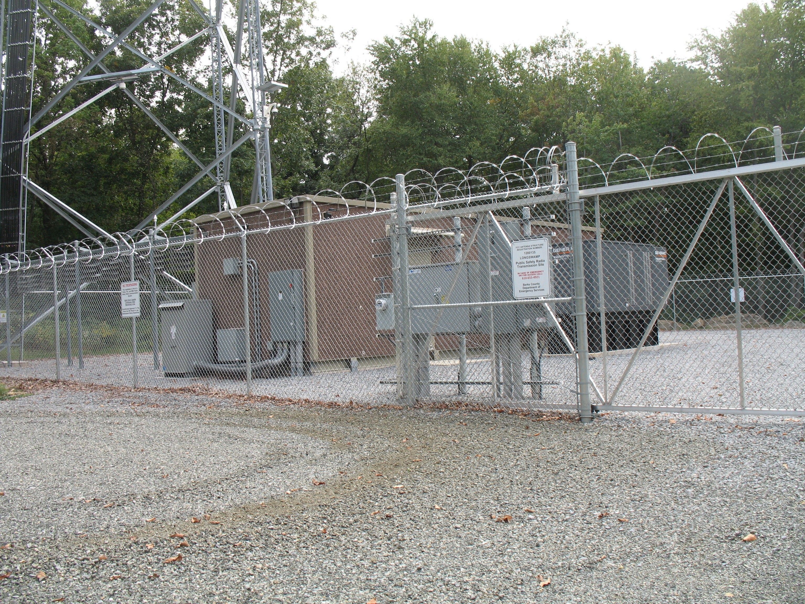
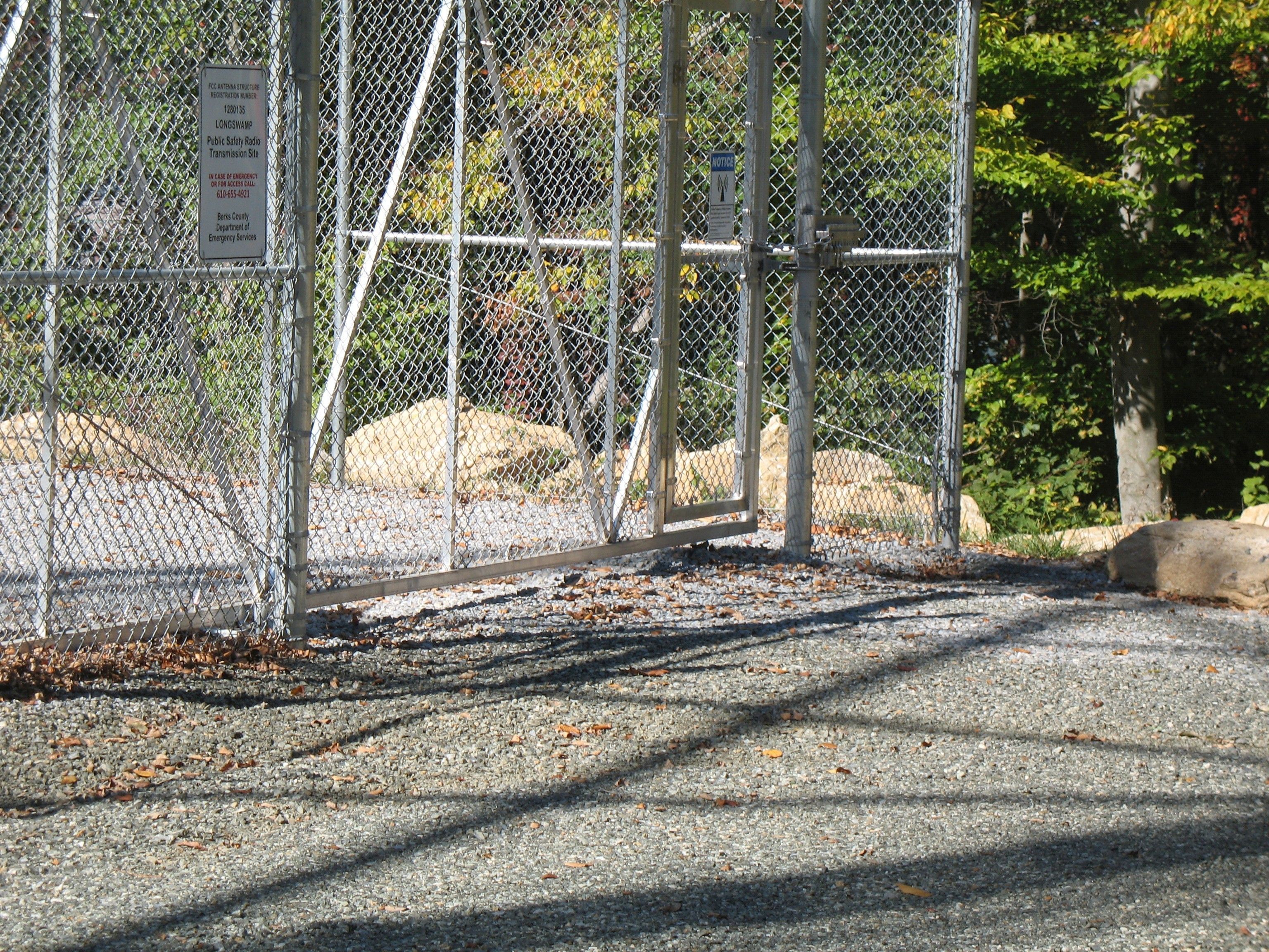
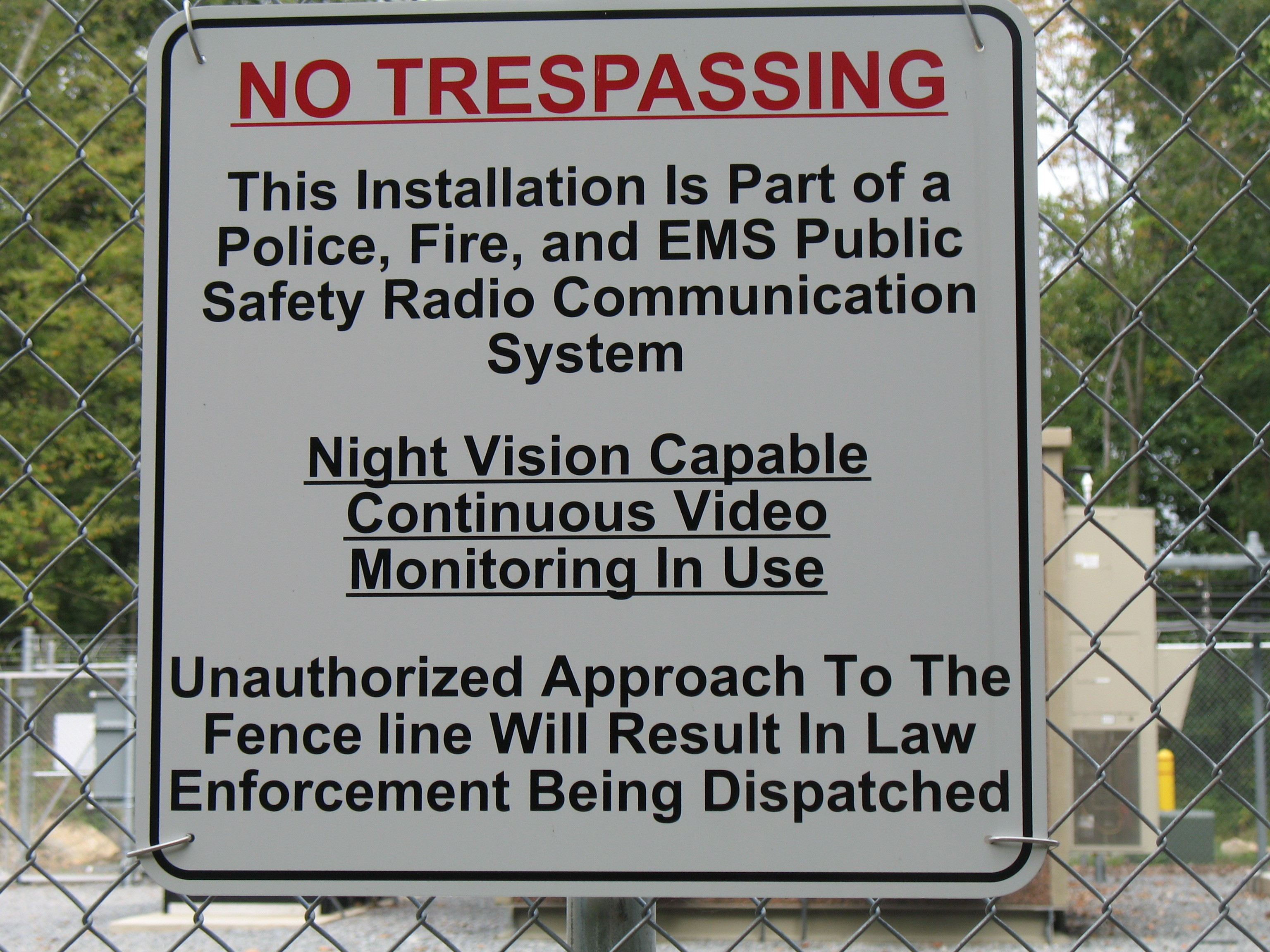
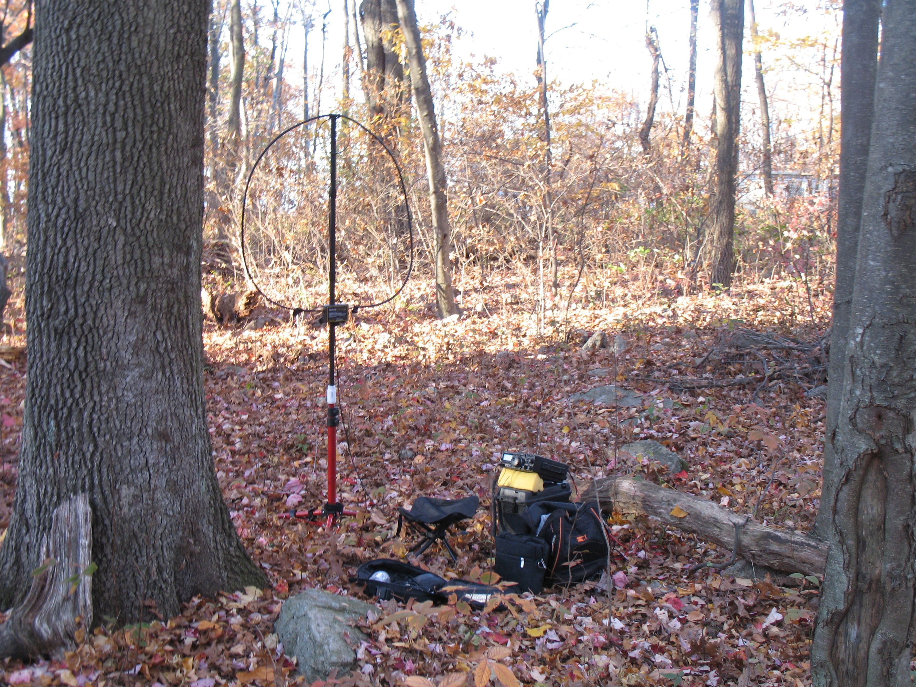
At the summit, you can easily avoid the radio site. That is advisable, since signs on the fence indicate they will dispatch law enforcement for unauthorized approach of the site fence. Seems a bit hash, but the first time I read that sign I was close enough to touch it. I took a photo of it then, and nothing happened. On another visit I sat on a rock 25 feet from the fence for an hour having a phone conversation. Nothing happened. So perhaps there is leeway to the warning, but my advice is to not push your luck. It is very easy to take a side trail by veering LEFT off of the gravel driveway BEFORE reaching the radio site. Look for the side trail about the same time the fence surrounding the radio site comes into view. This side trail passes south of the radio site, providing easy access to the area southwest of the summit. There is no shortage of available summit operating positions. I chose a small clearing with a good size tree trunk at my back to provide early afternoon shade at coordinates 40.4769°, -75.6837°.
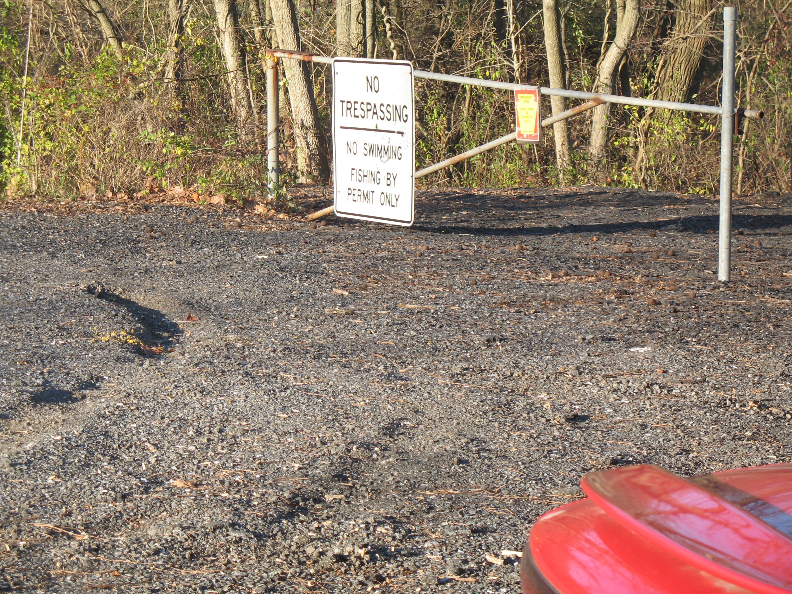
I was also curious about the possibility of an alternate approach from the opposite direction on the same Power Line Cut. There is more information to process for that route, and I did encounter the only ON TRAIL - No TRESPASSING sign known to me on the entire mountain (bypass directions for this lone questionable sign are included). As a route, this option is shorter and much steeper than the watershed trail. The total elevation gain to the summit this way is about 500 feet. It would mostly lack the woodland character of the watershed route if it were not for the detour required by that trail sign. To follow this alternate route, instead of stopping at the watershed gate/parking on Woodside Avenue, continuing driving on past it. Then make a LEFT on to Tower Road (the set back road sign for Tower Road is not visible until you are practically on it). Keep your eye on an Antenna Tower ahead with Microwave Feedhorns on it. Make the LEFT on Tower Road just before you would drive on past that Tower. And FYI – the other Antenna Tower you will now see to the left (UP HIGH ON THE MOUNTAIN) is at the destination Radio Site on the summit. Still on Tower Road, and 300 yards AFTER passing Glen Road (on the right), you will see a gate on the LEFT at a roadside grass pull-off area at coordinates 40.4823°, -75.6720°. In the short time I have taken an interest in this area, I have seen dumped items left here by idiots. I met a relative of one Power Cut property owner here (he was waiting to see me). He has been hunting and trapping this area for 40 years. When he determined I was harmless, and not messing with his traps, he was fine with me being there. I think he is the one that removed two full 5 gallon pails of discarded waste paint. I returned later with a truck to remove a dumped sofa-chair. I never realized how frustrating it could be to own simple roadside property.
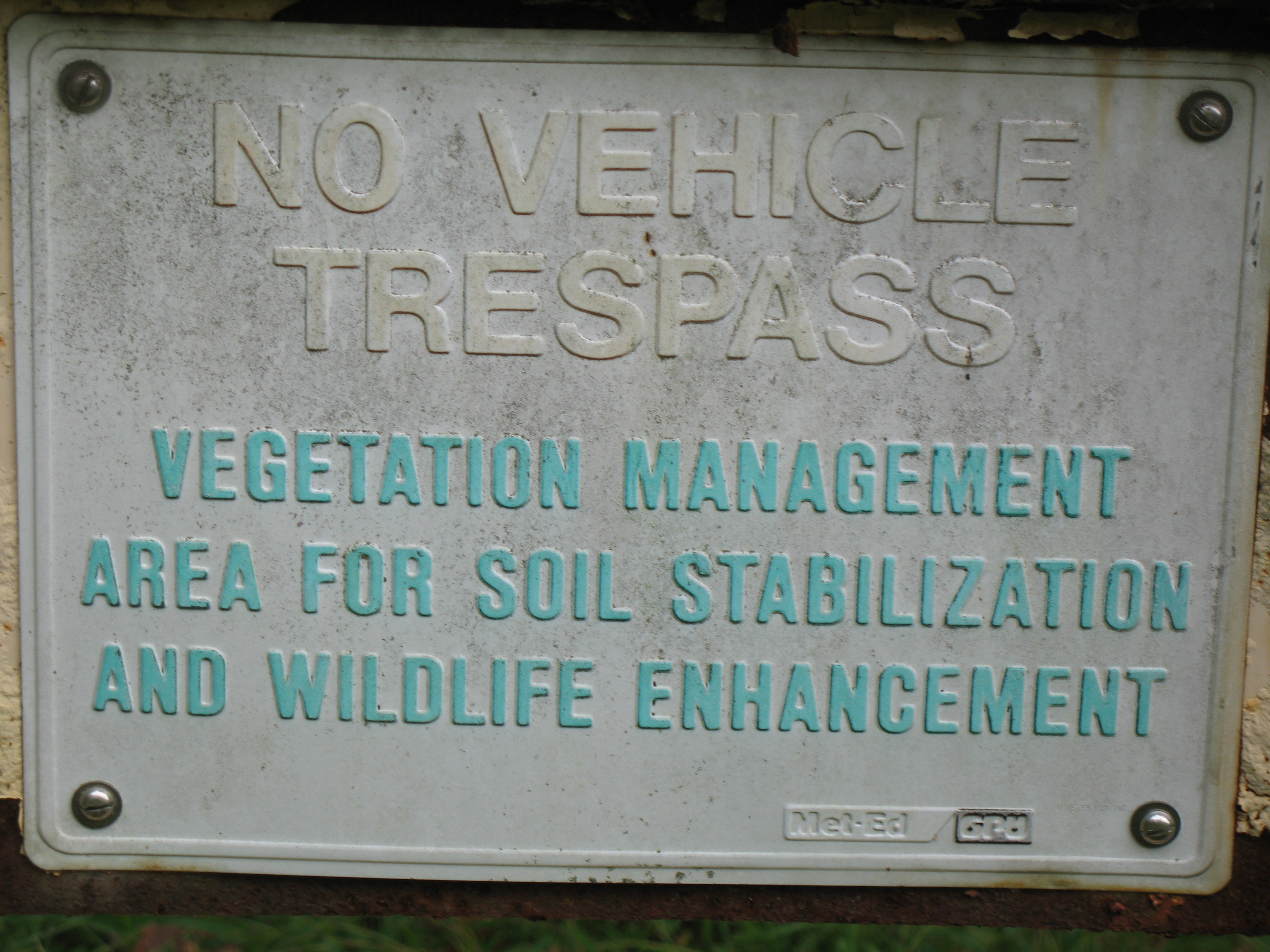
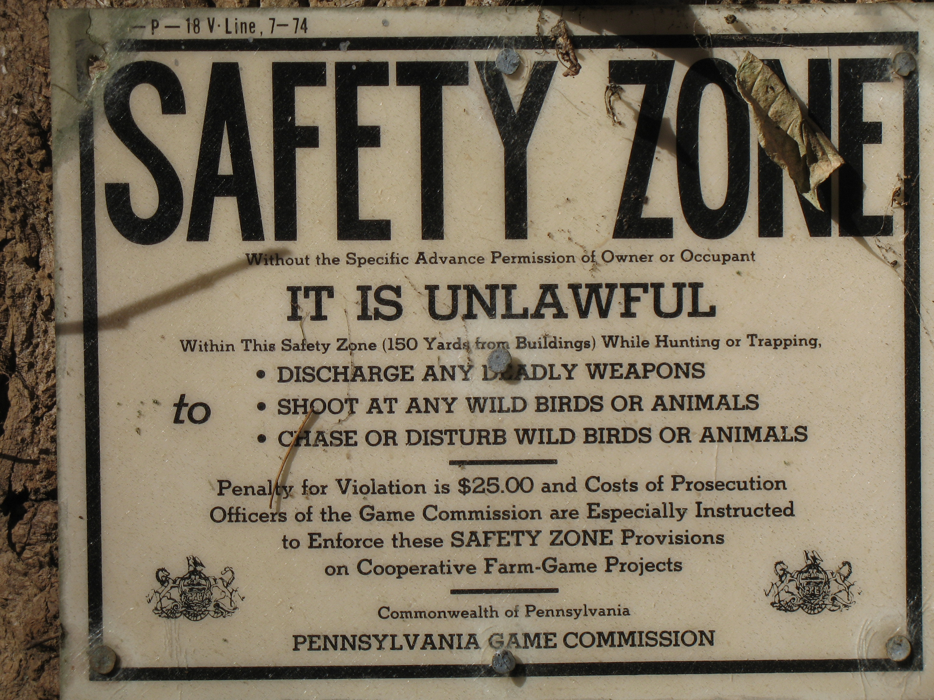
There are POSTED signs immediately adjacent to both sides of the gate, but there are no indicated parking prohibitions (as always, don’t block any gates). The gate has a curious sign that only prohibits VEHICULAR TRESPASS, citing Vegetation Management, Soil Stabilization, and Wildlife Enhancement. OK, but somebody has ridden around that Power Cut area with a quad ATV. No mention of hiking, and just 100 feet beyond the gate is a Safety Zone notice to hunters.
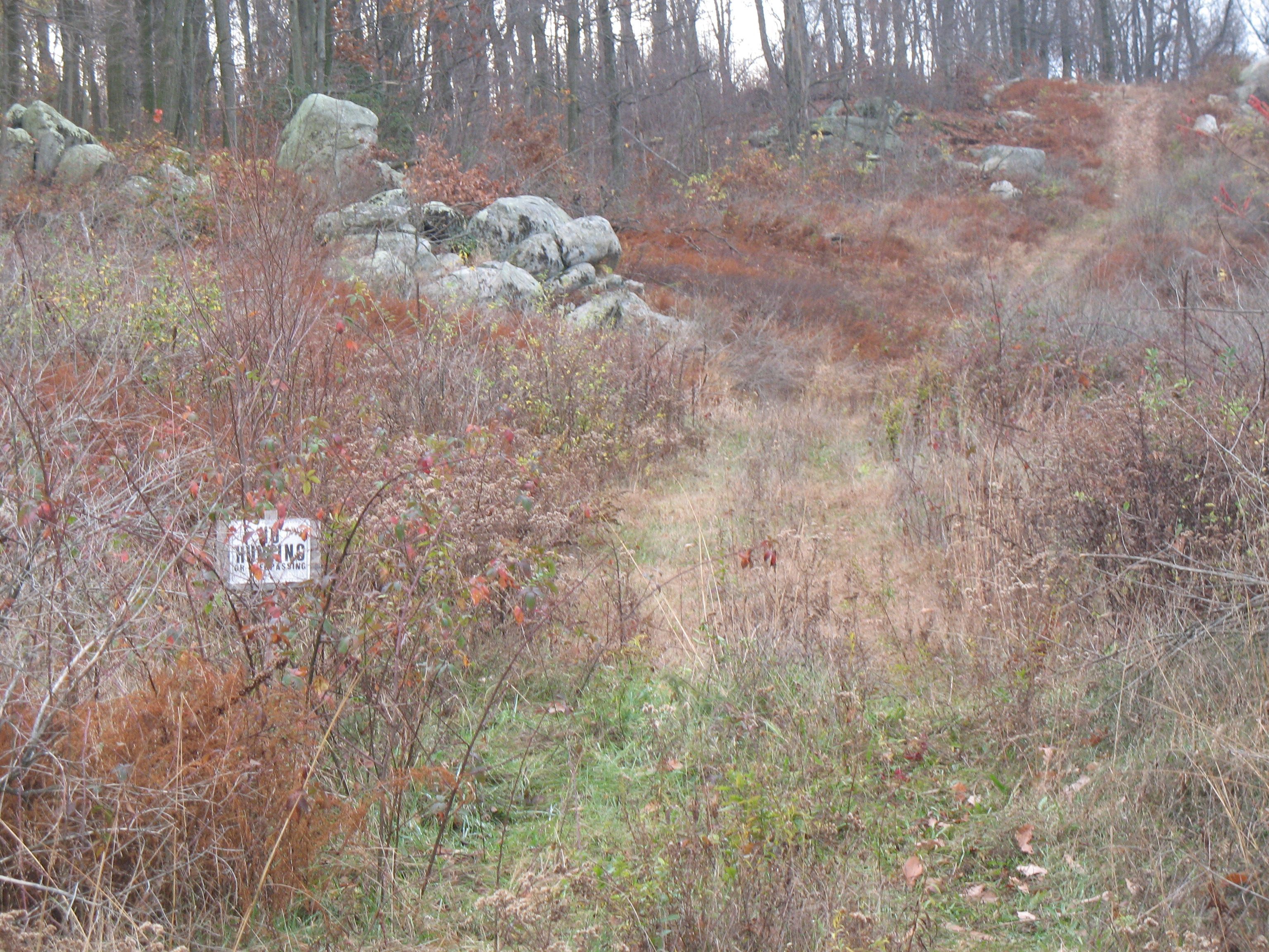
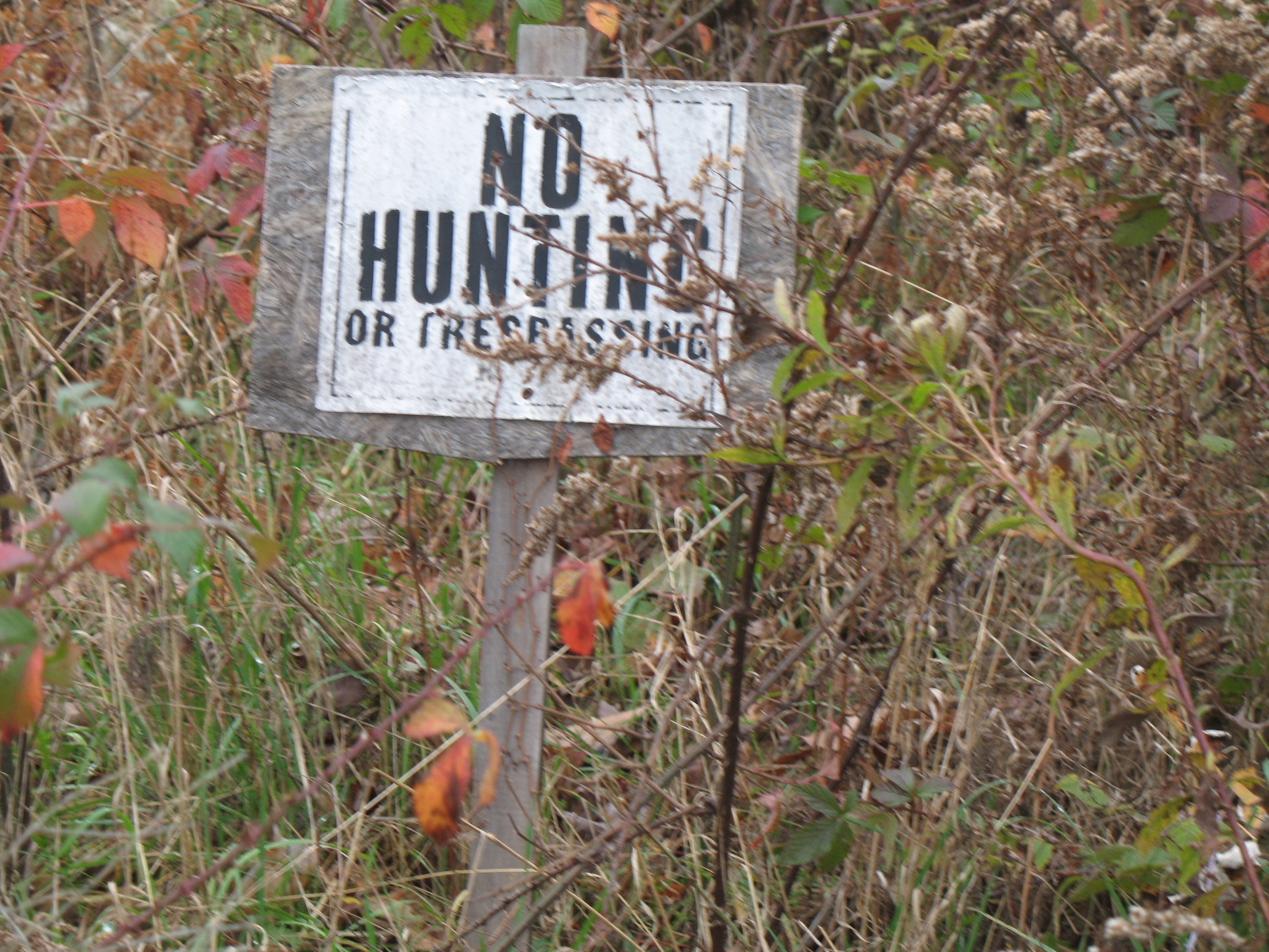
When you reach a lower power line cut, turn right. Take note of the steep grade on the left, and you will appreciate not going that direction. This lower power line cut then meets up at a 90 degree angle with the steep High Tension Power Line Cut that sort of leads directly to the summit. I call the Power Line Tower at the bottom of the cut Tower #1. Look up the cut from there, and only Tower #2 is visible for now. This is the steepest section, and follows the same run of High Tension Power Line Wire that passed over the sizeable fenced horse enclosure mentioned earlier. I didn’t see it there a month ago (was I blind?), but after passing Tower #2 (and before reaching Tower #3) an old, faded, not signed NO HUNTING – NO TRESPASSING sign is staked to the ground right on the path at coordinates 40.4817°, -75.6785° (indicated by a Skull and Crossbones in my included track views). Rats. I have no idea how legitimate this sign is, but I did find a woodland trail to bypass it. Perhaps that trail is not a coincidence.
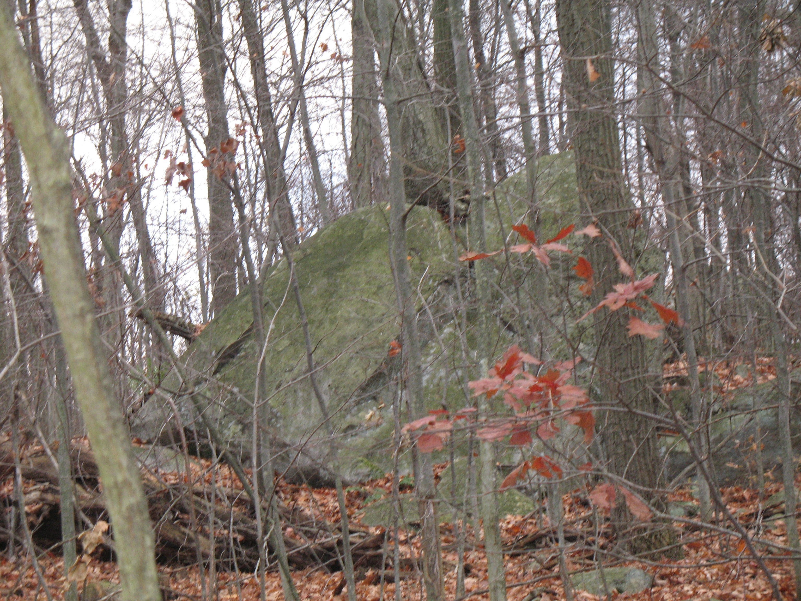
Back off about 75 feet from the NO TRESPASSING sign to an identifiably rocky trailhead of a faint trail at coordinates 40.4818°, -75.6683° (300 plus feet past Tower #2). The trail angles off a bit to the left, reaching over to the southern tree line. When you can see past the tree line, look for a sizable (8 foot high?) boulder with a tree growing out of its center. Work your way into the woods to circle around the left side of that boulder. Follow the easiest terrain behind it that angles up toward the summit. Roughly at coordinates 40.4808°, -75.6779° it becomes an actual trail to take you over to the nearby gravel driveway. It comes out to the same spot that a much easier connecting path would have brought you, had the NO TRESPASSING sign not made the detour necessary.
Follow the gravel driveway to the summit. You can look over to the Power Line Cut on the right, seeing clearly when you pass beyond Tower #3. Soon after, also on the right, you will see the 50 foot connecting trail recommended for the watershed approach. At this point you are looking at that same final FIFTH of a mile SOUTHWEST ascent to the 1252 foot elevation summit. Take the same side trail on the left side of the gravel driveway to circumvent the radio site.
Should you need additional parking space, there is a Pennsylvania Game Commission parking area roughly SIX TENTHS of a mile farther past the Tower Road gate/pull-off area. The PGC lot coordinates are 40.4909°, -75.6733°. If you do have an interest in the PGC lot, at this point you would have actually circled far enough around Topton Mountain to get close to SR1010 again (East Weis Street by now). The turnoffs from East Weis Street would be either South Park Avenue (then turning RIGHT onto Tower) or on to Tower Road directly. You do lose the road name “Tower Road” at a stop sign, but a right and then left turn combination from there will take you directly to the PGC parking area beside the Little Lehigh Creek.
I have included (perhaps too many) photos to illustrate this article; in the order the areas were described. There are also extracted aerial views and topo maps with most of the points of interest marked and labeled. How many SOTA participants use a coordinate navigation device when activating a summit? I feel lost without one. Coordinate navigation ability will allow you to take the greatest advantage of the waypoint coordinate information presented here.
AB3TQ and my Topton SOTA partners K3JH and KA3RCS