I love reading about SOTA activations in other countries. Weather, flora, geography, etc are endlessly fascinating to me. I thought a few of you might be interested in reading about an activation in remote western Nevada, where the terrain may be quite different from what many of you are used to.
Lorene (W6LOR) and I set our sights on Emigrant Peak W7N/EM-114, an unactivated desert peak in Nevada. The peak is about 40 miles west of the nearest town - unincorporated Tonopah, NV. The ‘EM’ in the peak designation is from Esmeralda and Mineral counties. Emigrant peak is in Esmeralda County, which with a population of less than 800, is the least populated in Nevada and one of the least populated counties in the lower 48 states of the US.
The combination of remote location and unknown road conditions lent an air of uncertainty to our trip. Although we searched for online hiker trip reports and satellite imagery, there is only so much that one can learn without being there. We went out driving on a Saturday morning with good weather. The temperature at the summit was predicted to be in the 50s (deg F) with sun and calm wind - perfect for a desert trip. As we drove east on a paved highway, a sign reminded us of the wild horses that roam some of the higher elevations and manage to eke out a living here.

As we continued, we could see the hills that contained the day’s objective come into view.

The crux of the trip would be how close we would be able to drive to the base of the hills. Although a dirt road was shown on our topo maps, there was no guarantee that the road still existed or hadn’t become impassable due to erosion. As it turned out, we were able to leave the paved road near an old ghost town and drive to the base of the hills along a sandy dirt road without incident. We had seen an occasional car or truck on the paved road, but after the turnoff, we would not see anyone for the rest of the day until we returned again to the pavement.
We parked the car when the road worsened noticeably and started off for the summit. It was now late morning, and the skies were clear.

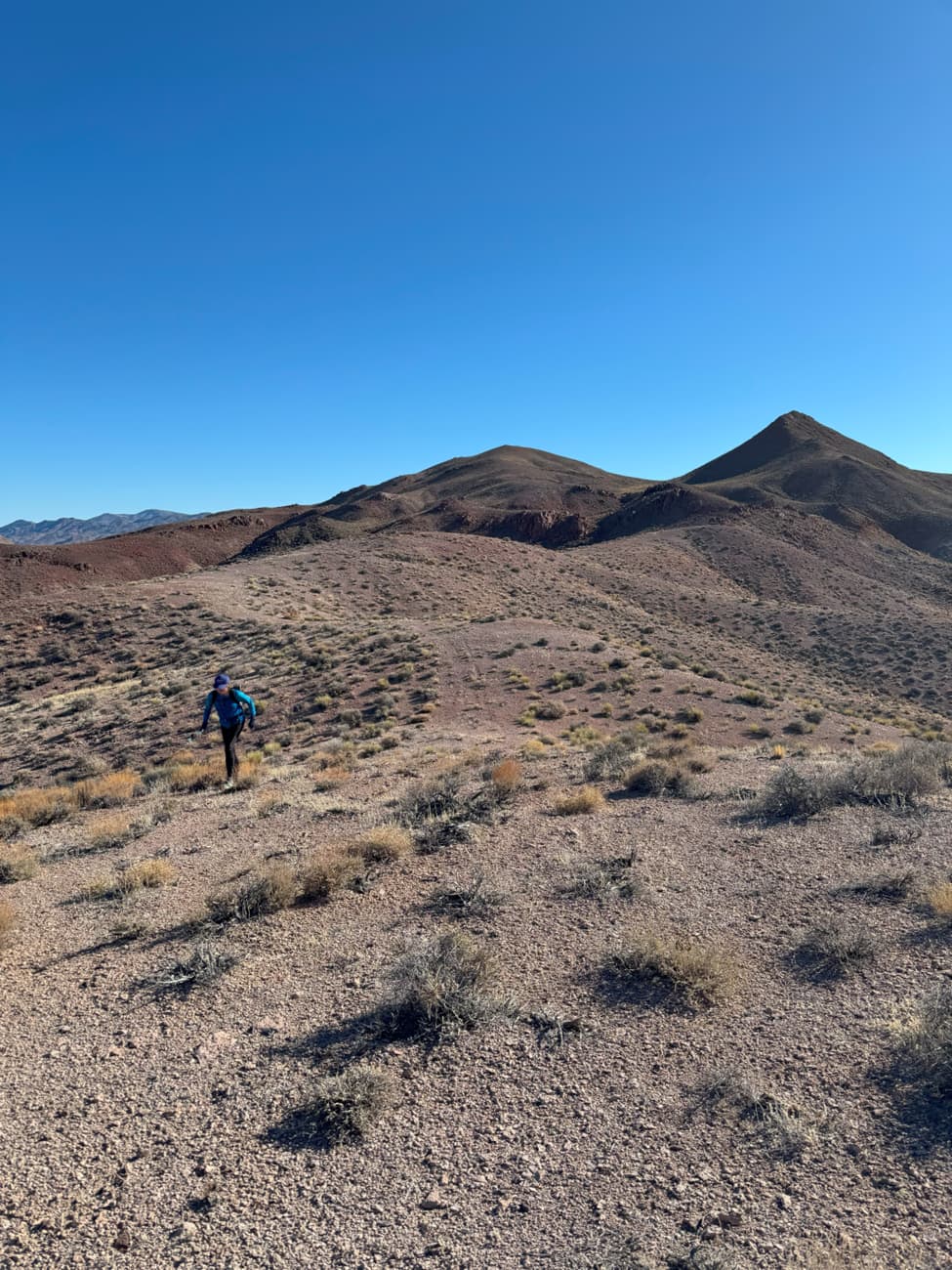
The peak was not in view at this point. We weren’t sure how difficult the going would be, but we soon picked up the remnants of an old mining road. Vehicle access was blocked by rockfall, but the disused road made for easier foot travel. Looking back to the east, the views were expansive, and if you look closely, you can spot our car where we left it.

We attempted to move quickly with a combination of power hiking and easy jogging. In some places this worked well, and in others the surface was covered with too much rubble to move quickly. The mining road led through a break in a cliff band, which was helpful.

After ascending for a while, we came to a small saddle that had a nice view to the north. The prominent white area is the Columbus Marsh, a salt flat that was a site for borax mining in the late 1800s.

Ground cover was sparse with a few grass clumps, a few shrubs, and occasional cholla cactus.


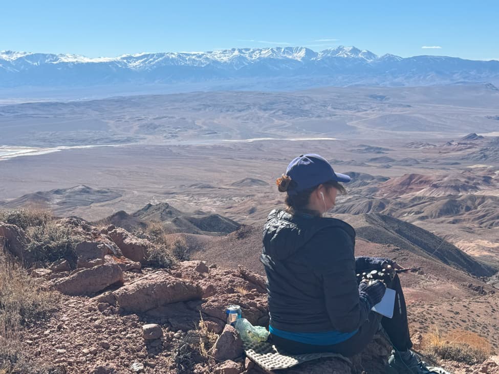
As we ascended further, we got our first view of the snowy White Mountains to the west, a range on the border between California and Nevada.

The summit objective soon came into view as well.

We took the north summit ridge, as this appeared to be the easiest route. There was some scrambling, which was generally easy but with a bit of loose rock.


We reached the summit and found a survey mark from 1950, but could not find a summit register.

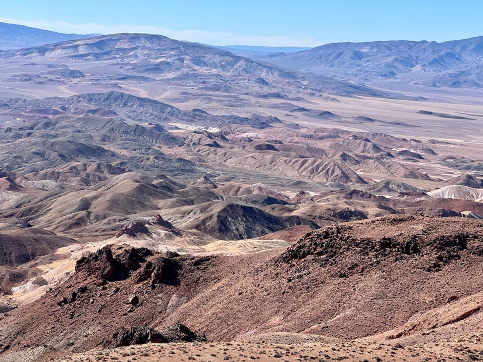
The views of jumbled topography with many desert hues extended in every direction.
We arrived on the summit at 1:29pm - one minute to spare for our alert! We set up with a KX2 and a 41’ EFRW antenna, arranged as an inverted vee. While Lorene had a well-earned lunch, I worked 15 stations or so on 20m cw, with the farthest being Christian F4WBN. After a nice run on 20, it was Lorene’s turn to operate and my time to have lunch. Lorene worked a few stations on 40m and 30m cw, but conditions on these lower bands were either not so good or else the chasers were also off having lunch. Activity picked up for her on 15m cw with a good number of stations, including several from Japan. She had a nice summit-to-summit contact with 7M4QZE, a distance of over 5000 miles.
After an hour or so on the summit, it was time to head back. We made good progress on the return.
We reached the car around 4pm, and rested and enjoyed the views for a bit before beginning our drive back.

It was a wonderful outing - a successful summit activation of a scenic, remote desert peak and a safe return to a functioning vehicle. On our drive back out to reach pavement, we were treated to a broad view of Lone Mountain.

Lone Mountain (W7N/EM-025 ), elevation 9108’, is another remote unactivated desert peak, with a few additional nearby prominent sub-peaks. It’s just begging for someone to plan a trip out there!
Thanks for reading and hope to hear you on the air.
73,
Mike K6STR
