EI/IS Activations Dingle Peninsula 12/09 – 19/09 2020
I spent a very enjoyable week 12th - 19th September activating summits in the Dingle peninsula in County Kerry. It was great to get away from the home office confinement for a few days. This is probably my favourite part of Ireland for SOTA. There is a good selection of summits which allow you to get out whatever the weather throws at you. Access is pretty good with no parking issues. Now that the schools have re-opened and there are few tourists around this year, there were few people on the hills. I activated 12 summits during the week, mainly hf cw (20m/30m/40m) using my kx2 and trapped efhw. FT-817nd and SW-3B back up. Thanks to all the chasers who took the time to help me fill the log.
Saturday, 12th September: An Scraig (Ballysitteragh) EI/IS-040 – 8 points
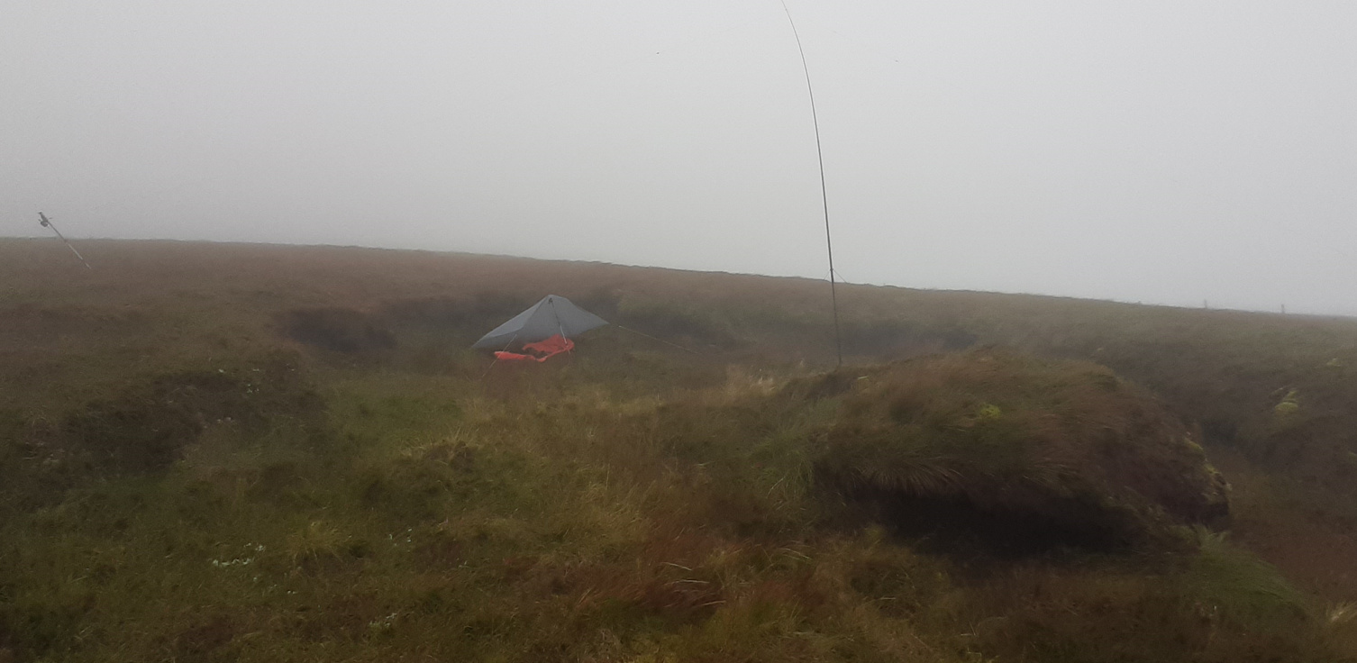
I activated this one on arrival in County Kerry. Trailhead is at the Connor pass on the old road to Dingle. The Connor pass provides a handy 400m leg up. Ballysitteragh is west of the trailhead. It was blowing a southerly gale and very misty. The wind direction was a problem because the leeward north side of the summit plunges directly into a corrie so it was difficult to find any shelter. I hunkered down in an old peat hag and set up the mini tarp shelter I have been using recently. This has saved quite a few activations lately – it doesn’t offer much comfort but at least it keeps the rain off the kx2. Conditions on the bands were only fair (as they were for the week). I made 21 qso’s on 20m and 30m, including 2 s2s.
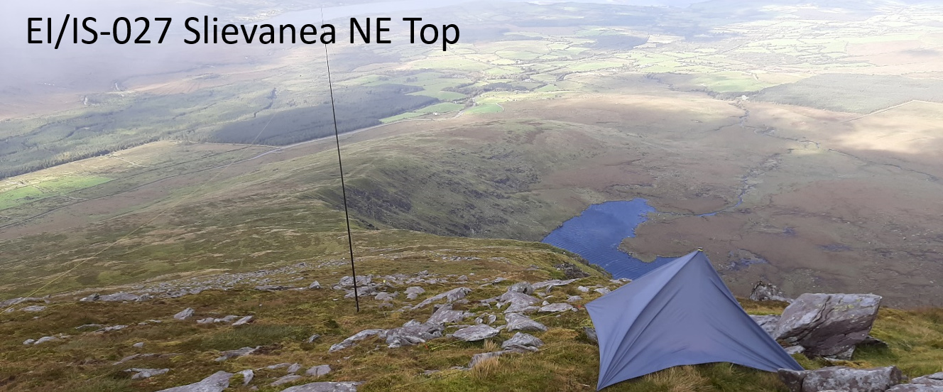
Sunday, 13th September: Slievanea NE Top EI/IS-027 – 8 points
It was still blowing a gale on Sunday, now a more conventional south-westerly. There was a slight drop in the wind later in the afternoon, so I activated Slievanea NE Top, east from the Connor Pass car park. I set up on the steep northern slopes to get a little shelter. Few takers for this one. Best qso was K4DY on 20m.
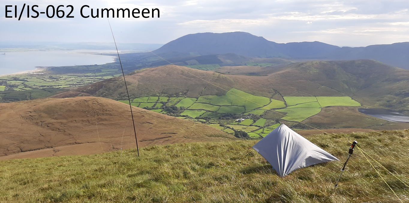
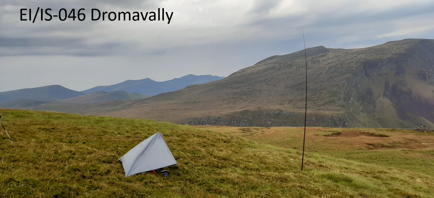
Monday, 14th September: Cummeen EI/IS-062 – 4 points and Dromavally Mtn EI/IS-046 – 6 points
Monday arrived sunny and relatively calm with just a slight risk of light rain showers. This hike took me from Glenteenassig Forest Park access road, first over Cummeen and then across the high bog to Dromavally and down the steep slope into the far end of the Forest Park. There is a farm track which provides an easier route down, but I have previously met the farmer and I found him not very accommodating. Cummeen has a relatively flat grassy summit which was a surprise after the steep climb. I set up with great views northwards over the bay. I made 18 qso’s on this one.
The hike from Cummeen to Dromavally is across very soft ground. A particularly wet summer doesn’t help. For this trip, I have finally been able to use my Scarpa SL boots which have been hell to break-in. My old Salomon boots would have been completely overwhelmed on this ground. I had to hurry to get the antenna and shelter set-up on the summit of Dromavally before approaching rain and the activation took place during a heavy shower. 16 qso’s. The descent to the Forest Park was easy until I reached the valley floor and I realised that I had to pass through about 100m of re-planted forest clearfell to get to the road. Gorse had also grown chest high between the trees making it a very prickly experience.
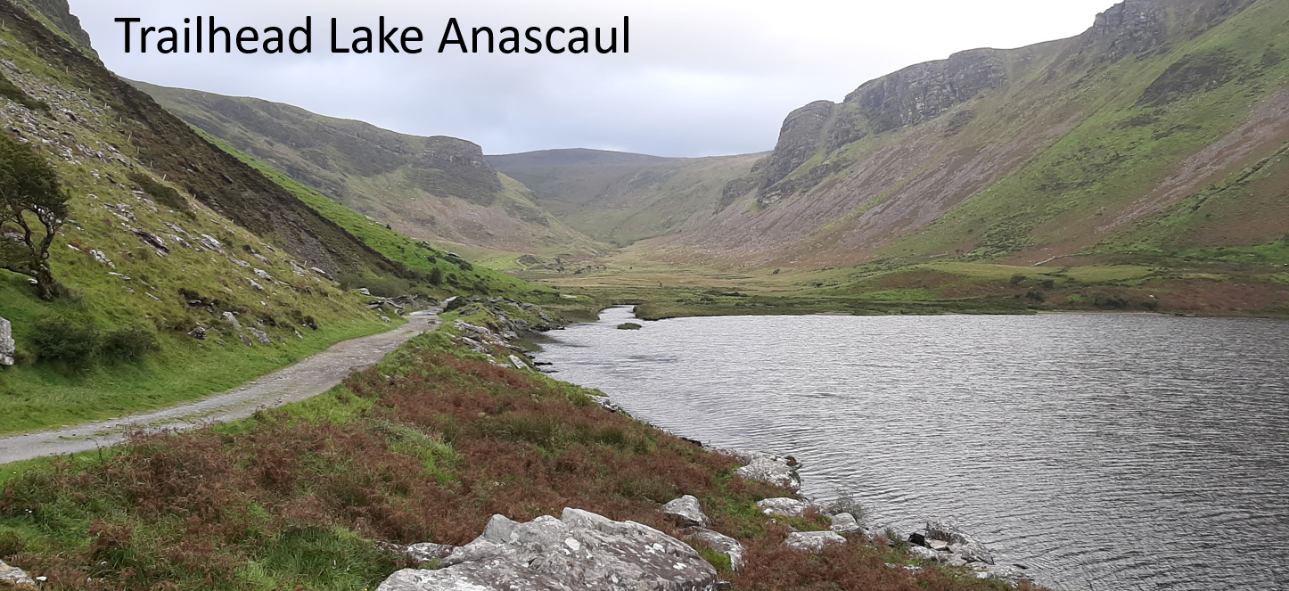
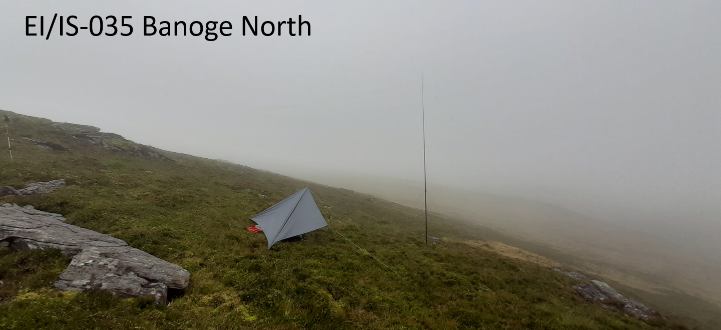
Tuesday, 15th September: Banoge North EI/IS-035 – 8 points and Beenoskee EI/IS-009 – 10 points
Starting from Lake Anascaul car park, the plan was to travel up the top of the valley in the photo below, first turn left and activate Banoge North, then return and continue up to the right to Beenoskee, before returning via the valley – round trip about 18km. I was a surprised that my handheld GPS (64s) was unable to find a satellite signal at the start of the hike. I had my old-school navigation aids, but it makes for more relaxed hike when you can just follow your planned route without thinking too much about it. The GPS did eventually get its act together after about an hour or so.
Banoge North is probably the most remote summit in the area. I have previously activated it from the Connor Pass which was a longer route but over much better ground. This route was over very rough, tussocky ground with lots of streams to cross. Mild and misty and misty at the summit. Plenty of midge about. Another 23 qso’s on this one.
It was 1600z by the time I finally got to the summit of Beenoskee and the mist had really come down thick and starting to rain. I still had about 2 hours to hike back to the car, so this was going to be a quick one. I made 15 qso’s during another heavy rain shower. Then I packed up quickly and started down the hill. In my haste I forgot to take any photos of this one. Back at the car at 1845z.
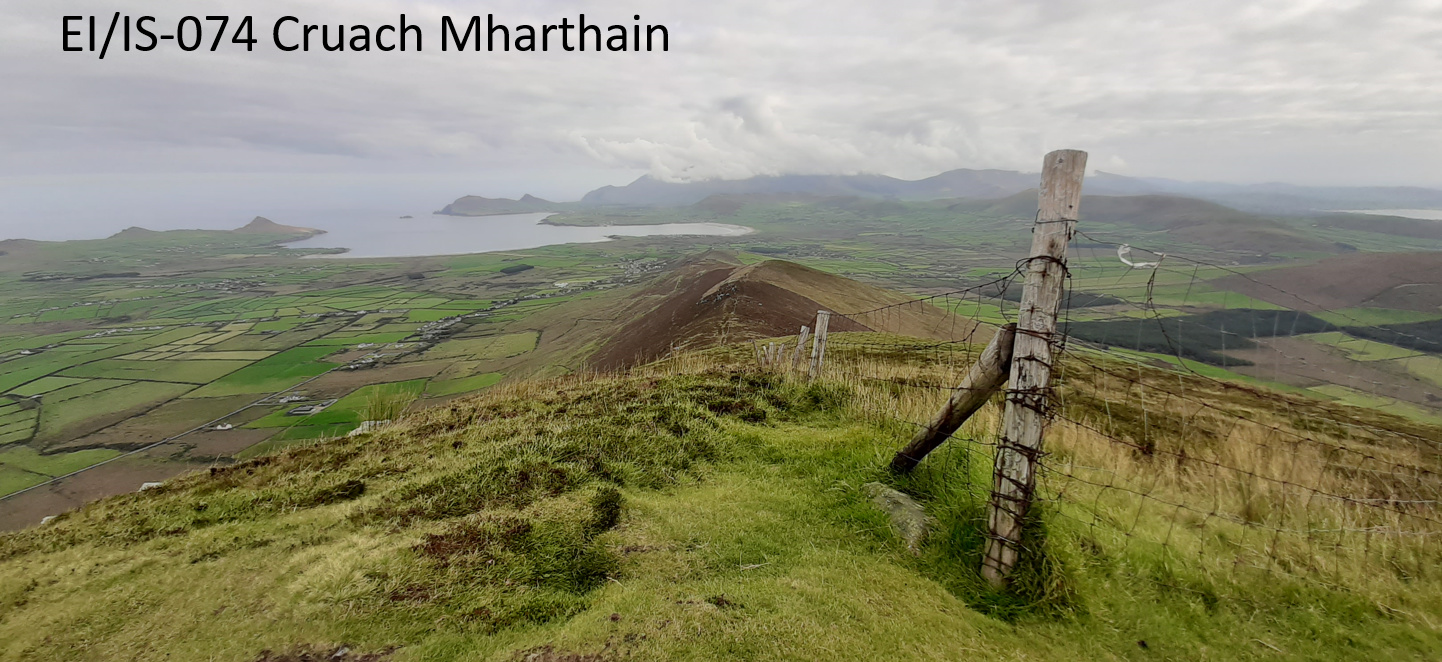
Wednesday, 16th September: Cruach Maharthain EI/IS-074 – 4 points, Sliabh an Iolair EI/IS-053 – 6 points and Sybill Head EI/IS-123 – 1 point.
Wednesday took me out to the end of the peninsula to three summits near Dunquin and Ballyferriter. First up was Cruach Mharthain which is a quick trot up the hill from the road which goes over the col between Cruach Mharthain and Sliabh an Iolair. There are communication masts here which curiously are located at the col and not on the summit – probably because this is a tourist area. I tried out a new 44 ft twisted pair doublet made from stranded cat 6 cable, fed via a 4:1 balun. It certainly works fine. It tunes up 40-10m on the kx2 atu. 25 qso’s.
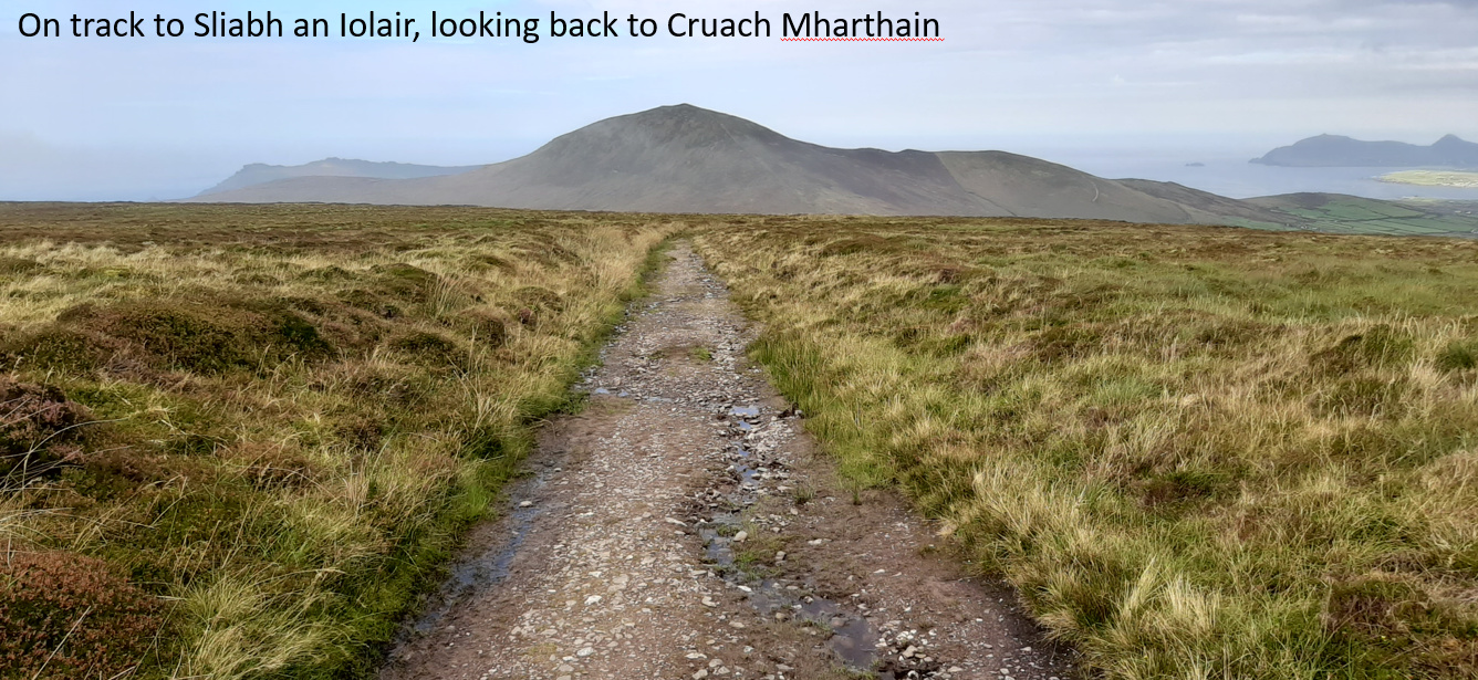
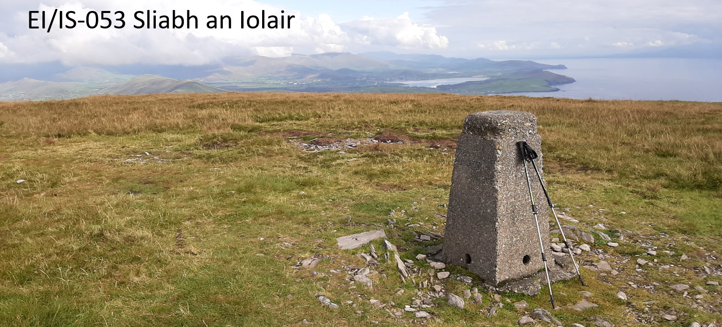
1km further down the road is the trailhead for Sliabh an Iolair. There is a good track most of the 3km route to the summit. It’s a bit boggy in parts. Great views on the way up. Conditions seemed a bit better – back to the end-fed, I made 35 qso’s here.
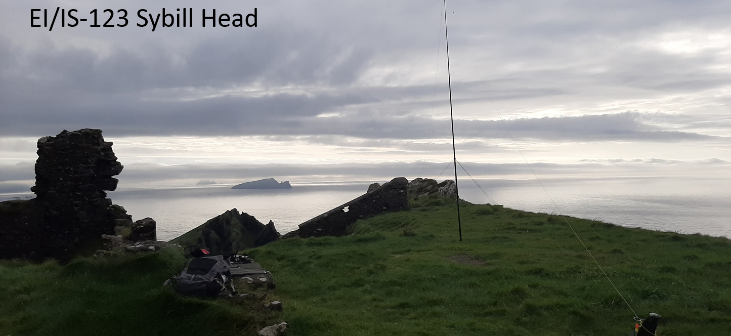
I made a late decision to activate single-pointer Ceann Sibeal (Sybill Head) EI/IS-123, although I wasn’t expecting much as it was 1700z before I was on the air. There is a farm track between electric fences which takes you to the summit. There is a ruined observation post and a small flat grassy area right next to a near 200m vertical drop into the sea. I was delighted to get a s2s on my first qso with AC1Z on W1/WL-001. I made nine other qso’s mainly on 30m.
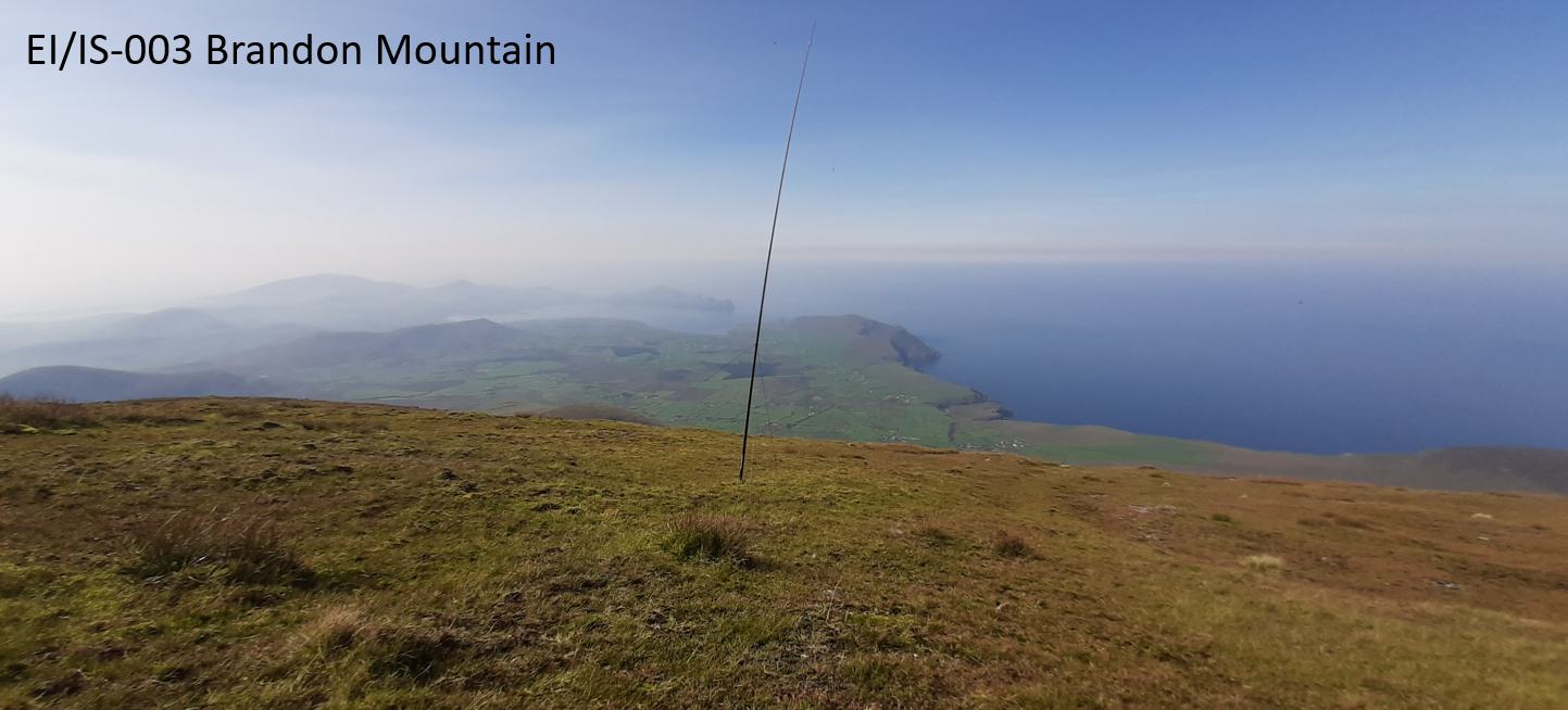
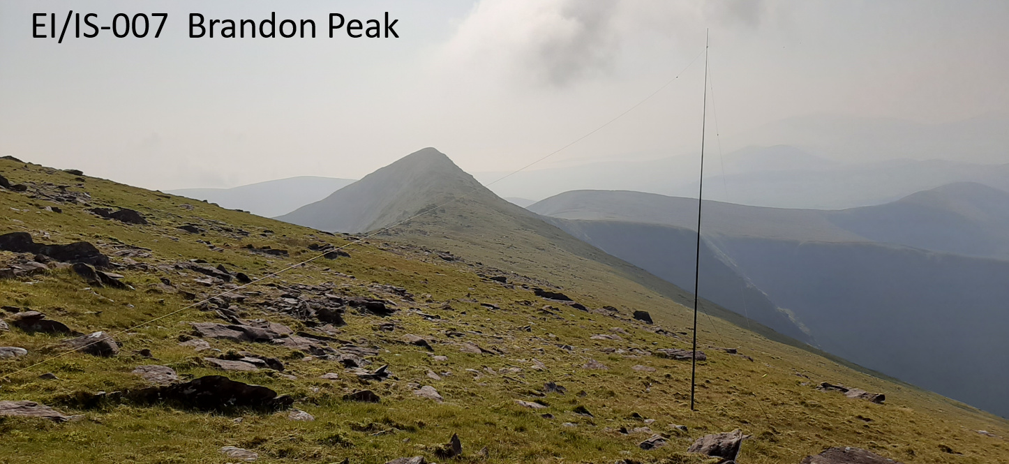
Thursday, 17th September: Brandon Mountain EI/IS-003 – 10 points, Brandon Peak EI/IS-007 – 10 points
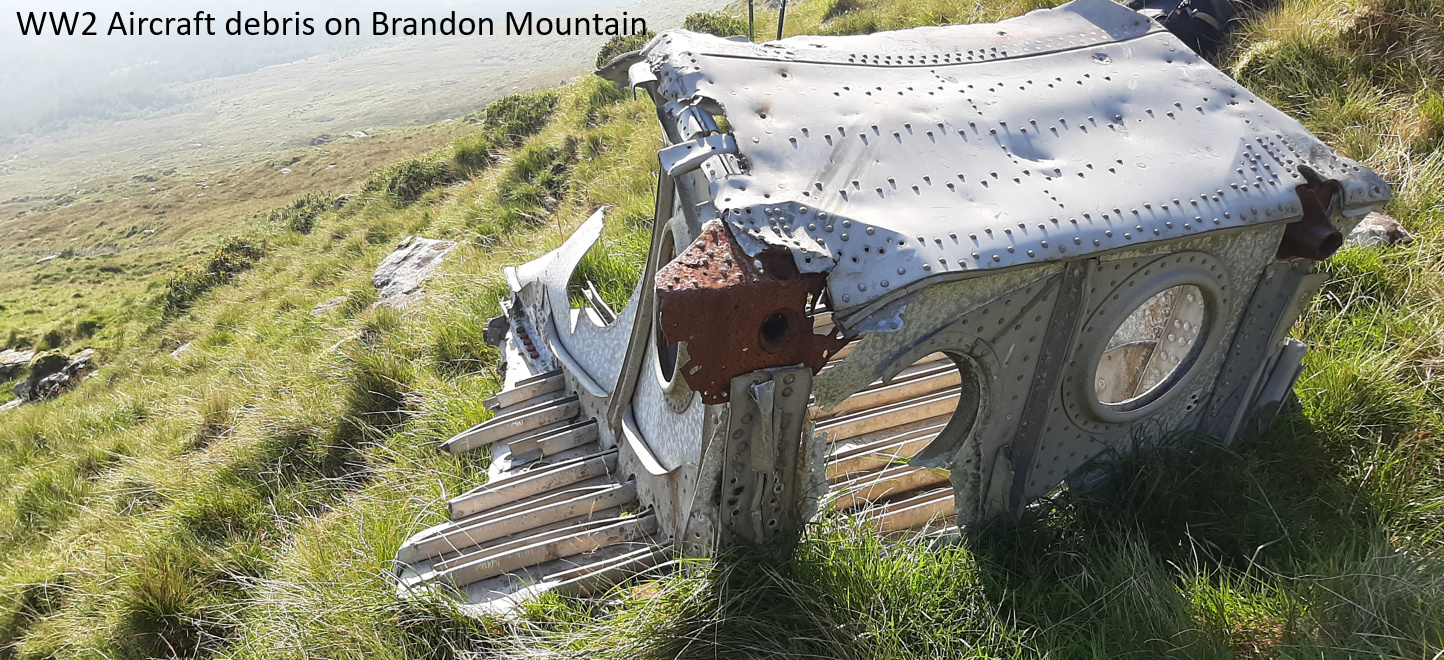
I waited all week for Mount Brandon to take its cloudy cap off and make this one possible. Conditions were perfect on Thursday – not a cloud in the sky and not a puff of wind. This was a straight out and back hike from the more interesting east side of the mountain. Leaving the trail head at Faha, I took the farm track by mistake instead of taking the correct trail up the mountain. I soon realised my mistake and started up the hill to intercept the trail. As I was doing so, I came across a large chunk of wreckage, which I recognised straight away from a previous life working in aerostructures as part of an aircraft wing. I later discovered that there were four air crashes on the Brandon range during World War 2. From where this piece was located, it is almost certainly part of a German FW 200 Condor which crash landed on the Faha ridge in August 1940. The crew of six all survived.
The good weather attracted quite a few people up the western ‘pilgrim’ route to Brandon Mountain, so, on reaching the summit, I moved a little down the western slope to set up. I made 19 qso’s on 20m and 30m cw.
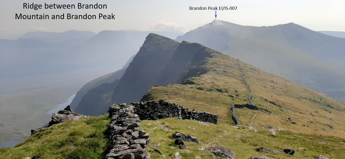
The ridge between Brandon Mountain and Brandon Peak provides some great views, particularly when the weather is like this. Once you leave Brandon Mountain summit, you have the mountain to yourself again. You give away a lot of elevation when you leave the summit and it is a wicked steep climb up to summit of Brandon Peak once you get to the bottom of the ridge. Conditions were lousy, and I managed only 8 qso’s, mainly on 20m cw, before I packed up and headed for home.
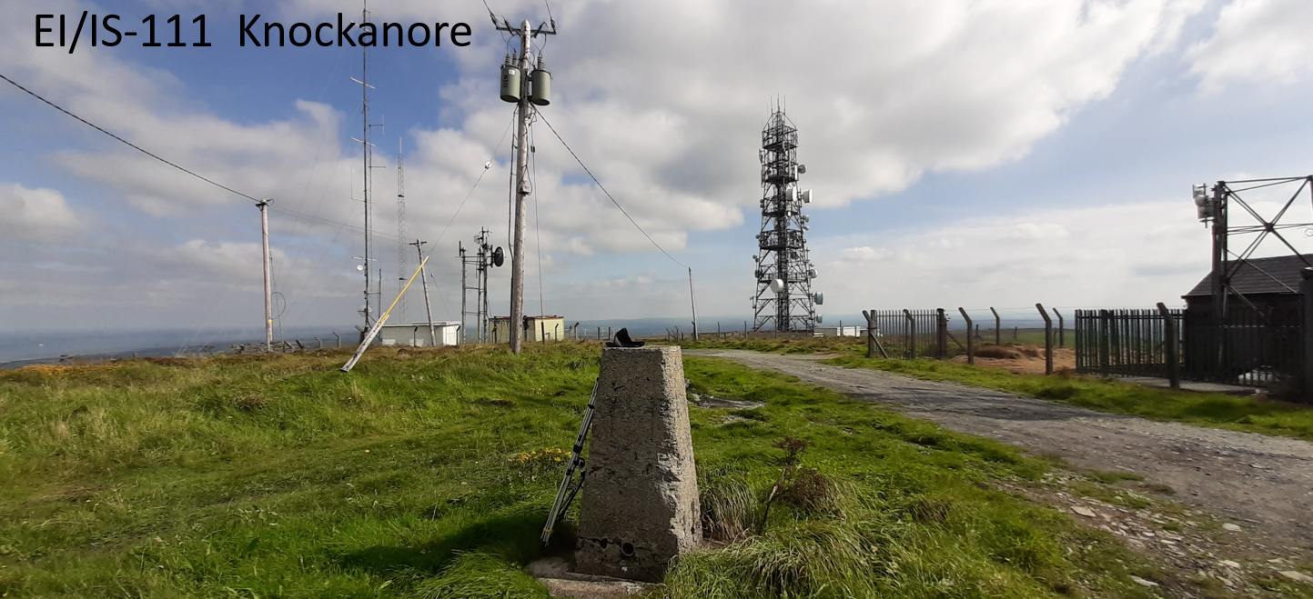
Saturday, 19th September, Knockanore – EI/IS-111 – 1 point.
On Saturday, I travelled back home to County Galway. I left early to stop off en-route to activate Knockanore, near Ballybunion in North County Kerry for the European SOTA Activity Day. This is not the most picturesque summit in the world. I was pushed for time on this so was a bit limited in what I could achieve. In the end I made just 25 qso’s but with a high proportion of s2s. Because it is a drive-on summit, I brought my FT-817nd and 5-element yagi from the car to see what I could do on 2m. I couldn’t hear the other EI’s that were active in the east but I had a s2s with GI0AZB on GI/MM-003 on FM. Switching to 2m SSB, I was very pleased to s2s with Robin GM7PKT/P on GM/WS-294 Ben Hiant, some 518km away by my reckoning.