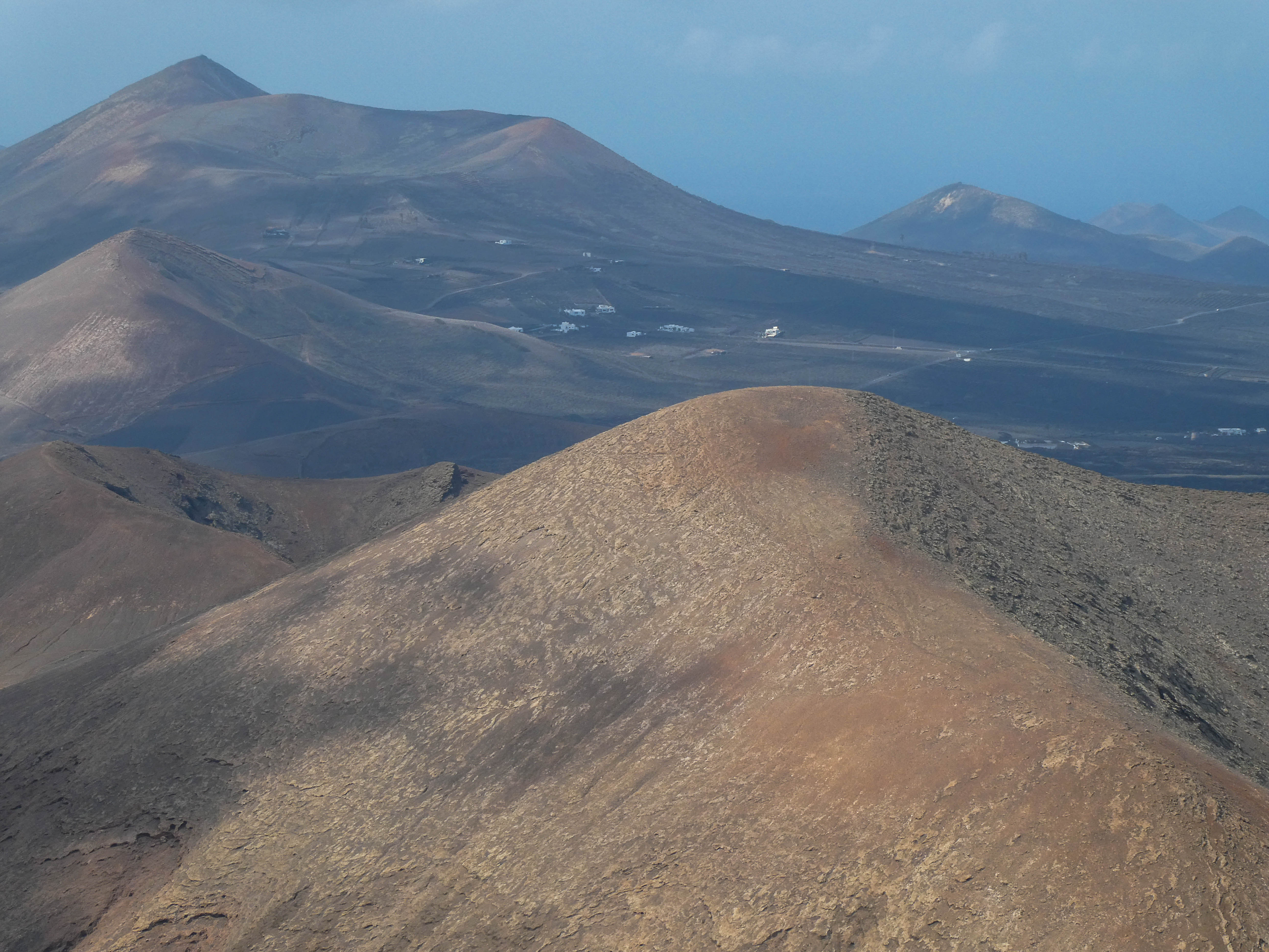
In my recent holiday in Lanzarote I activated 5 summits (LA-002, LA-004, LA-005, LA-023 and LA-026). I posted summary reports of each at the time and this report is intended to give logistical and operational info rather than re-hash the actual activation results. Before leaving home I researched all the summits, using Google Earth, Sotlas etc, previous activation reports and videos and also had some exchanges with Stefan, HB9HCS, who recently activated all of the possible Lanzarote summits. With that info I drew up a hit list of about 15.
KIT
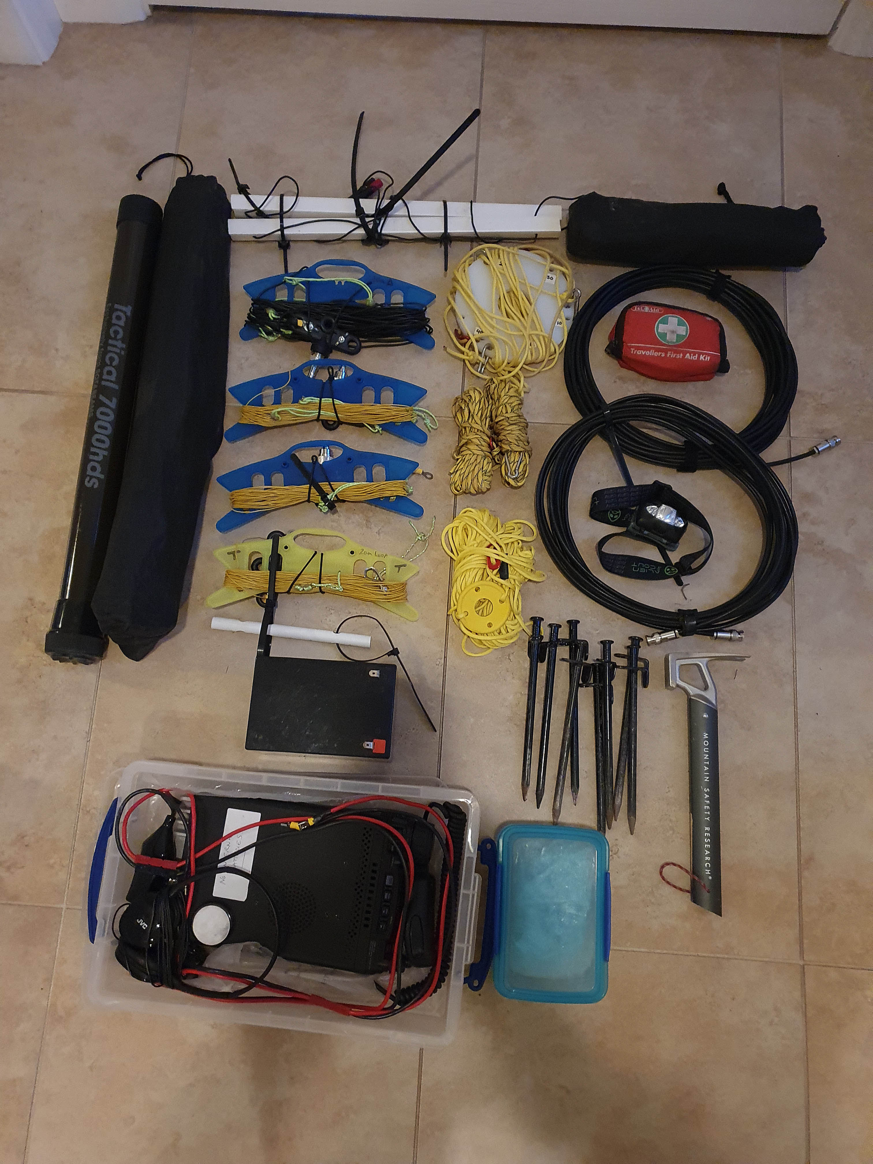
The kit I took with me up each summit was as follows:
Yaesu 857d, headphones, mic and key
12Ah 153.6Wh LiFePO4 battery - my usual SOTA battery
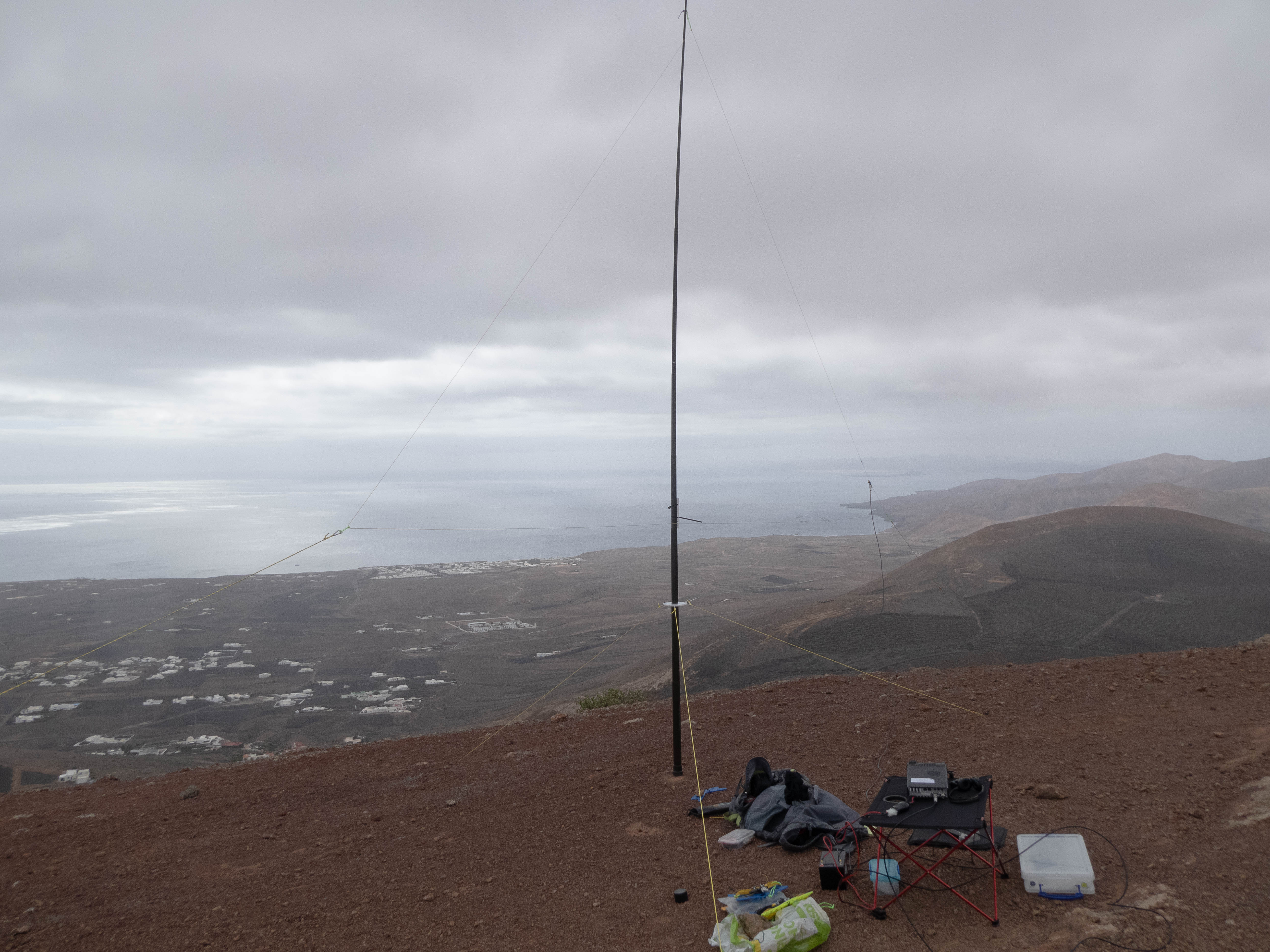
Sotabeams 7000ds Tactical mast - bought specifically for Lanzarote, as when collapsed it fits into a medium suitcase
Wire vertical delta loops for 20/17/15 and 10m - based on DL4AAE design as described on the Reflector by DL3TU
Simple wire loop for 2m (VK1NAM) - just used on LA-023
Guys and guy ring for mast, taken from my DX Commander vertical
Upper guy ring and guys in case of high winds (never used)
Guys for delta loops
2 lengths of Airborne 5 coax (1 as back-up)
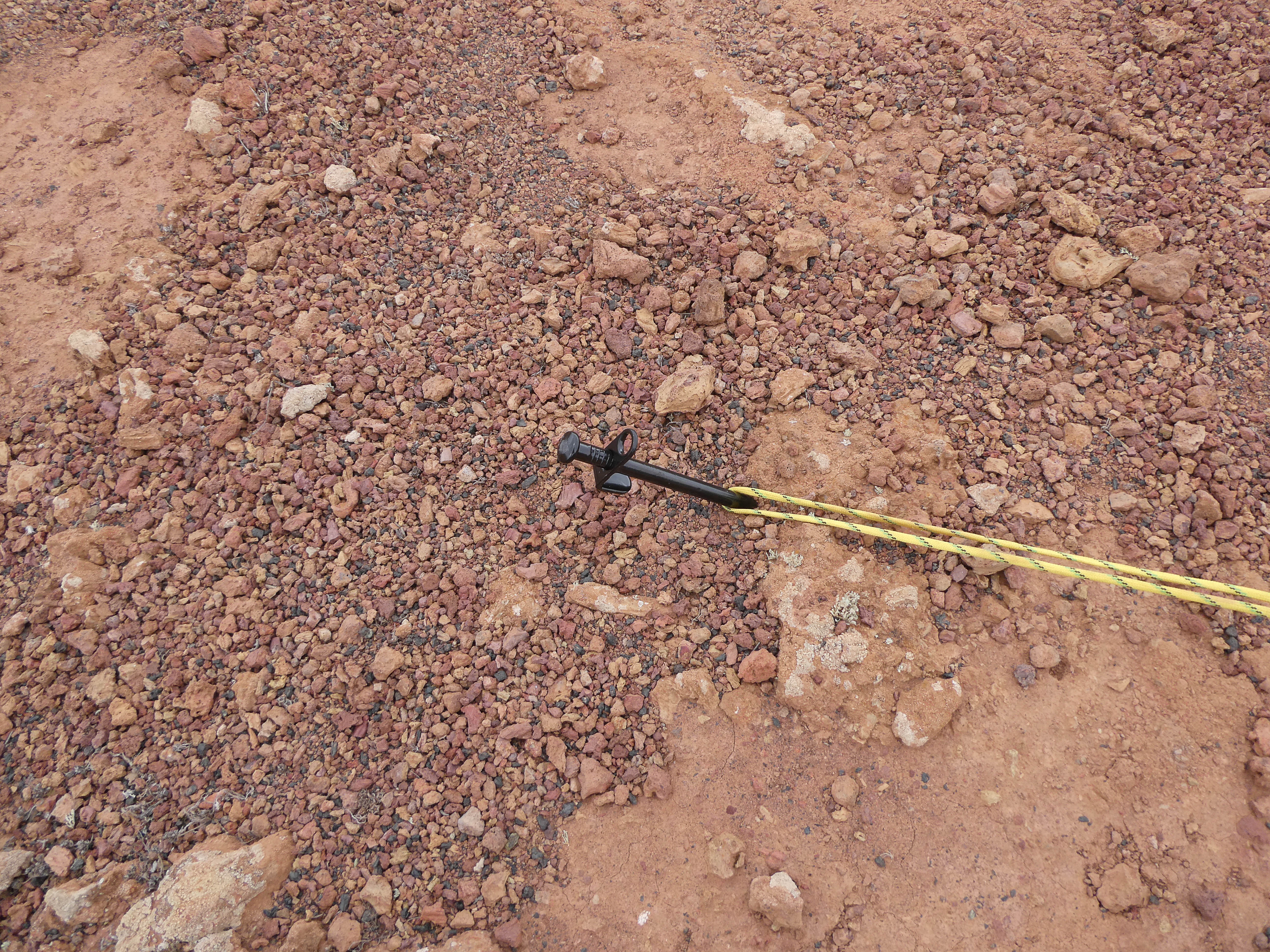
Heavy duty guy stakes and hammer - brought as other activators had mentioned difficulties in getting stakes into the ground due to the often rocky summits. The hammer weighs just 319g, the stakes just less than 1Kg - I do not use these on Scottish summits ![]()
Collapsible camping table
Inflatable cushion - I like my creature comforts!
First Aid kit/head torch/log books/pencils
2 litres of water = 2Kg ![]()
Lunch
Mobile phone
All fitted easily into my Osprey Atmos 65 rucksack for a total combined weight of 15Kg
Travelling by air with LiFePO4 battery
IATA regulations re Lithium batteries: https://www.iata.org/contentassets/6fea26dd84d24b26a7a1fd5788561d6e/passenger-lithium-battery.pdf Note that any exposed terminals need to be taped up.
Pre-flight I was concerned about getting approval from the airline Jet2 for my battery to travel as cabin baggage. The Jet2 online info stated that it was allowable but approval was required. After spending nearly 3 hours on hold trying to get through (this was at the time of the La Palma eruption) my XYL volunteered to visit the Jet2 check-in desk at Edinburgh airport as she was down there for a visit anyway. The desk assured her that the battery was OK but that I still needed to get a pre-flight approval by phone. I eventually got through and Jet2 confirmed all OK and I was told a note had been added accordingly to our flight reference. Surprisingly, they just took my word for the fact that the battery was rated at less than 160Wh - I could have supplied a full manufacturers spec sheet.
Passing through security my battery was picked up as it showed no internal details on X-ray. On brief examination it was waved through. At check-in, the Jet2 staff could find no details of the pre-flight approval ![]() . However, they were happy to take my word for it that the battery Wh rating was less than the 160 limit and waved us through (phew!). Plan B had been to buy a SLAB in Arrecife - I could find no online sellers in Lanzarote who stocked LiFePO4 batteries.
. However, they were happy to take my word for it that the battery Wh rating was less than the 160 limit and waved us through (phew!). Plan B had been to buy a SLAB in Arrecife - I could find no online sellers in Lanzarote who stocked LiFePO4 batteries.
On the return flight, airport security at Arrecife checked the battery but waved it through.
Apart from the battery, the rest of the kit went as checked baggage with no issues. I took a receipt for the 857d and a copy of my licence but these were never needed.
The summits-in activation order
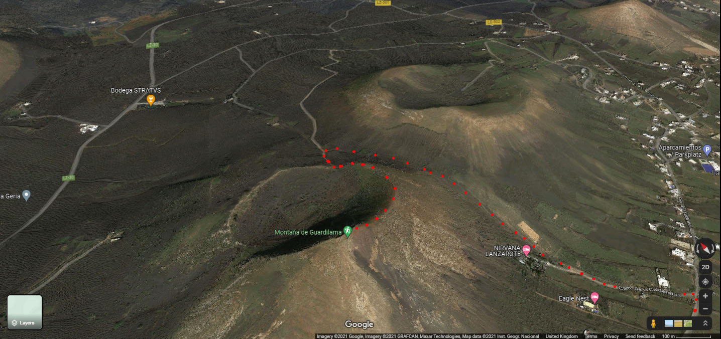
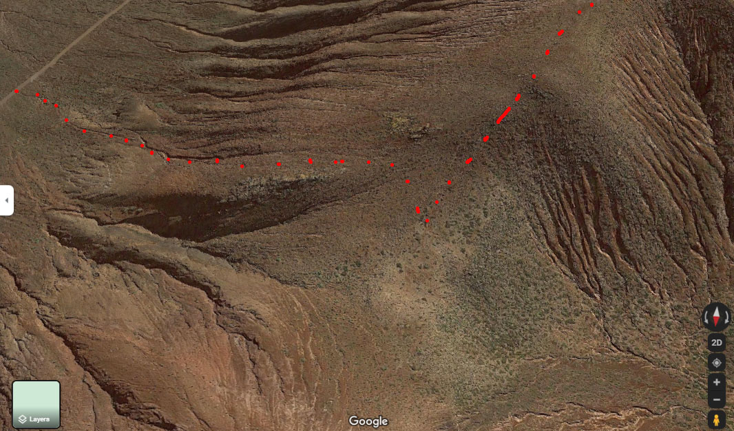
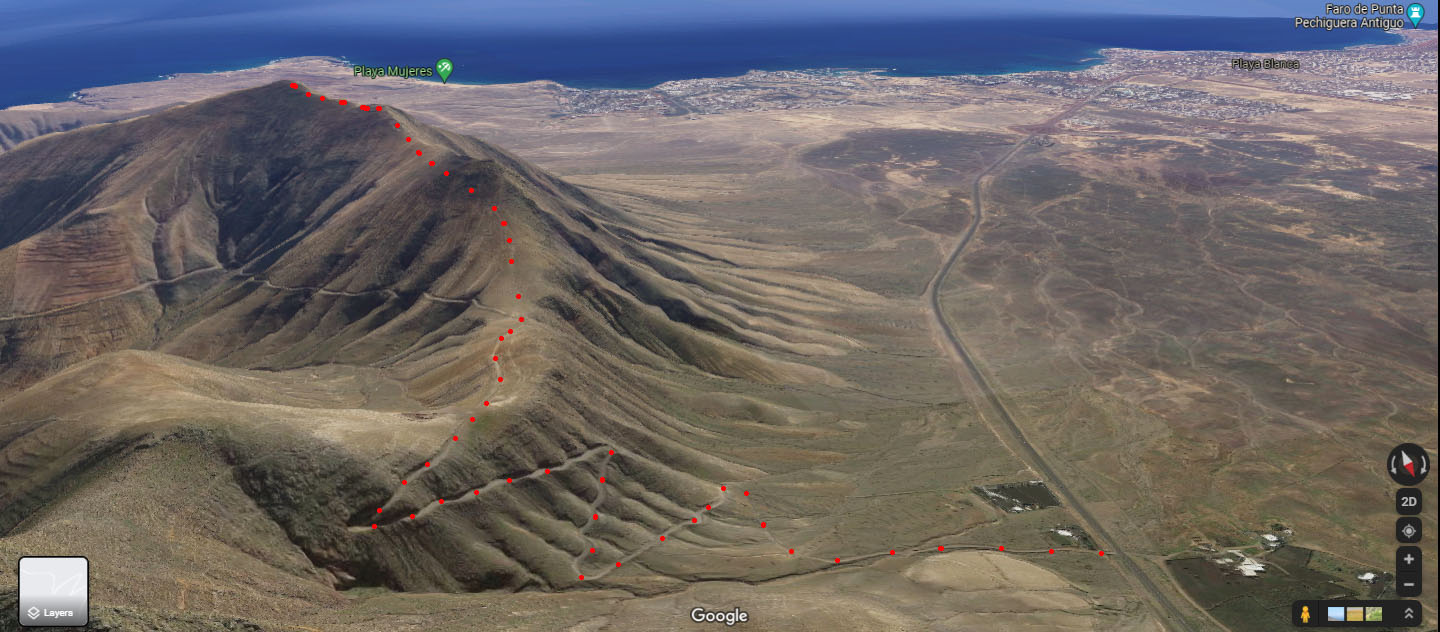
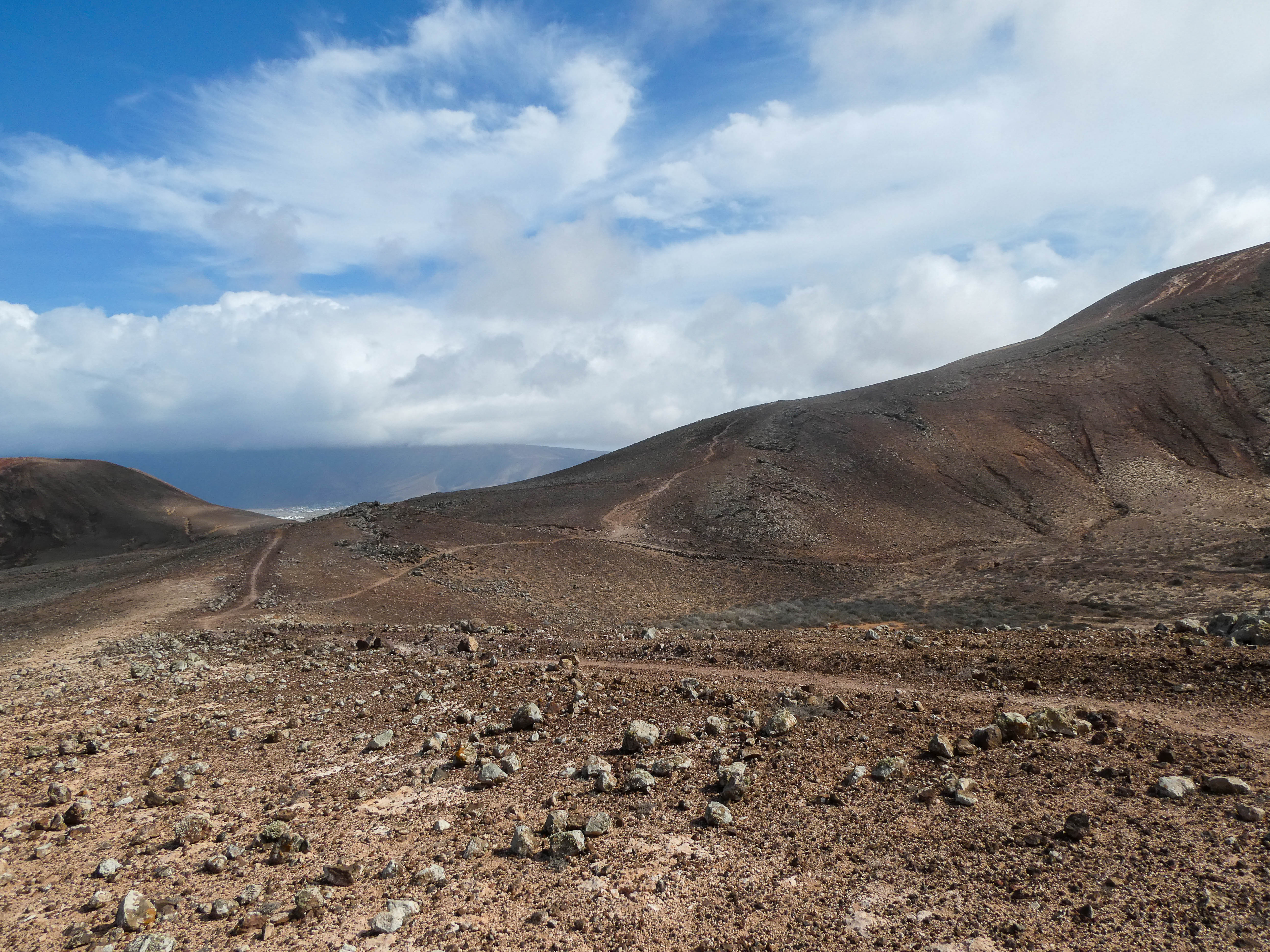
LA-004 Guardilama 23rd Oct 2021
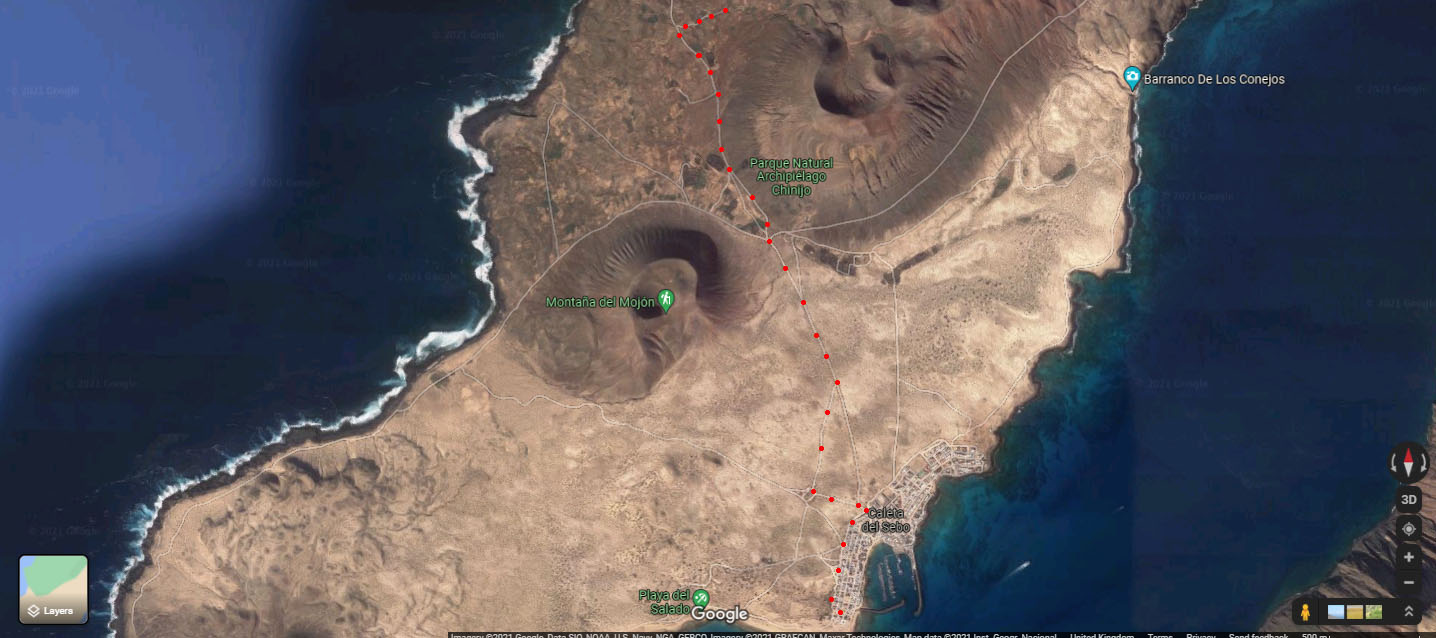
A path up from the south is very obvious on Google Earth
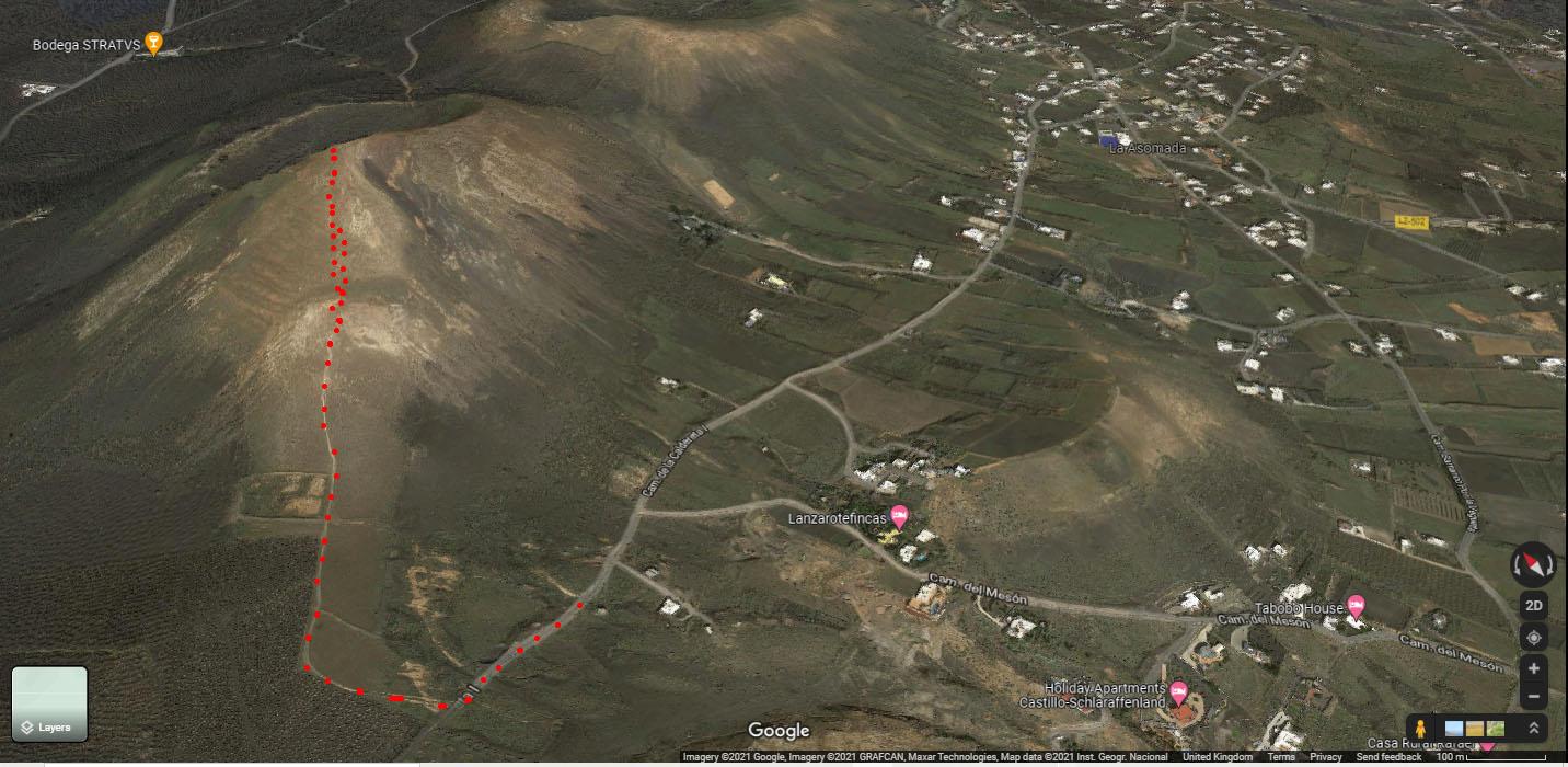
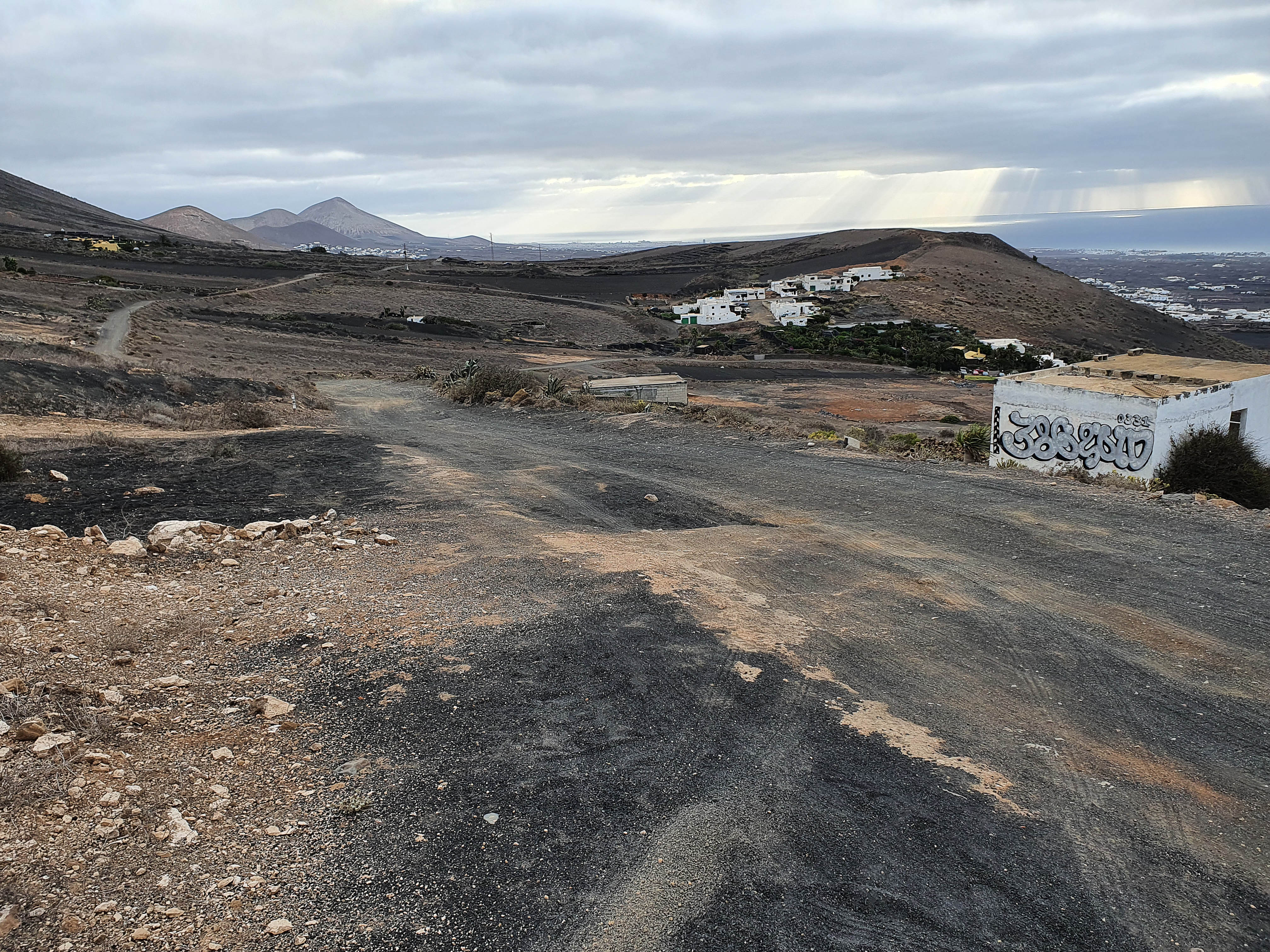
The path departs from the Camino de la Caldereta which is a good quality dirt track and I parked up at the beginning of the red dots on the above photo. My XYL Rachel had volunteered to come up with me and carried my 2 litres of water
Looking North back along the road from the parking spot
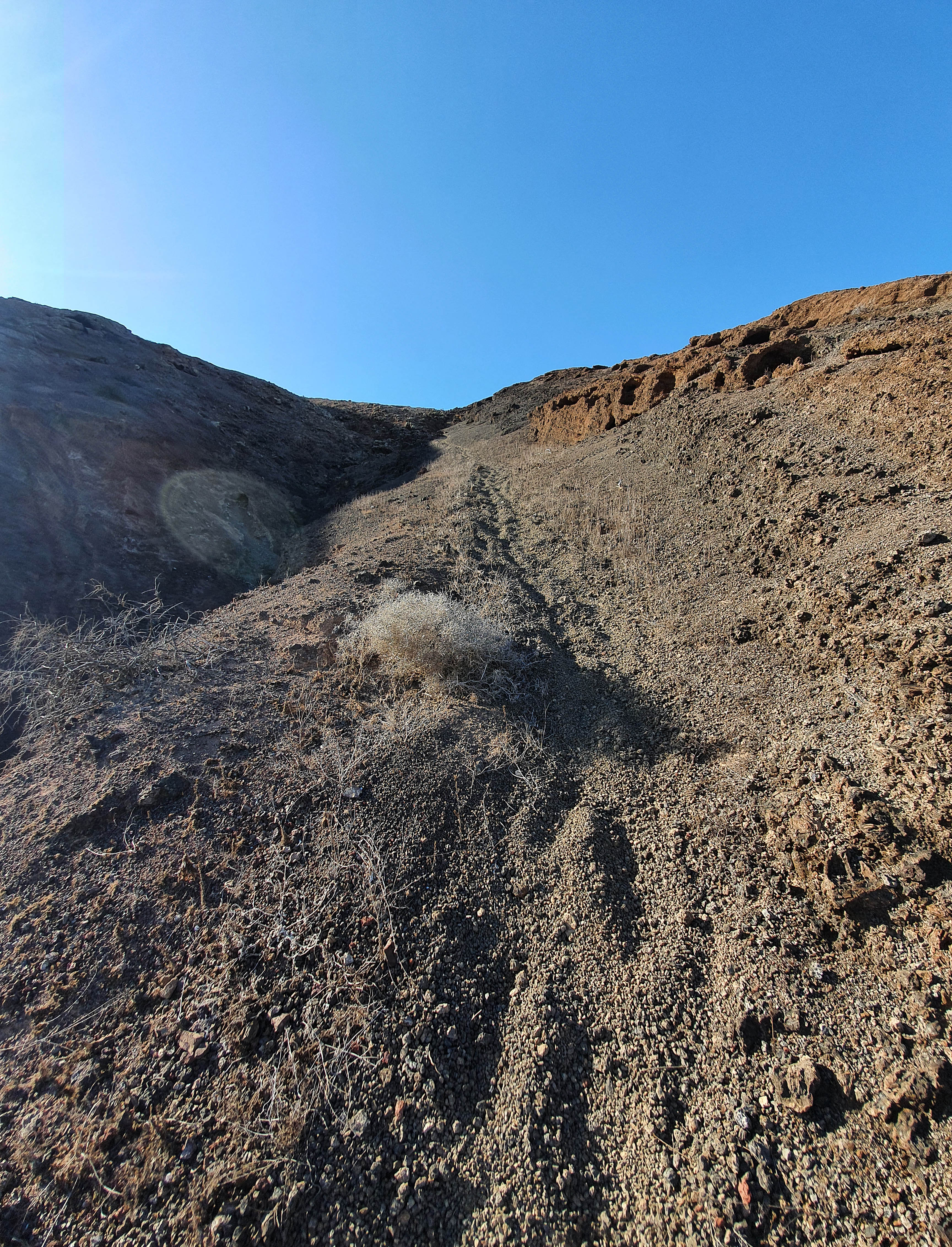
The path up is initially quite gentle but soon steepens into a tough zigzag
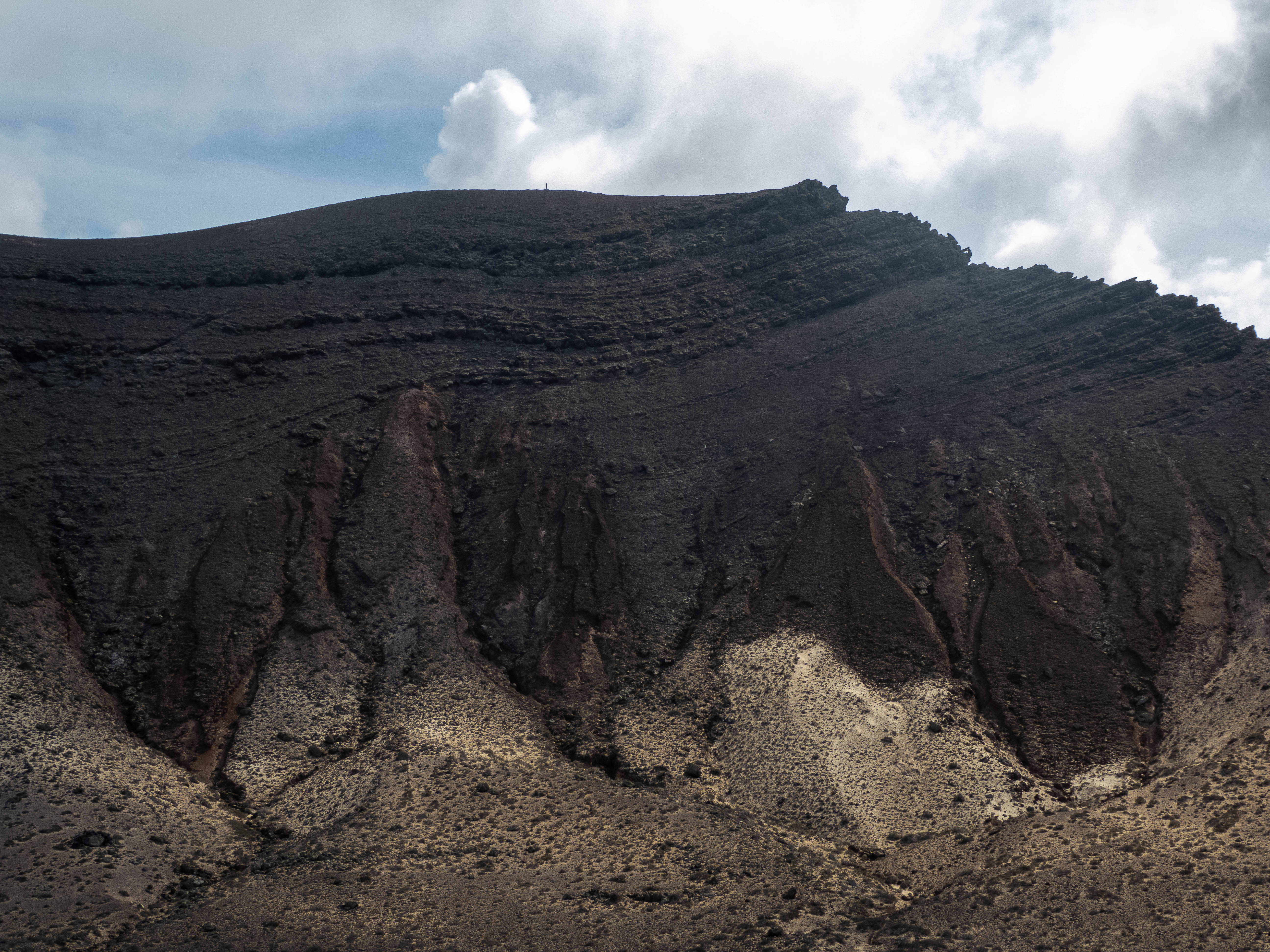
While I was happy enough going up, I had some concerns about coming down the same path with my heavyish rucksack. The path comes out at the top very close to the summit marker which sits on top of a crag. The ascent took about 45 minutes.
Happily, just North of the marker the ground flattens out and it was relatively easy to set up my mast and guy it, with the heavy duty stakes going into the ground with no issues. In addition, the area was quite well sheltered by the summit crag from the strong westerly breeze.
Having seen me set up OK, Rachel departed, going down the North side to see if was an easier descent - she reported back that it was fine and less steep than the “Up” route.
During the day I had a few visitors - walking parties of tourists who generally just said hello and moved on.
After packing up I took the North route down which drops into a col between Guardilama and a lower summit next to it. A strong westerly gale was blowing through the col which I had been sheltered from at the top.
It is a well-marked path that about 2/3 of the way down becomes deeply covered in gray gravel which my boots sank into at each step. Going down was fine, but I think walking up on the stuff would be an effort.
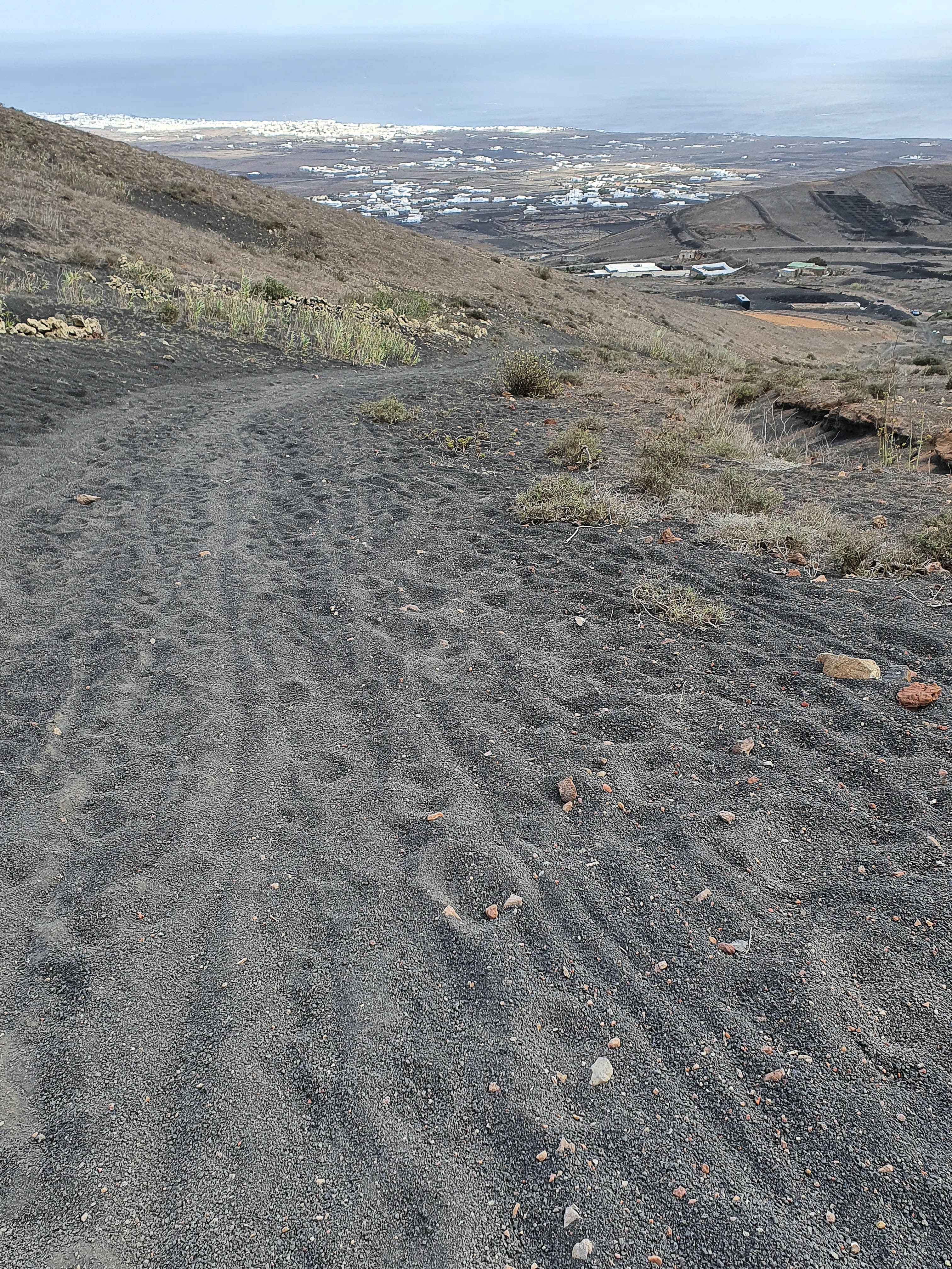
This track joins the road I parked on and I was back at the car in 40m.
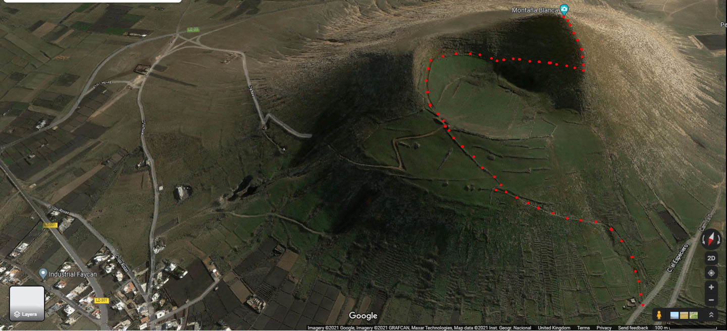
LA-005 -Montana Blanca 25th Oct 2021
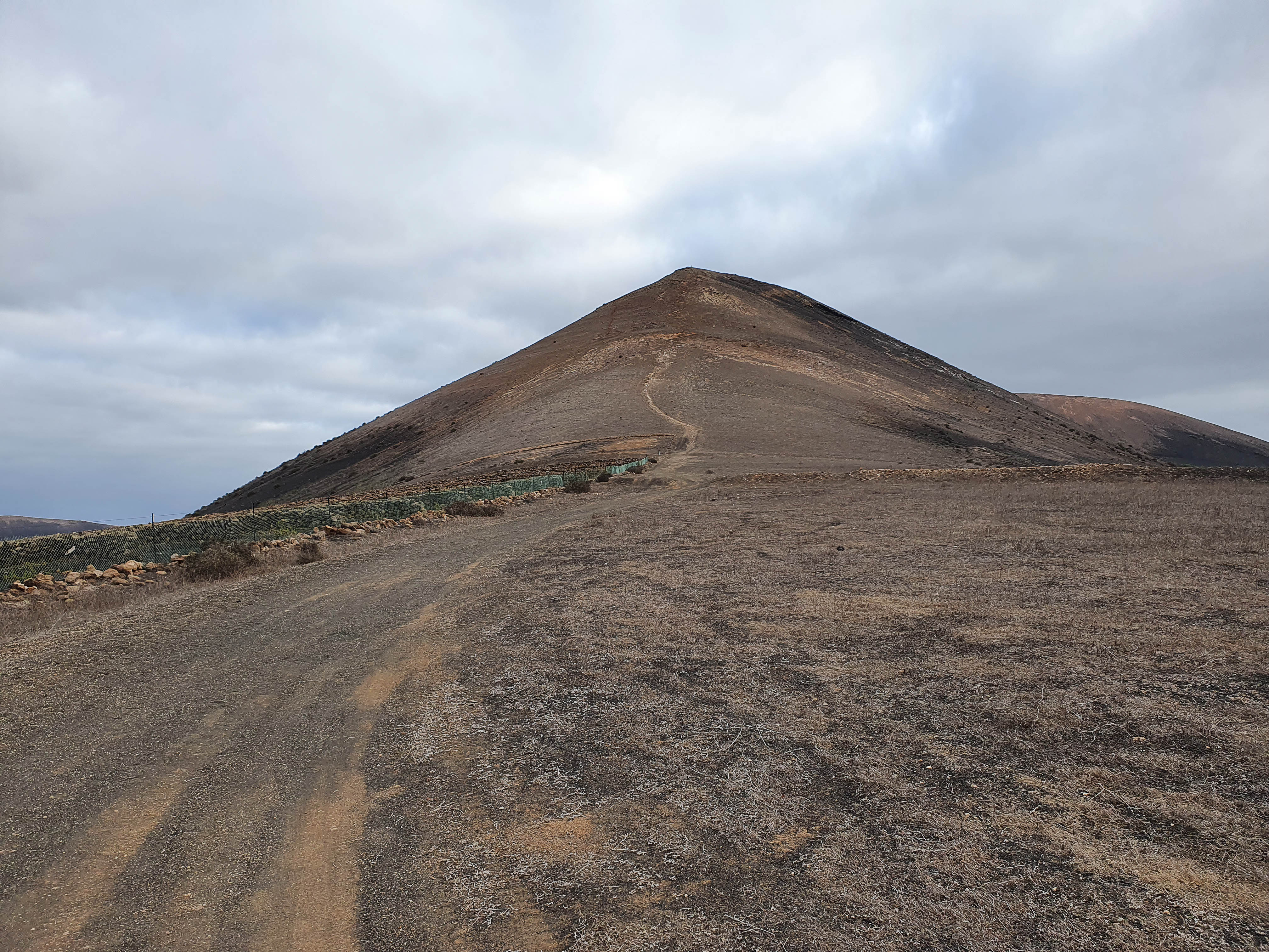
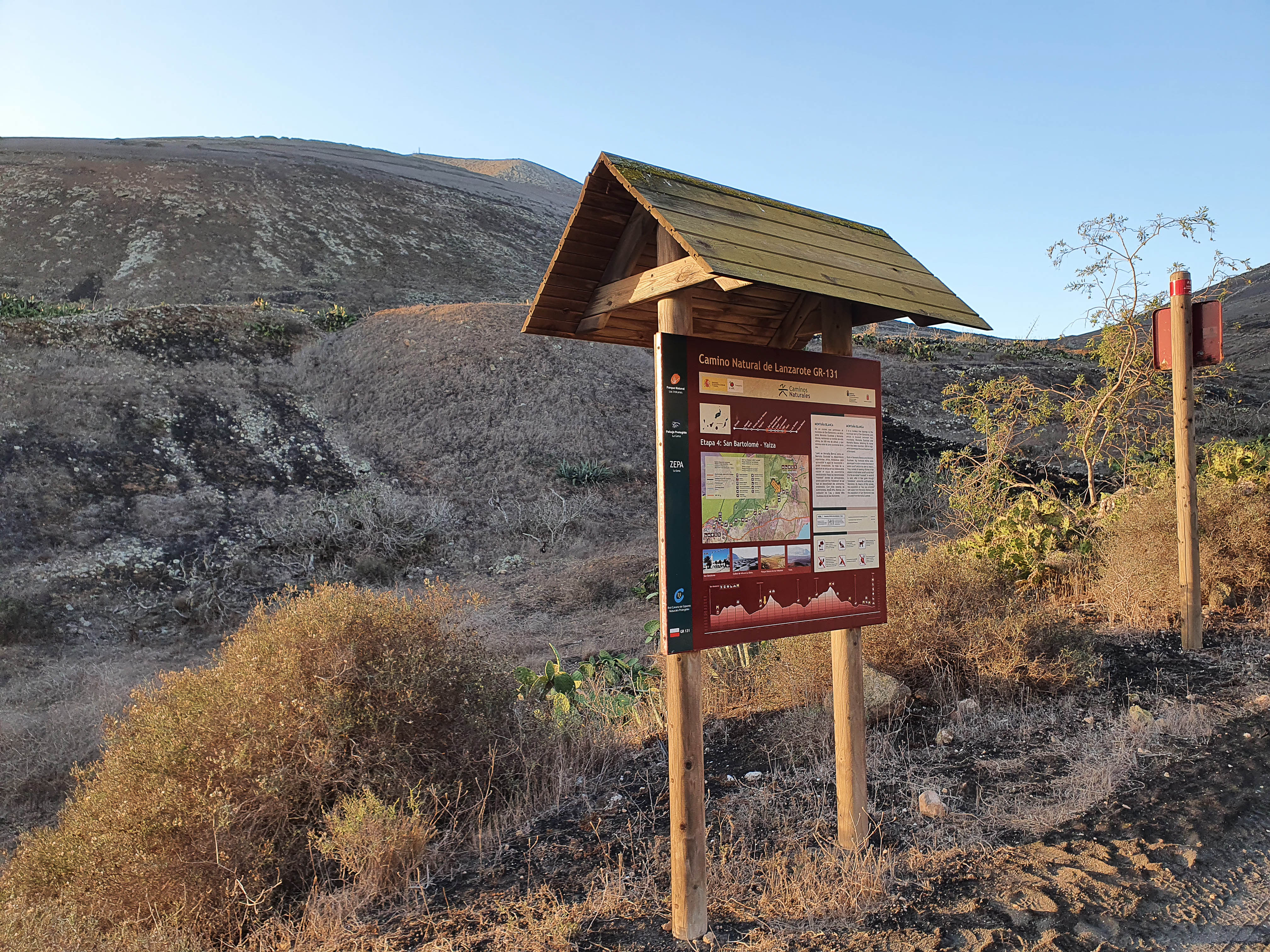
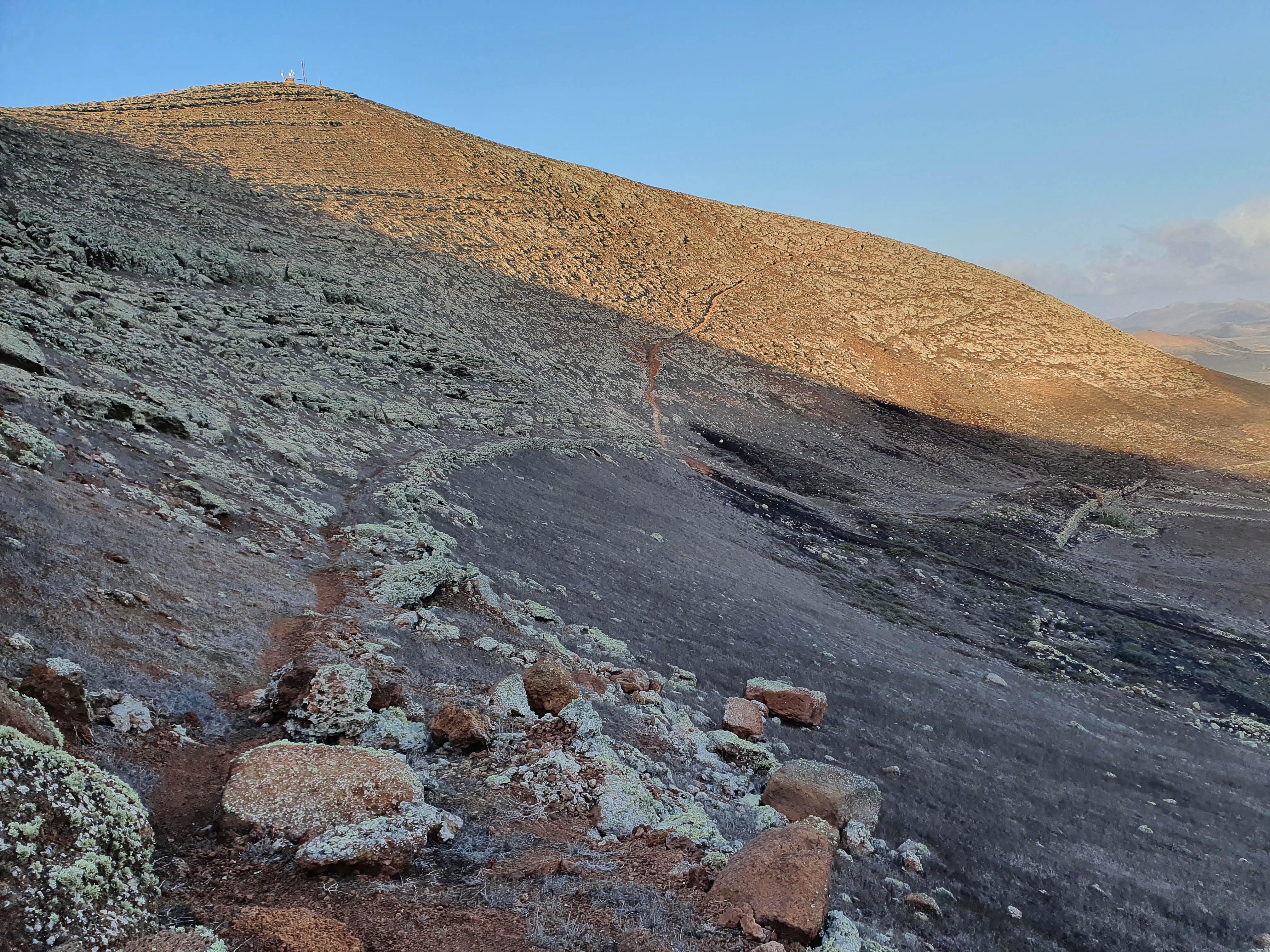
I went up the Western flank of Montana Blanca, starting from a good dirt road, Camino el Especiero, which leads out of the village of Montana Blanca. There are a number of pull-off points along this road where you can park and it is also signed as the GR-131 with an information board (which has a not very helpful map). The ascent took about 45 minutes.
Route up - note that the photo is oriented with North towards the base. The path skirts round the caldera before ascending the Western limb to the summit
Info board
Path around caldera
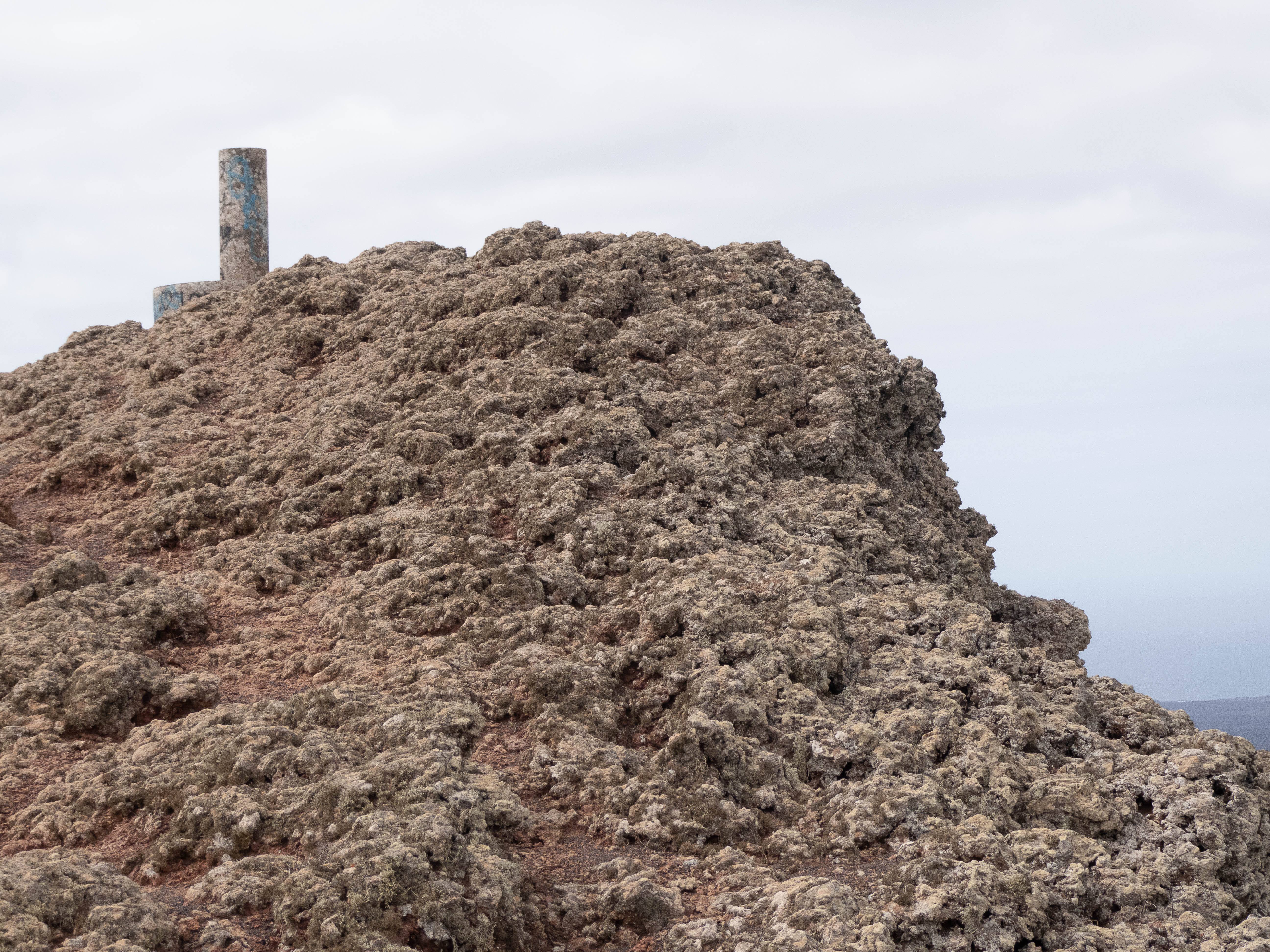
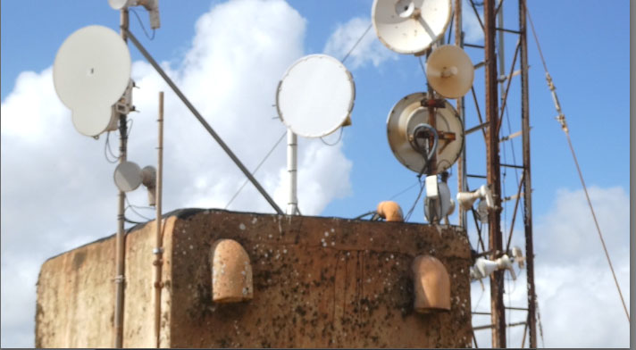
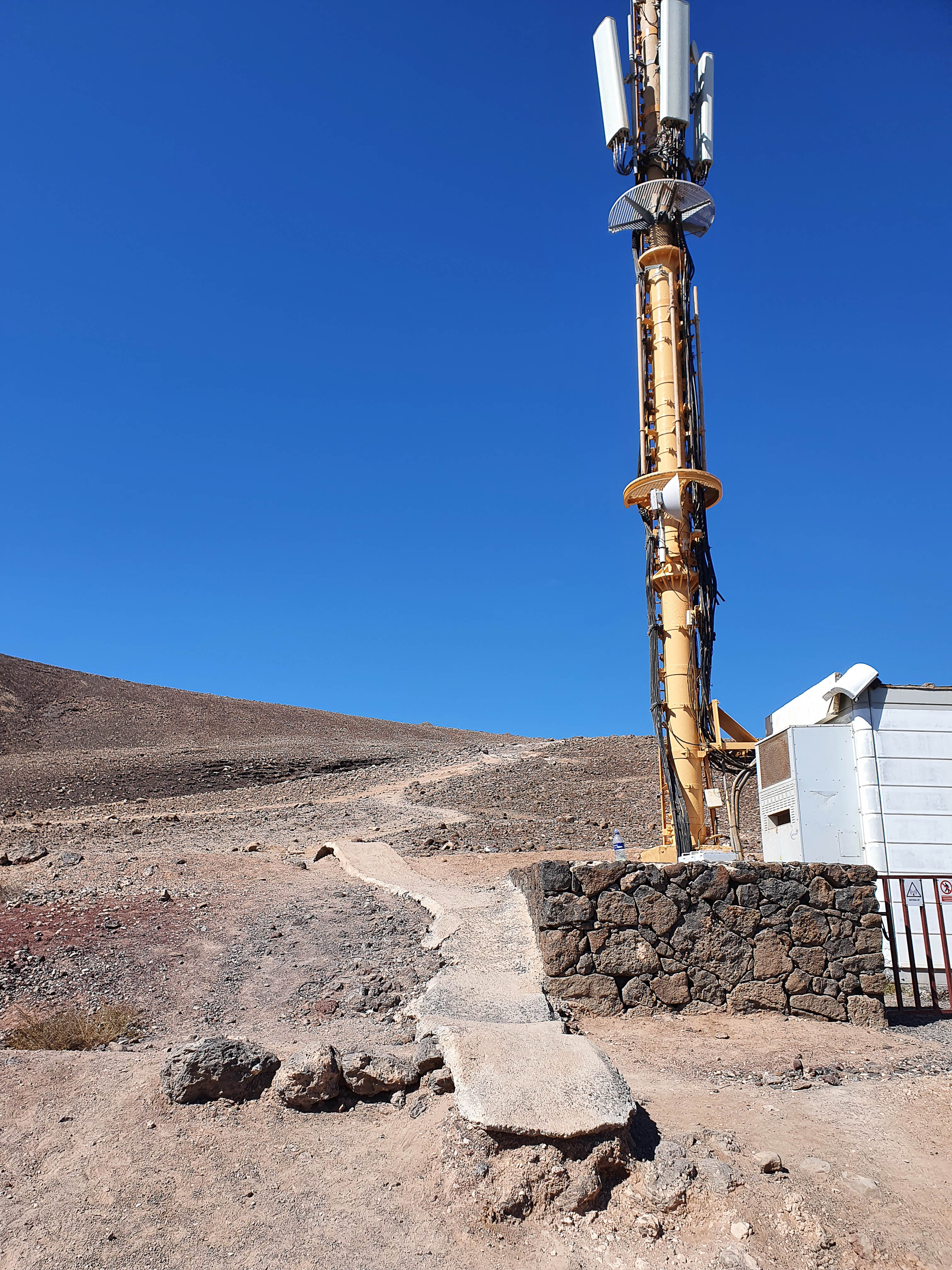
As previous activators have noted, there is a small comms complex at the top with an associated shed and excavated area next to it.
Excavated area
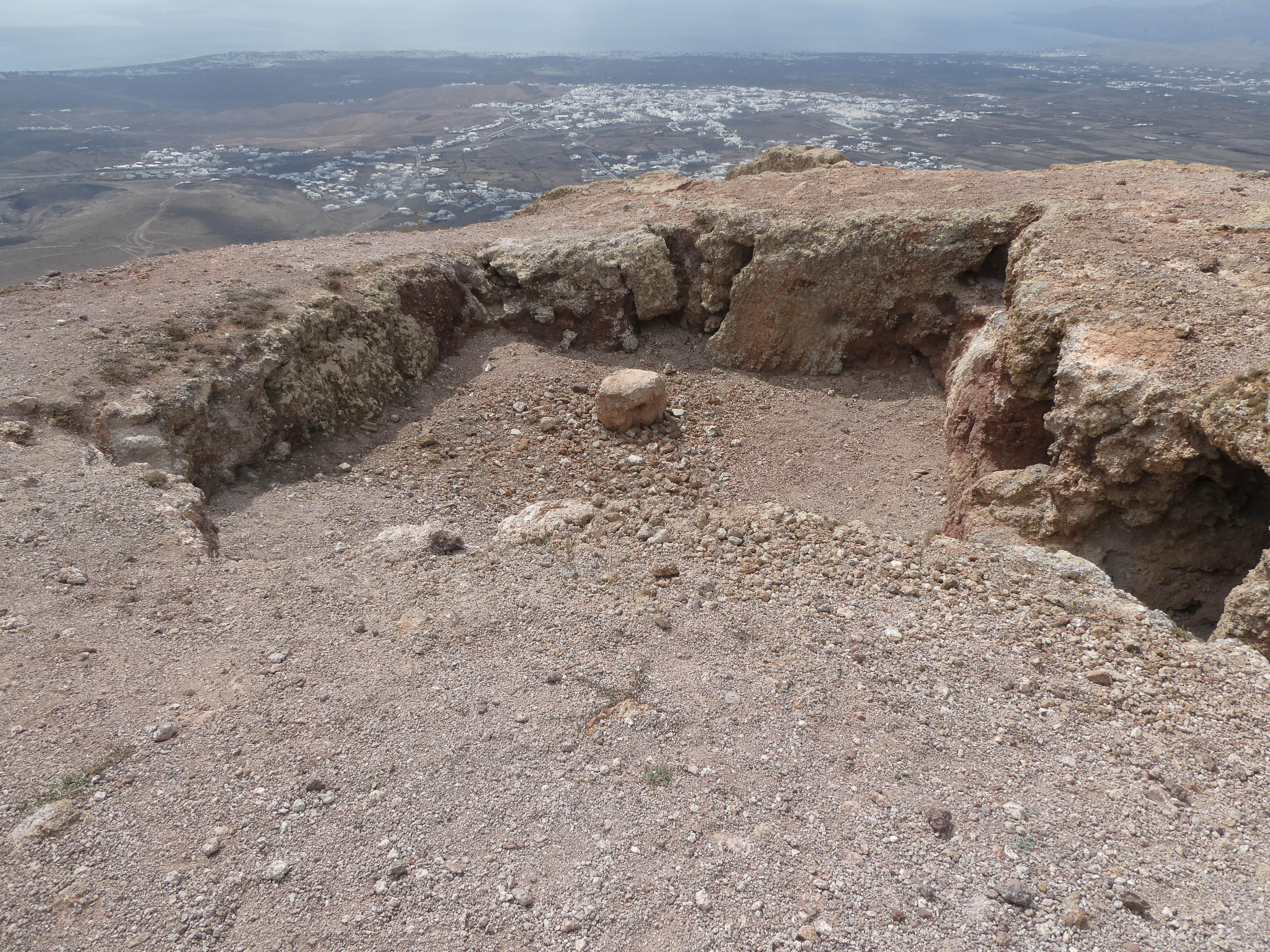
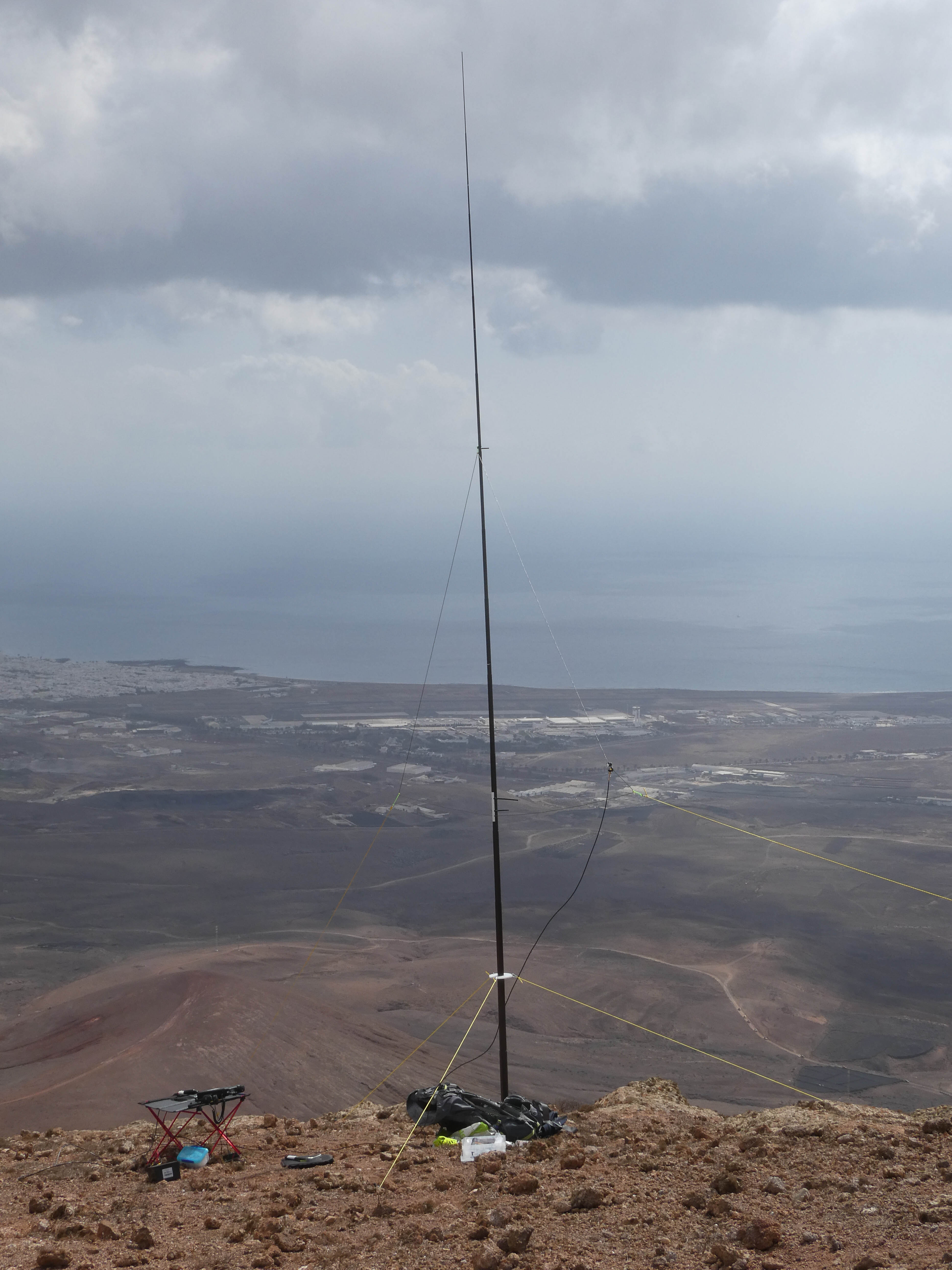
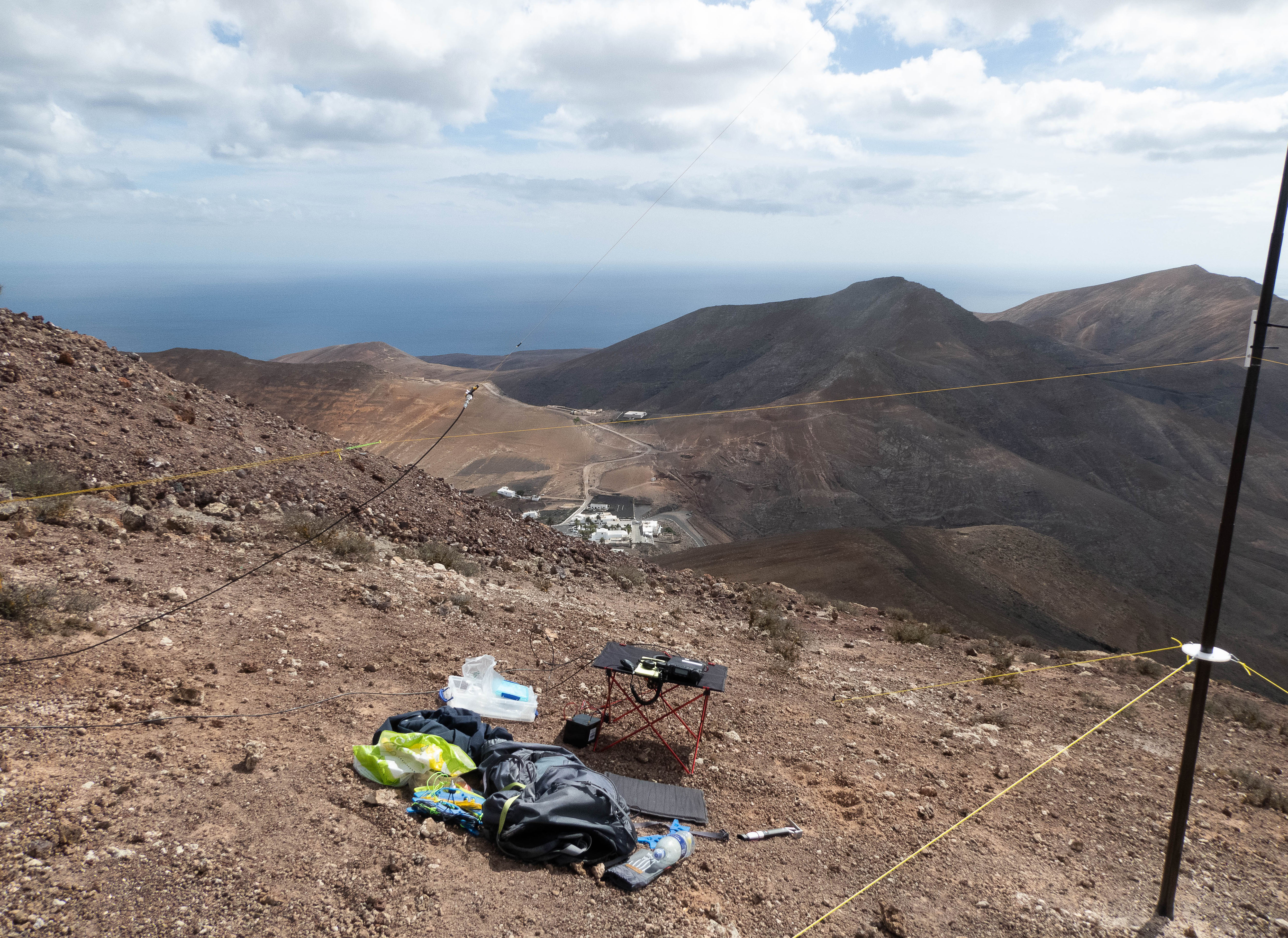
I set up just next to this excavation - there was plenty of room and I had no trouble getting the guy stakes into the ground. The area was nicely sheltered from the strong breeze.
As with most, if not all the Lanzarote summits, the views from the top were very nice.
Looking SouthWest
I had the summit to myself most of the day, with just one visitor in the afternoon who ran up!
I went down the same path and was back at the car in about 35 minutes.
LA-002 Atalaya de Femes 27th Oct 2021
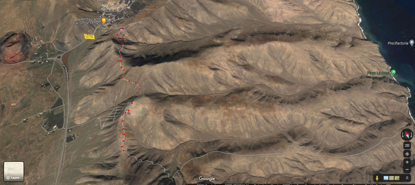
This is an easy route up from the village of Femes as there is a dirt track which is a service road for the large comms complex at the summit.
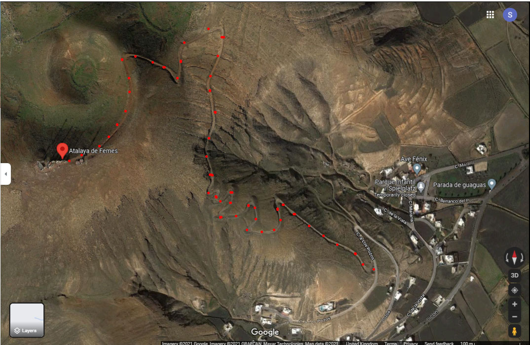
I parked at the point the track leaves the Camino de las Pozos and the ascent took 25 minutes
The summit marker is next to the comms complex
I set up West of the comms complex on a gently sloping area with a lot of rubble from the complex construction. Guying was no problem but I had to keep clear of a path that led down to a rather smart BBQ area set into the hill
BBQ area
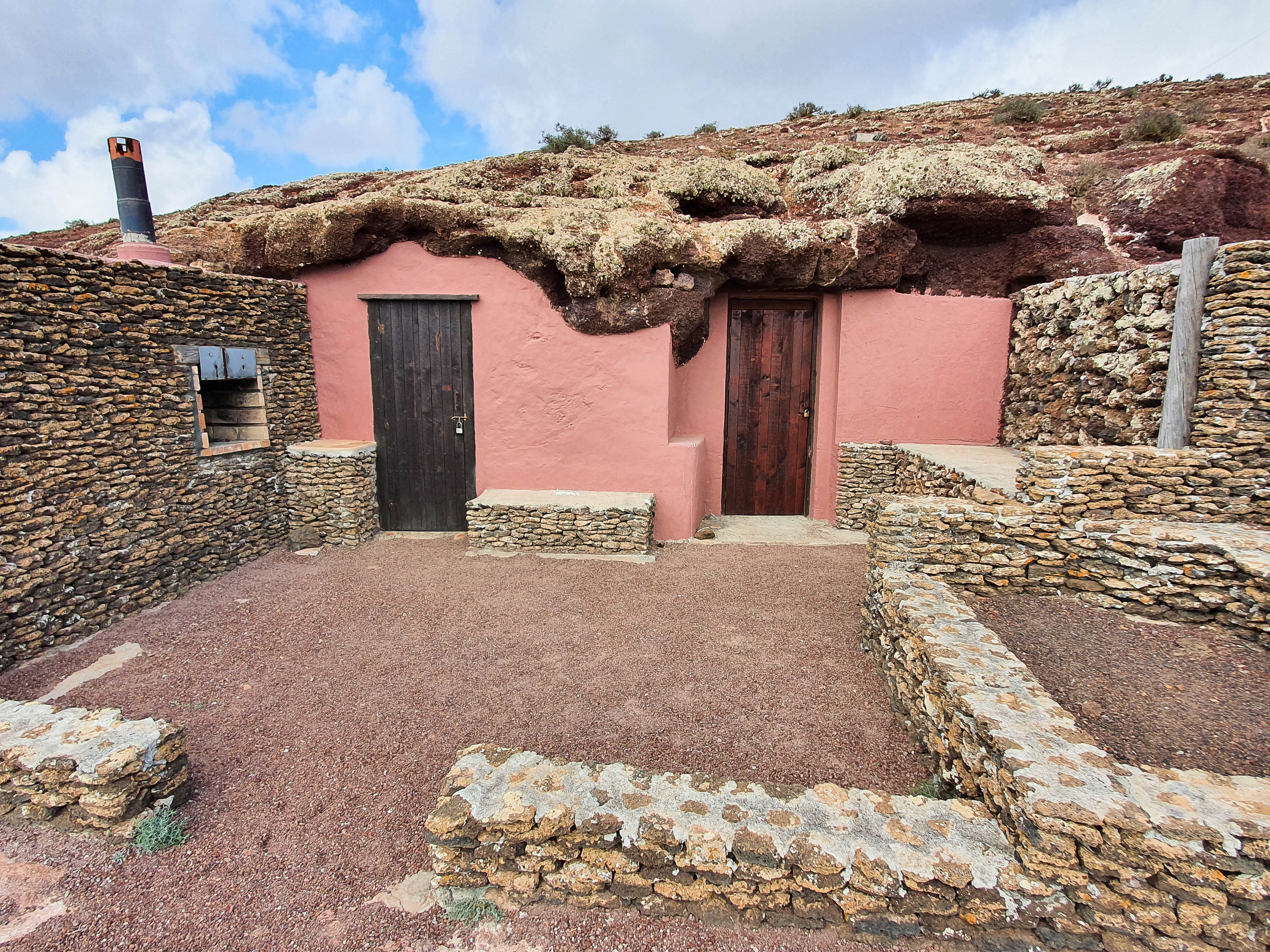
It was breezy but the operating position was relatively sheltered. I had a few visitors during the morning, a group of whom occupied the BBQ area for about 30 minutes.
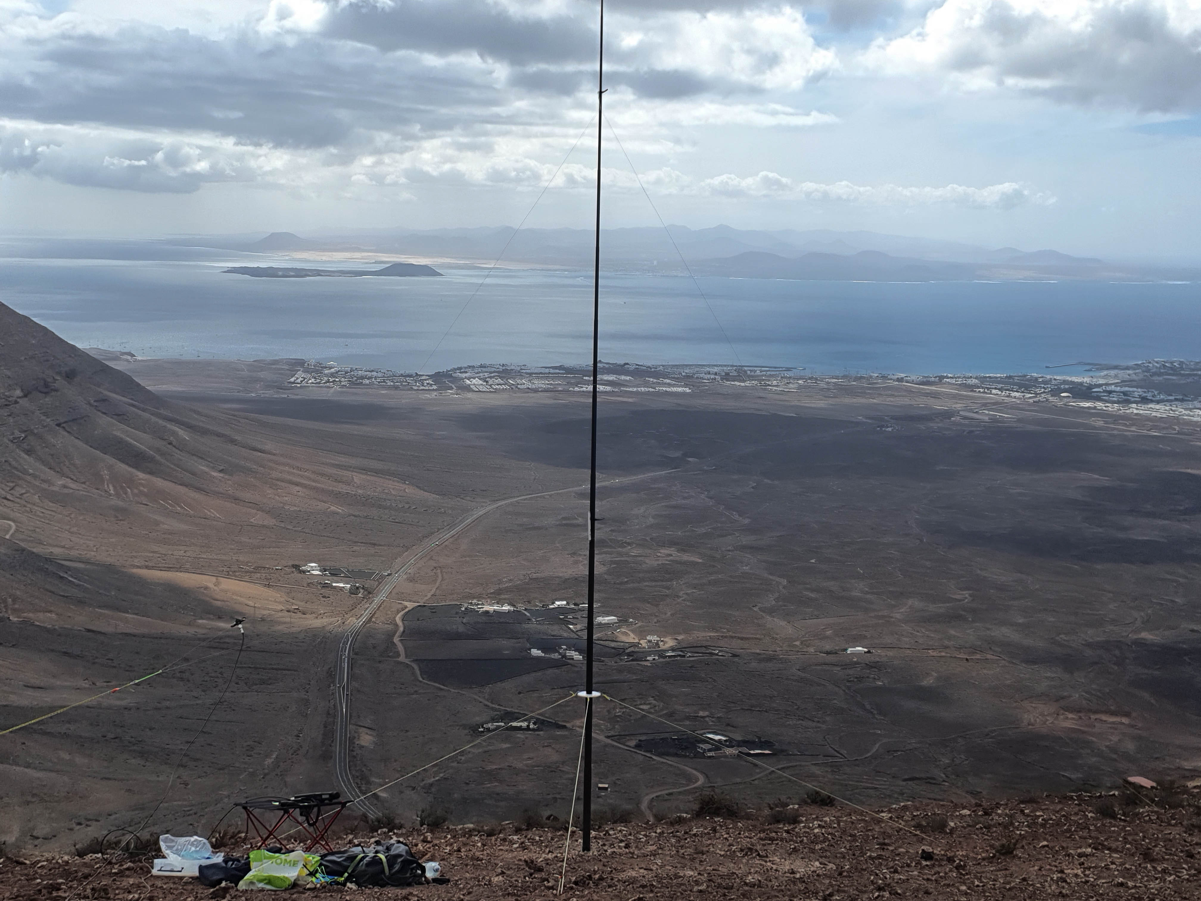
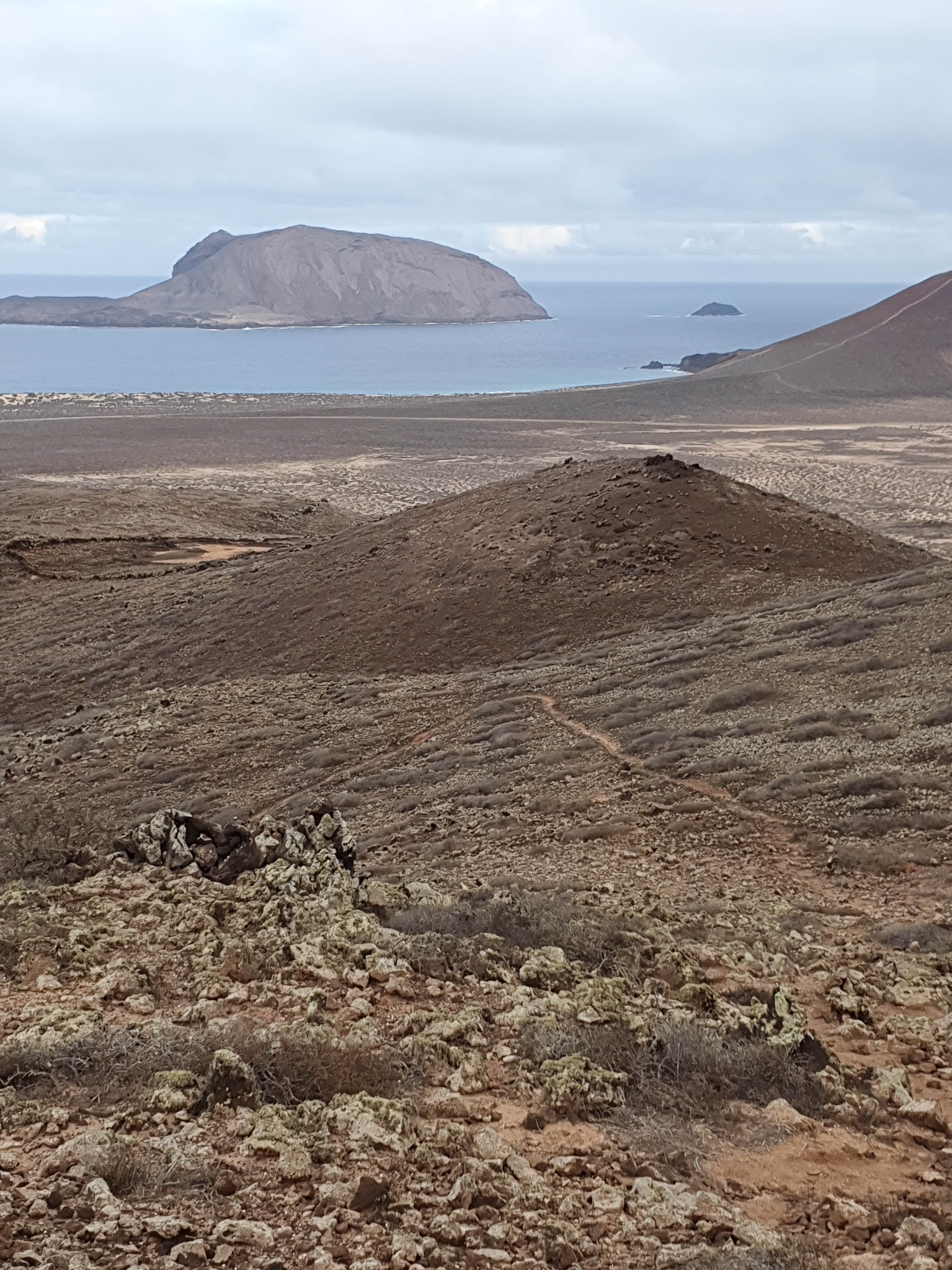
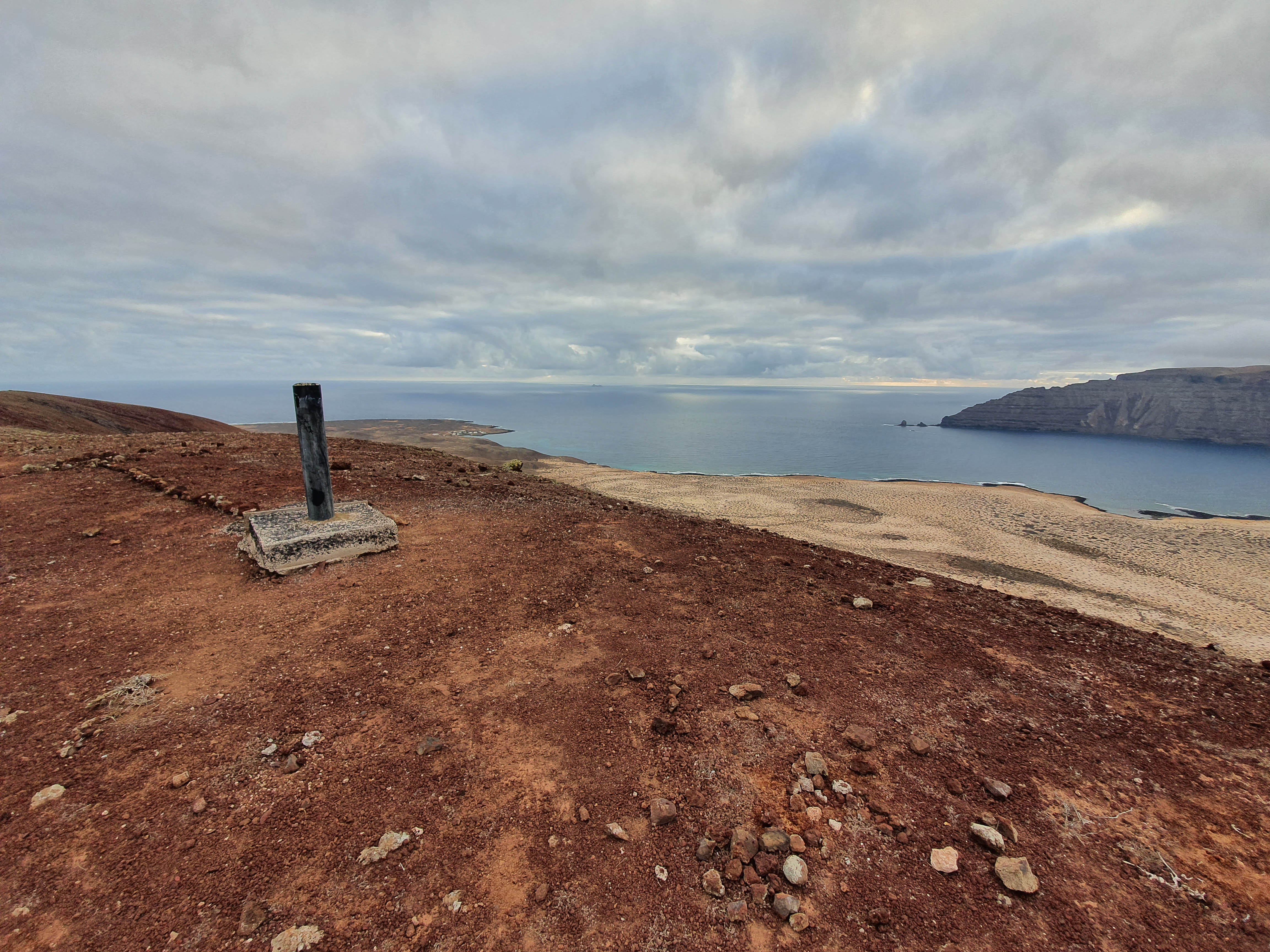
The summit provides nice views of Playa Blanca resort and the nearby islands of Fuerteventura and the little Isla de Lobos.
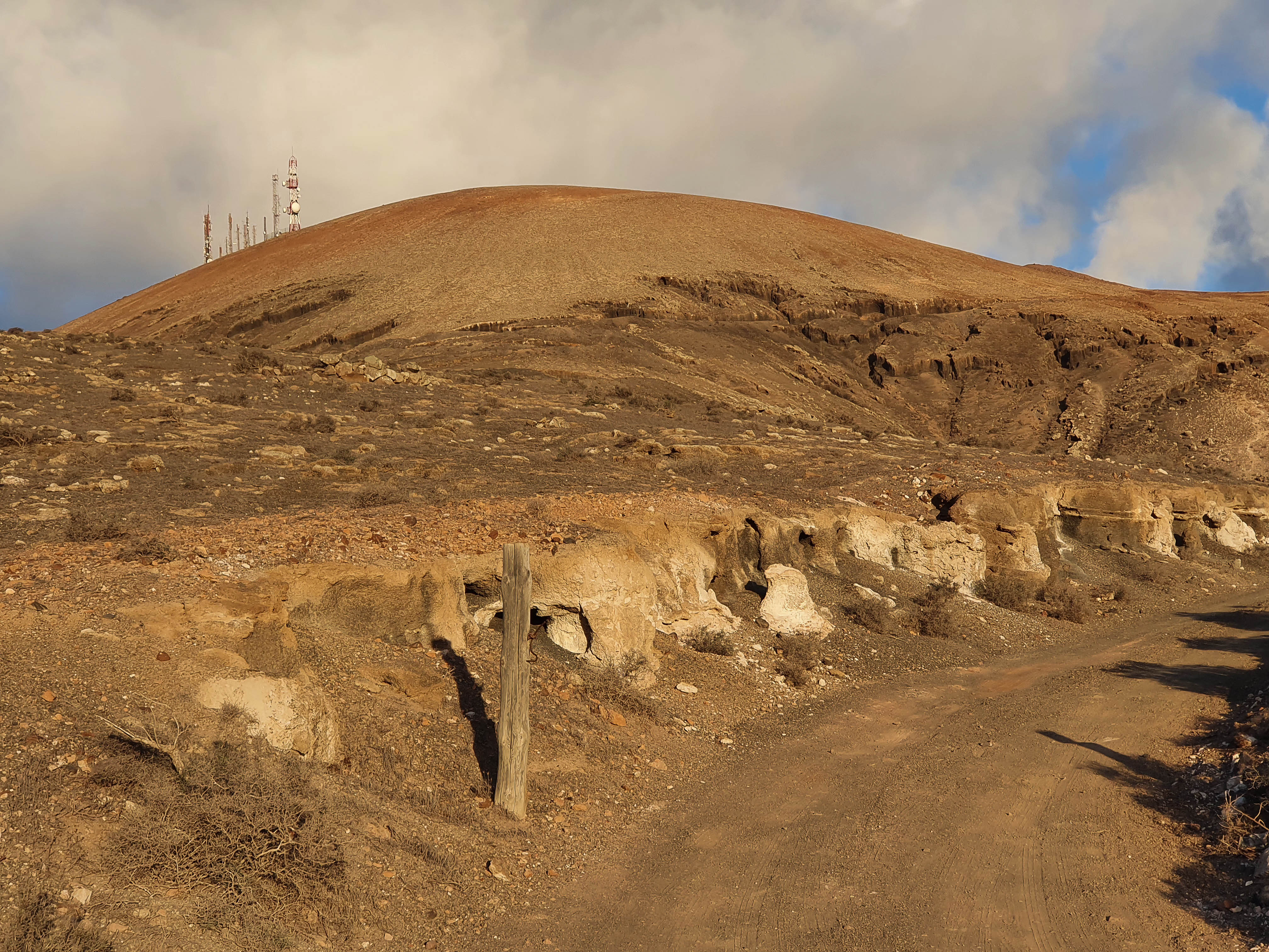
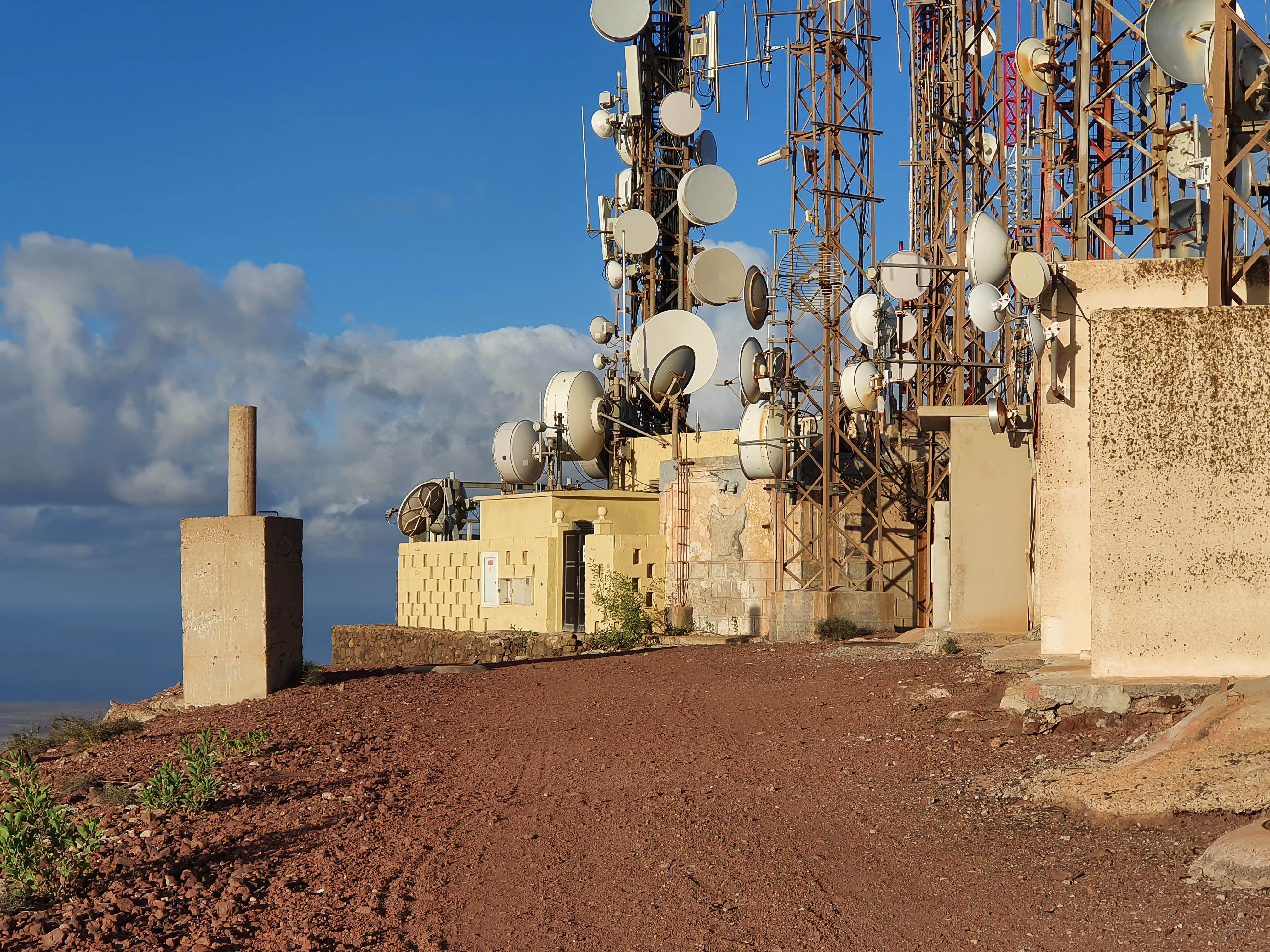
LA-026 Montana Roja 30th Oct 2021
Mark, M0NOM, has already described his activation of this summit next to Playa Blanca, so I have little to add. It is an easy walk up from the resort and I took the path which starts next to a large comms mast - you can’t miss it.
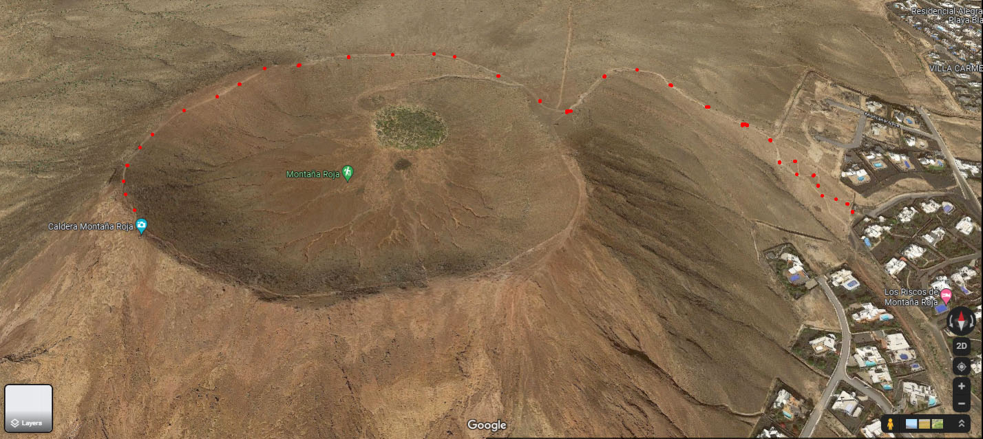
Operating position was off the main path just down from the summit marker. It was a little restricted regarding guying, as I had to stay well clear of the path which carried a regular procession of runners, dog walkers and family groups all morning.
LA-023 Agujas Grandes, Graciosa Island 2nd Nov 2021
For my last activation of the holiday we took the ferry over to La Graciosa and stayed a couple of nights in the little port of Caleta del Sebo. Graciosa has no properly paved roads and you can’t take a car with you. Most folk either walk or hire bikes to get around, plus there are 4x4s which act as taxis and transport groups around. The ferry leaves from the port of Orzola on the North coast of Lanzarote and takes about 30 minutes. We had met an ex-Graciosa guide earlier in the week who advised poor sailors to take a travel pill before taking the ferry as it could be choppy. As I get seasick very easily I took his advice. On the day, the weather was good but the boat did rock and roll a bit, so I imagine that with some significant wind it could be an interesting 30 minutes.
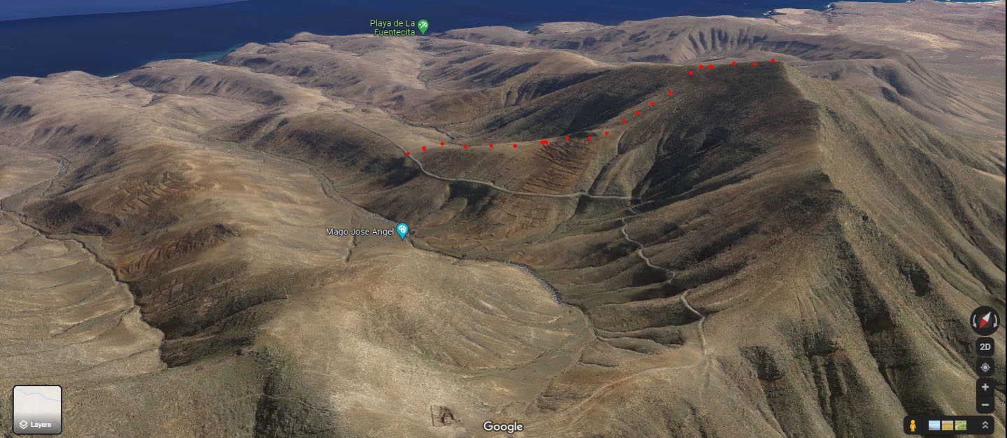
There are 2 summits on Graciosa and I chose the larger one in the middle of the island as it had only been activated once before, by Stefan, HB9HCS. After discussing the route with him, I set off before dawn.
Initial route:
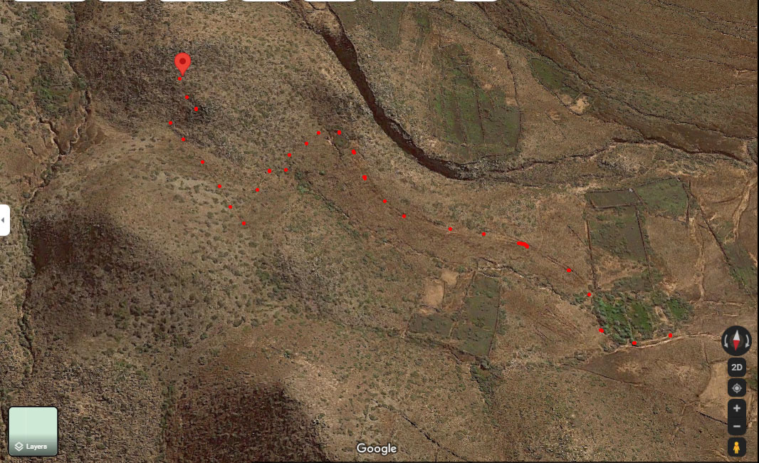
On joining the main “road” leading towards the hill I was confronted with a group of road works signs showing walkers and bikers were banned. I made a slight detour and joined the main “road” further along where there were no such signs
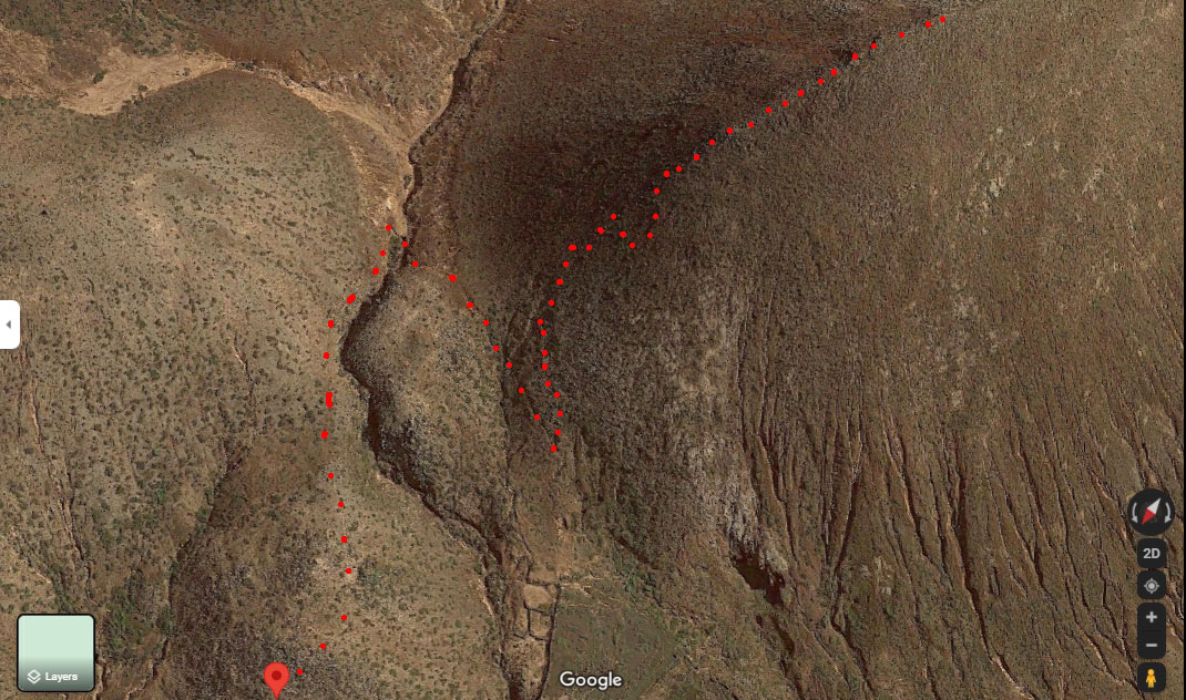
After searching about, I crossed over a couple of low field walls and walked towards the end of the Western limb of the caldera, eventually finding a trail of footprints that led to a reasonably well-defined path, which I now believe is the Sotlas trail.
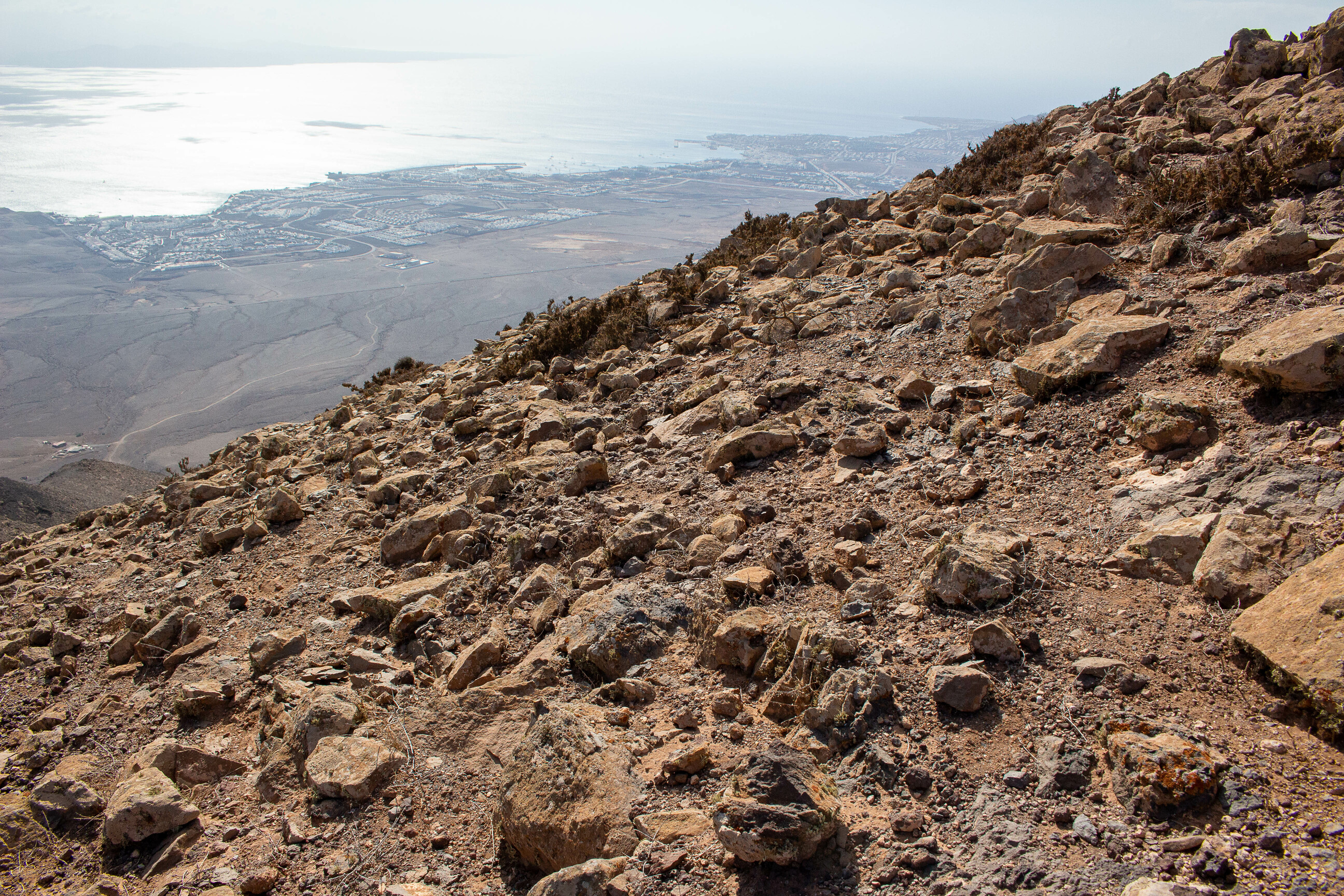
Looking back down to the path with island of Monte Clara in the background
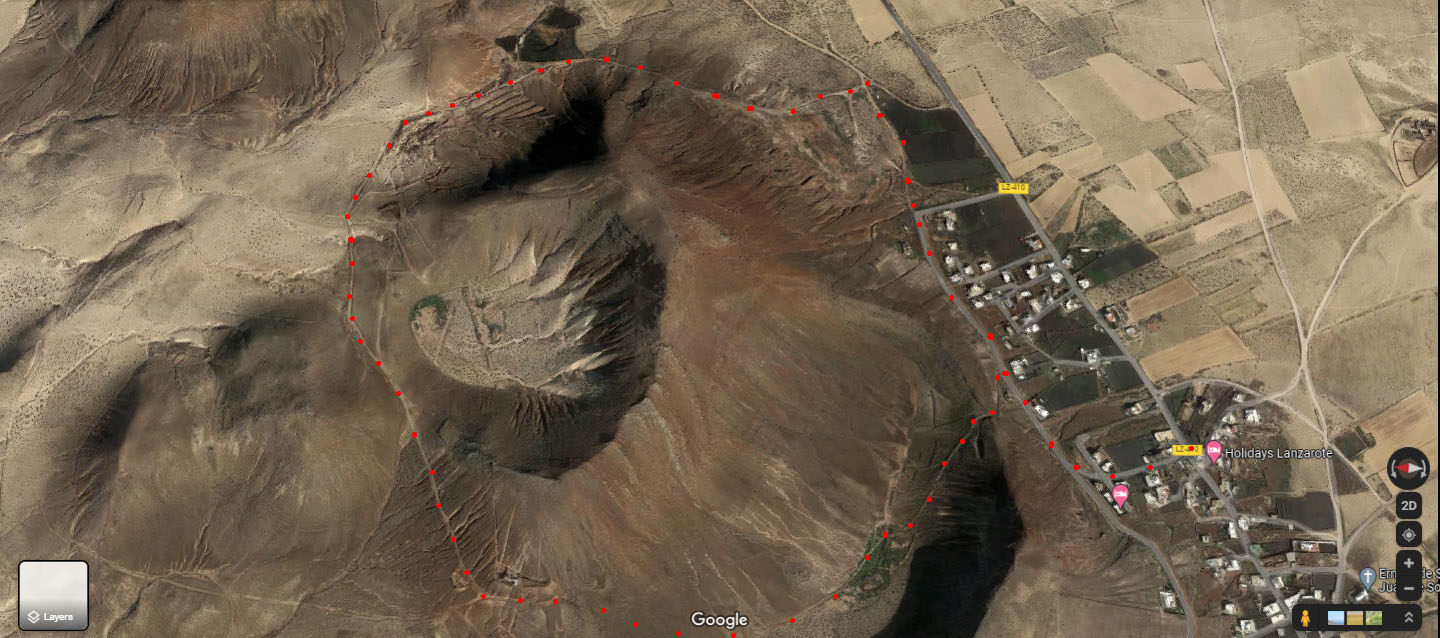
The continuation of the path can clearly be seen on Google Earth; it crosses over a dry river bed and then leads steeply up the Western limb of the caldera - which I deemed OK going up but thought would be problematic coming down.
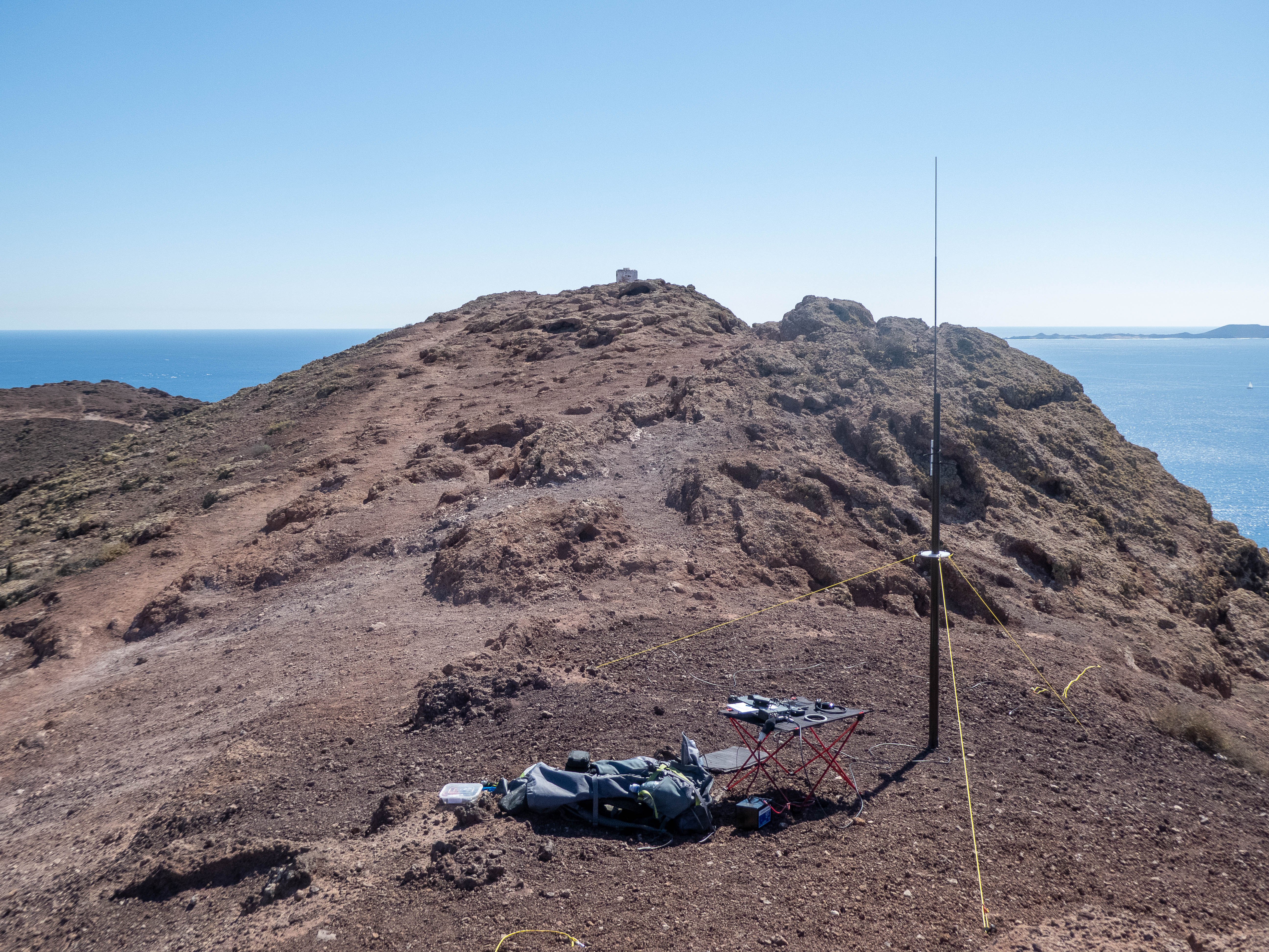
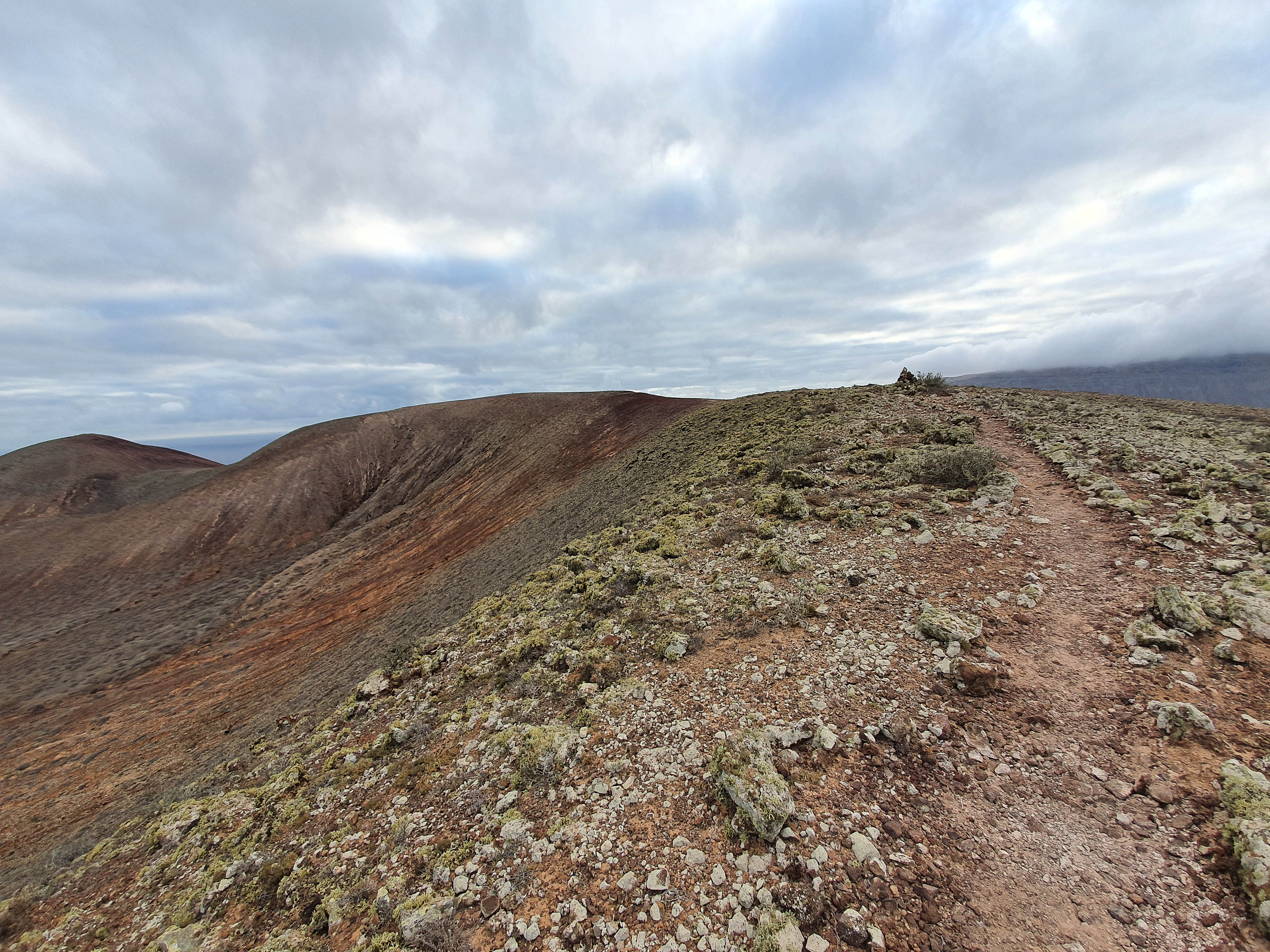
I then walked around the rim of the caldera to the summit marker
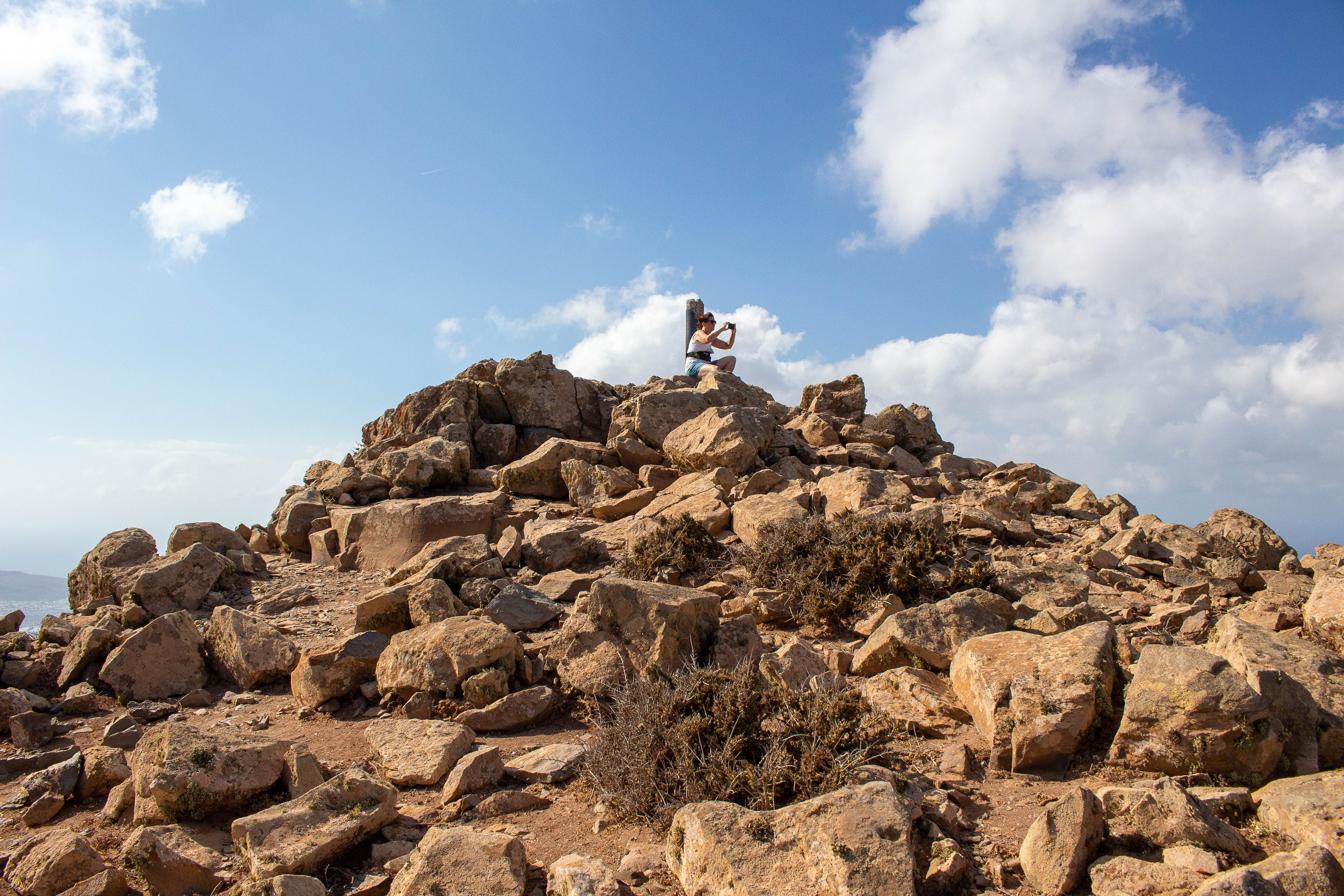
Summit marker
Operating position not far from the summit marker. It was quite windy but warm and I was not surprised to have the summit to myself all day. The only people I saw were bikers on the roads below.
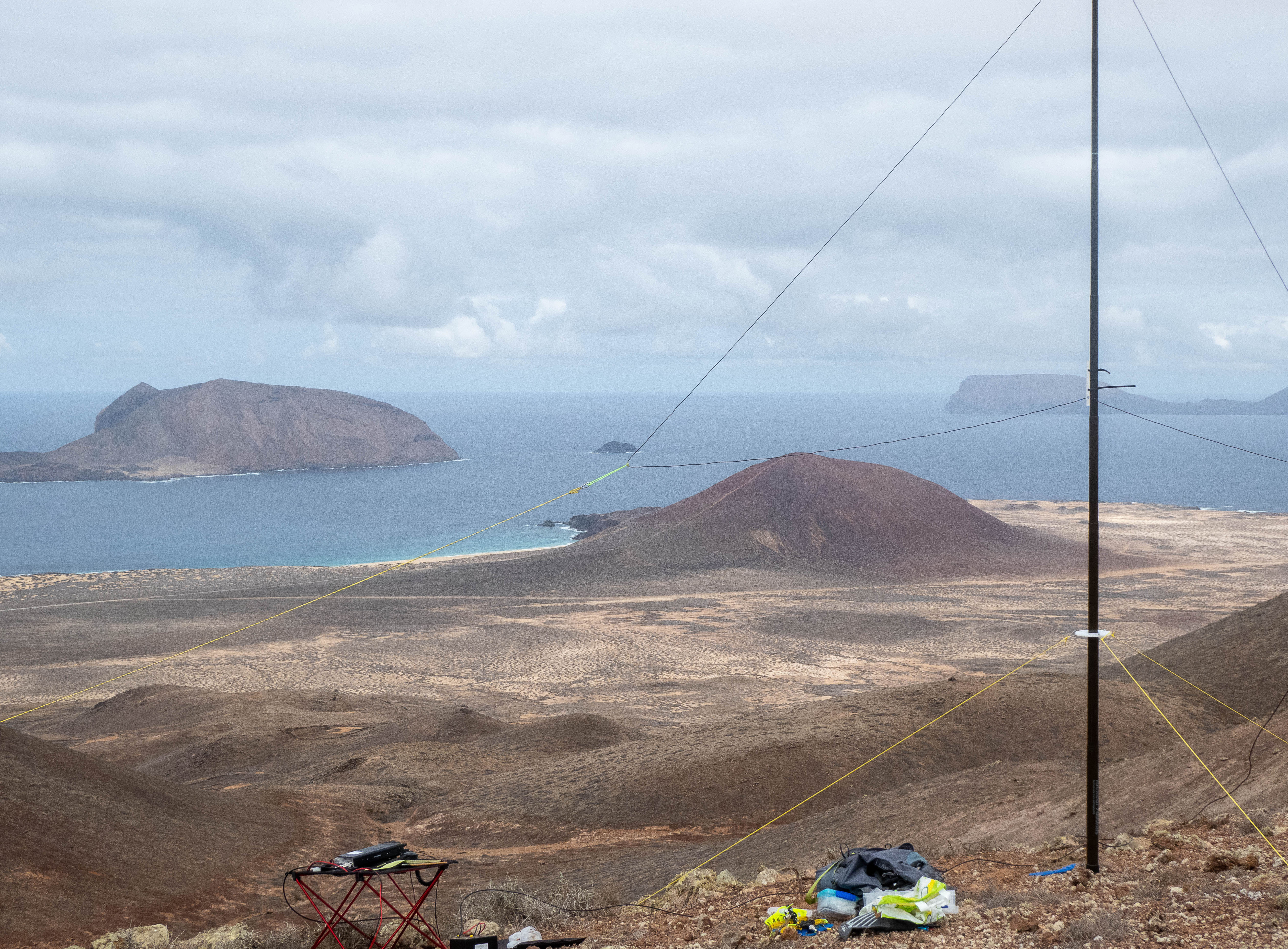
As I didn’t fancy going back down the way I’d come up, I decided to find a way down from the Eastern limb of the caldera. A clear path runs along the rim to a col between Agujas Grandes and the next hill to the North. A path then descends the flank, following beside a dry stream bed to the road running along the Eastern flank of the hill. Care was needed in a couple of places but it was a relatively quick descent. I think this is probably the same path shown on Sotlas.
Looking back up to the col
Recce of 2 other summits
While on non-SOTA walks with my XYL I checked out two other summits: LA-006 Hacha Grande and LA-021 Soo. Although I didn’t activate these (not yet, anyway), I hope the info will be useful to others.
LA-006 Hacha Grande
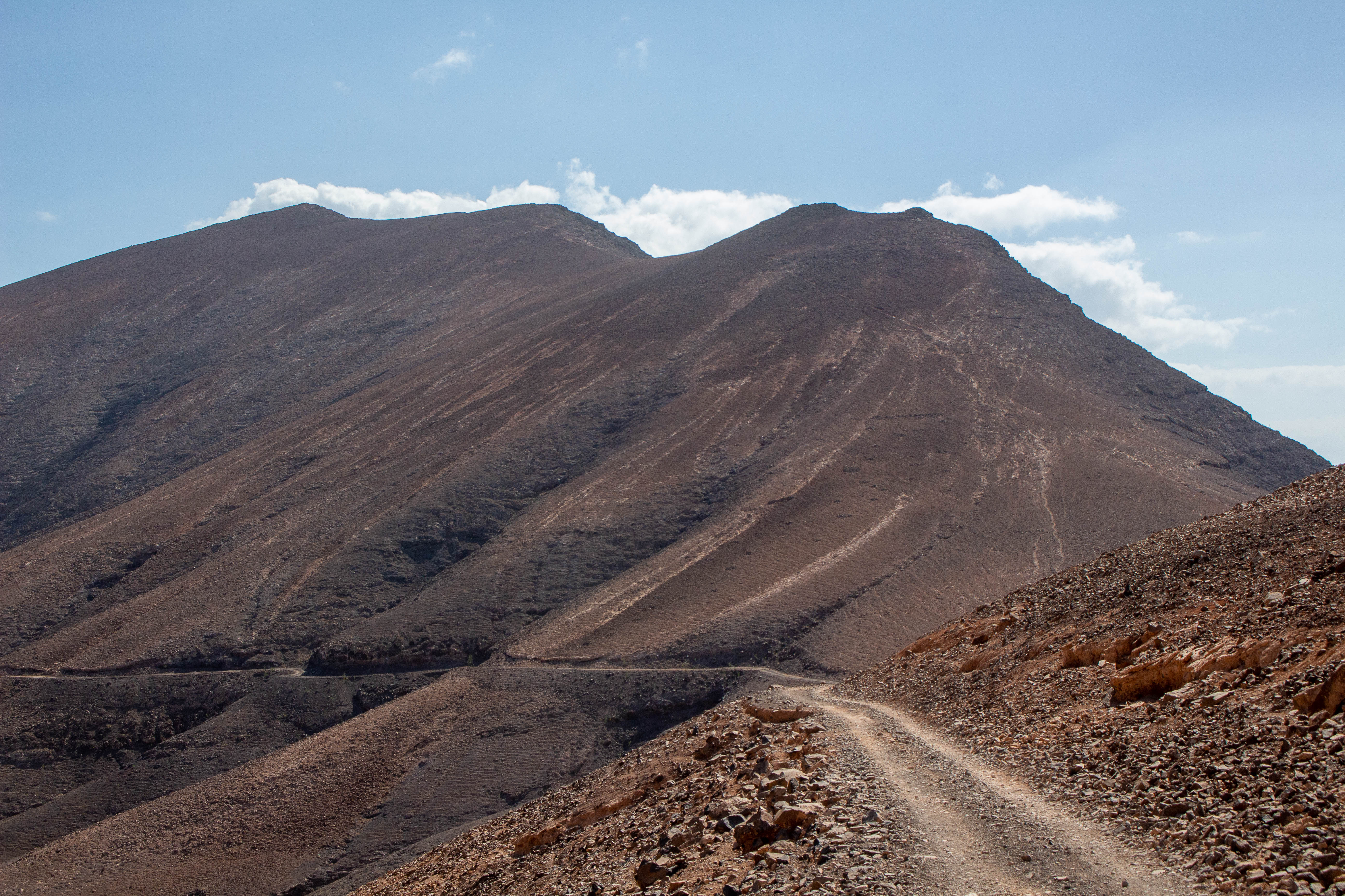
Hacha Grande is an imposing-looking summit in the Femes village area and is on a long ridge rather than a volcano. We approached it on a trail which starts by a goat farm in the village of Femes:
A more direct route would be via a dirt track that services another goat farm - this track can be seen in the photo above zig-zagging up the flank of the ridge. A better view is shown below:
This dirt track is marked on our map of Lanzarote as private, so I doubt if it would be possible to drive any distance along it.
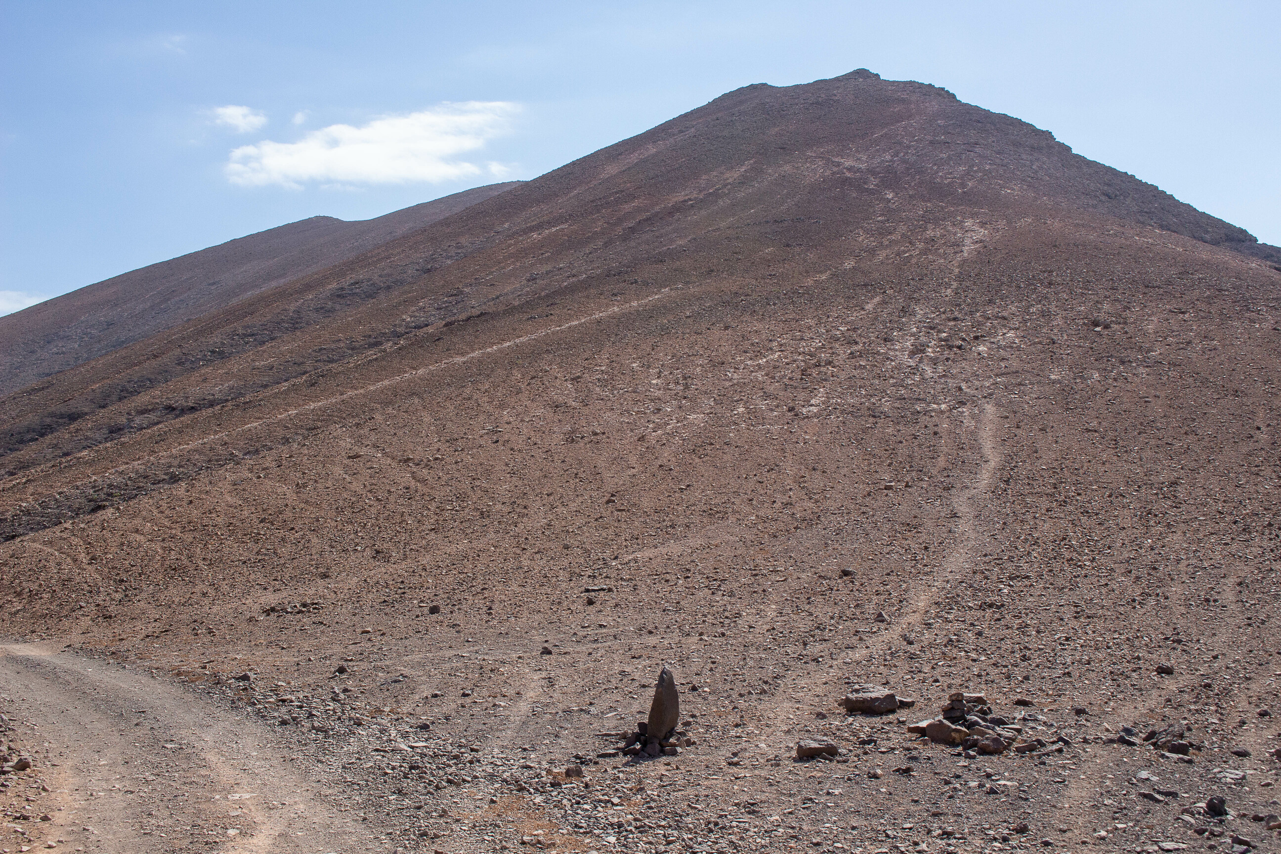
The ascent to Hacha Grande branches off the well-marked track which skirts the base of the ridge - the summit is the third peak to the left:
and is marked by a group of small rocks:
The path up is a steep one, but I think I could have managed with my kit OK - coming down would have been more challenging I think.
Approaching the summit marker:
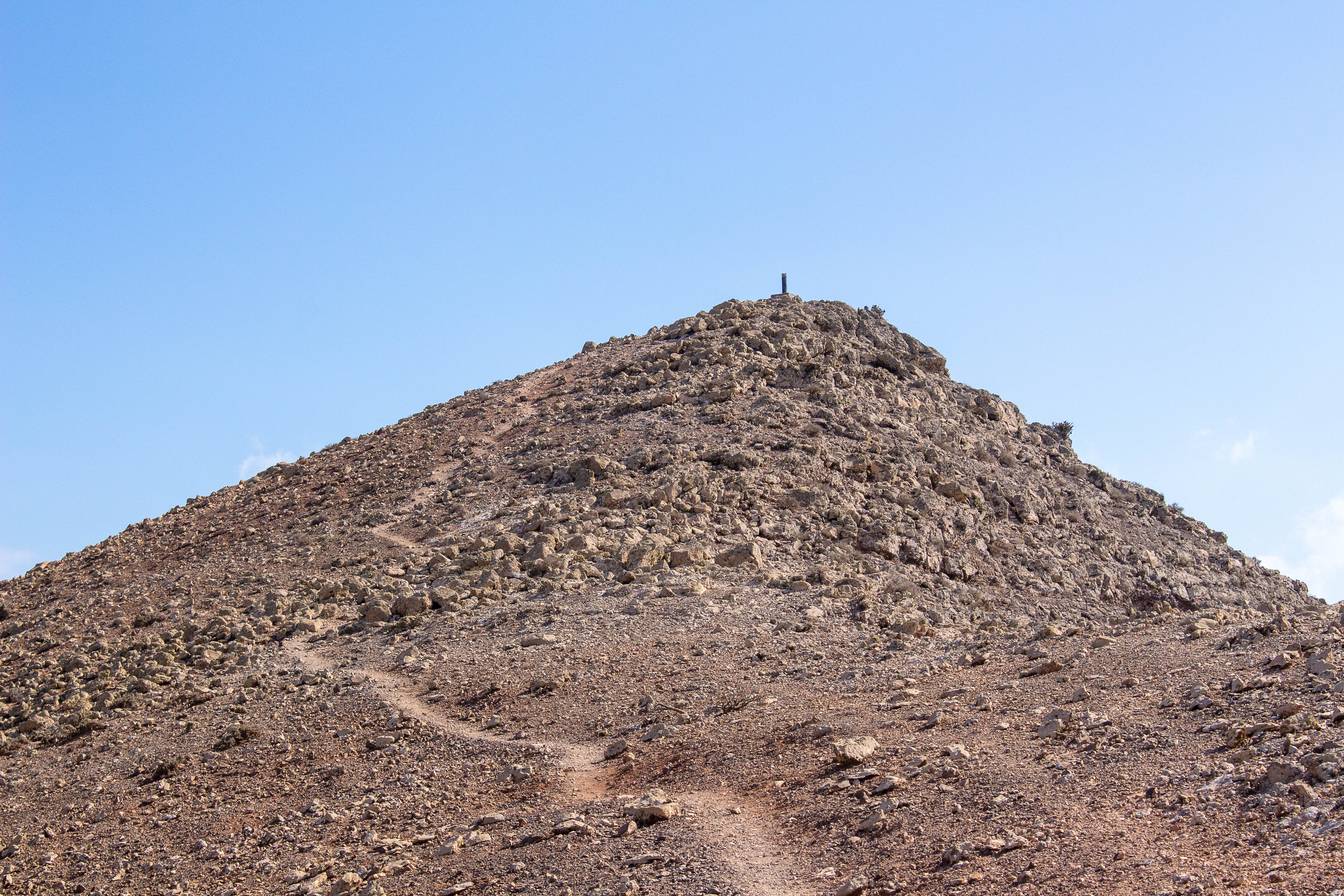
The summit itself is a boulder-strewn crag:
On the Western side, down from the summit, the ground is less bouldery and would provide a reasonable (although sloping) activation position with room for mast guys etc:
Coming down, you could just retrace your steps, although I would prefer to have some hiking poles if carrying any load. An alternative is to do what I and my XYL did, which was to come down “off-piste” and rejoin the main basal track further along:
I note that Sotlas shows a route up the North flank from Playa Blanca, which on Google Maps looks rather more challenging!
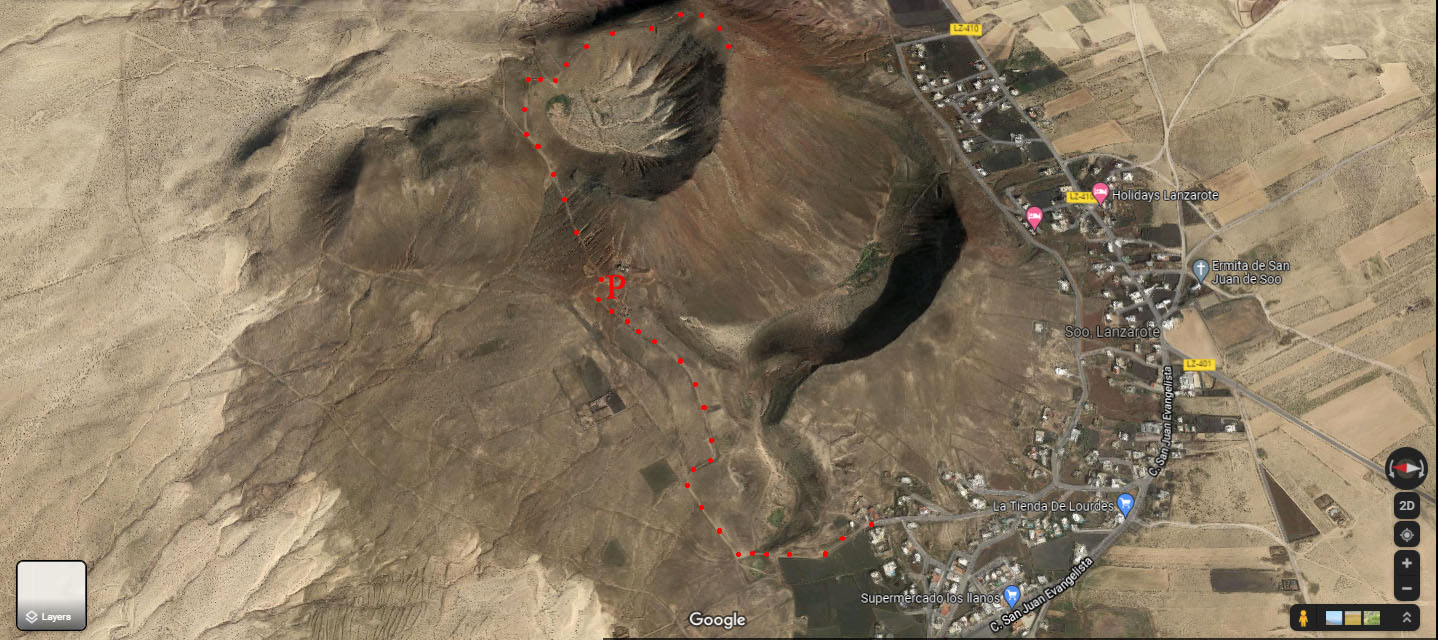
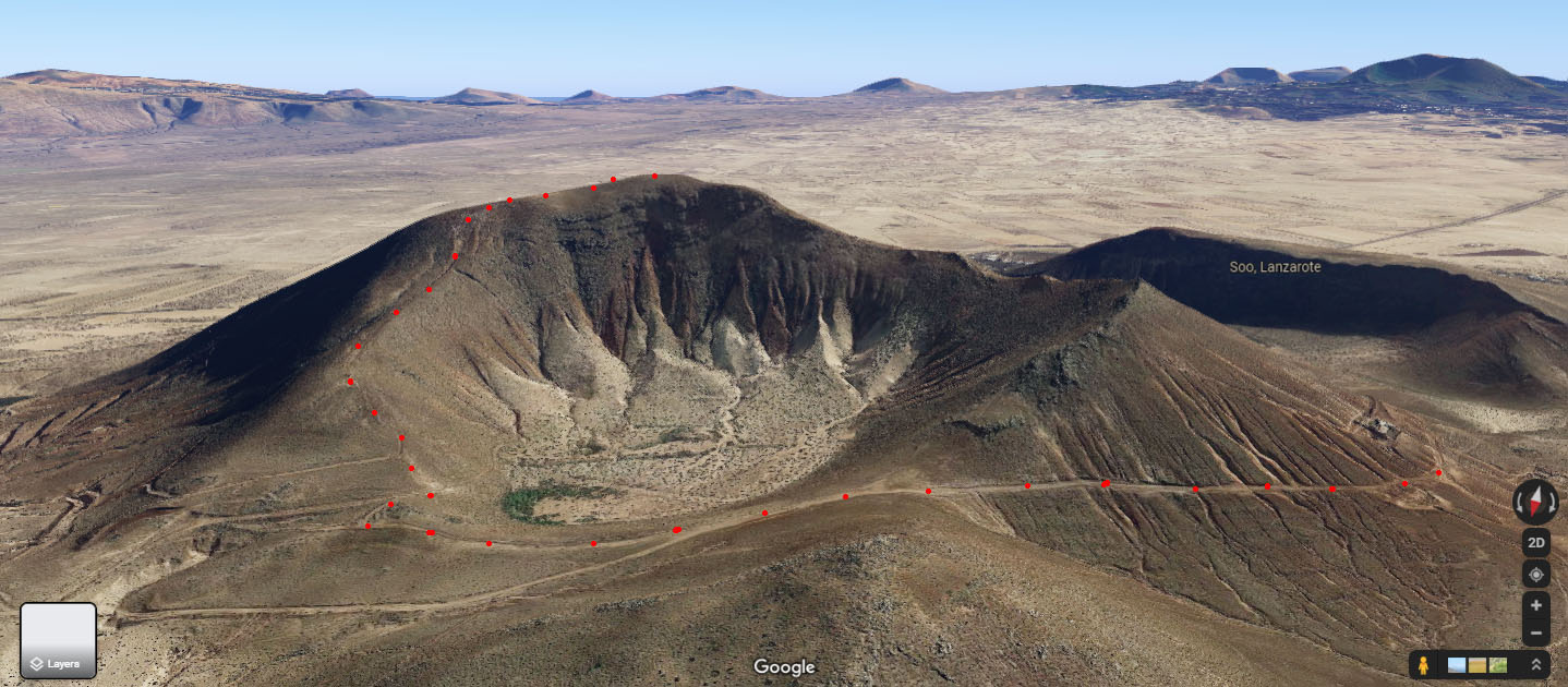
LA-021 Soo
LA-021 is a small volcano adjacent to the village of Soo in the NW of the island. Dirt tracks circle the base. We walked round anti-clockwise from the village:
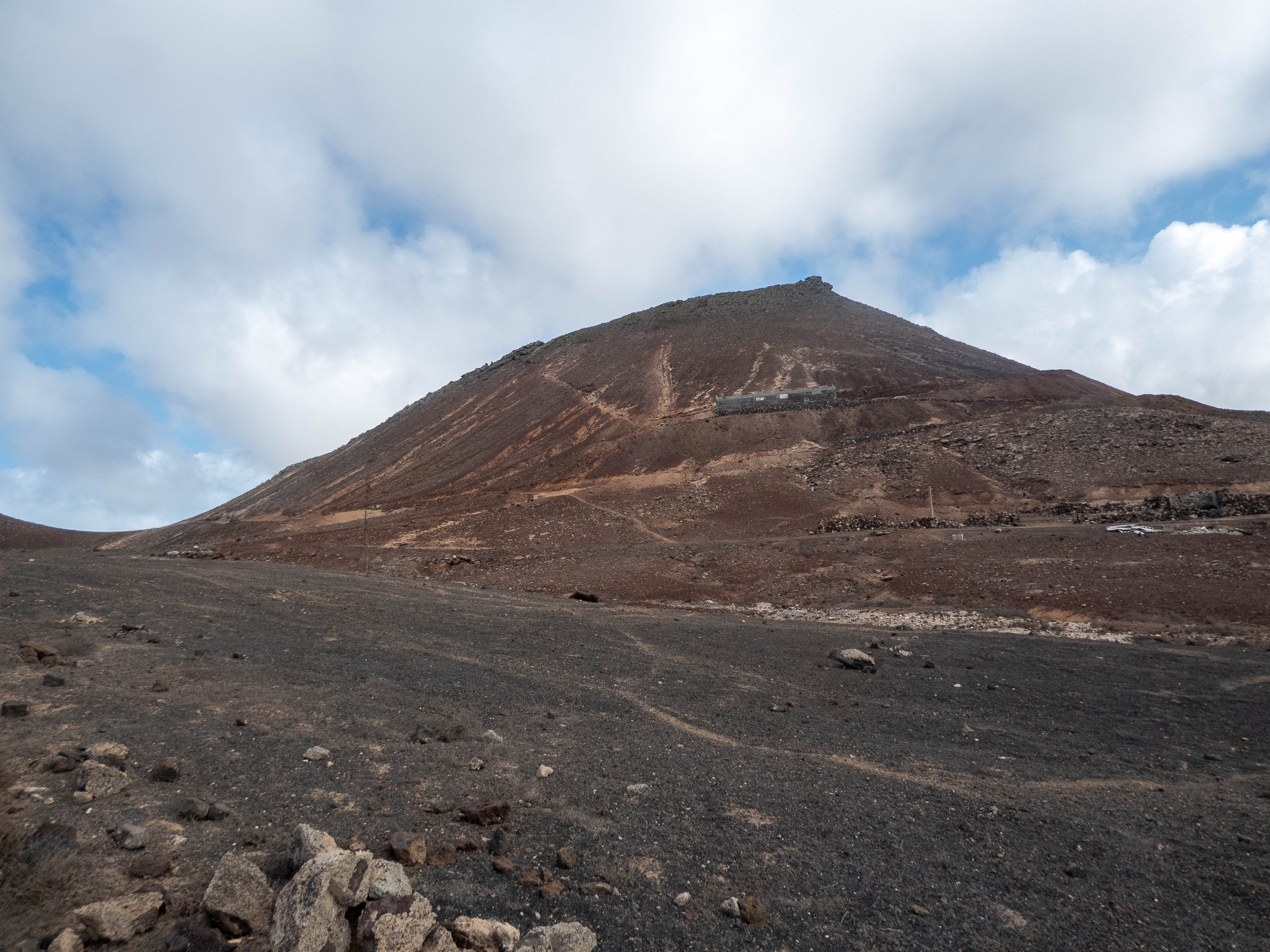
If I was going up to activate, I would start from the south.There is a good dirt track to a farm where there is ample parking space below the farm.
3D view:
Looking up at farm building:
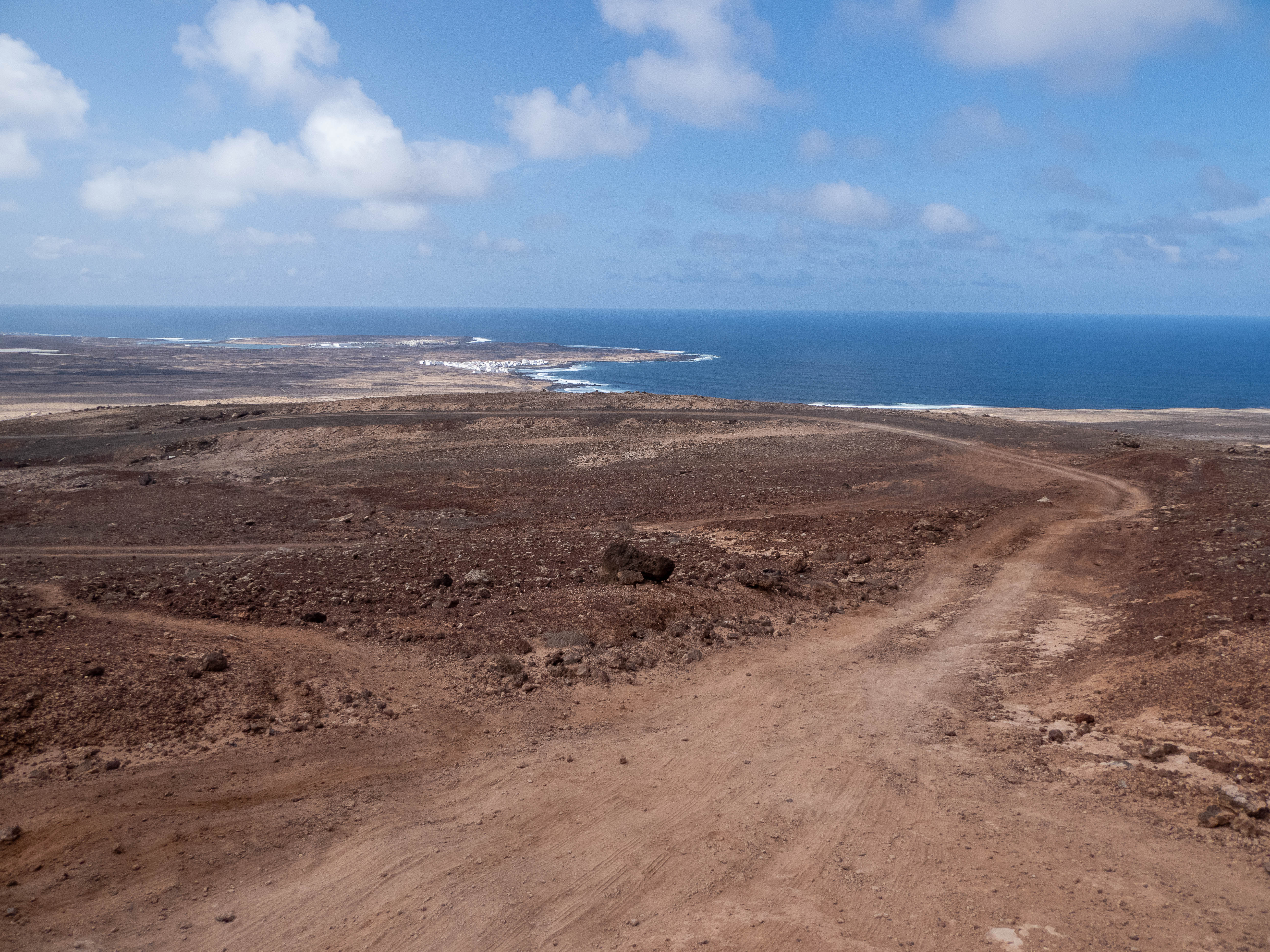
Looking back down the dirt track from parking area below farm:
The ascent is then up the North rim of the caldera on the path branching off to the right in the pic below:
There is also a path leading up the South rim, but the walk around the rim from that direction looks more challenging.
Soo summit marker on horizon:
In conclusion, I would thoroughly recommend Lanzarote as a SOTA destination. The only thing that could be an issue that I did not encounter would be very strong winds.
73 to all, Simon


