Approachable but spicy (?) - this summit has unique views as well as some interest.
Let’s explore its name first: The CNIG map and SOTA information agree… but Google (and other sources), refer to it as ‘La penya del Castellet’.
This can lead to a bit of confusion when planning and researching this summit… with ‘Penya Fordada’ pointing you to its smaller cousin to the west, which is actually ‘Alto De Tronca’ according to this map (courtesy of CNIG):

The starting point can be anywhere really. This summit is on the GR-330, the Costa Blanca Inland Path. There are loads of summits on this 270-280 mile trail. Divided into 20 stages, I can see this being an epic SOTA pilgrimage.
Having started the day with a bit of a booboo (a 1/4 mile walk turning into a 6 miler - @EA5IYL can verify this HI), I decided to drive most of the way in order to give myself enough time to activate.
Looking at the map below, you can see that it’s approachable from the north (CV-752) or the south (CV-757, or CV-755). Approaching from the north is best (if one must approach from the south it were better to go via Beniardá CV-757 - expect a long, twisty and bumpy ride).
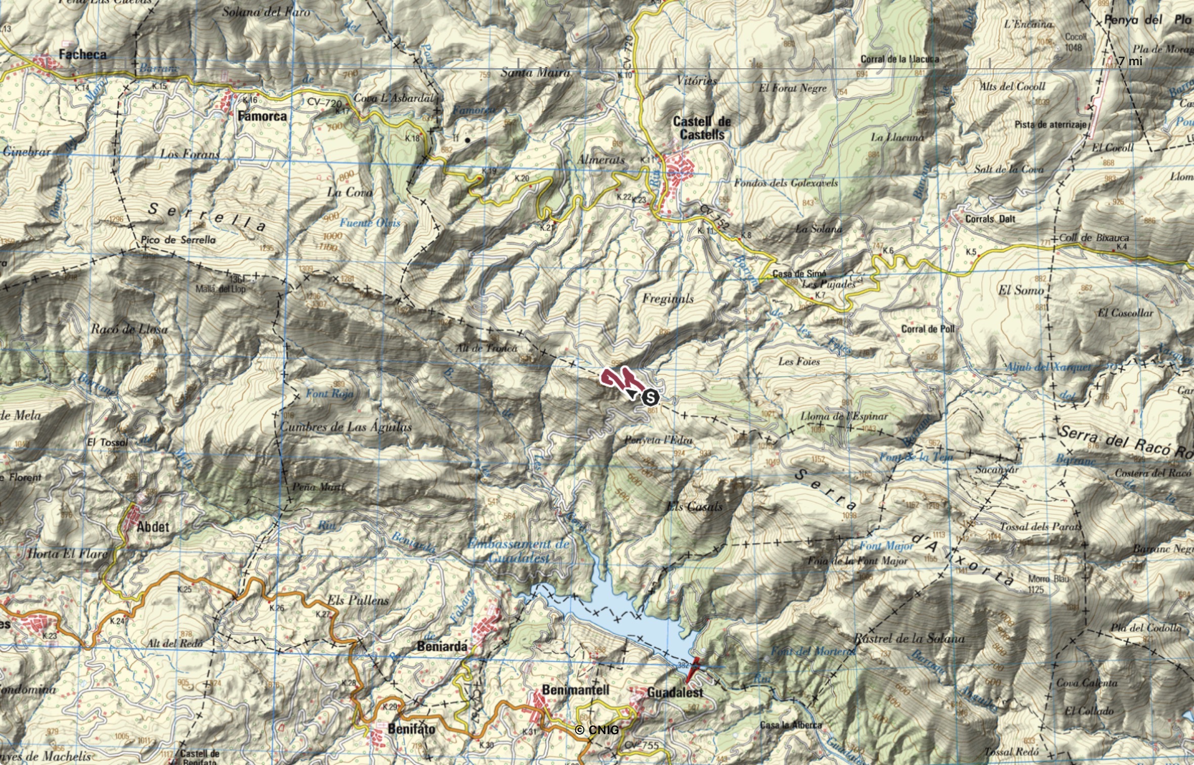
There’s a small area for parking (38.704500, -0.196850). From there it’s just under 1 mile to the summit, with 150m of ascent.
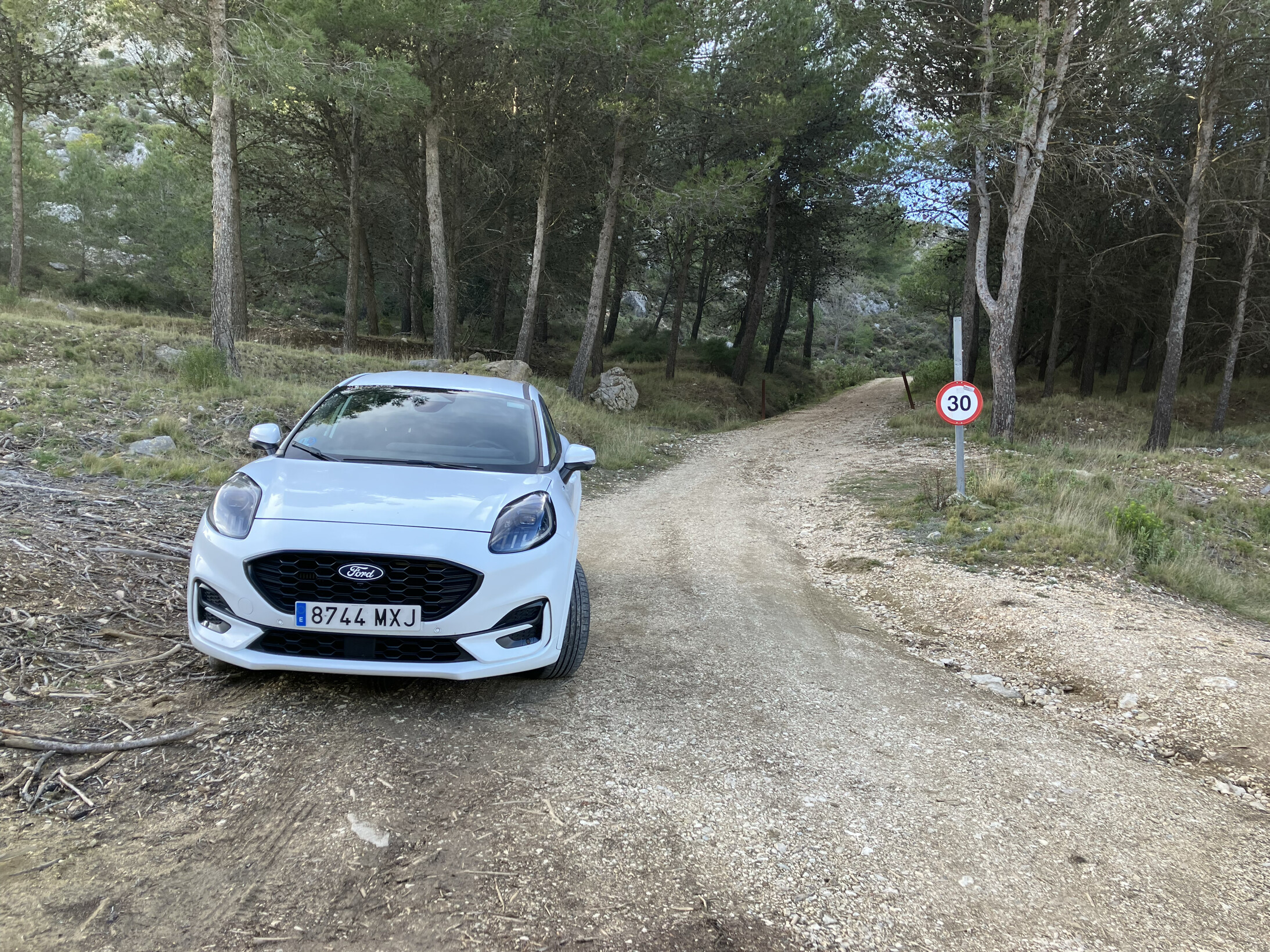
One can drive up further (80% of the way). The first 1/3 is a gravel track, with the latter 2/3 being a concrete road in very good condition.
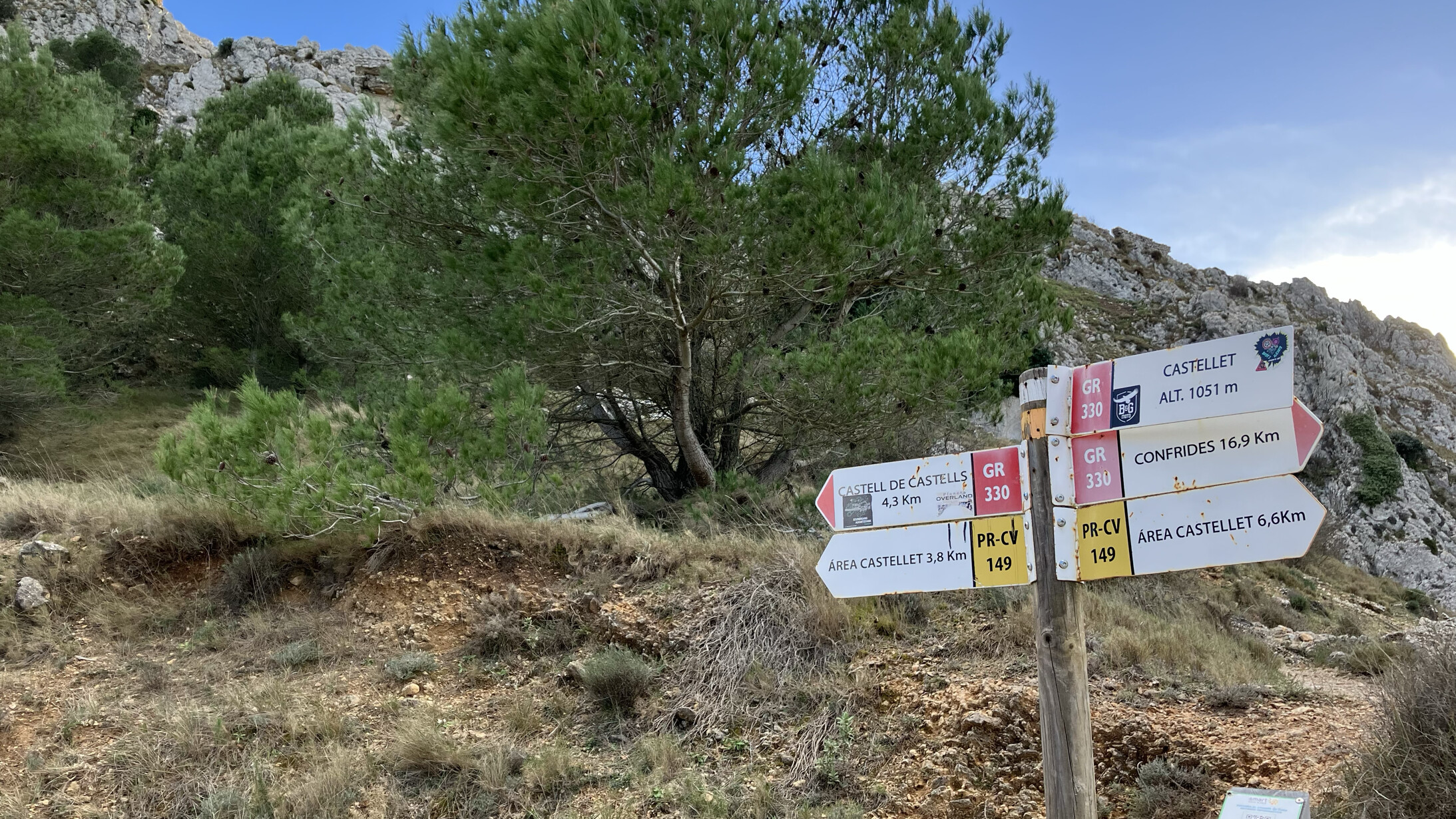
Regardless, follow that road up until you reach this point:
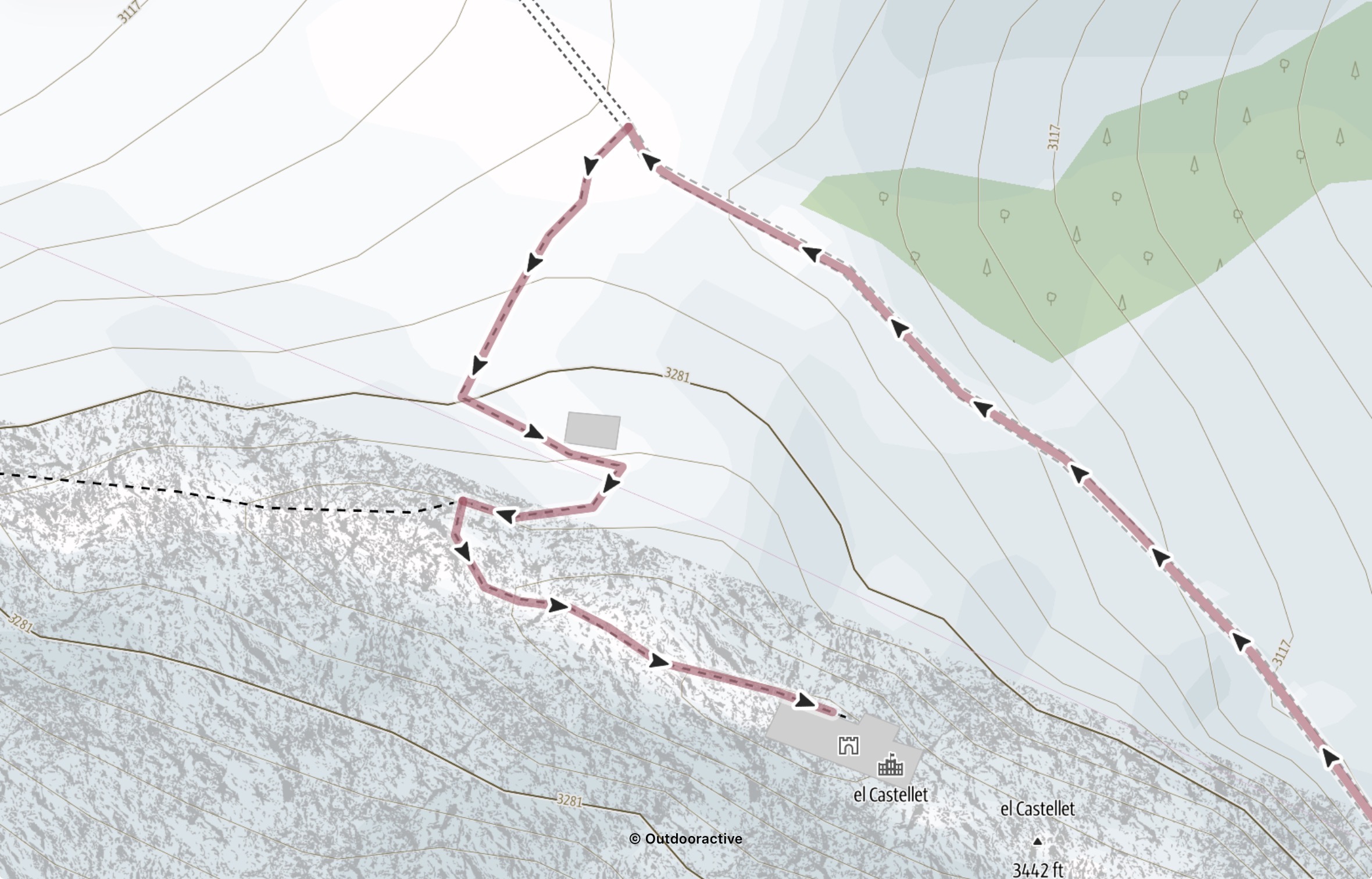
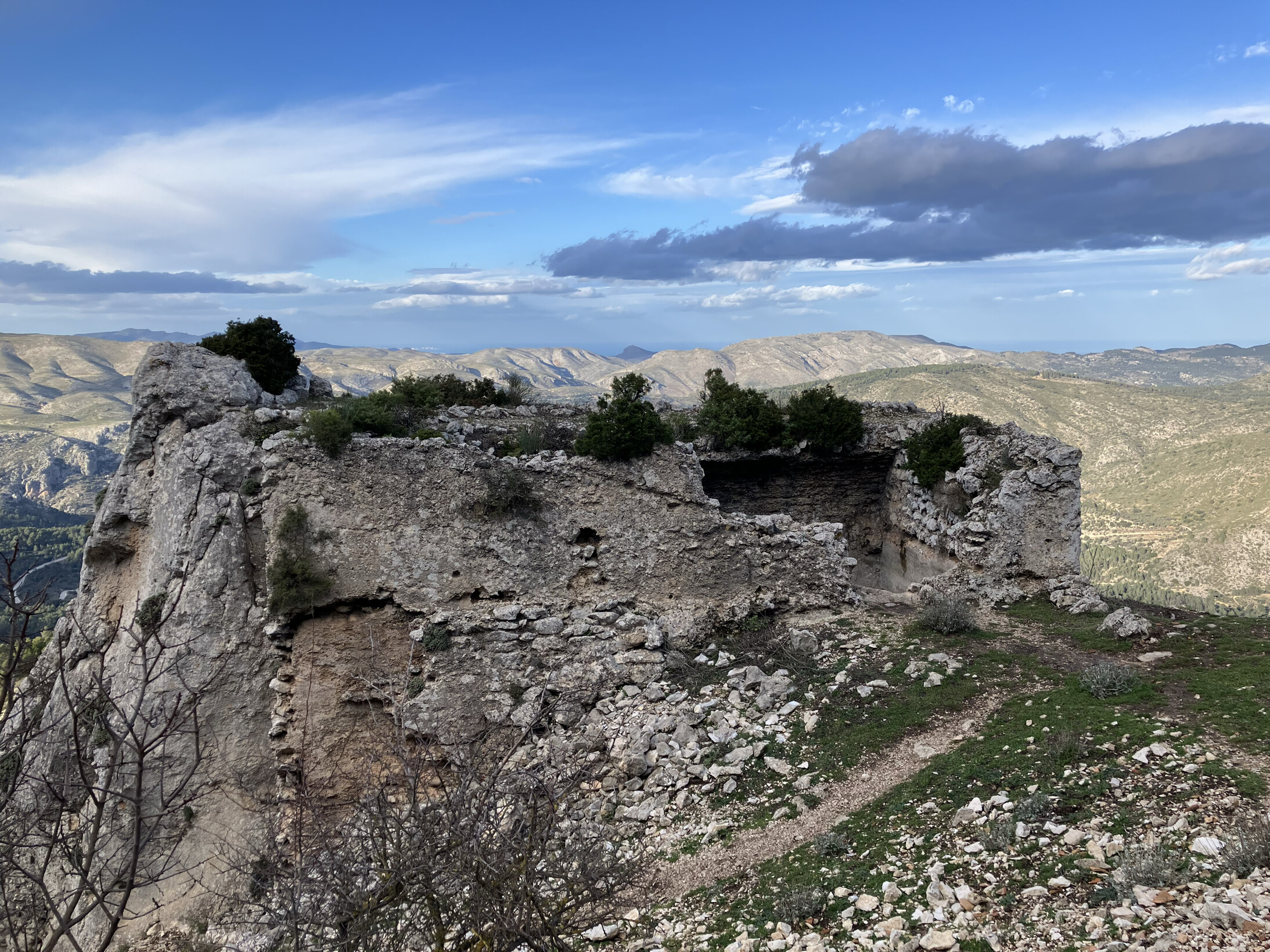
From here, follow a loose track up to the first ruin (depicted by the square on the map below). The main point of interest is the ruin right at the top - fascinating to think about how and why it was built:
From here, it gets less obvious. This would be the third time that the summit was ever activated, plus there were only two other cars at the bottom - don’t expect to be able to follow evidence of traffic.
After a bit of a scramble to an area approx 3m wide, you have a decision to make - scramble up the last (very exposed) 10-15m, or activate from here. I personally wasn’t in the mood for any more excitement HI (more on this later).
South-easterly view, with the Guadalest reservoir visible in its entirety:

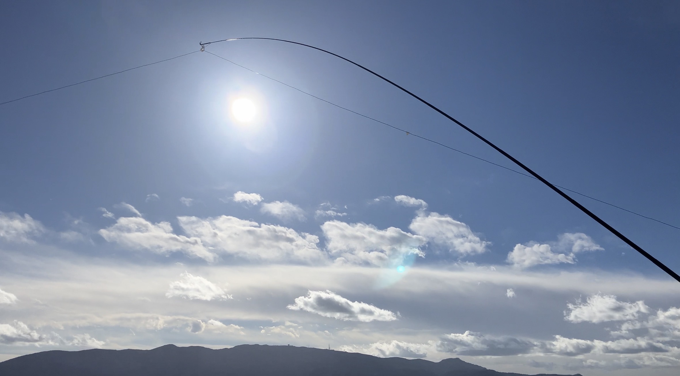
I found a hole to shove my mast into, and worked out where to shove my walking poles. The wind was picking up (with 50 mph gusts expected late night into the early morning). I found a sheltered spot to work from (another reason not to sit on the exposed, flat top):

The usual applies - found a free frequency, only to discover a POTA station started calling. We couldn’t hear each other, but thankfully this was reported to me by M7GFJ.
It also turns out that my coax had a problem - triggering the SWR protection. After a bit of faff, I found a position in which it would work.
I found another free frequency (with some help), and spotted myself. After a very slow start, I called the big guns - I messaged Mikel and he kindly spotted me for POTA too. This is when it got busy. I might SPOTA in future to get more contacts.
With 16 in the log, I had to go QRT - I needed time to disassemble the precariously placed mast etc, and get down safely. I had ascended a spicy way (hadn’t a clue which way to go) however the descent ended up far more palatable (hence sharing it above). Thank goodness - I’d already had enough exposure. ![]()
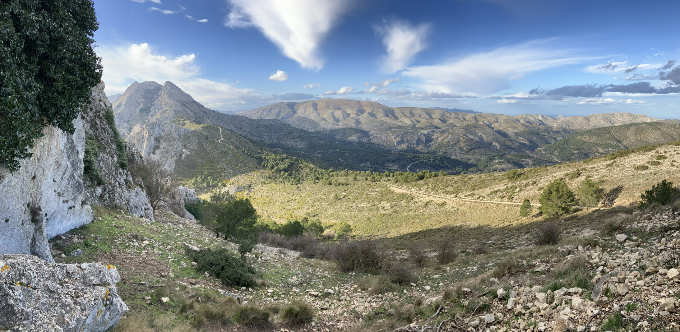
Beautiful views on the way down:
I really liked the surroundings. I’ve been up other summits in the area (including AT-001 and AT-002) - I found this to be up there with the best.