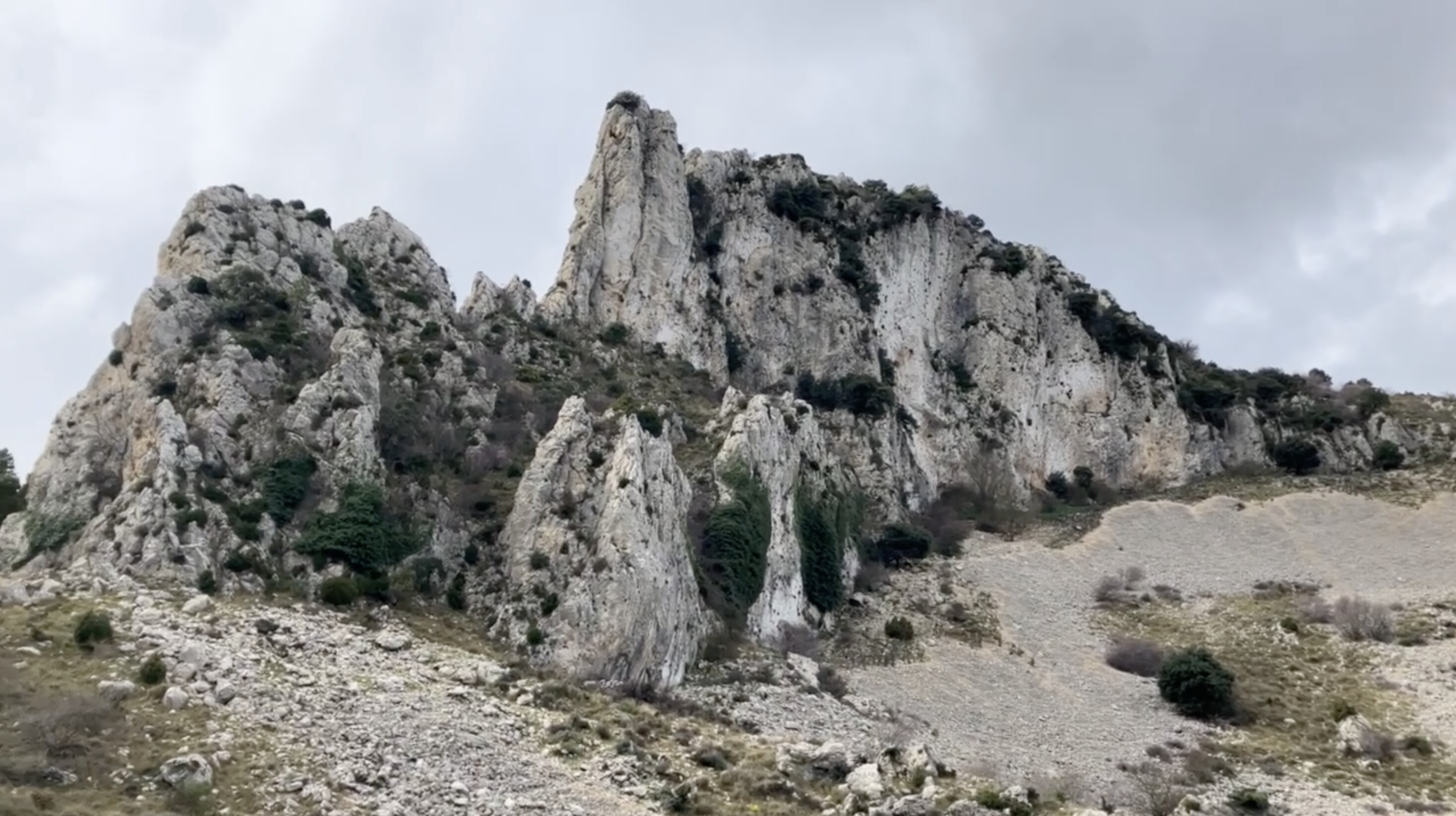
Yet another seldom activated summit, with some of the best views I’ve experienced so far. There’s a definite mountaineering feel to it.
This summit is on La Serella - a ridge that has wonderful views, as well as other summits to activate.
I saved this summit for my last day of hiking. The route starts in Fageca (Facheca), where I was staying, but there are other ways of approaching this summit. With other summits not too far away, this can be turned into an epic day out with some planning.
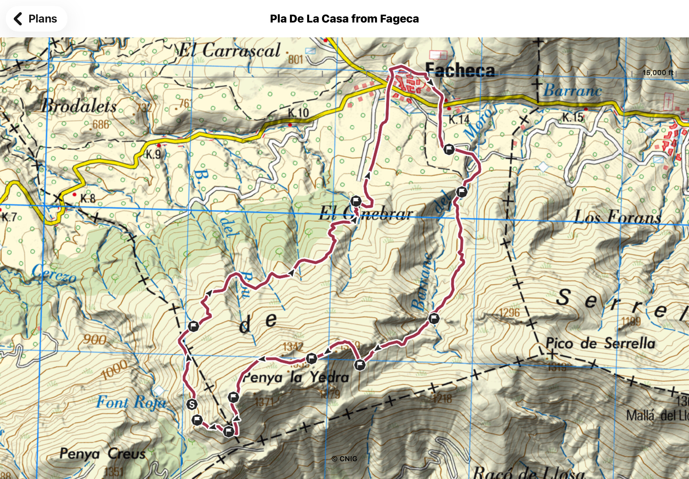
Map (courtesy of CNIG) of the intended route, I made a change due to poor GPS coverage on the day:
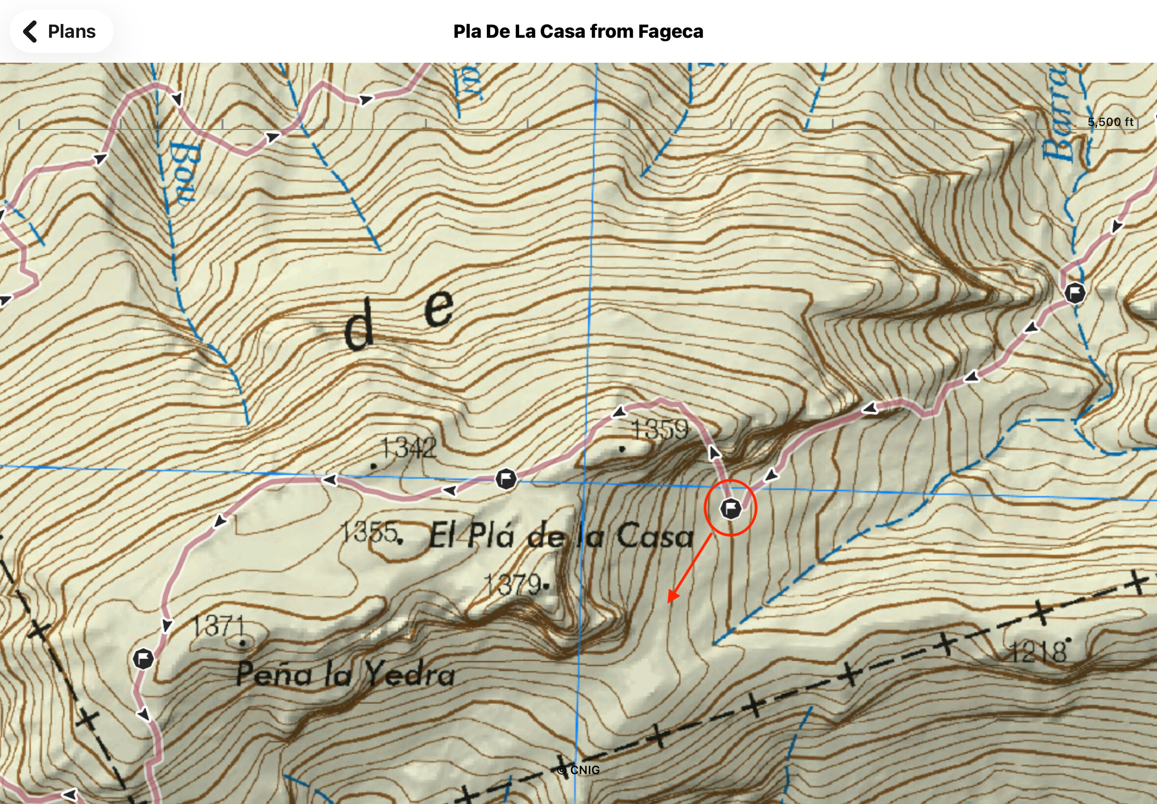
Note, this route doesn’t kiss the actual summit - I therefore ascended the extra distance to stand right on top of it (a little scramble is involved). There were GPS anomalies which concerned me, therefore I was ready to go back the way I came, descending back down to the waypoint east of the summit. From there, normal service resumed so I decided to walk underneath the summit, heading west towards Font Roja, to re-join the route.
This route clockwise. Whilst steeper on the ascent, it avoids a steep descent on loose scree (therefore avoiding a sore bottom). The published route (link above) suggests an anti-clockwise approach.
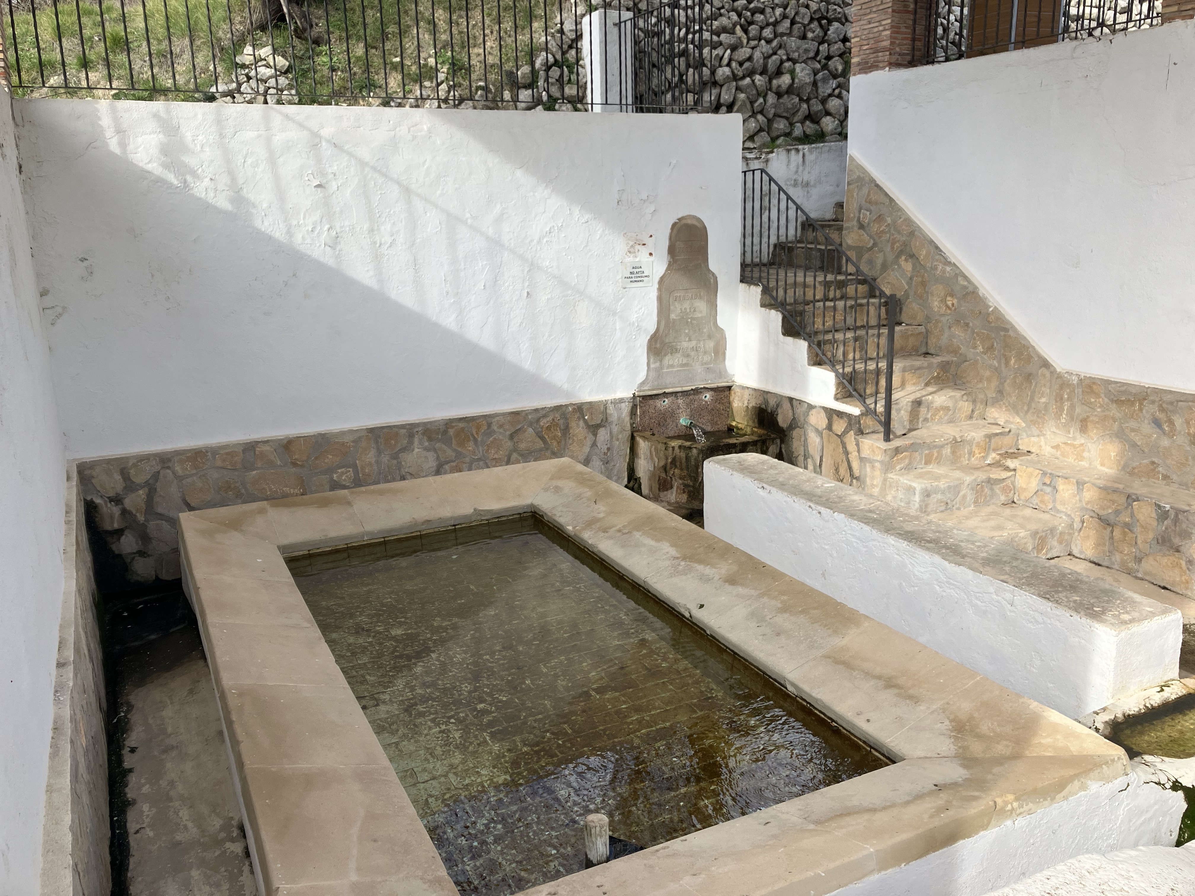
Heading south out of Fageca, along a rural access road, you quickly reach Font De L’esperit Sant.
The concrete ends as you start a steep, windy ascent. The route is well signposted however keep your eyes peeled - it is easy to go off-piste because of other foot traffic in the lower parts.
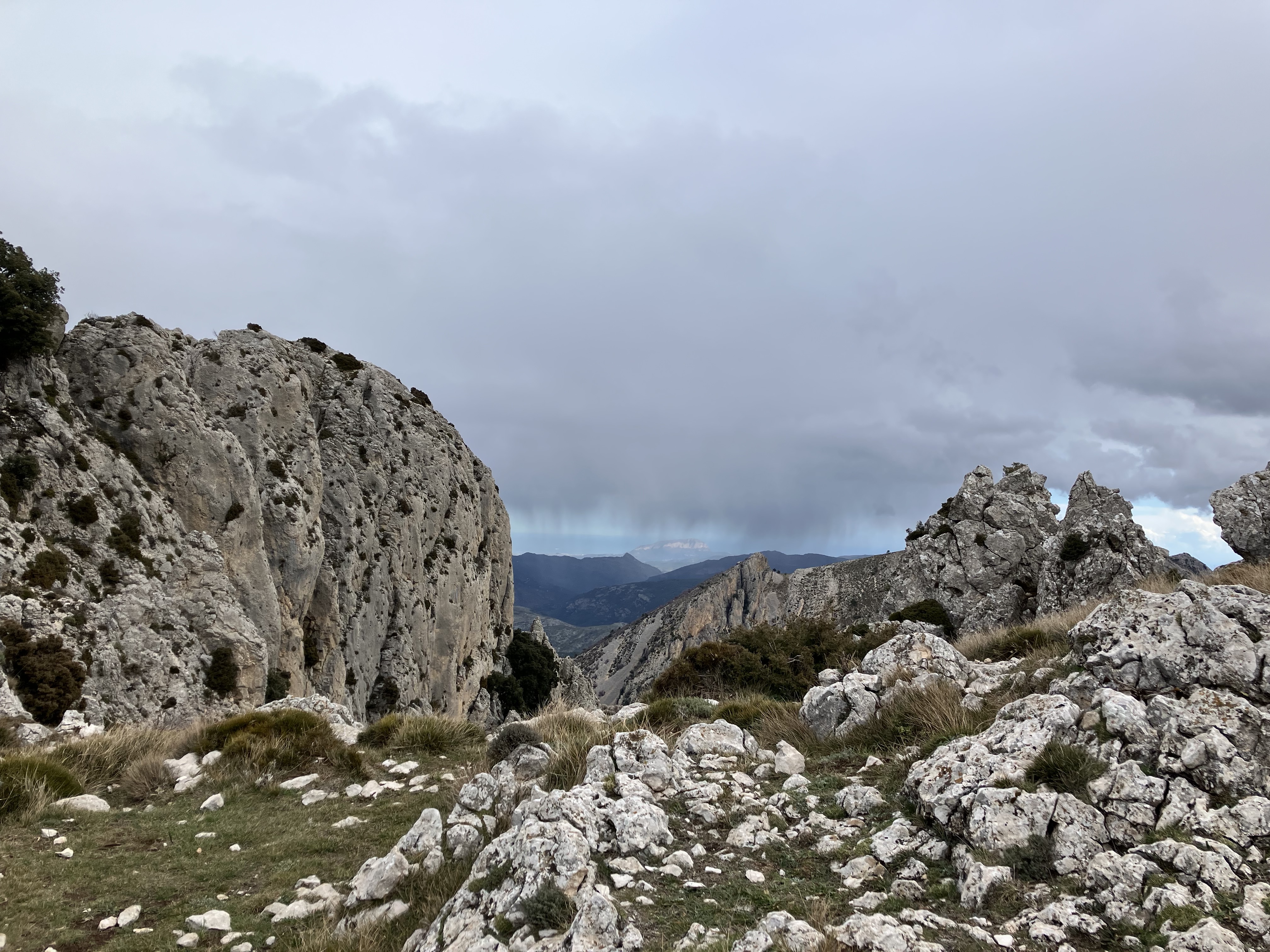
You reach a point where there’s scree - the ascent gets steep at this point, however I was glad not to have to descend this way. Lovely views looking back.
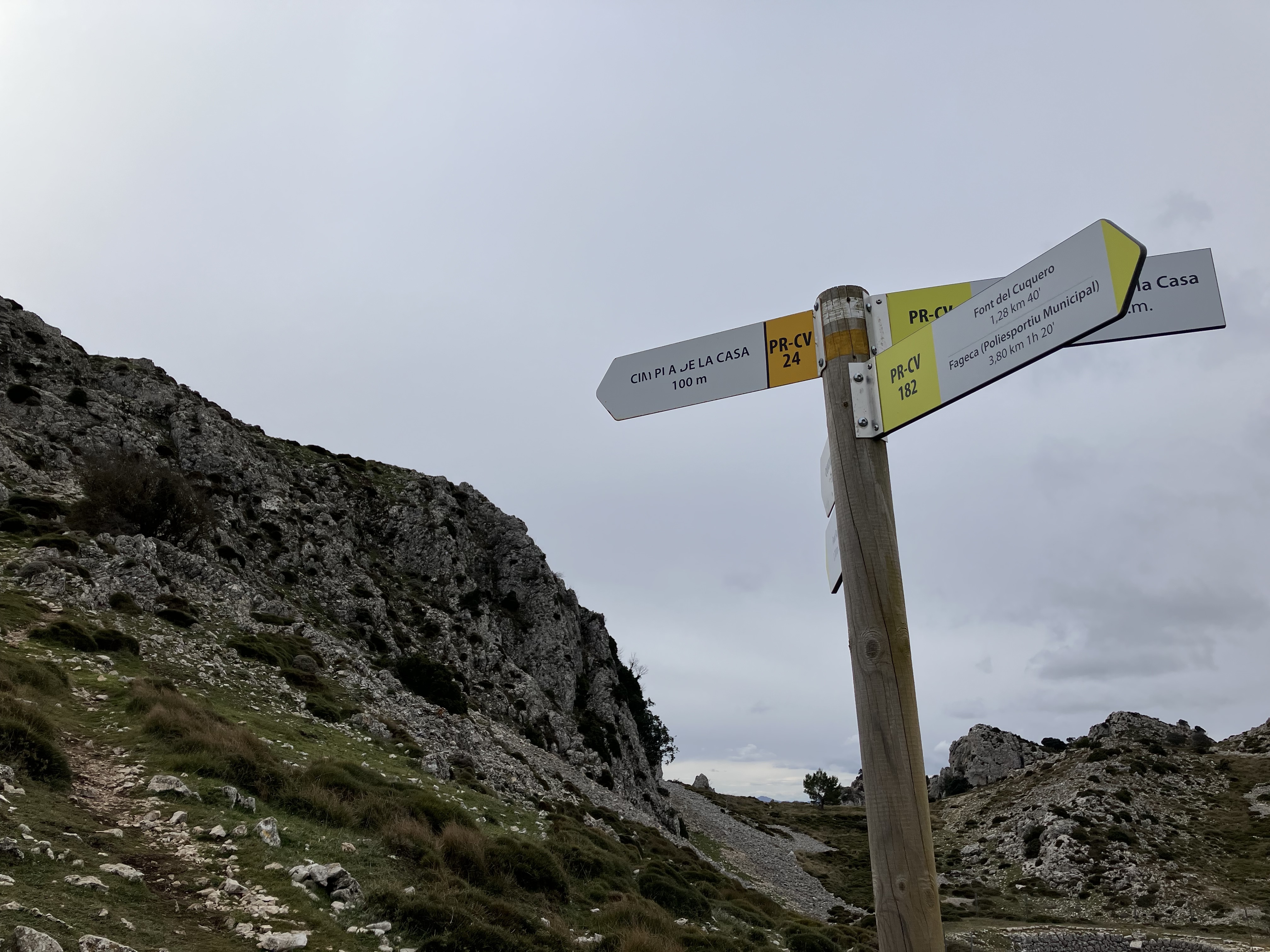
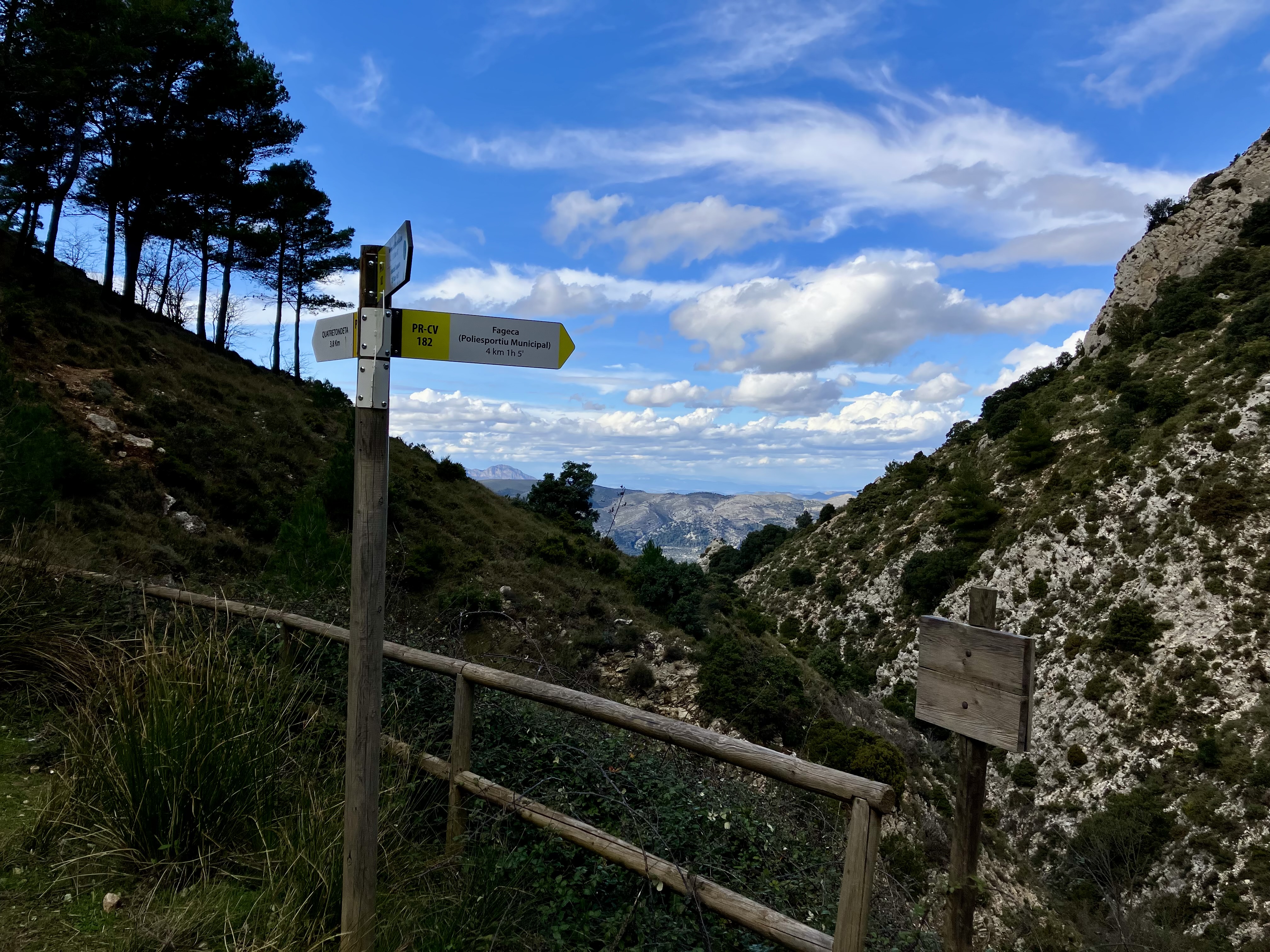
Reaching Font del Cuquero, there are more signposts and there’s more loose scree as you ascend.
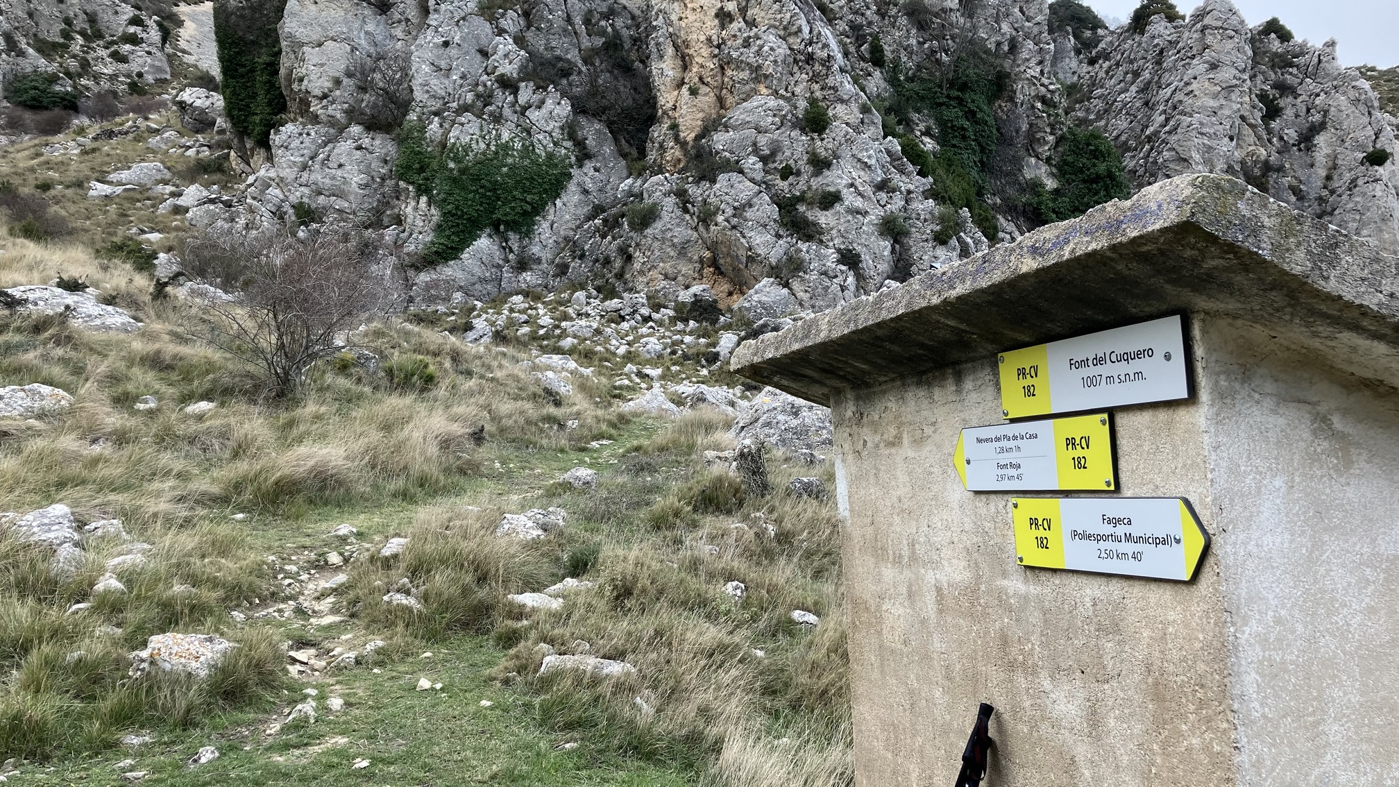
You reach a point E of the summit, where you can continue west towards Font Roja or climb north towards the top. Ascending this way, with 100m of climb remaining, the southerly views were wonderful.
You reach a flat-ish top (as per the published route). From there, sniff out the summit.
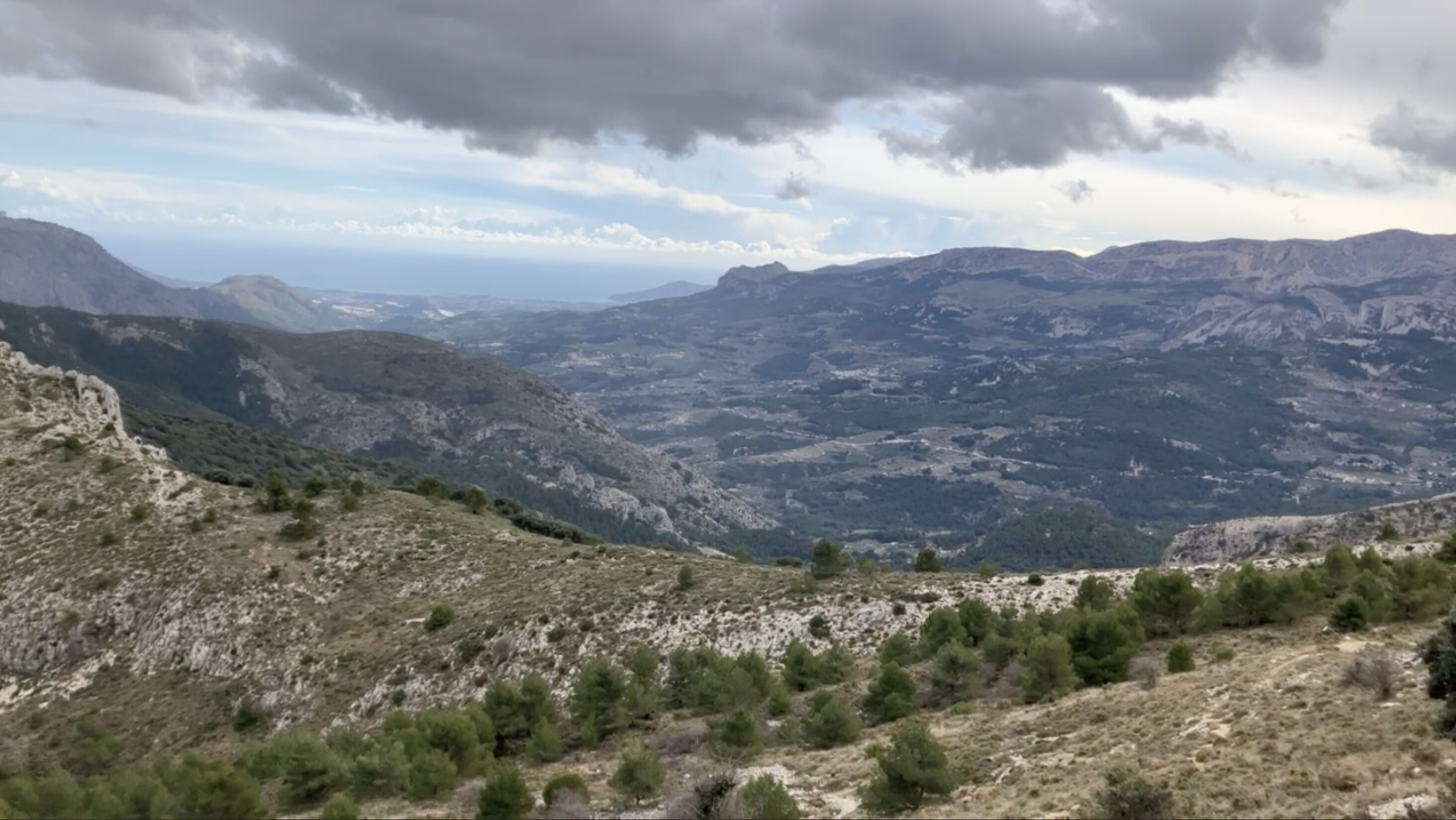
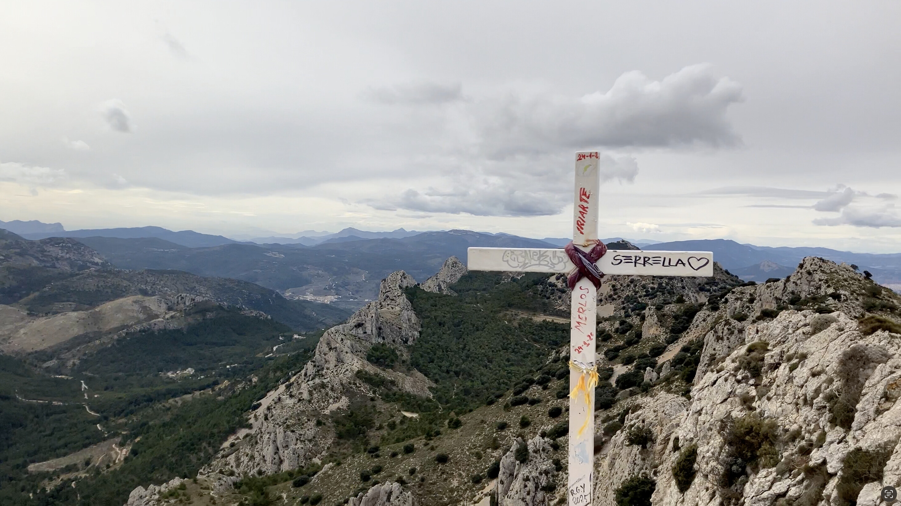
You reach an area perfect for pegging a mast into soil - a circular area that looks like it might have been used as a shelter in the past. Dump your rucksack there and scramble the last 3-4m to stand on top of the world, with a full 360 degree view of the area. Stunning.
I setup the EFHW, spotted myself, and off I went. 28 QSOs which I was very pleased with. I could probably have had a few more but I was patiently trying to work stations where QSB might have been a problem - this led to some stations disappearing.
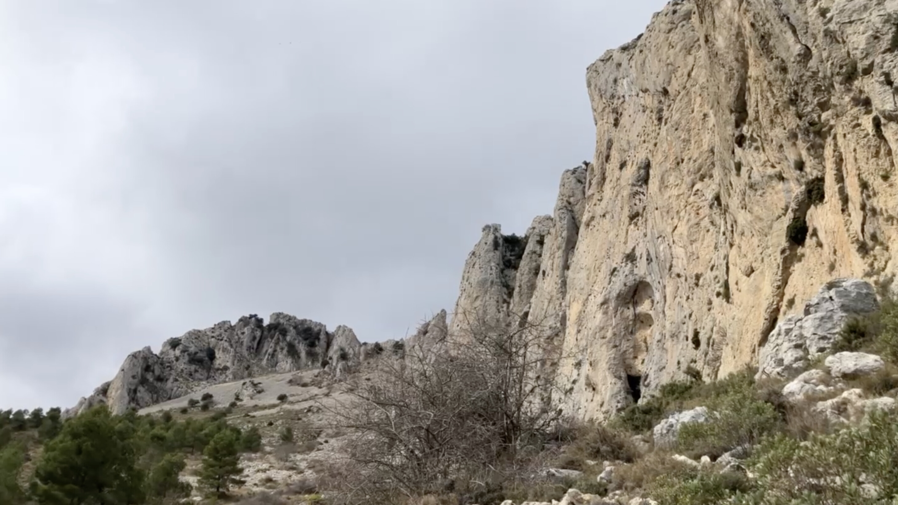
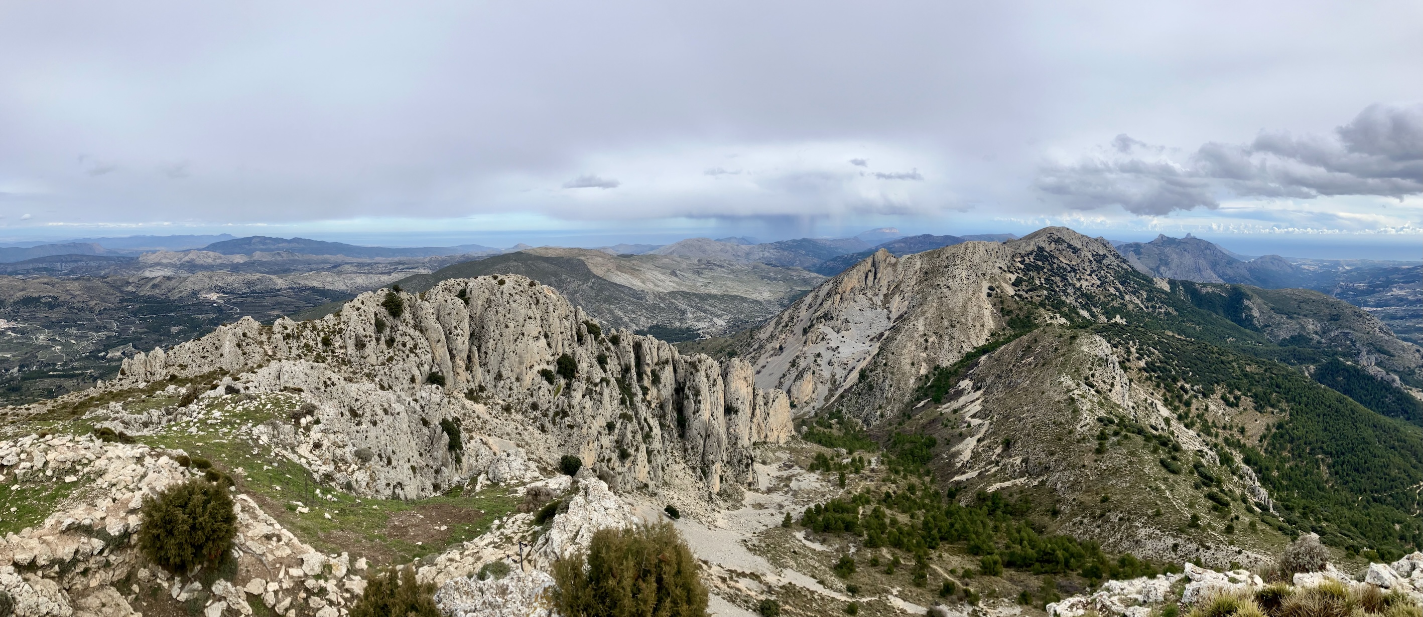
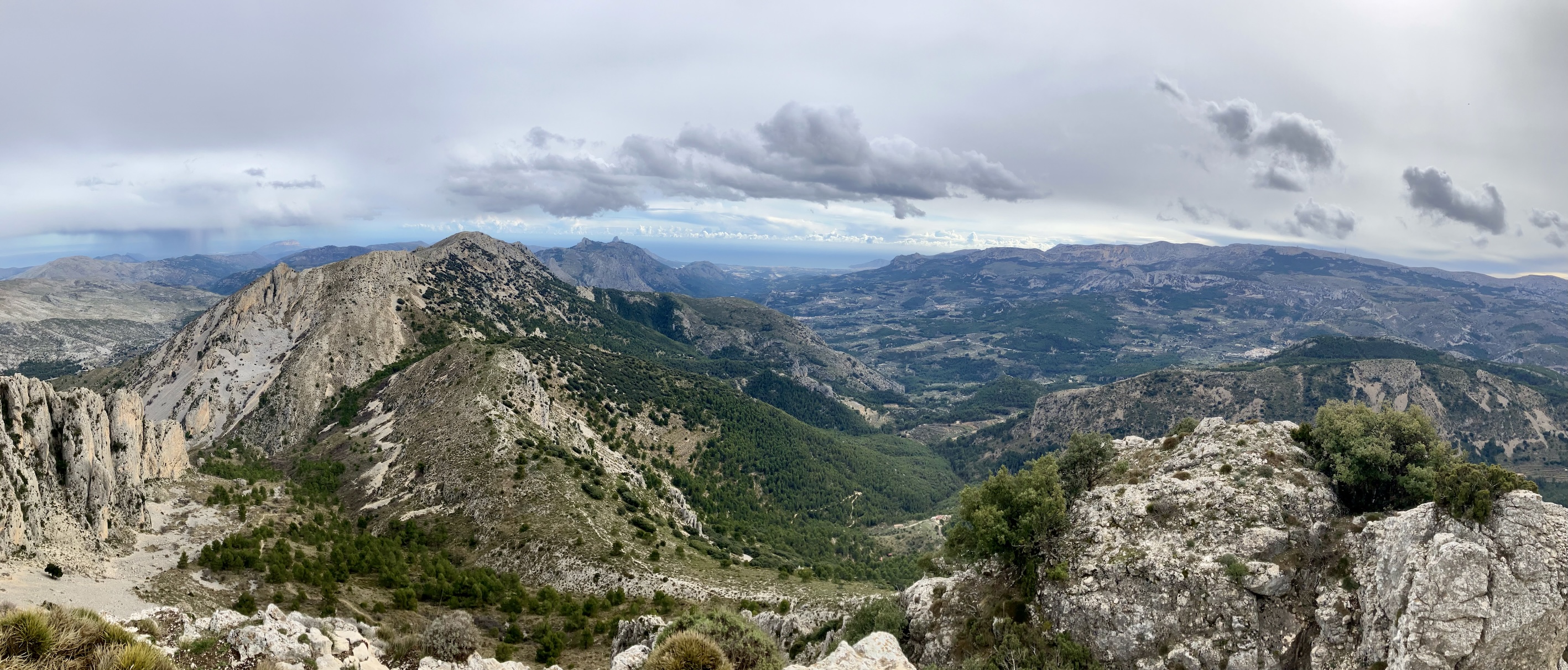
As pointed out earlier, there were GPS anomalies. I thought it were better to descend back to that signpost E of the summit in case I wanted to go back the same way. From there, normal service resumed, so I re-joined the route further west and I was rewarded with some lovely views and interesting features.
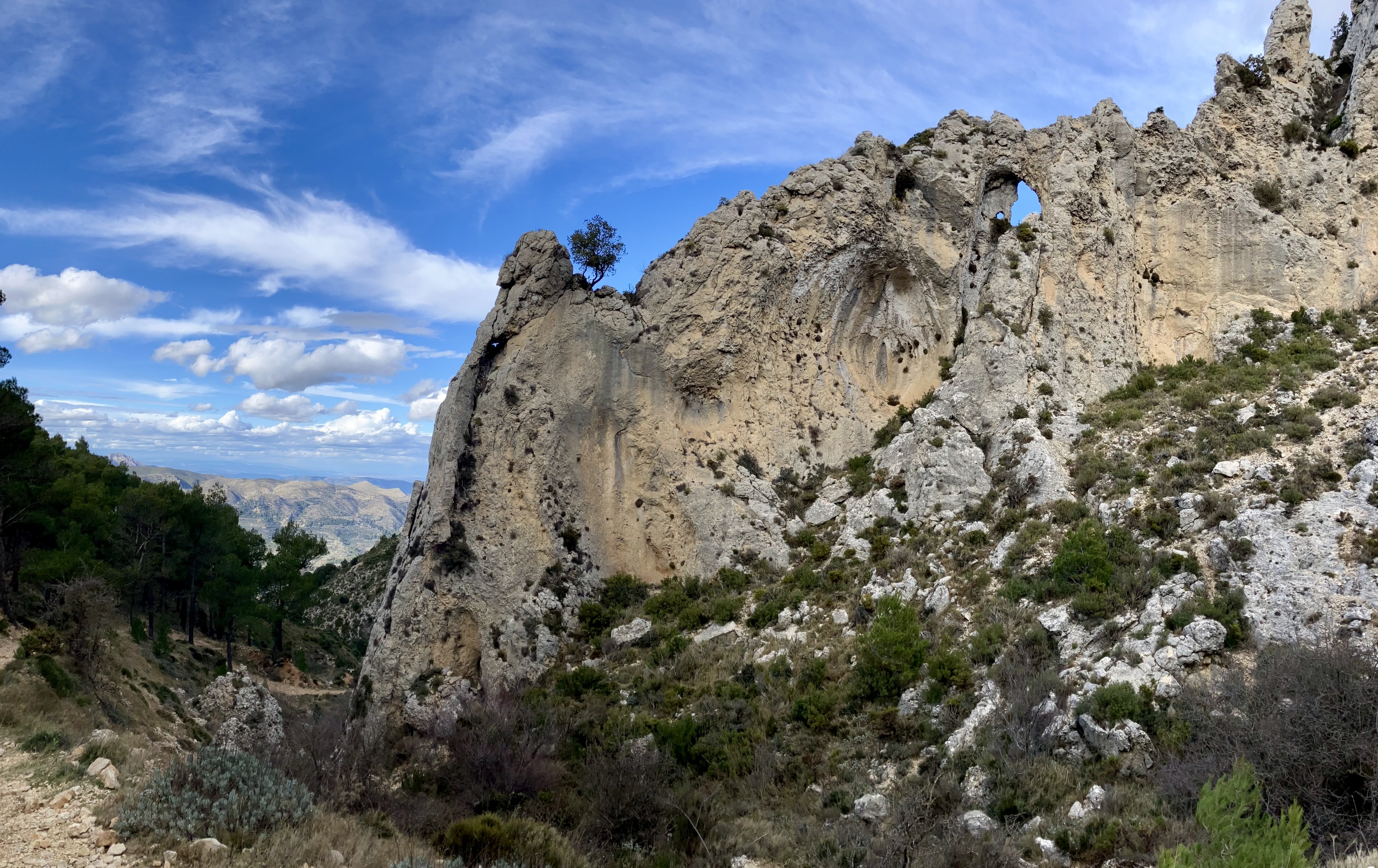
After this signpost, there is one area where you walk precariously close to a steep drop to your left, it’s only about 2m in length but worthy of mention nontheless.
A cracking day out, lovely views and a successful activation. The taller summits in the area are interesting, but sometimes the feel and views on other summits can be better.