Motivation
I had the target of activating these two summits in the border with France since long time ago, but it’s not easy to find the right time to do it. Weather is bad in winter and spring seasons, with rain / snow as it is quite close to the sea and clouds cover the area very often.
Therefore I waited for a proper time on summer, and today it was the chance to get the two summits in one go.
Activation date: July 22nd 2023
Driving directions
Both summits are in the border of EA2/NV with France.
You can drive to Roncesvalles, a collegiate church that marks the first significant point in the Way of St. James, point of departure for pilgrims in the way to Santiago de Compostela, a long walking pilgrimage to the west of Spain.
There, you get on following road N-135 towards France and stop at the chapel of Ibañeta. You could park there and start walking but this enlarges the route by about 2,7 km extra.
Instead I took a deviation right and drove a bumpy and at times loose gravel road. You must drive carefully to reach the col of Lepoeder. There you can park and start the hike.
An emergency comm point is located right at Lepoeder (1432 m.), to provide aid for pilgrims in case of bad weather. This spot is wide enough to park the car and start the hike.

It was about 8h utc and despite the sunny day there were low clouds. I started walking looking at the tip of my destination mountains over the fog. Hope it will not get worse!

The climb
I will describe the circular route I did to reach both summits. Most of it is done on an easy to follow gravel track. Only when reaching the base of the summits you must ascend on grassy but steep slopes.
Total distance was 12,6 km, and the accumulated elevation gain a bit more than 700 m.
And this is the profile of the whole route. Notice the huge slopes in the middle for the summits.

1) Urkulu
From Lepoeder you just follow the Santiago de Compostela pilgrimage route in reverse direction (towards France).
- Trail length (one way Lepoeder - Urkulu): 6,2 km
- Mountain elevation: 1421 m a.s.l.
- Walking time: 1h 35 minutes from the start to the summit.

2) Txangoamendi
- Trail length (one way Urkulu to Txangoamendi): 3 km / Return to the parking: 3,4 km
- Mountain elevation: 1467 m a.s.l.
- Walking time: 55 minutes from Urkulu to the 2nd summit. / 1h extra to return to the parking.

Activation of Urkulu EA2/NV-022
The way up to this mountain was nice. I entered into a forest at mid way and as I loose height in this section I met the fog. It wasn’t very dense and it wasn’t cold either. The fog around provided mystic images:

Soon after leaving the forest the fog vanished and I kept walking at good pace.
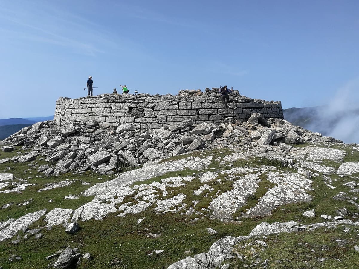
1h 15m after the start I found myself at the base of Urkulu. The characteristic double headed summit was visible and I attacked the last meters.

The summit is large and flat. The very summit is occupied with the remains of a Roman tower dated back in century 1 BC. Its big diameter and the size of the stones is quite impressive.

Looking East revealed the Pyrenees range between the clouds. The well shaped and clearly visible in the middle is Mt. Ori, EA2/NV-003.

Gear: I decided to carry the lightweight (tr)uSDX, 3 x 18650 LiIon cells, a 5m carbon rod and a compact trapped EFHW antenna. I also had my venerable VHF handheld Kenwood TH-F7 and a telescopic vertical.

First I switched on VHF and found Iratxe and Alberto, EA2DNO and EA2DCA, activating EA2/NV-187. Next I heard EA2EEB also in SOTA EA2/VI-061. To end the quick S2S run in VHF I logged Eloy, EA1IEH/P in EA1/SO-003, 148 km far away. Wow, I had just qualified on the handheld, does it worth to carry it?
I didn’t want to run out of time as I planned a second summit today, and decided to run only CW, in 14 MHz and briefly in 7 MHz. I closed my log with 33 QSO, including a bonus S2S with IK2LEY/IS0 and HB9CDH/P.
I packed and had the last view on the beautiful Pyrenees.
Then I watched my next destination, Mt. Txangoamendi EA2/NV-170, just in front of mine, at the middle of this picture. On the left hand side the large Mt. Ortzantzurieta NV-012 (1564 m) is visible. Notice the French parking at the base of Urkulu and the gravel path going towards Txangoamendi, marking the border with France:

Activation of Txangoamendi EA2/NV-170
Should I continue my way passing near the cows? Hopefully they were calm!

55 minutes after leaving Urkulu I arrived in the summit of Txangoamendi.
On the last few meters of ascent I turned to see Mt. Urkulu on the clouds and the footpath I had walked:

The summit is wide and marked with a nice aircraft mountain mailbox.

I installed the EFHW inverted Vee and the same gear again.

After a few VHF qso I ran on 14 and 10 MHz CW and logged S2S with DL1CR, HB9EVF, SP9MA, HB9BRJ and also EA2FAO on 7 MHz SSB. I closed the log with 32 QSO, thanks everybody!
The clouds covered the summit for some minutes but hopefully vanished and I could dismantle and pack to start the descent. This friendly young colt greet me on my descent.

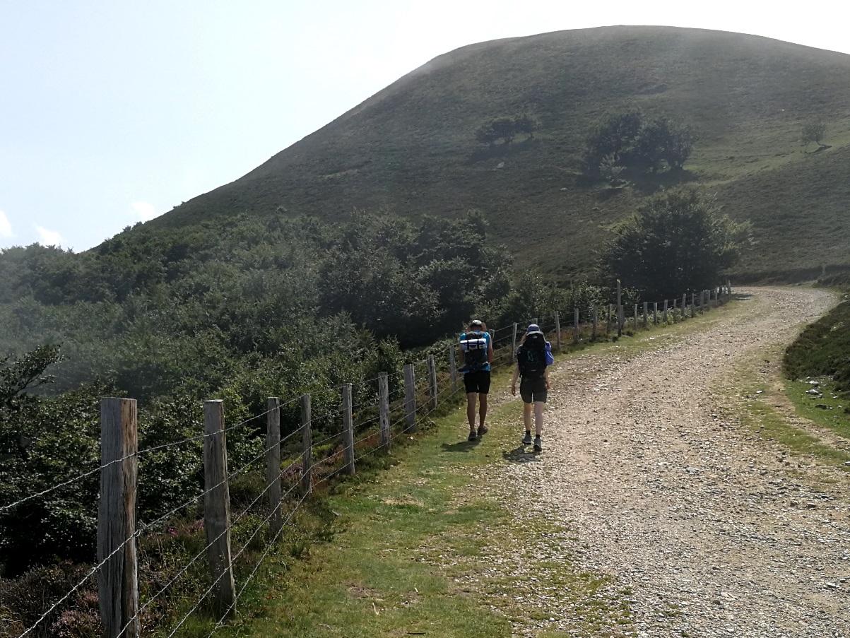
I was hungry and got back to the car, again greeting some of the pilgrims that followed the same path to Lepoeder.
I was soon at the main road in the pass of Ibañeta. There it’s a little church nowadays but by Middle age there was a Roman church and a Hospital to aid the pilgrims. It is said that they ran the bells when there was fog to help them guiding and being safe.

If you visit the area don’t miss the chance of visiting the near Roncesvalles and their heritage. I had there my delicious meal and I remembered the great scenery of the day while chewing.
73 Ignacio