The prospect of some Autumn sunshine and warmth prompted us to head to latitude 32 degrees south and the island of Madeirã, part of Portugal. There is excellent hillwalking and scrambling on this mountainous Atlantic Island, but I wanted to try to broadcast from a summit which, so far had been attempted, but not successfully G4YSS (CT9/M1NNN): CT3/ MI-007 Picos da Achadinha, FAILED! 04-04-15
Sunday 9th October 2022 was our final full day and we had done most of the popular and busy walks so moved off the beaten track to try to radio from this summit which had been attempted in 2015 (John G4YSS or CT9/M1NNN/P in Madeira).
The hill is called Queimadas SOTA reference Charlie Tango three/ Mike India, double oh seven (thus the name is Bond, James Bond!), height 1489m(on the SOTA website) SOTA Summits and is of a similar height to Ben Nevis (GM/WS-001) 1345m. However, being 24 degrees of latitude further south, as we discovered, any resemblance ends there. We had enjoyed a good start to our week on Madeirã activating five of the six highest peaks on the island, CT3/MI-001 (Pico Ruivo de Santana, 1862m), CT3/MI-002 (Pico Grande, 1655m), CT3/MI-004 (Pico do Arieiro, 1816m), CT3/MI-005 (Pico Casado, 1725m) and CT3/MI-006 (Pico Ruivo do Paul, 1639m). The second highest peak on the island, oddly numbered CT3/MI-003 (Pico das Torres, 1852m) remains unactivated, and I think I now understand why!
In his post on the SOTA reflector, John (G4YSS or CT9/M1NNN/P in Madeira) uses the name Picos da Achadinha; on the 1:40,000 walkers map Queimadas is the name given to a summit indicator which lies slightly north of the highest point (and which seems to have the main triangulation station, 1468m); while searching the web I found a post naming the highest point as Picos da Delgada 1489m (although I have not been able to find it again while researching this report!)
There is an established footpath marked on the 1:40,000 map which was just a few kilometres from our accommodation up the west side of the peak. It is also the route of the brave attempt in 2015, but seemed the best place to start. We were dropped off at the top of the concrete road (between 500 and 550m altitude) just before 10:00hours and as G4YSS describes, “Eureka! ……. the ‘buttress wall’ … just might have been masquerading as the start of the path ……… I climbed its concrete steps and quickly found a path which meandered uphill through dense trees and undergrowth. It was well defined at first and looked like it was going the right way. With spirits lifted, I pressed on ….”
There was a painted marker in red letters LED or LEO at the side of the concrete steps (LED marker photo, but on the summit).
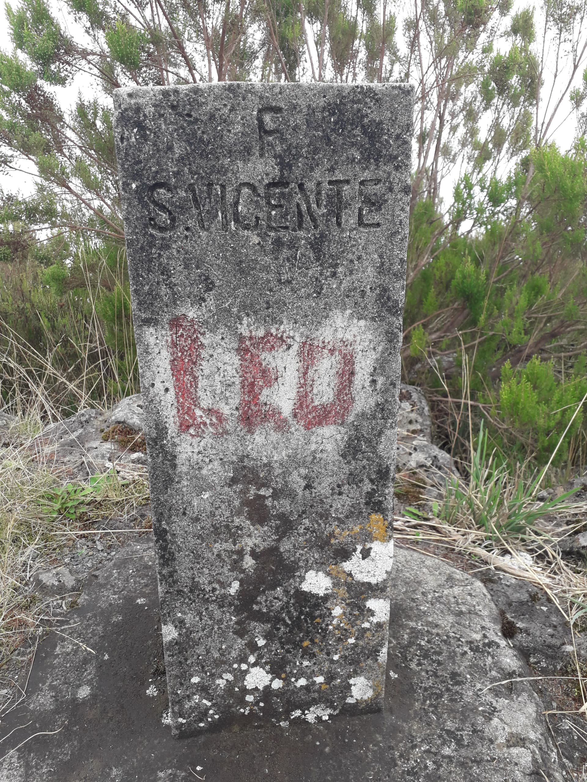
There were the same symbols on a rock halfway up and on the summit pillar but they were so rare they were of little use but did give some reassurance. The painted letters had probably been added since 2015 and along with some cut vegetation we found, it shows the path is still in use. Progress was steady, but slow as the path was tortuously steep and often difficult to follow. The tree canopy was very dense and trapped moisture giving humid air. There were also small breaks in the cover where a lot of new plant growth happened, mainly of brambles, which was a problem for those wearing shorts. There were many small, steep cliffs where steps had been chiselled and carved into the bed rock up unlikely terrain, and the path was often hard to find. Perhaps the only motivation for continuing was the unpleasant prospect of trying to descend the convoluted path we had followed! After a couple of hours the gradient seemed to ease, there was more scrambling along the ridge rocks where we climbed over a small outcrop (point 1342m) shown on the map. We were in cloud by now. We descended for a short distance then started gaining height again on a wide ridge where our way was blocked by a steep cliff. We were lost and spent about a hour trying to find the path through the brambles again. It was at this stage I began to wonder if Madeiran mountain rescue existed, and more importantly, how would they find us? To paraphrase Goldfinger, “do you expect me to talk?” No Mr Bond I expect you to die!”
However, after reviewing the map, description and GPS (none of which matched each other) I was certain that the path descended slightly, then traversed along the north side of the cliff. We lived to fight another day and as we pushed on past our earlier explorations (through many brambles), I started seeing three old axe marks cut on tree trunks. Someone else had obviously got lost here and by following the axe marked tree trunks; thicker than my arm but narrower than my thigh, we got back onto the path and finally reached the summit after nearly 4 hours (summit shack photo; doesn’t look happy, zoom in on those legs and arms to see why!)
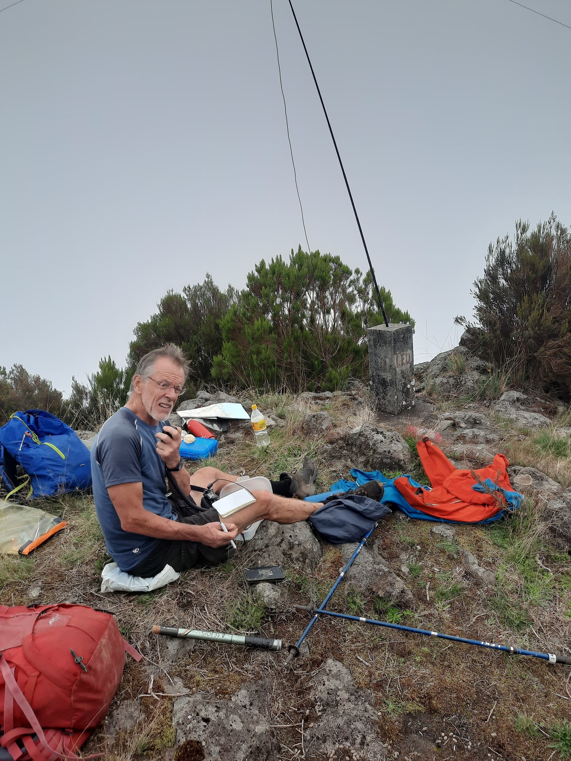
The summit has a small square section summit pillar and marks the junction of three areas; Sao Vincente, Bao Ventura and Ponta Delgado. It had a small hole in the top which held a 4 metre telescopic fishing pole where I used a resonant inverted-V dipole for 20m SSB. The radio was a YEASU FT817 (5 watts) and made my first QSO at 13:51hours. Overall I made only 8 QSOs on 14MHz; 5 Spanish stations, one in the UK, one French and one Dutch station. My experience over the previous week was that other bands produced no QSOs, and our ascent had taken at least twice as long an planned, so we did not want to waste time unnecessarily.
We had agreed that our ascent route was a poor choice for descent and we hoped that by following the largest and clearest path we could get back down quickly. This was north from the summit, through the obligatory brambles, cloud forest and continued onto the north coast of the island which became very steep. At one point the path had been destroyed by an old landslide, but we managed to pick our way down to get back on-track. Eventually continuing through steep ground and appeared above the village of Lombada. Brambles have been mentioned a number of times and they obviously grow quickly (plenty of sunshine and water) and the thorns seem to be larger and sharper than UK brambles. Some SOTA radio activations prove to be less than comfortable.
We decided to have the next day off!
MM0YCJ
Colwyn
