Clutha River summits - finished!

This report is more about rafting / kayaking and less about radio - so sorry for that. But you can also file it under ‘the length some people will go to for a 1-point summit’!

I set myself the challenge to raft/kakak the length of the Clutha River this break, activating the interesting parks / lakes / islands / summits on the way. Given I’m the one doing the rafting/kakaing, I get to choose which source of the river to count, and as such started at the road-accessible Haast Pass.

Day 1:

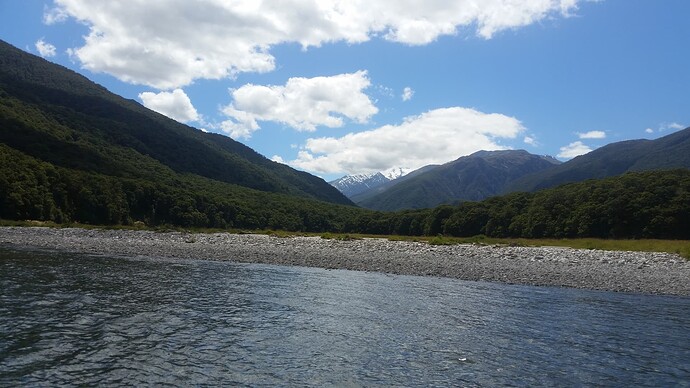
A 3km tramp down the old pack-horse track took me to the put-in point where the Makarora River exits it’s gorge and runs south towards Lake Wanaka. After a long dry spell there was very little water to be had, but just enough to float the raft so long as I kept my arse in the air for the gravel-bars!

A series of class 1 and 2 rapids make for an easy but entertaining 9km through the Mt Aspiring National Park - the best being a 1km class-2 section ending at the Blue Pools swingbridge were over 100 tourists watched me paddle by. Not the place to stuff up! Having already activated the POTA/WWFF park a number of times, I skipped this activation.


Mt Aspiring National Park from Makarora River

Below the pools the river is deeper but less entertaining, and the remaining 17km to the head of Lake Wanaka was an easy paddle, the only challenge being avoiding the commercial jetboats as we both needed the same single viable line for each rapid in the low river.

==

Day 2 saw me switch to the kayak for the 54km paddle down Lake Wanaka. You’ll gather at this point that I have a support crew!


Pre-dawn Lake Wanaka

A 5:30 start saw me out on a near-mirror lake in the first chill lights of morning. After 10km of solid paddling, the Haast Highway cuts out of the valley and we’re all alone on the water - just the swish of the paddles and the distant roar of waterfalls on the valleyside. Around 6:30am as the sun rises; the lake comes up with a strong north-west swell - almost whitecapping. Then, as the sunlight creeps down the valleysides and hits the water it calms, and we’re back to towing a tidy V down the flat water.

After an early lunch at the DOC Wanaka Faces Hut, I leave the lakeshore and cut out into the Lake to the first island of the trip Mou Waho. Mou Waho’s fame comes from the Arethusa Pool on its summit. Almost at the summit of the small island, and some 200m above the lake level, this spring-fed pool sources it’s water from the mountains surrounding the lake via aquifers. It is named after a similar feature in Syracuse. It also is famous amongst ZL activators for featuring a Lake on a SOTA summit in a park on an island within a lake. How many points across how many schemes is that all worth?!

The peace of the morning is broken upon arrival. Some dozen boats are moored on the small beach at the picnic area / campground, with 5 or 6 more waiting offshore for a spot. Thankfully the kayak slips nicely in between and is soon dragged up on the beach and radio gear unloaded.

A good track leads 1km to the Arethusa Pool lookout - people are walking up in jandals and barefoot. The lookout is just within the activation zone of Mt Tyrwitt - ZL3/OT-493, but I choose to bushbash a further 200m to the actual summit, mainly to get away from the crowds.


Arethusa Pool, Lake Wanaka Below, from near ZL3/OT493

FT8 spotting via SOTAmat works, but I follow it up with a conventional post, as SOTAmat does support the ZL islands, lakes and parks schemes. An easy 8 contacts follow on 20m and 40m, including 2 park-to-parks and 1 lake-to-lake before the well runs dry.

50km paddled so far, and one point to show for it!

==

Having read on the DOC webpage that Mou Tapu also features a campground, toilet and BBQ area, I leave to shaded grassy campsite of Mou Waho and paddle on across open lake for another 6km to Mou Tapu. There’s no sign of a good landing spot on the north shore, so I paddle clockwise 3/4 round the 2km x 500m island before getting suspiscious and managing to get the Wanaka Islands webpage up on my phone. Turns out that I’d skipped a line and the campsite is on Stevensons Island some 10km east on another arm of the lake. Luckily though, camping is not prohibited on Mou Tapu, so I find a shaded spot behind the shingle beach at the western tip of the island and set up camp.

The southern face of the island, though mature podocarp bush, is a maze of cliffs and gullies, and not straightforward access. The western end where I camp is scrubby and impassable. But the northern and eastern faces are low manuka bush with some open grassy leads, and the bluffs though present are smaller and dispersed. Bands of fern tangled with hook-thorned bush-lawyer don’t look too appealing, and it’s well into the 30’s. But it’s not even 5pm and 40+ in the tent, so I give myself a good kick, pack the radio gear, and start the crawl / scramble to the summit. The 500m ‘walk’ takes 45 minutes and leaves me wishing I’d brought hiking boots, gaiters and climbing axe!

There are 2 summits on the island - both in the activation zone and separated by a 15m saddle. The higher is the western, but that turns out to be a near-impenetrable mess of fern, scrub and bush-lawyer. So I settle for the eastern summit and bag my second peak (and 2nd island, an 2nd park) of the trip.


Mou Waho & Tyrwhitt Peak (ZL3/OT-493) from Mou Tapu (ZL3/OT-487)

VKs and beyond are spotted on 15m and 10m, but as usual I hear nothing. So I settle for 7 contacts, on a mix of 20m and 40m. I get briefly excited by 9V1RT (“where is 9V1?”) before hearing the VK2/ prefix. Still, a summit-to-summit and well worthwhile.


Activating Mou Tapu

The lake is swimming-pool warm, and a beautiful evening swim washes the bush-bash remnants from my skin, hair, ears. As the sun sets the lake cools the air and I sleep the sleep of the truly exhausted. 45km and two summits. Enough for the day!

==

Day 3:

Sunday dawns early. Not that I’d have noticed, but I forgot to cancel the 4:45am alarm of the previous day, and so - like the melodious island dawn-chorus, was awake to greet it.


Leaving Mou Tapu

A 10km paddle east past the tip of the Stevenson’s peninsula took me to Bull Island (ZLI/OT-003), just 1km north offshore of the Wanaka suburbs. Approaching the island, I was getting more and more concerned. The island looked so small that I was probably going to be limited to 20m, and at 8am (ZL) and 5am or earlier in VK 20m was not going to be much use. However, thankfully the island proved longer than wide, and I found a nice beach to pull into and set up the SOTApole on the summit with full 40m-half-wave over it. The next worry was the time - 8am on New Year’s day. How many hard-living hard-playing hams were going to be awake to answer my calls? Thankfully, the answer turned out to be ‘3’ - enough for the lake and the island.

===


Lake Wanaka Outlet

Taking the touring kayak 6km down the fast-flowing Clutha to my rendez-vous at Alberttown was interesting. I bought the kayak for lake and sea travel, and have not used it on anything but flat water before. All I can say is that I know how the skippers of oil tankers in the Suez Canal must feel! You need a lot of river and some decent velocity relative to water to get the rudder to turn the thing, and swinging 5m of keeled kayak by paddles alone is not easy. Thankfully the packraft (and breakfast) are waiting for me at the Alberttown bridge, into which I arrive without incident.

==

I’ve been warned of some interesting rapids and boils below Alberttown, and so am back in the packraft for my first radio+whitewater travel. The FT818 is in a dry bag, in a waterproof packliner, in a tramping pack, lashed to the deck. And I hope all those layers of waterprooofing hold!


Clutha River - back in the packraft

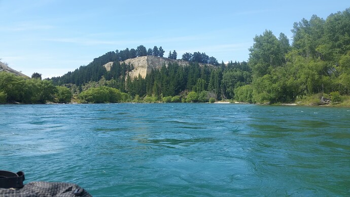
The Clutha is like nothing I’ve paddled before. Not steep, not with many traditional ‘rapids’ but a huge amount of water eager to be somewhere else. Disturbed, peturbed by boulders and bars often a meter or more below the surface. A seemingly random mix of churning white water and green-blue boils and eddies.

The packraft is nimble and stable as ever, and does me proud. The one interesting moment comes at a sharp 120 degree left-turn in the river. A narrow chute of white-water surrounded by whirlpools and boils either side forming the wings of a figure-of-8. I go in too cautiously and get hooked by the left-hand whirlpool, then ejected - to a drenching - back into the whitewater chute back upriver, paddling-hard to get back into it’s centre to avoid repeating the circuit.

I have a long-standing goal (well, last year’s goal, not yet achieved - so becoming more long-standing as the years pass) to activate all of Central Otago. That includes 20 lakes, 99 parks and 71 summits. 3 of those parks are only accessible by boat and lie of the Clutha River - another reason for this trip.

With all the bends, the river descent takes longer than hoped and it’s 2pm by the time I reach the first park at the confluence of the Clutha and Lindis rivers. 1 hour after New Year rollover - and not a good time to try and activate anything. I manage the requisite 2 contacts, and hear that 17 ZL operators were out activating SOTA around rollover - a very impressive total for such a small community. Plus a few lake activations by the more ascent-averse. Sadly they’re all on the way back down their respective hills or highways by now, and I’m lucky to scrape the 2x40m contacts that I do.


Activating Lower Lindis Conservation Area (ZLP/OT-0390)

The next park takes even longer, but thankfully by 4:30pm the activators are beginning to arrive back at their shacks, and the final activation of the day at Clutha River Islands Conservation Area (ZLP/OT-0318) nets a more respectable 6. As the Clutha hits the head of Lake Dunstan, it forms a delta splitting into a maze of small and large channels and a patchwork of islands. Once a productive wetland, this area is becoming choked with exotic (i.e. not native) willows, but areas of mudflats and shallows persist with their population of ducks, waders and kingfisher-like birds that looked designed for swoop & grab type fishing (you can tell I’m not an ornithologist!).

An ever-worsening right wrist slows me down for the final 2-3km down Lake Dunstan to the Bendigo campground, where my 1-woman support crew awaits with the caravan and the promise of something cold fizzy and calorie rich.

74km for the day, and I’m good for nothing but nurofen & sleep!

==

Day 4: CANCELLED

Sadly the wrist ache of yesterday has swollen up to render it unwise to continue the adventure today. So I’ll spend my time at the table with a pack of frozen peas writing up the trip so far. The next couple of days consist of kayaking Lake Dunstan (ZLL/0279) and Lake Roxburgh (ZLL/0696), with a brief 10km river section in between.

The day after that brings more fun in class 1-2 rapids and the final summit of the trip (ZL3/OT-521), the lowest summit in Central Otago and with the shortest legal access being up the unformed legal road from the riverbank. Below Beaumont we leave Central Otago, but will pass a couple more islands (ZLI/OT-018, ZLI/OT-001) in the fast-flowing blue water before the river slows, darkens to black for the final placid (read: lots of paddling) 2 days to the coast at Balclutha,

Will I make it this break? Maybe - if the wrist comes good and the weather holds. But with both of those looking unlikely, this may turn into another long-term goal on the long list - ‘finish off that Clutha river trip’!

PS Rapids? What rapids? - The reason there are only photos of flat, calm, water is that I was too busy paddling for the more interesting bits to fish the phone out of its dry bag & take photos!

===

Logs:


ZL3/OT-493 - Tyrwhitt Peak / Mou Waho / Arethusa Pool


ZL3/OT-487 - Mou Tapu


ZLI/OT-003 Bull Island / ZLL/0830 Lake Wanaka


ZLP/OT-0390 Lower Lindis Conservation Area


ZLP/OT-0325 Clutha River / South Lindis Conservation Area


ZLP/OT-0318 Clutha River Islands Conservation Area

15 Likes

Hi Matt, thanks for your report with great photos. I
listened on all the bands you tried but unfortunately I did not hear you on any band; poor conditions!

Geoff vk3sq HNY

Hi Matt,

Very interesting reading and photos.

You were very fortunate to snap a contact with 9V1RT at Mt Twynam vk2/SM-003. That’s a very rarely activated summit. No alert as far as I could see.

I was hoping he would return to 40m where I’d have a chance of a contact, but nothing of the kind happened. I had been out in the garden shovelling gravel out of the trailer, and the contact with you was made in one of the breaks I took from the heat and the sun.

On NYD we (VK1AD and VK1DA) stayed at Mt Foxlow VK2/ST-010 until about 0200 UTC, then the impending storm and electrical noise was increasing so there seemed to be no value in hanging on. 40 S2S contacts out of 45 total contacts.

73 Andrew VK1DA/VK2DA

3 Likes

Great report and photos Matt. It looks a fantastic expedition and I hope you’re able to complete it.

Cluaidh is the Gaelic name for the river Clyde, wnich flows through Glasgow. Unfortunately the name is also associated with the Clutha pub, which sits on the river in central Glasgow. In 2013 a Police helicopter suffered engine failure and crashed into the pub, killing 10 people.

The pub has been rebuilt and I’ve visited it on a few occasions. It’s a great music venue.

Happy New Year!
73, Fraser MM0EFI

4 Likes

Extradinary expedition. In comparison my SOTA activation today was “drive 40 minutes, get out of car, walk for 5 minutes, set up, activate. Return home the same way”. :slight_smile:

2 Likes

No radio on days 4 and 5, as I’m on home-ground here and had no unactivated parks, islands or peaks to visit. The account is included though for completeness.

Day 4:

Returning to the river at Bendigo Campground, I’m straight into the 37km paddle down Lake Dunstan. After the peace, space, verdantness of the upper river and lakes, we emerge into the hustle, bustle and aridity of the Central Otago ‘desert’ country.

Hillsides of scorched brown grass & tussock are tempered only by the ruled-line-grid regularity of the vinyards that creep up lower slopes and terraces where water can be found or economically pumped. The oily-calm waters of the lake are soon broken and chopped by the wake of dozens of motorboats, circling, speeding, weaving - dragging thrill seekers on boards, skis and biscuits in their wake. Whereas on lake Wanaka and the rivers, boats veer off far from the path of a kayaker, or slow to the polite 5 knots, here they tear past. This is their domain, and I am, at best, tolerated.

Beyond the township of Cromwell, the lake swings SE, entering the Cromwell Gorge as it cuts through the Dunstan Range towards Clyde. The busy state highway runs tight between lake and hillside on the north shore. Between the noise of the highway and the noise of the boats I might as well be kayaking thorough a motorway tunnel! I amuse myself by counting consecutive caravans on the highway. My record is 13 - if I include a large boat on a trailer and a horse-float.

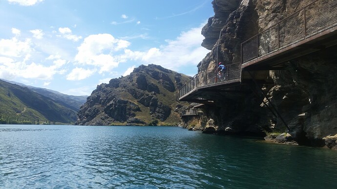
The newly built Lake Dunstan cycle trail runs down the south-western shore, and as such I favour that quieter side. The track is a piece of engineering artwork, with ‘clip-on’ sections traversing cliff-faces, and suspension bridges aplenty. Many had doubted the price-tag, but on this busy 3rd of January day there is approximately 1 cyclist per 50m. The coffee & burger boat half way down the lake has nearly 100 people eating or queued beside it. I save that pleasure for a quieter day and find a quiet bay to eat my peanut butter sandwiches.

3km from the Clyde Dam I meet my first kayaker (first non-motorised vessel of any sort) of the trip. He swings round and drops in beside me, happy for a chat. ‘Bogans’ is his verdict on the other lake users. A 7m+ sleek racing vessel, he is dipping gently away, as I make deep, hard pulls on the paddle, straining to keep up. And still failing. After a kilometer my arms are aching, and I’ve discovered that he’s out for a training session, and yes, he’s ‘done a bit’ of competition kayaking. The amused way he says it leaves me thinking I’m probably supposed to recognise either him or the name. I’m grateful for the chat, and even more grateful when he pulls away and turns back up-river to continue his session. I slow to a more manageable pace.

==

Below the Clyde Dam, the day ends with a gentle 10km float down the Clutha between banks of tall willows. The boaties and road noise are gone, the cyclists a quiet hiss of tyres on gravel, glimpsed occasionally through the trees. Approaching Alexandra groups of children appear in quiet bays and pools. Ubiquitous rope swings tied to high branches over the river. Convoyed-up groups in inner tubes seeking out swift-water flows and eddies. The familiar steel form of the Alex bridge comes into view, as day four ends at the boat ramp, leaving the cool of the river for that oppressive dry Central Otago heat.

==

Day 5

Below Alexandra the Clutha cuts through another range of hills via the Roxburgh Gorge. In contrast to Lake Dunstan, Lake Roxburgh is deep, narrow and quiet - the highway following an older river course on terraces several kilometers away and above.

I meet just 4 fisher’s boats in the 27km trip through the gorge, and spy a few dozen cyclists on the cycle trail, but a otherwise left alone to gaze up at the towering valleysides, and seek out the old huts and caves of the gold-mining era on the lakeshore. It is a wonderous, peaceful day,

==

A final 25km on swirling, boiling blue-green water (back in the packraft) takes me to the pull-out at the Millers Flat bridge. Passing the carcasses of old gold-dredges still protruding from the water 100 years on, like fossilised rib-cages. Another 50km under the paddle and within 2 days of the coast.

==

Well, tomorrow I’m off to Wanaka to have my thumb & wrist xrayed & ultrasounded. But weather permitting will be back on the water on Friday for the last of the swift-flowing river to Clydevale, the lowest SOTA peak in Central and a couple more island activations. Before the long slow pull to the coast at Clutha Mouth and Kaka Point the day after.

Hopefully all before any doctor looks at those x-rays and decides I’m not allowed to kayak!

2 Likes

Made me chuckle when you said about the trouble to go to for a 1 point summit. Usually I do 1 point summits because they are easiest to get access to. HI. Great story Matt and you sure have a nice part of the world to do SOTA with a bit of everything else titled Adventure. Good to see you push through the injury before the doctor tells you to stop, take care look forward to your next adventure. I see you on SW3 but often can’t hear you.
Regards
Ian vk5cz …

2 Likes

Thanks Ian, it’s always good to get you in the log.

For much of 2022 contacts to VK were easier and more numerous than within ZL. But the last few months someone seems to have closed ‘Highway’ 20m to VK and not signposted any diversions! My current portable antenna is good on 17m and usable on 15m, but neither of those seem to have a reliable path from ZL4 to VK either at the moment. Many of the reports on the NY rollover seem to confirm similar experiences. Looking forward to when ZL-VK becomes a part of every activation again.

1 Like

Hi Matt, you are spot on regarding “…closed highway to VK” I have noticed that also. I could hear and work you in the past; but not now. :-1:

cheers: Geoff vk3sq HNY

Day 6:

Early morning and back on the water at Millers Flat. Clouds cover the sky, cling to the valleysides restricting my watery pathway to shades of blue, green, grey.


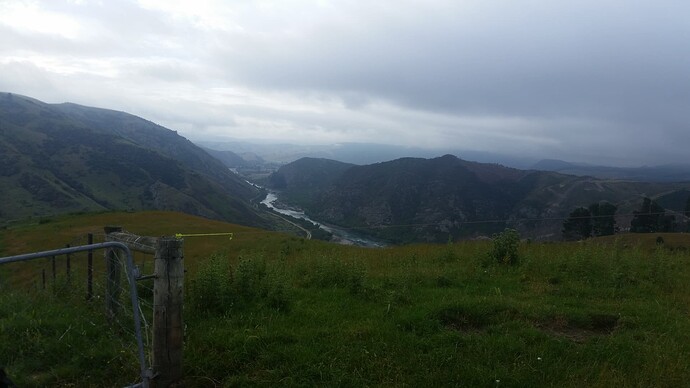
Clutha River from ZL3/OT-521

The river level has dropped over a meter since my take-out 2 days before - I guess the cooler day has reduced electricity demand on the hydros. And this means a much more interesting river, no longer bank-to-bank swirling water, but weaving and diving through rock-gardens and stone-cut channels. We pass under the 8th bridge of our trip - the century-plus old Horseshoe Bend suspension footbridge, build originally to allow children at the Horseshoe Bend settlement to attend school on the opposite bank, and replacing the earlier chair-on-wire contraption.


Horseshoe Bend Suspension Bridge

Below horseshoe bend the ‘best bit’ of the river lives up to its name. We leave the flat Teviot valley with its orchards and green pastures, for a series of fun class 1-2 rapids leading through the gorge to Beaumont. The legal access to ZL/OT-521 lies conveniently half-way down the longest of these, and I’m relieved to find a small eddy-pool at the river’s edge that I can steer into and pull out.

The legal road (crown-owned road reserve, but never constructed) is thankfully realistic in its route, zig-zagging up the face to join a fenceline on the ridge leading top the summit. These strips of crown-owned land provide the only legal access into many areas, but are tricky to use, following a 2-chain (~20m) wide strip of unmarked, unfenced crown land through surrounding farmland with nothing more than a GPS showing property boundaries to guide you. Frequently they were surveyed and gazetted (100+ years ago) from an office in London or Auckland or Dunedin with no idea of the underlying topography, and prove unusable. But this one is good and I’m soon standing on the summit of Central Otago’s lowest SOTA peak, winding out my 40m EFHW along the roadline.


ZL3/OT-521

The early hour restricts me to ZL, but within 15 minutes I have four in the bag on a mix of 40m and 20m with good signals all round.

==

Downriver the put-in halfway down a rapid is good fun, manic paddling trying and failing to reach the good centreline, followed by more frantic efforts to steer through the maze of rocks then eddies, stops and side-waves at the foot. Drenched and exhilarated!

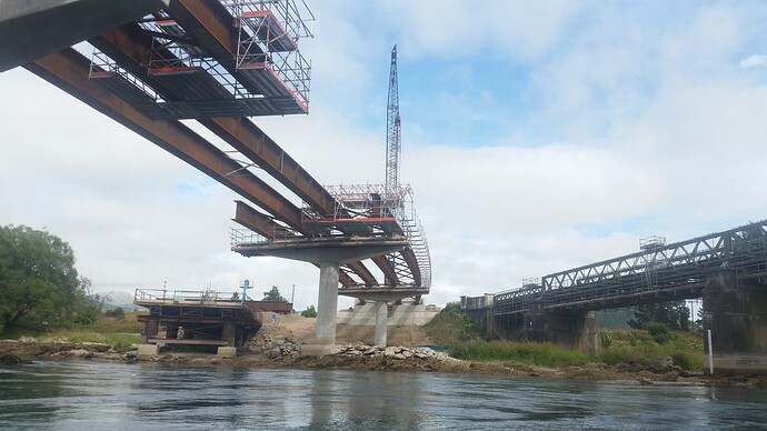
At Beaumont, we pass under the 1887 single-lane iron-truss and timber-decking road bridge that still carries State Highway 8 between Central Otago and the coast. The new bridge, soon to replace it, and a temporary structure to give construction access make an interesting threesome as we paddle beneath.


Beaumont Bridge

The 4th and final gorge follows. Back into the ‘real Otago’ that drew me and kept me 20+ years ago, we pass between steep valleysides of beech forest, drier slopes manuka covered and in the most intense season of flower I can ever recall. The scream of cicedas drowns out even the noise of the river. Two islands lie in the gorge, and I stop to activate both. At Island Rock I displace a crowd of seagulls. They sit throughout the activation - lined up on rocks offshore - protesting at my presence.


ZLI/OT-017 - Island Rock

Static from lightening strikes increases for the activation of Birch island, but we manage 4 contacts between the crashes. Soon after, I start to hear the rumbles and crashes for myself. A sudden downpour soaks me, raindrops sending splashes off the river several inches into the air. A dizzifying texture of momentary towers of water making the river impossible to read. As such thunderstorms do, it ceases as suddenly as it started, and we’re soon back paddling on eiery flat water, steaming gently.

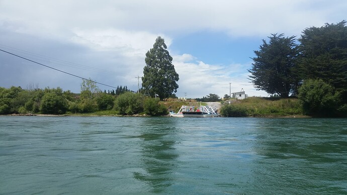
The chain ferry at Tuepeka Mouth is the last of the historic engineering marvels of the trip. The ‘chain’ bit had me worried - will I be able to pass? But it turns out to be guided by two overhead wires, well clear of the water. The ferry is unpowered, using deflectors to harness the river current to push it either right or left across the flow, taking it’s cargo of up to 2 vehicles with it. Thankfully it’s parked at the bank and I pass easily beneath the overhead wires.


Tuapeka Mouth Chain Ferry

Rain is setting in as I arrive at the 10th bridge at Clydevale. So I pull in and camp up in the ferry reserve (presumably once the site of another chain ferry) for the night.

===

Day 7:

The river below Clydevale is broad and flat. Paddling hard into a steady south easterly. We have left the ranges behind, pass through dairy-farmed flats separated by intermittent bands of low rolling hills. Rain comes and goes through the morning, and I skip the activations of Gull Island and Waitahuna Island as a result. Partly to keep radio gear dry, and more because keeping moving is all that is keeping me warm.

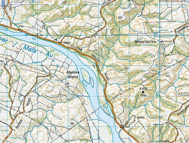
The third island, Manuka Island, appears to have gone. Where the map shows an island, there is nothing but river - I paddle through the middle of it. A small gravel bar appears to be all that remains.


Balclutha rail bridge

It’s not even 10am when the twin road and rail bridges of Balclutha come into view. The final bridges, and the final settlement on the Clutha before it winds its tortuous 27km way, the final 10km to the sea. It’s no match to its northern cousin, Glasgow, at the mouth of it’s sister river. A small farming hub, the only industry a dairy factory and meatworks, discretely hidden behind stopbanks and trees.

Sim is not far away, and I stow the packraft for the last time, and after a welcome coffee and bacon and egg panini, am back in the kayak for the paddle to the coast.

The fourth island of the day - Shaws Island - is another failure. Recent stopbanks appear to have cut it off from the river, and it now boasts a crop of swedes and various farm buildings. Clearly islands on the lower Clutha are ephemeral affairs, even without man’s interference. Washing away and forming with each scouring flood, and deposition of upstream sediment.


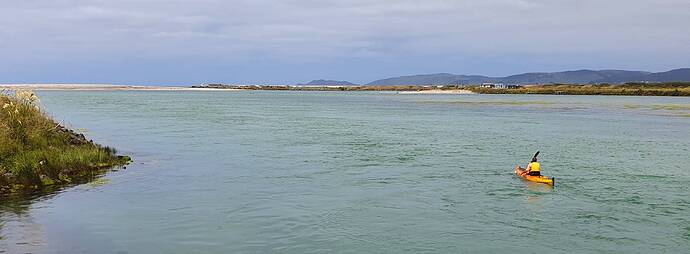
Approaching Clutha Mouth

As always, I smell the sea long before I see it. Sense the lack of a horizon ahead. A sandbar extends across the river mouth, forcing the flow against a stone-armoured stopbank on the southern shore. Collections of ramshackle fishermens huts dot the banks and dunes. A SE swell breaks in through the river mouth, splashing onto the beaches and lifting the kayak with its rhythmic movement. I pull onto the sandbar, wade through soft, unconsolidated sand to its summit, and look out over the Pacific Ocean.

My journey’s end.


Pacific Ocean, Clutha Mouth

==

Logs:


ZL3/OT-521


Island Rock ZLI/OT-017


Birch Island ZLI/OT-001


Inch Clutha / Clutha Mouth - ZLI/OT-018

5 Likes

Thinking of shifting islands and looking at historic maps of Manuka Island. Both the island, and the name referring to it have shifted significantly over time.


1929


1959


1979


2009


Latest airphoto

Fascinating how the river has shifted - the original Manuka island becoming part of the eastern bank and a new island forming to the west, to which the same name was (mis-?)applied. Only to be part-washed away, part incorporated into the west bank. Meanwhile new gravel islands forms upriver and downriver of the site - perhaps one day to be (mis-?)named Manuka Island?

(maps from http://mapspast.org.nz cc-attribution)

4 Likes