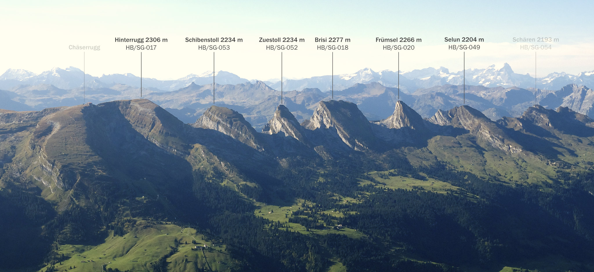
The Churfirsten (plural) are a mountain range in eastern Switzerland, towering above Lake Walen. Six summits are normally considered part of them, each with a SOTA reference:
Churfirsten as seen from Säntis, by chrisaliv, CC BY-SA 4.0
Chäserrugg is sometimes mentioned as a seventh summit, but it is actually only a subsidiary summit of Hinterrugg, and has a cable car. Schären, another SOTA summit to the west, is not considered part of the Churfirsten.
While the southern faces drop off almost vertically for several hundred meters, and are climber’s territory, the northern sides are more accessible (as seen in the photo above), with popular medium difficulty hiking trails, sometimes involving light scrambling, leading to each summit.
The unofficial “Churfirsten challenge” involves visiting all six summits in a single day. Depending on where one starts, whether one uses the cable cars, and how many more or less arduous shortcuts through rough pathless terrain between the summits one takes, the total ascent is somewhere between 3000 and 4000 meters.
I have long toyed with the idea of creating my own “Churfirsten SOTA challenge”. The plan was not to use any cable cars, but in exchange for not only visiting but also activating each summit on HF, I would allow myself the use of an e-MTB to get to the trailheads and carry food and water. Having to return to the bike meant fewer opportunities for shortcuts, but also less weight to carry.
This is the route that I took on Thursday, July 9, 2020. Sections on foot are in red, sections by bike in blue. According to the swisstopo map, the total is 29.2 km on foot with a 3775 m ascent (and identical descent), and another 23 km by bike.
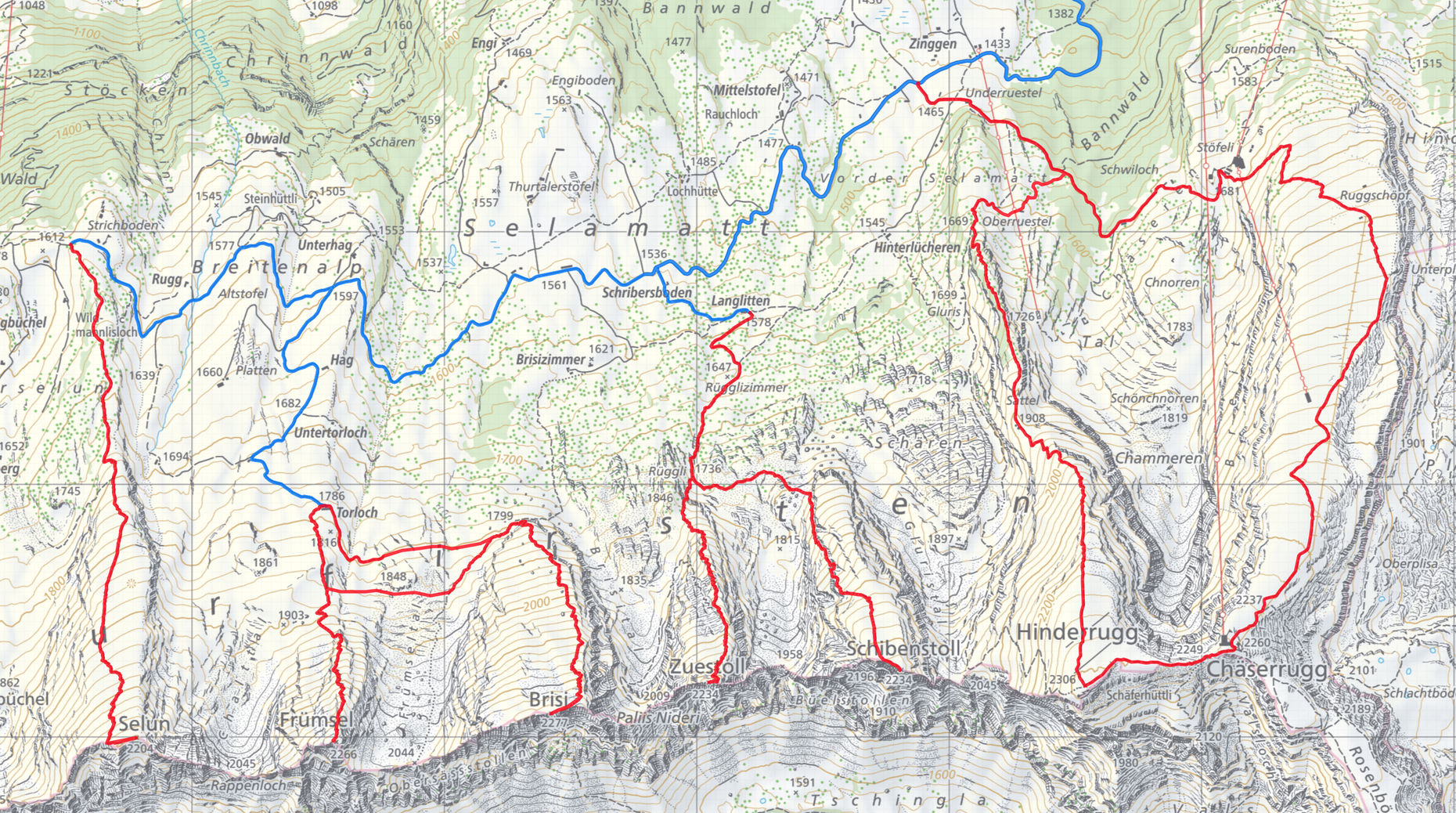
(Source: Federal Office of Topography swisstopo)
I spent about half an hour on each summit, picking one HF band each time and then staying QRV until the pile-up died down, or for 10 minutes, whichever was longer. The total was 101 QSOs, so despite the circumstances, these were not just “smash-and-grab” four QSO style activations. On the first summit (Selun), I only made two QSOs in half an hour, one each on VHF and HF, as it was still early in the day. But not to worry—there were no points to be obtained for me on that summit anyway, as I had already activated it in March.
Radio equipment: KX2 with internal battery, AX1 antenna with AXE1 and AXB1. The setup obviously had to be lightweight and quick to deploy. For 2m, I used my beloved little Yaesu VX-3 with an MFJ-1714S.
Timings: got up at 02:30, arrived at the parking at 04:00, first trailhead 04:45, first summit 05:35, back at the car at 20:45. About 11½ h spent hiking, 3½ h spent resting, eating and playing radio on the summits, 1½ h on the bike and ½ h changing between walking and biking. 4 liters of water consumed.
The first three summits didn’t feel like much effort. Things got tougher on the ascent to the fifth summit, and the last one—incidentally the one with the longest ascent—required a lot of determination to keep going.
It was interesting to find out how my body copes with that kind of ascent, as I have never done more than about 2000 m in a day before. I’m pleased to report that it worked out pretty well, with only slight discomfort in my right knee while descending from the last two summits, and no muscle soreness the next day. Nevertheless, I don’t plan on repeating this trip anytime soon ![]()
73 and thanks for the contacts, Manuel HB9DQM
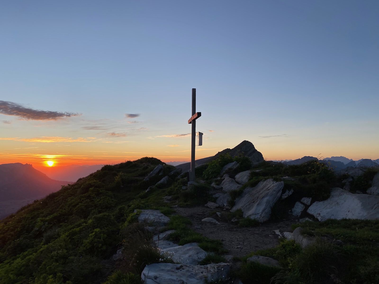
Sunrise on Selun HB/SG-049
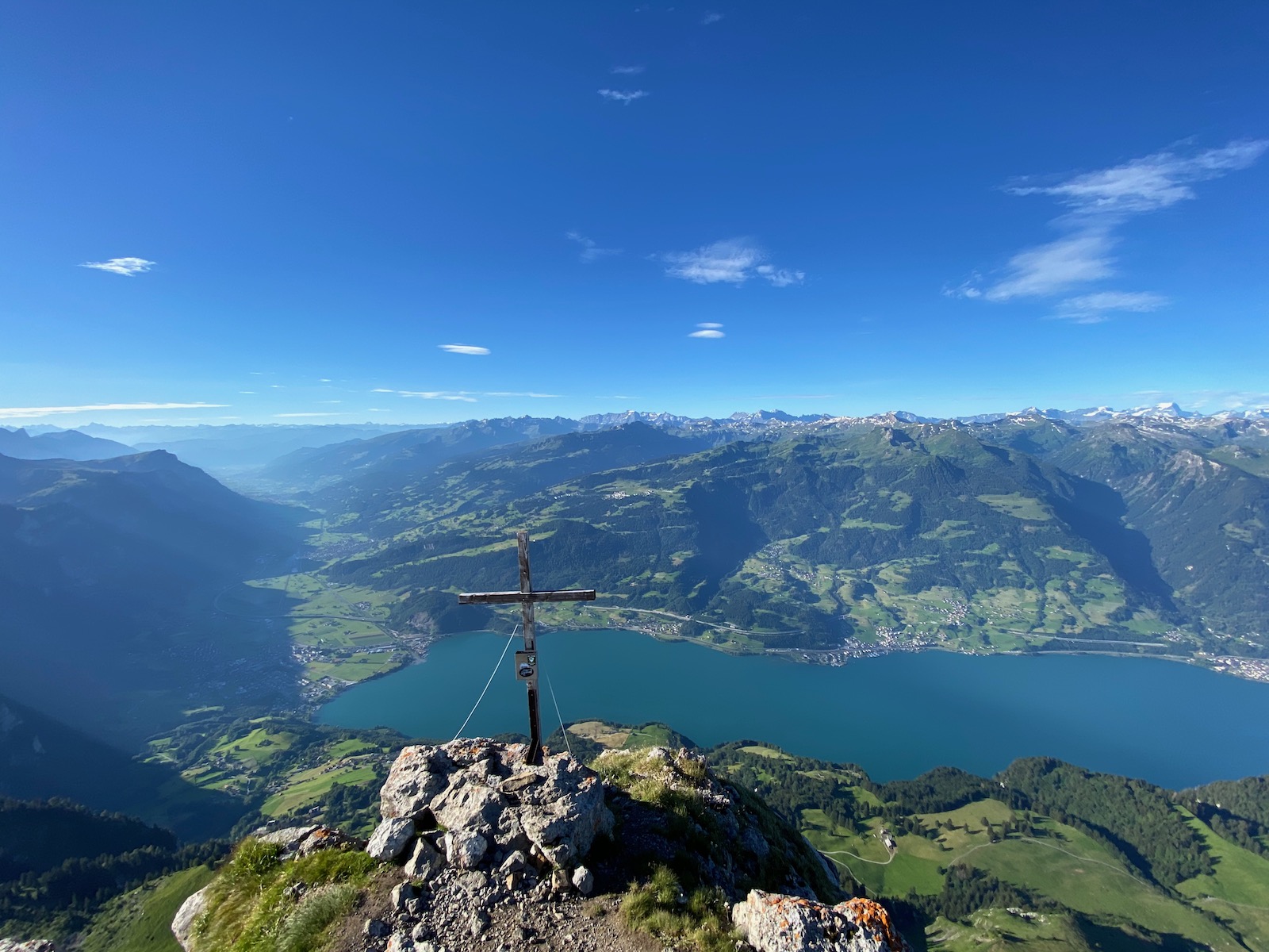
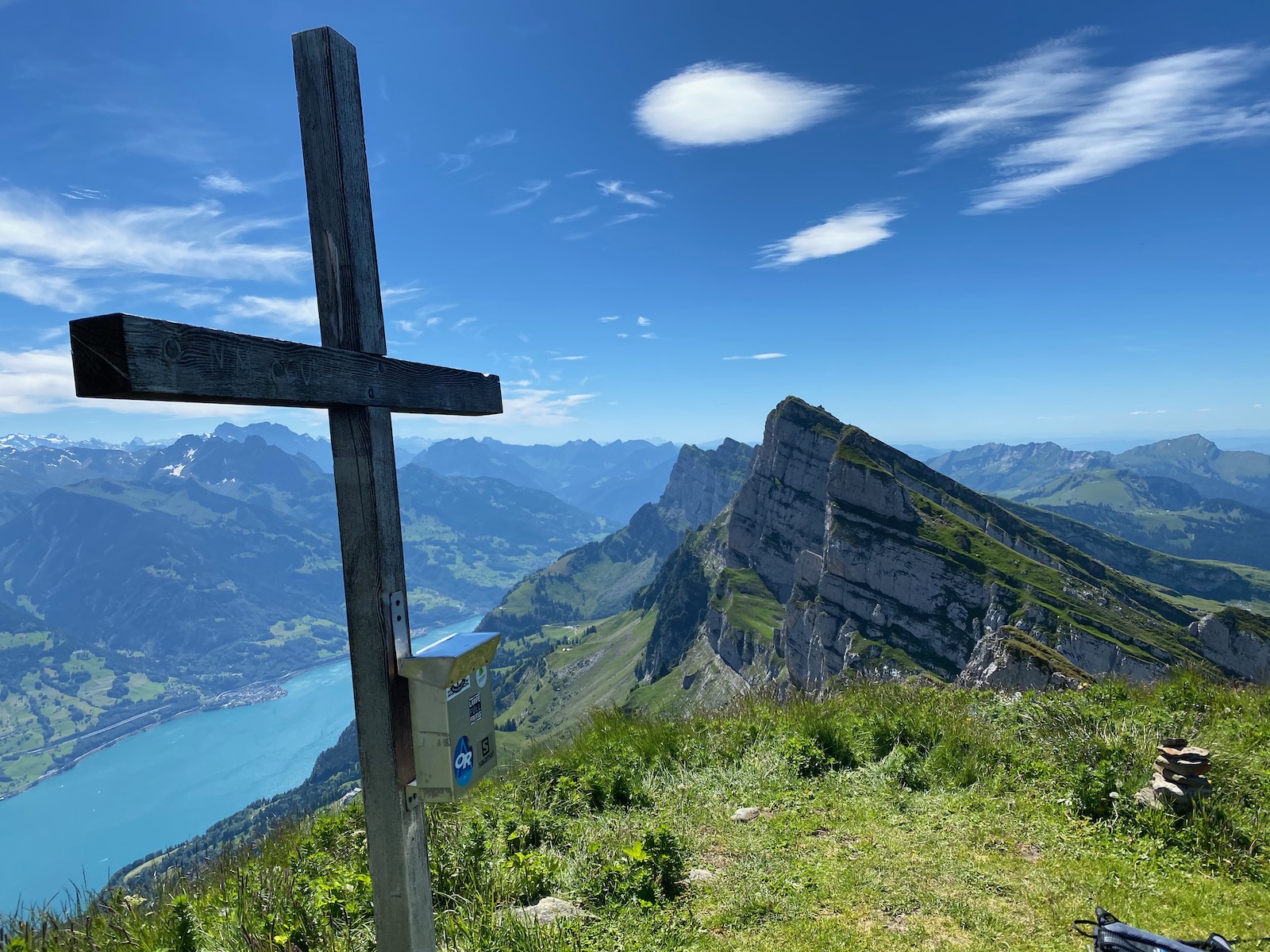
View from Frümsel HB/SG-020 down to Lake Walen, 1800 m below
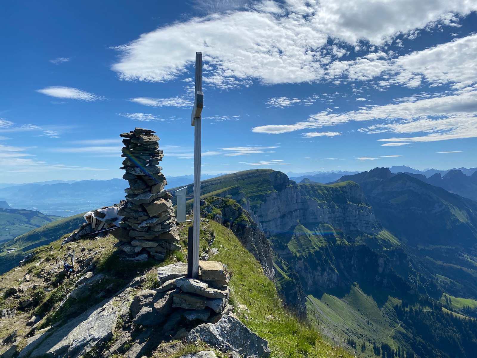
At the summit of Brisi HB/SG-018. The covered pile of wood behind the cairn is for a bonfire on Swiss National Day (bonfires will be lit on all Churfirsten summits this year)
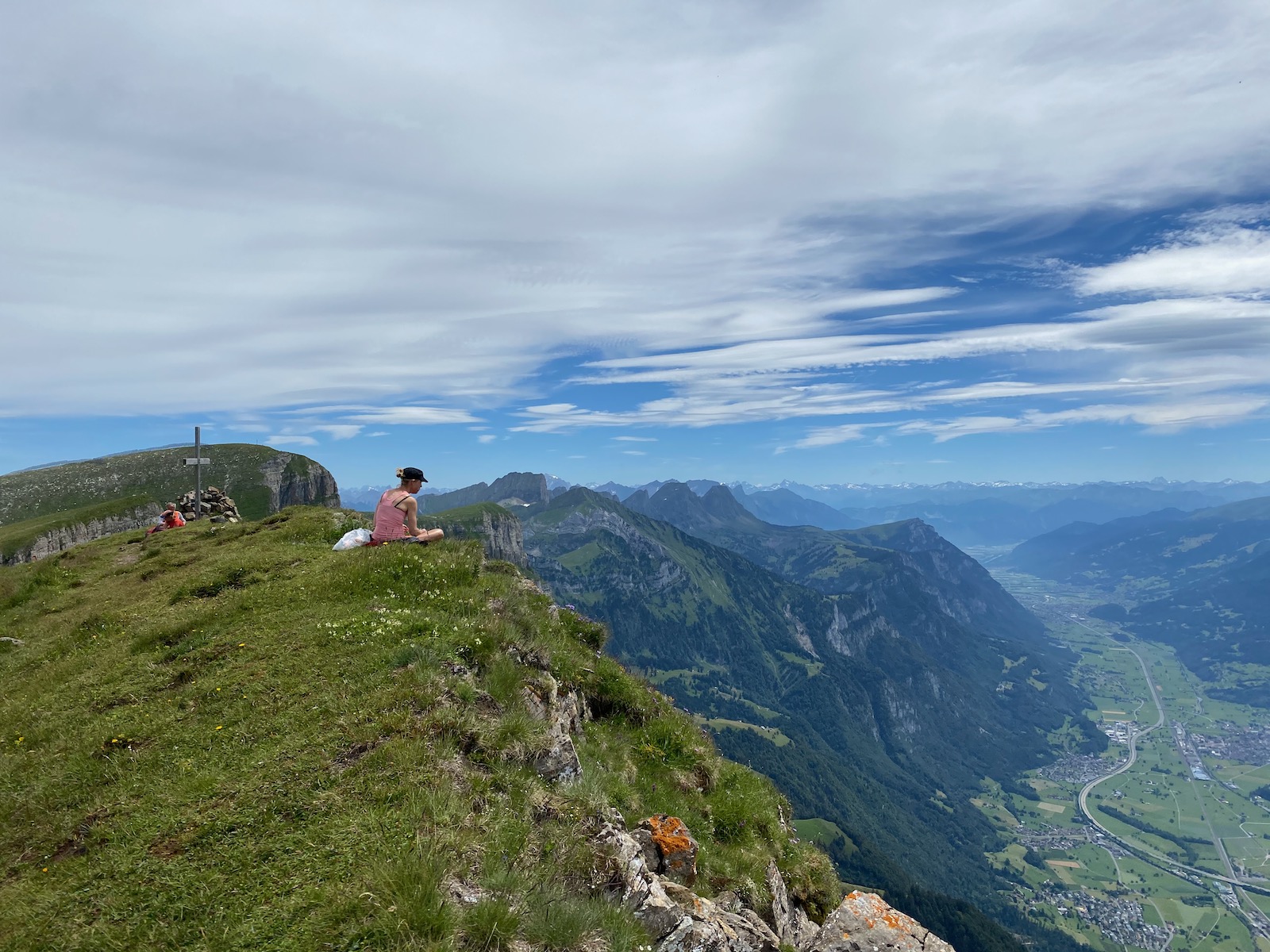
On Zuestoll HB/SG-052, the only summit where I was not in solitude
On Schibenstoll HB/SG-053, looking back
Hinterrugg HB/SG-017, the final summit with its huge AZ


