Weather has been awful lately, but the forcasts were showing a small 2-day window in the rain, about 30km across and centred on Queenstown. Now: Queenstown, being our local tourist hellhole, is the absolute last place I want to be around xmas. But beggars cant…, etc.
So I head off late Sunday night for the DOC Moke Lake campground, in the hope that everyone else would have arrived by then and be off the roads. A plan that, just for once, worked.
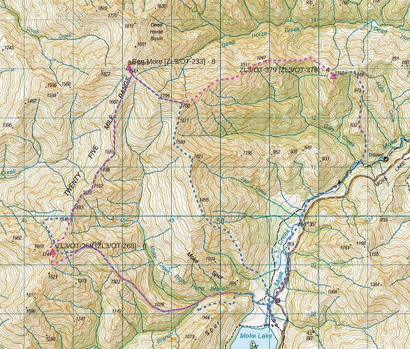
Planned circuit (pink), actual route (blue)
Five summits run the length of the range in the Mt Creighton Conservation Area, Jessie Peak, Mt Creighton, ZL3/OT-268, Ben More and ZL3/OT-379. I’ve already activated the first two of these, so plan a day circuit of Ben More and its two nameless neighbours, from the camp at Moke Lake.
==
Day 1: ZL3/OT-268 and Ben More [ZL3/OT-233]
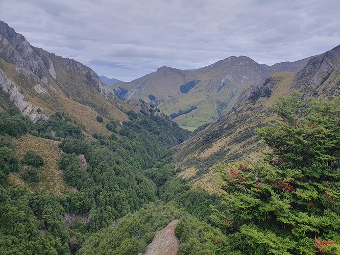
Monday, whilst hot and humid, dawns with high cloud, taking the bite out of the sun. The planned route up Moke Creek quickly turns to custard with a tight gorge and 10m high waterfall. Had I planned on this, I’d have climbed the Ben More access track to the low saddle to the north and sidled the open northern (true left) valleyside above the beech, but since I’m already 1km up the creek and penned in by bluffs, I scramble instead onto the southern face and spend a hot, frustrated hour sidling above the gorge through thick, painful matagouri scrub.
Looking down Moke Creek. Which side looks like it would have been the better choice!?
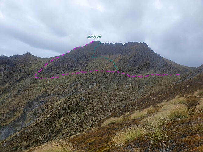
The nose of the spur leading to ZL3/OT-268 is steep and loose, but once above the creek provides good travel all the way to the final saddle before the summit at 1518m. I’ve contemplated this trip several times and wasted much time pouring over maps and air-photos trying to work out if the summit is attainable.
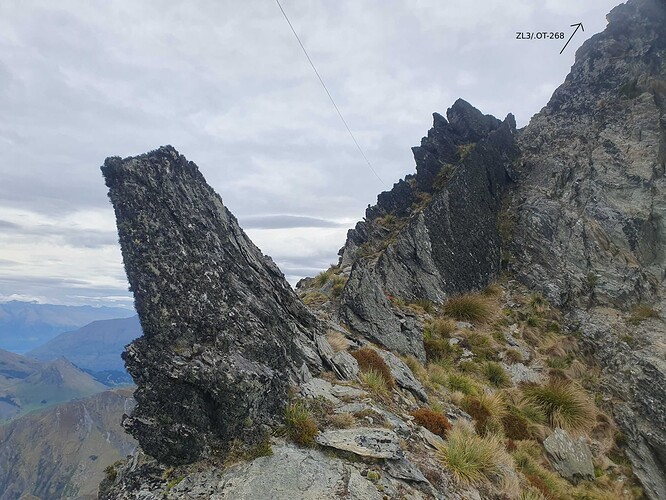
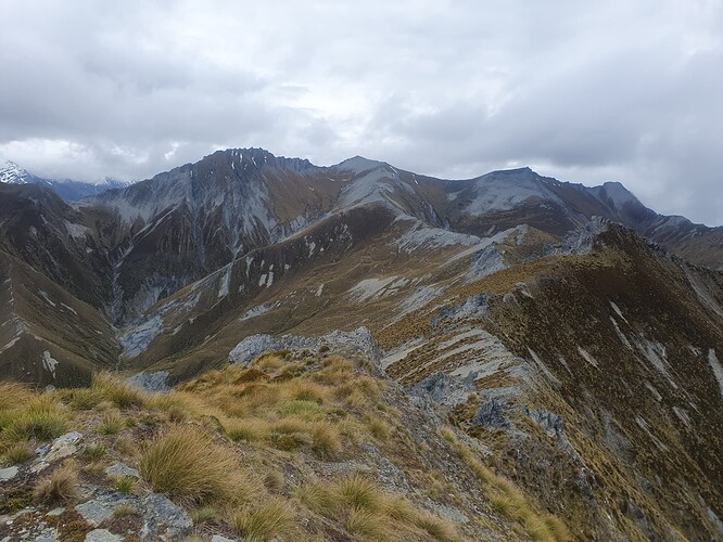
The saw-toothed ridgeline is certainly a no-go, and the best approach seemed to be to sidle the steep eastern face below bluffs and ascend from the saddle to the south. However, as I got closer, I became seduced by a series of guts and shelves apparently leading directly to the summit. This proved to be a major mistake, with repeated ice-axe assisted scrambles up steep snow-grass faces that would take a lot of care to descend should it come to that. Compounding the error, I soon lost track of the location of the summit itself and ended up much further north than planned, missing the ‘nice’ upper slopes I’d been aiming for and remaining on sketchy ground all the way to the ridgeline.
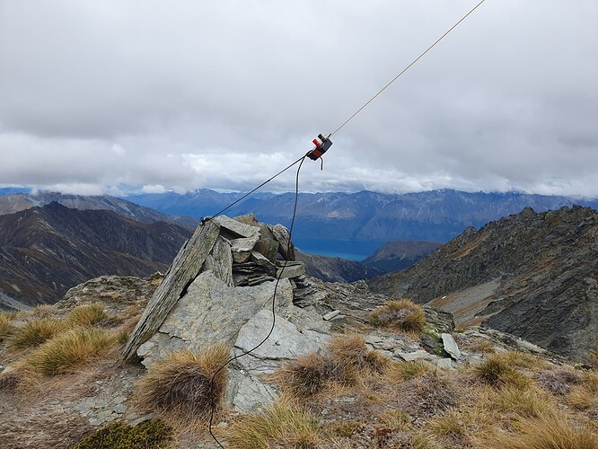
When I did hit the top, it was on an exposed shoulder just north of the summit and directly below it. The GPS put me at 19m below summit altitude, and the NZSoSDEM derived AZ maps showed me within the AZ. Neither measure is 100% reliable, but with no LiDAR data available for inland Otago, I decide to ask no further questions and ‘get this thing activated & get outa here’. I strung the EFHW between the two rock outcrops and found a flat spot just large enough to accommodate myself and the radio without losing either over the sides.
10 minutes on 40m netted 6 in the log, including an S2S with @ZL2NEB on ZL3/MB-093. Just as I spotted on 20m, cloud started to form around the summit, and I took the decision to abandon the rest of the activation and descend whilst I still had visibility - so sorry to the VK chasers who tried for me and heard nothing
The north-western face is gentler (relatively) that the one I ascended, but cut by rocky ribs and scoured-out guts dropping 400m to the basin below. However, this proved much more tempting than retreating the way I came, so I scrambled 400m down the tussock gully to the basin, and the re-ascended 300m to regain the ridgeline north of the sawtooth.
Looking towards Ben More [ZL3/OT-233]
From there, the ridge to Ben More [ZL3/OT-233] was generally broad and good going, with just a few scrambles around outcrops where well-worn game trails provided clues as to the best route.
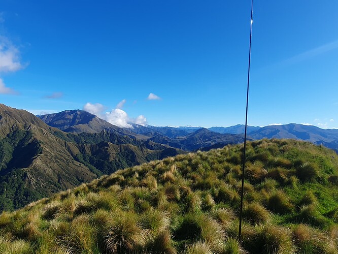
The activation of Ben More was also a much simpler affair - with space to peg out both ends of the EFHW and guy a mast to support in in the usual inverted V. Unfortunately the 40m band had deteriorated considerably in the meantime and reports were poor, the North Island completely unreachable. 15m brought 3 contacts including a S2S with @VK1DA on VK2/SM-093. Both @VK1DA and @VK1AD (confusingly) were operating on 10m for the challenge, but neither could be heard on that band.
Activating the Big Hill [ZL3/OT-233]
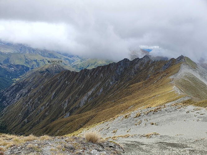
I had hoped to continue along the eastern ridgeline of Ben More to ZL3/OT-379. But it looked jagged in places, and the northern face appeared impassable making any detours around outcrops uncertain. More importantly I was exhausted, cramping up and had reached that state of dehydration where any attempt to drink water results in instant nausea.
Ridgeline from Ben More to ZL3/OT-379. Not inspiring!
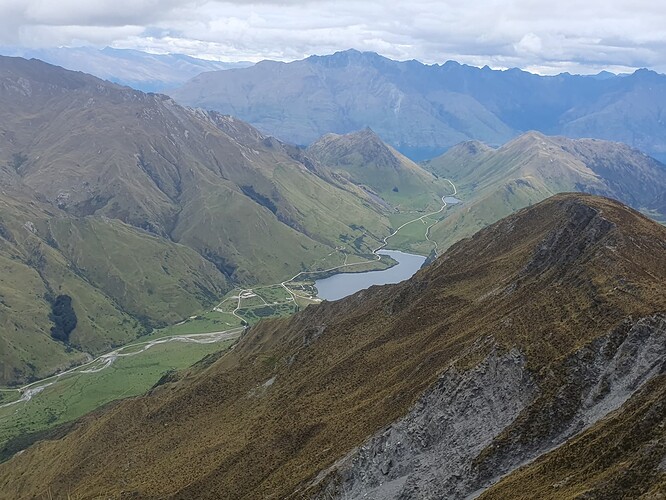
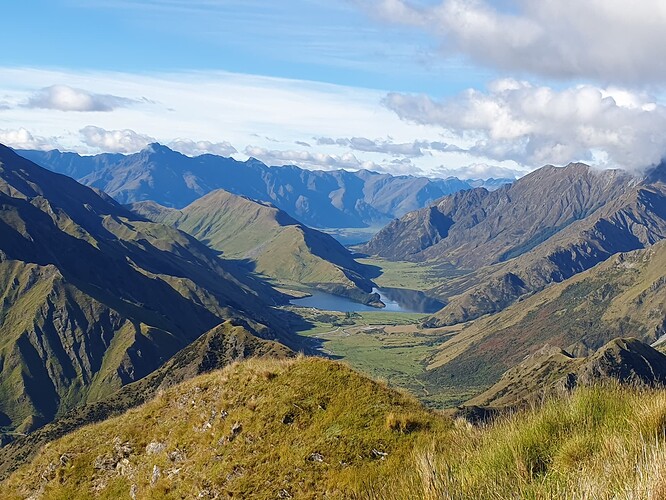
As such I decided to call it a day and descend the ‘usual route’ SW ridge off Ben More back to Moke Lake. There are a couple of airy bits where a detour onto the faces is advisable (follow the goats!) but it’s a pretty straight forward route, for anyone wanting to activate the Big Hill. A poled DOC track leads from Moke Lake to the first saddle 200m up the spur.
Moke Lake - ZLL/0911 via SW ridge
The day ended with a refreshing swim in Moke Lake, though I stayed at the shallow end due to the cramping legs - it would be a shame to drown after successfully completing all that!
==
Day 2 - ZL3/OT-379
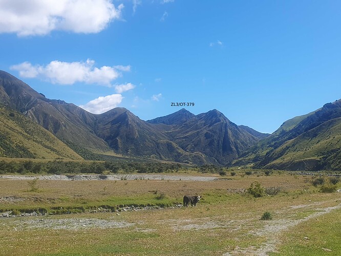
Plan B had always been to pick up the northernmost summit from the valley, and so that was the challenge for Tuesday. Accessing the spur to the summit is one of those NZ-specials, walking down the valley flats from the Moonlight Track to the start of the gorge, GPS-watching to keep within the 44m-wide corridor of the unformed legal roadline. Then down the creek sticking within the 11m-wide Queen’s Chain on either bank. Frustratingly the farm-track runs mostly just outside the margins of the public land.
ZL3/OT-379 from Moke Lake
A brief scrubby scramble north up the park boundary from Gills Creek leads to the grassy basin, and a straight forward climb to attain the ridgeline at pt832. An easy walk on grass and occasional beech put me at the 1166m summit at 8:30am - 1hr50 from the campground and an hour early.
Activating ZL3/OT-379
The early hour meant that no VKs could be raised on 20m, but I managed 8 ZLs between 40m and 20m, including a park-to-park with @ZL1HIM in ZLP/BP-0057.
The walk back was made more pleasant, despite the growing heat of the day, by the promise of another cooling dip in Moke Lake.
