Full report to follow when my endorphin trip finishes ![]()
Some taster photos.
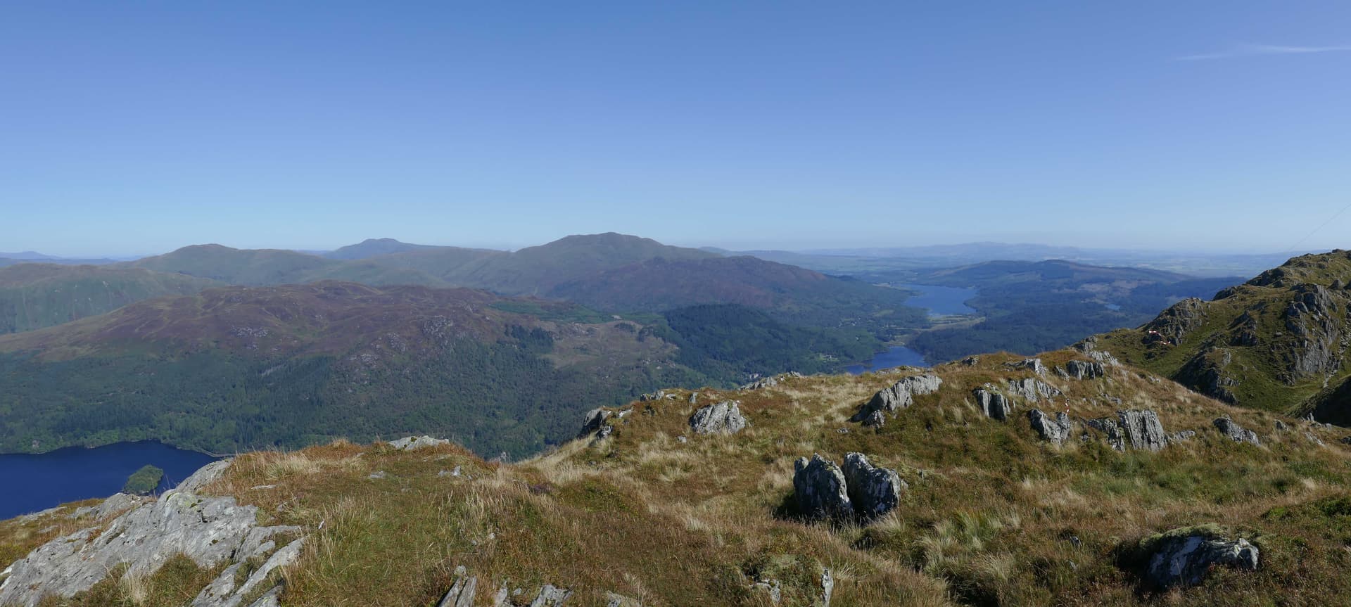
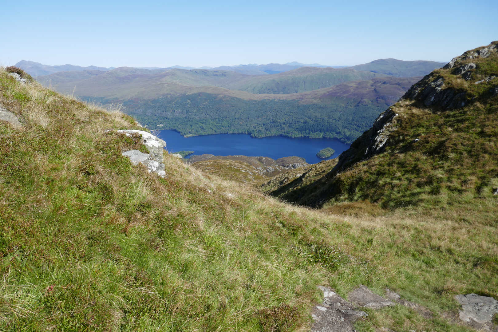
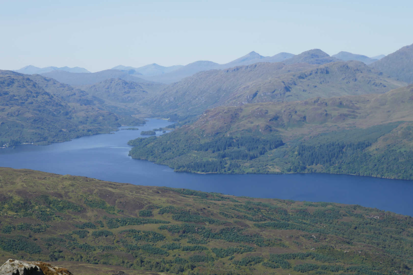
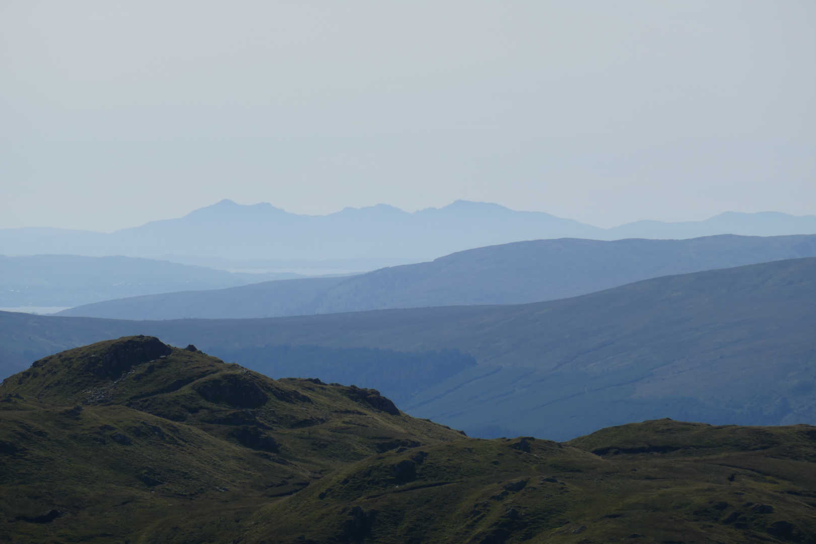
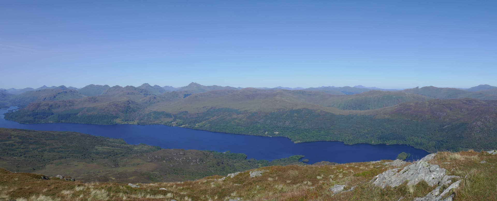
Looking from West to North over Loch Katrine.
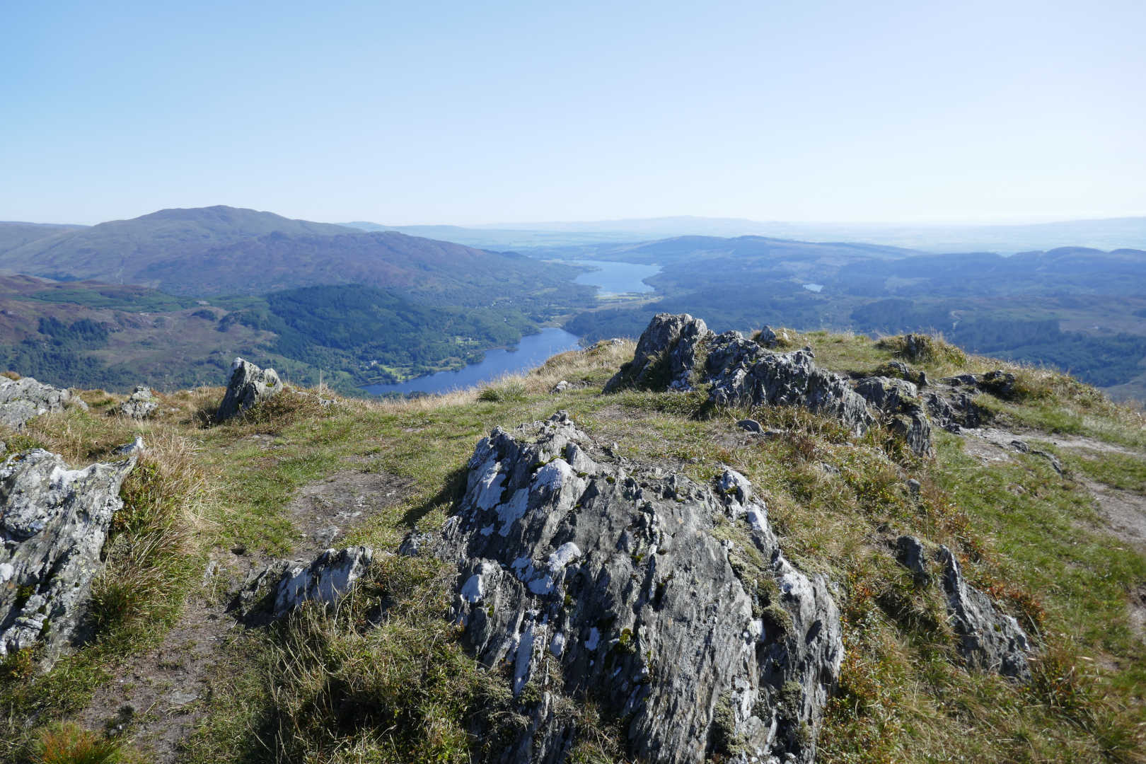
Looking North to North East over Lochs Achray and Venachar
Full report to follow when my endorphin trip finishes ![]()
Some taster photos.
Looking from West to North over Loch Katrine.
Looking North to North East over Lochs Achray and Venachar
Endorphin trip over and a day of fixing a regression server in a different office interrupted the write up.
Ben Venue GM/SS-058 is another 4 pt GM/SS summit. It can’t be harder than Green Lowther GM/SS-056 or Culter Fell GM/SS-049 or Tinto GM/SS-064 can it? Er… yes ![]()
I learnt of this hill when I was first getting into SOTA. I read about it and discovered it was a bit of a trek compare to other 4pt summits but also it had a ferociously boggy and mud section to the walk. The stories of the mud in the forest were legendary. Anyway I was running out of nearby summits not yet activated and so it rose up the ranks. And still I put it off. Then it got a new path which cured most of the old problems so finally it became “The One”.
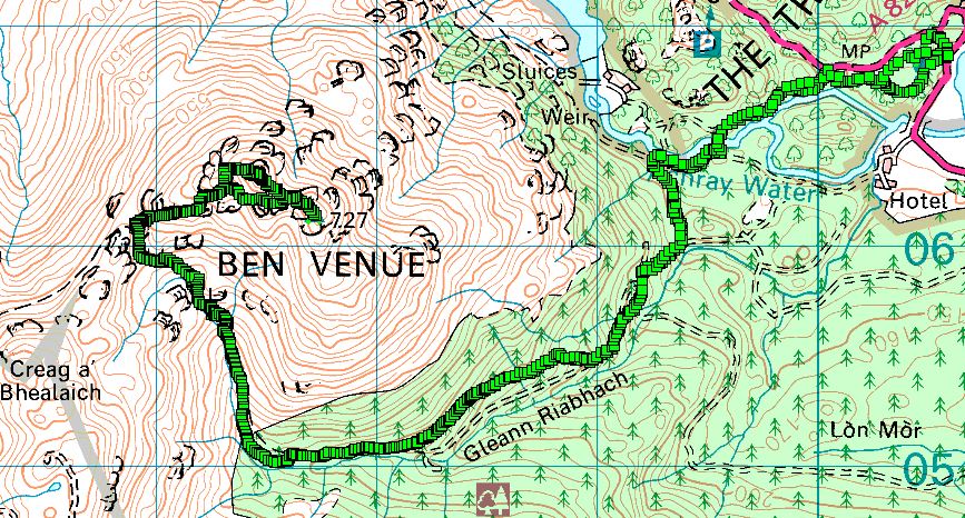
And it came to pass that I arrived in Callander on the way to Ben Venue. It was early as I was up early as it was predicted to be a very hot day, unusually hot for September. I looked at the road sign which said “A821 closed 9.00am to 3.30pm 0.1m West of Killmahog”. I didn’t believe it. It was 8.05am and the road would be closed. This part of the Trossachs is essential a rectangle of roads, A821 from Callender to Brig O’Turk the Achray, then South over the Duke’s Pass to Aberfoyle then east on the A81 to South of Callender. You can’t go much further because there these big mountains like Ben Lomond, Ben More and hundreds of sq. miles of wilderness. The road is very important but badly damaged with 20+ years of potholes. So they are resurfacing it in 250m strips… i.e. close it for a few hours whilst a strip is resurfaced. Then next day move on. Anyway at the road works a helpful man explained the situation, I had no problems getting to my destination at the far end of the road and my return I had two options to come back. Phew! I thought I was going to have to do something else. There was almost no traffic on the road, well it was closing soon, so all 310 ponies were unleashed and I was at The Ben Venue car park in a few minutes. Hmm, all day parking is £5. The ticket machine went through the motions and refused twice to accept a credit card. But there was Ringo App payment, I don’t have that but it gave a number to ring. That was answered by a nice voice that knew my registration (was there a camera?) and knew my credit card number, scary. I realised I used the none-app app payment before. So £5 lighter it was boots on and significant amounts of sunscreen… today was wall to wall blue sky but it was only 8C in the car park.
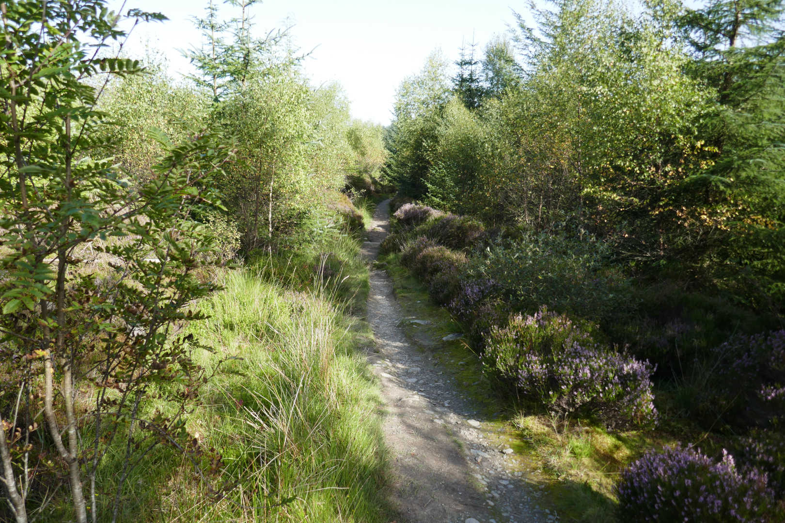
The path out of the back of the car park is excellent and is well sign-posted. You have quite a bit of up and down (which means up on the way home when tired ![]() ) in the forest. It was just gorgeous walking in the shade. But humid, it was cool but I was very sweaty quickly.
) in the forest. It was just gorgeous walking in the shade. But humid, it was cool but I was very sweaty quickly.
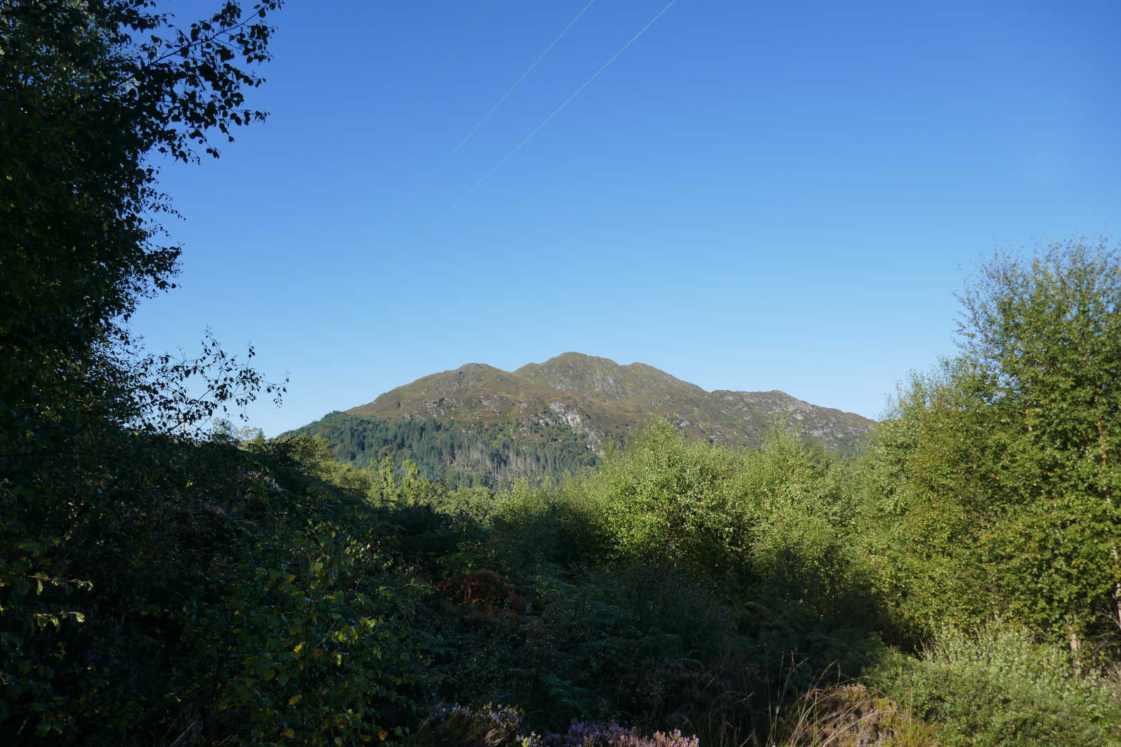
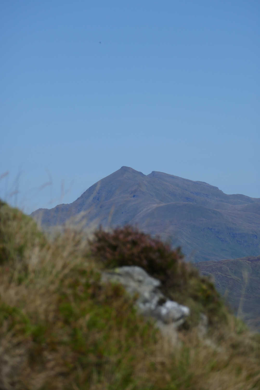
But my first proper view of Ben Venue cheered me up ![]()
You just follow the signs sadly for 3km an 220m of up and 80m of down. Hey that’s nearly a Scald Law’s worth of exercise and I’m not actually on the Ben Venue path! The last sign says “End of the waymarked parth. Are you prepared?” well yes, I had a paper map and a GPS.
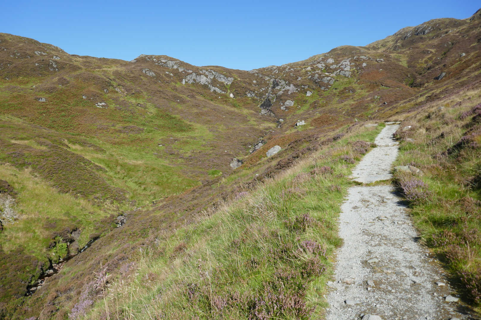
The path remains in woods for a while then the forest has been harvested and I was in the sunshine. But the walking was easy and slowly the headwall to Gleann Riabhach appears. So that’s another 2.25km and 250m of ascent before the climbing starts. It looked rather alarmingly steep especially as it was hot but there was a gentle breeze which made it bearable.
Coming to the end of the hardcore path. There is still a good path but it’s more just boots on ground made than engineered. And you have to put your hands on a few rocks along the way. I don’t like that but it was just the odd hand on rock, not scrambling in any sense of the word. It was not at all difficult.
Now I wasn’t making amazing time, some walkers later on were older (and slimmer) and were going much faster than me. But I got to the top without wanting to give up. There’s a 300m flat grass section that was boggy requiring careful routing to avoid tears and sunken bodies. This was after a dry spell, it could be nasty on a wet day. Then a bit more windy climbing and then a reasonably simple path takes you to the cairn.
2hrs to get here, 6.1km and 570m climbed. I always planned to stop here for a rest and drink. I normally take 1L of water in Summer but as it was going to be really hot I had 1.5L. That meant 0.5L here, then 0.5L at the summit and 0.5L for the return. Also there are plenty of fast, clean streams crossing the path on the way here and also the Allt Riabhach down in the glen which made the most fantastic noises whilst on the hardcore path. I met another walker here and we chatted for 10mins before a 3rd walker appeared and we all set off up the proper climb.
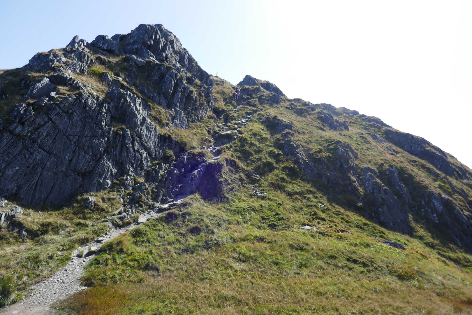
They were fast walkers unlike me and soon disappeared up the almost vertical path which wasn’t difficult just very much up and no along rather than along and some up!.
Typical of the final section, a bit of a climb normally followed by a level bit, similar ground but descending then more of the climbing. Lather, rinse, repeat for 1km and 160m ascent.
Now there are 2 summits, 727m and a trig point and 729m. The trig point was the one for me for WAB netting on 40m. Well when I got there and caught up the others it was obvious there was more than 25m descent before climbing to the true summit. Damn. So it meant down and back up but was just as well as there wasn’t much HF antenna space at the trig. But there was a the first views that made all the effort worthwhile.
Looking down into Loch Katrine
Ben Lawers GM/CS-001
Loch Achray and Loch Venachar, the big hill on the left distance is Ben Ledi GM/SS-021 and in front is Meall Gainmheach GM/SS-134 (never to be done again!)
Broken natural rock trig point, Southern Summit Ben Venue GM/SS-058, the flat lands South of The Highlands. The tiny bump in the far distance is Tinto Hill GM/SS-064.
We all set off to the true summit and 10 mins later we were all there. I hardly activate from this area so many of the mountains looked “wrong”. We chatted for 5mins and the other 2 set off home. Me, I found a nice area for the mast. Setup was a 5m Decathlon fibreglass pole, 17/20/30m dipole, KX2, Eremit battery. (Not yet charged after Lamachan Hill and Scald Law activations and it’s still full of life!). I notice one of the RC 2mm connectors had come off and was stuck in its matching half. 5 mins to remove both and strip the insulation and we had 30m but I had the 60/40/30 dipole too. End stop 4G from EE was available and I started on 20m CW.
Signals were generally strong, most were 599 and as the breeze was refreshing but not blowing hard I could hear the KX2’s crappy speaker with ease. It was easy working 16 QSOs in I, OK, DL, HB9, F, EA2, OE,EA7, EA1, OH, SM, SP and then 4 on 20m SSB. Fabulous views and plenty of mid-week chasers, rather good. Onto 30m and QSO into DL, PA, HB9, M. I worked Chris DL1CR/P (@DL1CR) who was not loud like the other callers, could this have been one of Chris’ homebrew radios with valves/tubes?
I was really enjoying things but it was hot in sun. I knew there was 2hr walk back and I was toying with 40m but had a quick shout on 2m FM. 6QSOs including a lengthy chat with Jack GM4COX about completing SS summits South of the RIver Forth/River Clyde. I decided it was time to stop at 1241Z after 90mins on air. I had a leisurely pack away, two (count them) two bars of chocolate and 0.5L of water.
Lots more walkers could be seen at the other summit, 10 or so but only 2 actually came to the top summit. There is a loop in the path that takes in both but I had to find that. It’s not on my printed map but was on the Oruxmaps map on my phone. Then it was photo time. The return path found and I simply kept putting one foot in front of the other for what seemed like a lifetime till back at the car where 2 cans of Diet Red Bull gave me wings for the drive back. That was over the Duke’s Pass to Aberfoyle and the ponies were all unleashed meaning I arrived in Aberfoyle with a lot less tread on the tyres and less diesel in the tank but one hell of a smile on my face. ![]()
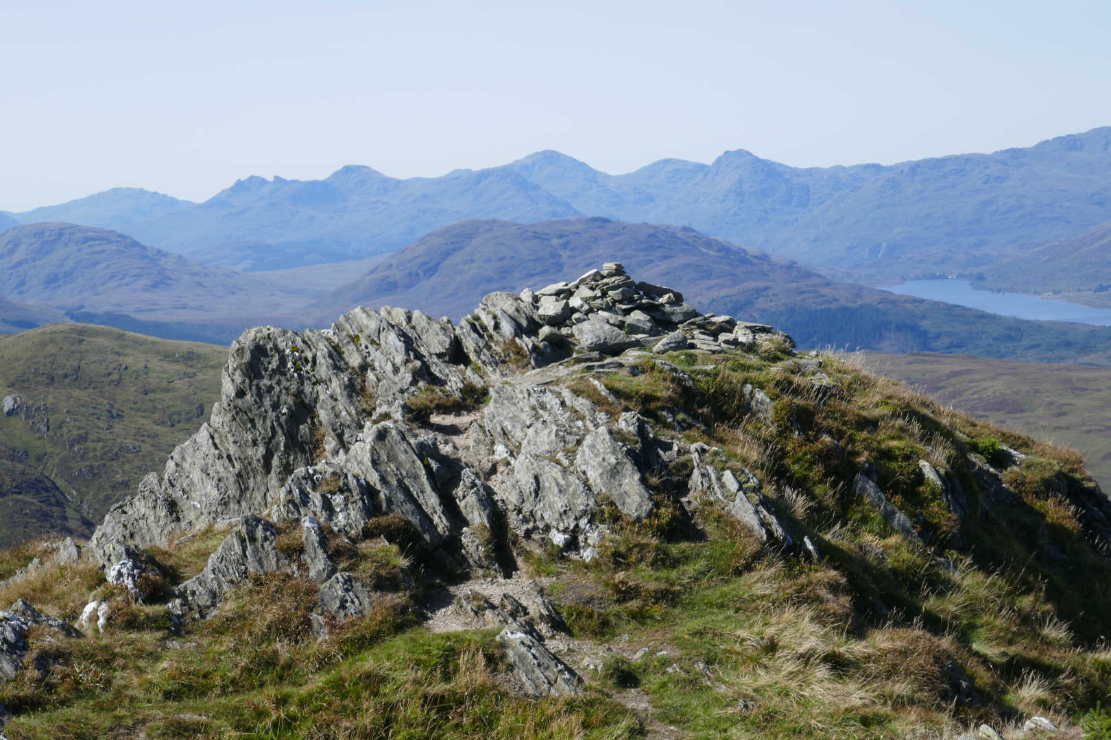
Ben Venue GM/SS-058 true summit and Arrochar Alps behind. The Cobbler, Beinn Narnain, Beinn Ime, Ben Vane, Ben Vorlich.
Ben Lomond GM/SS-011
Loch Katrine NW end, Stronachlachar is the wee village, L-R Ben Cruachan GM/WS-013 group, Beinn a’Chochuill GM/WS-071, Beinn EunaichGM/WS-065, Beinn a’Cleibh, Beinn Lui GM/SS-003, Ben Oss GM/SS-005, Stob a’Choin GM/SS-024, Deinn Dubhcraig GM/SS-009
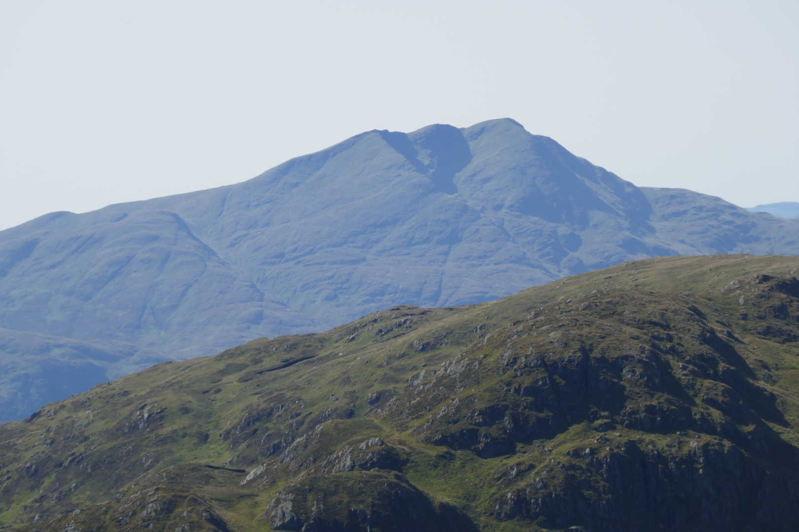
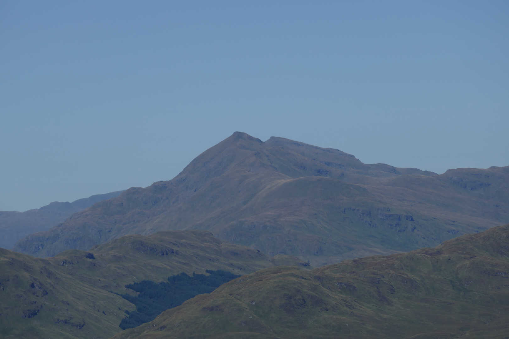
Stob Binnein GM/SS-002 and Ben More GM/SS-001. Looking up the southern ascent route of Stob Binnein.
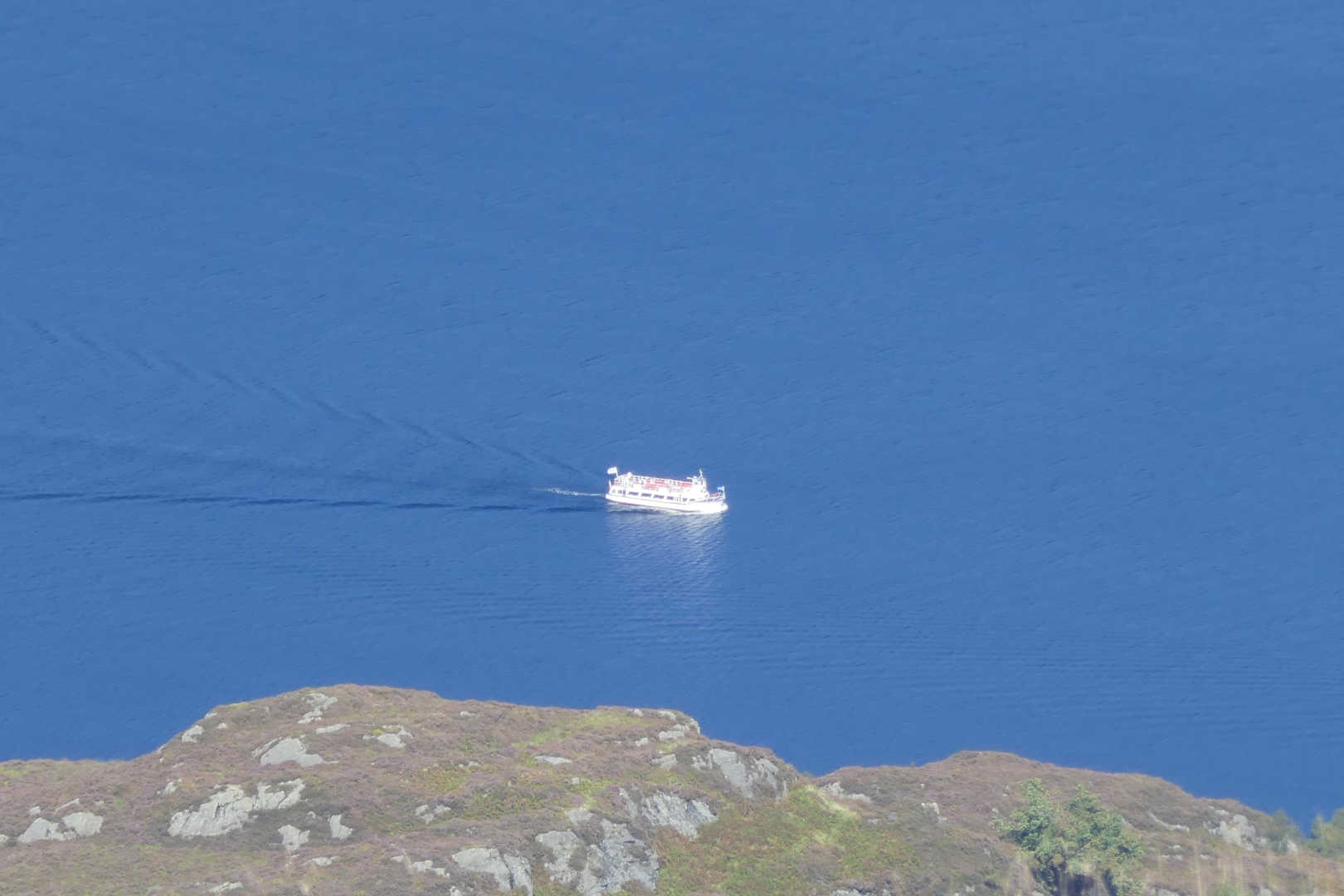
One of the many cruisers on Loch Katrine (diesel not steam powered)
The FMF antennas and the lower Ben Venue summit behind.
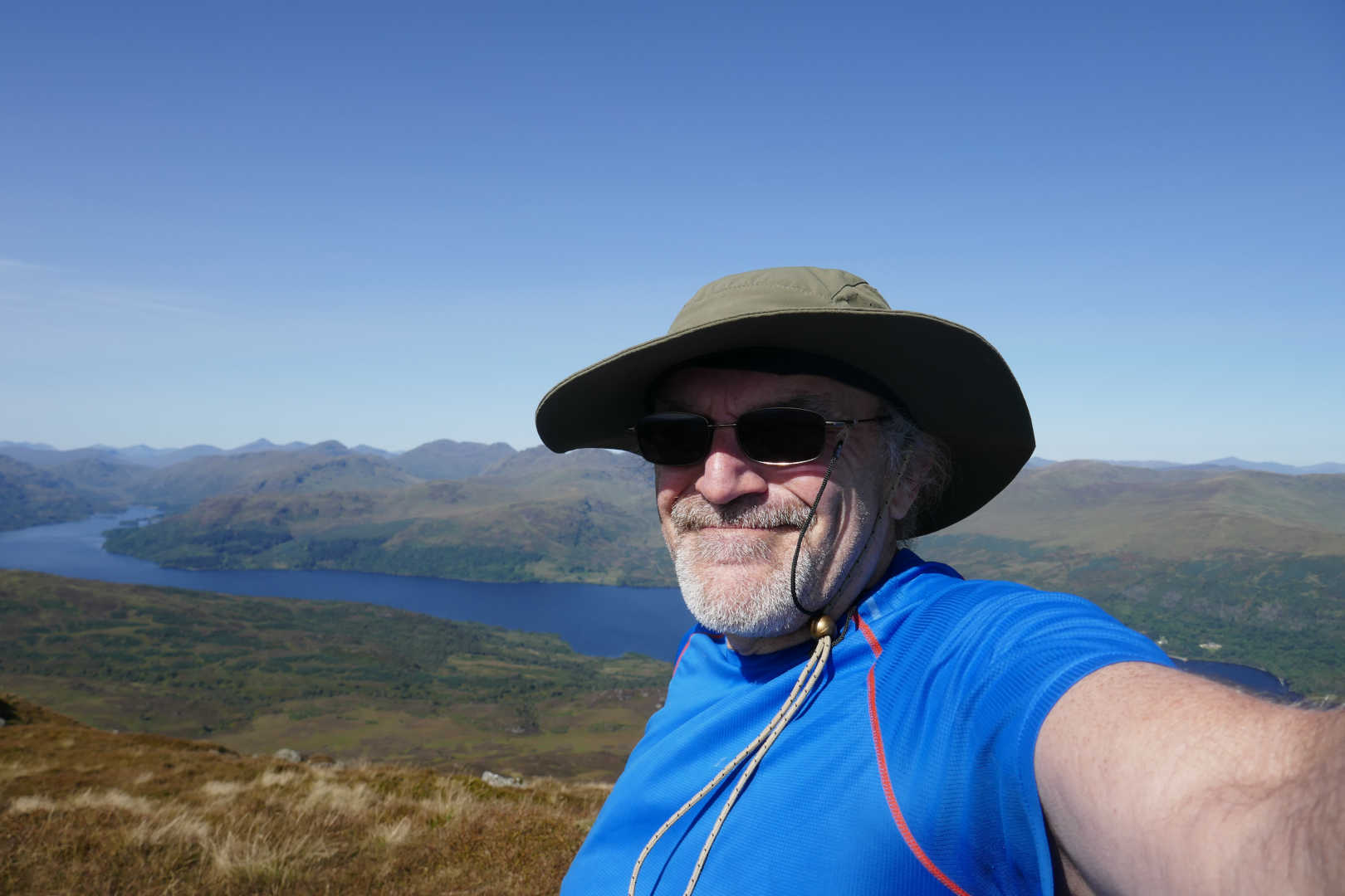
Happy MM0FMF having knocked off Ben Venue after dawling about activating it for 15 years.
Isle of Arran, 85km away, Goat Fell GM/SI-006, Cir Mhor GM/SI-011 and Caisteal Abhail GM/SI-007
Main summit Ben Venue GM/SS-058, the path to the trig point is on the right.
Finally the path through the forest. As it was proper hot and I was proper tired when back here, the shade was most welcome. The colours, sounds and smells were awesome.
Boy was that a grand day out. It was worth saving a summit that has a reputation for great views for a day when the WX was brilliant. It would OK on many days but special on a day like today.
Finally, the mandatory Andy-wants-to-be-an-arty-photographer shot. Stob Binnein and Ben More from a different viewpoint.
Splendid photos!
A SOTA activation cannot get much better…
Well Done Andy. Great activation. Very well described with Excellent Photography. 73 de Paul M0CQE.
Did you know that there is another route? It comes up the grassy gully in your first view to Loch Katrine, you follow the path from the hotel to the loch and on towards the Bealach nan Bo before turning south. It avoids most of the mud and is a little shorter. OTOH you cross two streams twice!
Sir Walter Scott gives good warning of the going:
High in the south, huge Benvenue
Down on the lake in masses threw
Crags, knolls and mounds, confusedly hurled,
The fragments of an earlier world.
There’s nothing like a bit of literature on a sunny Thursday morning! ![]()
Gud stuff Andy, great photos, great WX.
Magic.
You hum it and I’ll play a long! Yes, the 2 bods I met where taking that one back to Loch Katrine then along the loch. They said “it’s rather steep” so it’s not the ascent path for me ![]() The other is from Ledard Farm on Loch Ard at Kinlochard. This path has had all the bog removed by the engineered path, it used to be a nightmare through the forest. At the start there’s a boardwalk to keep you out of a marshy area. So only a few places on the final km to the summit and the flatish grass plateau are possible bogs now. Certainly not like before.
The other is from Ledard Farm on Loch Ard at Kinlochard. This path has had all the bog removed by the engineered path, it used to be a nightmare through the forest. At the start there’s a boardwalk to keep you out of a marshy area. So only a few places on the final km to the summit and the flatish grass plateau are possible bogs now. Certainly not like before.
Had my eye on this one for a few years. I’ve put it off on account of the effort relative to points ratio, so it’s earmarked for a winter bonus plod. The problem then might be daylight, but you know me… up before the lark. ![]()
Thanks for a great report and super photos. Much there to encourage me, but not in this heat. 31C in Middle England yesterday. ![]()