Unlocking Two Cairngorm Giants
Firstmost, let me get this out of the way. My view is that Ben Avon (pronnounce Ben A’an) is best climbed from Tomintoul. A long easy cycle followed by a magnificent traverse across the vast plateau from east to west, strolling amongst the giant tors, the last one being the summit - Leabaidh an Daimh Bhuidh.
And Beinn a’Bhuird is best approached from Glen Quoich, with its native Scots Pine forest and heathery sloped hills.
However, the route I will describe below allows both summits to be climbed in a 9 hour day, using a bike for part of the way.
The film is worth a watch. It describes the beautiful mountain scenery far better than I can in words.

Saturday 15th May 0715 BST saw me set off from the Keiloch walkers car park, just off the A93 east of Braemar. I used the bike for around an hour to gain the far side of the “fairy glen” at the top of Gleann an t-Slugain, a distance of around 8km. I made the mistake of heading into the fairy glen, determined to find the secret howff (shelter/bothy) that is concealed amongst the limestone crags of this area. It meant pushing the bike for a bit and I still didn’t find the howff.
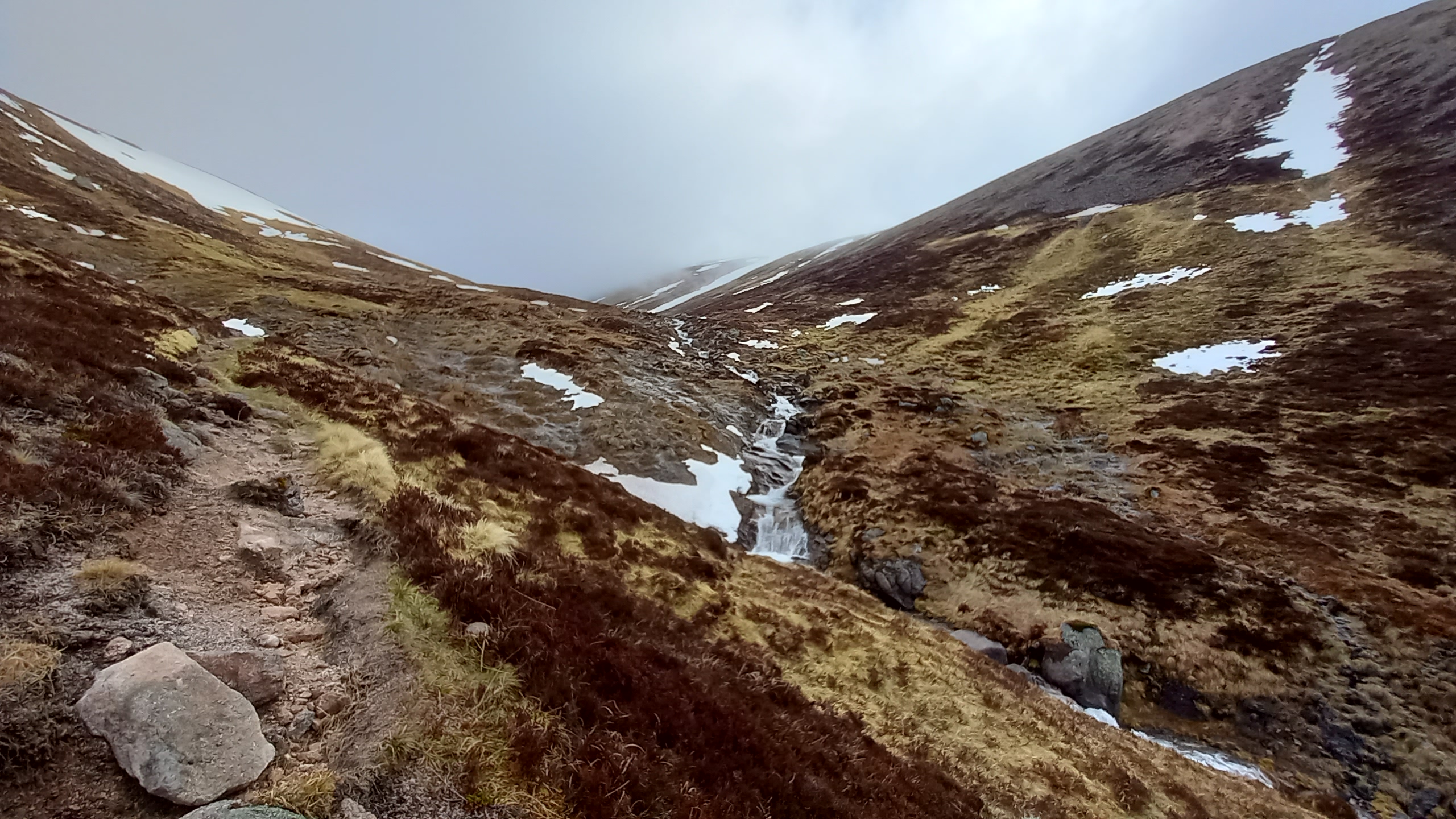
In the fairy glen

Riding out of the top of the fairy glen saw me re-join the main track. I decided to ditch the bike at a fork NO 116 957. This would allow me the option of returning via the south east shoulder of the South Top of Beinn a’Bhuird, although I wasn’t even sure I’d climb it at this stage, the cloud being pretty low in the glen. Cairngorm plateaux are no fun in mist.

Heading north, an initially boggy quad track soon joined with an excellent footpath coming up from Glen Quoich. This led up towards The Sneck at a reasonable gradient for most of the way. The Sneck is the high col or bealach that sits at 986m, allowing access to both hills.
.
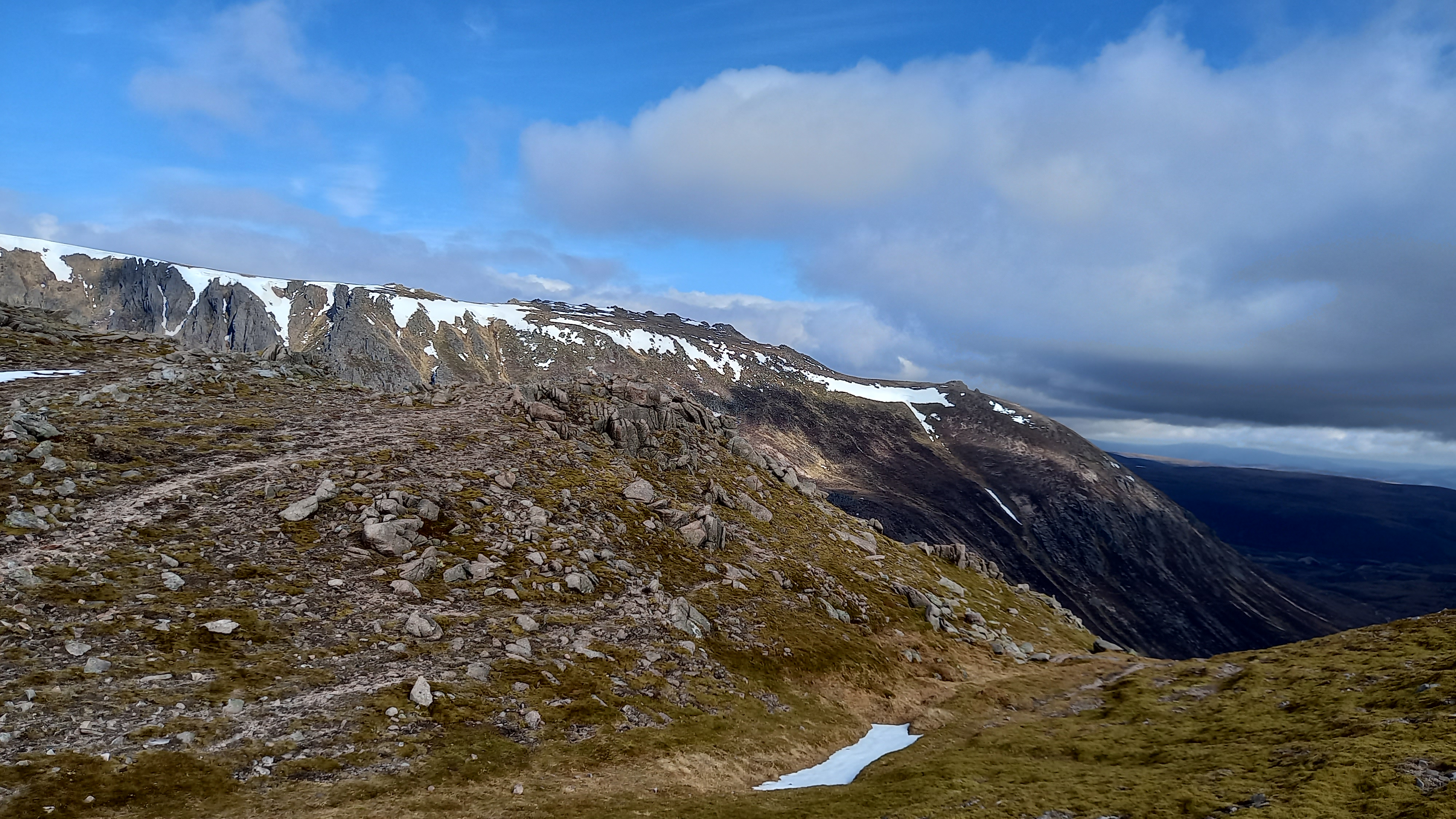
Looking north west from The Sneck
From there it was a steeper pull up the shoulder of Ben Avon and the summit plateau was soon gained. It was still misty at this point, but the clouds magically parted as I approached the summit mount, it topped by a granite tor - the true summit.

The tor can be gained from its north east side and a simple scramble leads to the top. It had taken me three hours thus far.

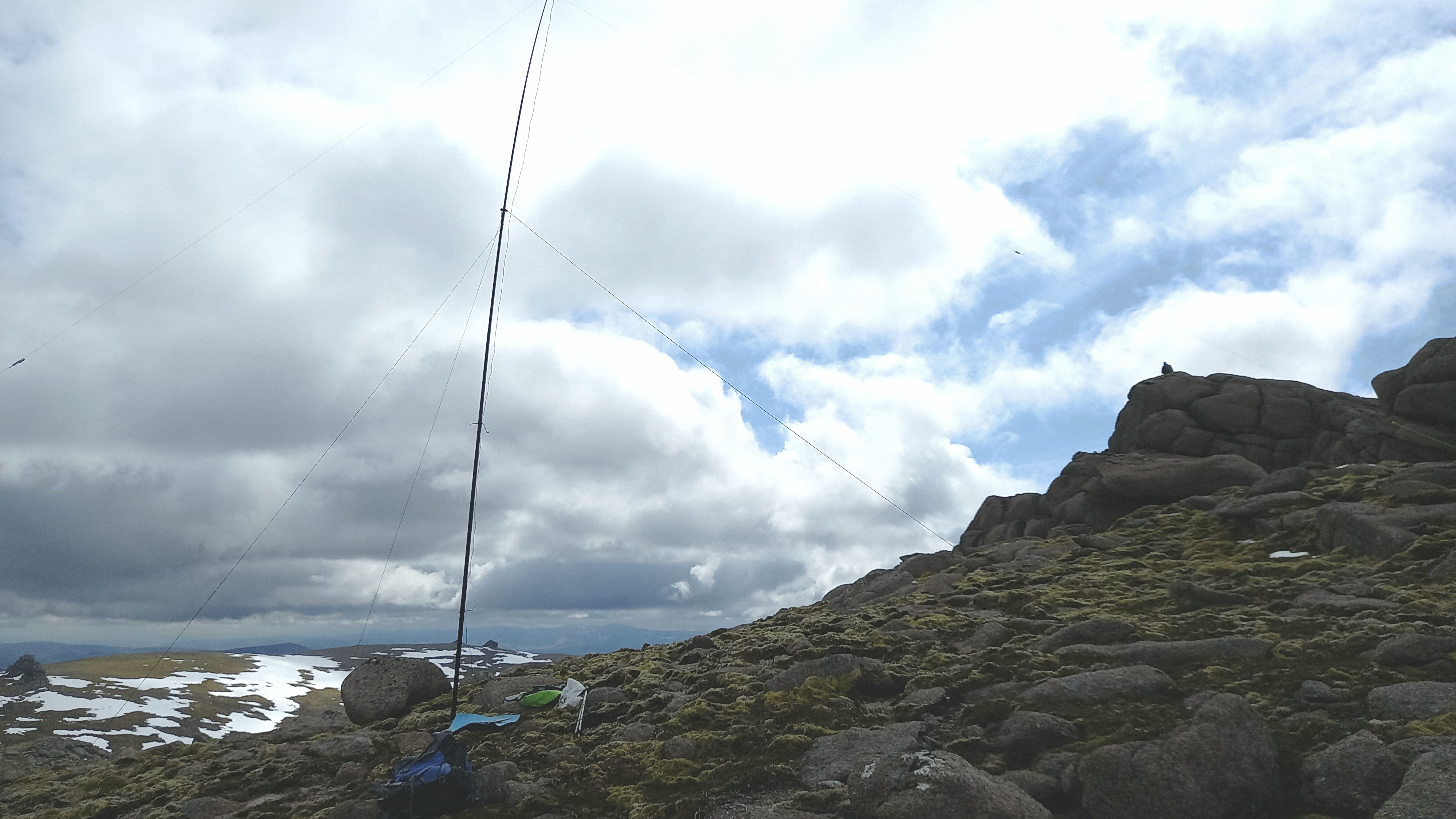
I had thought of planting my 20m vertical up on top of the tor, but I had passed a couple of walkers on the way up, and thought it would be a bit rude to block access. (As it happened the walkers eventually appeared just as I was finished operating!)
I considered carefully where to set up the station, keen to keep within 25m vertical of the summit! I ended up erecting the inverted V (linked for 40/20m) on the slopes to the north of the tor, with the dipole facing a south east direction. Propogation would be compromised, but not NVIS. The screengrab of my mapping app. shows that I was within the 25m vertical limit, with a few metres to spare.

I spotted myself using SOTLAS with the decent 4G signal, thereafter working eighteen stations on 40m SSB in quick succession, best DX being EA2CKX and IK2LEY, with regular chasers G0RQL and EA2DT appearing in the log. Spain is a hard graft with the dipole, the end fed W3EDP having delivering much stronger tx and rx in the past. Of course it needs a tuner, un-un and common-mode choke, excess weight I was not prepared to carry today.
I packed up and headed back to The Sneck, now under clearing skies.

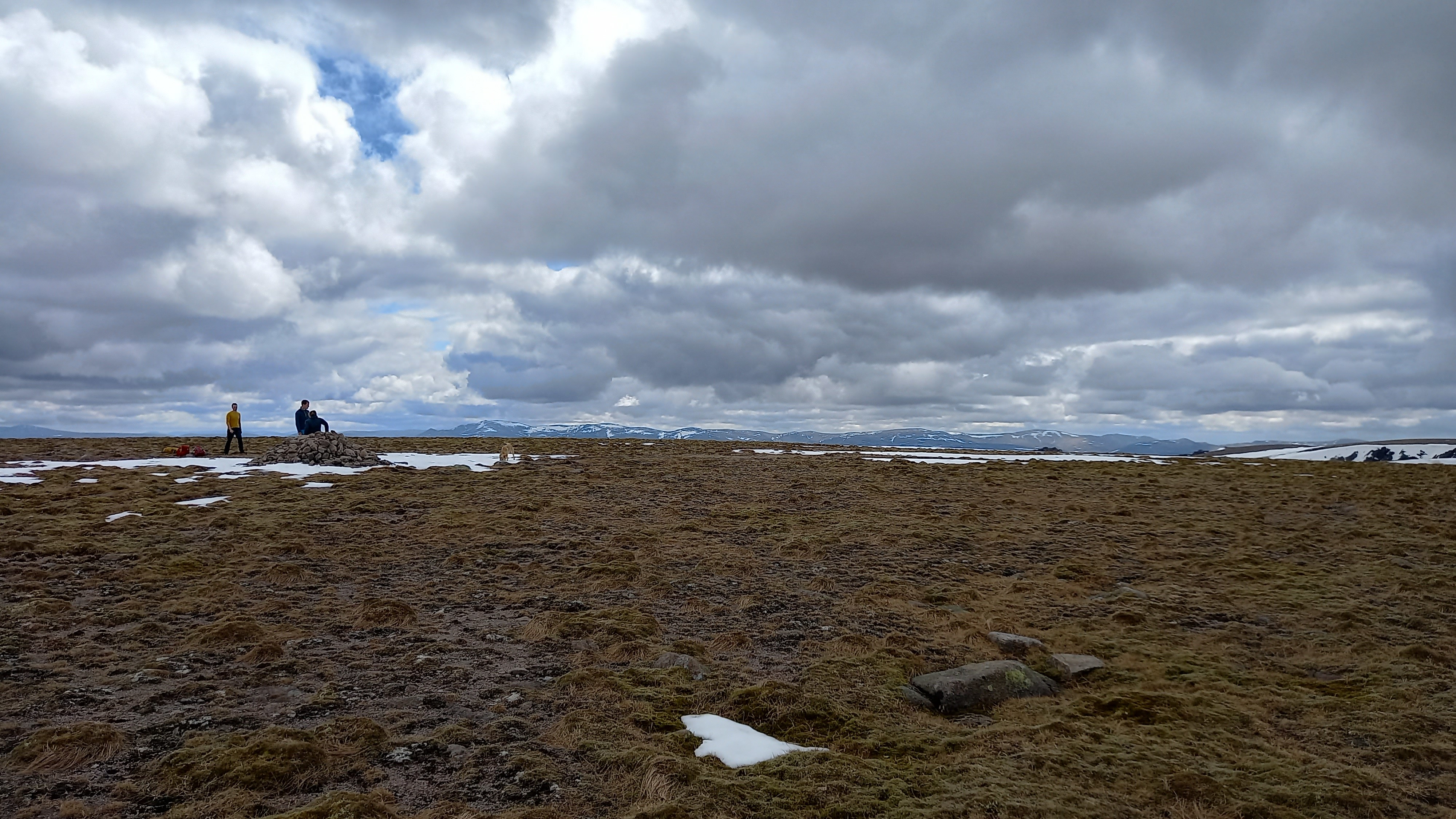
From the col, it was initially a steep pull on gravelly soils, but the angle soon eased and I found myself on the summit plateau of Beinn a’Bhuird, at a top named Cnap a’Cheirich.
1500m away was the summit. All that blocked the way was a few snowfields, some tundra and, as it turned out, a bog. Ptarmigan were wandering about here, their transformation to summer plumage almost complete.

The summit isn’t short on space for operating! One would probably be in the 25m limit anywhere in a square kilometre!
I set up around 100m west of the cairn, same set up as before. I was intending to work on 20m, but tuning to this band, I could only hear QRO stations, so 40m it was.

My SOTLAS/4G spot was followed by a 30 second pause, a CQ call and a pile up. QSB was an issue this time, but I worked fourteen stations, mainly UK, but with Spain, Belgium and France going in the log, as well as three or four who’d worked me on the first summit too. Thanks Chaps!
The descent was the part of the day I was most looking forward to. Beinn a’Bhuird has dramatic corries and they were still heavily corniced in places. The summit plateau also yields life in the summer, with micro flora and colour to be seen. Not yet though…

Views over to the Lairig Ghru and its mountains were also impressive.

I climbed around the side of the South Top and this led to snowfields and a somewhat stony descent. However, I soon spotted a stalkers path, which led down the flank of Carn Fiaclach and across the glen floor. The crossing of the Quoich Water proved problematic. I would not want to do it with a drop more water in it and I was glad of my walking poles.
Soon enough I was back at the bike and on the move. I took the track that bypassed the fairy glen on higher slopes to its north. I rattled down it ok, but it would have been a bit of riding and a bit of pushing on the way up for sure. I also found the secret howff, but I’m not telling…
In no time, I was down at the car park, and looking at my watch I could see that the entire endeavour had take me nine hours. I probably could have shaved 30 minutes off of this, however I’d picked up a walking companion at the summit of Beinn a’Bhuird, and he made good company on the way down. I also forgot to take any more photos and much video after this point - too busy yapping!
Kit:
Yaesu ft-857d, lifepo4 battery
7m mast, guy ring and three guys
inverted V linked dipole for 40m and 20m
20m vertical with counterpoise (unused)
Yaesu ft-3d (I called CQ on 145.500FM on both summits, but nothing was heard.)
waterproof pad and pencil for logging
Personal kit:
Ice axe (unused)
walking poles
first aid kit
Portable shelter (bothy)
spare fleece, gloves, hat
MemoryMaps on android phone
Garmin GPS with mapping
OS 1:50,000 map and a compass
Food and water
In all, a grand day out in perfect climbing conditions, with no wind. 24 miles in all. The activations went well and I’m pretty pleased with my biggest SOTA expedition to date. Several of the stations thanked me for activating the summits, which were “new ones” for them. However, I suspect I was pretty much following in the footsteps of Mountain Goat @GM3GAV , the last person to activate these summits!
Thanks for reading, 73!
Fraser


