August trip to Northern Scotland: Ben Loyal and friends

Here are the reports from my recent trip to the far North of Scotland.

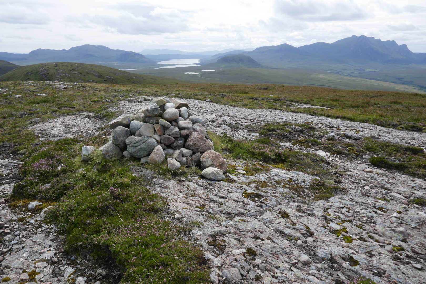
Cnoc Corr Guinnie NS135

My original plan was to drive up from near Edinburgh on the Monday and actiavte a small hill when I was near my fist stay in the village of Tongue. But checking the WX showed Monday likely to have the best WX and it didn’t make sense to drive on a good WX day. So I found a cheap B&B in Alness and drove up on Sunday. This was a 3+hr drive not a 5+hr drive so I bagged this simple summit on the Sunday. It’s a few miles from Alness on the Struie road. The route follows forestry tracks to the summit and parking is easy at the start. Just make sure you follow the public not private tracks… lots of signs telling you if you are on the wrong track.

WX was mild with the odd spot of un-forecast drizzle. Bands were rubbish. I did 5/7/10MHz SSB and CW. I did use my satellite spotter. Due to some changes in the SSO server and how SOTAwatch3 works getting this satellite spotter working was a frantic late night affair the day before I left. Andrew VK3ARR spent some time when on vacation helping along with lots of input from Jon G4ZFZ.

Summit area. Theres a good track 95% of the way, it’s just a bit boggy for 100m. I tied the pole to the nearby tree on the far right.

Heavy drizzle on the walk out, I put the rucksack cover on but it didn’t seem to wet me. Or it did and was evaporating as fast. No Goretex needed. Back to the B&B for a shower then out for a meal and quite a pleasant evening back at the B&B where the hosts provided Champagne, Highland Park 12yrold Whisky and some Gin free and they weren’t mean with it. That and scrambled eggs and smoked salmon for breakfast all for £29. :smile:

Ben Loyal NS-052

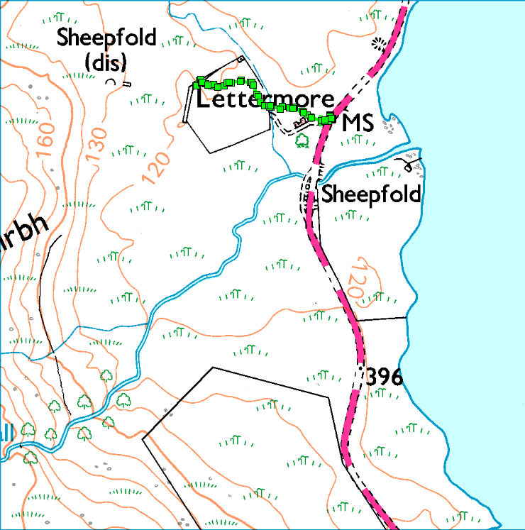
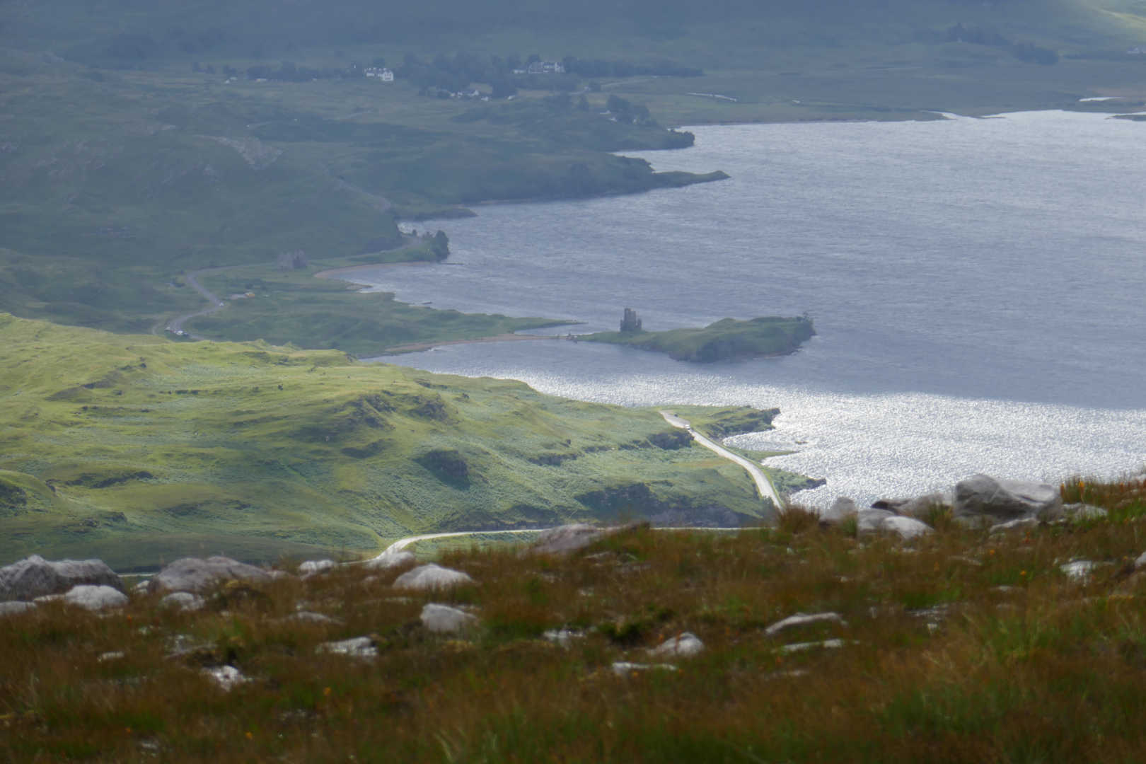
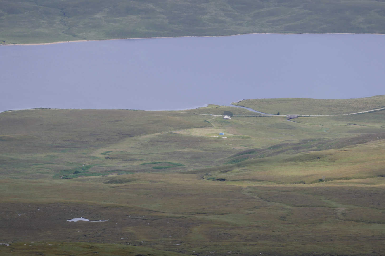
I filled up at Tain ASDA £1.257/L for diesel, wow cheap. I found a penny walking into the store as I need to buy a notepad having left the log book back home. My mother used to say “pick up a penny and all the day you will have good luck.” From Tain it’s about 1hr drive to Lettermore, an adbandonned cottage on the side of Loch Loyal. WX was wonderful. You used to be able to park here but the track is now chained off. Last time here there was always a camper van parked. Now we have the NC500: North Coast 500 tourist route around the top of Scotland. It’s been brilliant for the cafes, hotels, B&Bs etc. as it has drawn in massive numbers of tourists. With someone deciding it would be wise for the UK to make its currency worthless, there were stunning numbers of European mainland visitors here and traffic was “fun” at times. Especially as there were people driving in RHD cars for the 1st time or driving their LHD cars on the wrong side of the road. You just had to be more careful than normal!

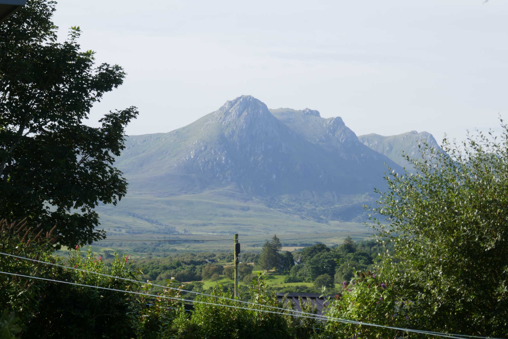
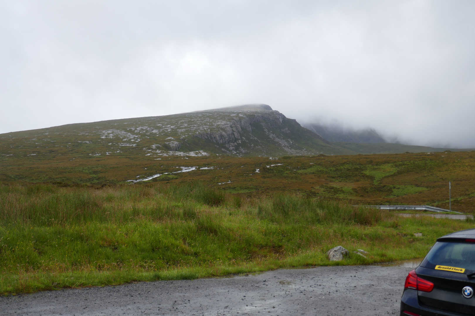
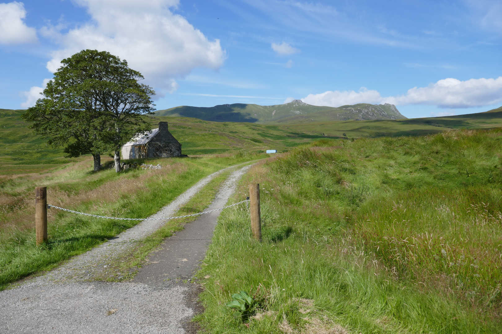
Lettermore with Ben Loyal behind. What a cracking day. I parked here on the right. There’s not much parking so it’s a shame the track cannot be used anymore. The new estate owner is going to refurbish the cottage.

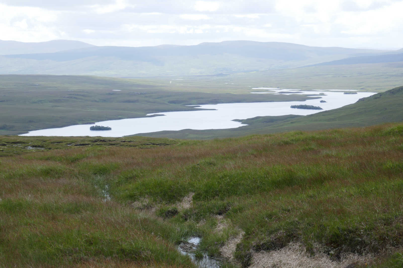
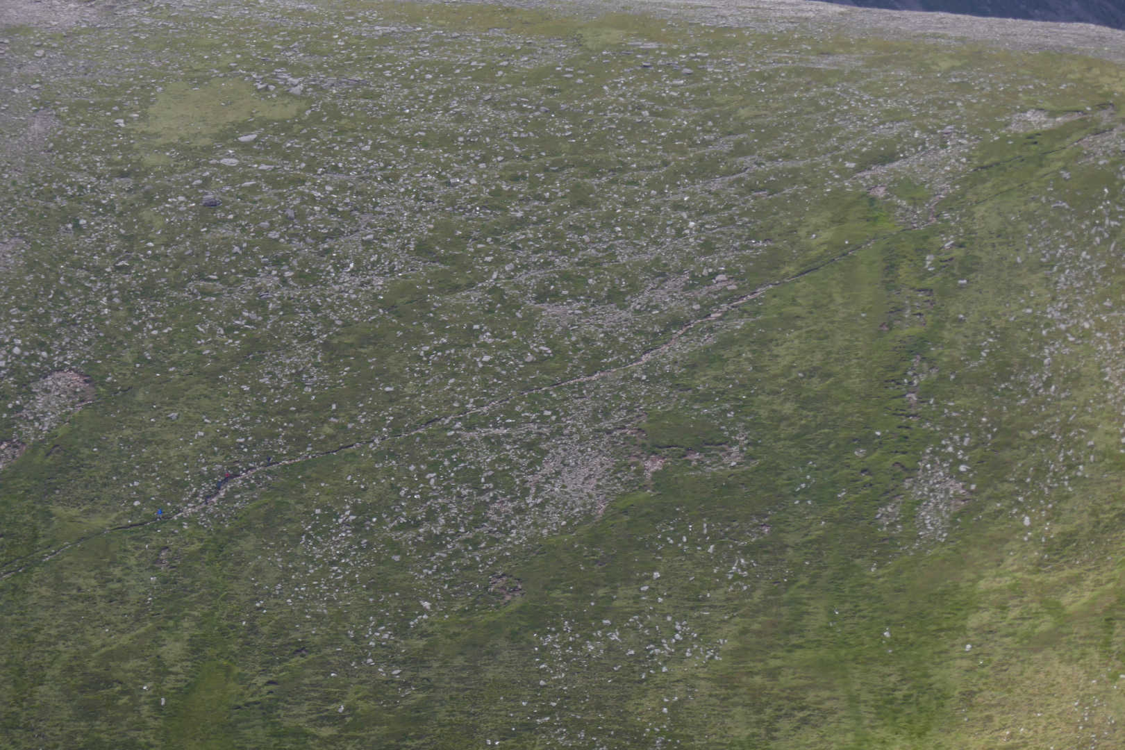
The walk in this way is over essentially featureless blanket bog. It was wet and squelchy all the way. Waterproof boots a godsend. The normal route from Ribigil Farm involves a river crossing which can be just wet rocks or over knee deep. With the rain of late I went for the boggy route.

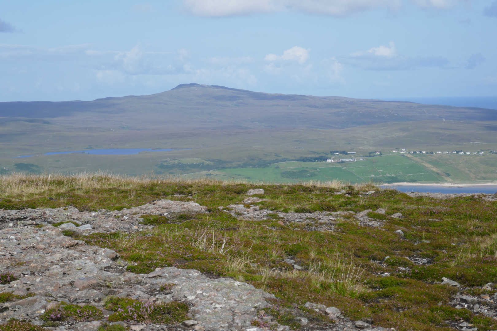
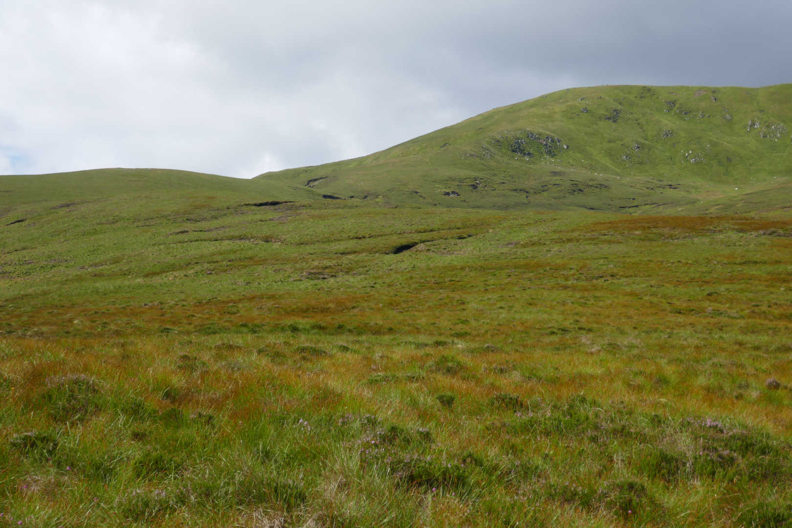
40 mins walking and you can see Ben Loyal and its many tops on the left and Ben Hiel NS-107 on the right. The walking was simple but hard work due to the springy but squelchy ground.

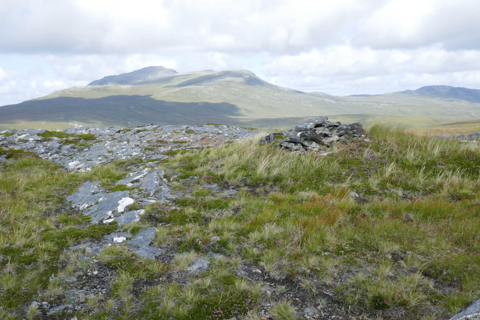
Cnoc nan Culean NS-06. I did this one 5 years ago. I didn’t realise what a good looking mountain it is as it’s a grassy lump from the other side.

Ben Griam Beag NS-091, Ben Griam Mor NS-089, Scaraben NS-083, Morven NS-067 and Smean NS-113.

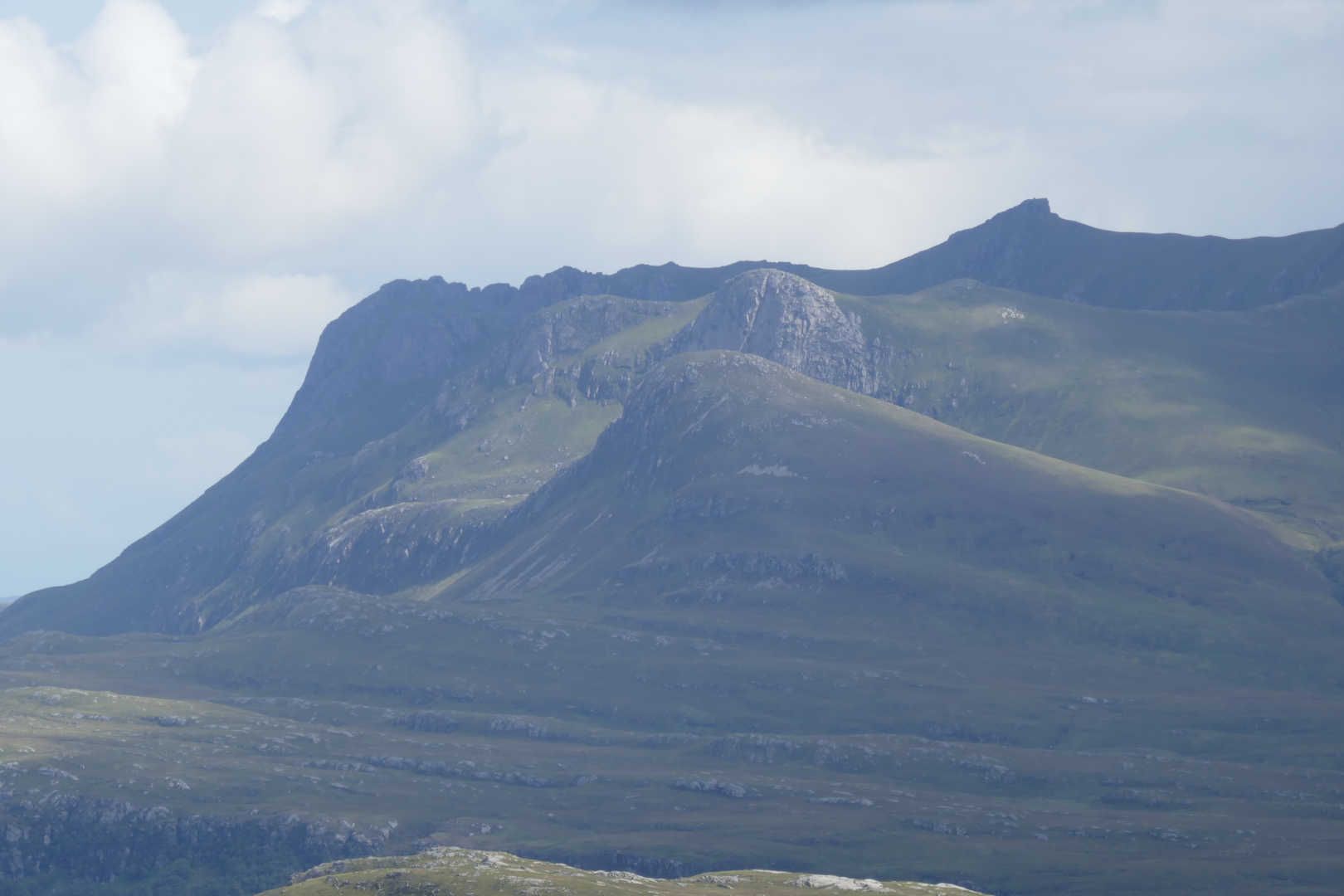
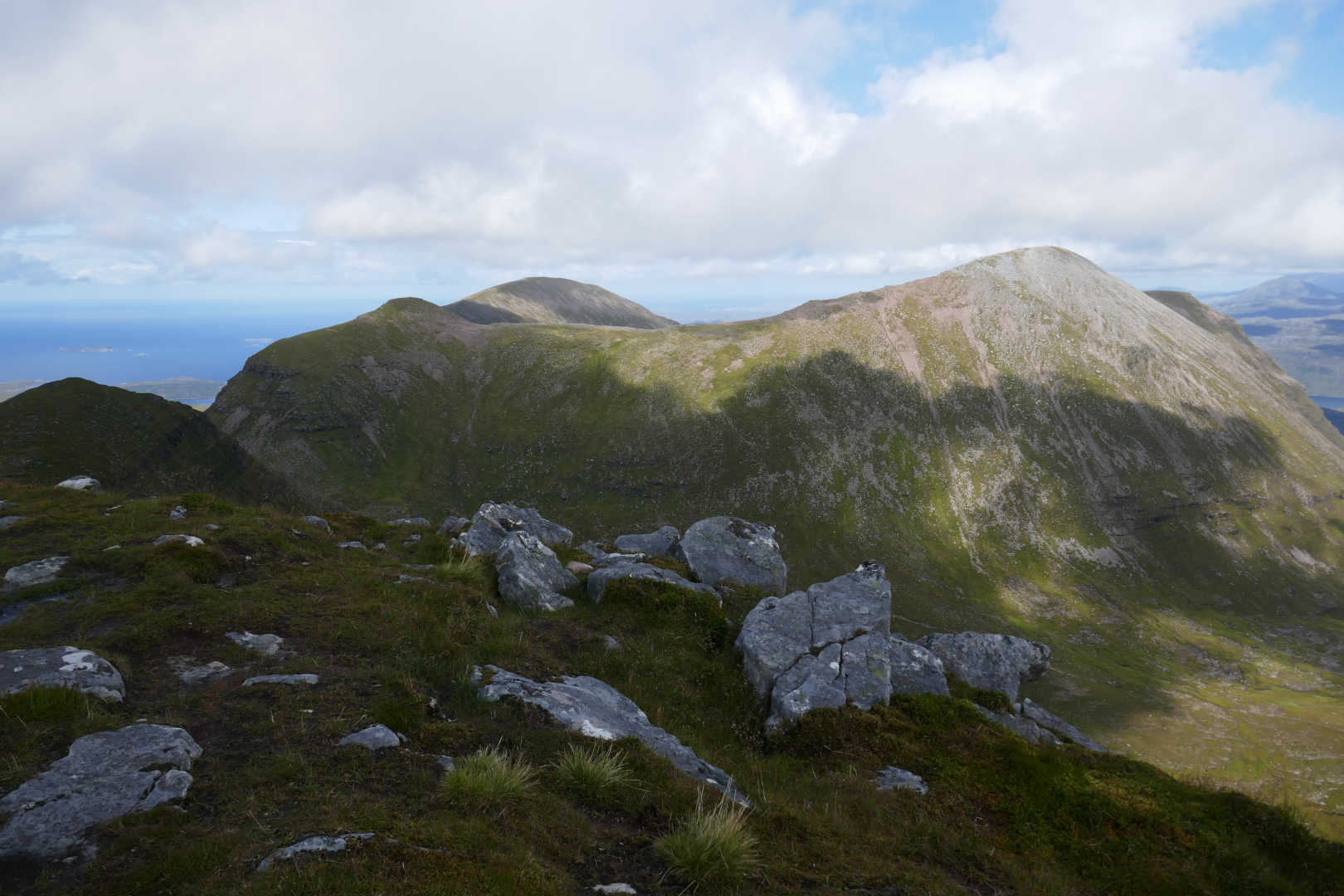
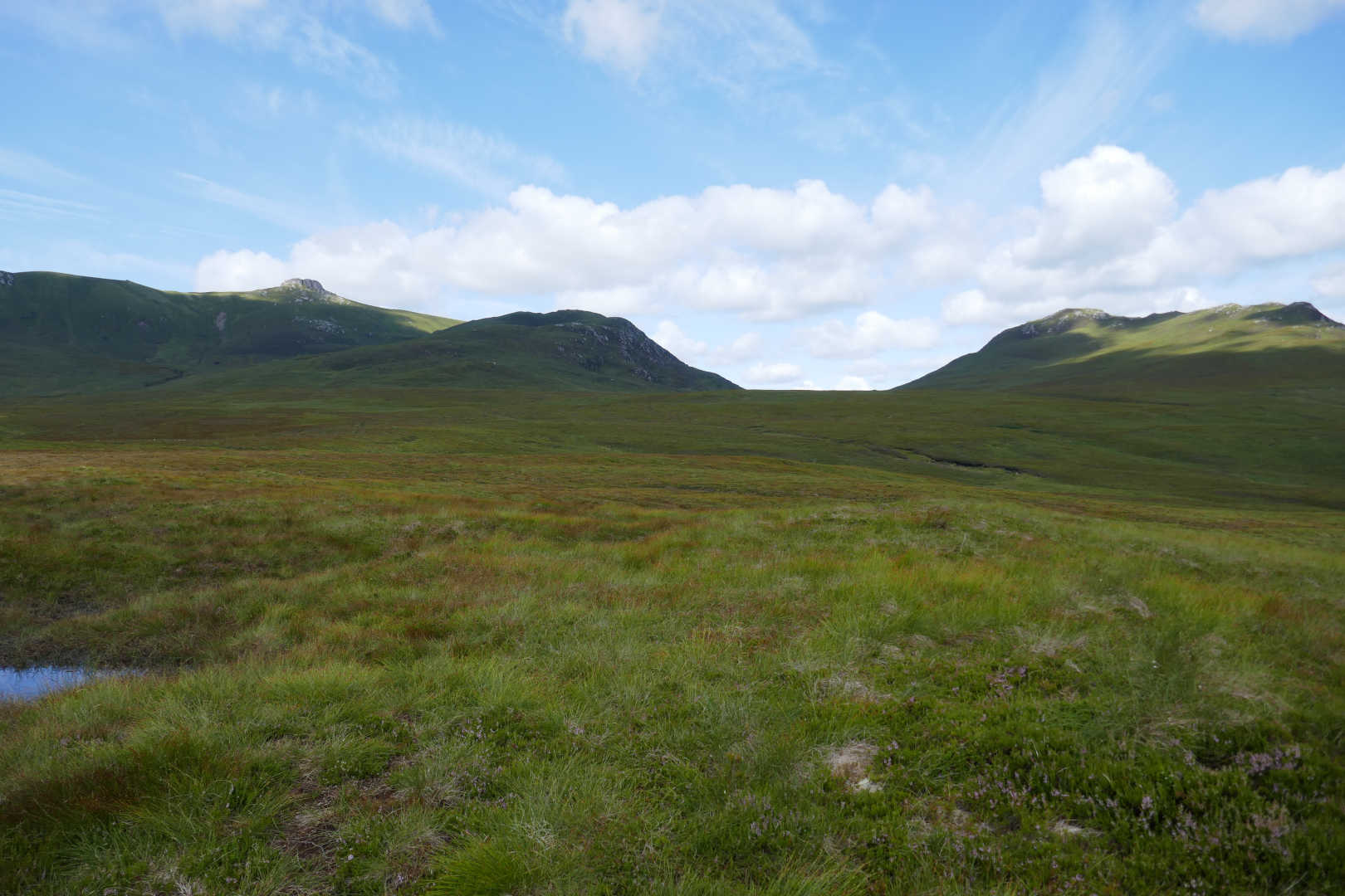
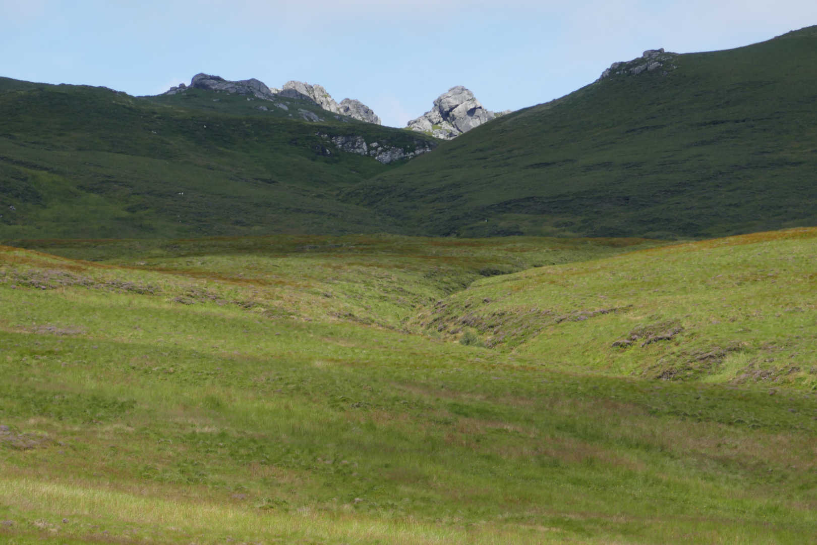
Looking up to Ben Loyal’s Northern most peaks, Sgor a Bhatain and Sgor Chaonasaid.

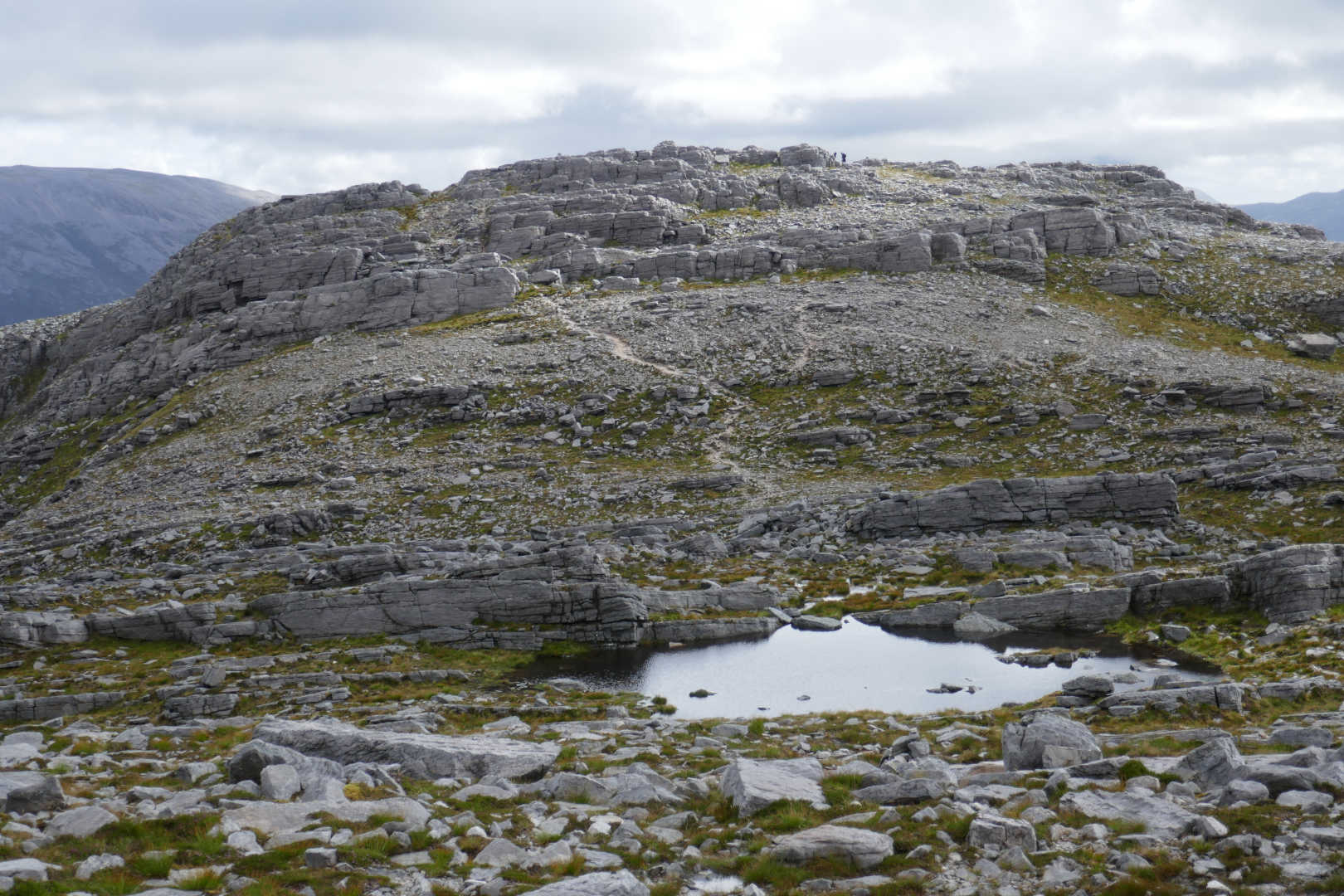
I was making hard work of the ascent and realised I was not going to have enough time to activate Ben Loyal properly and do Ben Hiel. So I decided that I would at least get a walk along the top of Ben Loyal. I went for the South end of the ridge and ascended these easy-ish grass slopes coming out just at the North of Carn an Tionail. You can see the WX changing. Grey but still warm.

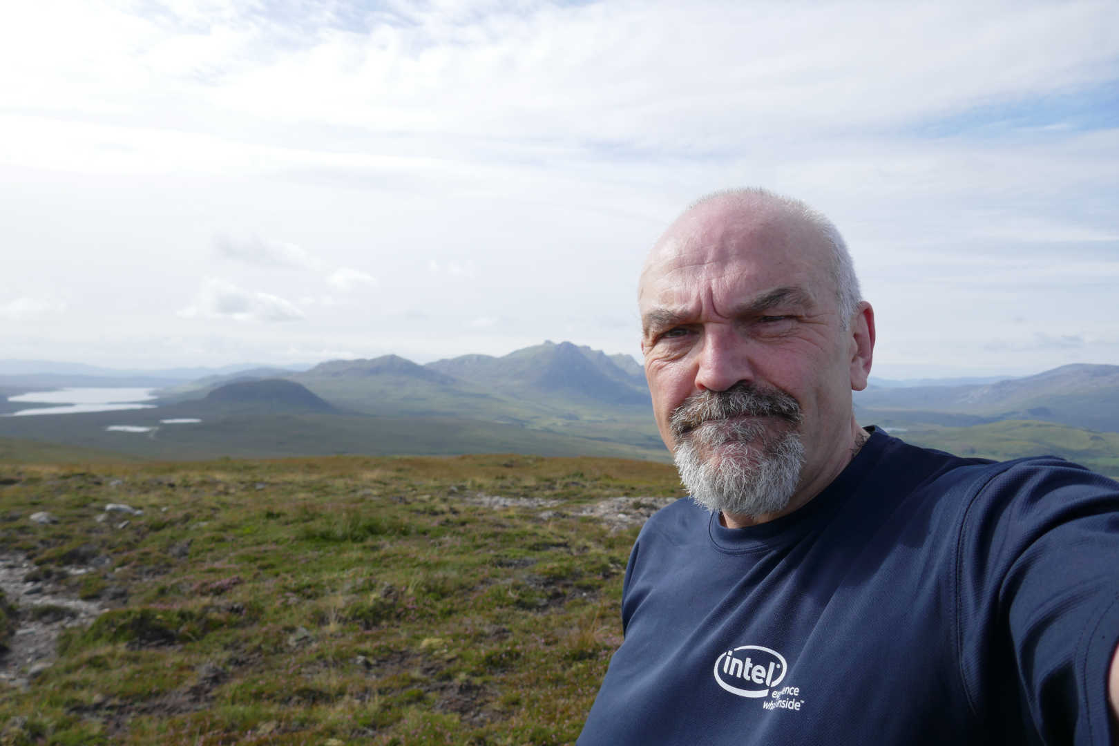
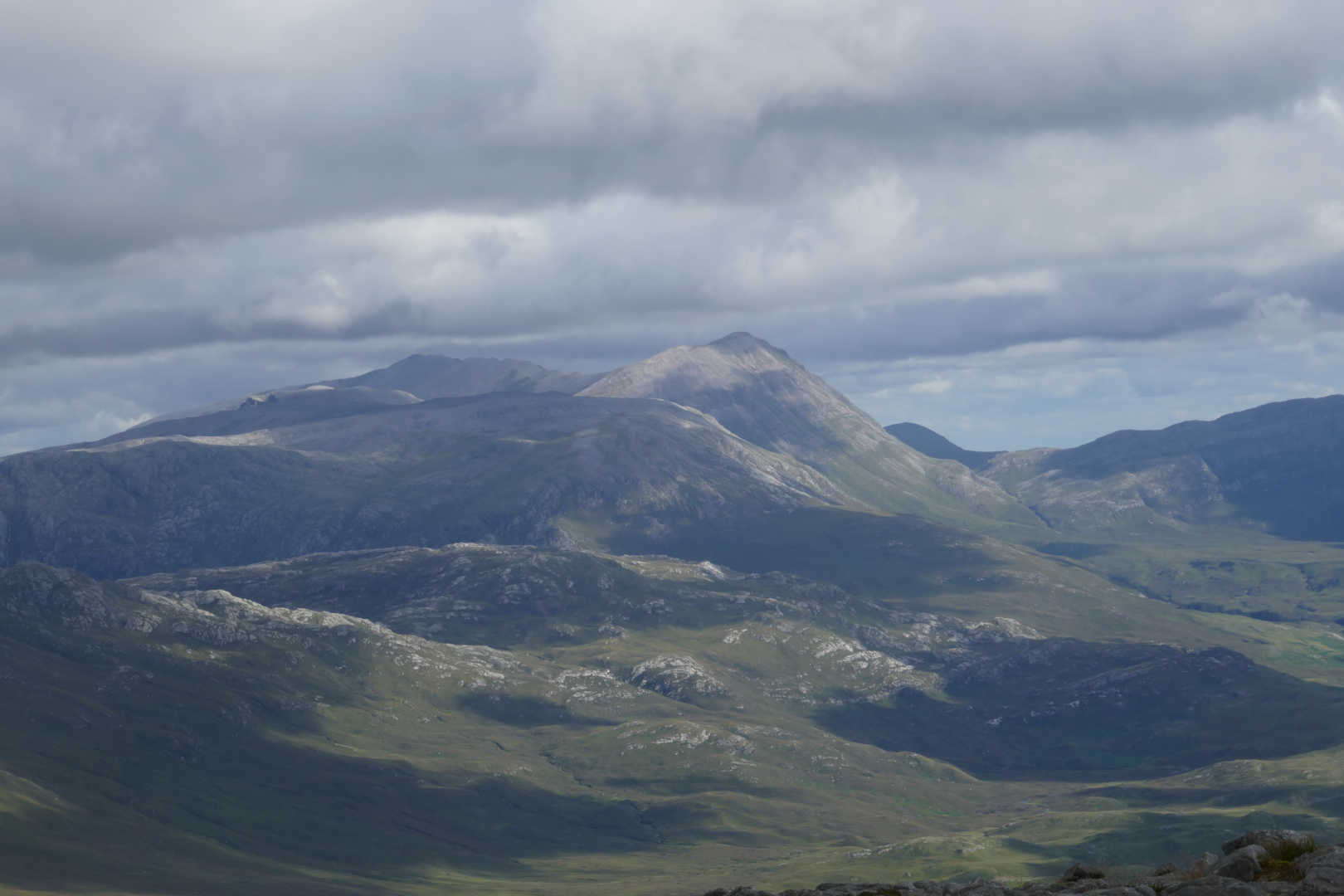
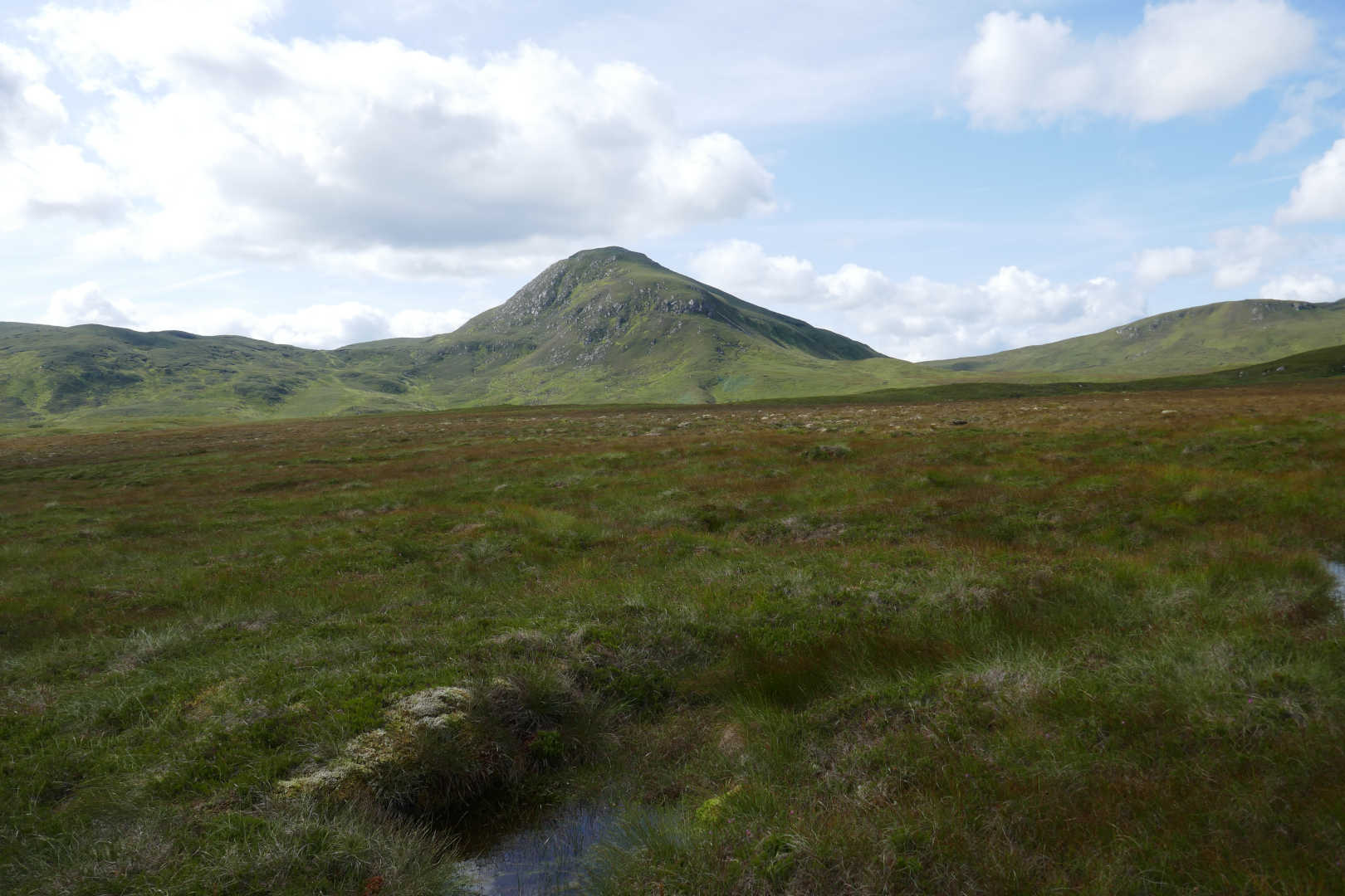
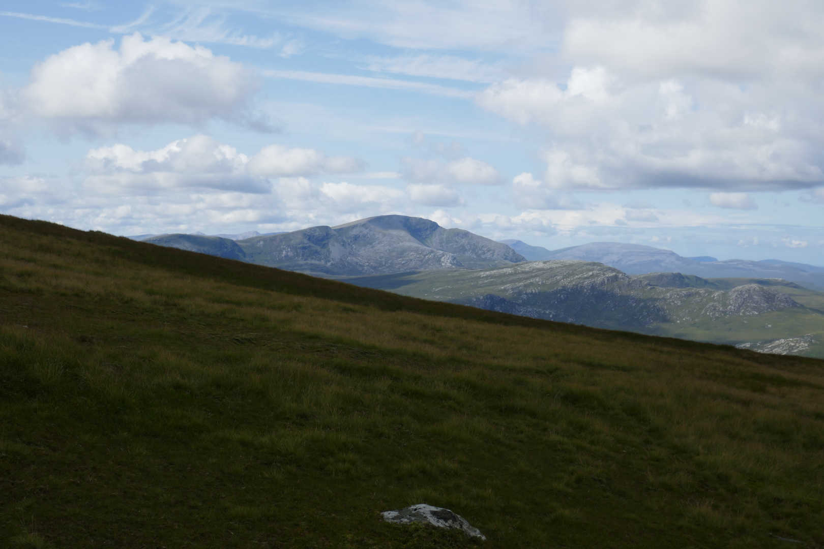
Once onto the ridge proper, you get to see Ben Hope NS-020 for the 1st time. This is the most Northerly Munro in Scotland.

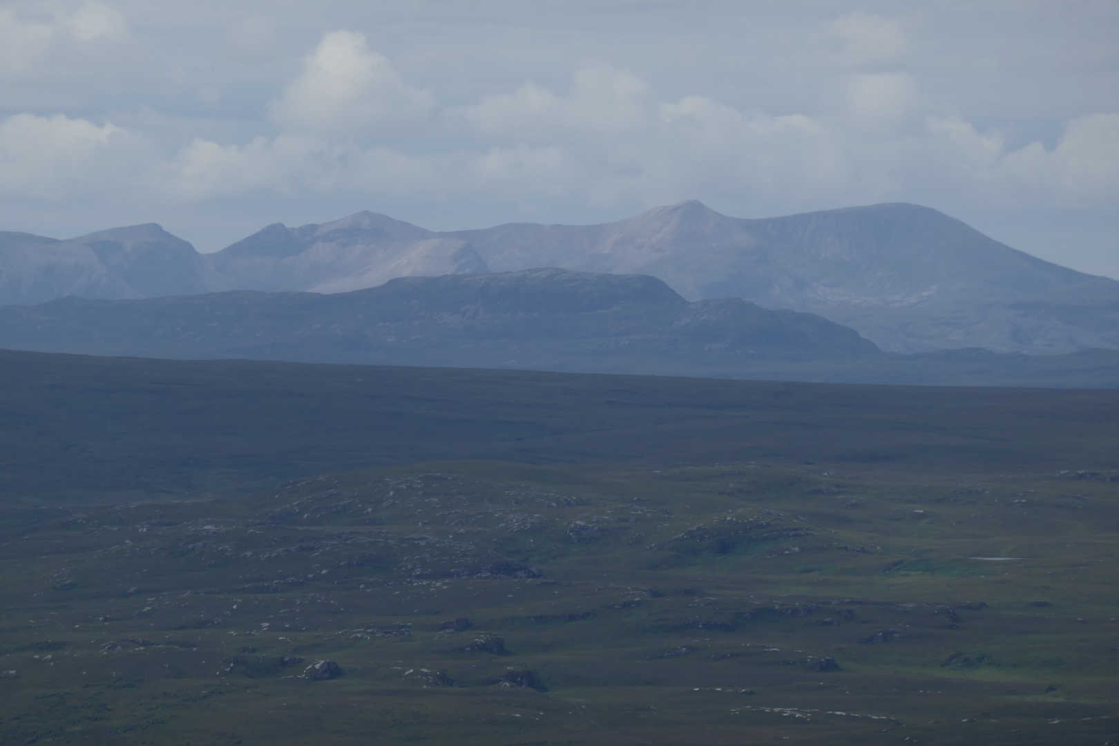
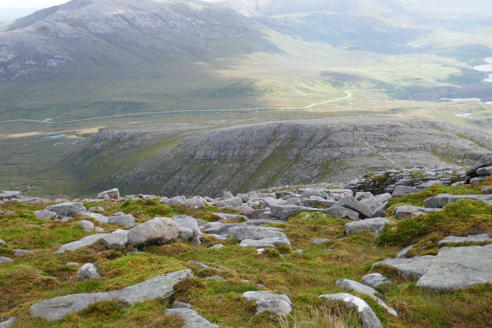
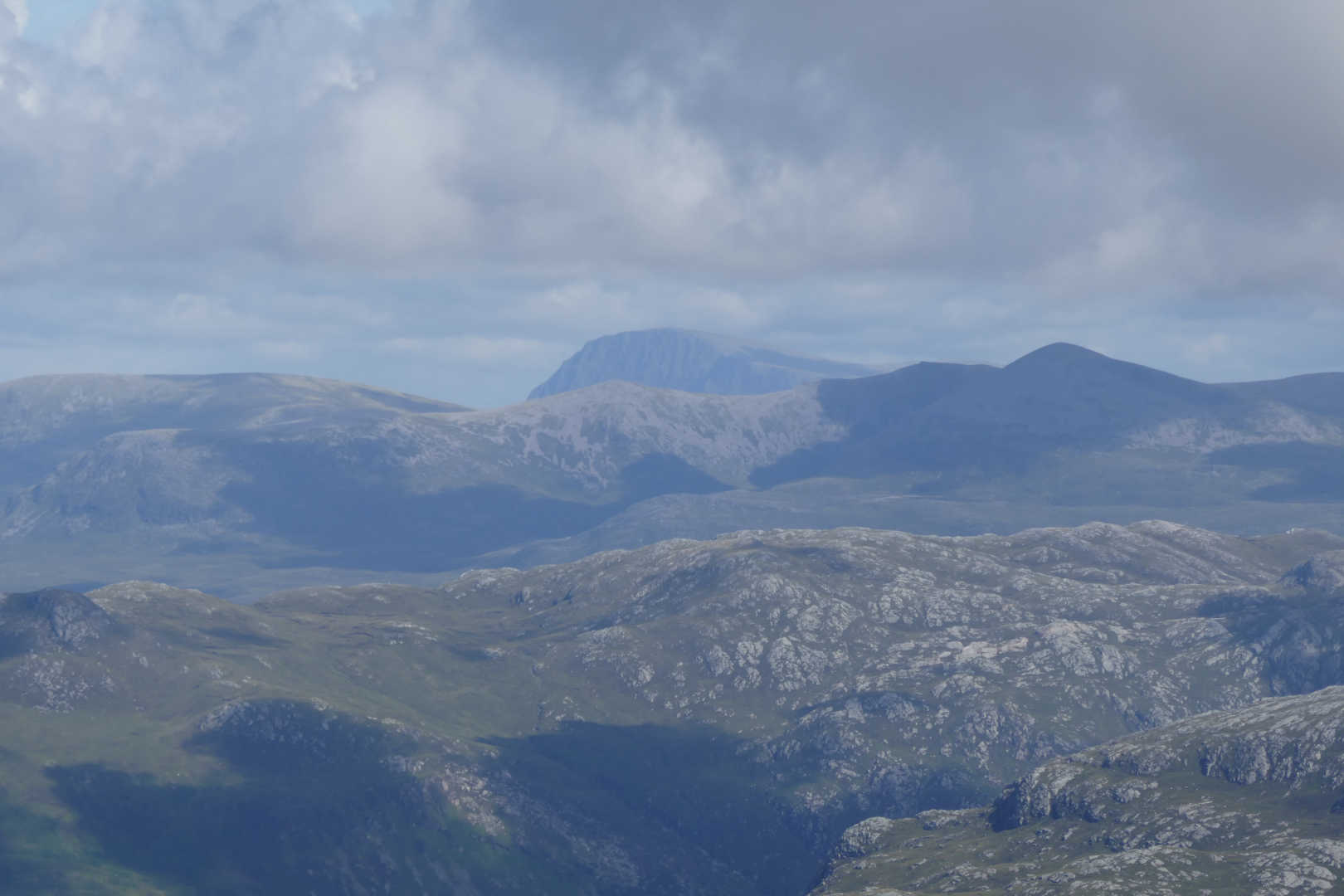
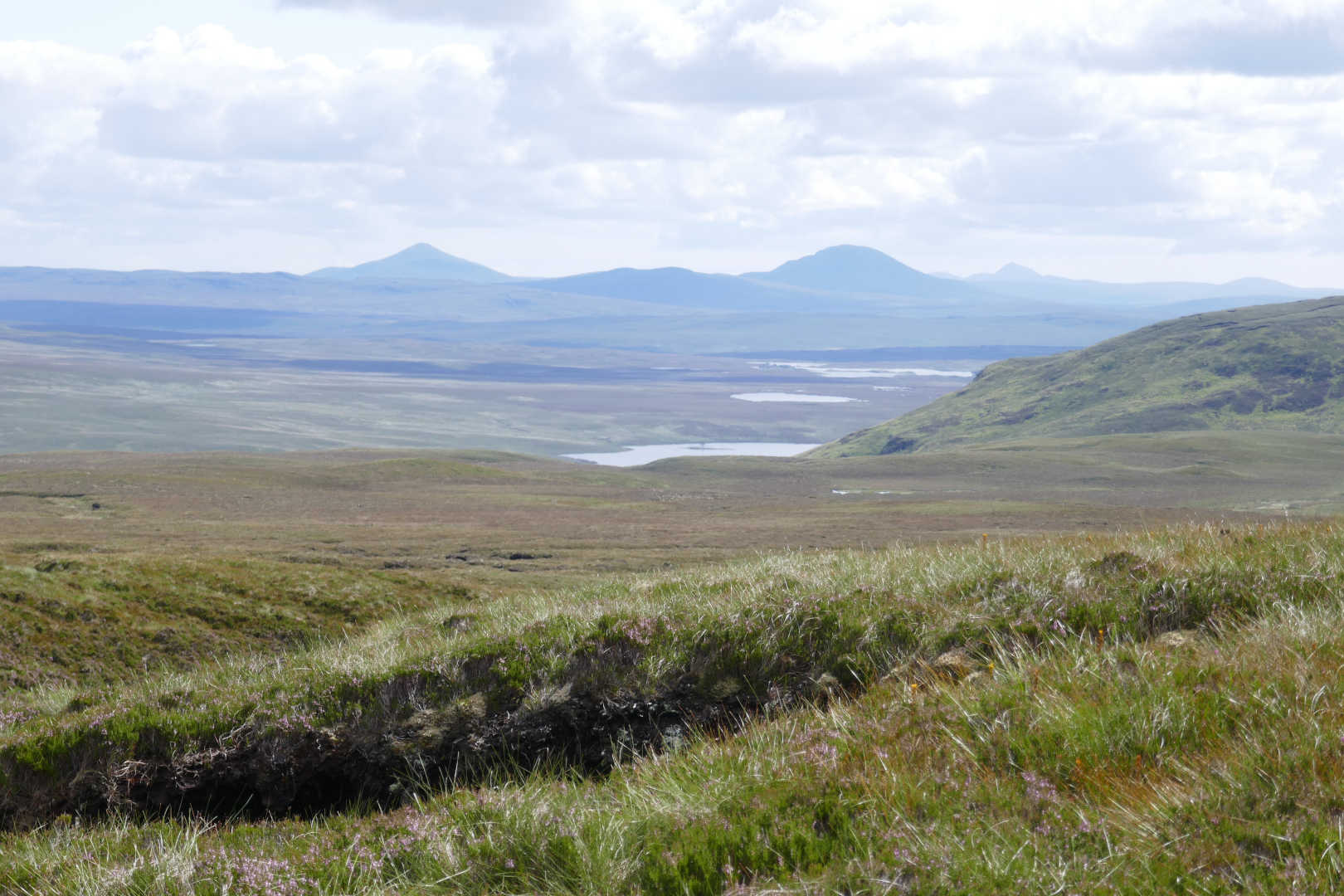
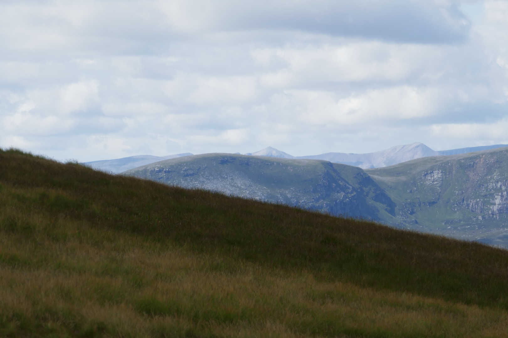
Here are Ben Stack NS-063 and Arkle NS-043

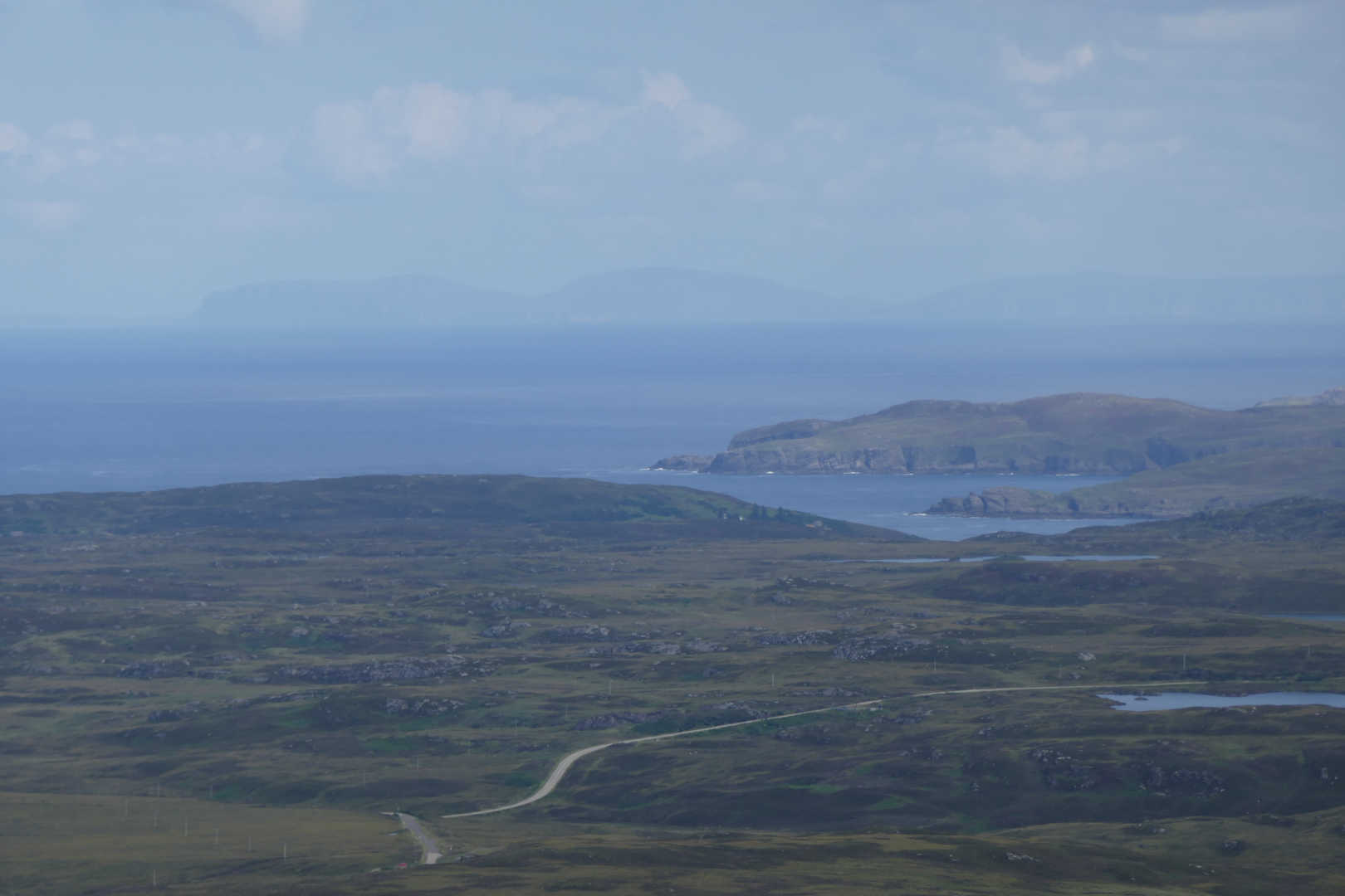
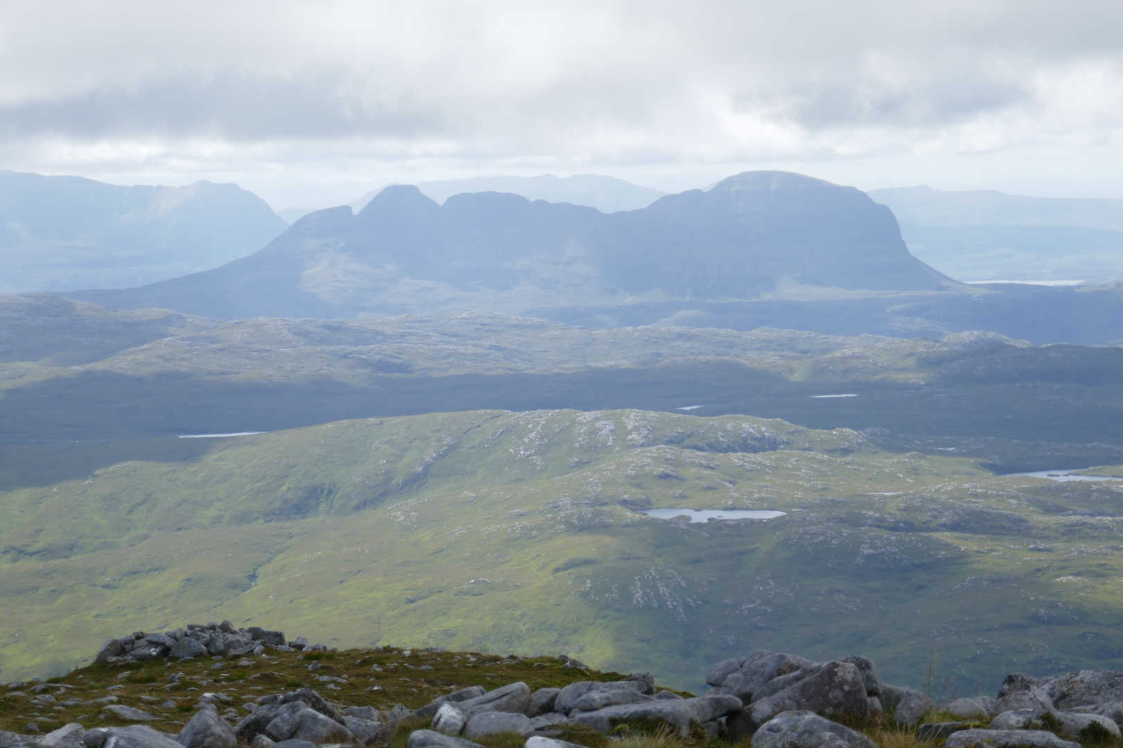
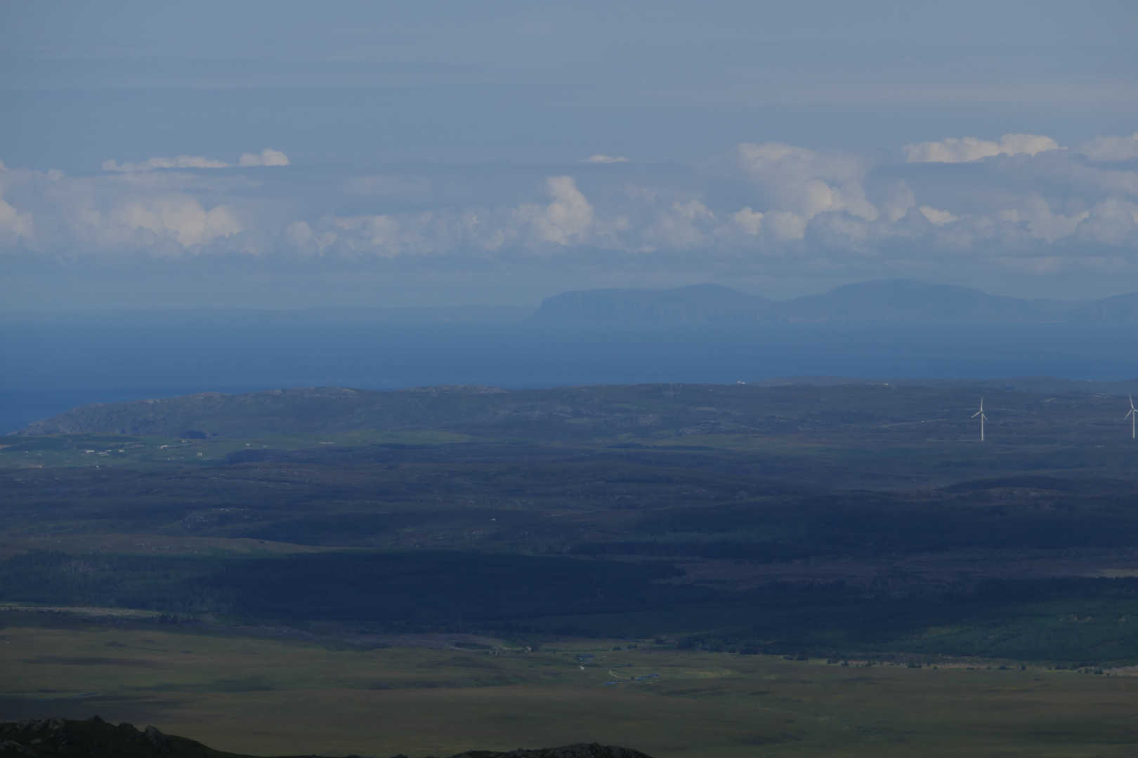
It was now clear out to the NE and the Orkney Island were visible, Hoy is the nearer island and The Old Man of Hoy is visible but as he is the same colour as Hoy cliffs, you cannot make him out. Orkney mainland is visible too.

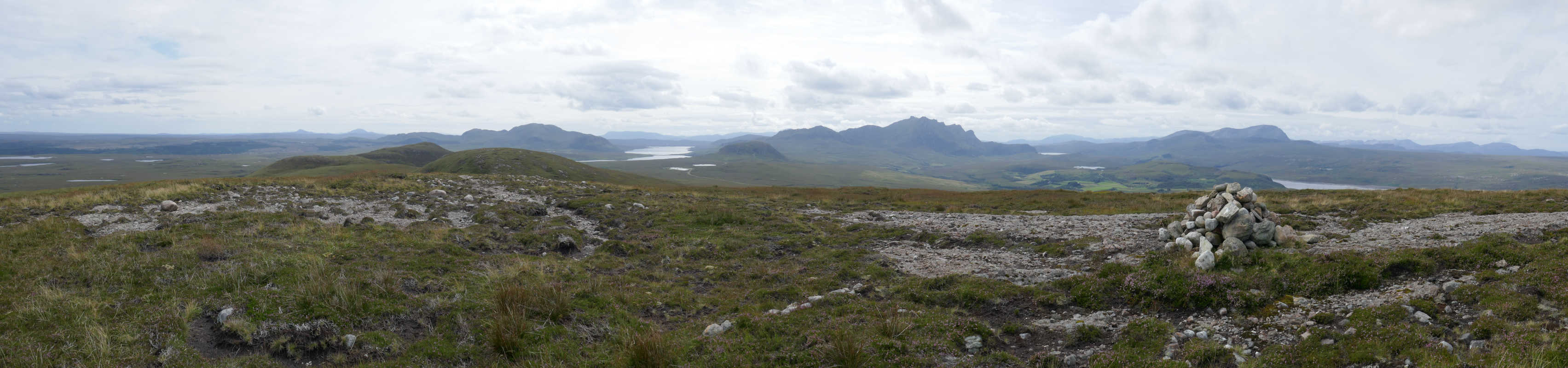
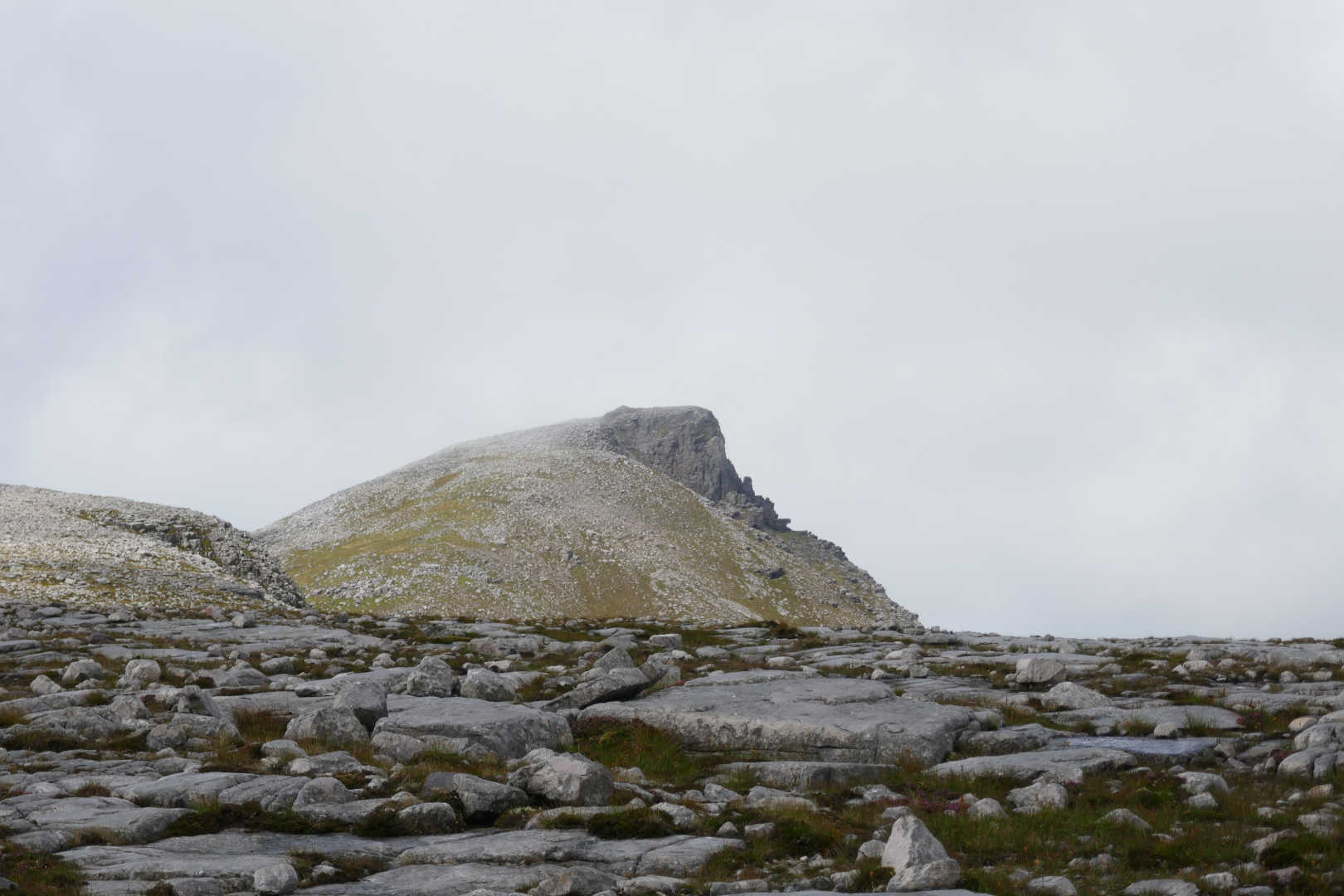
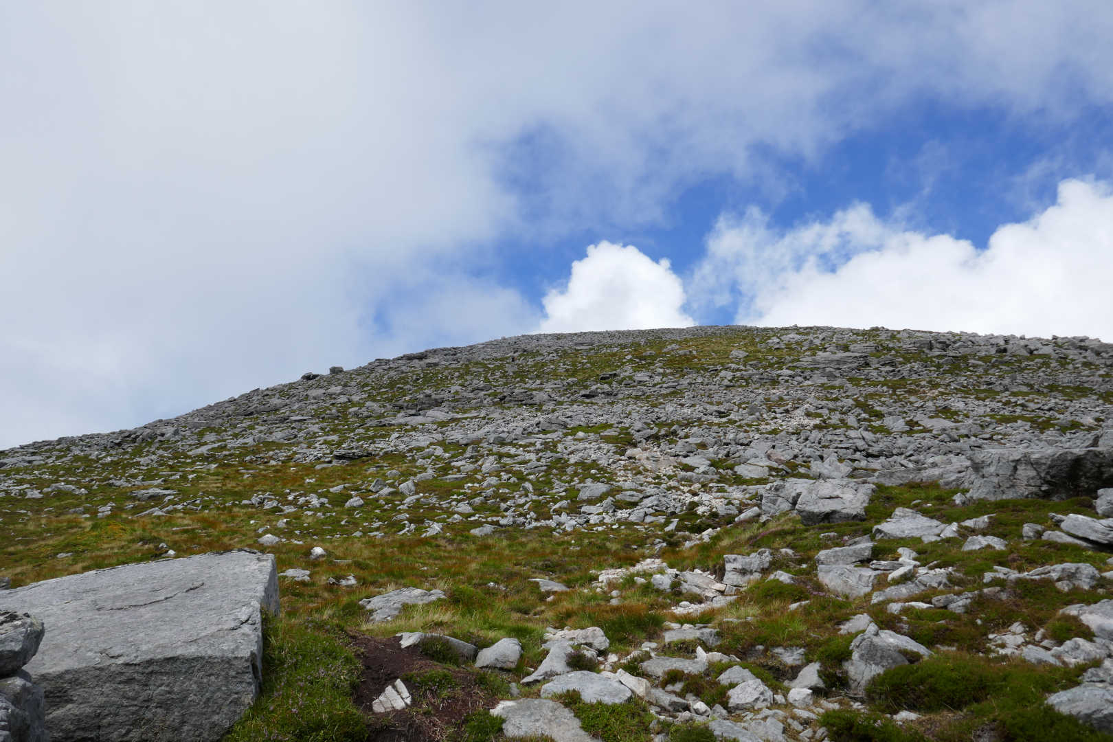
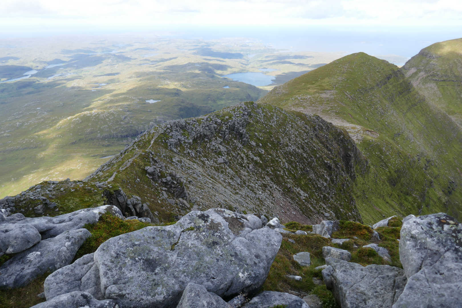
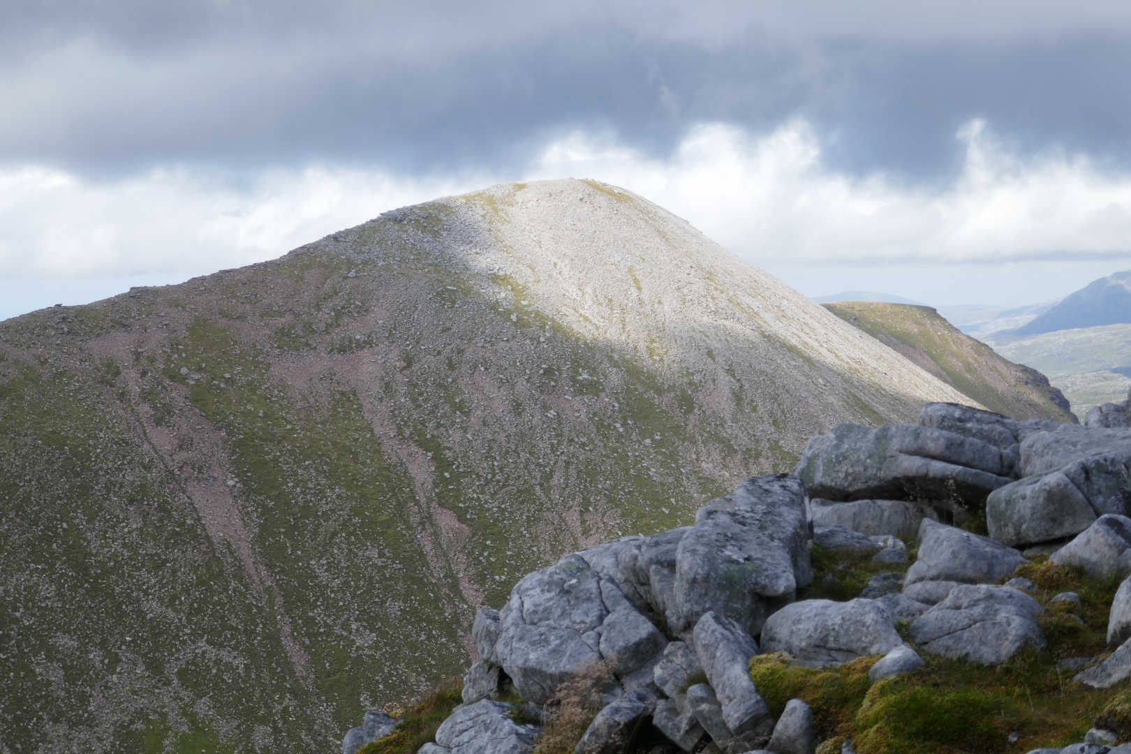
Finally after what seems a lifetime, An Caisteal (The castle) is within reach, about 15mins walk in this shot. Not sure how to get up that to be honest.

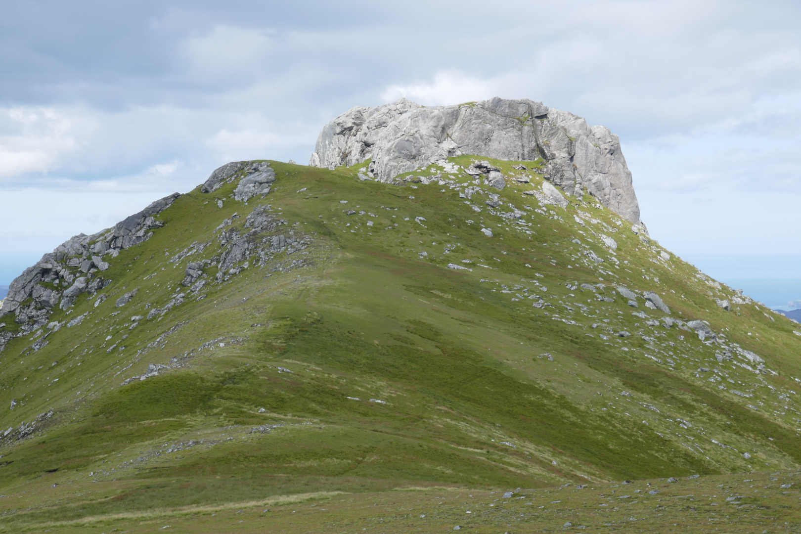
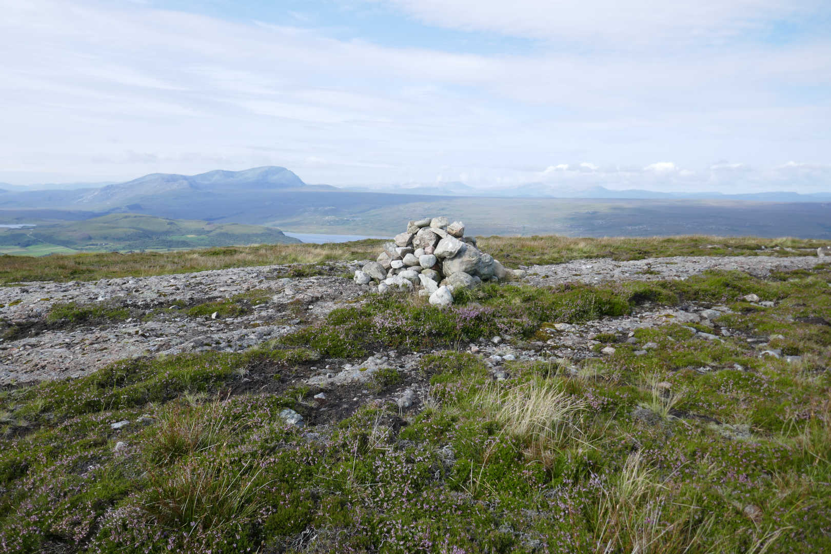
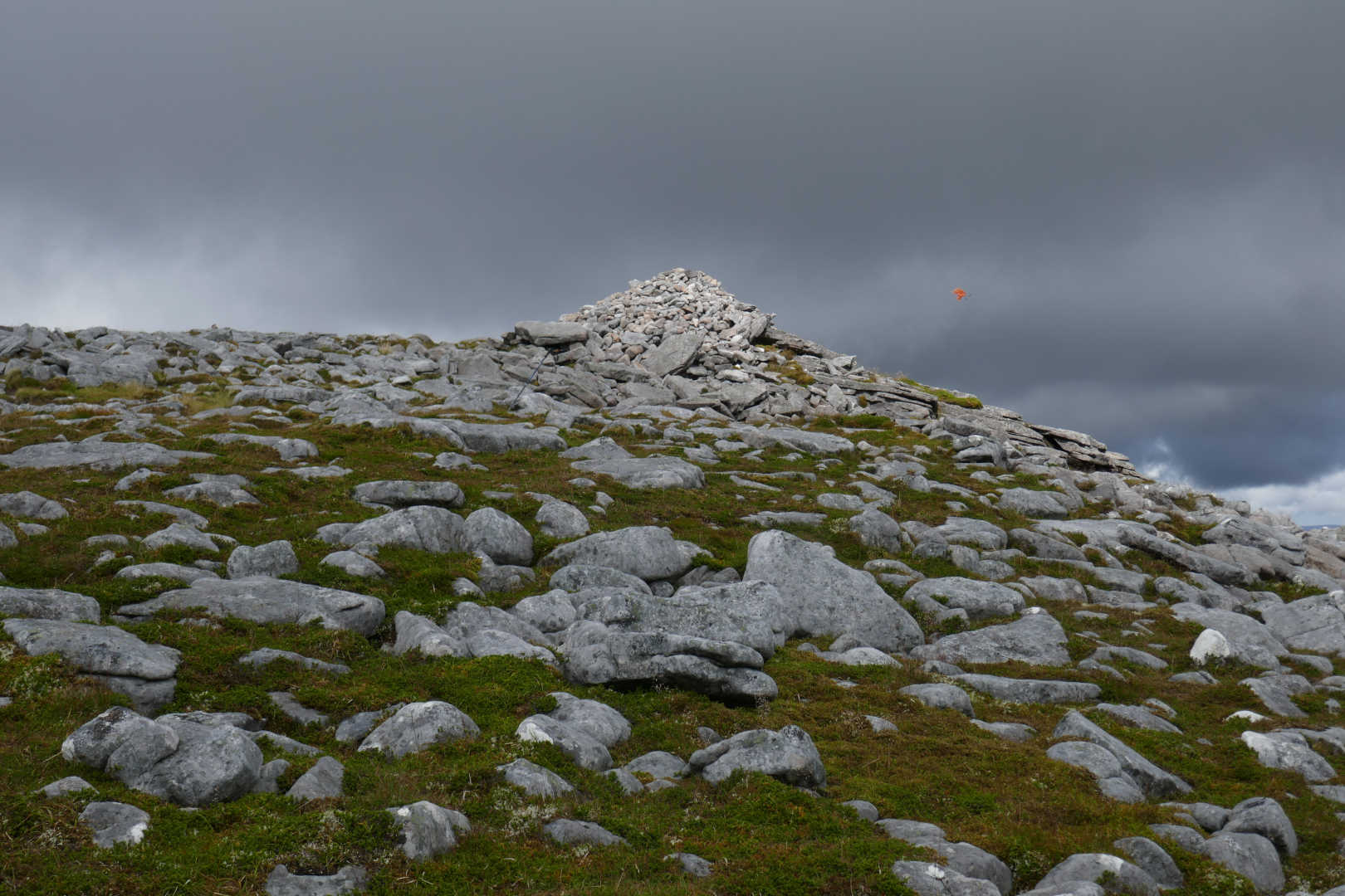
Up close I could see no way a chubby FMF could get up the tor. If I did I wasn’t sure how to rig an antenna as I could see other walkers on their way over from Sgor Chaonsasaid. A bit of GPS surveying showed the foot of the tor is in the AZ. My GPS and phone GPS said 743 and 744m for a 764m summit.

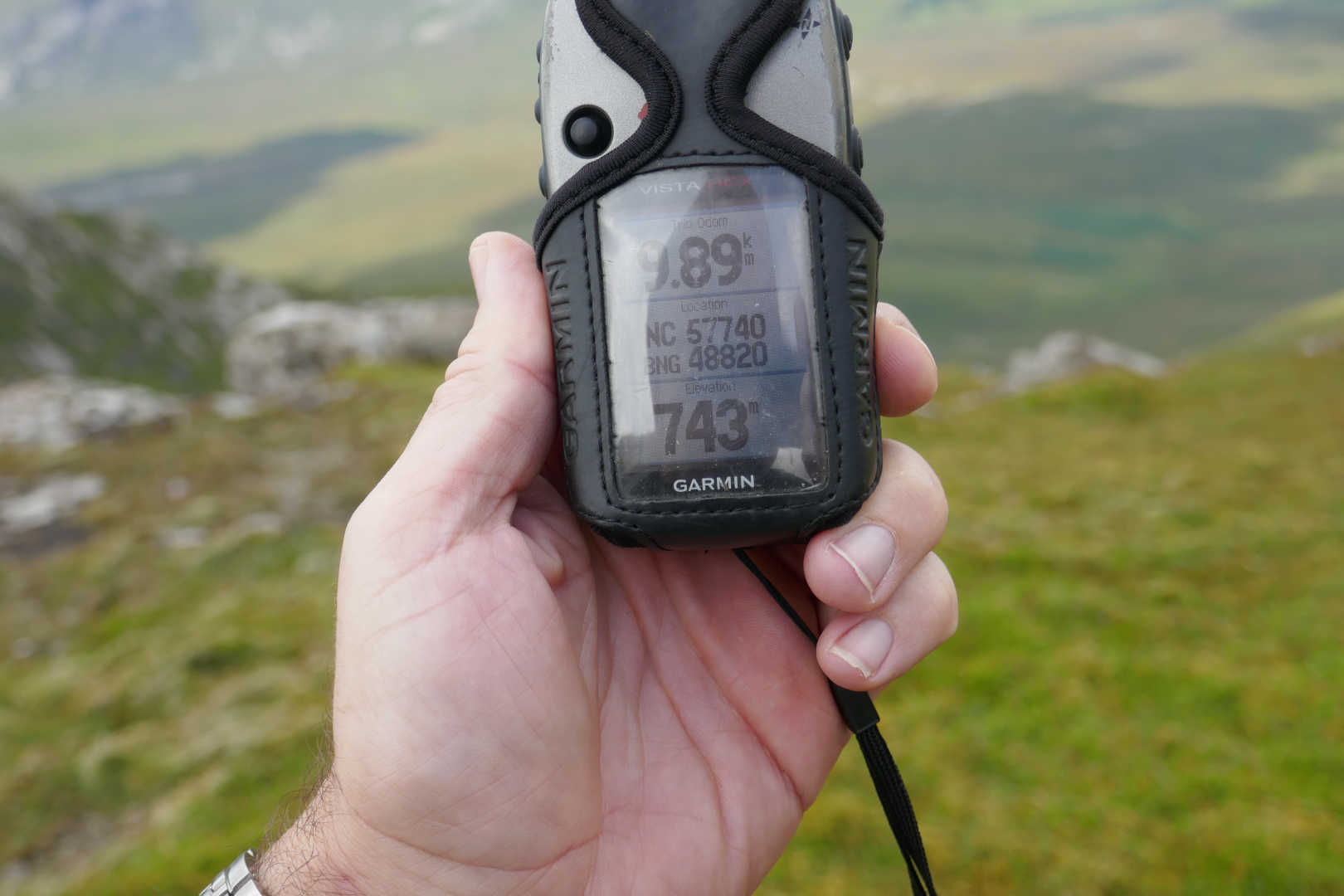
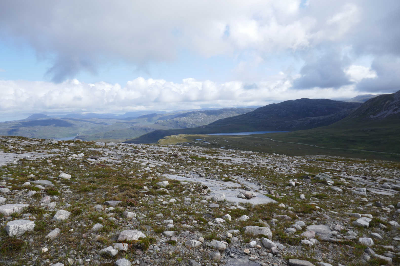
I operated from here were I could squeeze a 60m inv-v dipole at 743m and not block tracks. RF propagation was rubbish again. In 1hr5mins I could work just 19 stations. If you think conditions are bad, try coming up to the end of Scotland where they are awful!

I has a chat with some nice ladies out walking. They told me the river at Ribigill was a good foot deep, so it was boots off to cross. They were determined to get the top of the tor and wandered off. 15mins later they came back and said it was easy once you’ve done it. Indeed it was. A few steps up some rocks in a gully and you come out on to a wide grassy area, space for HF antennas, then easy sloping rocks to the top. No excess adrenalin at all. I took a photo on my phone (posted in the other thread) and saw it was going to rain so went down and picked up my bag from the foot of the rocks. Job done.

Just got to get back to the car without getting too wet…

The walk out was easy but tiring and very squelchy. I did think of trying Ben Hiel but it would have added 1hr45 to my arrival time in Tongue. Then I’d to get booked into my B&B, have a good shower, shoot up some drugs and get a meal and it was pushing things close to when the hotel stops serving food. Ben Hiel another day then.

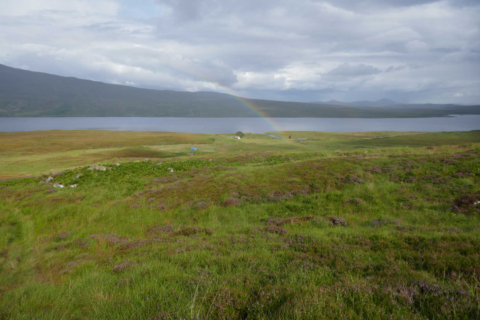
It showered a lot on the way out. On with the rucksack cover but it was never hard enough to bother me. I got damp and then the rain stopped and with 5 minutes I was dry. There was one period of proper rain and when that stopped it took 10minutes to dry out in the warm wind.

And there was a rainbow too…

Finally I got back to the car pleased with having summited to the top. This was when I realised I’d lost my phone which had the pictures of the summit. I happened to have my old phone with a PAYG SIM in it. The SIM was bought as insurance in case I couldn’t get the satellite spotter to work. It’s on the EE network and EE are meant to be providing the comms infrastructure (over 4g) for the UK emergency services. So EE coverage was rather splendid and my own (missing) phone’s coverage was spotty.

I had a good idea when I may have lost the phone and I checked I had the GPS data saved to the memory card so I could use the track the next day. Now it was shower and beer time.

9 Likes

Meadie Ridge NS-130

This one was unactivated. Understandable, it’s one long bog trot for a point. However, the views were good and after the effort of bog-trotting up Ben Loyal, I thought it would be easy. It wasn’t!

The route to this summit means passing Lettermore, where I parked for Ben Loyal and lost my phone. I was sure it was no more than 30mins from the car when I last had it, so I allocated myself 1hr to go searching. I’d checked how to back track with the GPS and a few tests showed it could distinguish between standing one side of the track or other and it aligned with my memory of the walk out. I reckoned the places where I stumbled would be likely phone drop zones. Boots on, up the track with the GPS in back track. I remembered stumbling at a nasty boggy puddle where the moor meets the track and when I lined my position with the recorded position, there was my phone in the grass. It landed with the USB port down so no rain from overnight had got in. One checking, 89% battery and phone happy. It was in airplane-mode so I couldn’t have rung it from the spare phone. I only had a spare phone because I wasn’t sure I’d get the satellite spotter to work, previous visits showed Three coverage to be spotty and I wanted some better coverage. £10 for an EE SIM in an old phone gave me fast 4G coverage from most locations. Apart from Ben Loyal when it was GPRS and my phone that I lost and found said Emergency calls only. Anyway, phone found in under 10mins. Oh I was deliriously happy :smile:

Onto Meadie Ridge. Parking for one car at NC482406 without blocking the passing spaces on the b-awful C road to Hope from Altnaharra. The surface is quite rough and the passing places are a bit far apart. Boots on and I took a direct line to the summit over Cnoc na Coileach. From the top of there, I could check for the best ground between the summit. There is none…squelch, splash, sink, slip, slide all the way.

Loch Meadie and the completely desolate bog land. No sign of man anywhere. This is from near the summit. The ground is like this in all directions apart from where there are mountains.

Meadie Ridge summit with Ben Hope NS-020 in the background. A bit murky as it had rained overnight and was due to be showery with rain later.

In fact this was a typical view on the day, another shower coming in from Sabhal Beag, Carn an Tional, Ben Hee direction. It looks worse than it was. It didn’t shower enough to make me put Goretex on, it was warm and breezy enough to dry off in minutes.

Finally, the Queen of Scottish mountains, Ben Loyal NS-052. I waited an age for a break in the clouds to get some lighting on the rugged West side of the mountain.

Propagation was poor again. 3 on 60m, 16 on 40m, none on 30m and 3 on 20m. I think the spot failed in someway for 30m. Route out was similar but I contoured around Cnoc na Coileach through even wetter bog. I also mislaid the car by not thinking when I got the road and walking the wrong way. Took 5 minutes to realise I was going the wrong way. Oops! The ground was so bad and I was so knackered after this trivial summit and Ben Loyal that I passed on another first activation and went back for an early bath. Well I had a big day planned for the next day. It was meant to rain more but didn’t. Ho hum!

Meall nan Clach Ruadha NS-145

This one is 10minutes driver from where I was staying in Tongue. Except I wasn’t staying in Tongue anymore but moving down to Lairg. I was planning to do a big walk elsewhere but the forecast was for heavy rain from luncthtime onwards. A shower or three I can live with but not a deluge. There wasn’t enough time to drive to the summit and activate the first of 3 possibles so I chose something that would be easy instead.

There’s a huge car park by the phone exchange. From there it’s a direct line tramp over heather and relatively dry bog land! Well it’s not as bad as the others!

First off the view from the B&B… Ben Loyal looking great.

The site of the UK’s proposed rocket launching complex… and Ben Hutig NS-132 seen from the summit. There is a Colby Camp at the top of Ben Hutig from the First Triangulation of the UK about 220years back.

Ben Hope NS-020 from the summit. Arkle, Foinaven, Beinn Spionnaidh and Cranstackie faintly in the distance.

Oh dear, looking a bit old now with Ben Loyal behind.

Ben Griam Beag (distance), Ben Griam Mor (distance), Beinn Stumanadh, Ben Armine (distance), Ben Klibreck (distance), Ben Hiel, Ben Loyal, Ben Hee (distance), Ben Hope, Arkle (distance), Foinaven (distance), Beinn Spionnaidh (distance) and Cranstackie (distance). Sorry it’s not a sharper photo.

A more zoomed version of above: Beinn Stumanadh, Ben Armine (distance), Ben Klibreck (distance), Ben Hiel, Ben Loyal.

Orkney Islands of Hoy and South Ronaldsay.

Arkle, Ben Stack and Foinaven

I tried 80m for the first time in years with an 80m dipole… wow big antenna. I’m not sure how well it should work being low but it sort of worked as I made 3 QSOs on 3.760LSB. After that 60m was better but the money band was 40m with a couple on 30m. Certainly things felt better on 40m and 38 QSOs mid-morning, mid-week is very respectable.

I walked out the way in and made for Lairg. I did stop at a very famous establishment, The Crask Inn. Alwasy a welcome sight as there is nothing otherwise between Lairg and Altnaharra. This is a well known place to stay or eat and drink for those doing Ben Kilbreck etc. and it’s future was in douibt. It’s now run by the Scottish Episcopal Church. Yes a church runs a pub. I called in for a cup of tea but also had a fabulous bowl of home made soup. It’s important to support these establishments in every little way.

After that down to Lairg for the next 2 nights.

5 Likes

Playing with Mapsource lets me extract the track of finding the missing phone. It was 320m from the car and the entire walk from car to phone and back to the car took 8mins!


©Crown copyright 2019 Ordnance Survey. Media 009/19

Spidean Coinich NS-051

The rains predicted for Wednesday afternoon never came. It was meant to be raining 4am-7am on Thursday. Instead of rain it was like a monsoon and late. The entire drive of 37 miles from Lairg to the car park was in torrential rain. The road is not too bad for a mainly single track road but in the bad weather I was more cautious than normal. I knew I was near the car park but drove past it as the rain was so hard I could not see the car park at the side of the road. I drove a few miles to far till I checked on the GPS and turned back. In the car park there were 5 cars and 2 motorhomes full of walkers waiting for Noah’s rain to stop.

And it did. The rain stopped as predicted and the clouds started to disperse. All you could hear was people putting boots on and zipping up bags. Quinag (pronounced coon-yack) is a Y shaped mountain with 3 SOTA peaks, Spidean Coinich, Sail Gorm and Sail Garbh. I was planning on Spidean Coinich and Sail Garbh but there’s a bit of a scramble down to a bealach and I was having misgivings about that being a big girl’s blouse.

The clouds lift… base of Spidean Coinich NS-051, 10 mins earlier you could see none of the hill.

There’s an excellent path to a cairn. The path splits going to the foot of Spidean Coinich or on to what is now considered the descent path from the beallach of the three ridges. The path to Spidean Coinich is a bit wet in places but soon you start climbing the rocks and slabs of the big ramp that leads to the top. It’s very easy, keep away of the steep edges and walk up the ramp.

An hour or so gets you to nearly the top before a 70m drop before the last climb. Still murky and cloudy looking out towards the Outer Hebrides.

Looking North the WX is starting to look rather bonny.

Looking down to Loch Assynt with Ardvreck Castle standing on the island. The castle is quite modern dating from 1590 or so.

There’s no obvious path up the big ramp but there are several on the short descent where you lose about 70m, cross the flat beallach and start the climb to the peak. You can see 2 people on the skyline. The man was climbing in a kilt and I’ve never seen that in 13+ years of hill walking. I met him and his wife on the way and we had a chat. How small a world is it? Well he was English but now lived in China and was a few years older than me. Commenting that I didn’t sound Scottish I told him where I was from and it turned out we used to live in the same street when I lived down on The Wirral in the 80s/90s! Indeed a small world.

WX looking better all the time. The final climb looks worse than it is. There’s a good path amongst the boulders and rocks and I just followed my nose up. I wasn’t breathless or feeling tired when I summitted.

Then suddenly you get to the top and, oh boy, the views are good. The climb up was not difficult or tiring but the views left me breathless. Sail Gorm NS-045 on the left and Sail Gharbh NS-035 on the right.

Summit of Spidean Coinich NS-051. The orange “thing” is a flag so people don’t walk into the antenna. WX looks a bit dodgy but there were big black clouds coming and going with periods of blue sky and hot sun.

The path to the beallach. You descend from 764m to about 550m before climbing up for the next two summits. The ridge looks worse than it is as the path is quite wide though a few years back looking at that path would have had me sweating like a dyslexic on the anagram round of Countdown. My problem is the far descent to the beallach, it just looks a bit to serious for me. Probably easy TBH.

Suilven NS-060 side on. Not a brilliant picture too much moisture in the air still.

Looking back down the ascent route… you can see the simple ramp that climbs up from the road. The car park is on the far side of the road at the left of the ramp.

Foinaven NS-023, Arkle NS-042, Ben Hope NS-020 (big mountain centre distance), the Toblerone shaped peak is Meallan Leith Coire Mhic Dhugall NS-037 (Hill of the grey coire McDougal) and the slight peak between it and Ben Hope is Sabhal Beag NS-059

It was a bit of a chore setting up the HF antenna so as to not block paths, especially as the final ascent slope eases right off and there were a miriad of pathlets. Hence the orange flags on the wires. Bits of an old plastic carrier bag that make the antenna stand out to walkers. I could get silly fast 4G from EE on the summit and respectably fast 3G from Three. I had arranged a 13cms sked with my good friend Martin GM8IEM who lives about 25km away at Clashmore. He was very loud on 2m FM and louder on 13cms. I arranged the sked and worked 5MHz first. Then onto 13cms were we nattered away for a good 25mins. Well the first GM/NS 13cms activation deserved more than UR 59 73 QRZ? After that 40m which was in good shape and I finished off with 10MHz. A total of 39 QSOs mid-week, bottom of the solar cycle from 58N is much more respectable.

Now I don’t like exposure and chatting to one of the many walkers got me thinking. They were doing the summits in the old order… Sail Gharbh, Sail Gorm, Spidean Coinich. I told them they had gone the wrong way and would have to go back and do them properly. But they did say the descent path is a trivial ascent path. It starts the descent from where the 3 ridges meet, drops down to a path that runs out of the coire and joins up at the cairn where the Spidean Coinich path splits off.

This shows the descent path running down the slops of Sail Gharbh and it looks simple and easy for a wuss like me. In fact the backwards route looks much better than the now classic route. You can just make a group of walkers at the left hand side of the path.

Anyway, now I’m sure I can do the descent path up, the other two look straightforward. Which is a damn fine reason to have to come back here. The only issue is sufficient time. I feel a bit guilty when doing some of these rarely activated GM hills if I do a quick activation on 1 band. I haven’t carried all the gear up to not want to work as many bands/chasers as possible. Doing both peaks I need to be a bit choosy with the bands/modes to do both. Unless I came back twice :smile:

Sail Gharbh NS-035 saying “come and activate me”

My descent route was the reverse of the ascent. On the way down I found one of those balancing rocks you get now and then. Left by a glacier? Or lifted in place by a gabg of walkers having a laugh?

Finally, Ben More Assynt NS-009 and a good view of the overall land types up here in Assynt.

Back at the car it was a gloriously sunny day. I had a fabulous drive back to Lairg for my last night in the North. Friday I was back up in the same place visiting Martin GM8IEM.

I drove 780miles at an average of 43mpg which is not bad for a 3L engined car. The NC500, a 500 mile drive around the North Coast has massively boosted tourism up here. Last time I was here it was quite quiet. Now there was lots of traffic and lots of visitors. It also means the B&B, hotels etc. are booked up well in advance and are not the bargains they used to be. 1 night in Alness, 2 nights B&B in Tongue and 2 in Lairg cost £279, meals, beer and whisky was another £125, fuel was £103 making £506. 5 summits and 130 QSOs means each summit cost £101 a shot or £3.67 / QSO. You know what, for the enjoyment of all that walking, drinking, eating, driving and then having QSOs with my SOTA friends, I think that’s quite cheap.

7 Likes

Thanks for the pictures, Andy, its gloriously wild country, isn’t it? You have me thinking, its half a lifetime since I was last all the way up there, and that’s far too long…