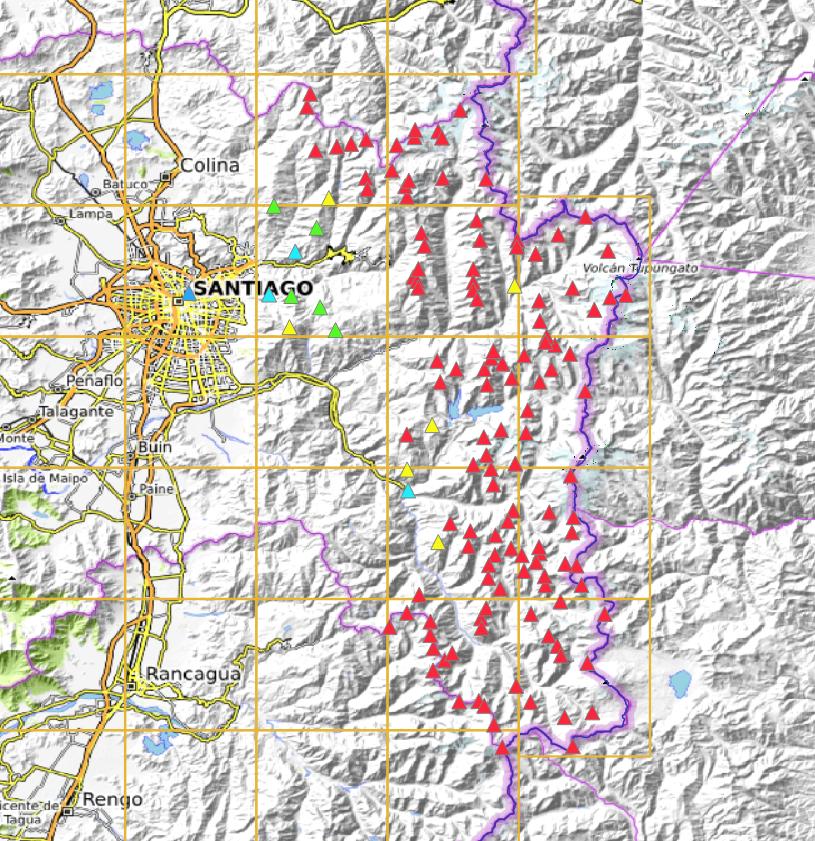
This month we welcome Mauricio, CE3KRM, as AM for our first association from Chile. As with their neighbours to the east there are some exceptionally high summits. Unfortunately we haven’t been able to add the gentler mountain ranges to the west yet, due to mapping availability issues. Consequently the association map looks heavily dominated by the 10-point summits whilst we await addition of the lower ones.
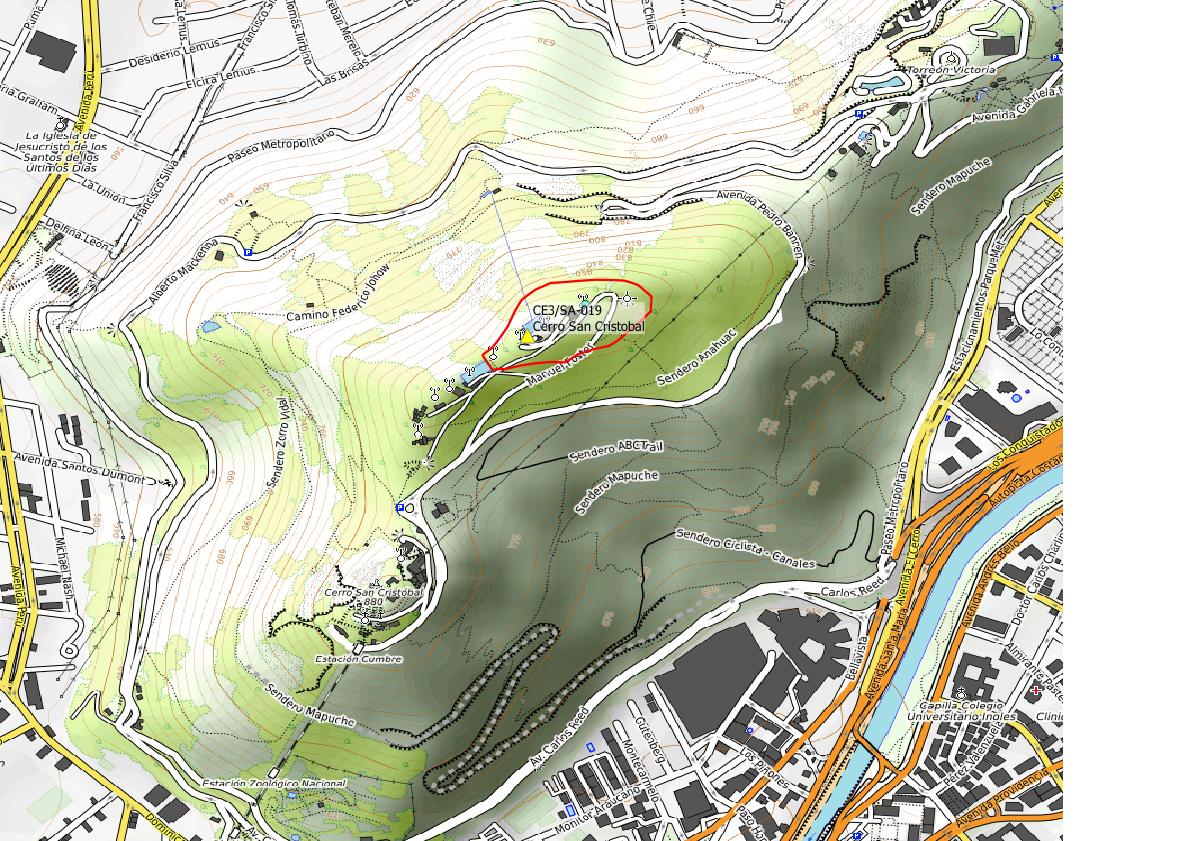
This shows the approximate AZ. Remember, the AZ is the contiguous area around the true summit, bounded by the contour surrounding it at 25m lower elevation. Here I am showing the summit-25m contour (in red) according to ALOS satellite data. There are actually two other outlying “islands” that fall into this elevation range, but because they are not contiguous with the zone around the summit (i.e. you have to drop >25m before you can reach them) they are not in the AZ. So would activators please resist any temptation to use either of the subsidiary summits (the monument / Santuario del Cerro San Cristobal or Observatorio Manuel Foster). Only the area around the true summit, as given by the coordinates (with the bulk of the radio towers it seems), is valid.
HI Simon
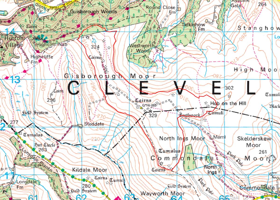
Thanks for the explanation of the contiguous zone around CE/SA-019. I generally study the AZ contouring around any summits I activate. I know the length of the contiguous activation zone around G/TW-004 is about 12 miles long! If you get chance with the tools at your disposal could you run a check on G/TW-003. I would be interested to know for sure if the trig point is within the activation zone as there is a significant dip at Three Howes in between the trig point at 324m and the highest point cairn at 328m as marked on OS maps. In my opinion from the OS map the trig point breaches the 25m limit by a few metres so it falls outside the activation zone.
It looks like that’s far from being an issue Phil. Vector Map Local has two spot heights around there at 321m. That’s borne out by the Terrain 5 elevation model which is in good agreement. That’s what I’ve used to make this AZ contour. No LIDAR coverage over the summit unfortunately, but it’s clear the trig is Ok, with lots and lots in hand.
CQ
Regarding CE3/SA-019:
I was fortunate to activate this summit on Monday 15th May 2023. It is worth knowing that there is no reciprocal agreement between CEPT countries and Chile so a temporary licence must be obtained for European activators. The summit is easily accessible as most of the climbing can be done by funicular, cable car or the park bus. Some of these forms of transport may not be operational on Mondays due to maintenance.
73
Nick CE3/G4OOE