Hi, Not all February activities appear.
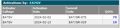
Only two, but there are four
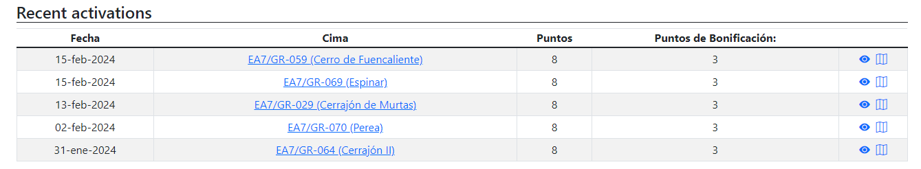
Any problem
73 José
Hi José,
It seems the database replication into the SMP DB copy has failed at some point recently and, as you say, only two of your activations from February are recorded there. This is a job for Andrew @VK3ARR to sort out.
Cheers, Rob
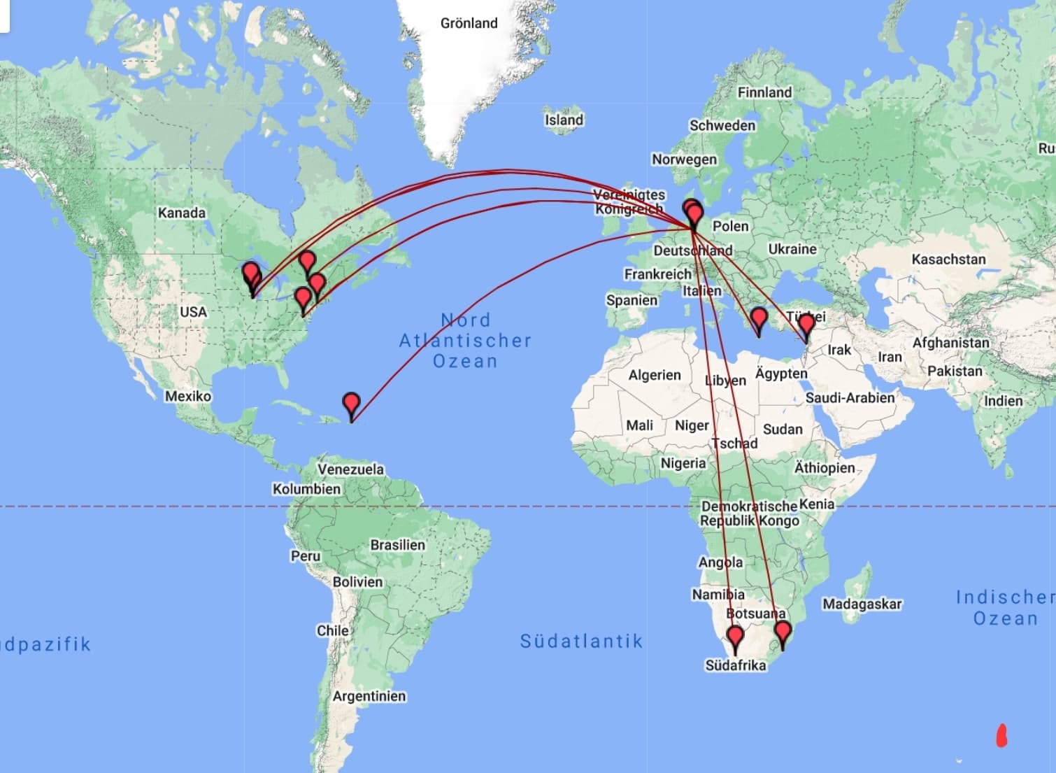
I recently started using http://analyzer.adventureradio.de/
for mapping and I am very satisfied.
Bye the way, best greetings to Adele and Sid in South Africa ![]()
73 Chris
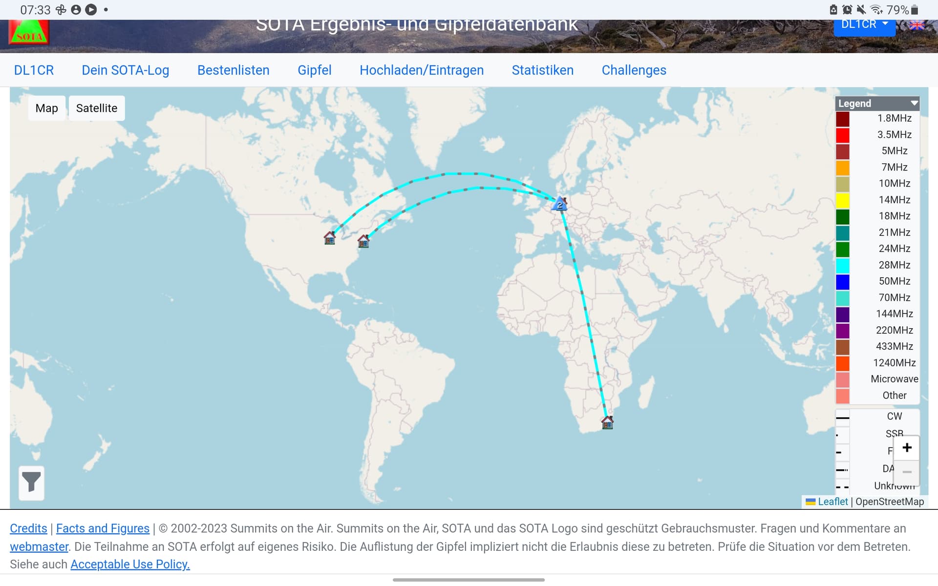
Sota map
Andrew did a very good job!
Andrew, perhaps creating a way to download an ADIF file would be a quick solution.
73 Chris
Chris, the fact that your first example map from adventureradio.de is able to show more QTH’s than the SOTA DB map is due to the fact that the adventureradio folks have more data on home-QTH positions than is available to the SOTA DB map page (as distinct from the sotamaps pages, which have their own QTH positions data.)
I would suggest you continue to use the adventureradio.de mapping, since they do seem to have more data, even though
The fact that the sotamaps data replication is very prone to crashing (no fault of the sotamaps code btw), and that the SOTA MT IT department is dragging its’ feet when it comes to sourcing/providing up-to-date QTH positions data, means that both of the mapping options offered by the SOTA website(s) will continue to be prone to such data omissions.
It’s perhaps a natural consequence of SOTA being managed by volunteers - speaking generally, volunteers will have commitments elsewhere (family, jobs, life) which take up their time, and in some cases may even lack the knowledge or degree of commitment necessary to undertake the task of keeping such data up-to-date. And yes, we have to recognize that provision of QTH data is low in the list of priorities of those responsible for the upkeep of the SOTA sites.
Cheers, Rob
If you have an ADIF file, another quick and easy map option to view QSOs is here:
But that needs the lat/lon or grid square for each record in the ADIF file.
If you are referring to the link I posted, then yes. I use a paper log on the summit. When home, I then log using a program that exports a complete ADIF file with the requisite data, which includes S2S data since it incorporates the other op’s summit location data (as well as mine). Seems to work quite well for me if I want a quick representation of QSO’s made. If the chaser is mobile or portable (not at QTH or known summit), then oh well.