Summary of Activation :
- SOTA Summit: GM/SS-167 : Black Hill : 501m : 2pts +3pts
- Activation Date: Fri-19-Dec-2025
- Callsign used: GM7STP/P
- ALERTS : for 13:30 UTC / time approx. / wx dependent
- SPOTS : 12:18 / 145.500 / QRV, windy ! … [GM7STP]
12:44 / 145.500 / qsy 145.400 MHz … [GM0AXY]
14:03 / QRT / Cold, windy and raining … time to go ! - Equipment for 145-fm :
• Icom ID-52 handheld / with counterpoise. - Successful QSOs :
• On 145-fm : 145.500/QSY MHz : Total QSOs = 5
• Including S2S QSOs = 1
Setting Up :
The summit of Black Hill, one of the Pentland Hills, has only a very small cairn, small pile of rocks, marking the summit. It has a broad summit, mainly heather and grassy with some mossy, boggy patches.
After getting comfortable on my carrymat and tarpaulin nearby the summit cairn, I self-Spotted at 12:18 for 2m fm, about 1hr 10mins earlier than my ALERT estimate. This was mainly due to easier walking and better weather than anticipated.
Operation on 145-fm :
I managed five QSOs in total. My first three QSOs were all from Bonnyrigg, Ken @GM0AXY, Kenny @GM1KEN and then Julia @MM3TQK. Ken @GM0AXY spotted for me ![]() and also mentioned that he heard Andy @MM7MOX call, but unfortunately Andy and I missed each other. My 4th QSO was with Jack @GM4COX, who then coordinated QSY 145.400 to 145.550 for my 5th QSO, a S2S with Archie @GM4KNU/P who was on GM/SS-164 Kirkland Hill, great to get a S2S again
and also mentioned that he heard Andy @MM7MOX call, but unfortunately Andy and I missed each other. My 4th QSO was with Jack @GM4COX, who then coordinated QSY 145.400 to 145.550 for my 5th QSO, a S2S with Archie @GM4KNU/P who was on GM/SS-164 Kirkland Hill, great to get a S2S again ![]() , although with a bit of a scratchy signal both ways; this with Alan @GM7VCV on standby for Archie, thanks Alan.
, although with a bit of a scratchy signal both ways; this with Alan @GM7VCV on standby for Archie, thanks Alan.
I was hoping for at least ten QSOs, but with the wind picking up combined with a rain shower lashing down I decided to pack up and head back to the car. So self SPOTted QRT at 14:03.
Overall, another very successful activation. Thanks to all my Chasers and S2S Activator !
Background stuff : Route & Photos :
Route Start : At the Harlaw Reservoir Car Park, Balerno, EH14 7BF.
Route to Summit of Black Hill : SotaMaps GM/SS-167
Distance to Summit : approx. 3.6km over elevation of 501 - 251 = 250m approx.
Wx : Overall a cloudy day, windy with strong gusts, short periods of rain / drizzle. Otherwise clear on the summit.
Route :
The planned route pretty much follows the route nicely described by Lee @MM7LEF in his “Black Hill Report - MM7LEF” from Aug-2024 … GM/SS-167 : See “Black Hill Report - MM7LEF”
My starting point was the Harlaw Reservoir Car Park, Balerno, EH14 7BF.
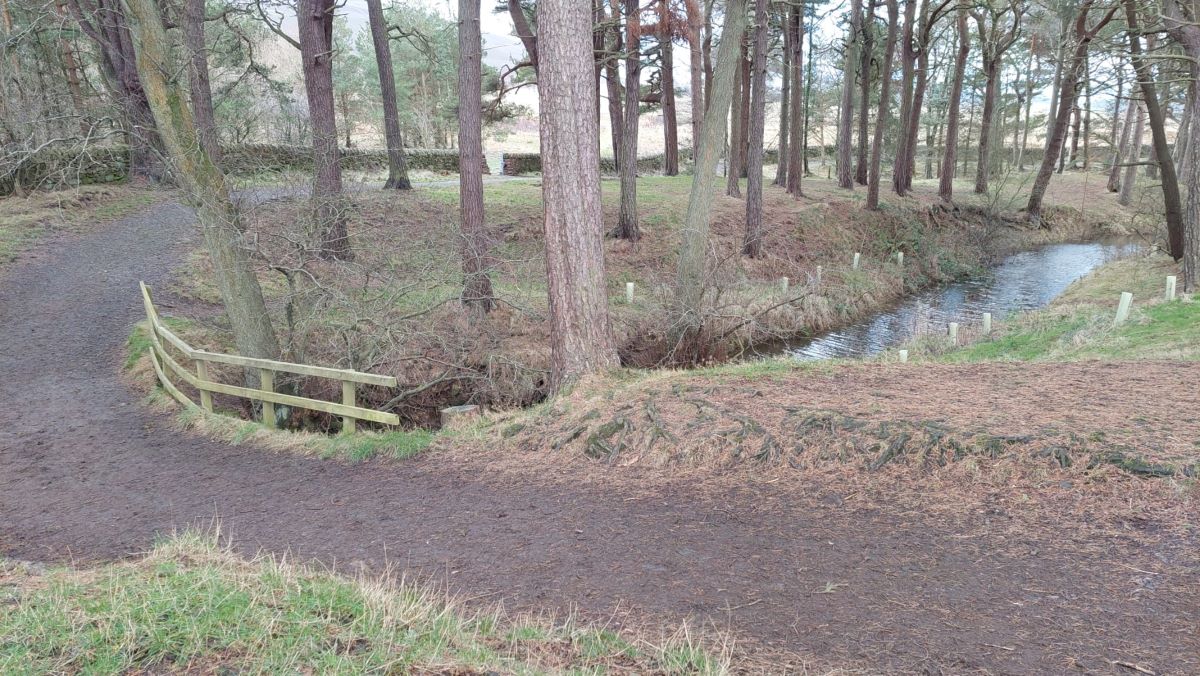
After walking from the car park down the tarmac road to the Harlaw Reservoir Visitors Centre (currently Closed !), it’s then an easy walk following the forest track down to the gate to the path running alongside the reservoir towards the short causeway.
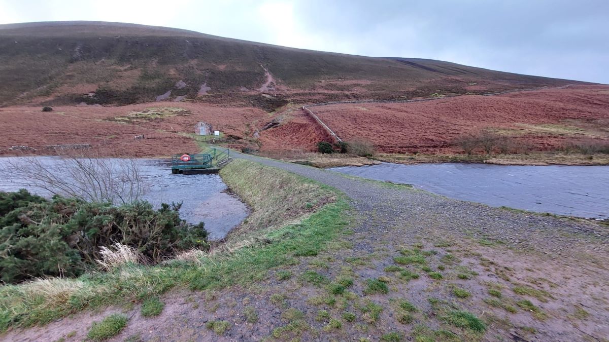
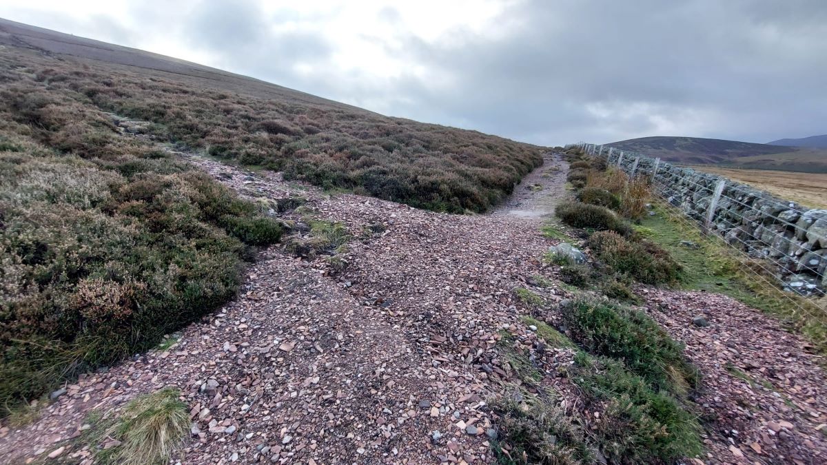
The route follows the causeway over to a pumping station, the small stone building, then onto a rough path up to the right following the stone wall all the way to the point where there is a route up the hill by the grouse butts. Approaching the top the track leads onto a broad summit with a small path just to the left leading to the summit cairn, or small pile of rocks.
Return route : As planned, my return route was to be the same in reverse, from the summit back down to the car. In fact after battling with the wind and rain when I was packing up, the wind died down a little and it stopped raining.
So instead of retracing my route back to the car I decided to continue over the summit and explore down the east side of Black Hill, more or less following a line of grouse butts all the way down. I then skirted the base of Black Hill following an anticlockwise route round and back to the small stone building by the short causeway crossing the narrow end of Threipmuir Reservoir. An interesting unplanned extension to my hike which allowed great views from the back of Black Hill.
Total distance walked was approx. 9.0km to the summit and back with total ascent of approx. 280m.

Above OSMaps-GM7STP-GMSS167-01.jpg : Black Hill at 501m. One of the Pentland Hills.
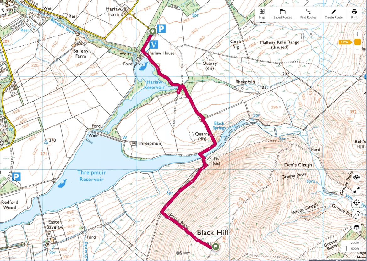
Above OSMaps-GM7STP-GMSS-167-02.jpg : Route : Harlaw Reservoir Car Park to Black Hill summit.
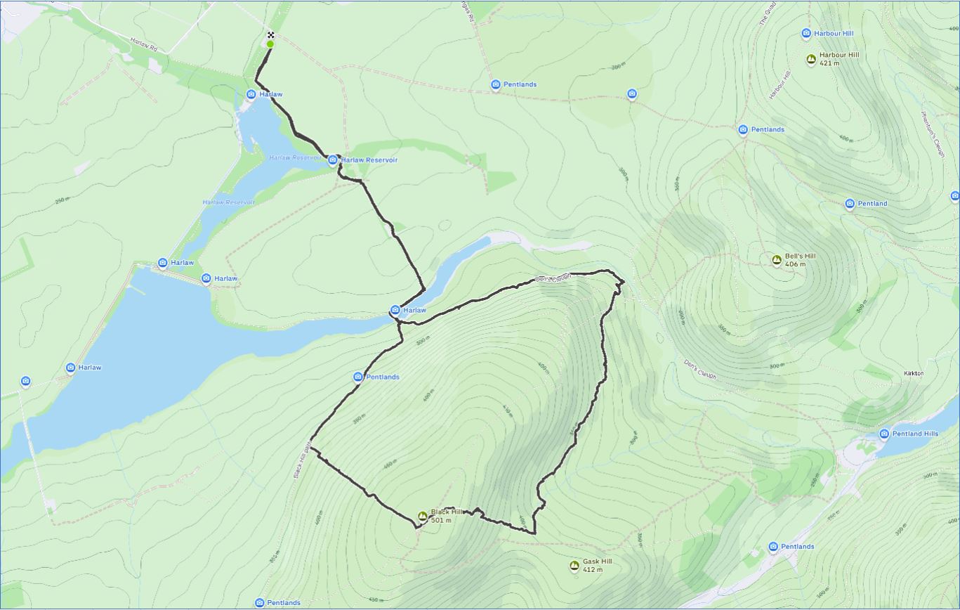
Above Strava-GM7STP-GMSS-167-01.jpg : Overall Route walked; exploring the east side of Black Hill.
Photos :
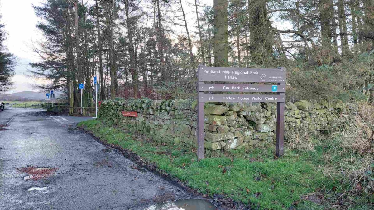
Above Photo-01-GM7STP-GMSS167.jpg : Harlaw Reservoir Car Park : Pentland Hills Regional Park
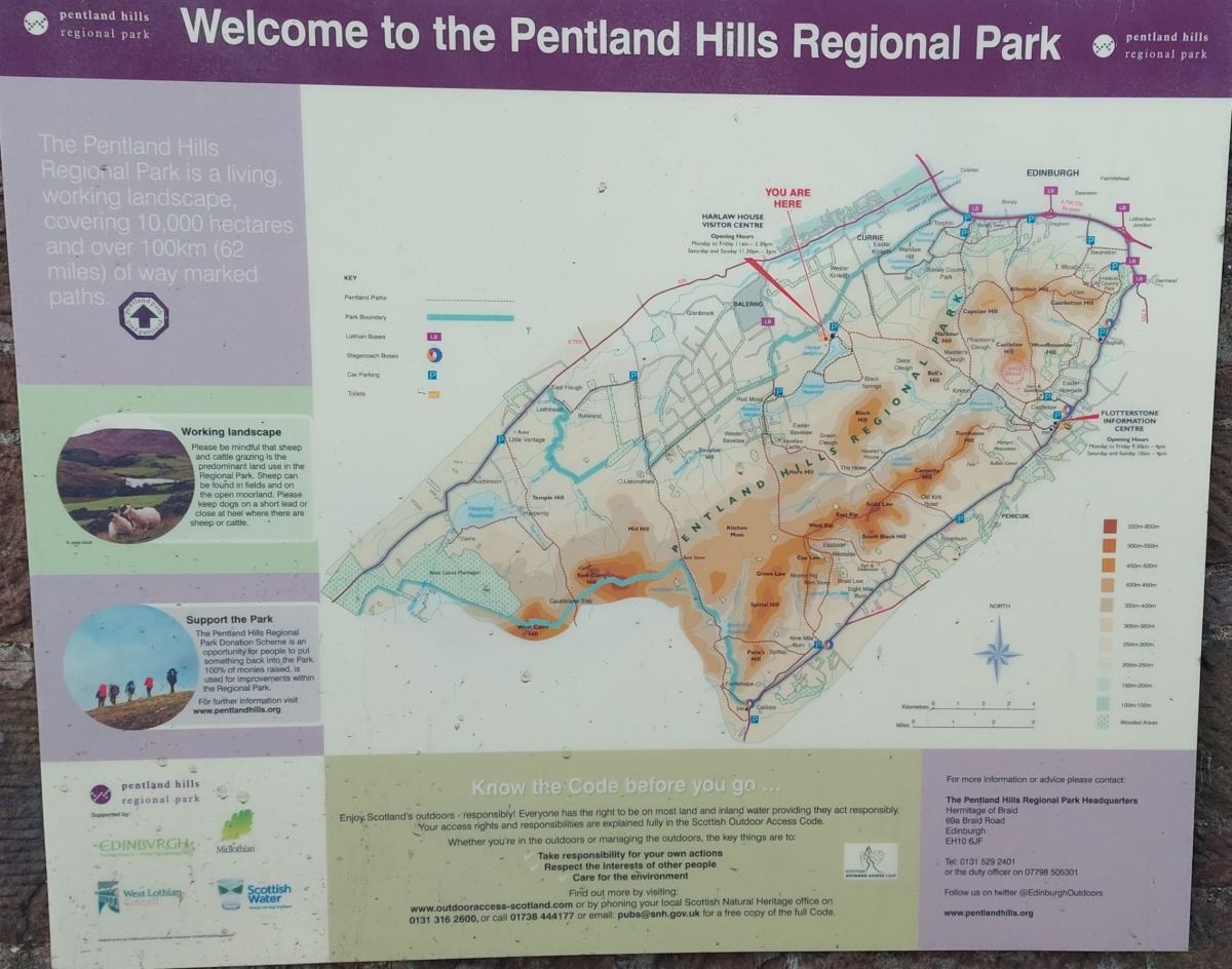
Above Photo-02-GM7STP-GMSS167.jpg : Information Board : Pentland Hills Regional Park
Note: the information board is at the Harlaw Reservoir Visitors Centre; but the Visitors Centre is closed at the moment.
Above Photo-03-GM7STP-GMSS167.jpg : Path through forest.
Above Photo-04-GM7STP-GMSS167.jpg : Out of the forest then turn right along the path to the short causeway
Above Photo-05-GM7STP-GMSS167.jpg : After following the path by the wall, turn left up hillside by the grouse butts, providing a route to the summit track.

Above Photo-06-GM7STP-GMSS167.jpg : View up towards grouse butts and the summit track.
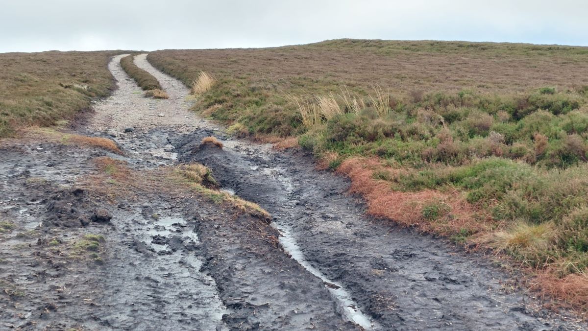
Above Photo-07-GM7STP-GMSS166.jpg : Top of track where the route levels off towards the summit path.
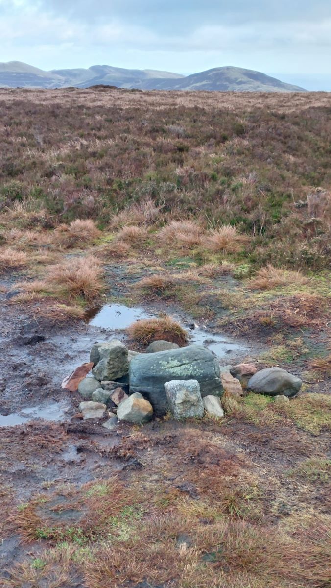
Above Photo-08-GM7STP-GMSS167.jpg : Black Hill : Summit Cairn / small pile of rocks.
Another great day out, successfully activating Black Hill in the Pentlands ! ![]()
Thanks to all the Chasers and S2S Activator for all the QSOs. ![]()
73 Peter GM7STP