Summary of Activation :
- SOTA Summit: GM/SS-155 : Hill of Stake : 522m : 2 pts +3 wbpts
- Activation Date: Tue 02-Dec-2025
- Callsign used: GM7STP/P
- ALERT : 13:30 UTC : 145.500 fm & maybe ssb too … wx dependent.
- SPOT : at 12:43 on 145.400 : fm only … QRV
- Equipment : for 145-fm :
- Rig: Icom ID-52 handheld / 5W
- Antenna : ID-52 Antenna plus a counterpoise. (Slim-G not used)
- Mast : Not used.
- Successful QSOs :
- On 145-fm : 145.500 MHz, etc : QSOs = 4.

- On 145-fm : 145.500 MHz, etc : QSOs = 4.
Setting Up :
Arriving at the summit well ahead of my target ETA, I began setting up. The summit of the Hill of Stake has a concrete pillar trig point in the fenced corner of a grassy top, with a pile of rocks nearby.
With quite a strong steady chilly wind I decided not to bother with the Slim-G and mast, and used my tarpaulin draped against the wire fence to provide some much needed shelter for operating. After settling down on my rolled out my carrymat I SPOTted myself on Sotawatch3: fm only … QRV at 12:43 for 145.400MHz.
Operation on 145-fm :
By about 12:45 UTC/GMT I was QRV and calling CQ SOTA, initially on the calling channel, QSY 145.400.
I got an immediate response to my first CQ SOTA, and my 1st QSO from Jack @GM4COX over near Carluke; 145.500 QSY 145.400. R59, S59.
My 2nd QSO followed just after on 145.400 with Peter @GM0VEK in Kirkintilloch; R59, S59. My top chaser to date !
My 3rd QSO followed shortly after with Dan @GM6CMQ in Dunfermline with a R57, S59.
My 4th QSO followed about 5 minutes later with Brian @MM1HMZ/M in Paisley on 145.400; R59 and S59. Great to get the 4th QSO !
After securing the points for the activation I decided to call it a day as it was getting pretty chilly, so SPOTted myself QRT at 13:08. Then packed up and headed back down to the car.
Overall, another very successful activation. Thanks to all my Chasers. Very enjoyable QSOs.
Background stuff : Route & Photos :
Route Start : Muirshiel Country Park Visitors Centre, down Calder Glen Road, Lochwinnoch.
Route : Summit : Hill of Stake : Refer to SotaMaps GM/SS-155 at 522m.
Distance to Summit : 6.5 km over elevation of 522 - 240 = 282m approx.
Wx : A dry but cloudy, cold and windy day; with a chilly wind, especially on the summit !
Route:
From the car park at the Muirshiel Country Park Visitors Centre take the track towards the bridge. Note that the map at the car park does not show the Hill of Stake but does show the route to the bridge. At the bridge it is signposted Mine Track 2.4miles / 3.8km across the bridge. An easy walk along the track to the Barytes Mine. Approaching the mine, pass by the green container up towards the mine itself. Then take the path to the left and follow it on up the hill with the mine on the right.
Once past the top mine workings and waterfall the path continues up past the fence posts on through the heather. Shortly after the path disappears completely! It’s a free for all ! Tough walking across heather, bog and very soggy ground, with the occasional stretch of deer track to follow if you’re lucky. The route is simply upwards towards the fence line on the Hill of Stake. Once at the fence it is then a simply plod up the grassy track following the fence to the summit.
Return route taken from the summit was the same in reverse … retracing our steps using Strava helped back across the boggy bits, backed up with map and compass to ensure we got back to the right gully for the Barytes Mine path. Once off the path by the mine it was an easy walk back along the track to the car park.
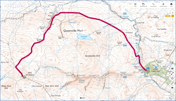
OSMaps-GM7STP-GMSS155-01.jpg : Route: Muirshiel Country Park Car Park to Hill of Stake
Photos :
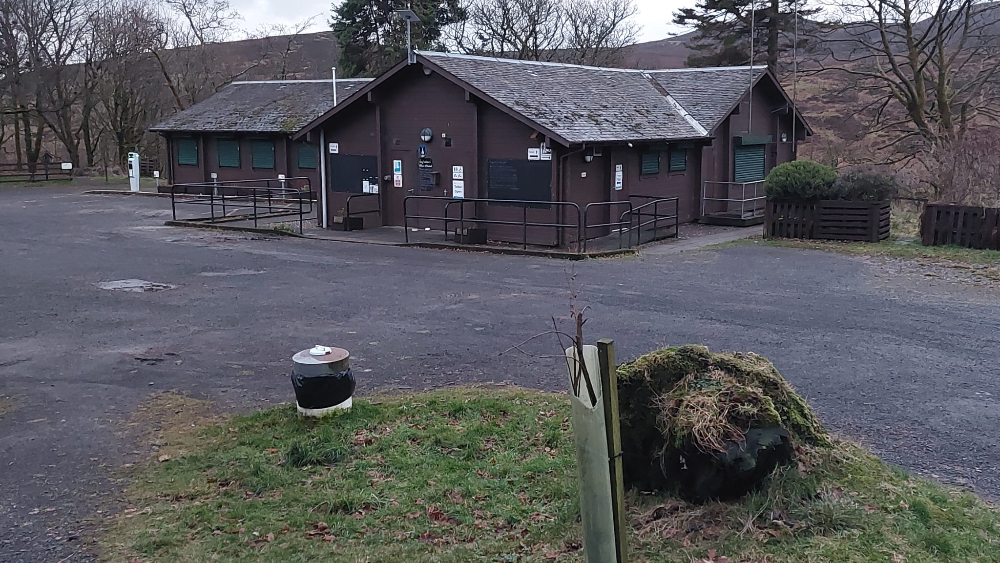
Above: Photo-01 : Muirshiel Country Park Visitors Centre & car park.
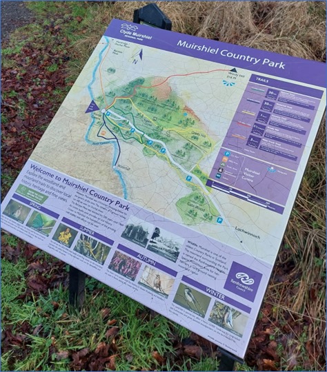
Above : Photo-02 : Map of Muirshiel Country Park showing route to the popular Windy Hill (not a SOTA hill). The route over the bridge to the Barytes Mine is shown on the top left corner. Barytes is naturally occurring barium sulphate. The Hill of Stake is well off the map to the left, part of Clyde Muirshiel Regional Park.
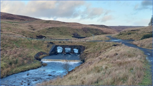
Above : Photo-03 : Bridge across the River Calder.
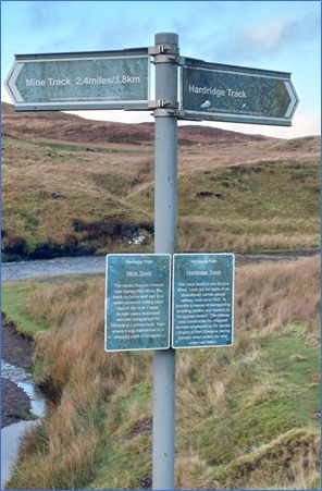
Above : Photo-04 : Signpost to the Mine Track and the Barytes Mine to the left across the bridge.
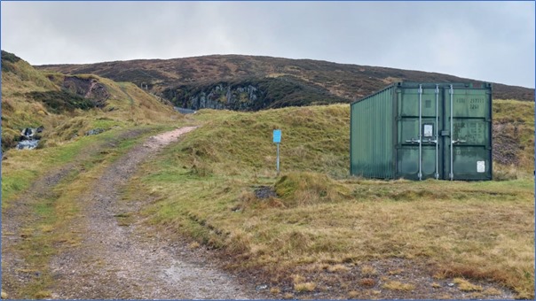
Above: Photo-05 : Approaching the lower mine workings, walking past the green container.
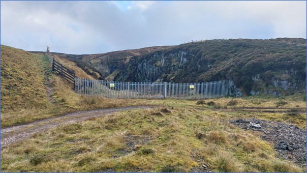
Above: Photo-06 : At the lower mine workings take the path up to the left.
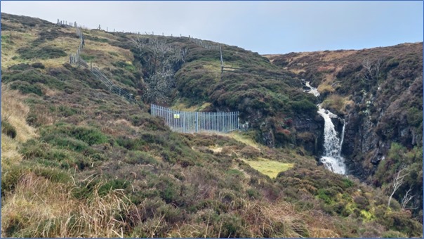
Above : Photo-07 : Path continues up to the left of the upper mine workings, past the fence posts top left.
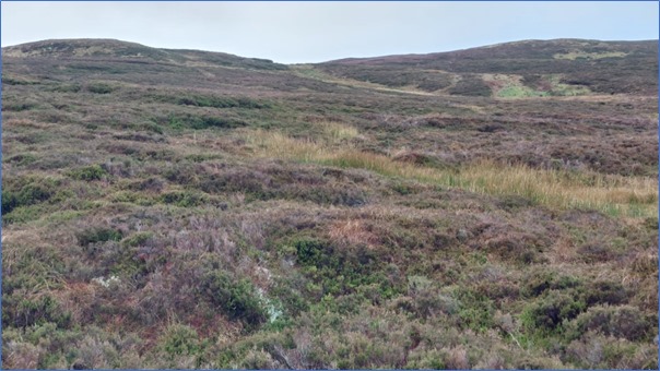
Above : Photo-08 : No path bit ! … heather, boggy and soggy. The Hill of Stake is over the hill … quite a slog !
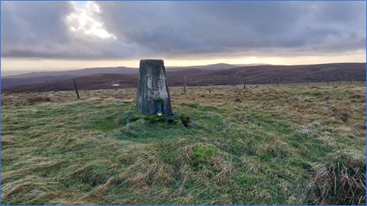
Above : Photo-09 : Hill of Stake summit trig point.
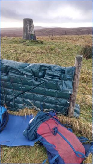
Above : Photo-10 : Hill of Stake : Operating position just down from the trig point.
A great day out successfully activating Hill of Stake ! ![]() Although a bit chilly !
Although a bit chilly ! ![]()
Thanks to all the Chasers for all the QSOs. ![]()
My next ALERT is for GM/WS-336 : Beinn Lora, up near Oban Airport. ![]()
73 Peter GM7STP
