Right, I’m down from my endorphin trip now !
I’ve put off doing Ben More since August 2007 when I did Stob Binnein, a significantly easier walk from the South. But I saw how much drop, re-ascent there was. I’ve seen it from so many places and I’ve read that there’s no real path and it’s steep. But it stuck out like a sore thumb and I promised myself to do it this year. Earlier on, July I think, I had it planned but I woke early with an incredible pain in right hand, I could not grip a toothbrush never mind hold a walking pole. Or Morse key. So it was cancelled. Afer the blowout on what should have been activation #800 on Monday when range activities meant I could not get to Beinn a.Mhanaich GM/SS-066 I was determined I should do something whilst the WX was unbelievable here. Ben More to the fore!
It was going to be hot so I made sure I was at the start early when it was cool. In fact it was Baltic at 3C at 830  The North face would be in shadow till at least lunchtime which gave me a shot to get up before it got hot. it was a good 20C+ in the valleys by afternoon and a pleasant 14C at the summit. My plan worked, I was in shadow till the last 50m ascent.
OK, it’s meant to be steep. Well it is, damned silly steep. The average slope is 1:3 but in places it’s much, much steeper. Only the start is easy and the final 100m of ascent is a little steep. It’s just mainly stupidly steep but not like some like Stob Dubh in Glen Etive.
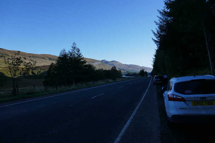
Glen Dochart, 0730Z, 3C at the foot of the hill. Already cars pulling in to park. If the weather had been like this on the weekend there would be over 50 cars parked here by now!
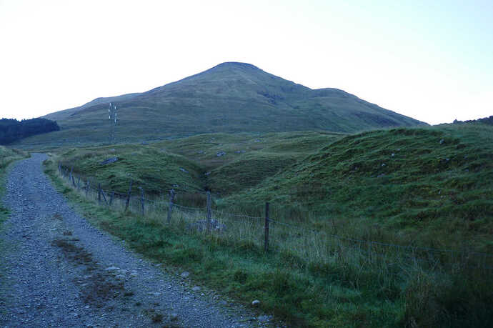
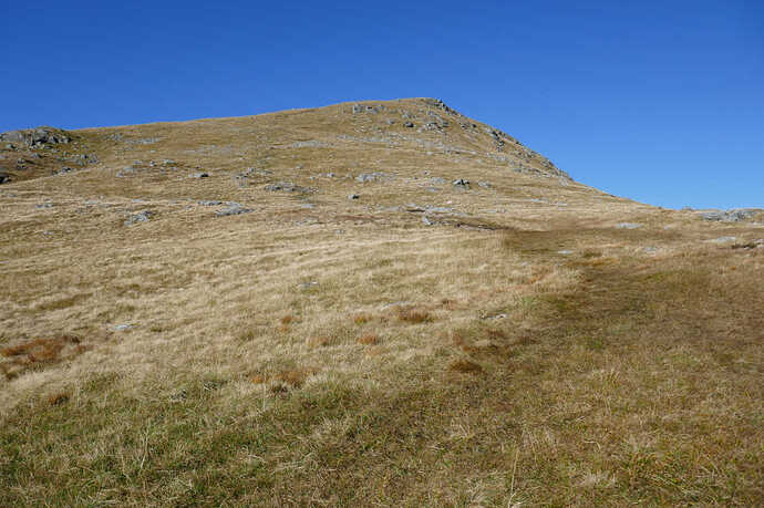
Through the trees at the sign, through the gate and the climb on the zig zag track. First view of the summit. Doesn’t look that bad from here. It is though.
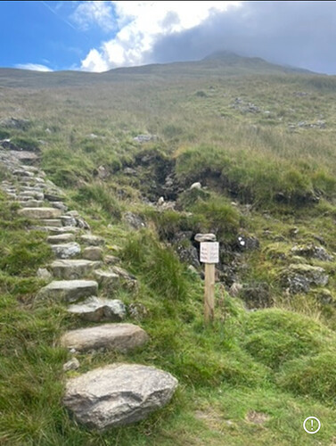
So finally you turn off the track at the sign and there is a stone staircase. A steep staircase and the rock stairs run about half of the route. There is meant to be a faint path. Well since that was written in 2010 a zillion boots have been up here, the stone stairs make the track obvious and there is a trench knee deep in places. There is a damned obvious path and there’s quite a lot of crampon rash visible on the stone steps too. Ooooh, this level of steep and needing crampons is SO FAR out of my comfort zone 
It climbs. Just climbs at what seems a relentless rate. There’s no relief, no gentle parts, just non-stop steps. I think I did about 40mins before I allowed myself a rest. I wasn’t going fast but I wasn’t stopping either. And up and on and up and on. I impressed myself that I could keep going. After a while the stairs end and it’s a rock/gravel and earth path. It was quite dry and I could imagine it’s not fun if wet. And up and up and up. No respite at all. The walk guides tell you to make sure you don’t get drawn into the massive choire Sloc Curraidh. So why does the path run so close to it then? After a while you are told to look for the drystane dyke that marks the dangerous bit of the choire. What they don’t say is it’s only 2 stones high as I was expecting a wall about 1m high. It’s obvious when you see it.
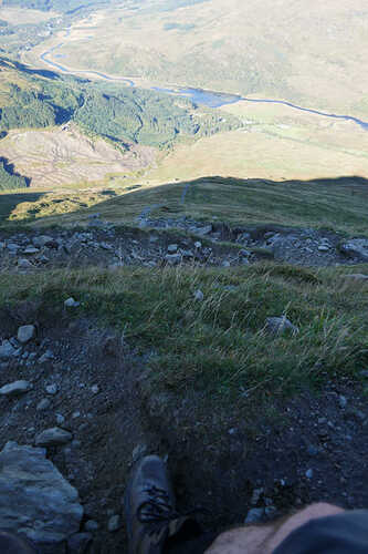
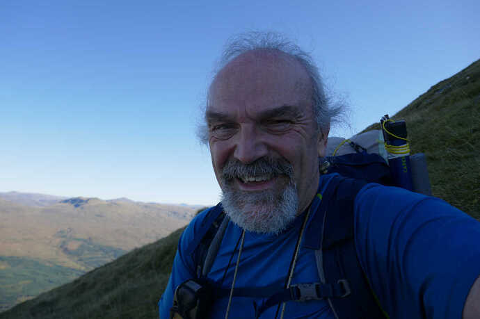
I’ve posted a picture of me looking down earlier. That was taken about 1h30 into my ascent at the top of the drystane dyke, about 950m. It was the first sit down rest I took. I was somewhat tired and beat up by now. As this picture shows. You can see the slope behind me. I couldn’t smile despite the views because I knew there was still 224m of ascent  The next 150m ascent are significantly steeper.
Of course you walk up with your back facing North and can see grass, earth and rock and nothing else but from my resting perch the view North blows your mind.
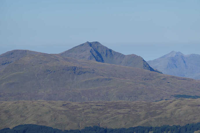
Just for Brian @G8ADD , Ben Lui GM/SS-003. Ben Cruachan GM/WS-013 has sneaked into the photo.
The 150m really steep bit seemed to drag on and then there was a bit of the mildest scramble over a few rocks and suddenly the path was not like climbing a ladder but just a steepish path. Lots of crushed rocks from so many boots and it wandered and wandered and zigs and zags and if you have climbed enough hills you know, you really know that any second now the summit comes into view and you are there.
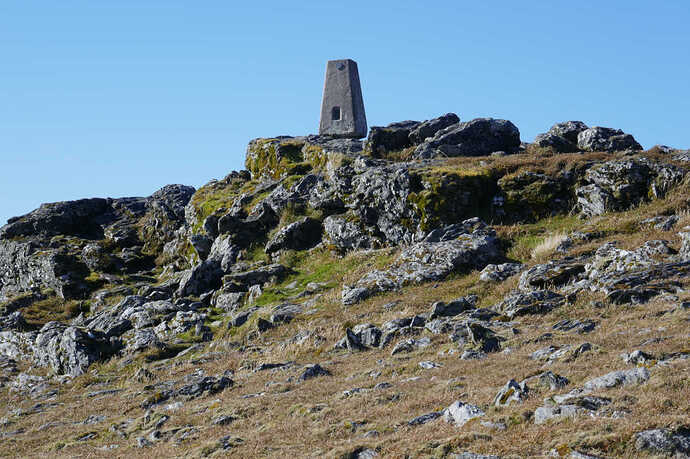
I have to say it was an almost religious experience coming out on top, see the cairn and trig and the 360 degree view of beauty. So many summits, such colours, views out to over 100km. I took some photos, picked my spot to setup and was just getting ready to start when the cramps came. Not classic cramps where you can see a leg muscle all squished to the size of an orange but an unreal ache throughout my left leg. I’d already drunk 500mL of my 1.75L of water at the top. But the pain was quite amazing. Another walker came over and checked I had drunk something. I did stretches and rubbed it and he did say “do we need the helicopter?”. After about 5mins it started to ebb but I was incapable of coherent speech (what’s new) for about 15-20mins in total. I’ve had cramp before not like this though. I’ll put it down to exertion,temperature and dehydration. It took a 63yr old fat guy 2h25 to get to the top from locking the car and that did include a longish stop at 950m and a good handful of quick breathers. I had another cramp driving home down Glen Ogle at a rate of knots. I felt my right leg go numb and I couldn’t press the pedals. After about a min of panicking I saw an estate entrance and pulled off the road. Another 10mins of stretching and cursing with a completely numb leg. Then just like a switch was turned, complete normality returned. I may carry some electrolytes in future to take at the top and back at the car.
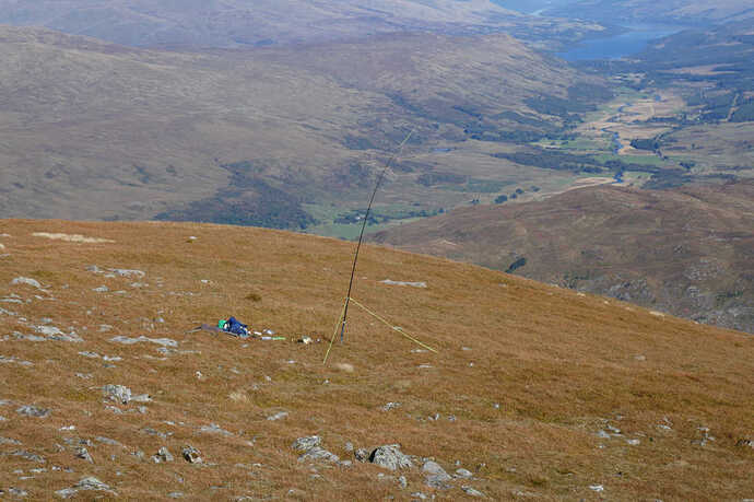
Setup was the 5m pole, 40/30/20m trapped EFHW, 1:49 coupler, KX2. Trivial job for the KX2 tuner on 20/30/40 of course and all other bands match easily too. There’s about 4m vertical with the match unit at the height of the guys in this picture. The rest of the antenna ran SE and the counterpoise ran NW down one the guys and on to the ground. The KX2 sat in the sun whilst I did my cramp moves, was hot to the touch when I started so the golden sunshade was deployed, visible in this picture. Definitely Autumn (Fall) on the way.
I started on 10m as there were plenty of SSB stations, I worked just one and nobody answered my CQs. 2m ore worked 10m CW. OK so some multipliers for the challenge. Now I feel duty bound on summits like this that are primarily activated on 2m FM to do some 40m SSB to offer it to the original chasers who supported me when I couldn’t do CW. So 40m SSB and a beautifully behaved pileup ensued. It was a delight to get regulars in the log, G0FEX, G0RQL, G4WHA, GM4COX and many more. Also Martyn/Caroline M1MAJ/M3ZCB for n S2S and also MM/WN2G/P on Clisham GM/SI-012 up on Lewis. We tried a QSO on 10m CW, I could hear someone sending MM/… but there signal was barely there so nothing on 10m but no problems on 40m. I also worked Gerald on 40m for his complete. He knew I was there from the day before but if he hadn’t appeared on 40m I was going to text him (full scale EE 4G on the summit) and make a sked before I left.
At that time 2m burst into life, Alan MM0VPM/P was calling from Chno Dearg GM/WS-032. I managed a quick S2S nad left Alan to talk to Jack GM4COX. I was pleased with that one. Alan along with Andy MM7MOX is a member of my local club and having some activators there means we can arrange mutual support activations chases etc. It’s fabulous stuff. Though Alan doesn’t carry enough anvils judging by the scale of some of his walks etc 
Onto 15m and 17 EU stations worked, all good signals. Nice to work Jame N6JFD in EA3 as well as OM/F4JYM/P and HB9HZC/P for 3x S2S. Back to 10m and a few my LZ CW contacts… the antenna did seem to be pointing to LZ land based on the stations work. Another 17 worked on 18m which seem to give very strong signals ODX was K4DY.
Then it was time to go. Packup, more water, then photo time.
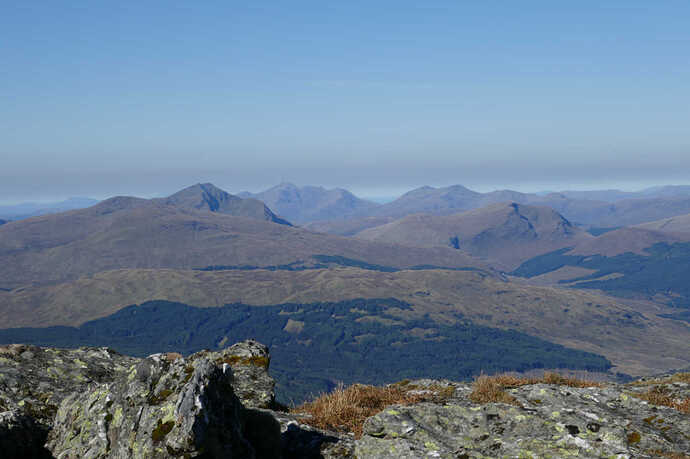
Ben Lui GM/SS-003 on the left with Beinn Oss GM/SS-005 and Bein Dubhchraig GM/SS-009 in front. Ben Cruachan GM/WS-013 in the centre distance, then Beinn O’Chocuil GM/WS-071 and Beinn Eunaich GM/WS-065. Then Beinn Chuirn GM/SS-021 right middle distance. Nice 
It gets better.
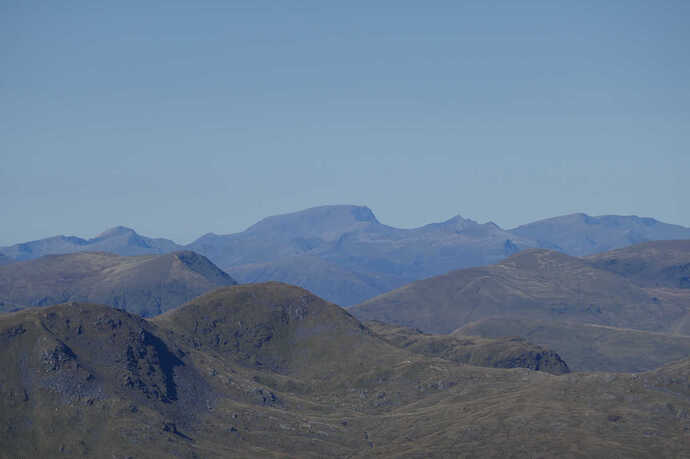
Far distance L-R Sgurr a’Mhaim GM/WS-20, Am Bodach GM/WS-037 Ben Nevis GM/WS-001, Carn Mor Dearg GM/WS-003 (You can clearly see the Carn Mor Dearg Arrete), Binnein Mor GM/WS-011, Aonach Beag GM/WS-002
Centre middle Beinn a’Chrulaiste GM/WS-146
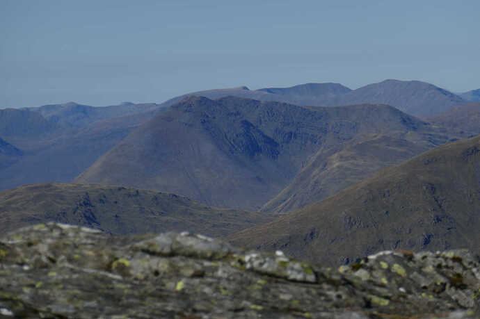
L-R Beinn an Dothaidh GM/CS-025, Beinn Achaladair GM/CS-018
Front Ben Challum GM/CS-021
Centre Beinn Dorain GM/CS-008. Behind Meall a’Bhuiridh GM/CS-017 Creise GM/WS-019 Front right Beinn a’Chaisteil GM/CS-054
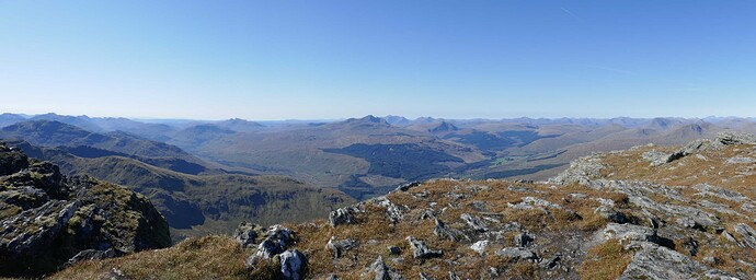
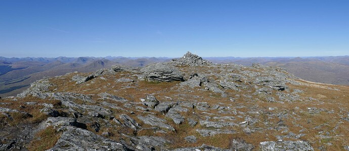
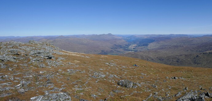
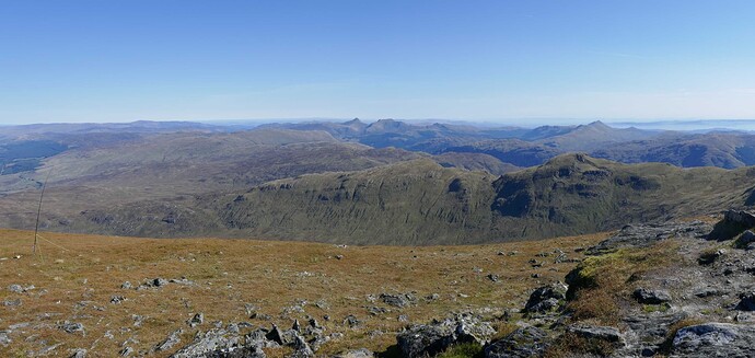
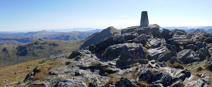
I’ve left these panoramas at full size but dropped the quality to drop them down in size by a factor of 10. From the main story, click one then click it again to get full size. Close with ESC. Then click the next twice etc.
West
North
East
South East
South
I didn’t want to go it was so warm and lovely and the views where to die for. There are 2 routes off, back down the front which was a lot of steps. Or the route down the South face to the bealach where you can then do Stob Binnein GM/SS-002 if you have the legs. I was down the near 300m slope to the bealach in about 25 mins and I knew I could climb and desend Stob Binnein if my life depended on it. I did thin kof leaving my bag at the huge boulder and just talking a handy. But I knew it was too much and having done and not being points driven I would not enjoy it.
Looking up to Stob Binnein GM/SS-002, about the same ascent as Scald Law GM/SS-125, my local training hill.
Ben More GM/SS-001, the top is set back about 25m vertically and 50-100m horizontally.
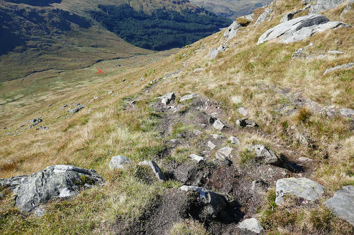
The descent path runs from the bealach. “The path descends on initially gentle slopes before getting steeper until it meets the path back to Ben More Farm”. Hahahahaha. Well you drop about 150m from 850m AGL at the bealach on the path shown. Then you hit the boggy bit which had some bog pools as deep as my walking pole. Then it drops like a stone to the farm track, the start is shown with a red cross. That’s about 375m of descent. Oh my knees and feet were complaining when I finally got to the track. I stopped for 15 mins chillax time and more chocolate. It was 20C or more in the valley and there was no wind. There was only a gentle breeze at the 1174m summit.
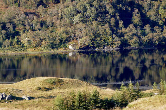
Then it’s along the track back to the start of the stone staircase and down the zig zgas to the car, About 35-40mins. It was clear the wind had vanished looking at Loch Dochart just before getting to the end of teh zig zags.
There was much doing nothing sat in the tailgate of the car letting my feet steam and drinking Red Bull clones. I spent 20-30mins again chilling before the 1hr50min drive home. With just one cramp session as described.
The antenna worked well and I was using a new LiIon battery. I found 4 LiIon 21700 cells in the shack. These are massive compared to 18650s which many of use. I have no idea where they came from but are 4000mAH. They worked fine but I noticed why a KX2 wants LiFePO not LiIon…only 7W on 10m as the voltage is lower. But 10W on all other bands.
I put this summit off for over 15 years thinking I wasn’t fit enough. So I left it till I was much older and found it was hard work but such an incredible buzz when I finally got to the top. And back to the car 
2h25 elapsed for an oldish fat bloke… that will do fine thanks.
I forgot to add this initially. Use this link to generate a fully annotated panorama of the summits, names and distances. Absolutely brilliant website.
https://www.udeuschle.de/panoramas/panqueryfull.aspx?mode=newstandard&data=lon:-4.54027$$$lat:56.38597$$$alt:auto$$$altcam:10$$$hialt:false$$$resolution:20$$$azimut:180$$$sweep:360$$$leftbound:0$$$rightbound:360$$$split:60$$$splitnr:6$$$tilt:-3.33333333333333$$$tiltsplit:false$$$elexagg:1.2$$$range:300$$$colorcoding:false$$$colorcodinglimit:146$$$title:Zugspitze$$$description:$$$email:$$$language:en$$$screenwidth:1920$$$screenheight:1080
