A photo-essay covering my recent week in the Hakatere basin.
==
Following on from my Mt Stevenson story - I limped off that 10-point summit with a stuffed back and my tail between my legs having activated just 1 of 3 peaks. Something easier was called for to soothe the recovery - to keep moving but don’t exert or strain.
I stop at Mt Somers campground that night, aiming for an evening activation of Mt Barrosa [ZL3/CB-499] to chase some greyline DX and cheer myself up. Lying on my mattress on the cabin floor afterwards and dreaming over maps, I realise that there are enough peaks in the area to keep me busy all week and beyond …
Tue 5th September
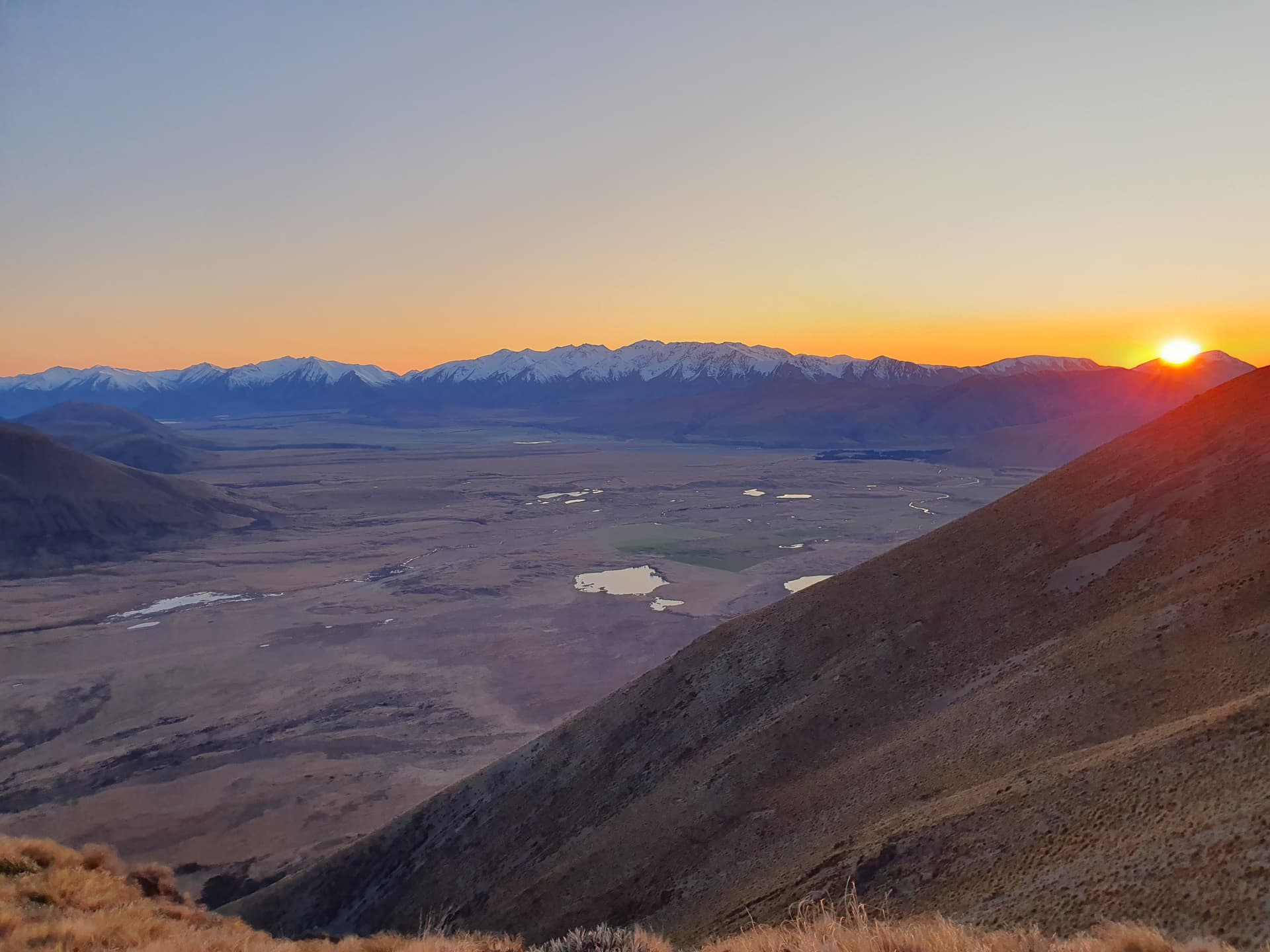
Chasing greyline DX I make the 800m evening climb up the easy track to Mt Barrosa. 53 contacts result, 35 EU and 1 North America.
Pastel evening light from Mt Barrosa [ZL3/CB-499]
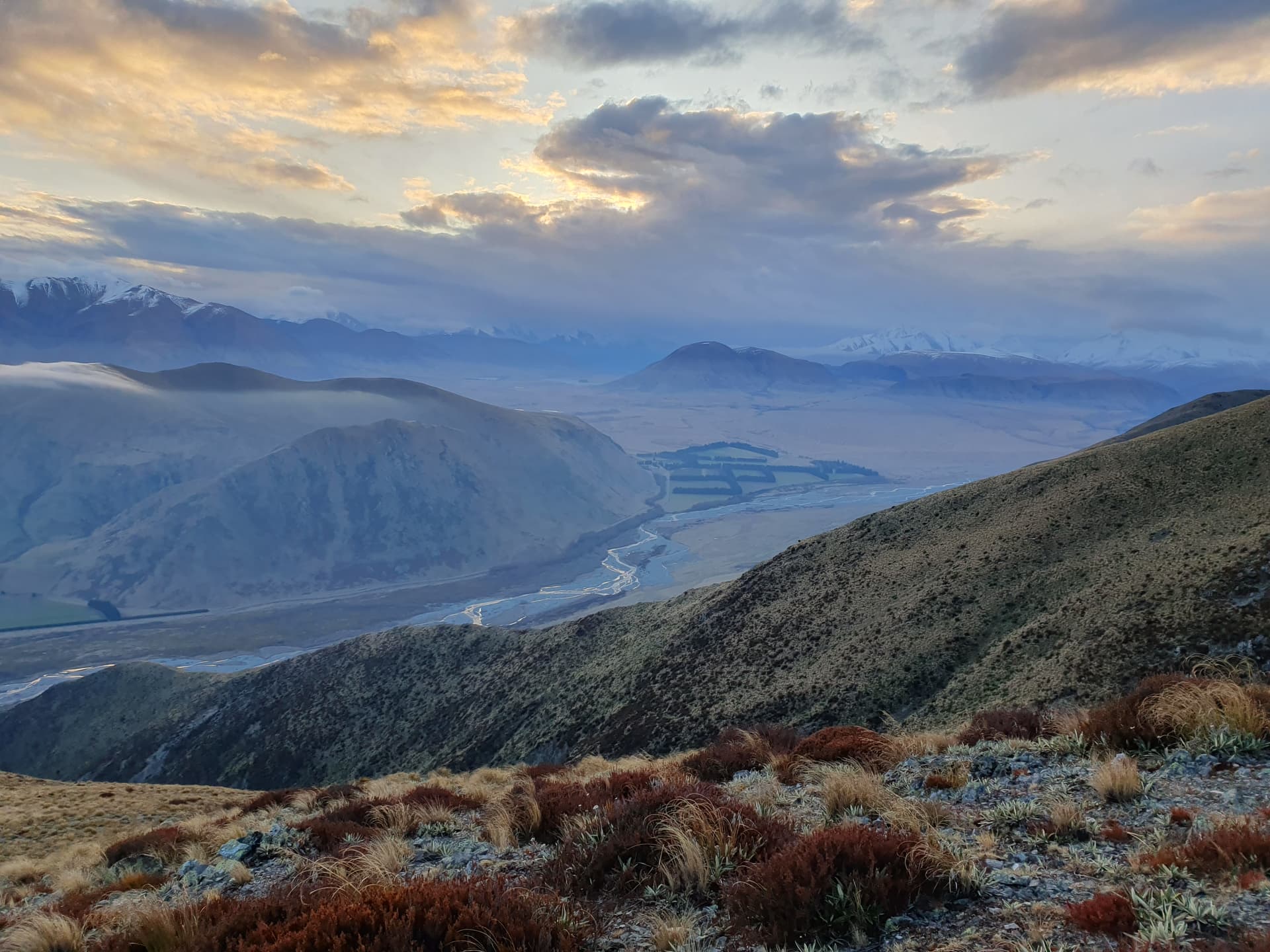
Wed 6th September
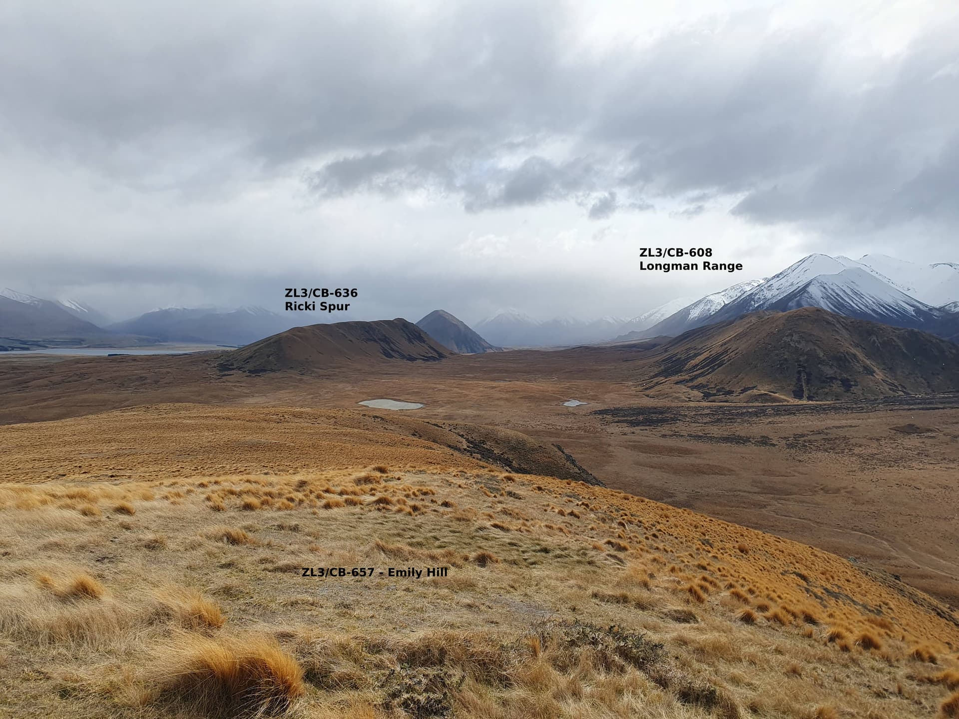
With injuries and poor weather on the Main Divide, I head into Manuka Hut for the night. Three 2-point summits lie north and west of the hut making an easy loop on the way in: Emily Hill [ZL3/CB-657], Ricki Spur [ZL3/CB-636] and Longman Range [ZL3/CB-608].
Why we’re playing in the foothills and not up on the Main Divide!
Day 1: A trifecta on the way to Manuka Hut
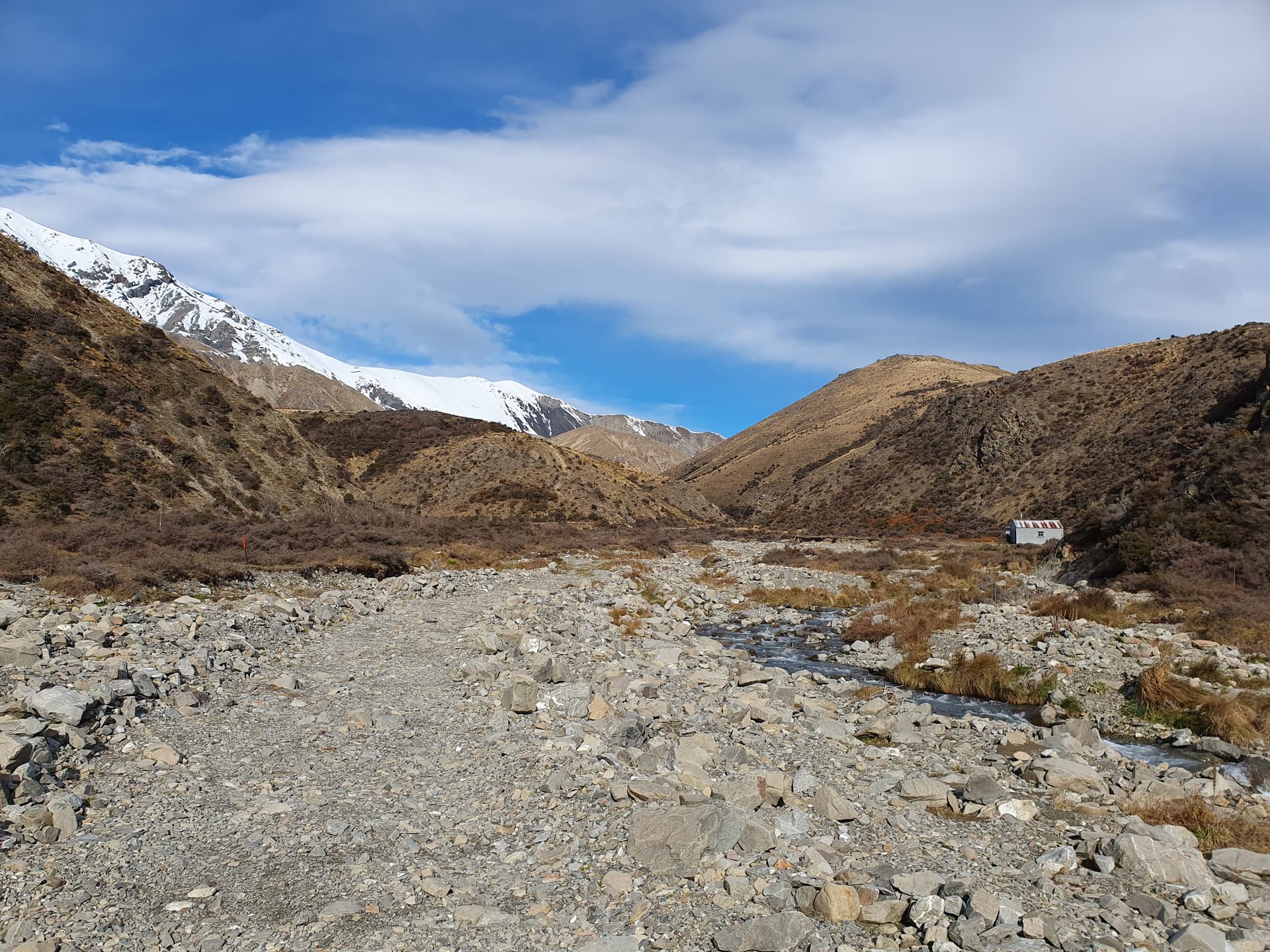
Manuka Hut, tucked between Manuka Range & Winterslow Range
Thur 7th September
With the rain cleared overnight, and the wind due to die off in the afternoon, I head onto the low Manuka Range [ZL3/CB-598] above the hut for a morning activation. Sadly, whilst the skies are clear, the wind is still 40-60kph and discourages the ambitious 6-point snow-capped 2nd summit of Winterslow Range [ZL3/CB-380].
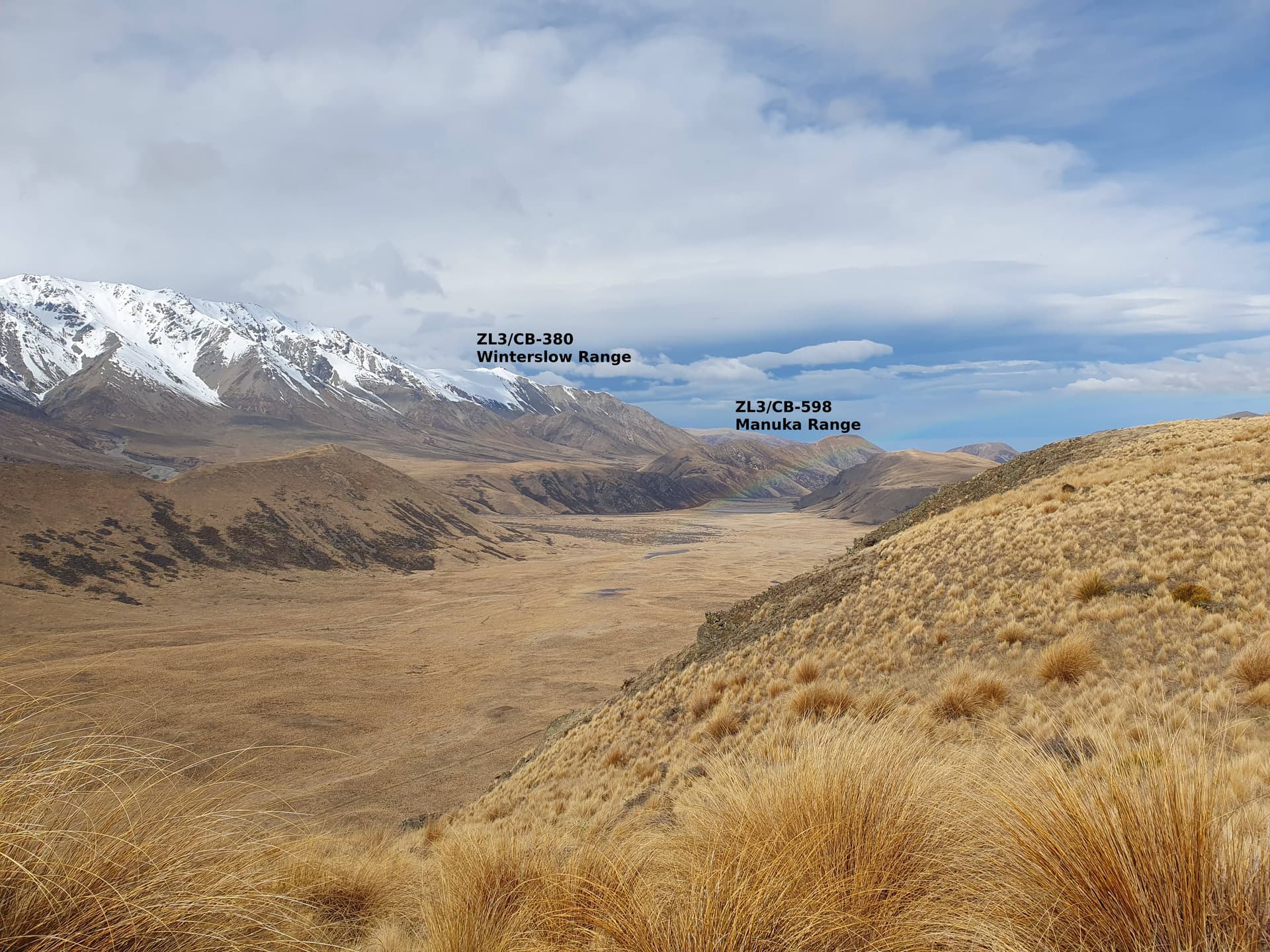
Plans for Day 2: Manuka Range & Winterslow Range
Playing in the rats and mice whilst the mountains look down on us
Plan B: more rats & mice!
So instead I loop back west over a couple of lower peaks ZL3/CB-649 and ZL3/CB-514 to return to my truck at the Lake Emily roadend.
10 minutes drive away across the valley at the Paddle creek roadend, there are already two 2-bay horsefloats parkedup. I decide to abandon plans for a stay at the cozy, but probably full, Boundary Creek Hut below Dogs Hill. Instead, I head for the more luxurious lodgings at Client Hills Station.
Fri 8th September

Chill mornings at Client Hills
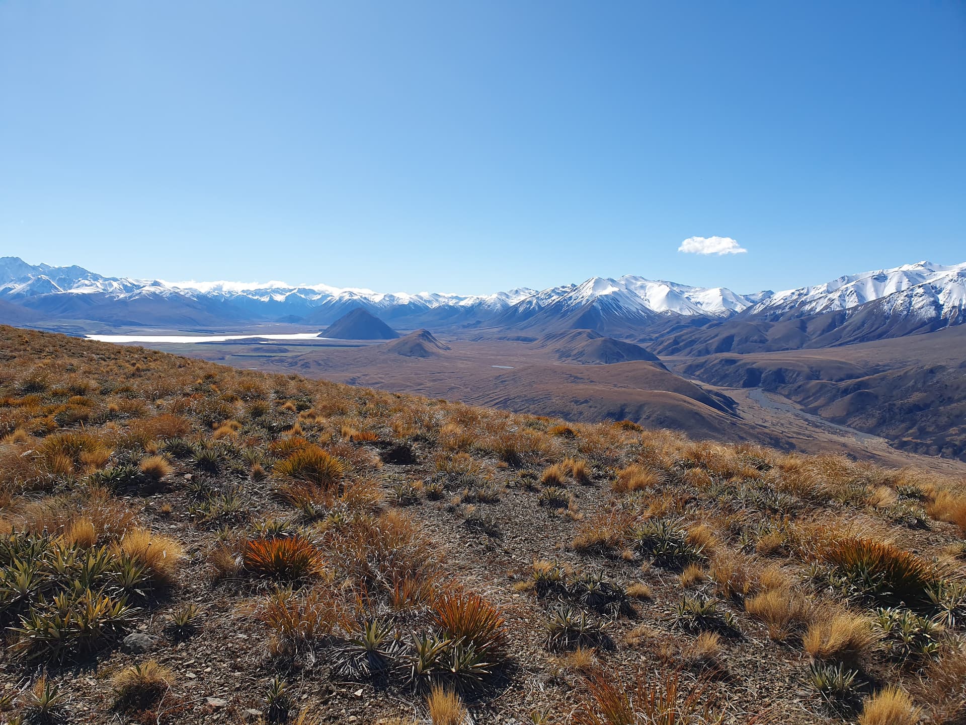
For my third full day in the Hakatere basin, I decide on a loop into the Dogs Range to take in Dogs Hill (north) [ZL3/CB-572] and Mt Guy [ZL3/CB-521].
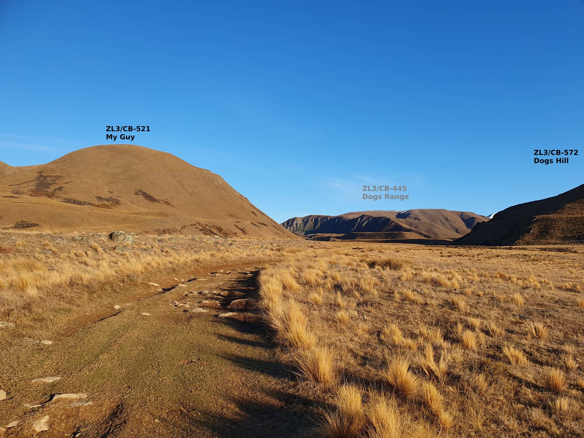
Dogs Hill and Mt Guy. Dogs Range still unactivated beyond
Upper Ashburton River, Arrowsmith Range. Boundary Stream Hut at confluence below. From Dogs Hill
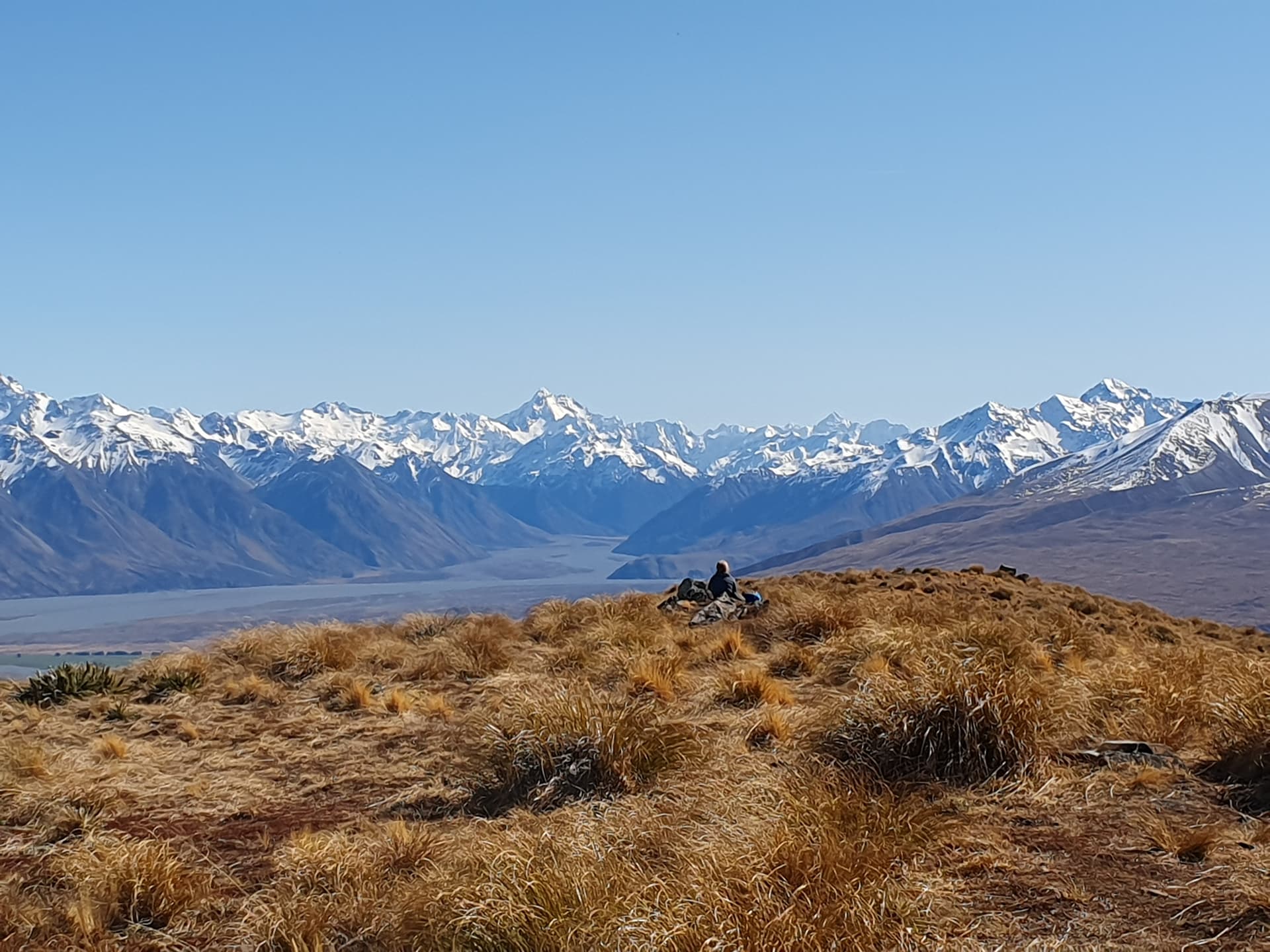
Unaccustomed company, Mt Gow
Aiming for a pre-dawn start the next day, I head 10km up the valley for the night to Camp Lake at the foot of Mt Harper.
Camped at Lake Camp
Saturday 9th Sept
The alarm is set for 5:30 but I’m awake and up at 5am, the alarm embarrassingly sounding as I walk through the slumbering campground towards the base of the peak.
Sunrise ascending Mt Harper
The climb takes 2hrs15 in the luxurious cool of the pre-dawn. There is no official track beyond the base of the hill, but the ground trail is well enough trodden to follow by torchlight. And after all - if you’re climbing, you’re going the right way!
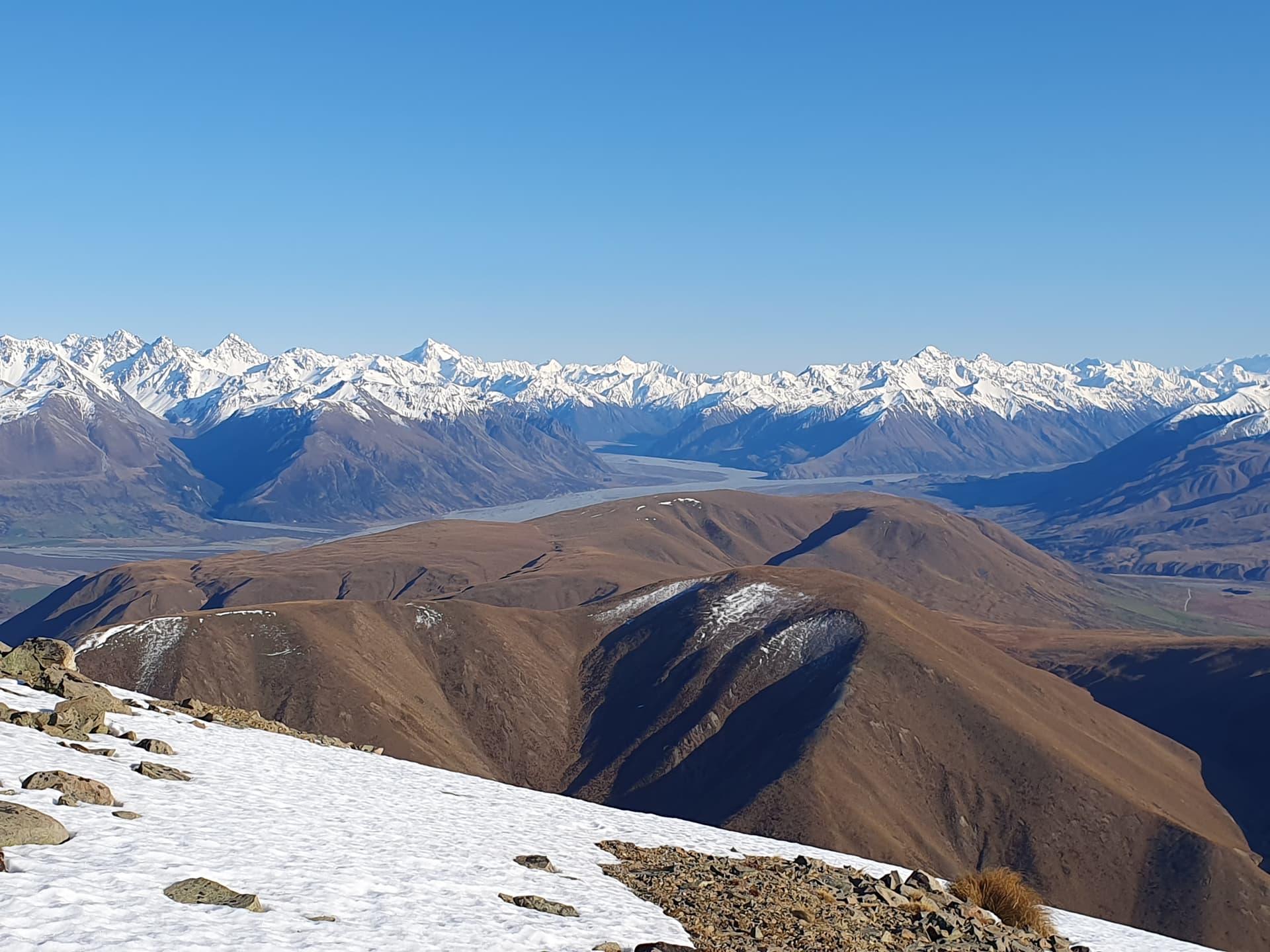
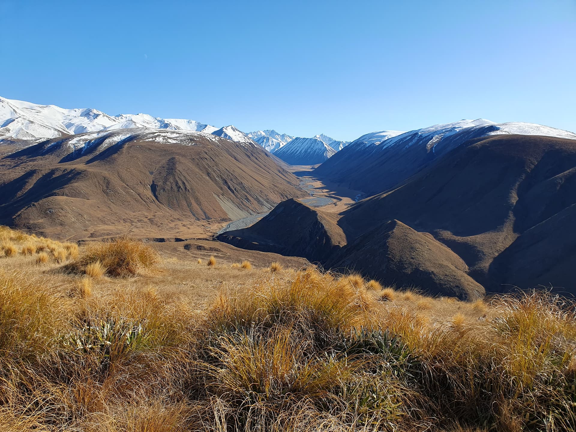
Upper Rangitata from Mt Harper
Views of the divide from the summit are, as usual, reward in themselves.
Sunday 10th September
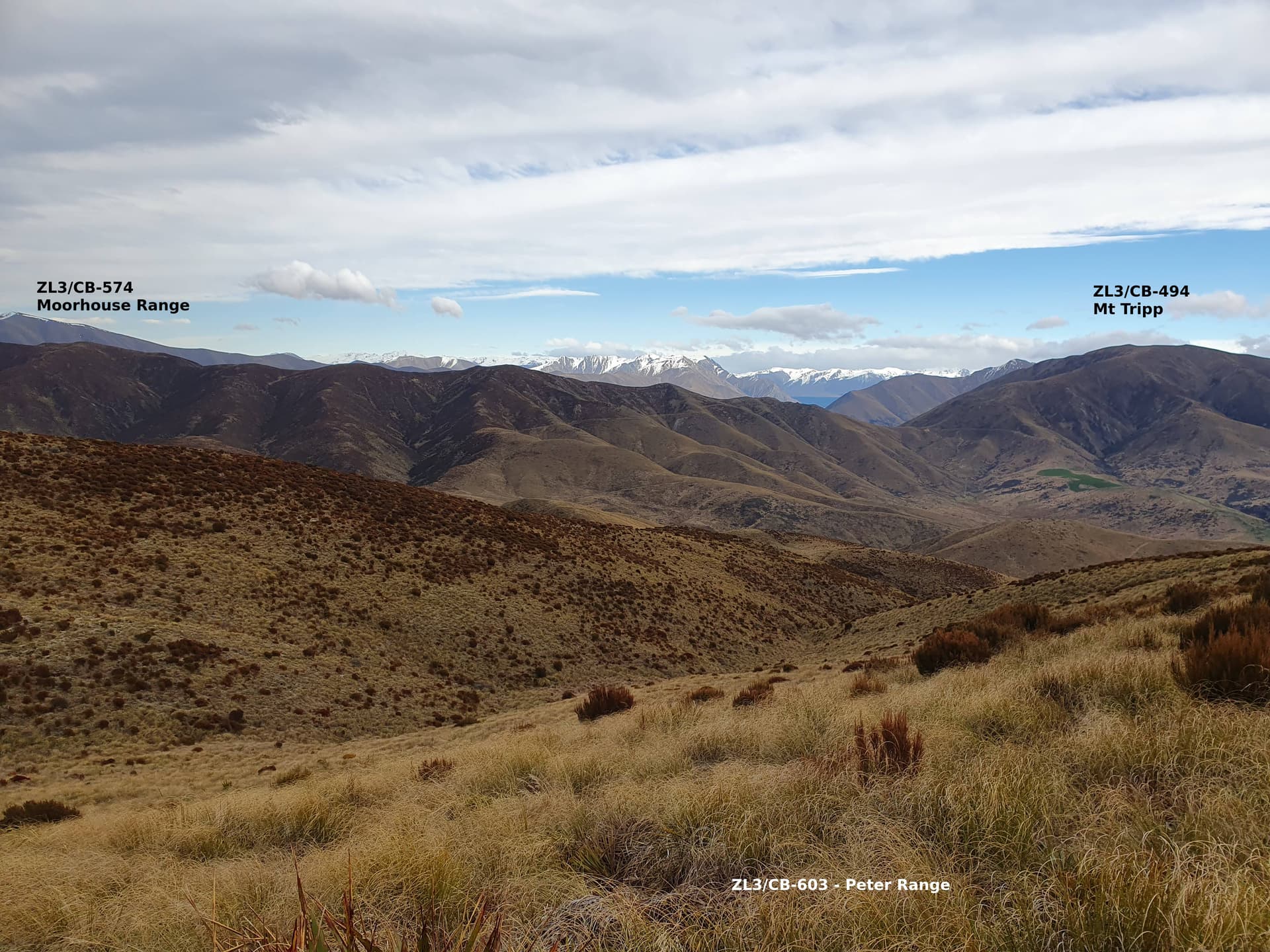
A circuit of Moorhouse Range
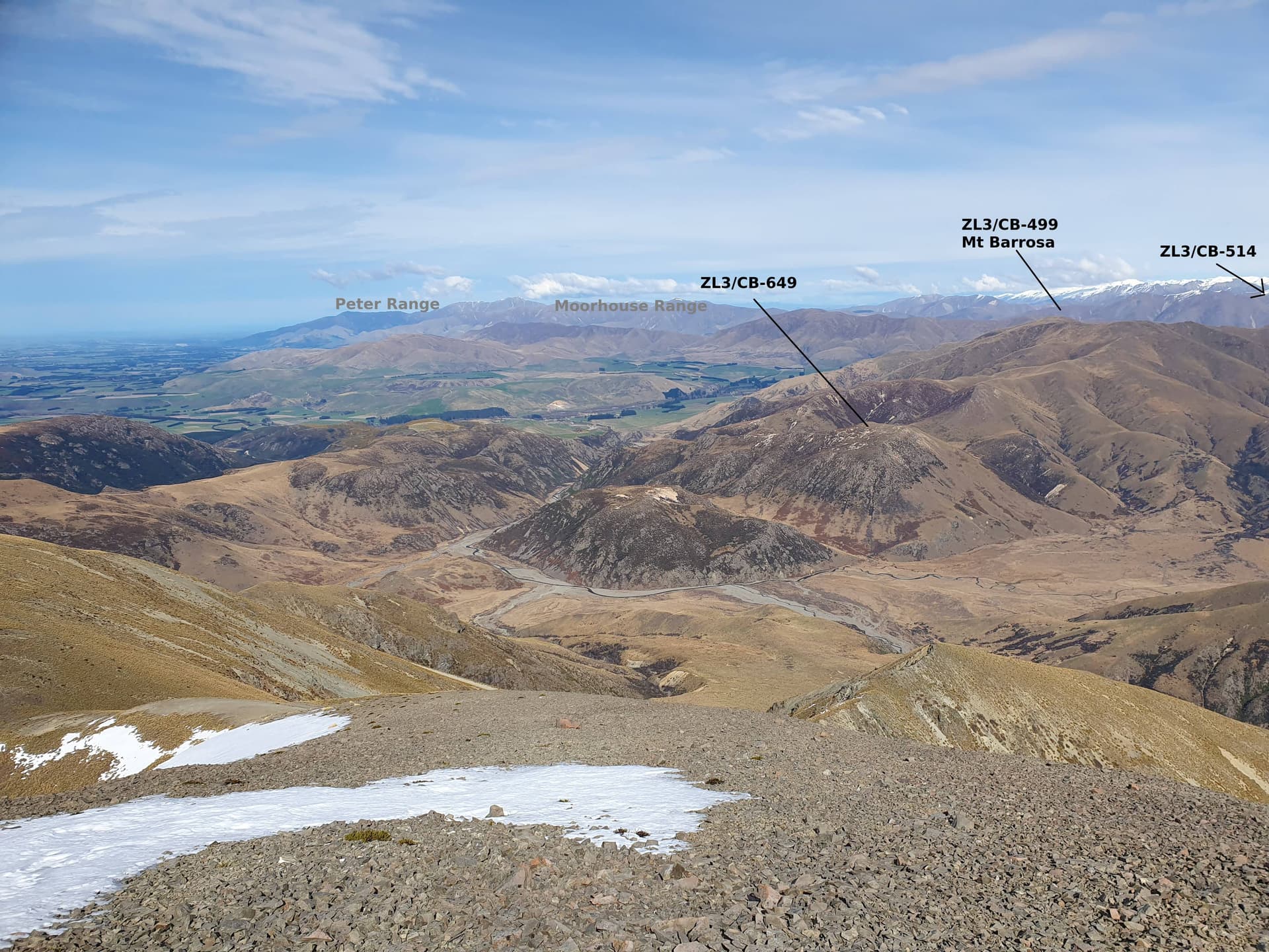
Three summits amongst the turpentine scrub of Moorhouse Range. Peter Range [ZL3/CB-603] is not inside the park, but a legal road-line roughly follows the ridgeline from the park boundary into the activation zone - 2km of GPS-watching to remain within the legal 20m wide strip of crown land. Typically, the roadline is not well surveyed, and a 3 places ‘falls off’ the side of the ridge, leading to frustrating sidling. But we make the AZ without setting foot on private land - always a fun challenge!
Back at the park I follow the fenceline west to Brown Saddle and climb to Mt Tripp. The return journey follows the ridgeline through waist-high turpentine scrub. I expect slow progress, but a good ground trail makes for easy going.
Monday 11th Sept
A night in the luxury of the Mt Somers campground. The forecast for Monday is rain, clearing then showers developing in the afternoon. But Monday is the only still day in the first half of the week. I’ve been dreaming of summiting the Winterslow Range for a couple of years now, and decide to give it a go, so long at it looks clear at dawn.
The necessity to get a visual on the summit before setting off leads to a late departure, 8am at the roadend rather than the preferred 5-6am for snow-capped peaks. It takes 50 minutes with a full pack into Woolshed Creek Hut at 800m where I drop overnight gear - just in case of a late return - and continue 1km up the valley before cutting onto the spur leading to the 1696m Winsterlow Range, The western slopes remain mostly snow-free to 1450m, and so the crampons only go on for the final 200m. The snow is thankfully still well crusted with ice for most of the ascent, though where I do break through it’s often waist deep.
A stiff NW is buffeting the summit, and the activation is carried out on a small snow-shelf kicked into the protected eastern face.
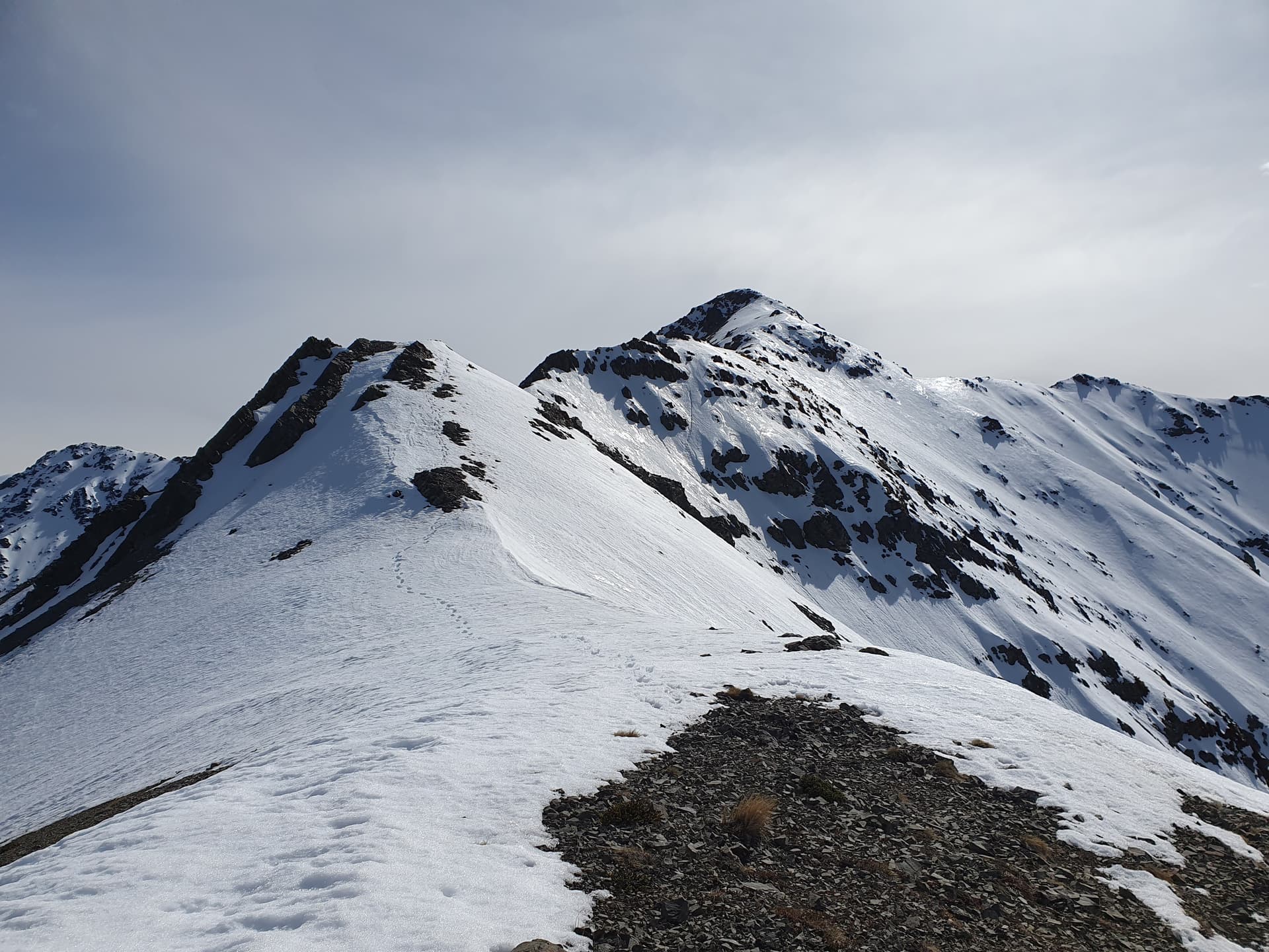
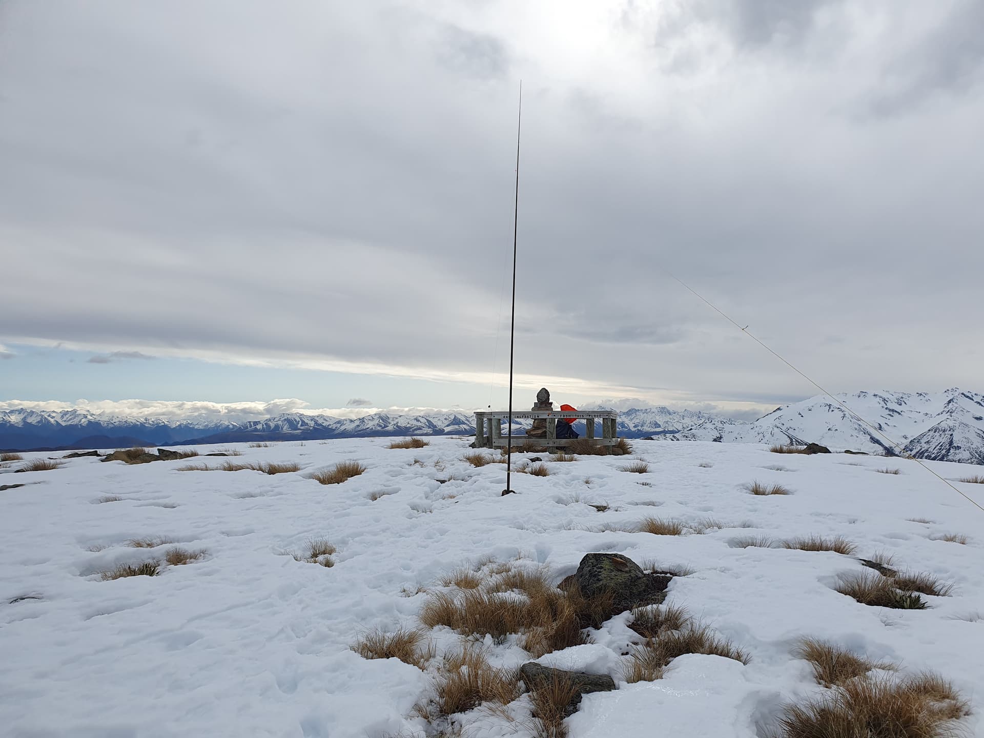
Winterslow Range, finally!
Lunchtime sees me back at Woolshed Creek hut (where I had accidentally left my lunch). The final summit left the plan dreamt up the previous Monday night-time lies just 5km to the east, 900m above us: Mt Somers.
Mt Somers
Tuesday 12th Sept
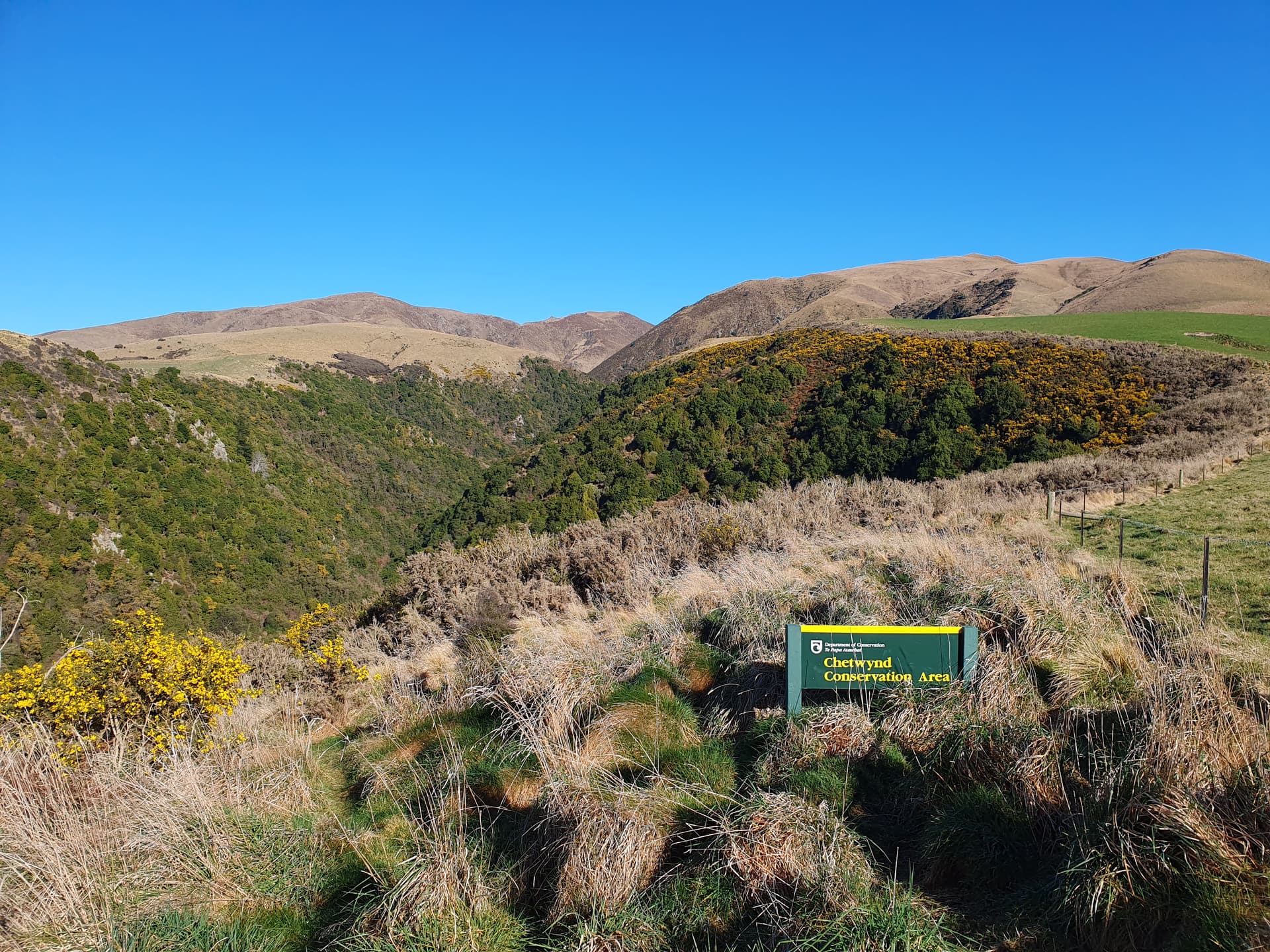
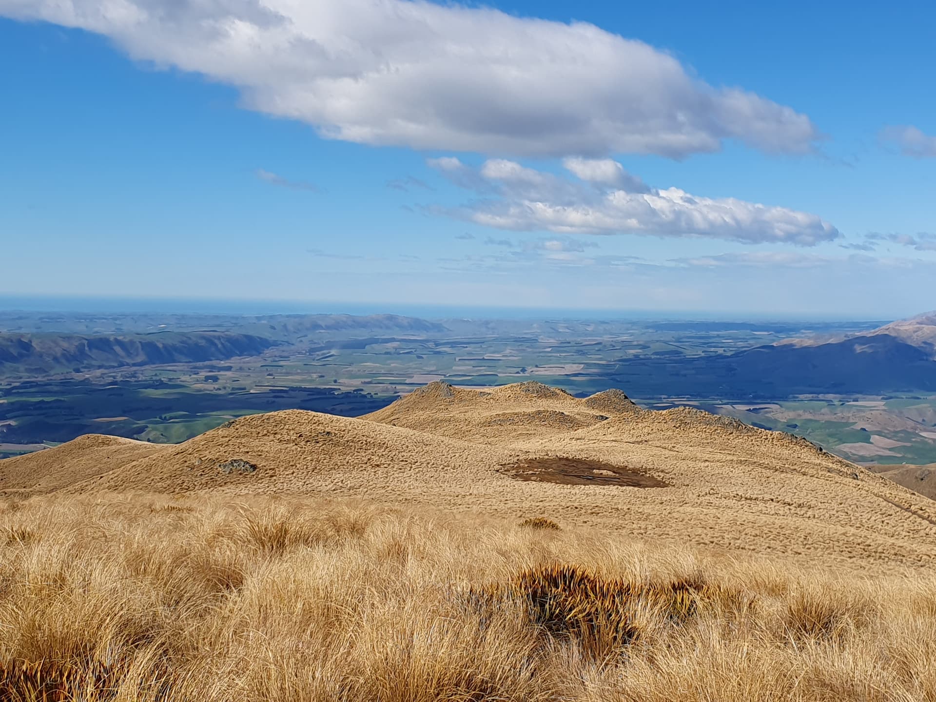
Objectives achieved it’s time to head home. But with a long drive it seems sensible to break the journey. The 1323m Chetwynd, [ZL3-CB-518] above Fairlie seems a good option. A pleasant 6km ascent along retired farm fracks to the summit.
Chetwynd
Wind is again buffetting the peak, where parts of an old repeater station lie scattered, the frame housing the solar panels rocking worryingly with each gust.
Chetwynd
I’ve activated two of the four peaks can only be accessed when the Mt Dobson Skifield road is open, and I decide to pick off one more on the way back to Central. On the maps it looks like an easy 2km sidle from the skifield road at the park boundary to [ZL3/CB-561], but it turns out to be 2km of turpentine-scrub hell battling in and out of three valleys on the way.
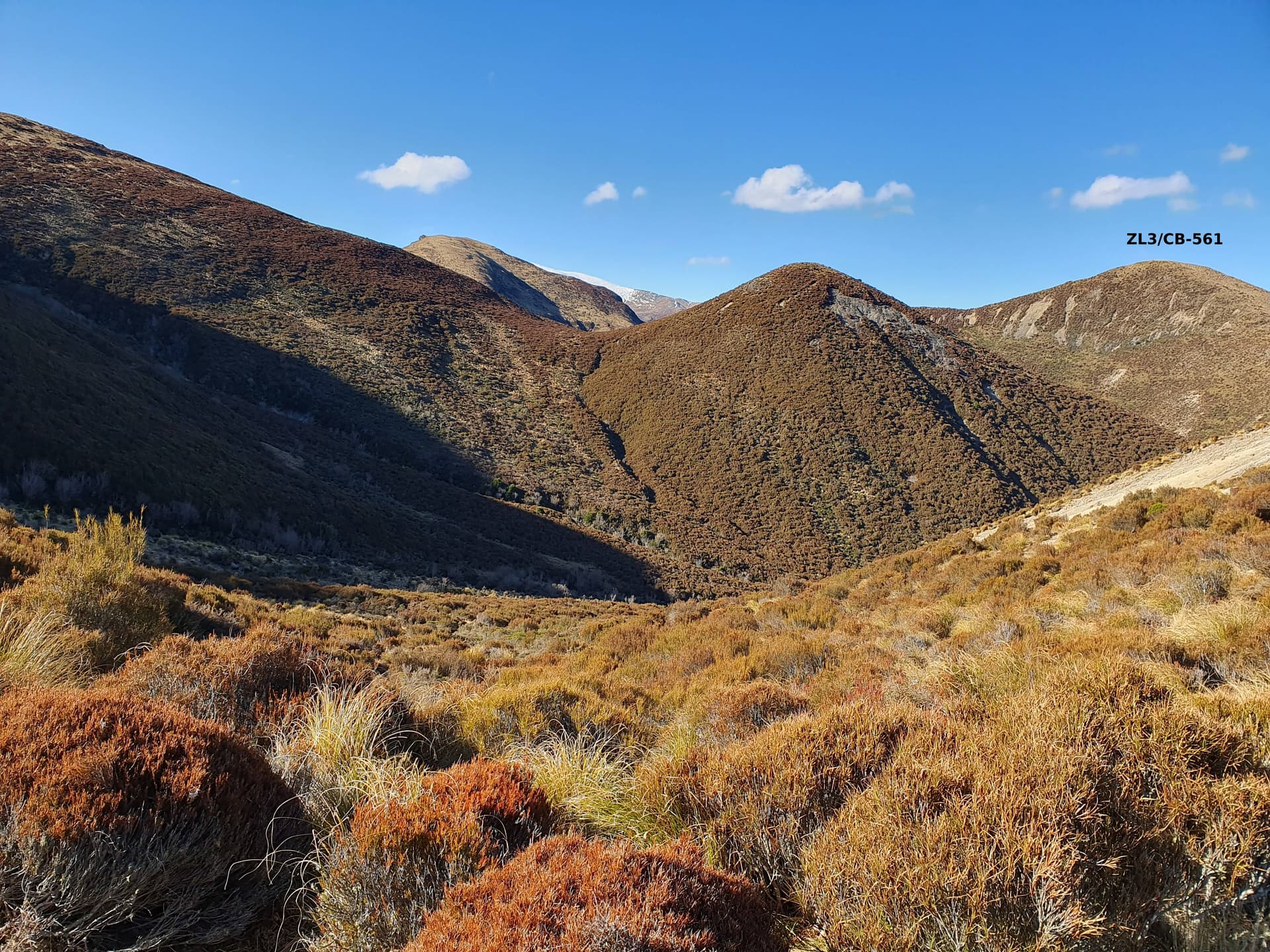
Scrubby hell to reach ZL3/CB-561
===
Summary:
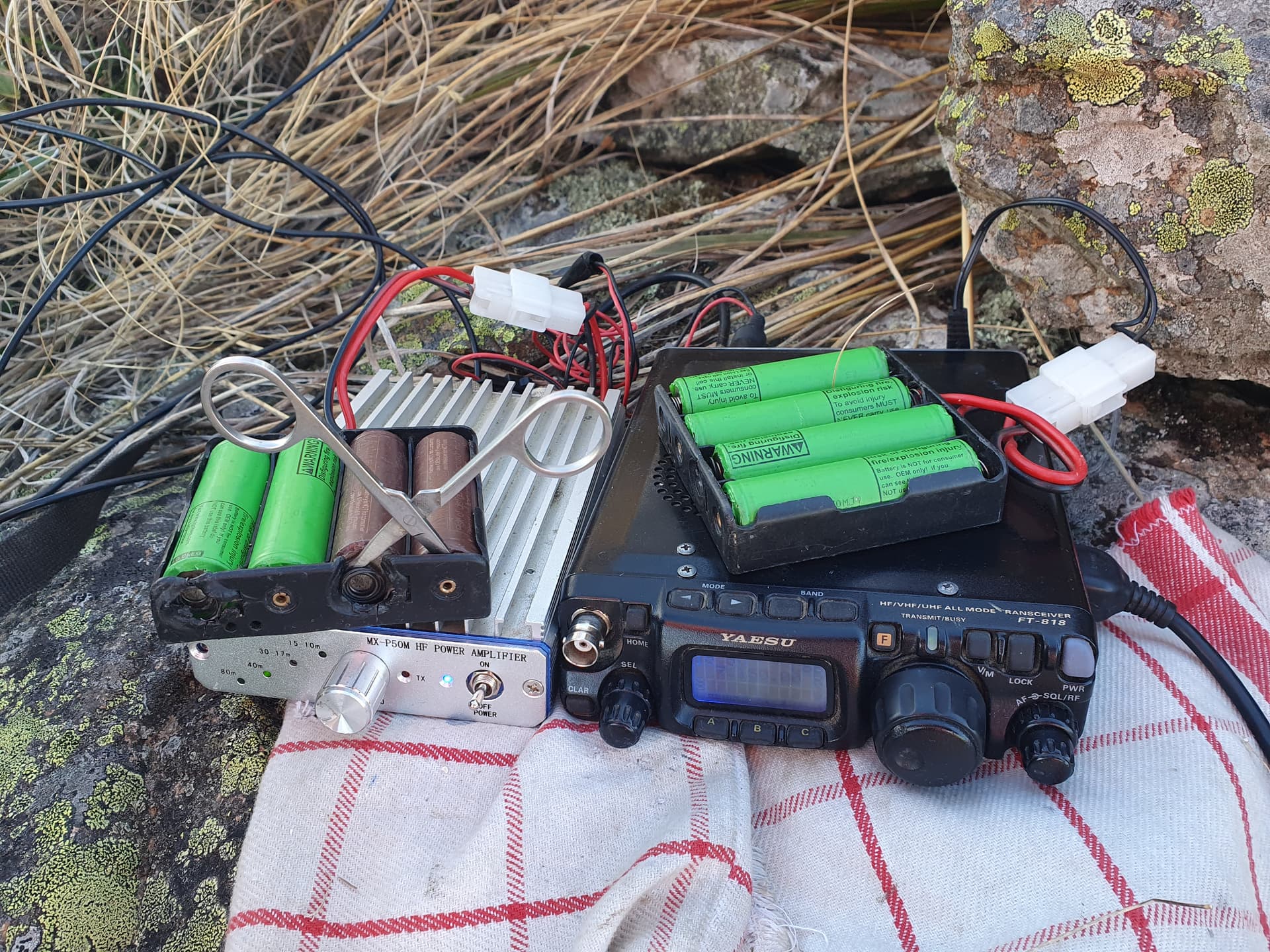
Radio: FT-818
Amp: MX-P50M driven to produce 20w
Antenna: Home-built EndFed 40m HalfWave
Power: 4x18650 (radio), 4x18650 (amp)
Breakages & failures:
- Elements 1,2 & 4 of SOTA-pole (wind damage, two incidents)
- 1 x internal connection in battery bank
- Matching unit BNC socket (how do you get the ice out?)
Summits:
| Date | Name | Code | Base | Summit | Alt Gain | Contacts | Points |
|---|---|---|---|---|---|---|---|
| 05/09 | Mt Barrosa | ZL3/CB-499 | 540m | 1304m | 764m | 53 | 4 |
| 06/09 | Emily Hill | ZL3/CB-657 | 660m | 963m | 303m | 16 | 2 |
| 06/09 | Ricki Spur | ZL3/CB-636 | 760m | 1014m | 254m | 9 | 2 |
| 06/09 | Longman Range | ZL3/CB-608 | 800m | 1054m | 254m | 6 | 2 |
| 07/09 | Manuka Range | ZL3/CB-598 | 780m | 1083m | 303m | 5 | 2 |
| 07/09 | ZL3/CB-649 | 600m | 978m | 378m | 13 | 2 | |
| 07/09 | ZL3/CB-514 | 600m | 1331m | 731m | 18 | 4 | |
| 08/09 | Dogs Hill (nth) | ZL3/CB-572 | 720m | 1169m | 449m | 17 | 4 |
| 08/09 | Mt Guy | ZL3/CB-521 | 800m | 1319m | 519m | 13 | 4 |
| 09/09 | Mt Harper | ZL3/CB-313 | 680m | 1829m | 1149m | 8 | 8 |
| 09/09 | Rockwood Forest | ZL3/CB-753 | 400m | 775m | 375m | 8 | 2 |
| 10/09 | Peter Range | ZL3/CB-603 | 480m | 1065m | 585m | 6 | 2 |
| 10/09 | Mt Tripp | ZL3/CB-494 | 720m | 1378m | 658m | 19 | 4 |
| 10/09 | Moorhouse Range | ZL3/CB-574 | 898m | 1158m | 260m | 16 | 2 |
| 11/09 | Winterslow Range | ZL3/CB-380 | 520m | 1700m | 1180m | 12 | 6 |
| 11/09 | Mt Somers | ZL3/CB-387 | 800m | 1688m | 888m | 13 | 6 |
| 12/09 | Chetwynd | ZL3/CB-518 | 500m | 1323m | 823m | 9 | 4 |
| 12/09 | ZL3/CB-561 | 1000m | 1192m | 192m | 6 | 4 | |
| Total | (incl winter bonus) | 10065m | 247 | 118 |
(ascents for subsequent peaks show my route from previous summit, not total from carpark. Ascents are altitude gain from low point to high point and do not include intermediate climbs and descents)