A South Borland circuit
Fresh off a work + radio trip to Secretary island (trip report to come soon) I found myself in Te Anau with a couple of days free. A glance at ontheair.nz showed a tidy collection of unactivated SOTA peaks clustered around the Borland Saddle.
The Manapouri Hydro ‘Think Big’ project of the late 60’s and early 70’s diverted the outflow of Lake Manapouri through a tunnel under the Southern Alps to the sea at Doubtful Sound, adding ~800MW of power to the NZ National Grid, and in the process building one of the only access roads into the Fiordland National Park - the Borland Road. A rough 4WD track, this services the transmission lines coming out from the West Arm power station through otherwise virgin temperate rain forest, and gives convenient recreational access into some amazing country.
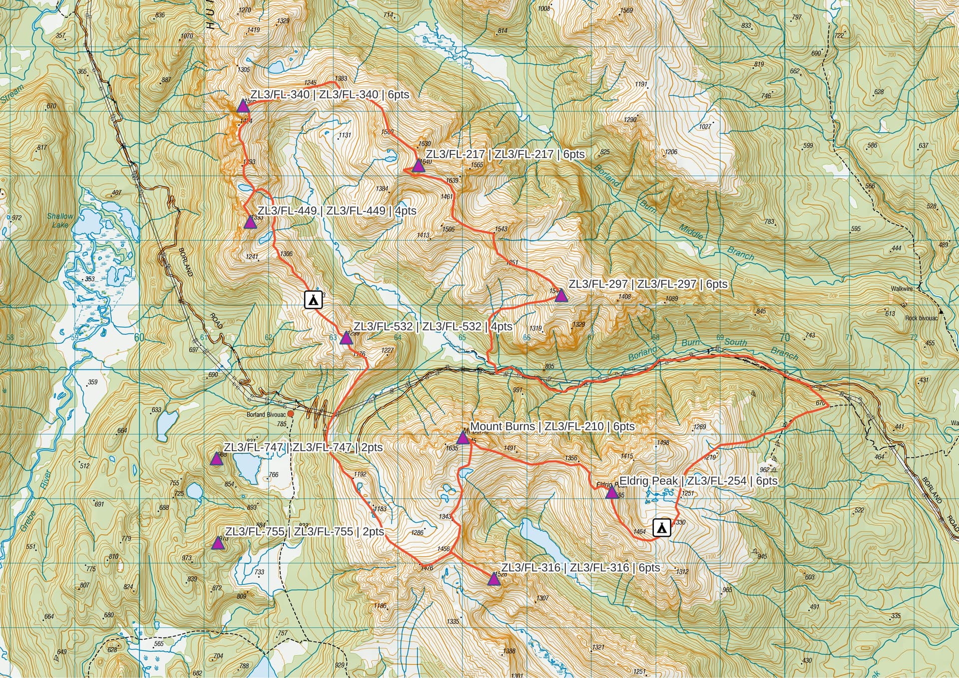
My plan for my ‘weekend’ was to circumnavigate the South Branch of the Borland River, taking in 8 unactivated SOTA summits on the way.
I’ve grown used to quiet nights in Te Anau over the last 2 years, frequently the only person in the 200-odd room lodge at the Lakeview Holdiay Park. However, post-covid ‘normal service’ as resumed and my usual resting place was fully booked so I found myself in a campground cabin at Lumsden, 40km to the east. ‘Take cabin 2. The door’s open, leave your $30 in the honesty box’.
=======
I hope that the photographs below speak more than my words can of the country I encountered during the trip.
=======
ZL3/FL-297 From an 8am start where the road leaves the South Borland, an 800m climb up the obvious spur takes me through first open, deer-browsed beech, later low tussock to the first summit of the day.
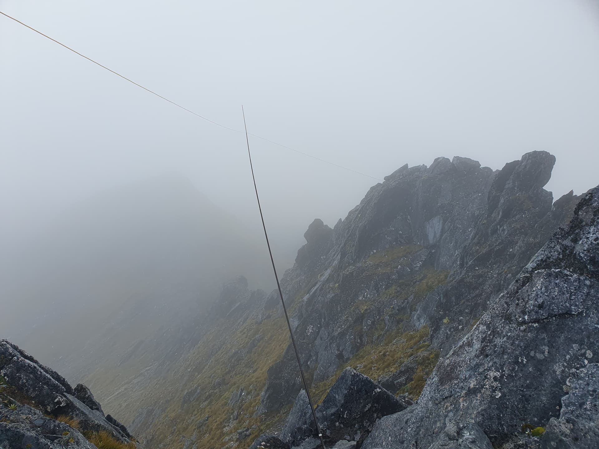
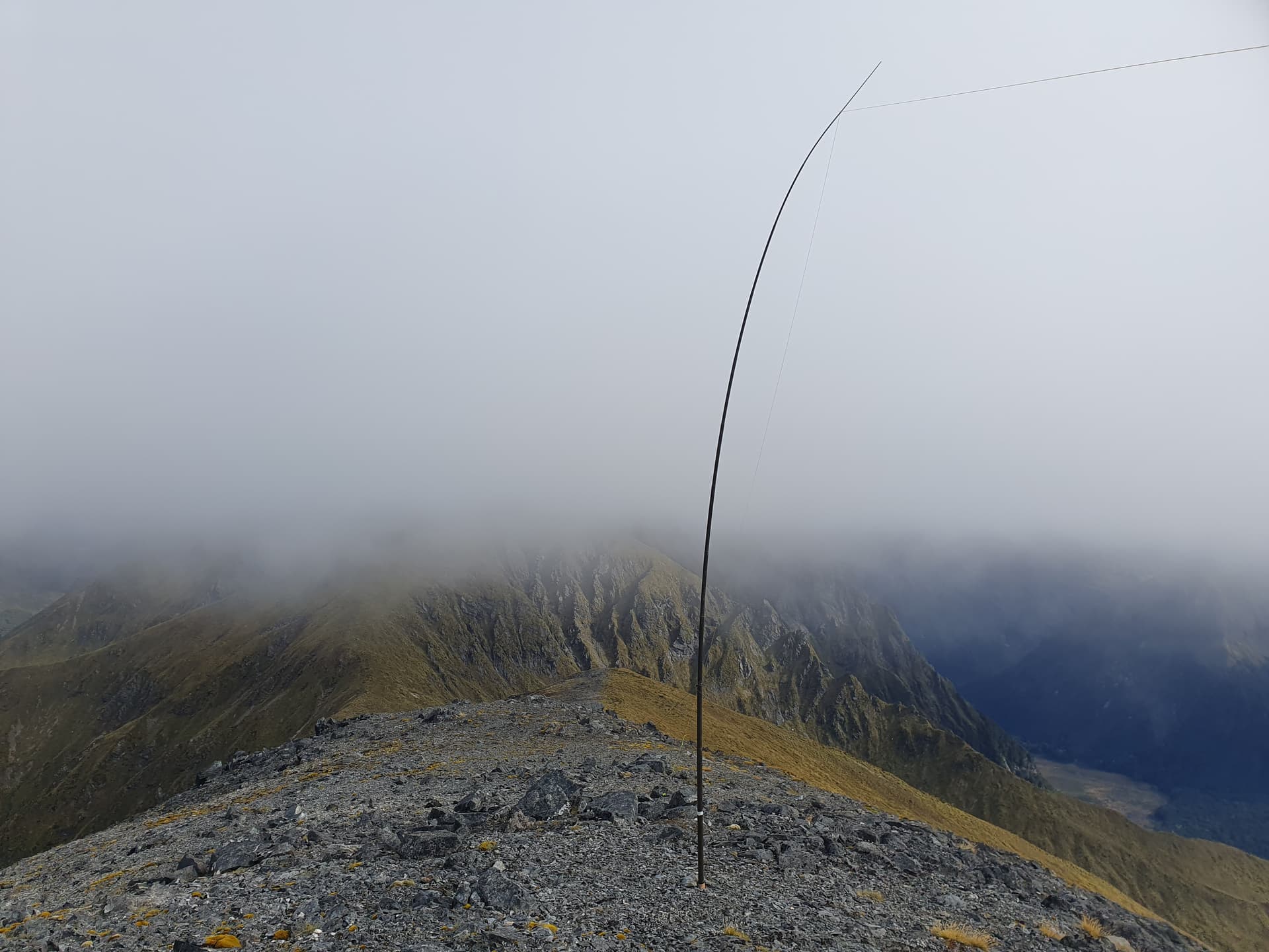
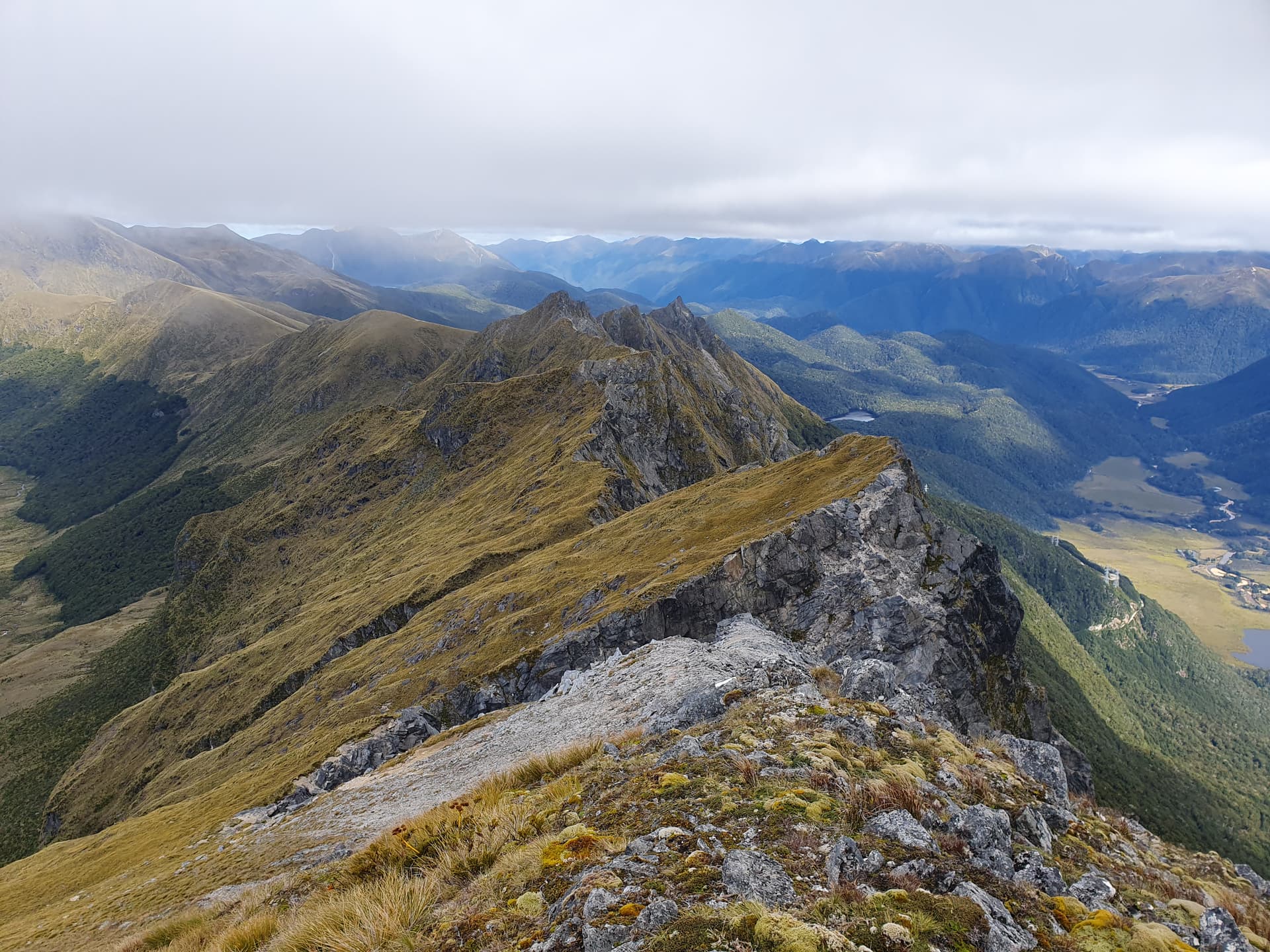
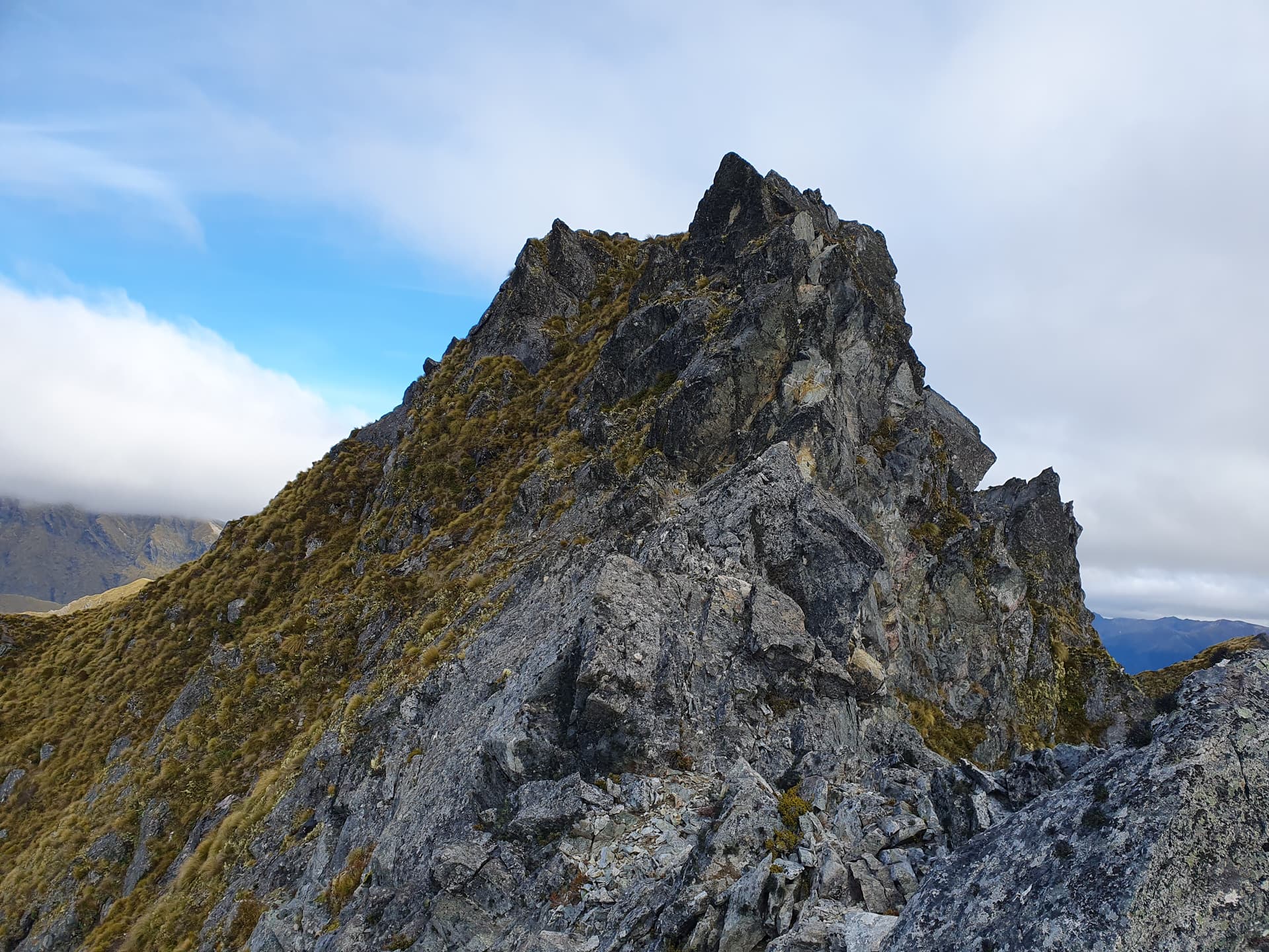
ZL3/FL-217 An initially rounded rock and tussock ridgeline becomes steeper and more knife-edged as we head north-west towards ZL3/FL-217. The final approach to the summit from the east is sawtoothed and impassible without serious climbing equipment and experience, and instead I am forced into a low sidle to scramble the steep western ridge to the summit. Antenna deployment is rather tricky!
North of FL-217 the ridgeline becomes more manageable, meandering north and east to join the watershed with The Grebe at ZL3/FL-340. A single exposed scramble leads to the rounded summit - hidden in cloud.
The western face of the watershed is seriously eroded, with unstable suspended faces and earthquake debris-fields below. Not the place to be when AF8 finally occurs. But the route proves viable with a hundred meters or so of clinging-to-the-ice-axe traverse of sheer snow-grass faces to reach the final ascent.
Sadly the summit of ZL3/FL-449 itself proves inaccessible, but the northern and eastern shoulders are less than 20m below the peak and so within the activation zone. To continue south along the ridgeline it is necessary to return to the tarns north of the peak, descend through a series of strata of bluffs, and then sidle above the scrub to the tarn to its south.
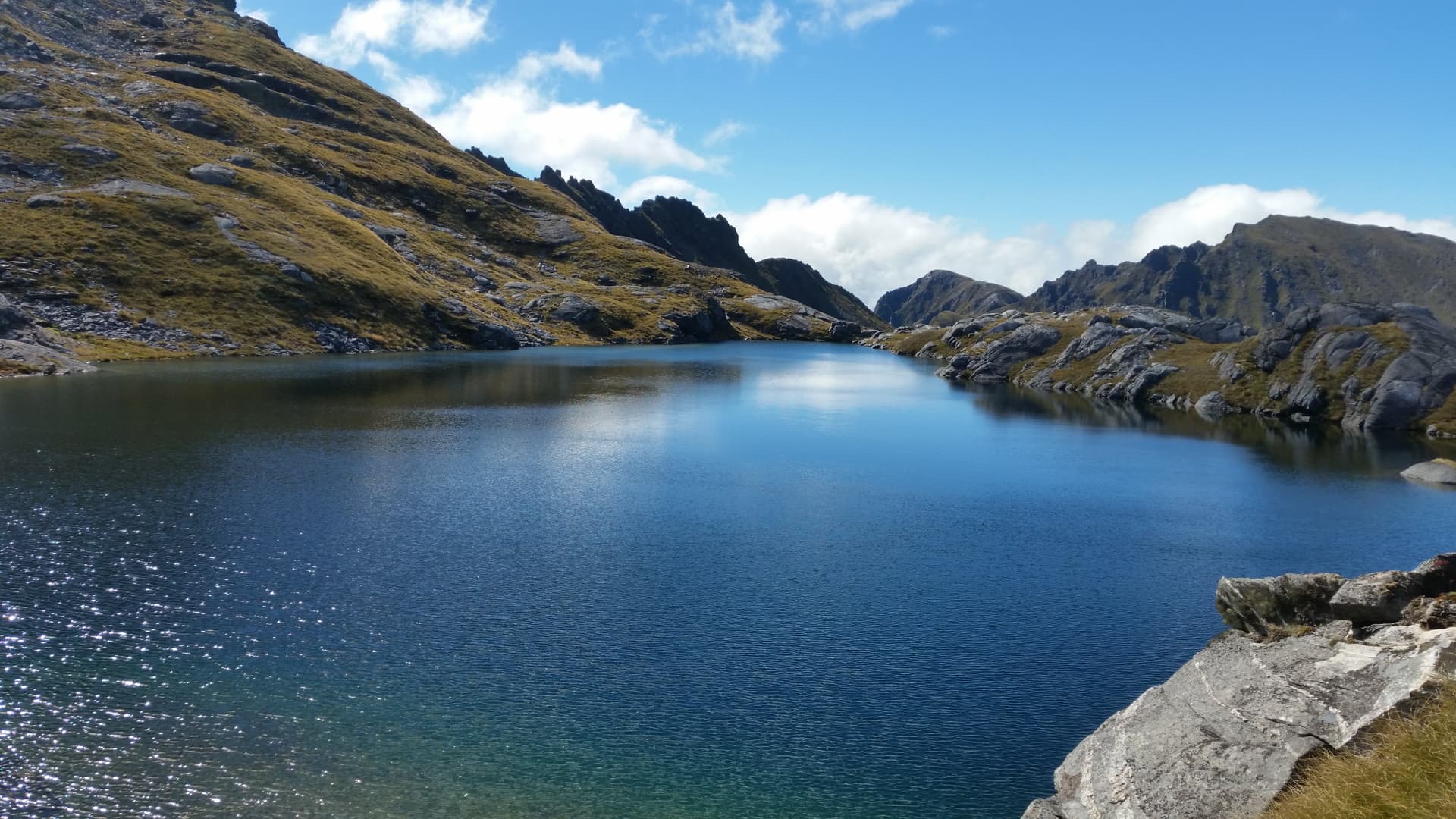
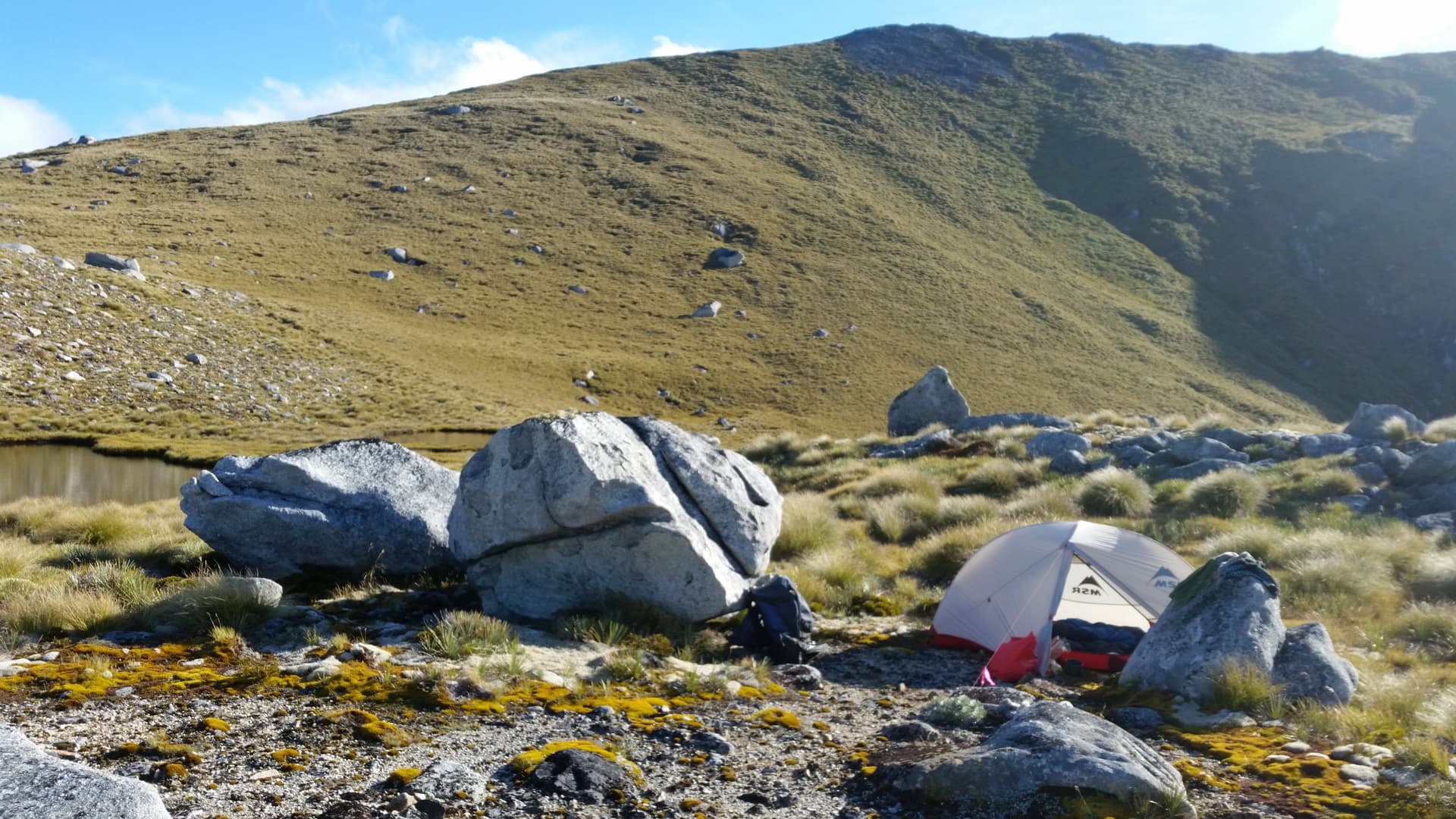
A series of small tarns in the broad saddle just north of ZL3/FL-532 provide a sheltered, watered camp after a long day on the tops. The short 1km/200m ascent to Zl3/FL-523 up tussock faces provides an easy start to day 2 of the trip.
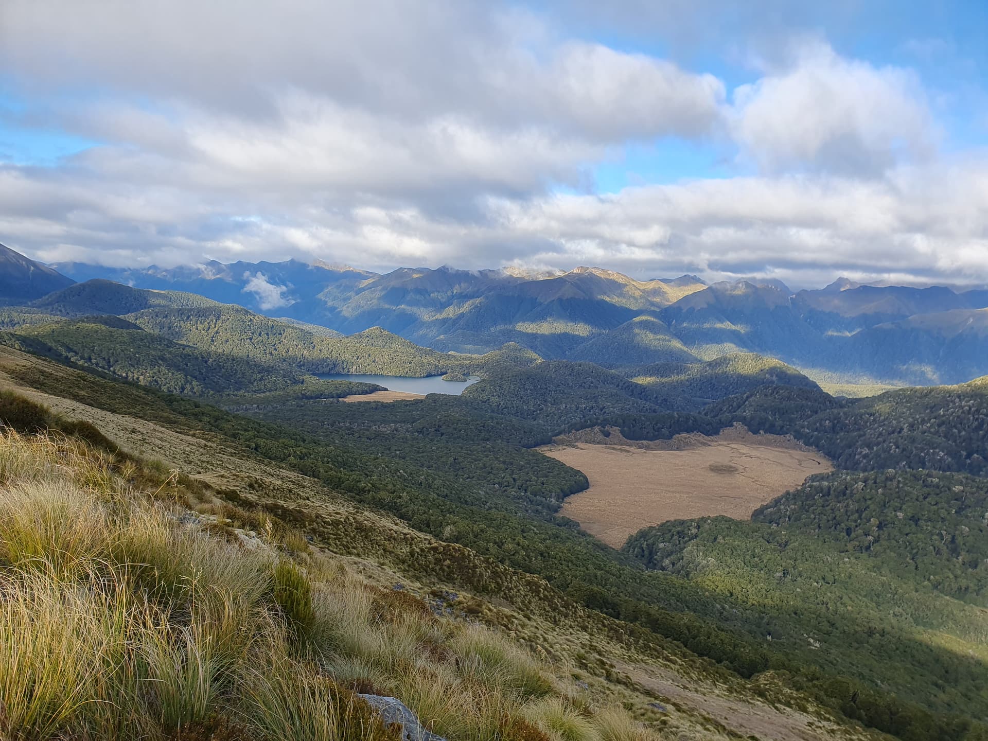
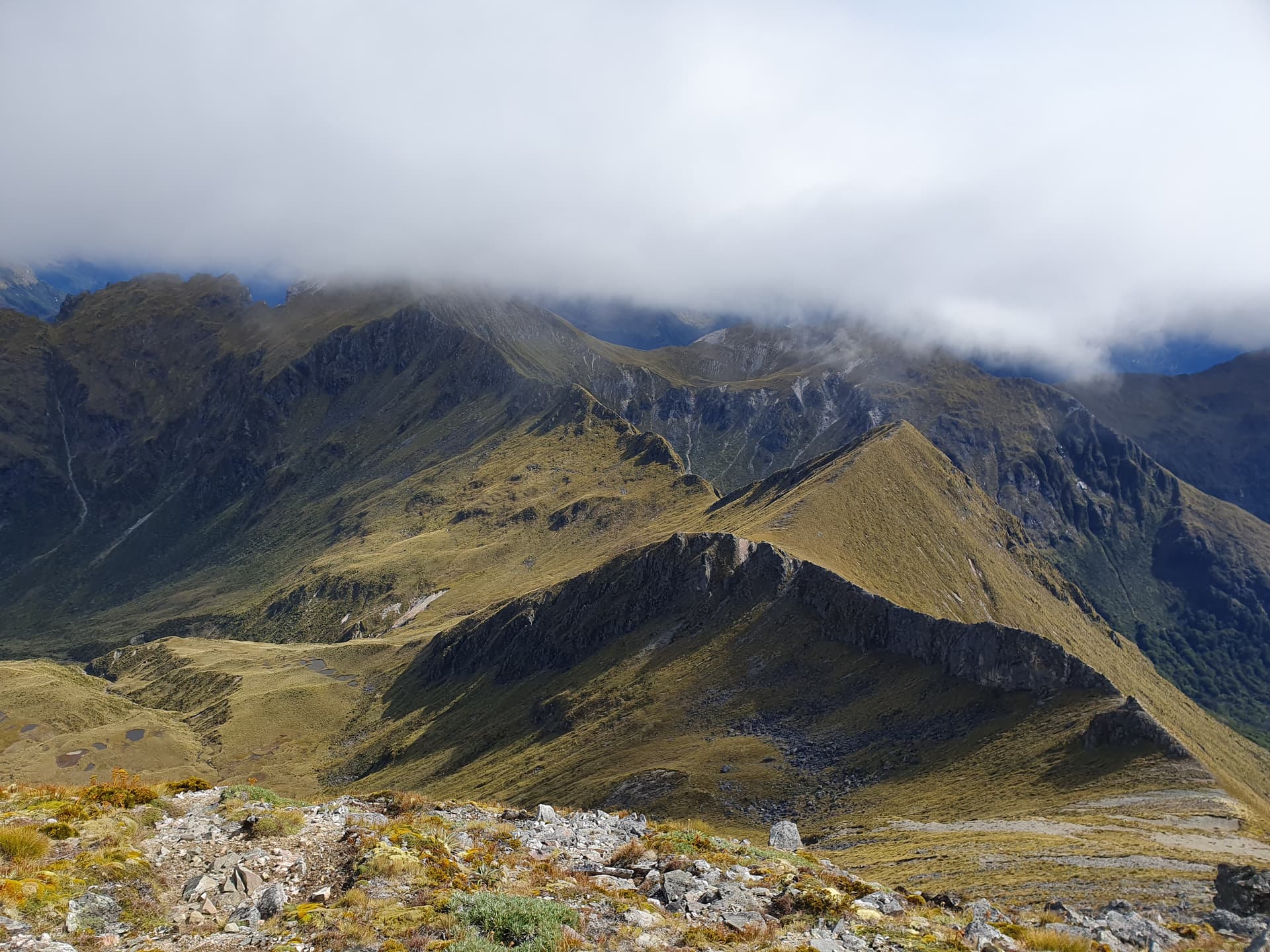
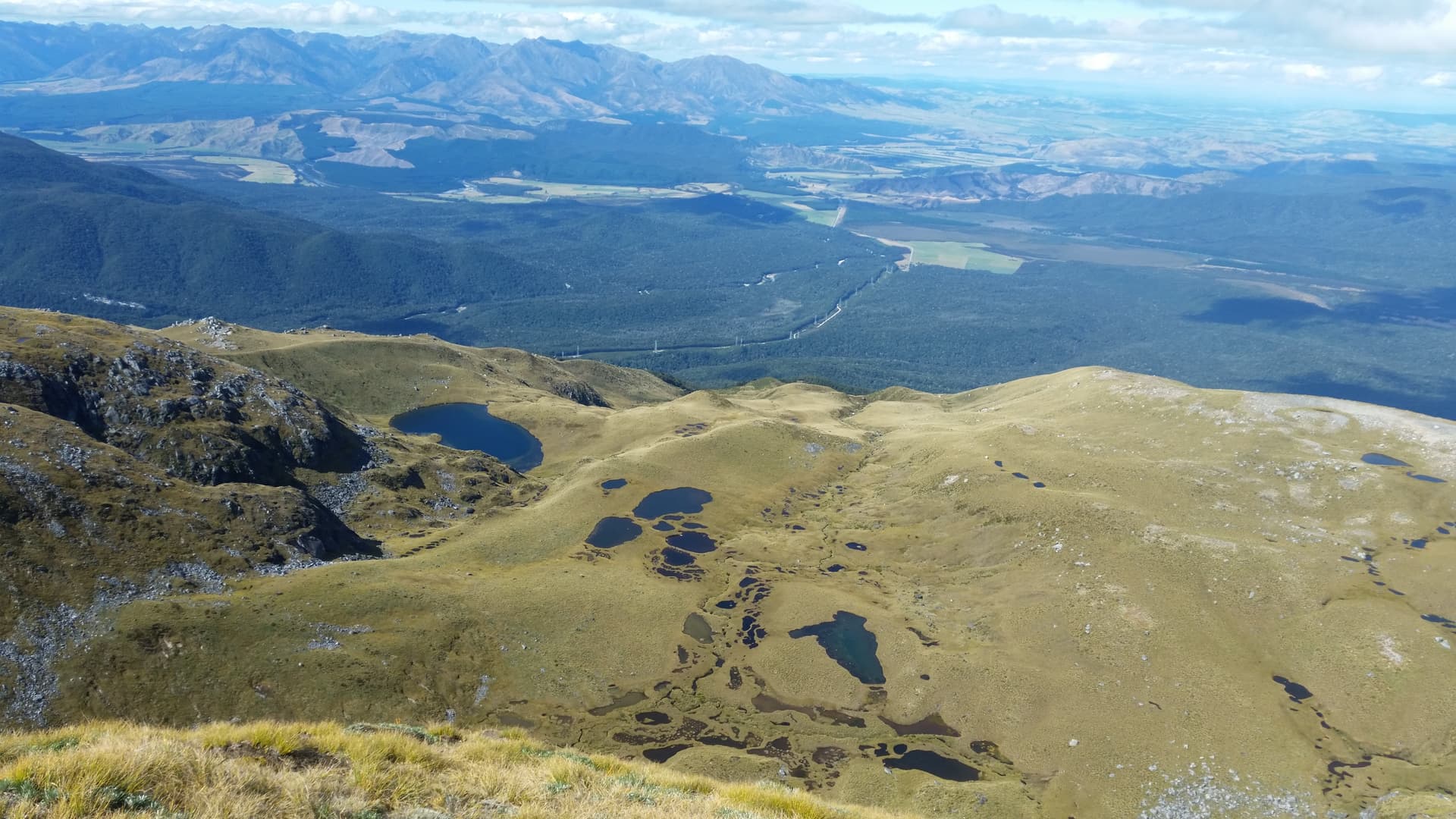
Crossing the Borland Road at the Borland Saddle, we start the easy ascent to the Borland Tops up a handy cut track - the first formal trail of the trip. To the west of the range the vast lake-scattered debris-field is all that remains of this once-tall section of the range, destroyed in a long-past earthquake resulting from a slipping of the Alpine Fault. All that you see below was once part of the mountain range to our left.
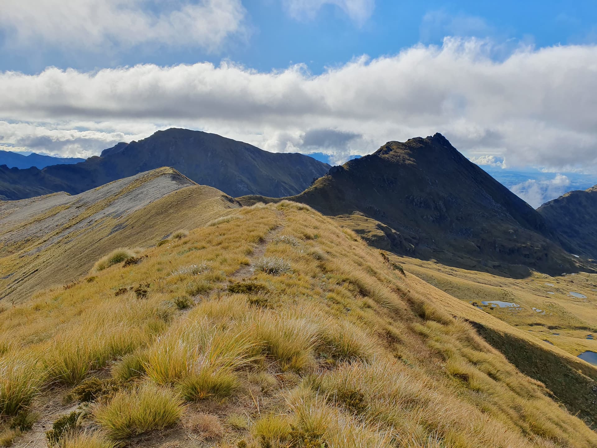
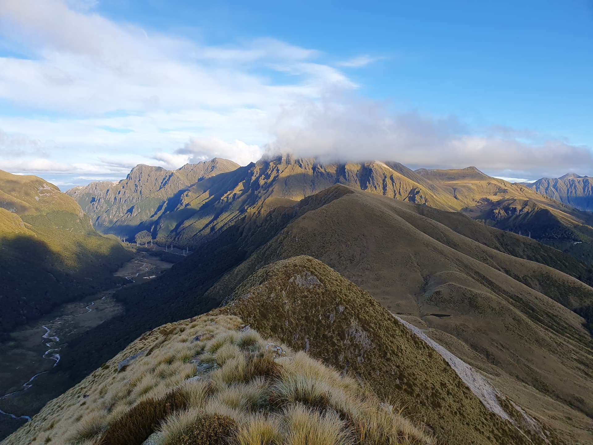
From the end of the cut track at the bushedge, a well used trail leads up onto the spine of the range. My favouriite peak of the trip lies beyond: the unnamed ZL3/FL-316. Sandwiched between Green Lake to the south, and the thin lake at the head of the Pig River to the north; looking west towards the endless Fiordland Ranges; east over the broad Waiau Valley to the rocky barren peaks of the Takitimu Range. A beautiful, but accessible spot - suitable for most operators with reasonable fitness and comfortable on unmarked routes.
An easy tarn-studded saddle leads to Mt Burns (left), ZL3/FL-210 - the first named summit of the trip. As with ZL3/FL-316, Mt Burns would make an easy summit from the Borland Saddle for any operator with reasonable fitness and passable route-finding skills.
The ridgeline beyond (centre) to Eldrig Peak (right), however, is sawtoothed and impassible, and a long, careful sidle of the steep snow-grass faces is required to reach to spur leading to the next peak. Knee-wobbling muscles are well exercised, and well tired by the time we reach the safer terrain of that summit.
After a long, challenging traverse, Mt Eldrig, ZL3/FL-254, provides an easy activation of the last summit of the trip. Tarns below provide good camping spots, but my attempt to descend directly to them cost me an hour and an additional 300m climb back to the ridgeline - the only viable descent route is to arc south, then cross the tarn-dotted plateau back north to pick up the marked, cut track back to the Borland Road.
================
A big thank you to all the chasers on this trip. The crowd seemed to snowball as the journey went on, with many VK and ZL callsigns I’ve not heard before, and several operators managing to catch me on all, or almost all 8 summits. Thanks everybody. @WW7D on 20m proved the only DX of the trip - and a very welcome surprise!