4 Days in the Smokies

Dean-K2JB, Scott-KW4JM and myself (Pat-KI4SVM) recently went on a 4-day backpacking trip activating summits that we all wanted to check off of our respective lists. Our SOTA targets on this trip were four rarely activated summits in the Great Smoky Mountains National Park. The relative remoteness of these summits make them difficult to be done as day hikes, especially for us old men! We may not make huge miles, but we also play radio for a couple hours a day usually. That’s my excuse and I am sticking to it.

To avoid having to get on the road at 4 a.m. I started out my trip a day early and camped close to where we would have to leave a vehicle for our shuttle. I was hoping to sneak out early from work, but the emails and phone calls just kept coming in on Tuesday afternoon. I made it to the Cable Cove campground near Fontana Village just at dusk, which gave me just enough time to install some new hammock goodies before dark. Cable Cove is a really nice Forest Service primitive campground just off of Highway 28. The campsites are spacious and flat.

Cable Cove Campground

I have a thing for odd signs, so this one next to the garbage cans at the campground fit right in.

Cable Cove Campground Sign

5 Likes

Day 1 - Cades Cove to Thunderhead Mtn (W4T/SU-009) to Spence Field Shelter - 8.75 miles, 4240’ EG, 1320’ EL

We were originally planning to hike back out to the other end of Cades Cove, but due to a bridge replacement project on Forge Creek Road blocking any access we decided to hike out to the Twentymile Ranger Station nstead. I met my buddy Scott - KW4JM at the Twentymile Ranger Station where we left his car and we proceeded to drive the infamous Tale of the Dragon (318 curves in 11 miles) around the west end of the park. It was early on a Wednesday morning so we didn’t really slow any sports cars or motorcycles down. Here’s a picture of a previous trip that definitely didn’t set any speed records! :wink:

High Speed Run on the Tail of the Dragon

When we got to a highpoint on the Foothills parkway, we talked to our other companion, Dean - K2JB on 2 meters. He had already started hiking and told us to go to the overflow parking lot, turn and park behind him. The Cades Cove loop road is closed to motor vehicles on Wednesdays so people can walk or ride bicycles through the valley in peace. When we got there at 9:30 there were no more parking spots available and they were turning people away. Dean’s truck was right there at the front of the parking lot and I told the ranger that I was going to park right behind that truck. She said “Oh, you are the other ham radio guys” and let us double park. We were so thankful that Dean had gotten there in the early morning and we didn’t have to hunt for parking.

Cades Cove Parking

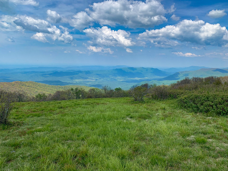
We started hiking up the Anthony Creek trail, stopping at campsite 9 for a break and to tank up on water. The gradient picks up a bit after there and doesn’t get any better when you take a right on the Bote Mtn trail.

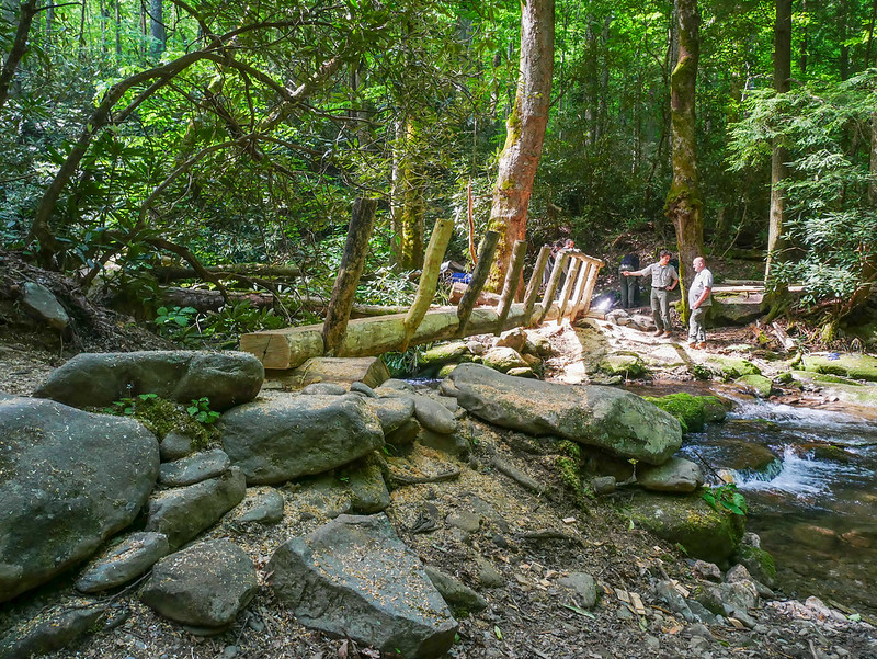
Bridge Construction on Anthony Creek Trail

Campsite 9 Water Source

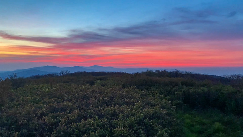
We finally got a little bit of a breather when we hit the Appalachian Trail. We turned northbound on the AT and headed towards Thunderhead Mtn. Everybody knows (Good Ol’) Rocky Top, but Thunderhead is actually the high point on the ridgeline. But, you are basically standing in a rhododendron thicket with no views so it is understanding why Rocky Top is the more popular destination. Just before we started the final climb to Rocky Top, there was a bear foraging right beside the trail. He quickly scurried away down the ridge 50’ or so and hung out there while we passed.
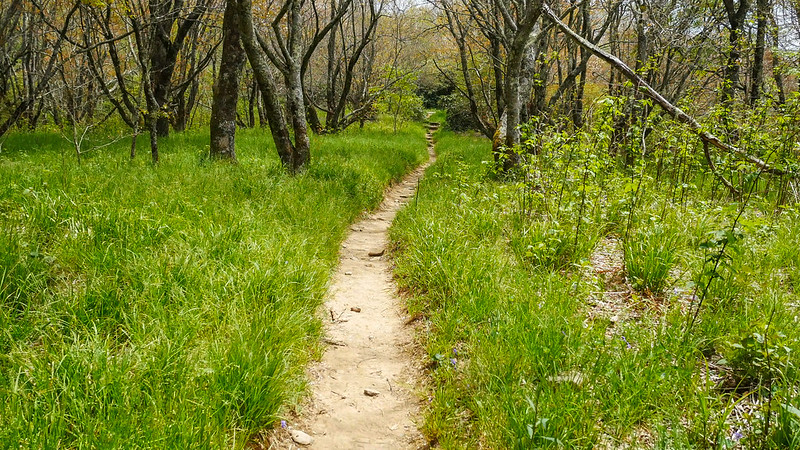
Finally on the AT

After meeting Dean on Thunderhead, Scott and I borrowed his antenna that was already strung up and we proceeded to make many contacts. Yeah, I know, it is kinda geeky but it get’s us out and about! On the way down, we ran into a large tom turkey gobbling away. I screwed up the video that I tried to take of him gobbling, but I got a decent picture of him at least.

Dean-K2JB on W4T/SU-009 - Thunderhead Mtn

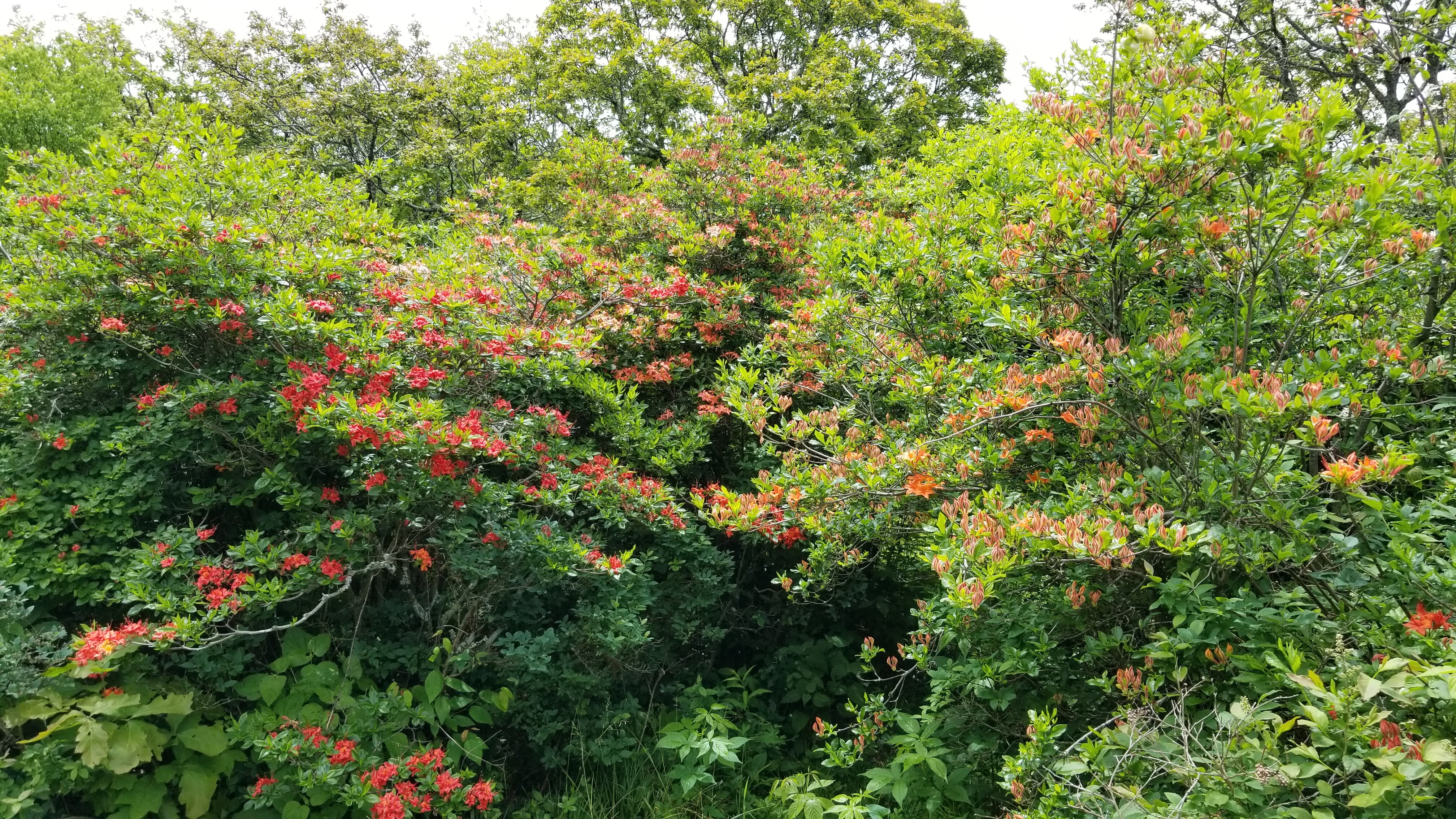
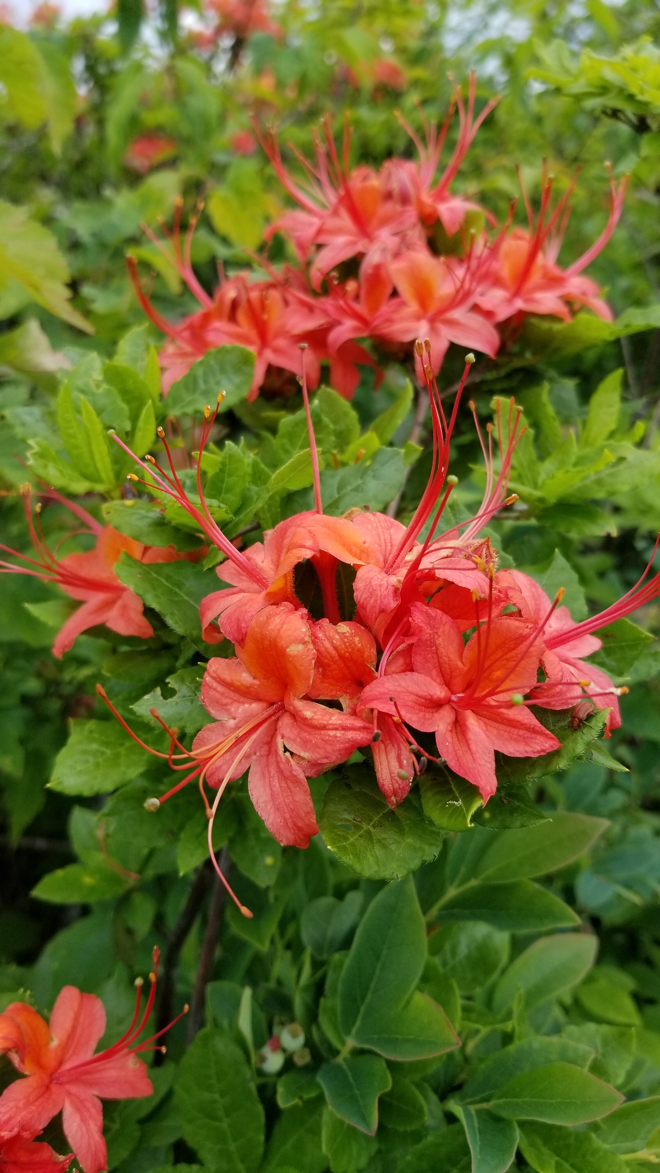
Trillium on W4T/SU-009 - Thunderhead Mtn

Wild Tom Turkey

The shelter at Spence Field was reasonably busy, but with it still being thru-hiker season and the relaxation of the rules for camping outside of shelters due to COVID most of the campers were spread out around the shelter in tents and hammocks. I wouldn’t be out here if it wasn’t for the changes due to COVID and I have been trying to take advantage of that while it lasts. I would be miserable sleeping in a shelter yet feel totally rejuvenated after a night in the hammock. At the end of the day I wonder if my bad knee will make it another day or if I will have to bail out, but I wake up the next morning ready to go. Before I went to bed, it got pretty breezy and I did deploy the trap and used the pole mods. Overnight temps each night probably got down into the low 50s and my 40 degree quilts were really too much so a bit of a breeze helped a bit too.

Spence Field Shelter

Camp at Spence Field Shelter

4 Likes

Day 2 - Spence Field Shelter to Blockhouse Mtn (W4C/WM-017) to Russell Field - 9.4 miles, 2190’ EG, 2710’ EL

It was still pretty breezy in the morning, we packed up and headed north on the AT again, but only for a half mile before heading down the Jenkins Ridge Trail. After heading down the Jenkins Ridge Trail for two miles, we dropped our packs, hung our foods bags and headed up off-trail to the top of Blockhouse Mtn. We decided to take a more direct route on the way up than originally planned and other than being steep (740’ elevation gain in 0.4 miles) it was fairly open forest all the way to the summit. Blockhouse Mountain is one of those places that only peak baggers or SOTA activators could love. The summit itself is pretty thick with growth and there are no views, at least now that things have greened up.

Gunna Creek on the Jenkins Ridge Trail

Start of off-trail hike to W4C/WM-017 - Blockhouse Mtn

Dean set up in the thick of it and used the summit cairn for a chair! Scott and I found a nice log a little down from the summit where the forest opened up a bit.

Dean-K2JB sitting on Summit Cairn on W4C/WM-017 - Blockhouse Mtn

Scott-KW4JM on W4C/WM-017 - Blockhouse Mtn

On the way down, we stuck to the original plan and descended the western ridge line back to the Jenkins Ridge trail. It felt like a walk in the park compared to the ascent with a much more gentle slope with less elevation difference between the summit and the trail at the cost of a bit more distance (560’ in 0.5 miles). Backtracking up the trail 1/3 of a mile, we picked up our packs and headed to a nice creek crossing for a nice break and water refill. After climbing back up to the ridge line, we finally started our south bound journey on the AT. The crowd at the Russell Field shelter was a little more lively it seemed with a mix of thru hikers, section hikers and folks like us just out for a few days. It is always fun to chat with other hikers and there is such a diverse group on people on the trails this time of year. It has been 30+ years since I had stayed at the Russell Field shelter and like all of the shelters in the park, I really like the additional porch area, benches and tables that they have added. Another breezy night with warm temps.

Open Forest descending W4C/WM-017 - Blockhouse Mtn

Gunna (take a break) Creek on the Jenkins Ridge Trail

View of Rocky Top and Thunderhead Mtn

AT View to the South

Russell Field Shelter

Camp at Russell Field Shelter

3 Likes

Day 3 - Russell Field Shelter to Devil’s Tater Patch (W4T/SU-017) to Gregory Bald (W4C/WM-038) to Campsite 13 at Sheep Pen Gap - 9.4 miles, 2580’ EG, 2280’ EL

Dean got up and out of the shelter a bit before Scott and I started south bound on the AT towards Devil’s Tater Patch. About three miles south of Russell Field shelter on the AT you will cross the top of Devil’s Tater Patch and that is where we found Dean set up by the side of the trail. We set up off the trail a bit and started making contacts. Dean was talking to all of the hikers as they passed by and the reports of the sighting of a mother bear and her cubs kept getting closer and closer to the summit. The last report was of a cub about 50 yards down the trail. Unfortunately, we did not see any more bears on this trip. Who knows, maybe bears don’t like the sound of morse code and it is a natural bear deterrent? Dean headed down the trail while we stuck around to enjoy the pleasant weather and seek out other SOTA activators on other summits. We call these Summit to Summits and it is fun to make contacts with these other low power stations on other mountain tops.

Dean-K2JB working contacts on W4T/SU-017 - Devils Tater Patch

Shack with cup holder on W4T/SU-017 - Devils Tater Patch

Soon after leaving the summit, we reached the Mollie’s Ridge shelter and took a break to fill up on water. We wouldn’t have another reliable water source before we hit camp and we wanted to spend a little time on Gregory Bald before descending to camp. About 3.5 miles southbound on the AT, we took a right on the Gregory Bald trail. I think it was a combination of the higher temps and being towards the end of our hike, but some of the climbs on this trail were quite punchy and were kicking our tails. None of them were that long, but they were so vertical you could see a lot of the climb and which made you think ‘Oh crap, not another one!’ I don’t normally take breaks when hiking but there were a few made that afternoon.

Mollies Ridge Shelter

Gregory Bald Trail

Breaking out into the grassy bald on Gregory Bald was quite a relief. That meant that all that was left for the day was a 0.4 mile descent down to backcountry campsite 13 at Sheep Pen Gap. The only word to describe Gregory Bald is Wow! The views are amazing. The entire Cades Cove valley is laid out below you and you can see most of the peaks in the western half of the Smokies as well as Slickrock/Citico Creek area and so many more. If you were there on a clear day I bet you could see summits as far south as Georgia and north into Kentucky. I can’t believe that I had never made it here before, but it won’t be the last time for sure. I kicked off the boots and socks and the grass felt luxurious. We had a fairly quick activation of the summit before heading down to camp. There were two brothers with bunch of their boys all hanging out in hammocks at the campsite. This was their first night trying them out and most (but not all) got a good night’s sleep.

Gregory Bald View

Camp at Sheep Pen Gap (CS #13)

That evening before dusk, we had a herd of deer come through the camp. It always amazes me how the deer in the park almost don’t pay any attention to you and will freely walk around while you carry on with whatever you are doing.

No breeze this night and with temps in the upper 50s, I was quite warm. Too cold without the topquilt, too warm with it. Never could find a happy medium and maybe why this was the first night that I didn’t sleep soundly.

5 Likes

Day 4 - Sheep Pen Gap to Twentymile Ranger Station - 7 miles, 200’ EG, 3560’ EL

We started the day at 5 a.m. and packed up in the dark, before heading back up to Gregory Bald for the sunrise and a little more radio activity. The sunrise was great, but radio propagation not so much. In the early morning you may have enhanced propagation and can work more distant stations like Europeans, but not on this day! But it is hard to beat sunrise from a mountain top, with a warm cup of coffee and a few contacts on the radio. It was really hard to leave such a great place and it wasn’t until we drained the juice out of all of our batteries that we descended back to the campsite for a final check and begin our descent.

Gregory Bald Sunrise

Gregory Bald Sunrise

Pat-KI4SVM on Gregory Bald Benchmark

After passing over Parson (not so) Bald, it is a loooong downhill hike to the Twentymile Ranger Station. None of it is steep, but is just down, down, down. After 4.25 miles the trail starts to follow Dalton Branch first, then Moore Springs Branch before finally following Twentymile Creek the rest of the way. I love hiking ridge lines but hiking alongside a creek is pretty hard to beat too! As we descended to lower elevations, we noticed more and more Mountain Laurels just starting to bloom.

Small Clearing on Parson Bald

Wolf Ridge Trail

Mountain Laurel Blooms

Another great trip in the Smokies with remarkable weather. We stopped at Deal’s Gap and treated ourselves to a juicy burger and some people watching. On our shuttle back to Cades Cove, we probably did slow down a few folks on the 318 curves on the Tail of the Dragon but we used the frequent pull-outs to let them continue on their way and have their fun.

13 Likes

Great story and photos. Can see why people like walking there so much.

Thanks for posting.

73 Andrew VK1DA/VK2UH

1 Like

Beautiful Pictures! Thanks for all the activations. Got a few
of them. We try harder.
JohnPaul//AB4PP

1 Like

Awesome write-up and photos. Glad you all had a good time. Thanks for the contacts.
73 Gary

1 Like

Pat - Tnx for writing this trip up, and great fotos. You, Dean and Scott are inspiring. Really glad we got to meet you at Middle Creek last month.
Sorry missed your activations…but will try harder in the future.
Have a great summer. Keep having fun.
Bob K4RLC
Flatlands of eastern NC

1 Like

Great trip guys! Thanks for all the activations along the way.

Ken W4KAC

1 Like

Thanks for the inspiring report, Pat, and for the memories. We hiked the Appalachian Trail through the park (in my pre-SOTA days) and stayed in some of those shelters.

You didn’t mention the flame azaleas on Gregory Bald so I guess you must have been a bit too early for them. We activated Gregory in June 2020 and the summit was ablaze with the orange blossoms.


A great trip either way!
73,
Scott WB8ICQ

1 Like

Awesome tour in some wonderful landscapes! Thanks for sharing.

1 Like

Great write up and photos. Love the Cades Cove area, were you bothered by ticks much?

1 Like

Pat, sounds like you all enjoyed an epic trip. I need to try something like that before I get too decrepit ;-)! Tnx for sharing.

73 Paula k9ir

1 Like

Great report Pat. It was fun to reminisce this fun trip. Pat and Dean are an inspiration to me both in radio and backpacking. They are mighty good to let me tag along on these challenging hikes.
Scott Kw4jm

1 Like

Thanks for the comments and glad y’all enjoyed the photos. The Smoky Mountains have always been a special place to me and I am glad to have a chance to share it. We have been activating a lot of the harder to get to summits within the park over the last year and we already making plans for the next backpacking trip.

We saw lots of wild flowers but I agree that is just too early for azaleas. I bet the bald was beautiful covered in blooms. Just all the more reason to get back up there soon.

Scott or Dean had a tick crawling on them at some point and I think that was the only one that we saw on this trip. Can’t stand those useless things.