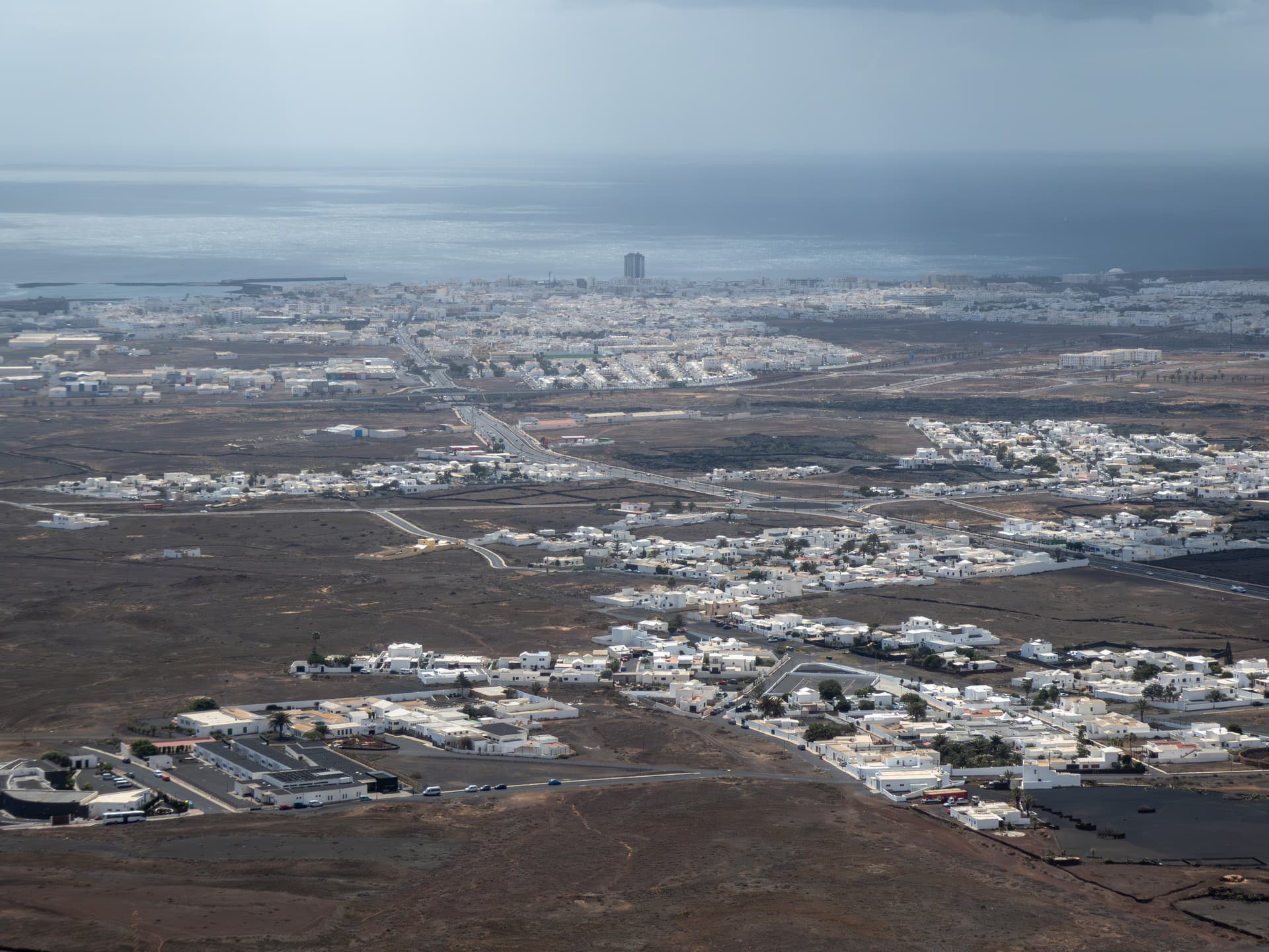
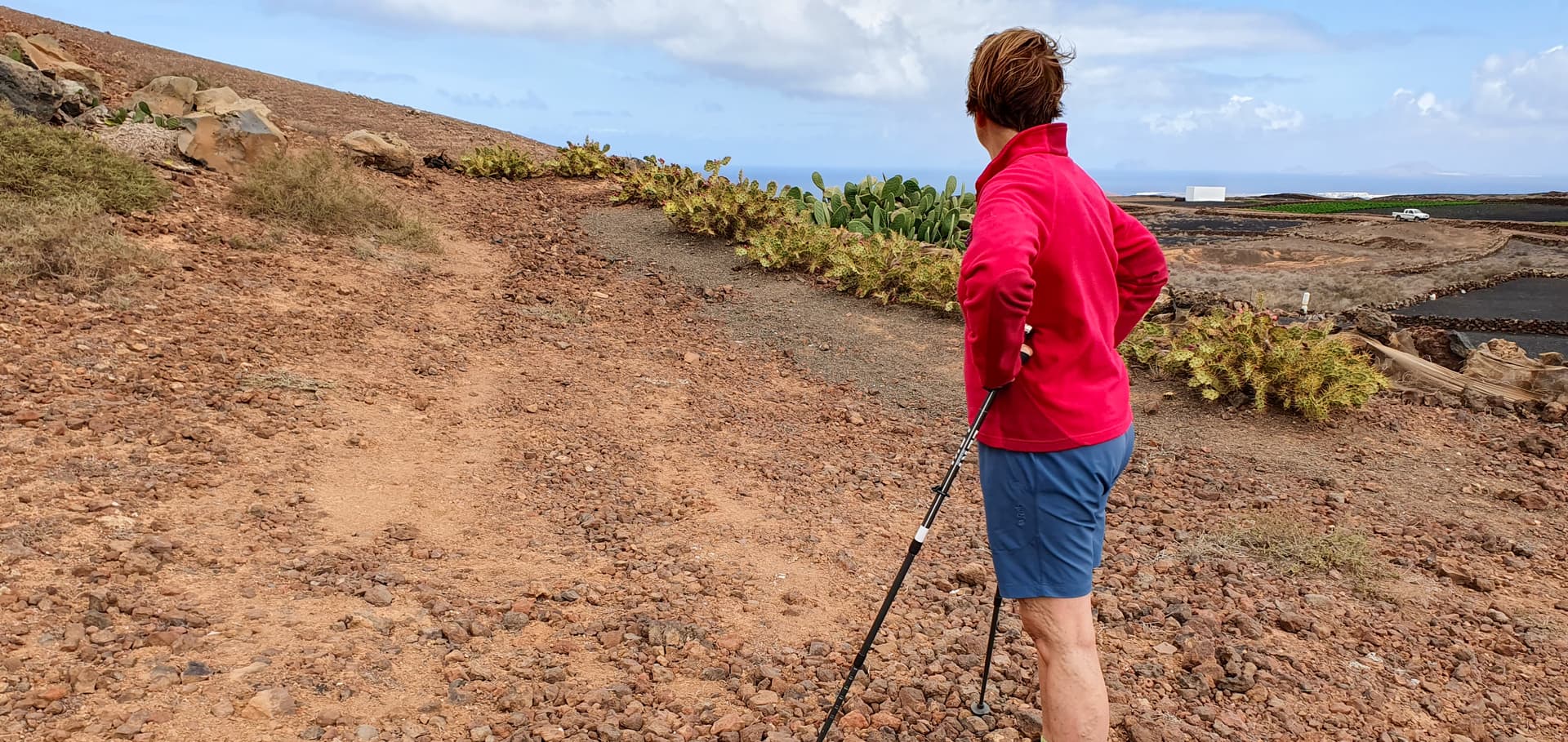
My XYL Rachel and I arrived in Puerto del Carmen, Lanzarote on Thursday 29th Feb for a week of winter warmth. We’d booked the holiday before the 10m Challenge was announced, but I reckoned it would be an ideal location to work both EU and USA, given the experience from our previous visit in 2021. It was warm (18-20 deg C) but very windy and cloudy for the first couple of days with even a few brief showers. With the wind blowing a gale (gusting to 35mph) from the NE at sea level, I decided to limit myself to the lowest hills.The wind didn’t drop much until Sunday when I headed for the first summit - LA-019 Montana Tahiche (1053ft). On Monday we did a scouting visit to LA-018 Teneza (1207ft) so that I could check what it was like at the top as regards the wind and a set-up area. On Tuesday I went up LA-018 again on my own. On Wednesday we headed for La Graciosa, the popular little island which is a 30m ferry ride from the village of Orzola, right in the North of Lanzarote. We had stayed there in 2021, when I activated the highest of the 2 island summits, LA-026 Agujas Grandes, while Rachel explored the smaller summit of Montana Amarilla, LA-027(571ft). This time, we both went up the smaller one.
LA-019 Tahiche
A typical Lanzarote volcanic cone located beside the village of Tahiche near the East coast.
I parked just off the main road (LZ-34) just by the short dirt track which leads up to the summit. This is clearly visible on Google Maps
.
Looking back down the track to my parked car.
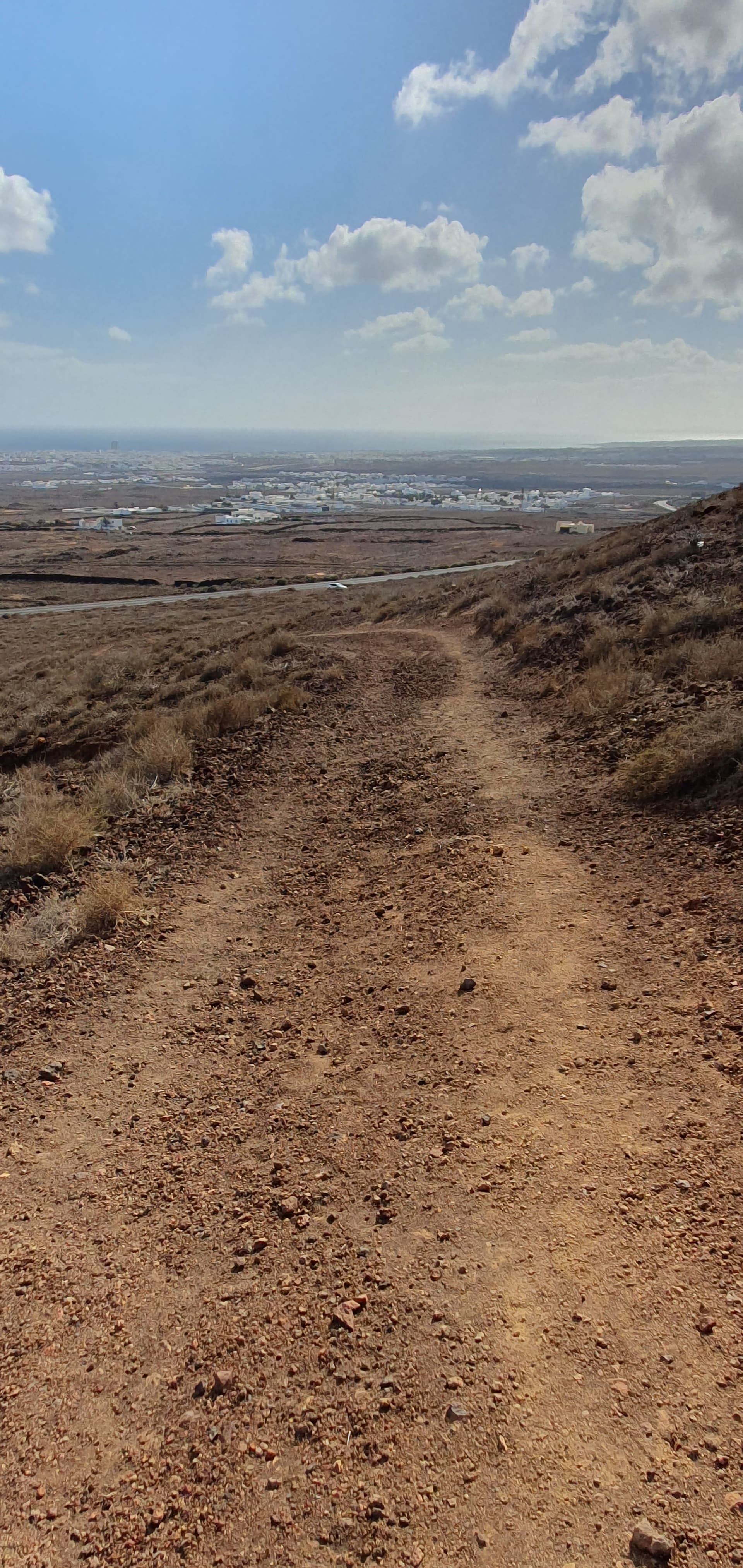
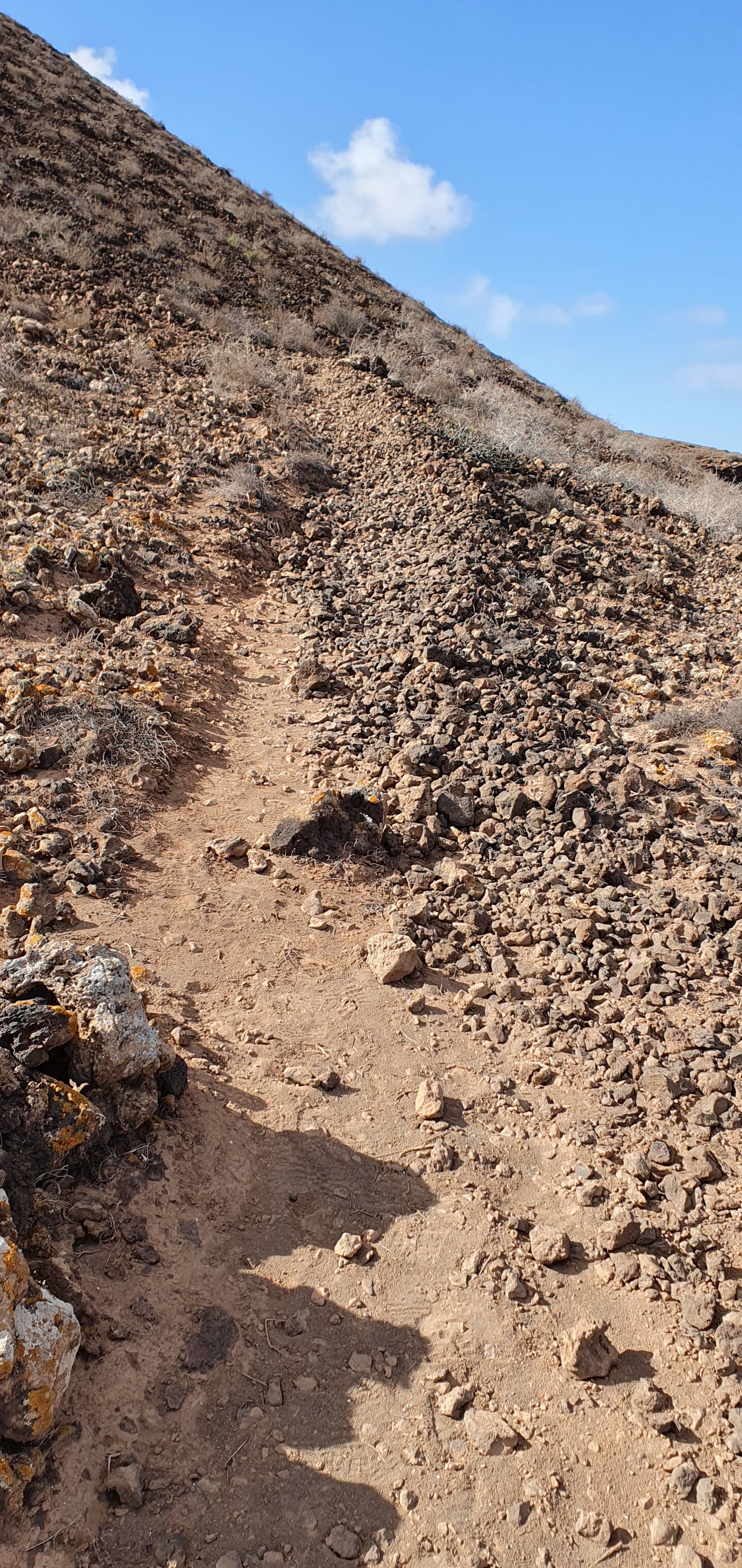
I actually took a short cut up to the main ridge but found the surface quite treacherous - very soft volcanic sand, pebbles and gravel and I wouldn’t advise coming down anything other than the main track and even that was slow going - walking poles advisable, especially if carrying any back pack with weight.
Start of the path up - about 30 minutes walk
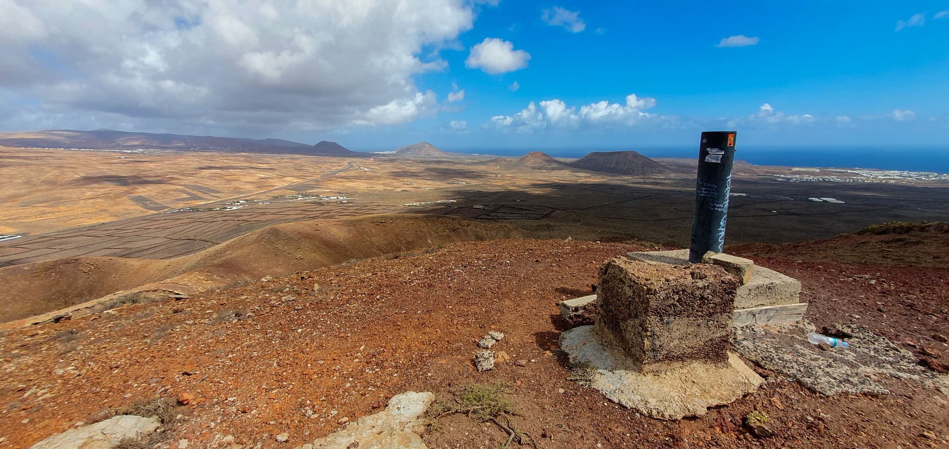
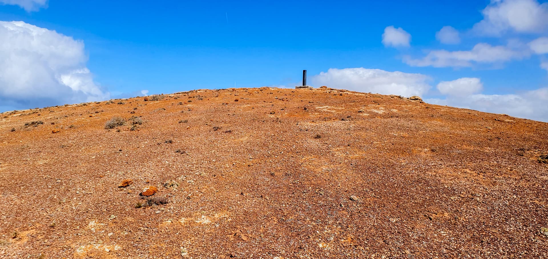
Summit marker. Next to this are the remains of the foundations of an old comms mast.
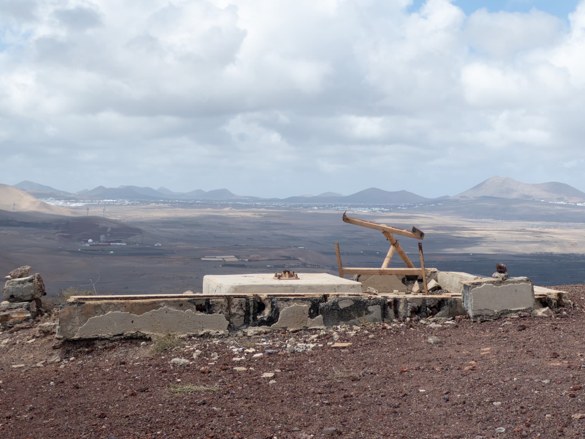
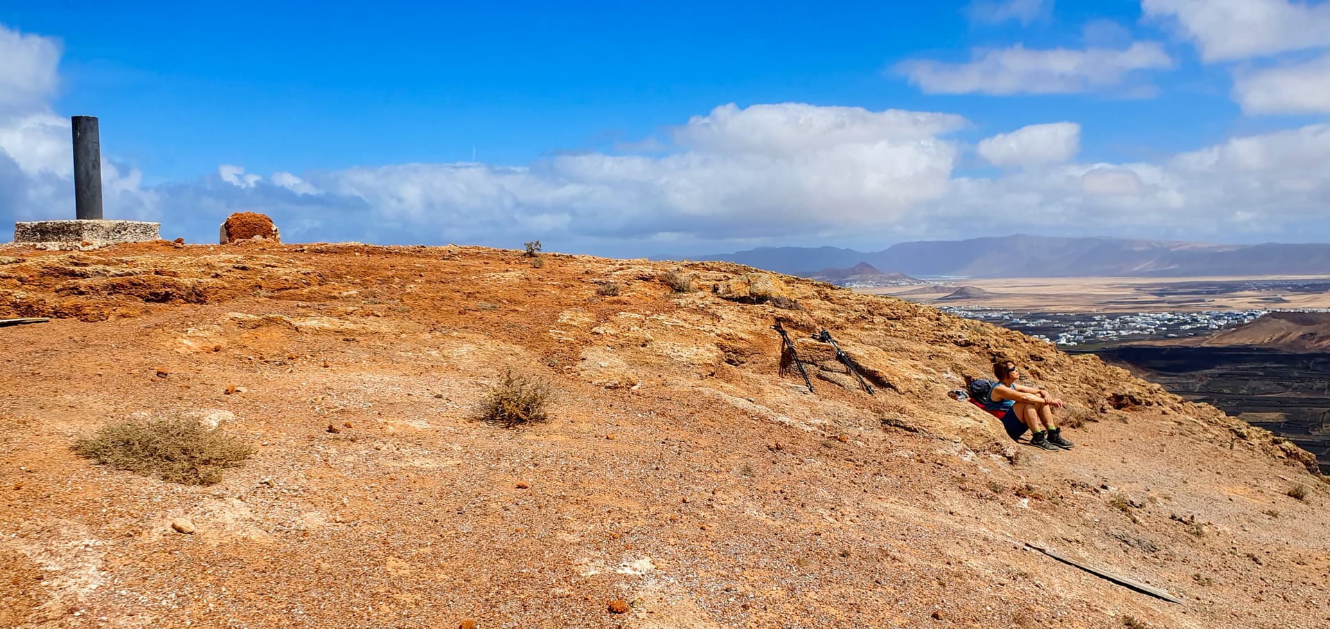
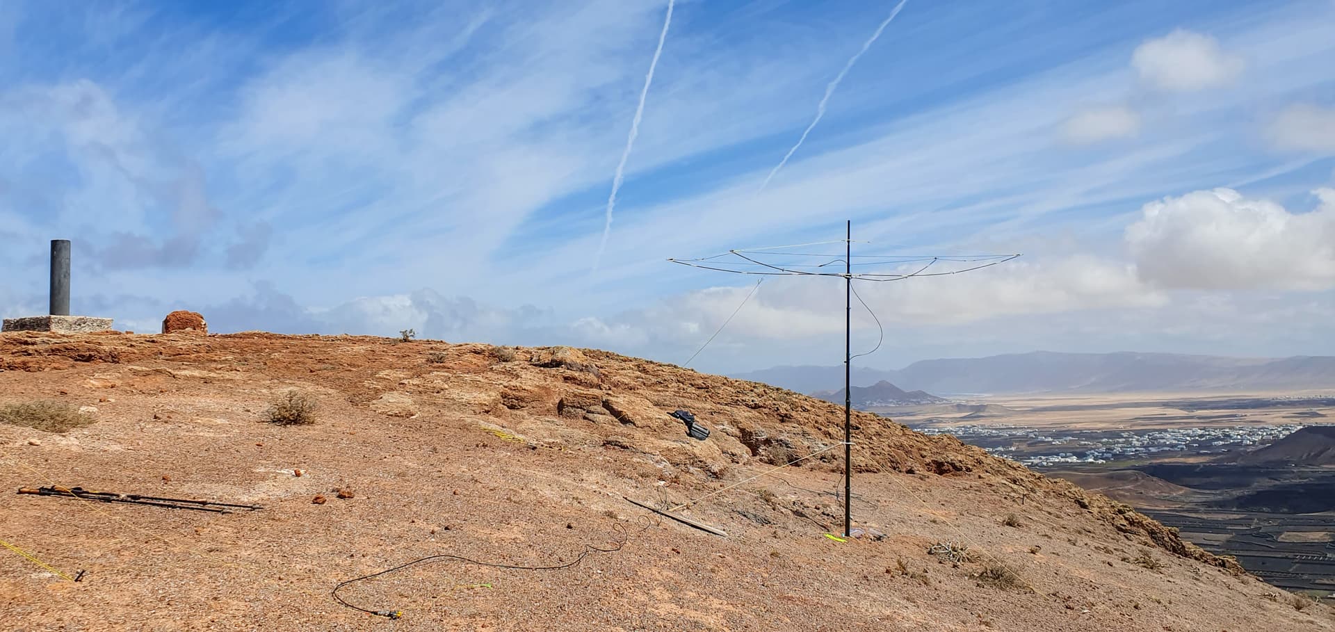
Just down from the summit is a nicely sheltered area (from the NE wind), with some large rocks forming an ideal location to set up.
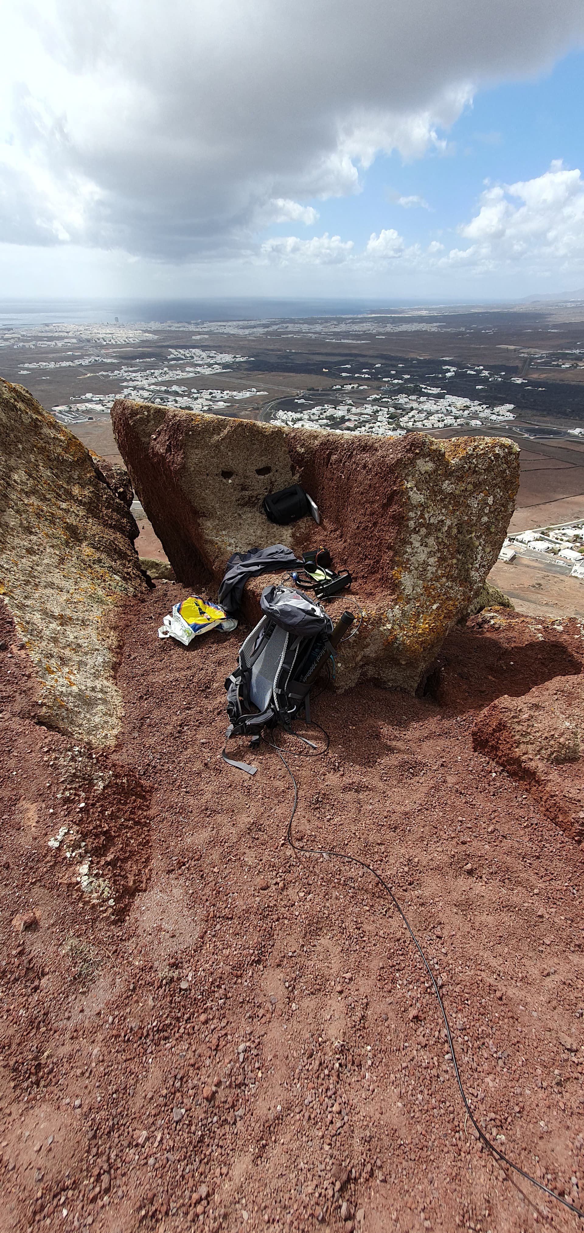
My mast for the 10/12 and 17m delta loops went up nearby with no issues.
Activation - all SSB
Equipment: KX3, Spiderbeam 7m mast, wire delta loops. I also used heavyweight guy stakes which I had used on my previous Lanzarote visit.
With Sunday being the 2nd day of the ARRL DX Contest, I decided just to activate on 10/12 and 17m.
Starting on 10m at 1042 UTC I found the band relatively civilised as it was only just opening to the US. I managed to stay on the same frequency for an hour, working a steady stream of EU chasers plus the occasional US E.Coast station looking for contest points. Signals were OK, but there was quite a lot of QSB. By the time the contest forced me to QSY, I had 46 itl including 3 S2S and 3 for whom the QSO was a Complete (G6WRW, OE5FSM and 3Z7Z). At one point some confusion was caused by an erroneous spot which showed EA8/DL2DXA/P on my summit and freq, but happily that didn’t cause too much of a problem. With the DX Contest in full swing I QSYd several times to clearer spots, but eventually gave up after managing to get another 10 itl including a S2S with Stefan, HB9HCS/P, who was very helpful to me ahead of my first visit to Lanzarote in 2021.
Moving to 17m was a disappointment - very quiet, just 4 EU chasers in 10 minutes.
12m was only slightly better, with 8 chasers in 25 minutes, including a S2S with EI6IRB.
Just after 1400 UTC I ventured back into the 10m contest zoo and managed another 9, with 3 S2S including EA8/DL2DXA/P on Gran Canaria.WB8BHN was furthest West of the day, furthest East was SV2OSX and furthest South ZS5APT and ZS5AYC.
Further summit views:
Looking West
Looking at Arrecife, the capital city
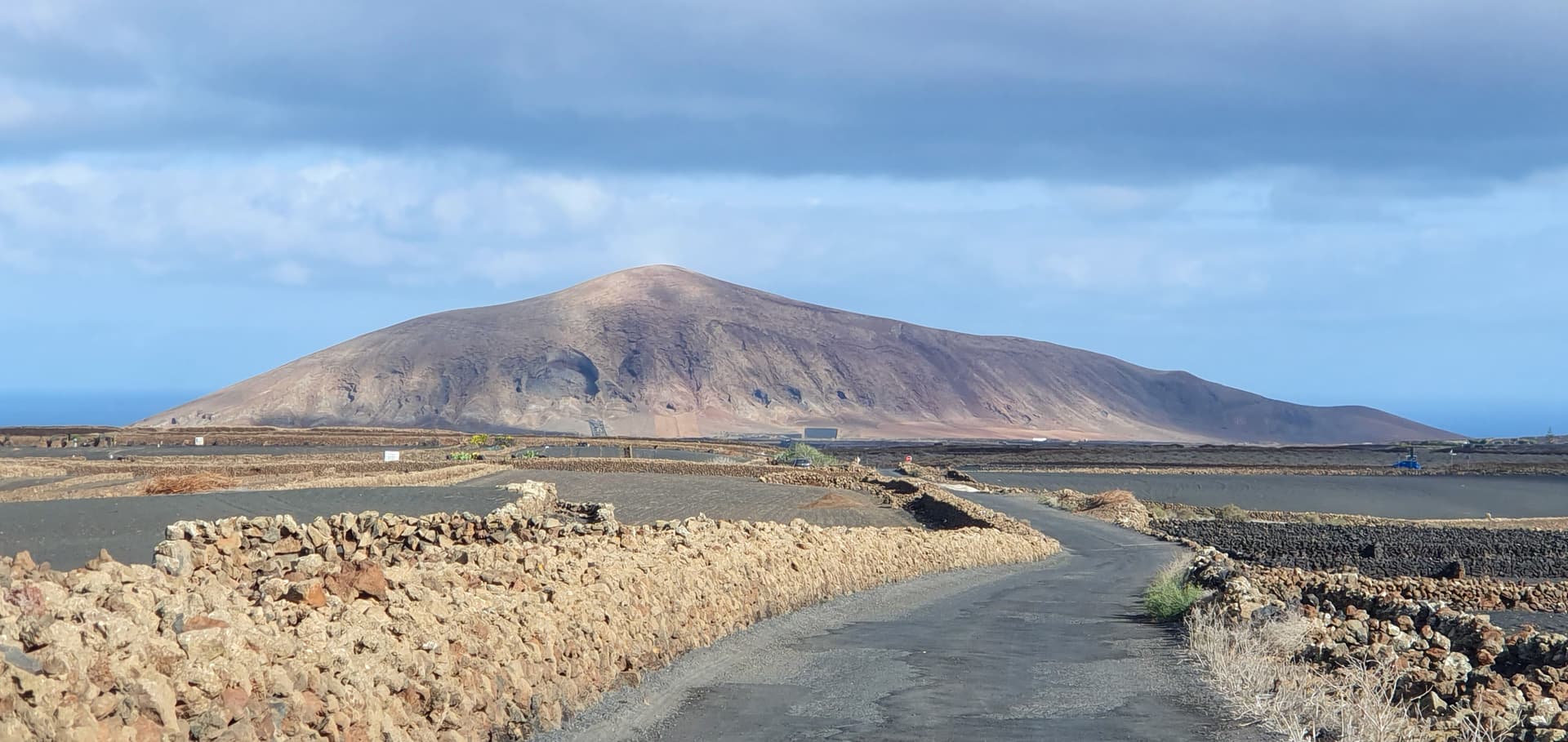
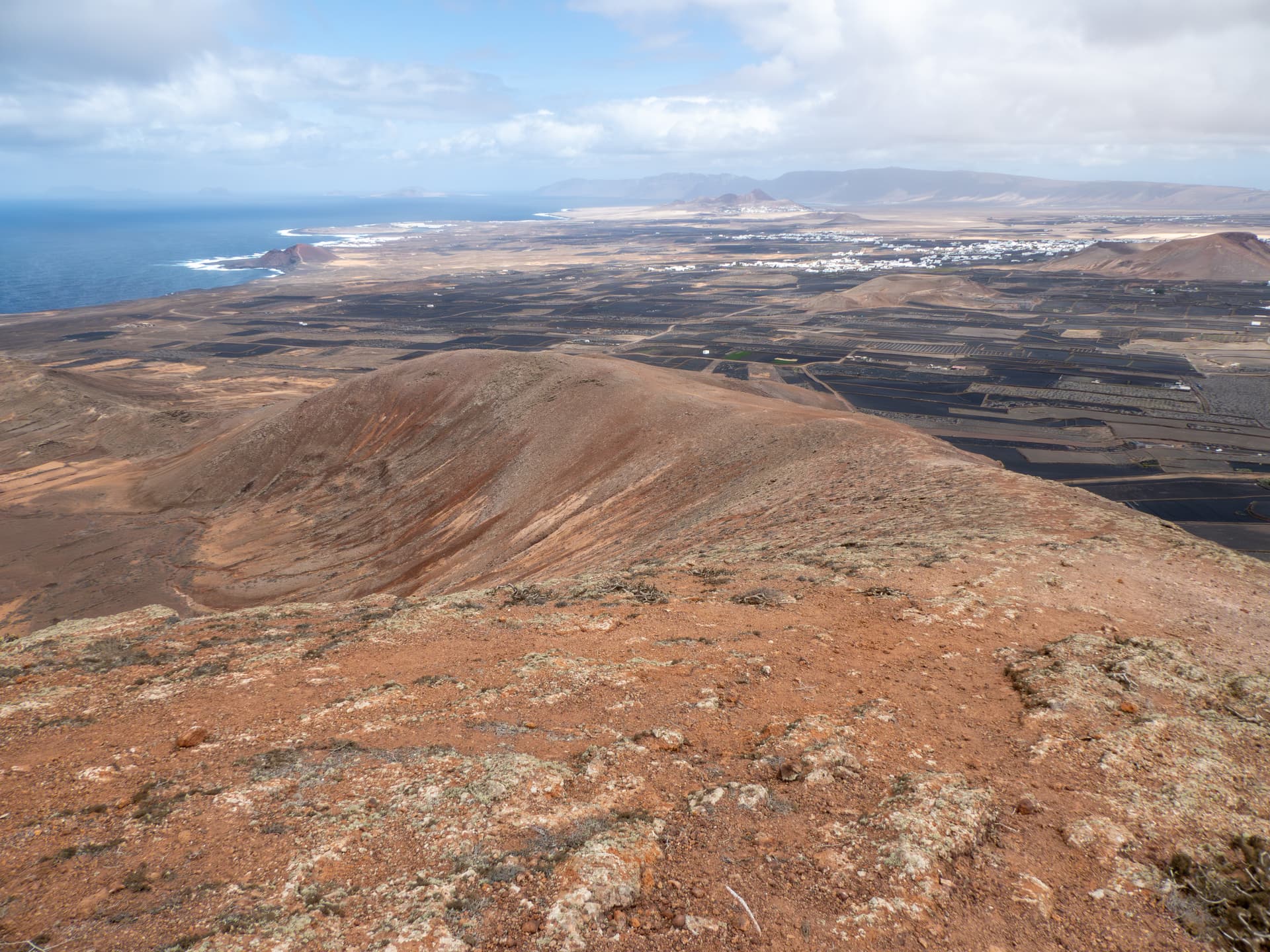
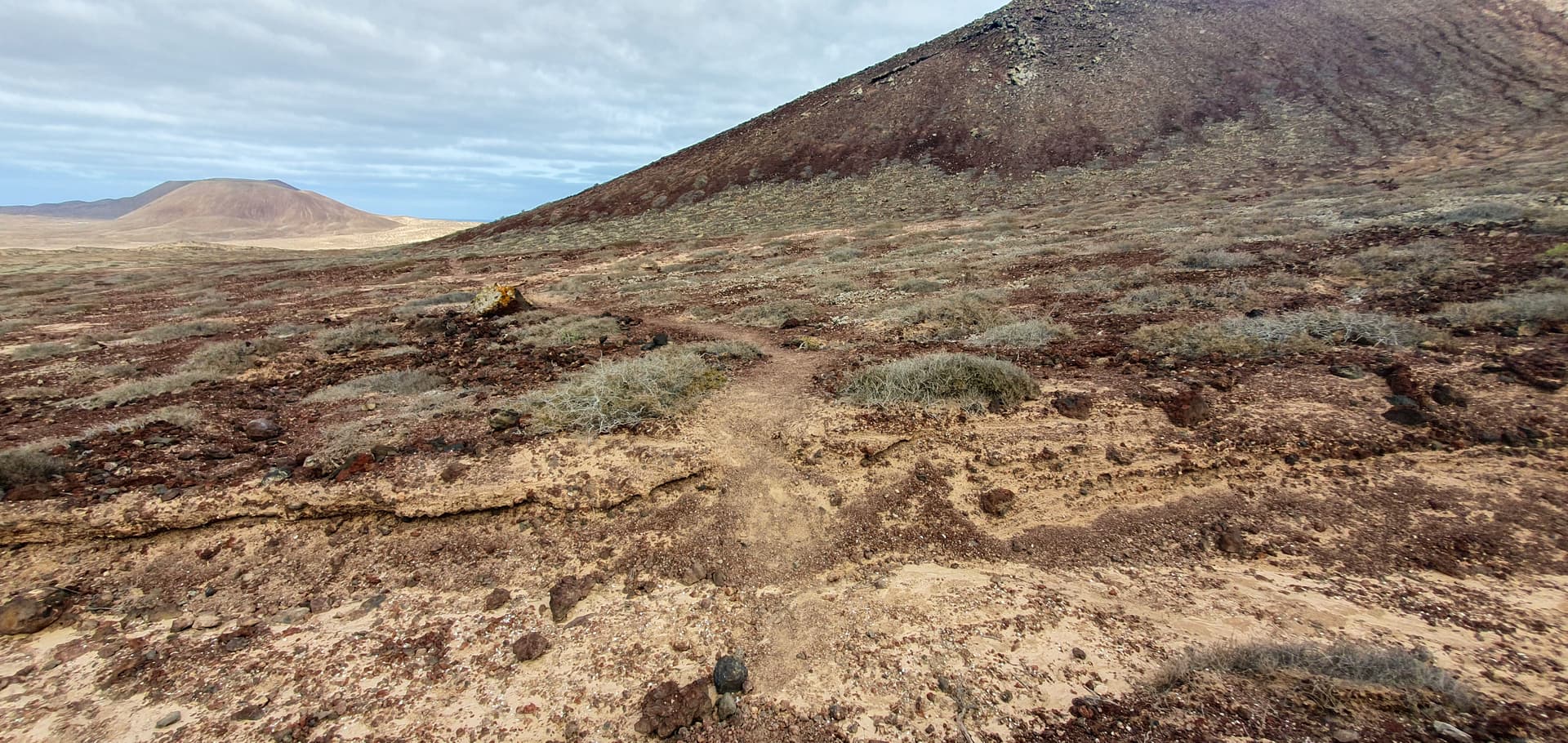
LA-018 Taneza
Another cone, located on the West coast near the village of Tinajo. For some reason, this had only 4 previous activations, but access was easy and the summit has a broad activation area. A dirt track leads off the good tarmac road which runs E-W from Tinajo - the map in Sot.las is incorrect as it shows the dirt track not joining the road. The dirt track soon broadens out, with plenty of space to park. The track then continues round the base ot the hill, where another well-defined track then leads upwards.
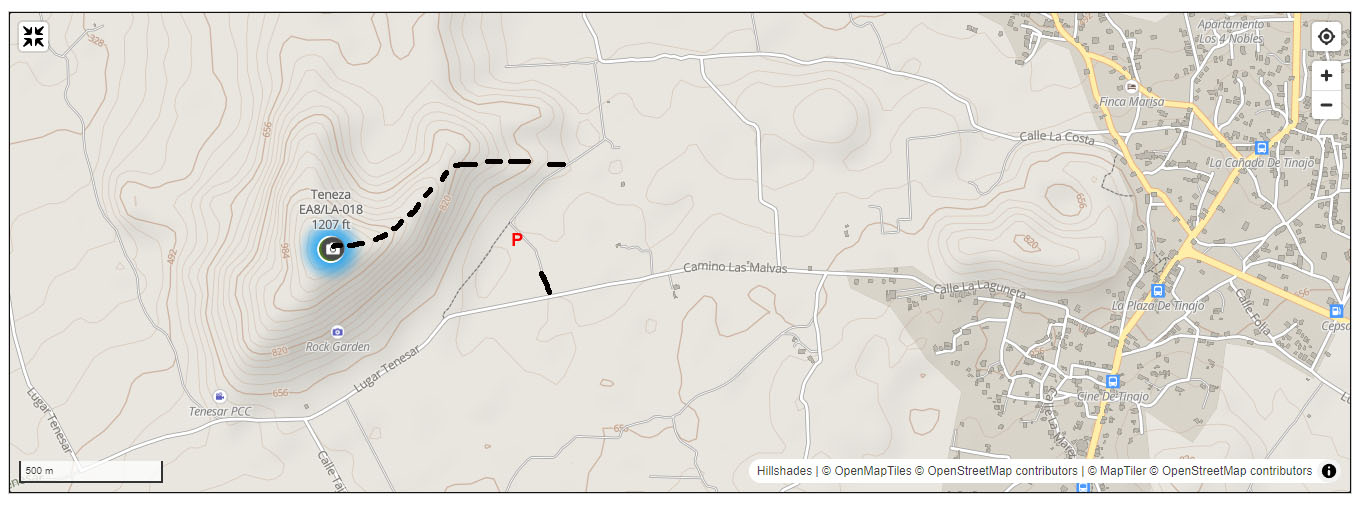
Approaching Teneza from the SE
Looking back along the dirt track towards the parking area
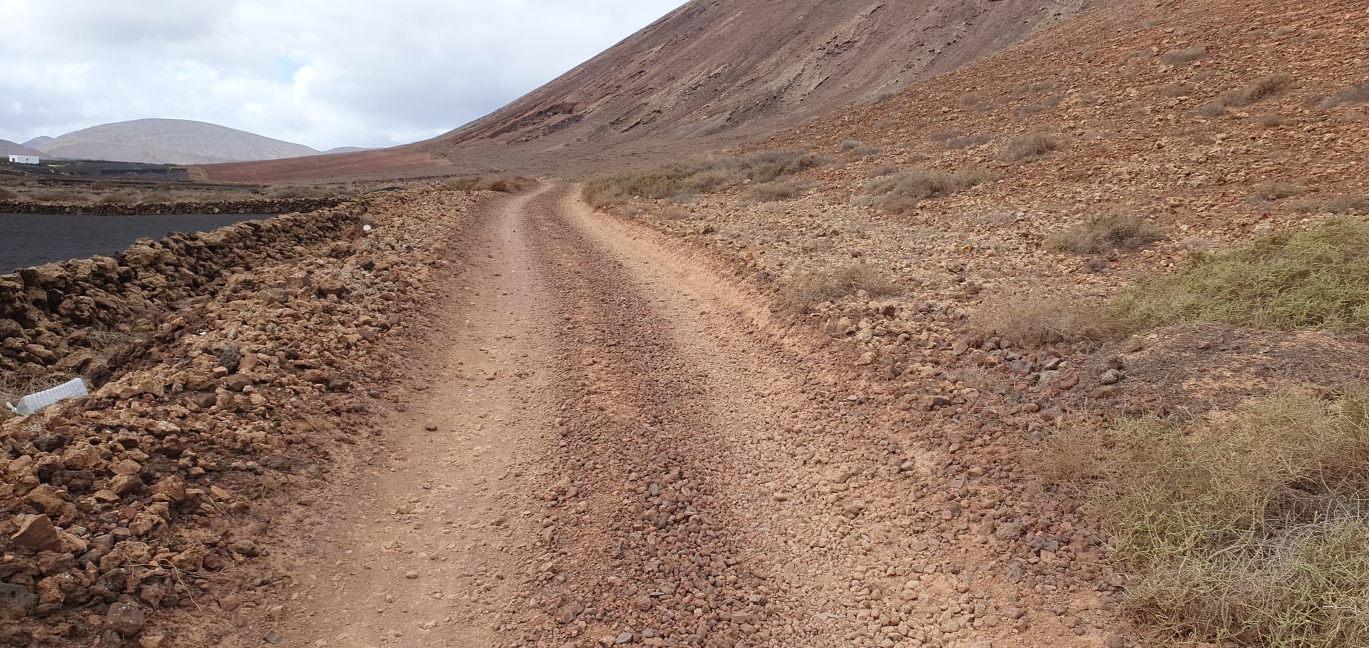
Start of the track up
On our Monday scouting trip, the wind was strong but we never felt in any danger on the way up, although my glasses nearly blew away at one point. The track is generally good, with a fairly steep start, then a flattish section, then another steepish part just before the top. It took about 45m.
Looking back down the main ridge
Broad summit area with a reasonably gentle slope
Nice activation position, sheltered from the NE wind. The slope does get quite steep to the right of picture and I lost a lunchtime satsuma which escaped and rolled away.
Activation
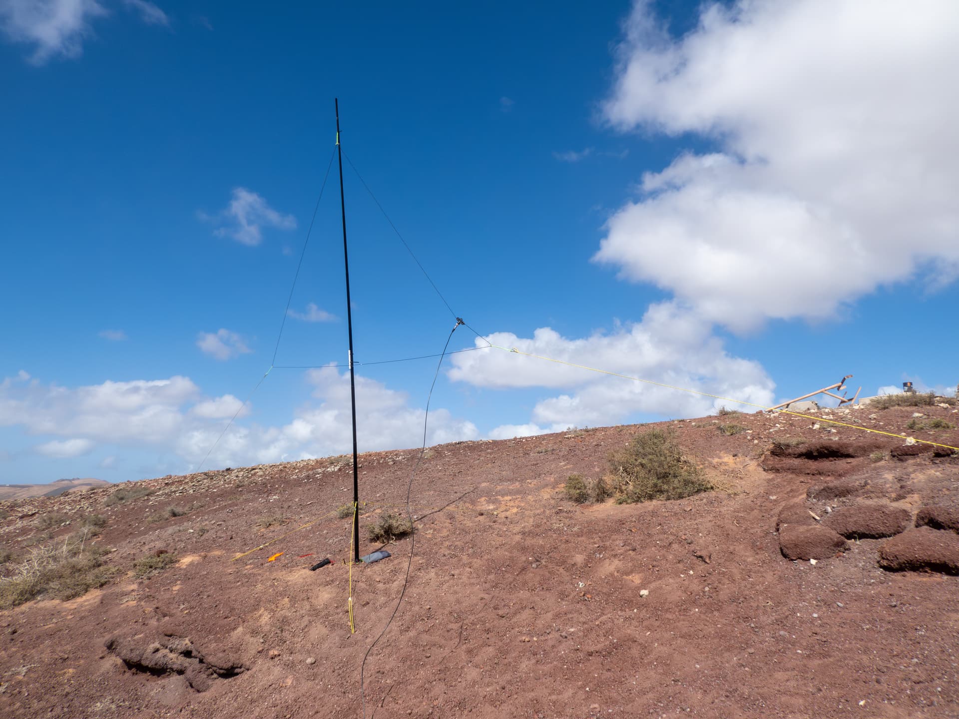
Equipment: KX3, 10m moxon, hf delta loops, Sotabeams 7000HDS mast, Spiderbeam 7m mast.
Due to the wind, I had to set up the moxon downslope, which I think negatively impacted performance.
10m -I started with the moxon, with Fraser HB9/M0EFI/P first in the log for a S2S. A first spot brought 15 EU chasers including 2 more S2S, plus local EC8ADS on Gran Canaria. A QSY and spot produced another 11 EU, then it went quiet, so I had a look around the band and found Mike 2E0YYY/P. A third spot gave another 6 chasers, including a few from the WAB/Bunkers group.
20m didn’t seem in very good shape and a spot gave just 6 EU chasers.
12m was more interesting, with NT2A the first US station itl for the day, shortly followed by N4EX. 4Z4DX was furthest East.
Back on 10m I heard DU3DG calling CQ and gave him a call. After several tries he copied my call but frustratingly we were unable to exchange signal reports. With the wind messing about with the moxon, I switched to the 10m delta loop and a spot brought a nice run of 22, including PY2VM, ND0C,PU2RDB, NE4TN, KC1NDQ, WB8BHN and KF9D, plus a S2S with IW3AGO/P and IN3ENN/P.
Switching back to the moxon brought W3SLW and another double S2S with MW1MAJ/P and MW3ZCB/P. I then alternated between the loop and moxon, with the loop performing better to the US, with N6WT in Ca and WA7JTM in Ariz - Peter didn’t hear me until I switched to the loop, which is interesting, as on my Scottish activations the moxon has done better than the loop. I think maybe the mox was just too close to the ground for optimal performance.
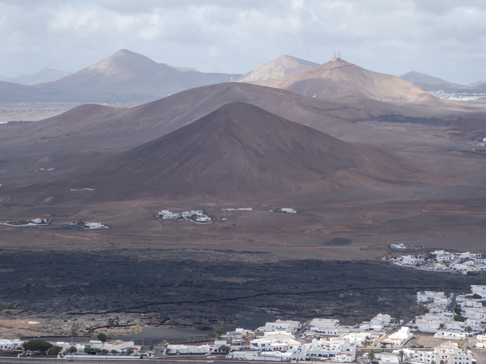
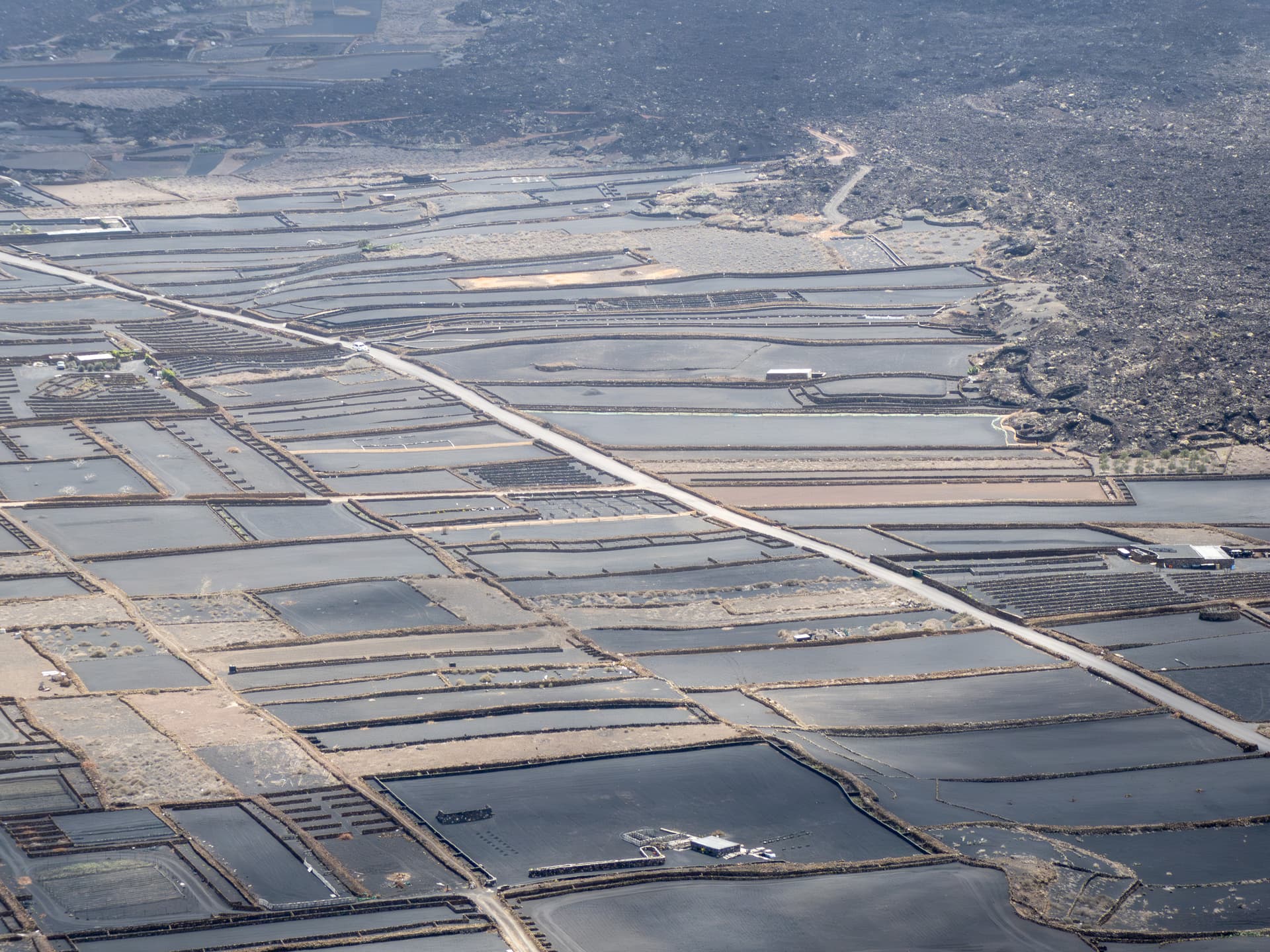
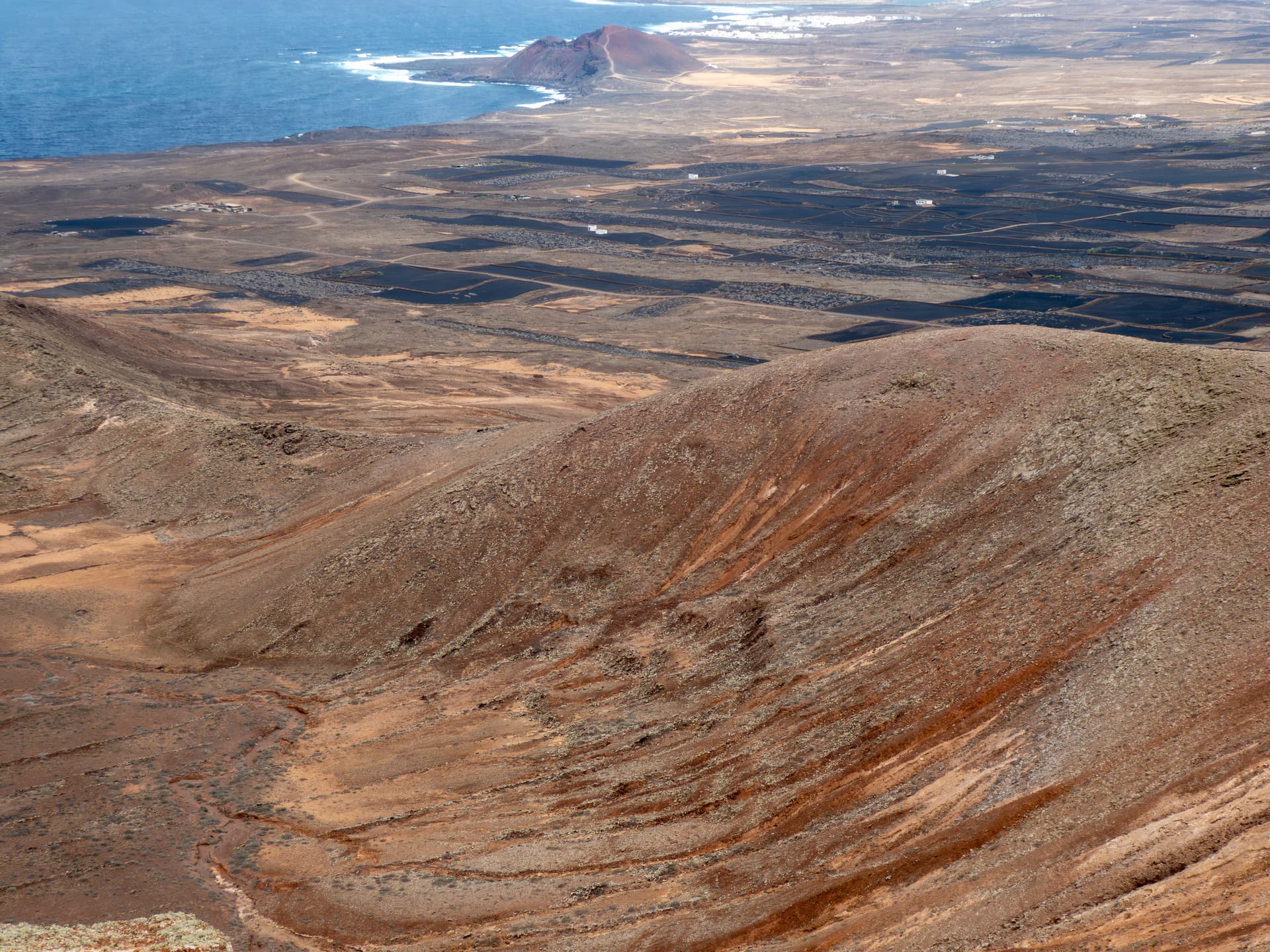
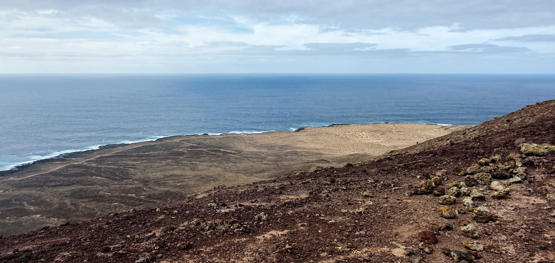
Views from the summit - this area has a lot of black lava flows
Looking SSW
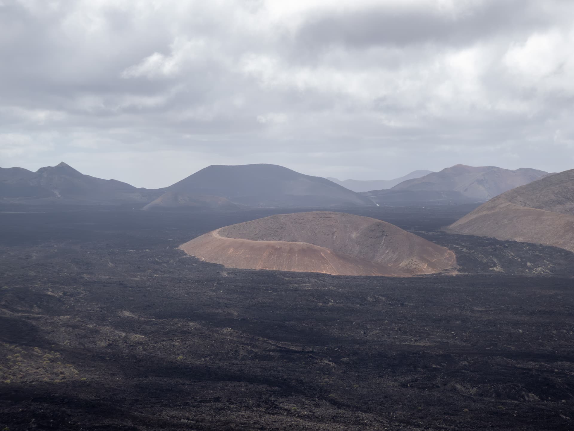
Nice contrast between the black cultivated fields and the lava flows
Looking North up the coast
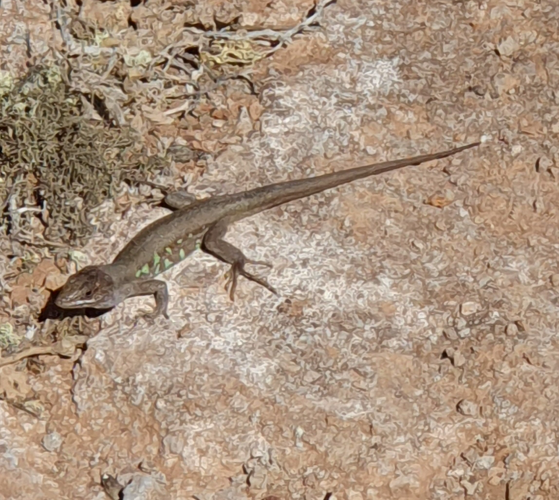
A little visitor
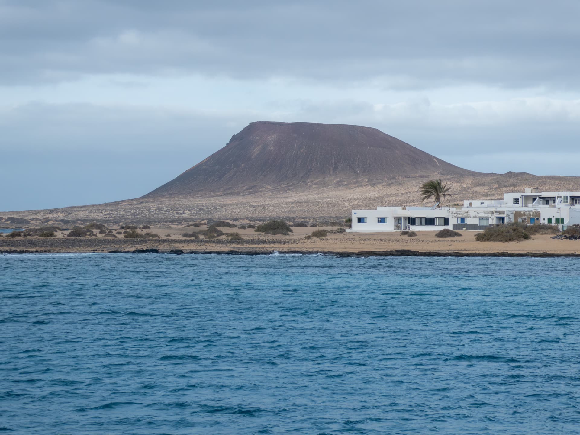
LA-027 Montana Amarilla
This is a little volcanic cone in the South of La Graciosa, right beside the sea. Wednesday had been forecast all week to be the sunniest day, but it turned out to be the cloudiest, which was a tad disappointing. We caught the 0830 ferry from Orzola, which is 10m of rock and roll until the boat rounds the headland between the 2 islands. After a quick breakfast and purchase of lunchibles in the village we headed off.
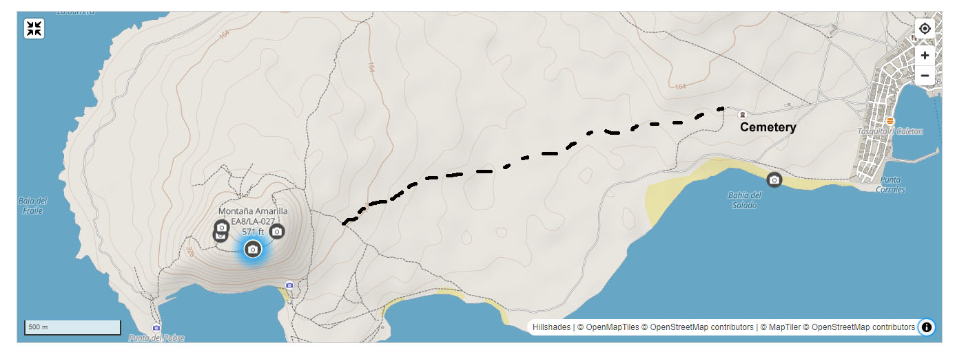
The base of the hill is an hour or so’s walk from Caleta del Sebo, the only village on the island. A well-defined track hugs the coast, but there are a myriad of smaller tracks that cross the intervening belt of shelly sand and brushwood. Starting from the local cemetery, we just headed directly for the track which which can be seen clearly.ascending the hill.
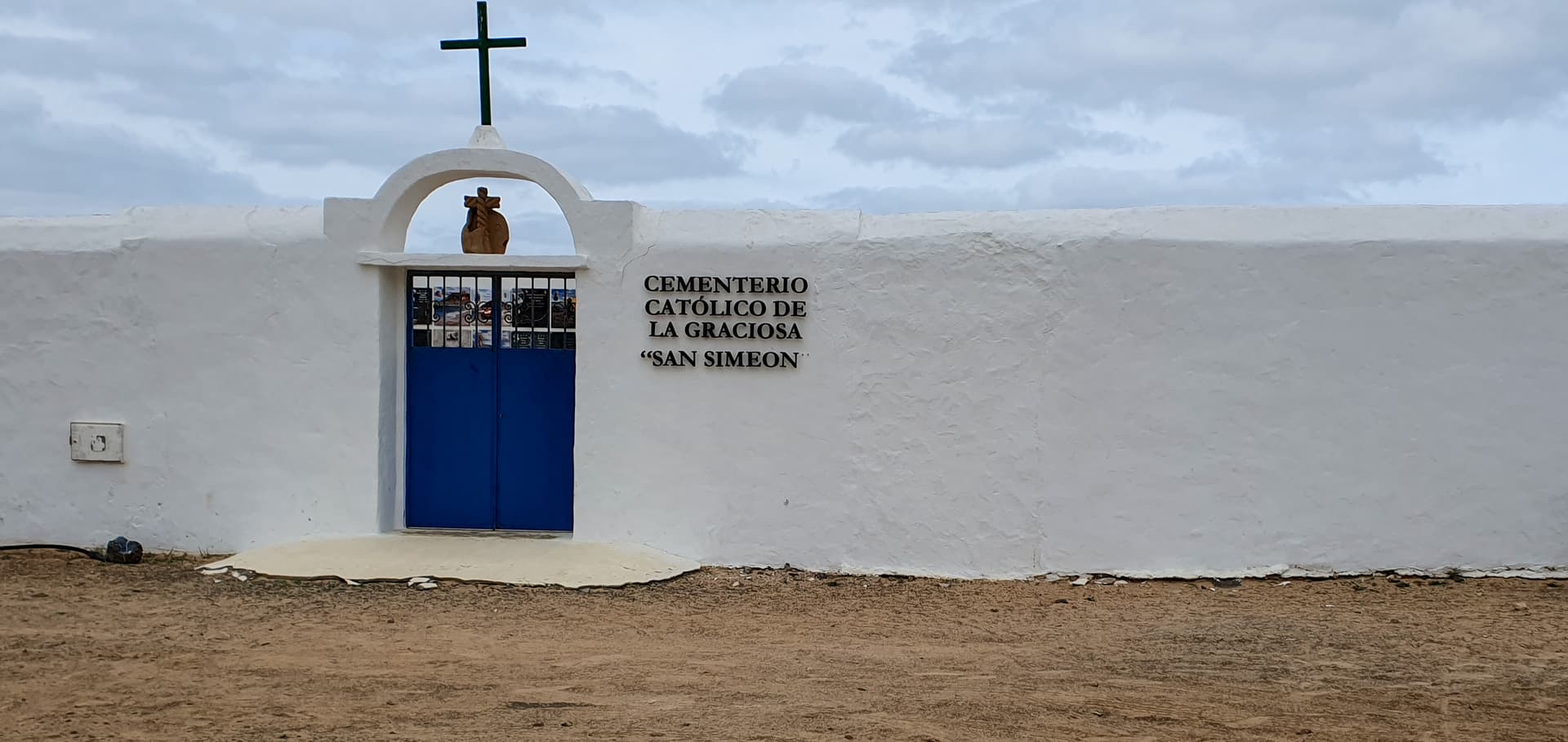
Cemetery (good name ![]() )
)
Now for some potential controversy
Arriving at the track up, we found a Prohibido sign on the track which continues around the base
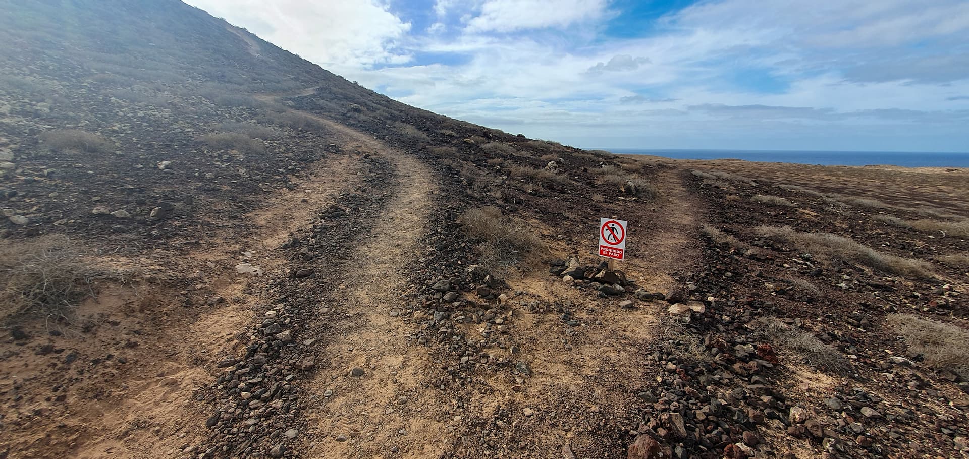
A bit disconcerting, but we carried on up the hill via the steep 15 minute huff and puff track of loose sand and gravel - not particularly nice to come down on. Arriving at the top, we found AARGH! another Prohibido sign a few metres along the ridge. Are the local officials “having a laff” or what? We were the only folk on the hill at the time and after a brief discussion, we continued on, slowly, to the summit marker and then further along to the point where the track starts to descend again. No obvious issues noted, although I wouldn’t like to venture along the summit if there was an absolute howler blowing, as the track is quite narrow and its a sheer drop on the South flank to the sea.
Decision - activation goes ahead.
If anyone can advise why those signs were there, I would be interested. I couldn’t find any reference on Google. In the absence of any obvious problems like cliff falls/path erosion or nesting birds, the only thing I can think of is that they are a “Proceed at Your Own Risk” thing. I did find a reference to 3 Brits having to be rescued in January after getting stuck on Montana Bermeja.
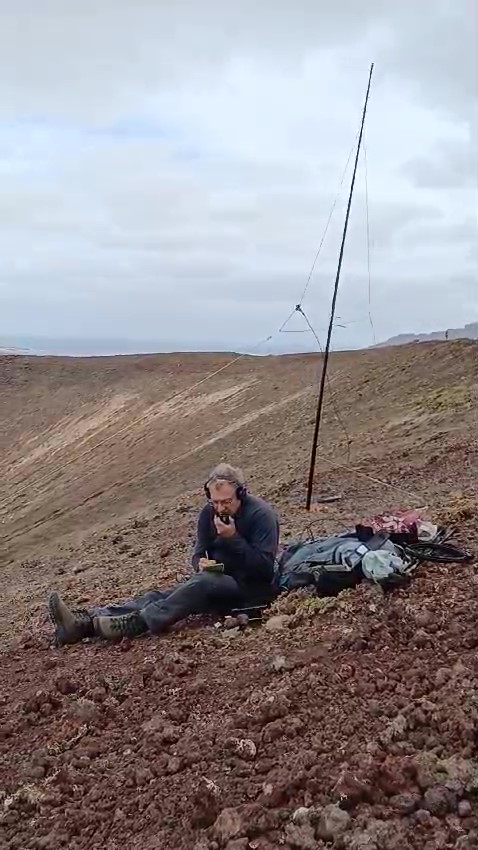
Activation all SSB
Equipment: KX3, 10m delta loop, Spiderbeam 7m mast
Location - least windy area of the summit ridge, at the Western end.
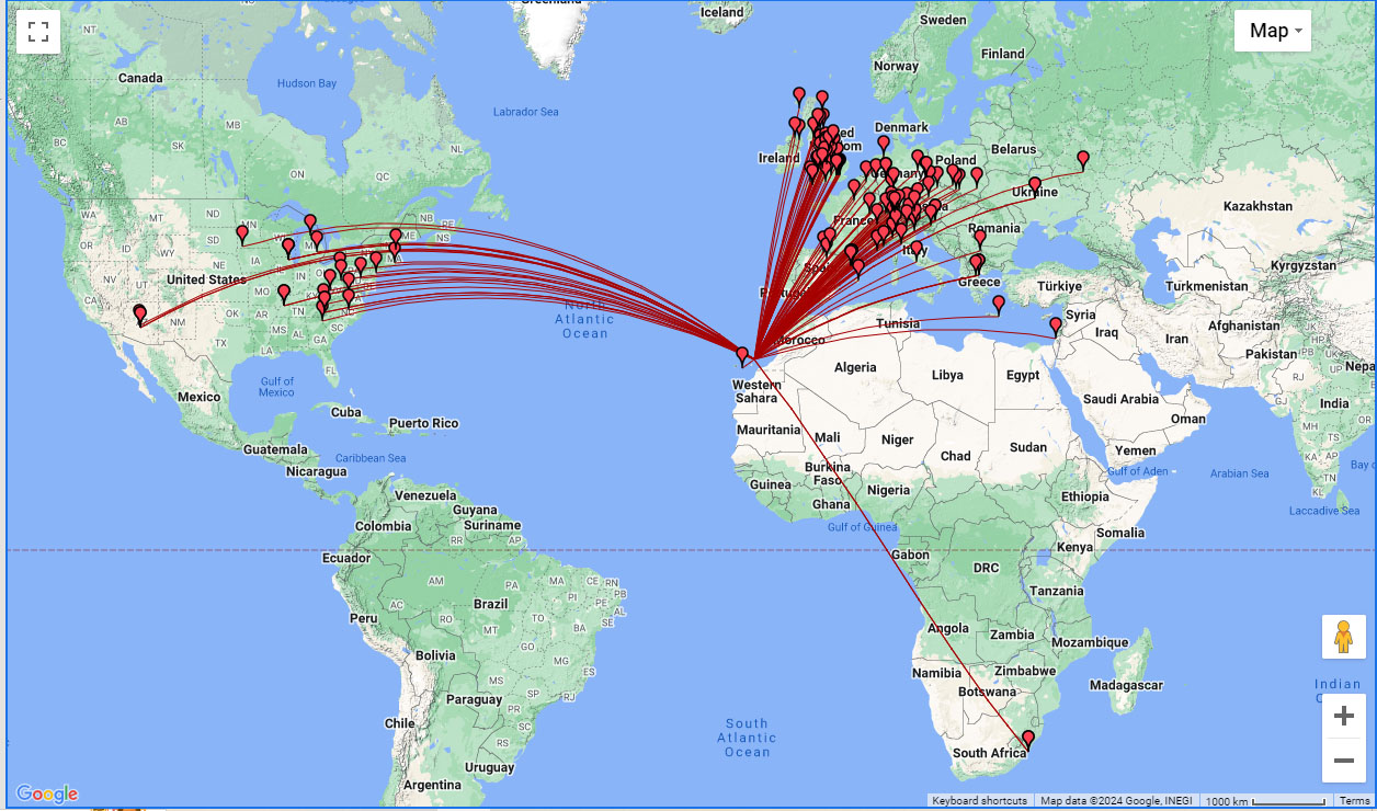
10m was in excellent shape, so I stayed on it all day, ending with 127 itl, 6 S2S including Fraser F/M0EFI/P, for our second. Best DX West was KF6HI Ariz (just pipping WA7JTM and W7USA) best East R2OB, best South ZS5APT, ZS5AYC. 20 US stations in total. In addition it was nice to work a few GMs -MM7MOX/P S2S, GM4LUD, MM7MWL Mike, from our Deeside group, 2M0RMV Isle of Skye, MM6KFE and GM0NCA. M3NCD was running just 2.5w.
During the day, the summit had other visitors. A German chap had his lunch sitting by the summit marker, 2 French women came past, having walked up the Western limb and a large party of about 12 appeared at the end of the ridge but didn’t go further than the Prohibido sign.
Views from the summit
This shows all of the other hills on La Graciosa - Montana del Mojon (non-Sota) in front of LA-026 Agujas Grandes with Montana Bermeja (non-Sota) furthest North
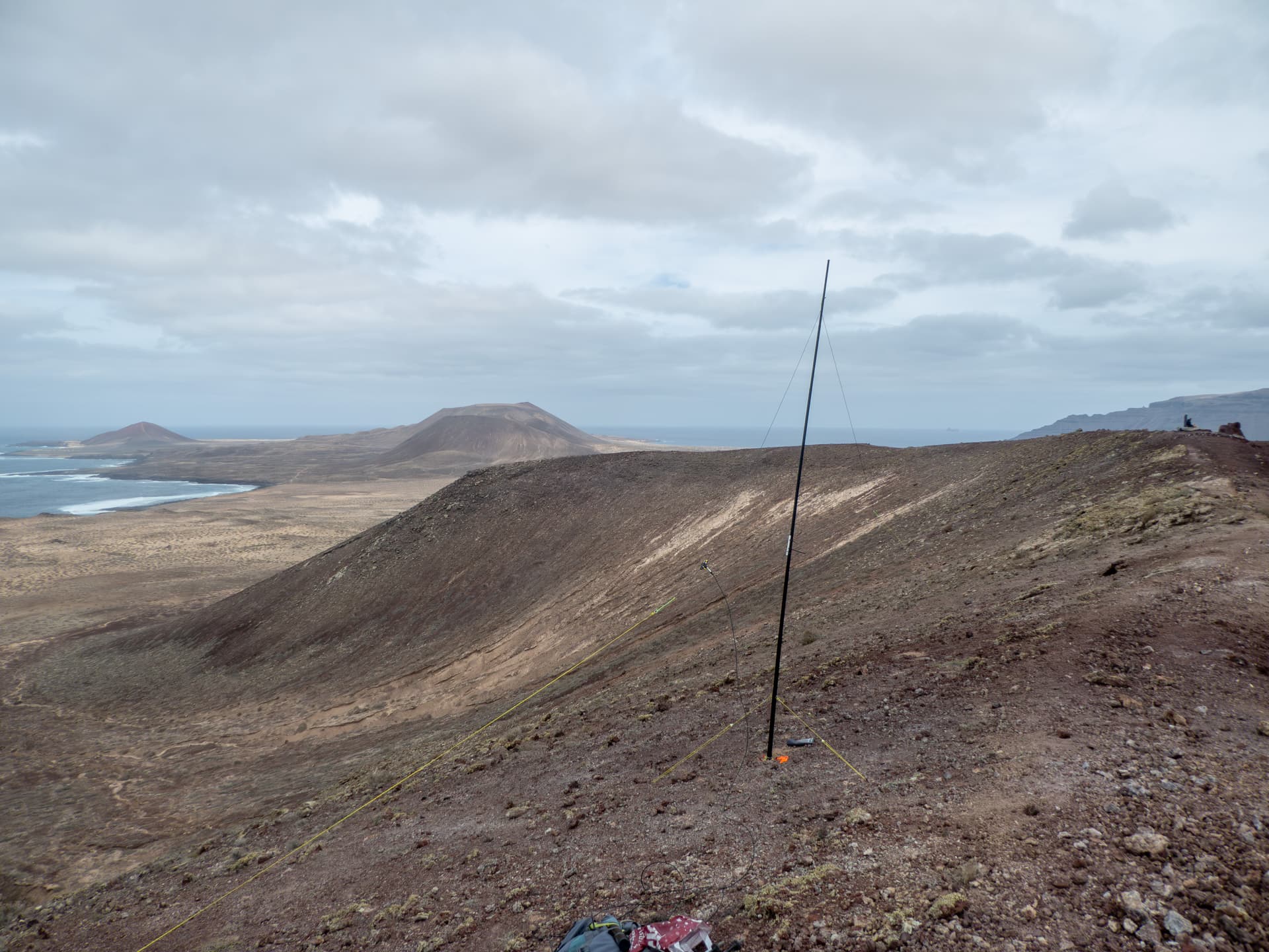
Looking NW
My XYL Rachel had left the summit after lunch and descended via the Western limb, which is a bit longer but much less steep than the path we used coming up, so I went the same way after my last QSO at 1536 utc. The cemetery is visible on the horizon, so I just used that as a guide heading back.
Track at the bottom
A last-minute drama
Our ferry was supposed to leave at 1830, but we discovered that that only ran during peak season and we had missed the last ferry which went at 1730. It seems this is fairly common, a ferry employee telling us that the previous week a group of 8 French girls did the same thing and missed their flight home. Our flight wasn’t until 1400, so we just secured a 1 bed apartment for the night on Booking.com and caught the 0700 ferry the next morning.
Thanks as usual to all chasers and fellow activators. I’m now looking forward to our next holiday/SOTA expedition which is to Sicily in May.