In reply to G7LAS:
Hi Rob.
Hmmm… Maybe Dent, Muncsaster, Watch Hill, Binsey or Hallin Fell may be an option.
High Rigg, Blake Fell and Low Fell may be a possibility and there are some higher ones such as Skiddaw via the long bridleway walk up but I guess it depends upon how far you want to push !! Others may have some ideas also that have done more SOTA’s
From Dent both ways are possible, though there will be one point where you will have to lift the pushchair over the stile on either route. Dent from the Black How farm side rather than Nannycath Gate is a good solid forestry road for 2/3rds of the way, then you swing left, over the stile and onto good grass covered ground straight up following the wall line to the big cairn. The Nannycatch route is also Forestry tracks though not quite as good and the stile crossing and route to the main summit point marked by a smaller cairn is on rougher ground.
The walk between the two summit cairns (the big on being the secondary summit - though only about 10m in height in it and still well within the activation zone) gets a little bit soft in the middle where it dips but still should be ok for a decent pushchair.
Free parking at either Nanny Catch or bottom of Forestry Track opposite farm at Black How.
Muncaster is fairly straight forwards until you reach the final climb bit but probably not totally out of the question. The start is up a good solid track before finally opening out onto the fell.
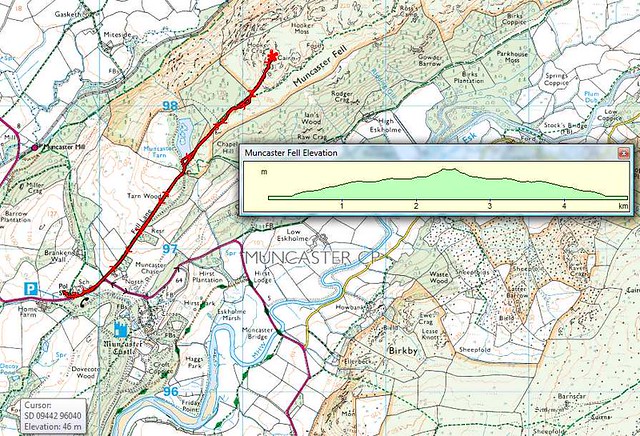
Free parking at Muncaster Castle car park just on the main road.
Watch Hill is once again a good solid Forestry Track up to the top from the southern side or on the main bridleway from the North West / Sout East side - Allerdale Ramble.
The true summit point is in the farm field but the track is well within the activation zone if the pushchair limits you.
Free parking at end of Forestry Tracks
Binsey is a nice wide and quite firm grass track all the way up except for the very last bit but the track passes just below the summit and within the zone (see first photo in the set below). There are good shelters here. Try not to pick a blustery day as the wind can be strong at the top blowing in from the Solway. You may also get some intereference, depending upon rig used, from Caldbeck masts.
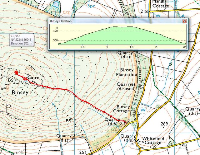
Free parking at side of road.
Hallin Fell is a difficult summit to work from so take a good antenna and post alerts but the climb up for the church is via a grass track and not too bad at the final part.
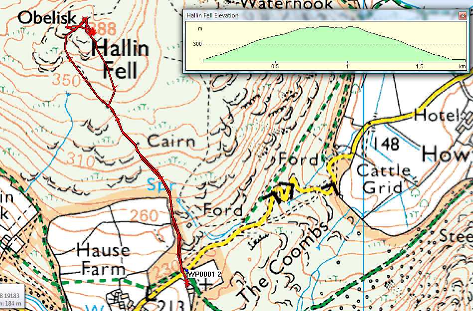
Free parking at the church.
High Rigg from the Youth Hostel is fairly straight forward, though a little awkward at the start for a pushchair as there are steps up round the side of the YHA. Once up these it is grass tracks to the top.
High Rigg is another summit that can prove difficult to work from. Again, take a good aerial and post alerts.
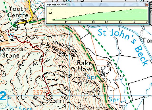
Free parking by church and YHA (don’t be put off by the gate at the farm and cottage across the road. Open and carry on through to YHA)
Low fell is a long walk up and at the bottom part you will need to negotiate 3 kissing gates (farm gates to side) and top part will be harder work once off the track. Going is good though and not soft ground. This is a good hour+ walk to the top so allow plenty of time.
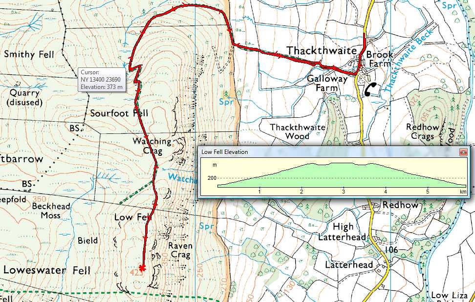
Free parking at side of road
If you don’t mind a short but quite sharp climb then Litte Mell Fell is a nice summit. It’s grass track all the way and two farm gates allow access by the stiles at both points.
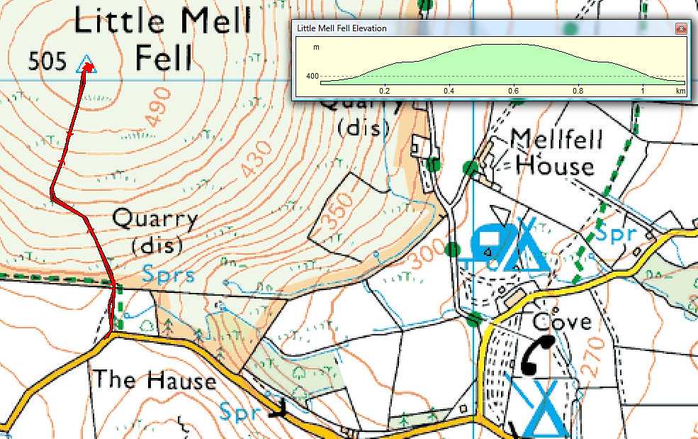
Free parking at side of the road
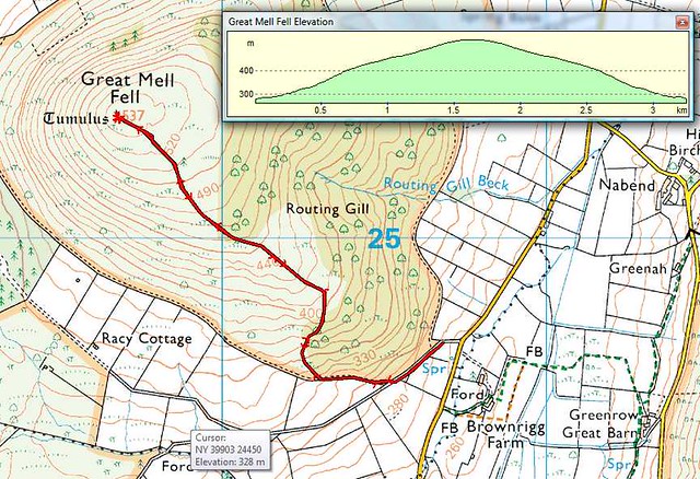
Great Mell Fell I would probably say is not feasible as the path up the side of the trees is rough and would make things difficult. The long haul to the summit beyond the trees also gets very wet and boggy and makes for hard going under foot.
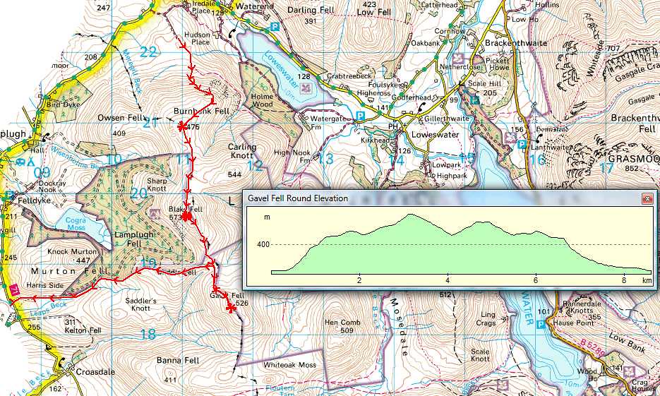
Blake Fell may be another possibility. It’s quite a long walk up but if you go from the Forestry Track, follow up towards Cogra Moss and then turn right along the fence line, over High Pen and then up to Blake Fell. My GPS track shows Gavel and Burnbank - ignore those. The track comes up from bottom left.
Do not attempt from Burnbank end with a push chair !
Lord’s Seat above Whinlatter may be possible but not from the route Colin and I did up to Barf and across. It looked from the summit as though you may be able to take good routes up through the forest and then come out onto the side of the summit. G4RQJ and others may be able to help with that one.
Grisedale Pike may also be worth asking about. Not done thay yet so again, others may be able to help.
If you are feeling very energetic and adventurous then Dalehead from Honister Slate Mine ;-0
Hope that helps.
Liz.
![]()
![]()


