I wonder what they were up to - nothing (except stalking) in season at this time of year. If they had dogs then it might be foxes otherwise the only other possible prey is corvids or pigeons
#Beneraird GM/SS-201
There are two ways to approach this fairly easy summit. Either from the North from Kinwhannel Farm where there is limited parking and a 4.5mile easy walk. Or from the the South via Lagafater Lodge. Now here’s the rub, the public road runs as far as Stone Bridge and then it’s a private road for 3.5miles to the Lodge, no vehicles allowed, just walkers. From the Lodge itself it’s only a 45-50min walk. I was able to arrange access because someone at work knows someone on the estate staff. 3.5mile walk x2 saved 
I was travelling from Dalbeattie and the WX suggested it would be wet till midday then OK. I swapped about the order of this with Cairn Pat. Dalbeattie to Stranraer takes a good 1hr40 as there are some windy roads and plenty of lorries making the trip out to the ferry terminal at Cairnryan. The road to the lodge is from the road to Penwhin Reservoir. This is a very narrow minor road from just off the A77 at Stranraer. The first thing as you climb out past the farms and houses at the start is that as soon as it becomes a typically desolate and boggy moor, there are plenty of signs warning you not to touch anything on the ground because of explosion risks. Then you come across the wall.
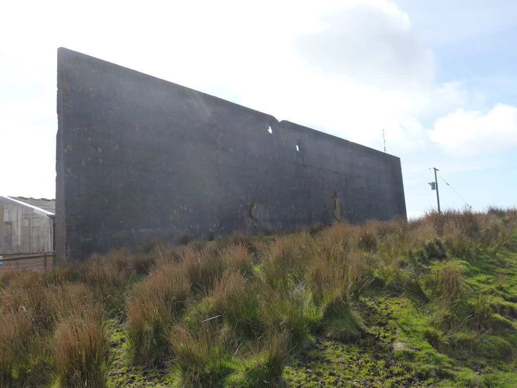
As I drove past it I thought it was an obstacle that soldiers in training had to climb over with grappling hooks etc. That photo was taken on the way back when the holes made by rockets were clear. There are also cracks and impact marks on it. No it’s not a training ground for soldiers, it’s a disused bombing range used between 1942 and 1958. I missed the concrete marker arrows on the ground that pointed to the target.
© Goegraph & James T. M. Towill
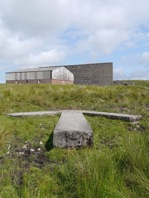
There’s a range control building and the site of a mock factory. The wall and factory were rebuilt as needed. Nothing remains of the factory but the area is fenced off. The RAF bomb disposal team was only withdrawn 2014 and the last few years they were there the made safe some 800 items. The housekeeper at the Lodge told me you regularly heard big bangs as the RAF blew up stuff that had been found.
Anyway you drive up a fairly decent quality road for a lifetime to get to the reservoir and pumping stations. Then you have a few miles to Stone Bridge then 3.5 miles of private road. The private road is very poor with a badly broken surface but no potholes. Still I had to put my car into 2nd and let it drive on tick-over at 10mph. I really thought I’d soon see snow and ice and sign marking the North Pole I drove for so long. Well it’s over 11miles from the turn off! Worse, I had to drive all the way back again. Hrrmph!
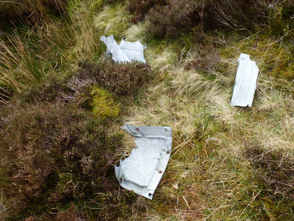
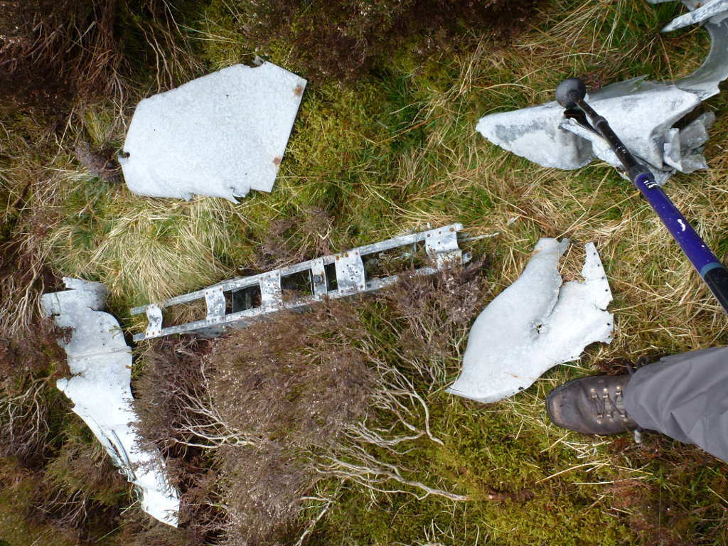
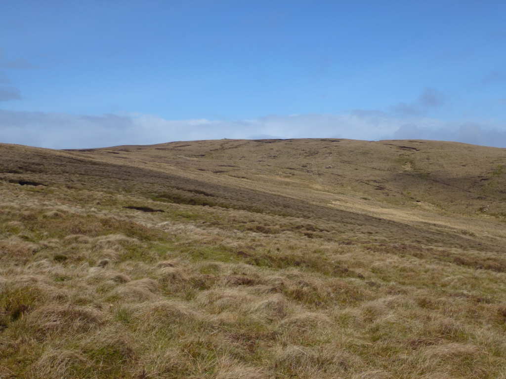
There’s a splendid track from the lodge. It’s recently been scraped with a bulldozer so all the grass and reeds have gone. As such I was able to make good time up here. It reverts to a grass track higher up. Just before you turn off the track for Beneraird itself you can see the plane wreckage lying on the left side of the grass. A B24 Liberator crashed on Goodman’s Cairn on 12th June 1945. Now there’s never a good time to die in a war but for 17 people to die so close to the end of hostilities seems very unfair to me.
Wreckage from the B24 by the path. There’s a lot more wreckage higher up from the track and I planned to find this on my return.
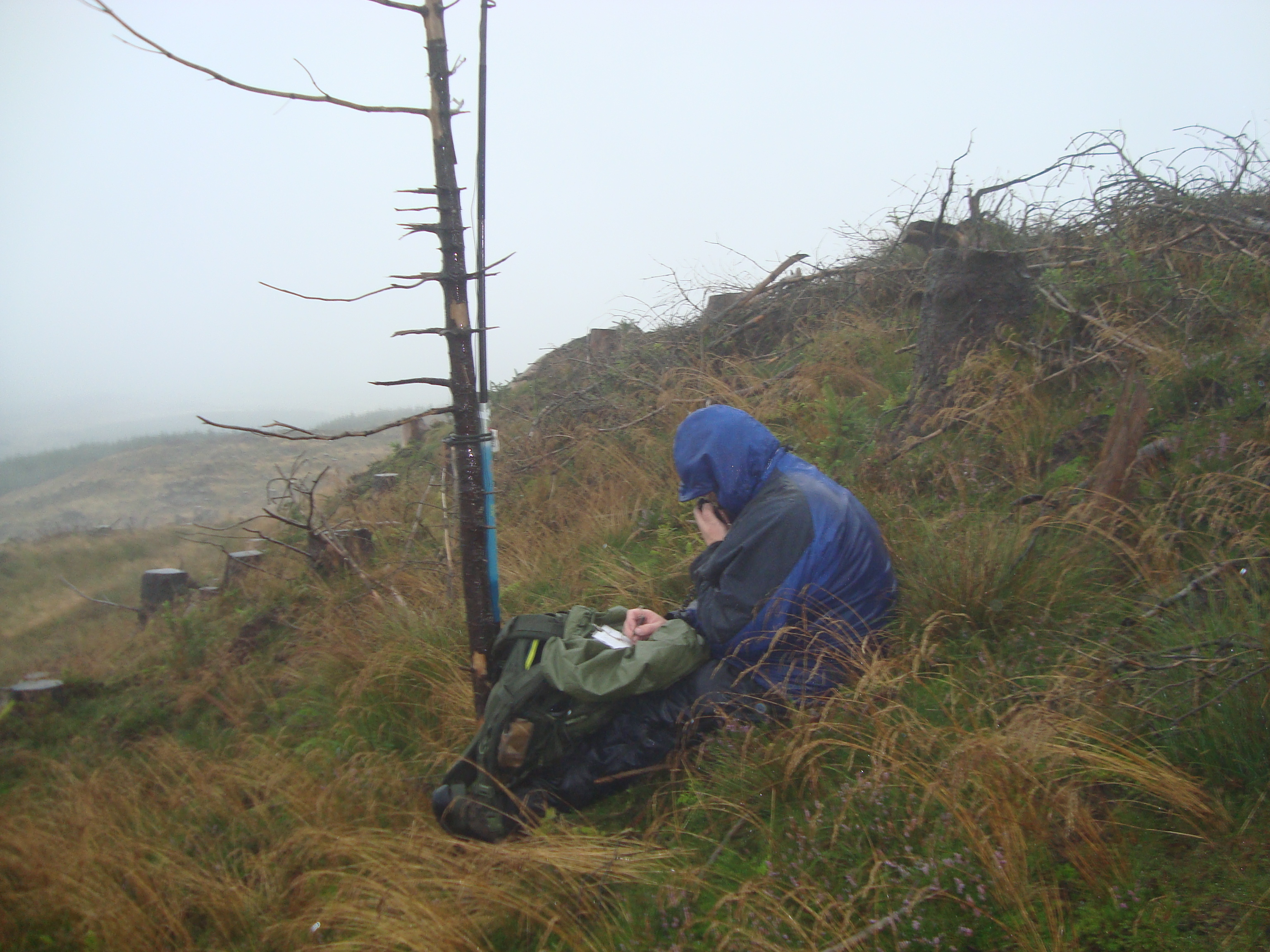
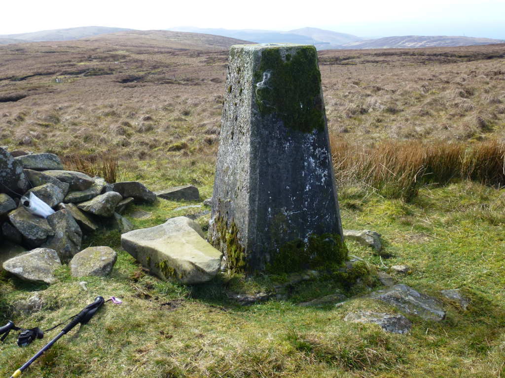
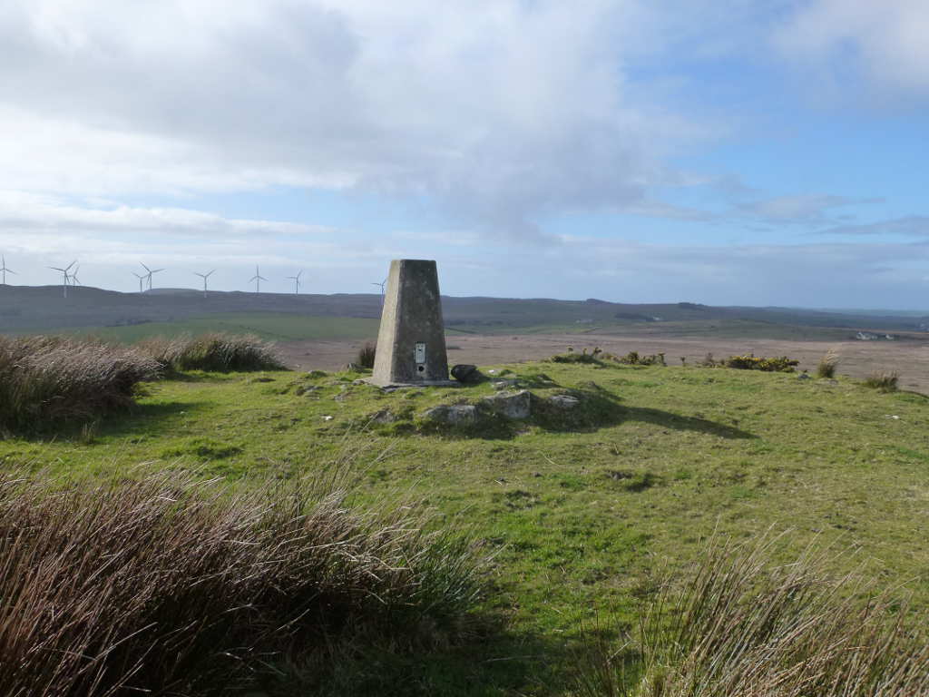
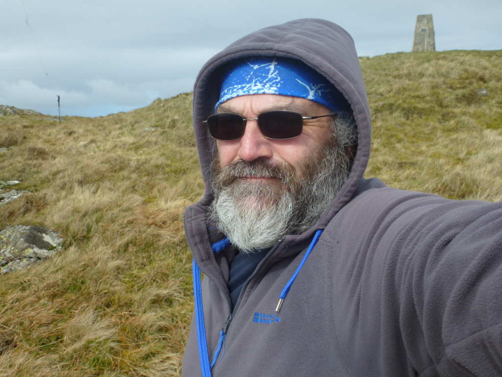
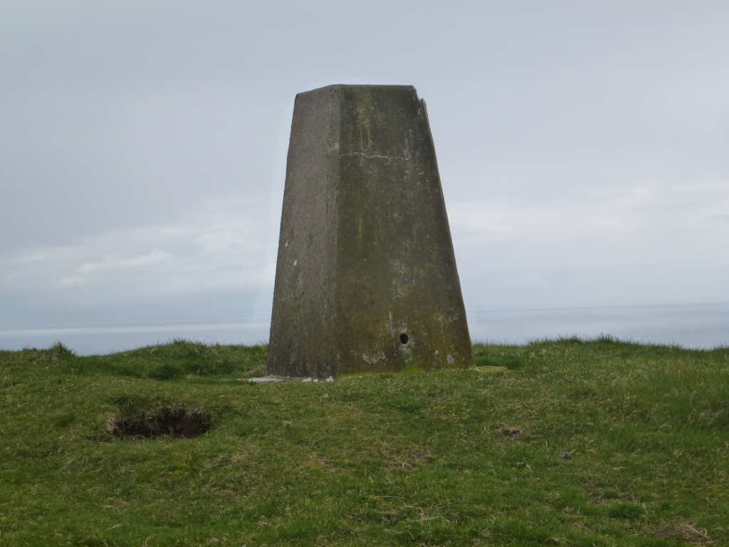
I pressed on and was at the summit in about 50mins allowing for photos on the way. The wind was now officially “damn silly” strength. I spent ages ensuring my pole was guyed and supported so it was not bearing all the wind loading and this meant arranging the dipole legs in a V to support it. I was able to hide behind the trig to keep out of the wind because there is nowhere to shelter at the summit, wide open to the wind roaring in of the sea. I started on 60m and conditions seemed OK when the first rain drops hit. Hit they did, blown at great strength by the wind. Now most of the rain hit the trig and I covered up everything else but then a properly violent squall came throw.
There was some static rain that lifted the noise floor to S2 but I kept on. My arms sticking out either side of the trig got wet but it was bearable. However, the wind was so fierce that as soon as the rain stopped I could see the wind drying things. The rain did stop and I nipped out to set the links for 40m and came back behind the trig. No more rain and by the time I’d finished on 40m SSB most gear was dry. OK DWR (durable water resistant) treatment on Belay jacket and walking trousers meant most of the water stayed on the surface but I was impressed how fast you dry in a 40kmh wind. A quick check suggested there’d be enough time to pack up and escape before more rain so that’s what I did.
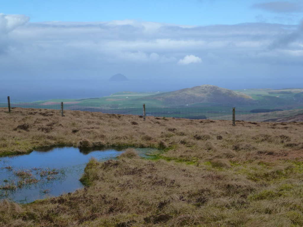
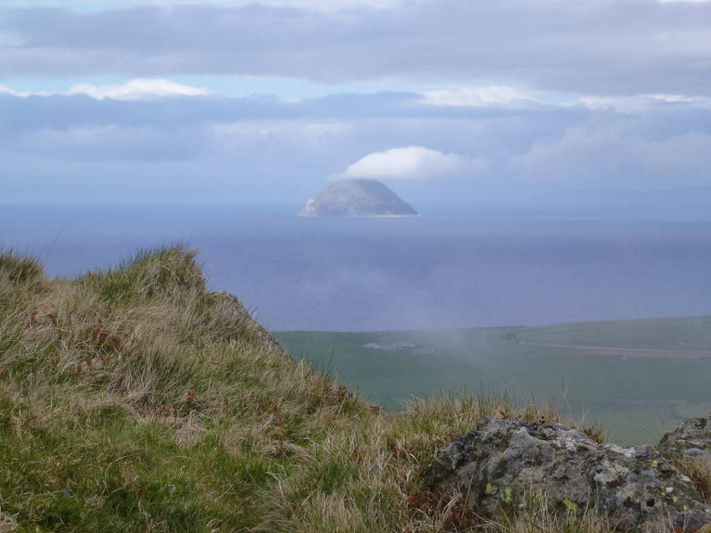
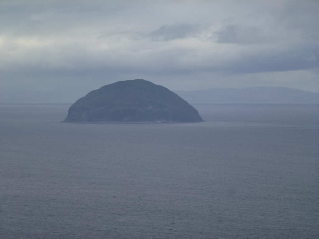
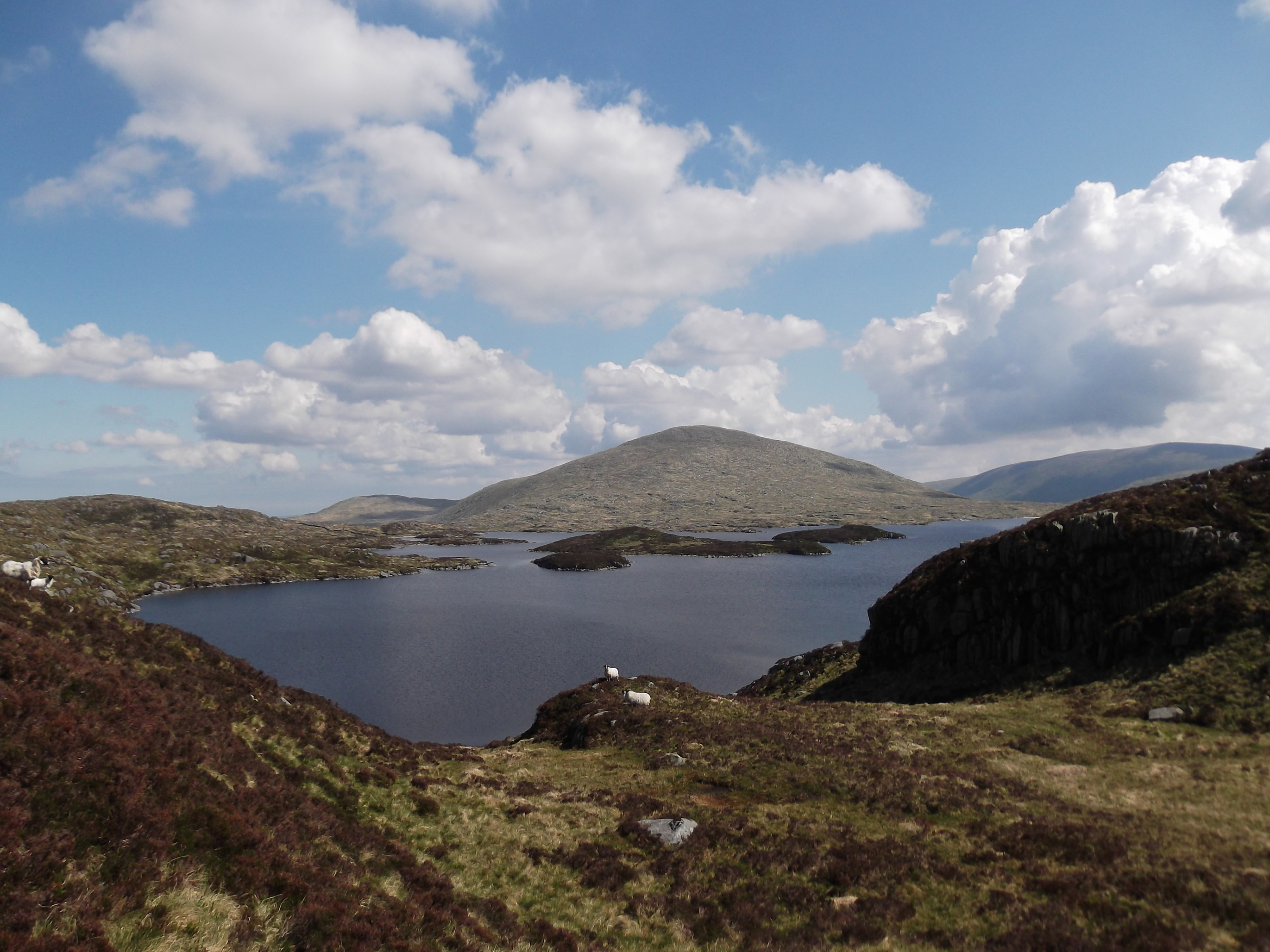
Looking towards Ailsa Craig SS-246 and Knockdolian SS-267. Some fairly filthy weather looks to be coming my way.
The trig and my lovely Ortleib map case. I can remember putting this in the boot of the car when I returned but now there is no trace of it. I’m assuming it blew out of the boot at some time when getting changed / booting up on the next summits. Boo!
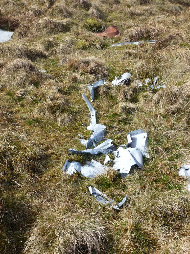
I walked back out and it’s possible to walk onto Goodman’s Cairn without having to climb much. I was off in search of more wreckage. There was a lot still in 2014 but I didn’t find the big piles where there are motors, cables, and oxygen bottles still remaining. I did find some more smaller pieces in several locations
Another of the B24 wreckage sites
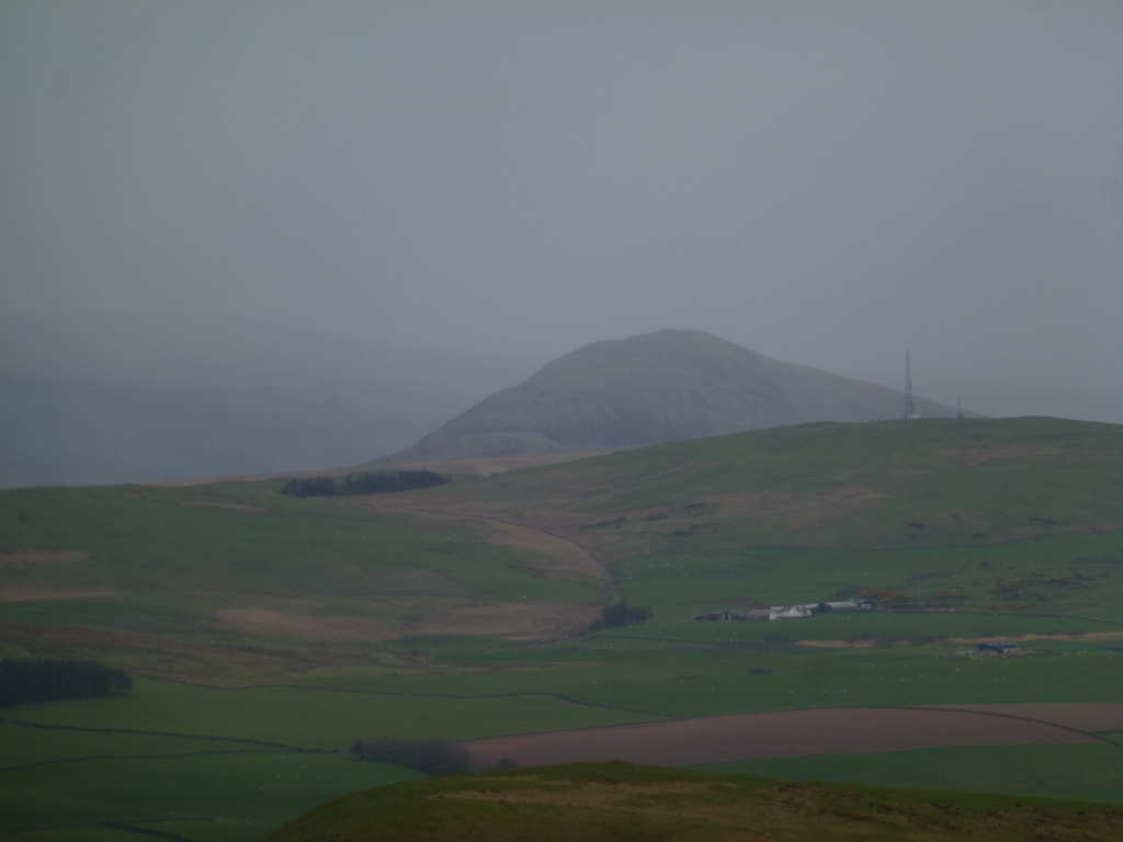
A view back from one of wreckage sites up to Beneraird. WX really quite nice.
After this it was back to the car ASAP ready for the drive across Stranraer and out to Cairn Pat.
2 Likes
We could all club together & buy Andy a razor ![]()
3 Likes
#Cairn Pat GM/SS-281
This is a very easy summit although I drove past the entrance to the track twice before I found it. That is the hardest part, locating the entrance. You can drive nearly half way to the top, there used to be a car parking area at the water tank but that seems to be closed off now. I parked between 2 gates off the track, there were no cattle to be seen, so this didn’t look like it would be an issue. That’s something else reported about this summit, wild cattle! Not angry but very inquisitive and nosey that need scaring away from your activation.
I wasn’t sure if boots were needed as there is a dirt track to the summit and whilst it’s reported as boggy, today was very dry. Boots on and off I went. Just as well as at the end of the almost level section there was a huge pool of standing water across the track. Deeper than my boots and probably 10m long. The verges were very. very soft so boots were just right. From there it was no time to the top where the wind was still strong.
I set up using the fence to the compound and was off on 60m followed up with 40m CW. The WX was fine to start with, mainly blue skies with clouds scudding by but it did get progressively greyer and greyer threatening rain. At a lull on 40m CW after 4 CW calls went unanswered, I pulled the station down and headed back to the car as fast as I could. Probably takes 15mins from the car on the way up and 10mins on the way down.
Cairn Pat trig point.
The view down. The track makes the ascent trivial. Gorse in flower adds great colour when the sun shines.
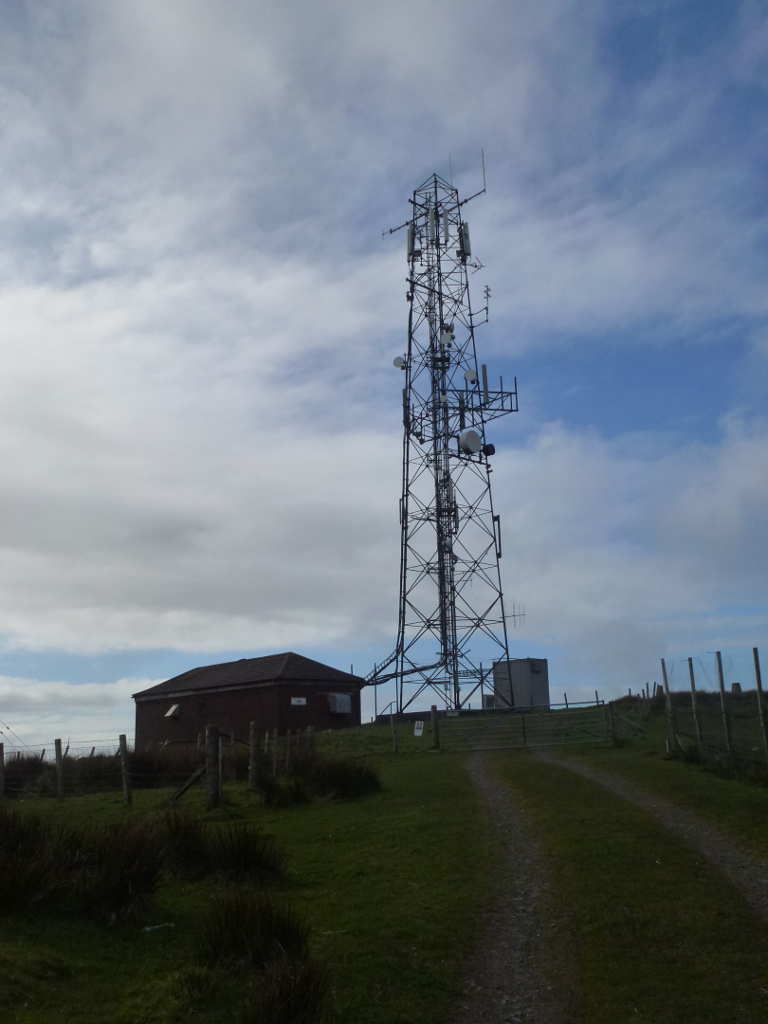
Cairn Pat comms tower. No interference noted on 60 or 40m.
1 Like
#Knockdolian GM/SS-267
I stayed in the village of Colmonell on Wednesday evening and Knockdolian is about a mile and half from here. There are a few gates you can park near, especially the marked gate for the footpath to the summit. However, the ground was badly churned and looked oh-so-soft. My car has AWD and EDL (electronic diff locks to stop wheels spinning in mud) but it has the wrong tyres on it for these surfaces. They’re sporty road tyres and so I parked on some hard standing opposite Finnart Cottage about 100m up the road. I checked with the owner that I wasn’t blocking the turning area. If you park at the cottage then ensure you do not impede access.
It was a lovely morning when I got up, then it showered whilst I had my last full cooked breakfast, then was sunny and had become grey with gentle drizzle when I set off. The top was in the mist but it was still windy enough that the drizzle didn’t bother me. The ascent is quite steep and there are plenty of tracks to follow. Just go up till you can’t go up anymore. Took under 30mins but it was a nice plod and I didn’t really notice time passing. By the time I got to the top, the drizzle had stopped, the wind had dried me and the mist had cleared.
There’s trig point here adorned with “In memoriam” plaques. I set up just down out of the wind slightly. The view improved until I could see the coast of Northen Ireland in the distance along with Aisla Craig and the Kintyre Peninsula. Again 60/40m were the bands activated and conditions seemed OK, but still long on 40m. I wandered up to the trig with the handy to see if I could work anyone as I was getting nearer to larger towns now. I was delighted to get a QSO with Victor GI4ONL with just 5W and the rubber duck. That was 2 DXCC worked on 2m FM excluding my own country! Photos taken it was take everything down and set off for the last summit of the expedition.
The Woodstock refugee trying to keep out of the wind.
Ailsa Craig with a cloud for a cap.
Another view of Ailsa Craig on the descent. You can see how steep the ground is. Knockdolian looks much steeper than it actually is.
This is a really nice wee hill and recommended if you are passing.
1 Like
#Grey Hill GM/SS-256
The last hill of the expedition. Loads of routes exist up this, one route is from the East which starts quite high up but involves parking on soft ground again. My route was from the main road along the Ayrshire coast, the A77. There is a good sized layby just after the average speed cameras going North. Opposite the layby is a track leading to a comms mast part way up the hill. The downside is you start from sea level.
I spent 25mins dismantling the car looking for the map case. But finally accepted it was no longer with me. Boo! Hiss! After that I set off up the path. You can walk up the path to the end and then it’s an easy walk over shortish grass and gentle slopes tiill you get nearer the final slopes. These are a lot steeper but there were plenty of sheep trails making it really easy. Then there was the last trig point. I’d made good time to here, I had nothing to do when I got back apart from cost up a mirror glass (and it’s not cheap but not as bad as expected) so the only thing to make me cut short the activation was the WX. A bit grey and windy still but not as bad as previous. This meant I was able to operate 60/40 & 30m. Again no problems working plenty of people and I bagged both Helen MD0YHB/P and Carolyn GD6WRW/P on GD/GD-003.
Another nice hill. Nothing massive in the walk or technical but just nice views.
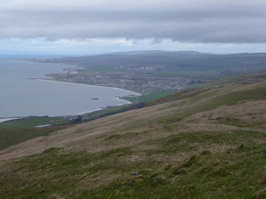
Looking up the coast to the town of Girvan. The boat to Ailsa Craig sails from the harbour here.
Final view of Ailsa Craig. I’m ever so glad Neil 2M0NCM organised the visit to bag this two summers back or it would be bugging me that I hadn’t activated it!
The trig point.
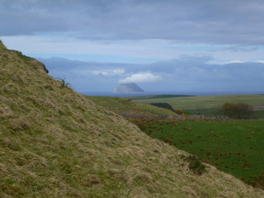
Knockdolian GM/SS-267 with a wee shower passing over.
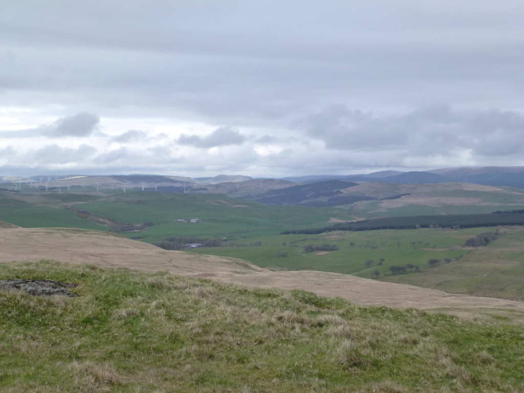
General view to the North West. There’s not too much out this way making it nice and quiet. Sadly that means not much traffic and so the roads are a bit small and slow. It’s quite a drag from where I live near Edinburgh to get here and one of the reasons why I’ve left these summits for so long.
Back to the car in 40mins. Boots off and I was able to hit Glasgow just for the evening rush hour. Grr. Back home and I picked a Chinese takeaway. Mrs. FMF wasn’t due back till late the next day so I went into Brownie Points mode and ensured that by the time she was back I’d done all the washing from my holiday, cleaned up all the SOTA gear, put everything away and also done some hoovering and general housework. 
Overall, this was the first time I came close to running out of summits. Normally my legs fail or so does the WX and so I have plenty of summits left over. This time, I was able to pick up 2 bonus activations that I thought I’d have to do much later. I was very pleased to get Mochrum Fell bagged as it is fairly awkward to get to. There are few summits to hoover up down that way still… Fell of Fleet and Blackcraig of Dee being two 1 point summits that do have a bit of a reputation for “Galloway Ground”.
I managed 10 uniques and that has made a massive dent in the remaining summits in my plan to activate all the GM/SS summits South of Edinburgh and Glasgow. I also hit activation number 500 on the activation of Beneraird. The remaining ones being:
Benbeoch
Bengray (probably to be done when out contesting 6th May)
Blackcraig of Dee
Blackwood Hill (Arnton Fell)
Brown Carrick Hill
Cairnsmore of Carsphairn
Craiglee
Craiglee ( the other one )
Craigenreoch
Craignell
Criffel
Caulkin Rig
Grange Fell
Fell of Fleet
Lamachan Hill
Millfore
Troweir
and, of course, Mulwharcher.
I need to get my mountain bike sorted as that will make a few of these much easier. I could drive up some of the forest roads in the pickup. Wear a hi-vis vest and hard hat and nobody will ask what you’re doing! But biking does seem a more wholesome way of getting about. The easiest route to Mulwharcher involves a 12k ride in. It’s getting so I can almost see the end of the task.
Anyway, none of this would be any fun if it wasn’t for the chasers. I would really like to thank every single chaser for making the effort to catch these activations, without chasers, activating becomes a lot, lot harder. Sure you can tune about and find people to work, but having a bunch of people seeking you out makes it all so much easier. I haven’t checked carefully but I think Don G0RQL worked me on every activation and I think he may be the only 100% chaser. In addition, due to the long skip and with Don being down in Devon, he was far enough away to be a good signal with me on either 60 or 40 and became an unofficial control station, holding the frequency when I need to fix antennas or change batteries for instance. Also Don placed plenty of spots for me for the QSY frequencies, things you can do yourself as an activator, but having a someone with a good station to help out makes life much easier. Thanks to Don and everyone who called in.
I need to disentangle all the routes from one big route capture in the GPS and I’ll push them to the mapping site.
I normally take a selection of walking clothes, socks, boots, hats, gloves etc. I print out maps for all the summits at 1:25k beforehand. My Windows10 notebook has full UK OS mapping at 1:25k and can drive the GPS to upload and download routes, tracks etc. I have an aging Garmin Etrex Vista HCx GPS and recently saw one on eBay for £30 which I picked up as a spare (hard to refuse at that silly price). I have two 5m poles, one which has done probably 450 activations now. I took a 12v soldering iron and solder, a small pair of pliers and some bits of wire, enough to effect emergency repairs if needed. 2x 817 and some spare runs of coax. My satellite spotter consists of 2 boxes each the size of a Raspberry Pi. Finally I had 2 4Ahr LiPos and some 2.2Ahr LiPos plus a big box of USB and LiPo chargers. Considering I have enough handhelds to stock a shop, I only took my VX170.
Taking so much gear including spares/duplicates suggests some kind of OCD issues but it’s just common sense. If you are driving a fair old distance specifically to bag a run of summits and you have spare equipment anyway, then why on Earth would you not take it with you? Most of it sat in a box in the boot of the car for the whole trip!
Now to plan how to get the rest of them bagged…
3 Likes
I see that like me you can’t resist taking photos of Ailsa Craig. Knockdolian is one of my favourite little hills. I note you have Blackcraig of Dee in your todo list: we did it pre-SOTA and it’s not one I look forward to revisiting: I have bad memories of the ground, and slightly more pleasant ones of a Peregrine - we guess we had somehow strayed too close to its nest.
First of all who missed me?? Anyone? No one! Aw!! ![]()
Keep to the north end of Loch Enoch and cross over Elgin Lane (it is a stream, not a road) and from there it is a 200m climb. I was up there a few weeks ago but arrived from the NW as I had set off from Stinchar Bridge, up Shalloch on Minnoch GM/SS-042, south to Kirriereoch Hill (again) then across to The Lump of the Elgin before the easy climb up Mullwharchar. Total distance in and out about 26km, Didnt have the GPS as it is that long since I used it the case broke so didn’t want to lose it on the the hills. Cat would thump me!!
Shame I missed all your local activity but I have been rather busy over the last year or so, not always doing better things but rather other things and not having an antenna up at home for the last 10 months has dampened the chasing as well. But I do hope to get back to playing SOTA at some point but not sure when as all the summits I have still to do are several hours drive from home.
I have popped in here from time to time but this is the first I have had this computer on since December - updates!! Jeez!
Anyhoo best of luck with the rest of your adventure and if you need any info on the Merrick group or a guide feel free.
73 Neil
Hi Neil!
Well Gerald and I had often commented on your absence as we trudged round the various GM peaks of late so I reckon that counts as missing you! Great to hear from you, hope all is well and your back is sorted. Look forward to increases in your SOTA activity levels ![]()
Regards to Cat and 73
Paul G4MD
1 Like
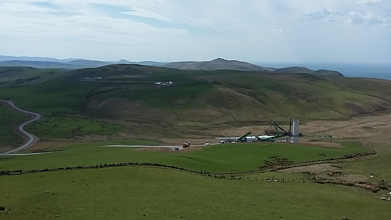
Troweir Hill, if anyone is interested in doing this summit before it gets deleted there is now a windfarm built just to the south of it so access is now a lot easier. This picture was taken in May 2016 and is the turbine next to Troweir that is shown in the photo. I however have not been up this hill since the picture was taken and as you can see the road heads south. So I presume the road in starts about Pinmore somewhere, I can go have a look if anyone wants as it is only 6 or 7 minutes along the road.
Cheers Paul, yes I have often wondered what I have been missing over the last year or so. I have not been out hiking very often but I still keep reasonably fit at work. My back, well it is never going to get better but I have learnt to live with it and know what I can do and what I dare not try. Sitting is the sorest thing. Walking without a back pack is sore but manageable, while walking with a back pack is usually fine. Though I don’t think wandering round the shops getting the messages with a back pack on would be the best of things. hi hi.
As I said I pop in here sometimes and just for some reason yesterday I was drawn here for some reason then found my call had been mentioned. Spooky!
I even stopped taking the hand held up the wee hills I was wandering after one SOTA chaser said he didn’t want to talk to me on a SOTA summit if I wasn’t actually doing a SOTA activation!! Och weel, less weight.
Take care and hopefully I will be back soon. I miss the crack!
73 Neil
Well Neil I did wonder if I might hear you when I was out in your part of the country. Thanks for the update on Troweir, it’s on my list of course. The official Marilyn list has it and Saugh Hill as a double topped entity and I’m fairly sure you can do either for SOTA although the DB lists Troweir’s position. Saugh Hill has the trig point though.
That’s a cracking photo of Mulwharcher. When I last saw it (9.5years back) there was more high altitude cloud but it was sunny and warm still. ISTR temps around 18-20C as we had an Indian Summer at the time. I consumed a huge amount of water that day. I’ve been looking at routes to it and I think I favour Jack GM4COX’s route through the forests past the former Back of Bush bothy and up Mulwharcher from the East. I need to get my bike fixed for that though. As for the others, I’m trying to figure out maximum bang-per-buck activations by grouping summits that can be done together. Throw in a few nights B&B and it’s possible to sometimes clear up 4 in two days, legs and WX willing.
Your knowledge of the routes possible in this part of the world is invaluable in my opinion. I’d be more than happy if you wanted to blunder about country with me. Or natter on the radio whether you were chasing / activating or not!
Sympathy offered for your back. Mine sometimes gives me some gyp but a day or three of doing those exercises you mailed me gets it back under control again. My quack pointed me at the same exercises when I saw him. They worked wonderfully for me and still do. E&OE!