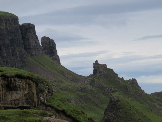
The forecast was again for a mixture of rain and finer weather, but with the north looking less bad than the south, we made our target the two most northerly summits on Skye. This was a moderate drive from our base at Sconser, but once we were on the coast road north of Portree, there were rewarding views of the Trotternish ridge, despite the clouds topping them. The Old Man of Storr was visible under the clouds, and the car park for it looked full as we drove past: would we be able to get into our target car park at NG439679? The single track road was busy as we headed up the steep road with several stops to allow cars to pass. Emerging at the top the road past the parking looked completely blocked by manoeuvring vehicles, including several minibuses and campervans: this didn’t look good, but Caroline spotted that we might be able to squeeze in at the end without blocking anyone – success!
Quiraing
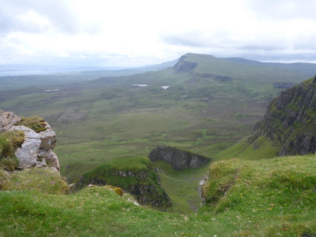
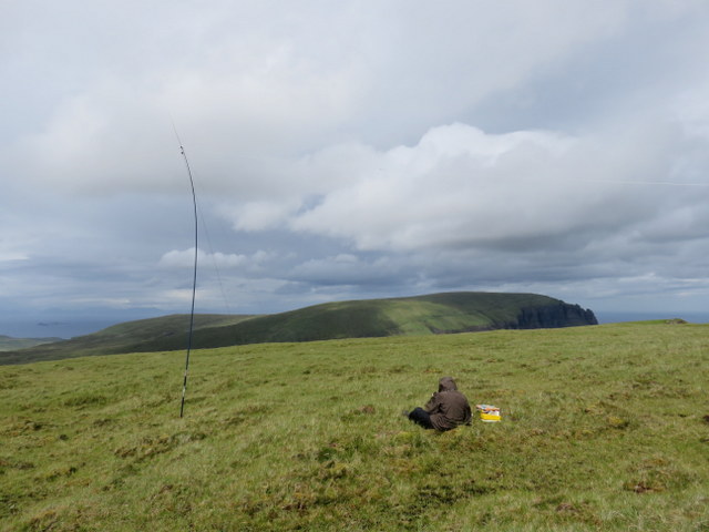
The clouds were above the hills and we got good views. Most of the many visitors were heading across the road towards the Quiraing, but our initial target was GM/SI-081 Bioda Buidhe in the other direction. We headed south along the path near the cliff edge: the clouds were mostly above the hills so we had reasonable views along the ridge both north and south and out over the coastal plain towards Staffin Bay. The path wandered a little inland to ascend through an escarpment, and it started to rain, so we applied waterproofs, and before long it stopped again. The summit was fairly flat with a small pile of stones as a marker. It was too windy to set up at the summit to we retreated a little further north to get a little bit of shelter. Caroline didn’t want to be too far off the summit to get a reasonable VHF takeoff, managing 3 contacts (though 2 were the same person with different callsigns). Martyn managed just 4 contacts on 5MHz to qualify the hill, so passed the HF rig to Caroline who got 13 contacts on 7MHz. While Caroline finished lunch Martyn had a final try on 14MHz where 6 contacts at least got his total just into double figures. It had stayed dry while we were at the summit, but was now looking generally more cloudy as we descended.
Trotternish ridge ascending Bioda Buidhe
Bioda Buidhe
As we passed the car park we stopped to get water, noting the car was now blocked in by a campervan, whose owner soon appeared and apologised, but we re-assured her we didn’t want to drive off. We headed off on the path towards Quiraing, still with many tourists, including a party being shown round by a kilted gentleman. Although some of the hordes were continuing towards Quiraing itself, most weren’t going very far. We only followed the Quiraing path a short distance before taking a wetter and fainter path which headed straight up the hill, which bent right after climbing steeply, ascending more gently parallel to the cliff edge. Where it levelled out we headed over rough ground towards where we thought the trig point would be and eventually the stone built trig point appeared in front of us. It was still windy and the clouds were getting closer to the hill top: we started off with views under the clouds but they soon descended removing all hope of a view. The trig point didn’t have a hole in the top, and there was precious little shelter at the top, so we set up our stations in the shelter of a small rock a little way from the trig point. We added extra layers of clothing and Caroline needed gloves – it really didn’t feel like the end of June!
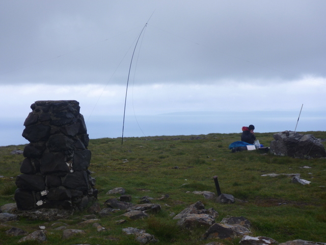
Meall na Suiramach before clouds descended and blocked all views.
Caroline’s initial 2m FM call yielded just one contact, so she moved to 7MHz after Martyn had qualified the hill with just 7 contacts on 5MHz. Conditions weren’t good and Caroline only made 7 7MHz contacts, though a final 2m FM call yielded one more. By now the clouds had descended and we were getting damp, so it was time to pack up. We had intended to head east to the cliff edge to get the view over to Quiraing, but there was no point given the lack of visibility, but by heading in roughly that direction we picked up a better path which led us back to our outbound path. As we dropped we had interesting effects as the cloud swirled around the Trotternish ridge. By the time we were back at the car the rain had stopped, though the summit was still in the clouds. Despite the lower clouds there were still good views as we drive back to the cottage.
