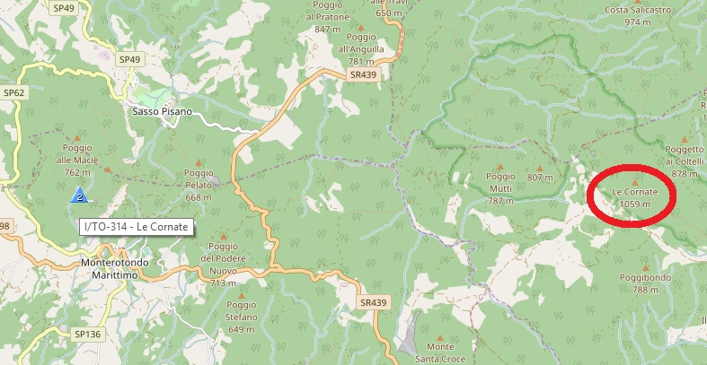
The pointer I/LO-314 is shifted respect to the real summit position.
For my summer holidays I’m going to be there; is it correct to reach the real summit? ( signed by red circle )
I activated Le Cornate I/TO-314. I noted the error in position from Phil OBK’s previous adventure!
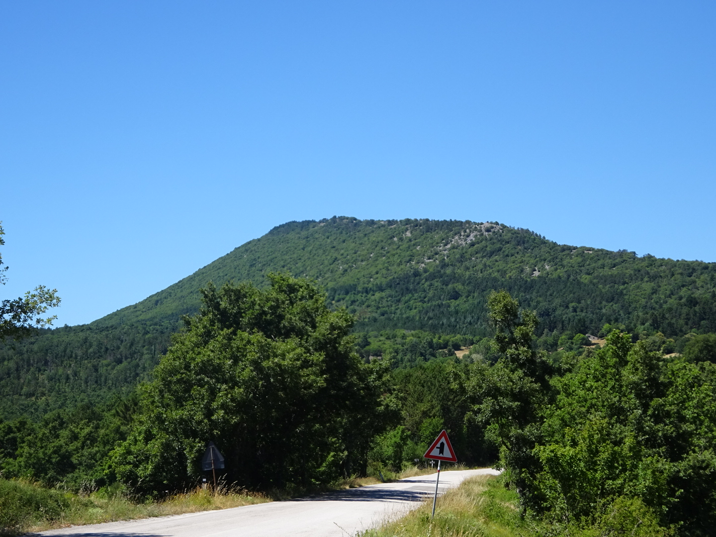
You have the correct position, its a nice walk of under 1 hour up from Gerfalco to the south. In fact it is a much nicer walk and summit than Monte Calvi. There is a good path to the summit. I will attach route to sotamaps when I get home from holiday.
73 Gavin
GM0GAV
I’d like to assure people that the update to Italy is well advanced. We can’t commit to an exact date yet, but it is not so very far off. Please bear with us a little longer.
Hello everybody,
So, the Gavin’s activation was a valid one? If so, can we all do the same thing: if a SOTA summit is apparently misplaced, we find supposedly a right one (name match looks like a sufficient criterion) and activate it for the SOTA indicated points of the misplaced summit. Please comment on this. (There are many misplaced/misnamed summits in E7 and I’ve been avoiding them simply because I do not know which approach to such situations would be a valid one…)
73’s!
Zoran / E70AA
Zoran,
I am sure the SOTA Gods may have an opinion, but I am happy it was the correct summit. The name and height match the database, location was wrong by 8 km.
The first thing to do when you find an apparently misplaced or misnamed summit is inform somebody who can do something about it! Inform the AM, if he isn’t responsive - or in addition! - inform the summits team, via Simon G4TJC. If nobody knows about these things, they won’t get fixed!
The second thing is to look at the latitude and longitude given for the summit. Sometimes they get accidentally transposed, because most of us still automatically put latitude before longitude in accordance with long standing custom reinforced by international treaty, but Google in their infinite wisdom decided to reverse this and all the computer people slavishly followed them! This is a recipe for errors in transcription! At other times one will be correct and the other affected by a misprint - in the example above it appears that latitude is correct but something has gone wrong with the longitude. If you are convinced that you have identified the correct summit - name and height look right - then go ahead and activate it…but let somebody know about the problem.
Gavin,
I’m glad that you enjoyed your activation. It looks like the MT guys will accept it, which is a great news because it establishes a procedure for dealing with some kinds of errors in SOTA lists of summits.
Enjoy your Italian vacation!
73’s, Zoran
E7 AM, Zaro, and I have already started the conversation. I think E7 positions as currently listed are not bad, but there will be a good complement of new ones to add.
Italy, as currently listed, is really not a good comparison with other associations! Yes, there are some associations with lots of crazy summits (prominence far far below the minimum) but I think (hope!) none with the gross positional inaccuracies that Italy has. When positions are so inaccurate as to let the activator have doubts about where he or she should be activating is clearly unacceptable.
If we had just declared Italy was not valid at all until we fixed it there would have been an outcry. But equally it is not acceptable for activators just to go off and “make it up” where they think the summit should be. Please take the responsibility to pass on the fixes, via the AMs in the first instance, and direct to MT if that fails. I do prefer to keep major updates together as a package, rather than lots of bitty updates, but if there’s a gross error that makes a summit position ambiguous we will listen.
Brian,
Thanks for the advice. One of my incoming activations will be E7/BO-011, which bears the name and approximate elevation of a central-Bosnian summit, but its SOTA coordinates place it in the neighboring Serbia! Hopefully there will be no problem with validity of my Bosnian activation of a Bosnian summit…
73’s, Zoran
Thank you at all for your answer and I apologies for my oversight,
I just have read the OBK’s adventures. They will be very useful!
I will be in Tuscany from 19 to 26 August, I’d like activate in HF I/TO-314 and 304.
Many thanks to the Team that is working on italian ref.
Well, the internationally-accepted definition of a GIS (Geographic information system) point is as [longitude, latitude, altitude] and is the geographic analog of the [x, y, z] point in mathematics. So, no slavish following of anything, just following a newer convention dedicated to aiding calculations of positions, distances, slopes, prominences, etc. (eminently useful), rather than on printing-to-paper cartography (nice to put in the pocket while hiking, or on the wall as decoration).
Well you might carry a globe in your rucsac, Rob, but I carry a flat map!
In fact, the order radius, inclination, azimuth is codified in ISO 31-11. Geographers don’t need the radius (or to the extent they do, they use elevation/altitude, which is the deviation from the nominal radius of the earth), so we just have inclination (latitude) and azimuth (longitude). From this perspective, latitude/longitude is perfectly correct. Latitude has an historical priority in that it could be measured directly from celestial bodies whereas longitude could only be inferred from dead reckoning until the invention of accurate timepieces in 1773. If I remember correctly the International Meridian Conference of 1884 codified the Greenwich meridian as 0 longitude and codified the historical practise of noting latitude before longitude. Even in everyday speaking we say “latitude and longitude”, the order is ingrained into us. Thus reversing a long standing convention for trivial reasons opens the door to accidental reversing of the co-ordinates when tabulating large numbers of summits - in other words, blame it all on Google!
I would hardly call trivial the harmonization of mathematical and geographic informations systems in order to more easily facilitate calculations.
We just need to be aware that there are (at least) two different ways of looking at the same problem, one historic, and one new(ish), each with its’ pros and cons, but each equally valid in its’ own domain of applicability. Why all the fuss about Google and evil machinations and slavish following of this and that?[quote=“G8ADD, post:16, topic:15597”]
until the invention of accurate timepieces in 1773. If I remember correctly the International Meridian Conference of 1884 codified the Greenwich meridian…
[/quote]
etc… But it’s now 2017 and things have moved on from those days.
Only if you’re using the simplest of all approximations to the Earth’s shape - i.e. a sphere. A modern geographical system defines a geoid - a complex mathematical construct or shape where all points on the surface of the shape have the same gravitational potential energy. And, yes, geographers, oceanographers and the like do need to know to a fair degree of precision (better than meters) where that surface is at any point on the real globe.
Long gone are the days of reckoning the Earth to be a sphere…
Well, it is you that mentioned “evil machinations”! I prefer to apply Hanlon’s Razor - “Never attribute to malice that which is adequately explained by stupidity”!
As for the “why all the fuss” question, as I pointed out, reversing a long held convention for trivial reasons opens the door to transposition errors. Look at it this way, say a new Association has several thousand summits identified as probably valid from satellite data. Each one of those summits then has to be individually identified from maps, giving them a name, height, and location of both the summit and the key col. This data has then to be entered into a spreadsheet. Most of us would regard this as a mind-bendingly boring routine task which will continue for months, and since part of this routine includes determining latitude and longitude which then has to be transposed to longitude and latitude before entry onto the spreadsheet, the potential for error becomes clear. From time to time these transposition errors show up in the SOTA summit lists and have to be corrected, and its all because some genius decided that he was too good to follow a long standing convention and reversed a co-ordinate system because " it’s now 2017 and things have moved on from those days."
Oh, and any point on the geoid can be related to a sphere by a signed difference, so your point is irrelevant to the discussion!
Well, a person can hold cherished beliefs about the advanatages of some particular system of reckoning, and if he or she is happy with that, then so am I. But phrases like “reversing a long held convention for trivial reasons” and “some genius decided that he was too good to follow a long standing convention and reversed a co-ordinate system because it’s now 2017” are value-judgments at best and ought not to be raised in such a discussion. Both systems are valid, after all.
Well, true: so some form of Stick-It note is required to remind the hapless administrator that “here there be transposition dragons”. Or automate some of the work with some MT-grown software to minimize the possibility of such errors? Get creative, or let somebody else get creative - this ain’t rocket science we’re talking about.