Well, that’s everything finally prepared (although I only remembered the toilet paper last thing last night). All being well, I will be in England this time tomorrow and possibly on Buckden Pike G/NP-009. As I have said before, if you chase regularly and use VE7CC, please consider adding TF/OE6FEG/P to the alarm list, it’s good to have as many spotting options as possible. Looking forward to lots of QSOs!
73 de OE6FEG
Matt
Regarding camping in Iceland, one is allowed to use up to 3 conventional tents for one night, just about anywhere, without asking permission, unless it is on land that is cultivated or near houses. If there is a prepared campground near, it must be used though.
-Einar
1 Like
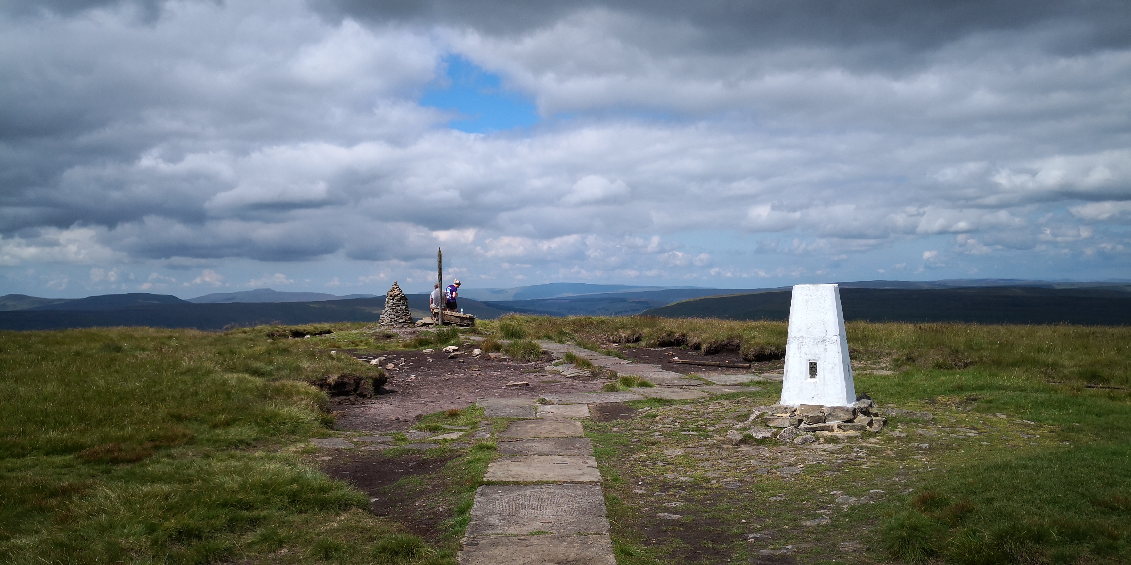
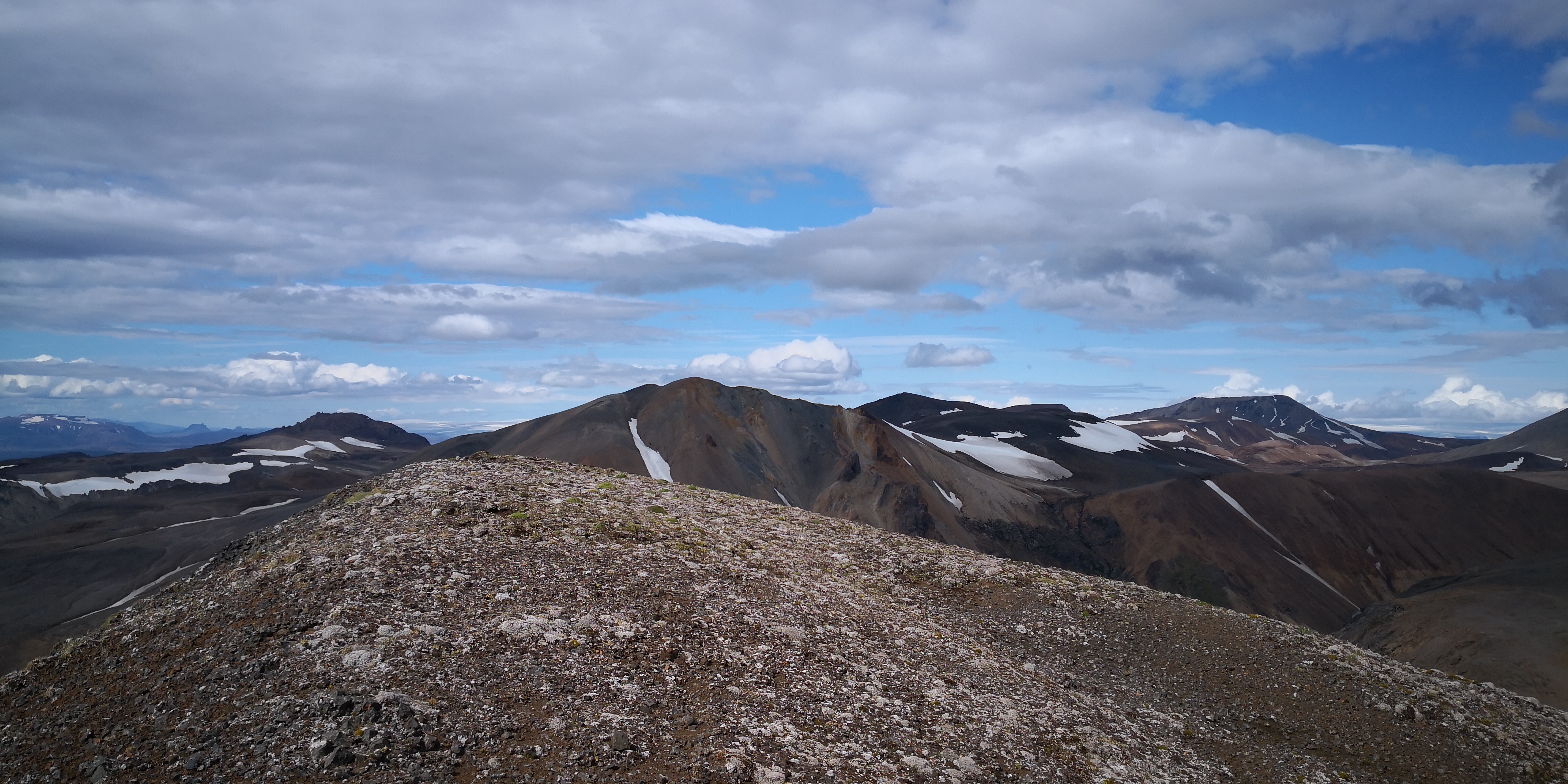
Had a nice prelude activation in the Yorkshire Dales today. G/NP-009 is a hill well known to me, but never activated for SOTA. I needed to stay active in the days leading up to my Iceland visit, and Buckden Pike also gives me my 101st unique. The weather was perfect, and despite getting only 4 hours sleep last night (having arrived in Manchester at 23:20), I was up bright and early and heading over Greenhow Hill towards Wharfedale. I picked up a Cornish Pasty in Grassington and was all set for a perfect day out in the Dales. The walk up is not very taxing, and the view from the summit was fantastic:
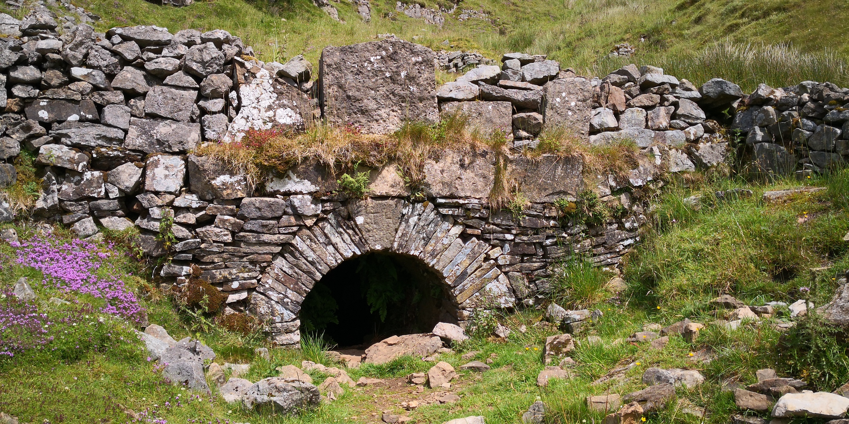
Band conditions are still poor with lots of deep QSB, but I still managed to get Les (K4DY) in the log; once the inReach got my SMS out, which took a lot longer than usual. If anything, the best was saved for last and the walk down was past Buckden leadmine:
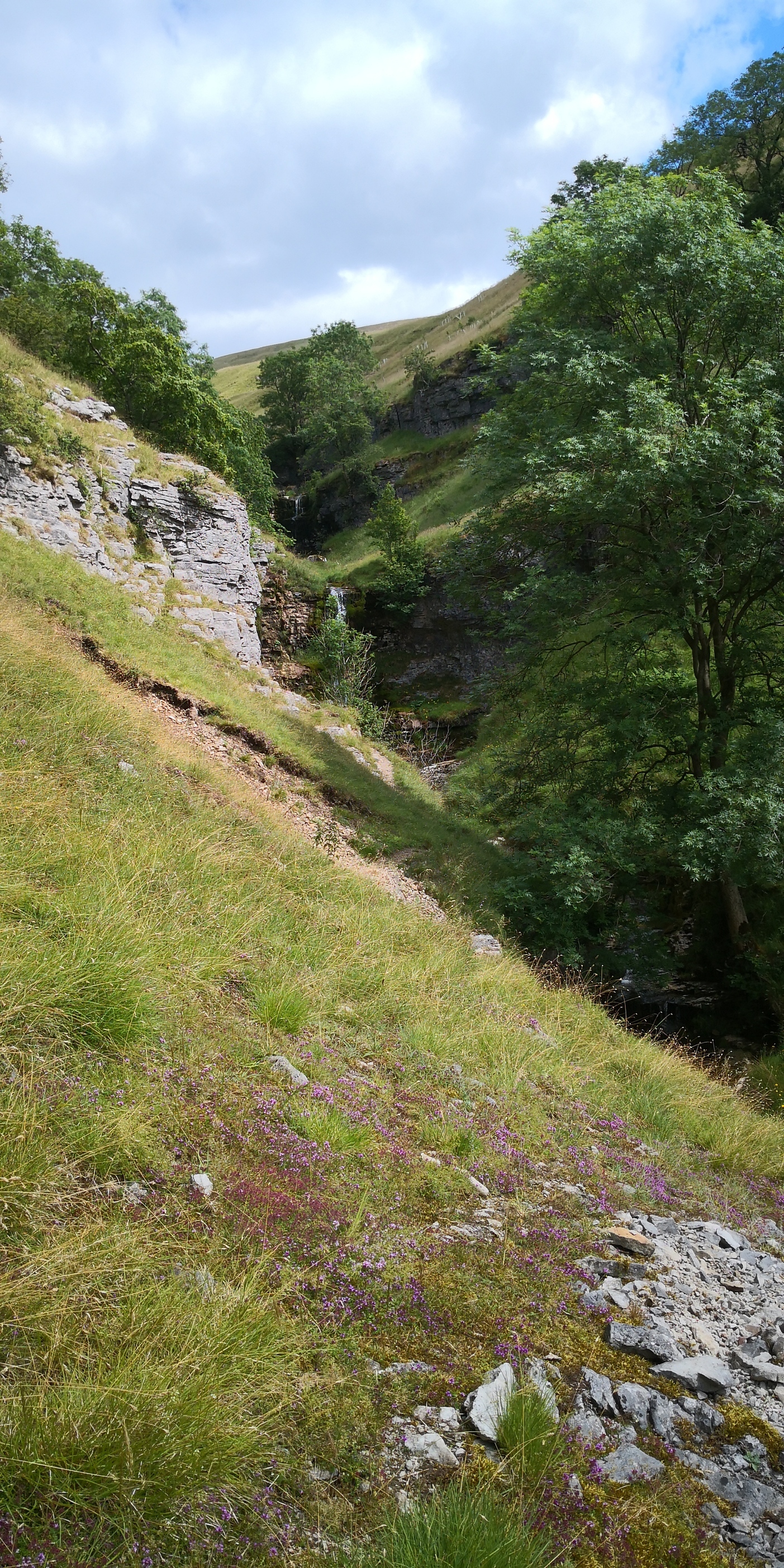
The narrow gill leading back to Buckden is really very beautiful:
Great day out!
de M/OE6FEG/P
Matt
8 Likes
Well, the Garmin certainly helped in the Yorkshire Dales today.
Hey it worked! That means I set the info up correctly… this could be a first! 
Very best of luck with your trip Matt! Iceland truly an amazing place. I played radio a bit on a trip there last summer and found HF tough but with persistence on 20m I’m sure it’ll be fine.
After several busts due to extreme wx I only managed one activation, tf/nl211, but it was an amazing hike and at over four hours each way over wild terrain it was the toughest 1 point I ever earned 
73 Gareth G0MFR
2 Likes
Day One:
The flight over was fairly uneventful; after we had changed planes due to a mix up over range and holding fuel. At first they asked for 14 passengers to voluntarily leave in order to get the weight right. I volunteered as I didn’t have to be in Reykjavik until Friday, and €400 compensation seemed quite reasonable:money_mouth_face:. Of course, as soon as I put my hand up they changed their minds:frowning:. Eventually we took off and arrived about 1:45 minutes late. The airport transfer company were very helpful and transferred me onto the next bus even though I had not paid for a flexible ticket:blush: . The hostel is basic but, on the other hand, I found some methylated spirits in the cupboard left by some previous guests. That has saved me about €10 off the bat. There was also pasta, oil and ketchup to be had, which will also save quite a bit of money: a basic red wine costs €14 a bottle:grimacing:
 . The weather for the days ahead is changable, but I expected that and prepared for some wet weather hiking. The wind is the bigger issue, hopefully it will not get too strong.
73 de TF/OE6FEG/P
Matt
4 Likes
Day Two
Not much happening today. I changed hostels and the City Hostel next to the campsite, where I am now, is much nicer:
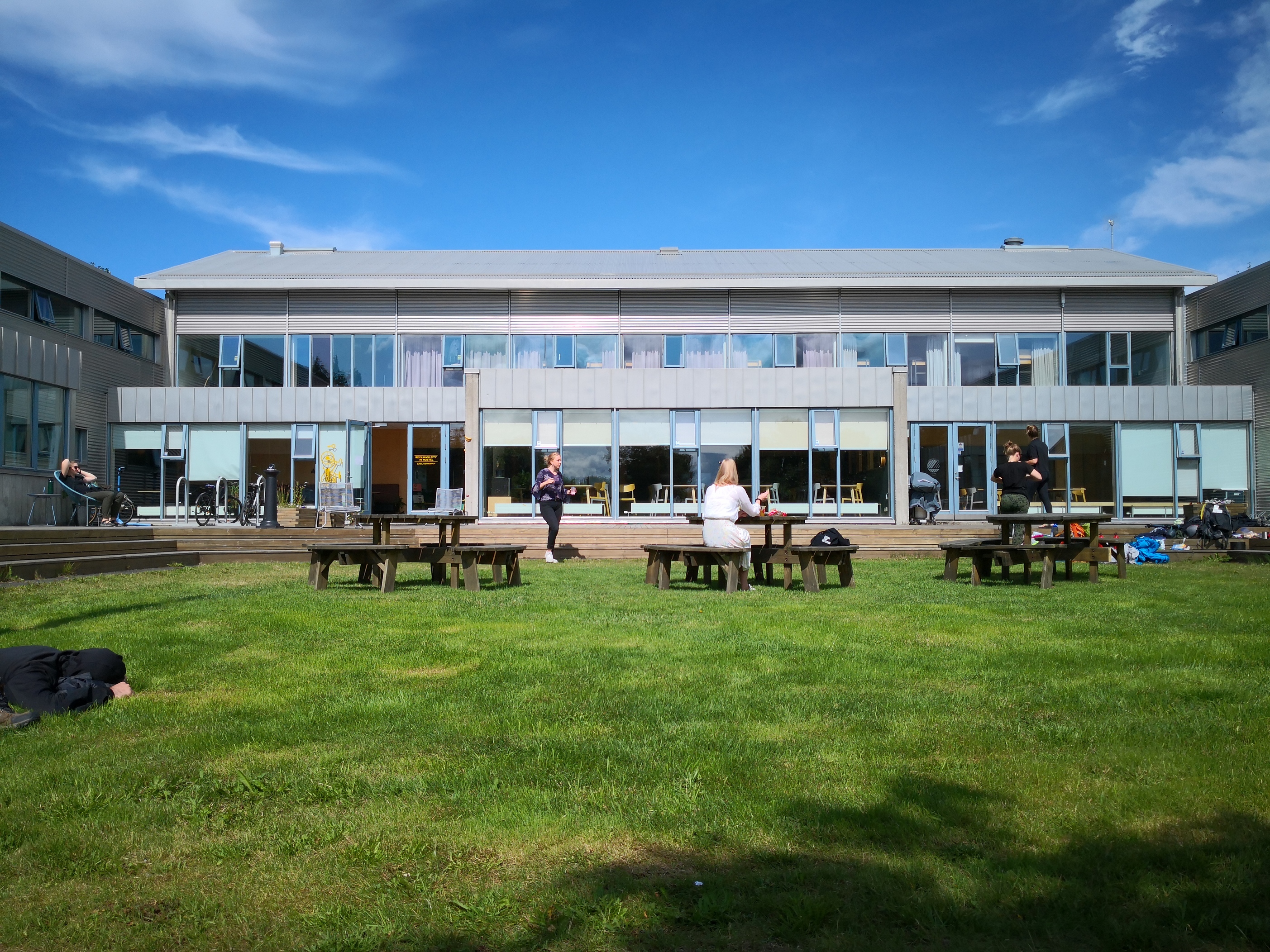
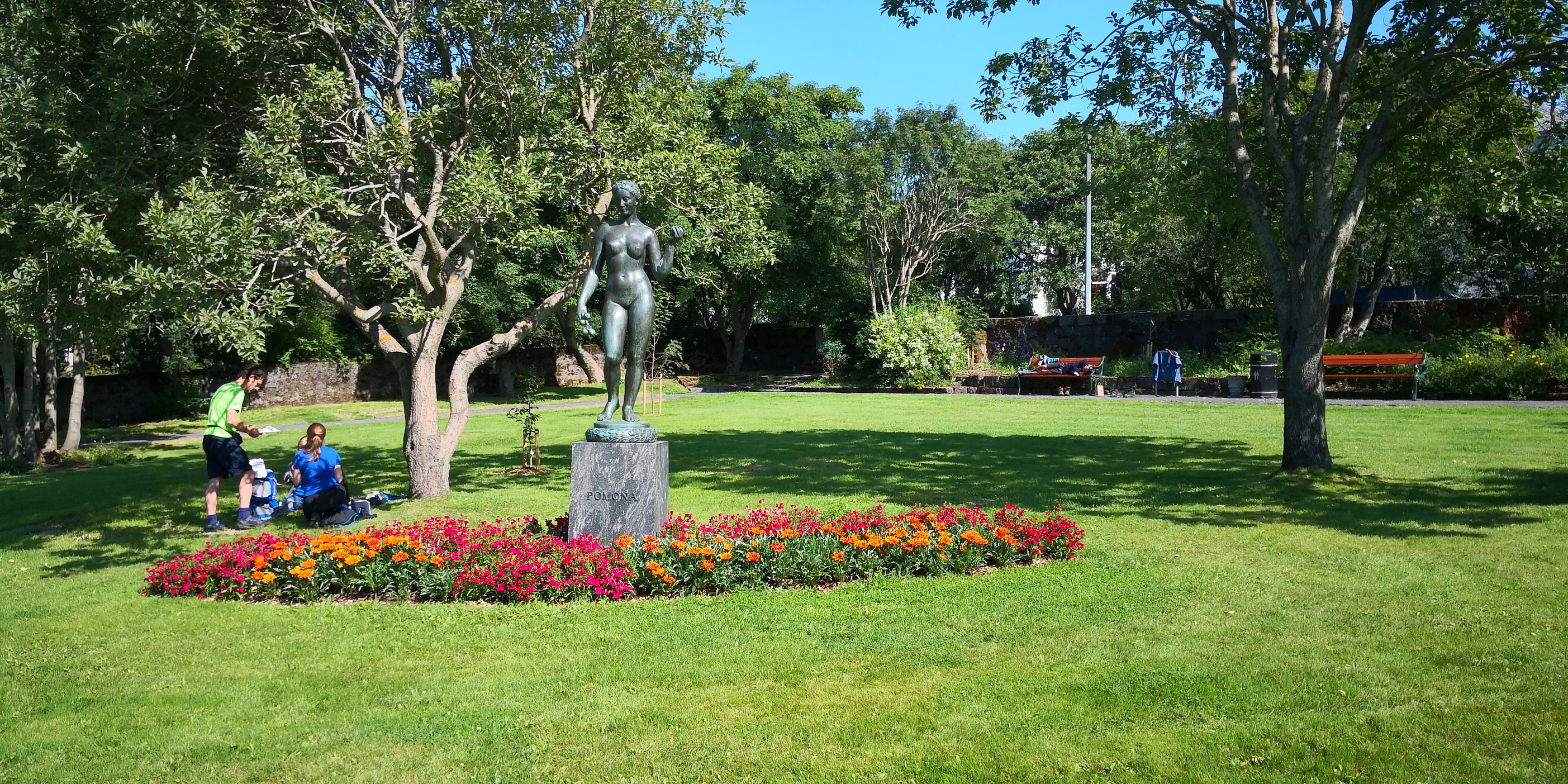
There was another bottle of methylated spirits on the swap shelf when I got here. In Iceland, they do not sell meths or bioethanol as we know it, but rather something called Rauðspritt (pronounced rauthsprit) which is a mixture of ethanol and a little isopropanol that is red rather than purple. It should work the same as the bioethanol we use in Austria; maybe even a bit better. I went into the centre of Reykjavik to make sure I know exactly where my bus will depart from tomorrow, and to make sure I know which busses to take to get there. I had time for some sightseeing:
When I got back, most of the Rauðspritt was gone. The lesson here is clear, always check swap shelves and free food cupboards before going shopping yourself. The weather is warm (18°C) and sunny again and I am sunbathing in the garden as I write. The weather in the central highlands will be a very different kettle of fish.
73 de TF/OE6FEG/P
Matt
4 Likes
Day Three:
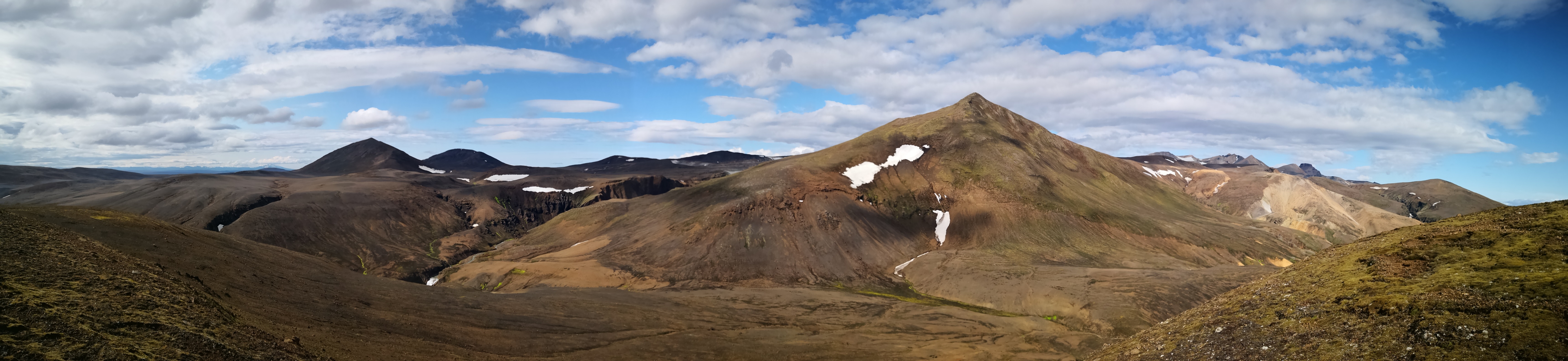
The bus ride out to Kerlingafjöll is an experience in itself. The interior of Iceland looks like nothing so much as the surface of Mars. We picked up quite a few cyclists along the way. Eventually, the bus was so full they had to put the bicycles in the aisles. The other passengers were very understanding about it; well, when in Iceland. It rained most of the morning, but by the time I got to the huts at Kerlingafjöll it had dried up a bit. It was still very windy but I set off up the track to Fanbourg thinking that at least I could get up as high as possible in order to take advantage of any break in the weather that may come. As I got higher up the sun came out and the wind eased off:
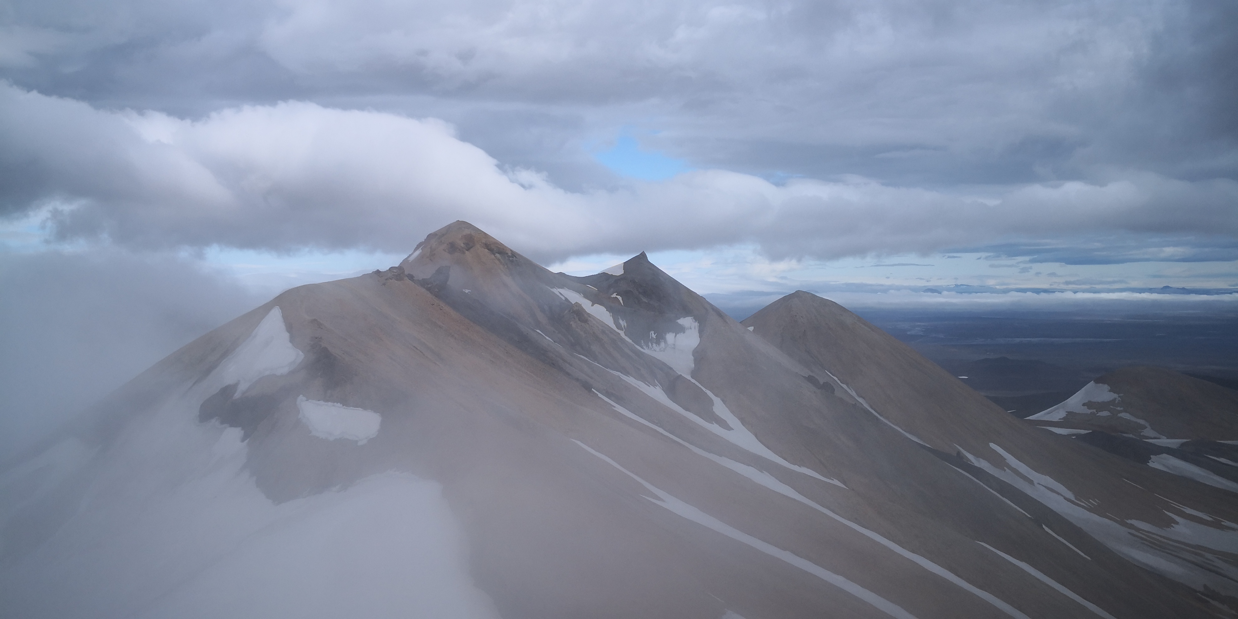
This encouraged me to go for my first summit right away: Snækollur Kerlingafjöllum TF/SL-009 is just after Fanbourg and has a rather small summit:
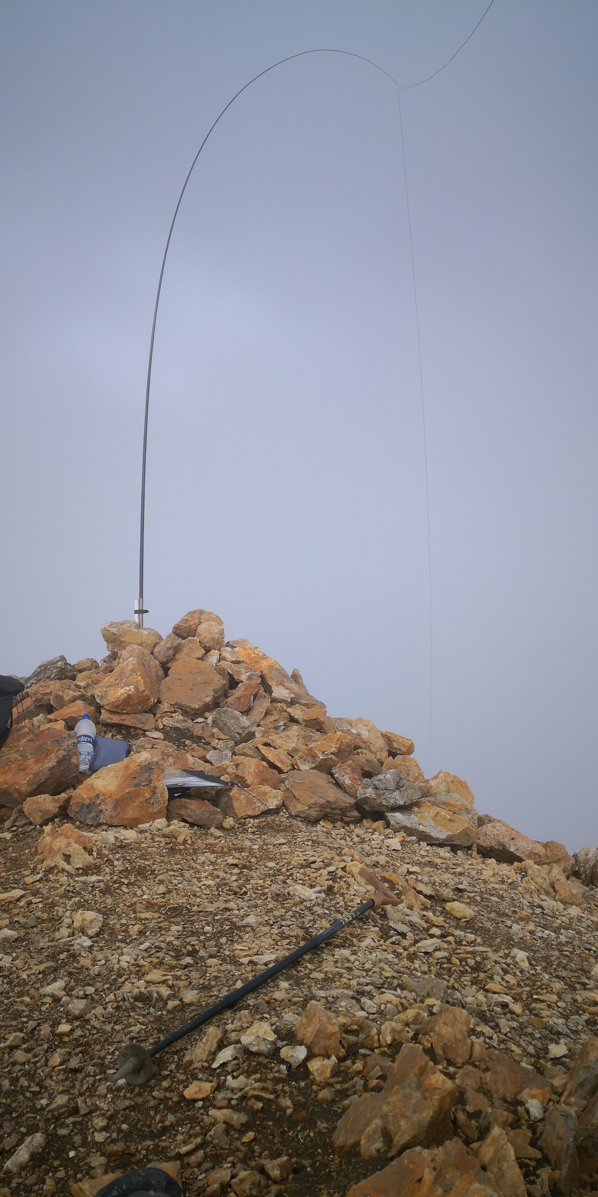
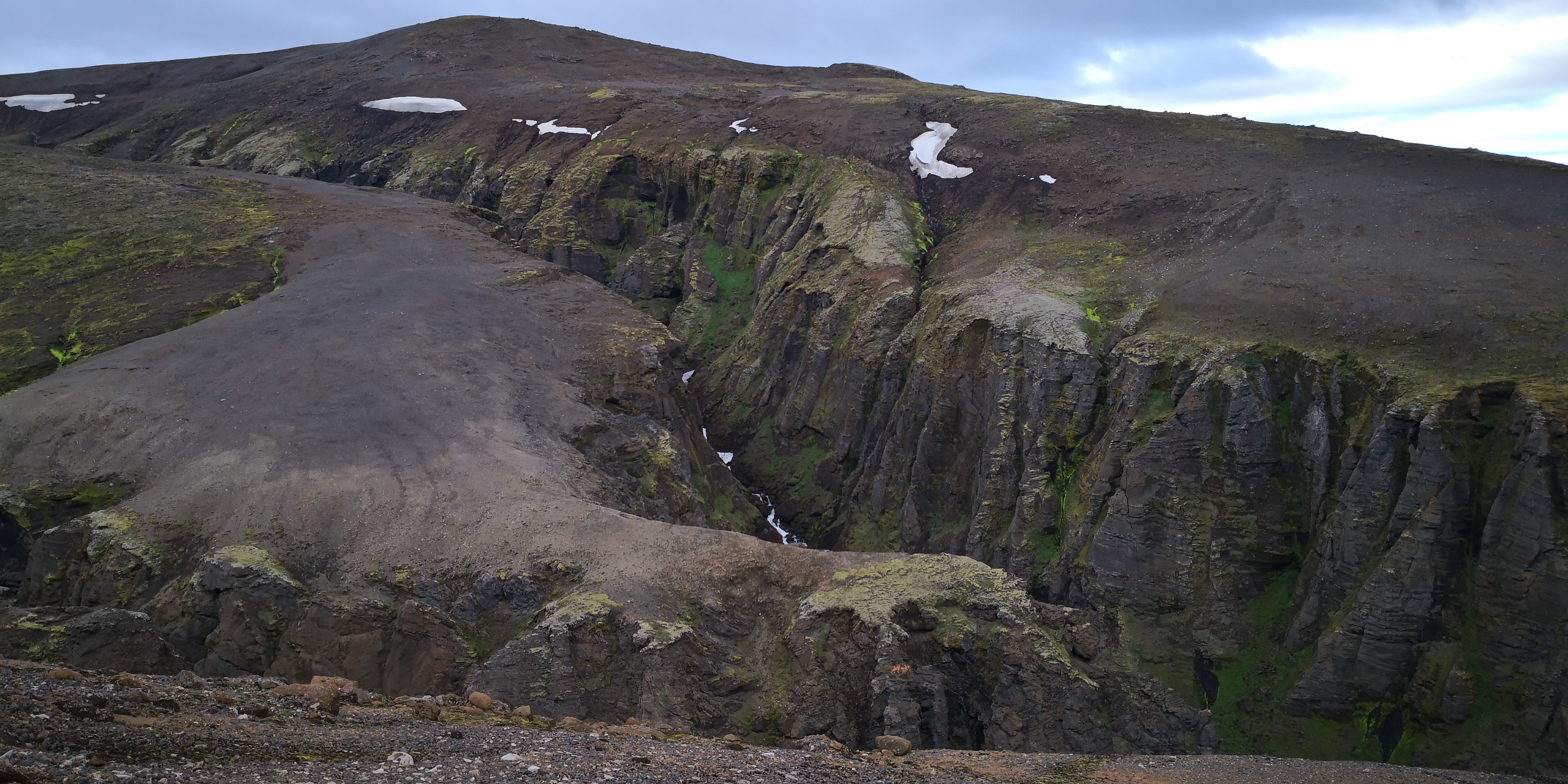
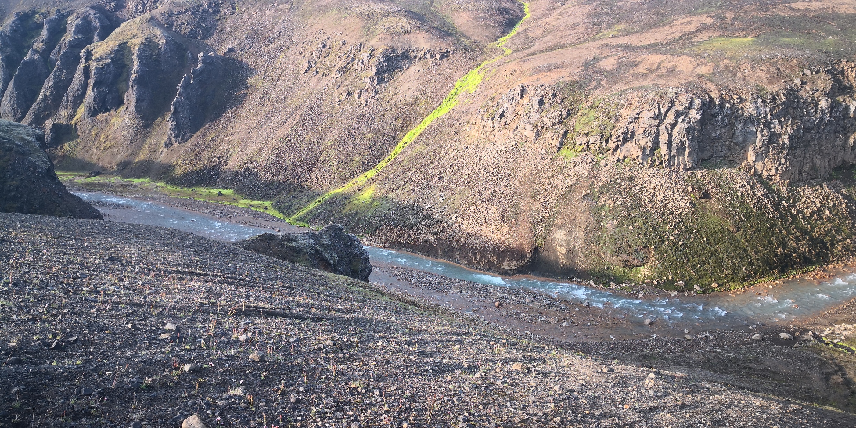
The wind stayed light but clouds occasionally came along and wreathed the summit in white. I set up quickly and was able to attach the mast to a piece of wood in the summit cairn. As other operators have said, working from TF is not easy and I just scraped my 4 contacts on 20m. Judging by what everyone else has said, 40m is a waste of time, so I haven’t even bothered trying. The wind picked up a bit and I decided to head down the mountain rather than sleeping high and activating Loðmundur to the north west. It would have been hard to pitch a tent up high as the ground is mostly loose rock. Perhaps a lightweight freestanding tent would be ok, but I decided to head down to the Kisu Botnaskáli hut, where there would at least be some grass. The way down is fairly simple, but you have to make sure you end up on the right side of a fairly massive gorge in order to avoid crossing the stream further down:
It was about 20:00h when I got to the hut. There was a nice Belgian family already there who let me in. The fire was on and, after quite a strenuous first day, I decided to avail myself of the very comfortable bed therein. After eating dinner I fell into a deep and long sleep. I woke up the next morning at about 7:30.
Day Four:
Next morning the sun was shining and, whilst it was a little windy, it still seemed like an ideal opportunity to pick off a nearby 8 pointer. The Belgian family very kindly shared their tea with me; after washing down my muesli I packed up a day-sack and headed up the nearby Kisubotnahnúkur TF/SL-041:
In the event, I actually climbed the wrong mountain. However, the way over was not long and I was soon on the right summit:
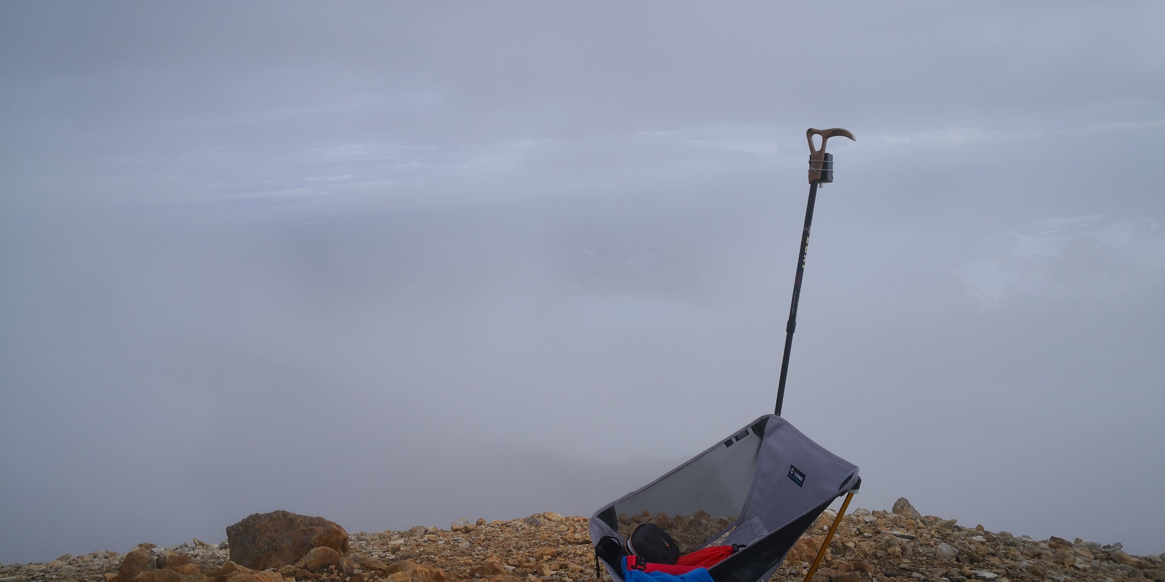
The wind higher up was very blustery, but amazingly, I found a suitable spot on the lee-side that was not too bad. As I was setting up, the wind caught my chair and trekking pole (which I bind together to support one end of the antenna) and tore it off the mountainside, simultaneously disassembling it in the process. Simply putting my rucksack on it had not been enough to keep it on the ground. However, to my amazement, the wind coming from the other side of the hill – the summit was splitting the airflow in two – carried both parts back to where I was standing; unbelievable! I quickly grabbed both parts and started setting up again, this time more carefully. When I finally started calling CQ, it was about midday local time. I did slightly better than the day before and got 6 stations in the log. It never ceases to amaze me what a couple of watts CW can do. That said, the QSB was still very deep and troublesome. I descended and went back to the hut, having decided to spend a second night there. I even managed to have a quick wash in the stream in the afternoon 

 . With my underwear washed and drying nicely over the fire, I could sit back and eat dinner at leisure. I doubt that the weather will be quite so kind in the coming days, but I have a few in hand to play with if things turn nasty. Still, 2 first activations under the belt feels very nice.
Day Five:
I sent Einar TF3EK a text via Iridium the day before saying I would be heading over to the Klakkskáli hut and perhaps we could meet up for a joint activation. I would turn on my phone and sync my messages on my next summit (receiving messages via Iridium is quite complicated). I took a short cut off the marked trail to the next summit: Kerlingafjöll 1056, TF/SL-057. This involved another stream crossing  :
:
Putting warm boots back on after that is just the nicest feeling. However, I made good time to the summit and was QRV late morning:
I still had to really work for those 4 contacts. Calling on 14.060 did not help, and I will make sure I call higher up the band in future; lesson learned. As I finished, I turned on the phone and synced my messages. I got a call from Einar saying he had put an alert up for the summit I was on for 14:00. When I told him I had just finished he decided that we should meet at the Klakkskáli hut in 2 hours, have some lunch and then decide what to do. I agreed and set of post-haste to meet him there. The way over to the Klakkskáli is really breathtaking:
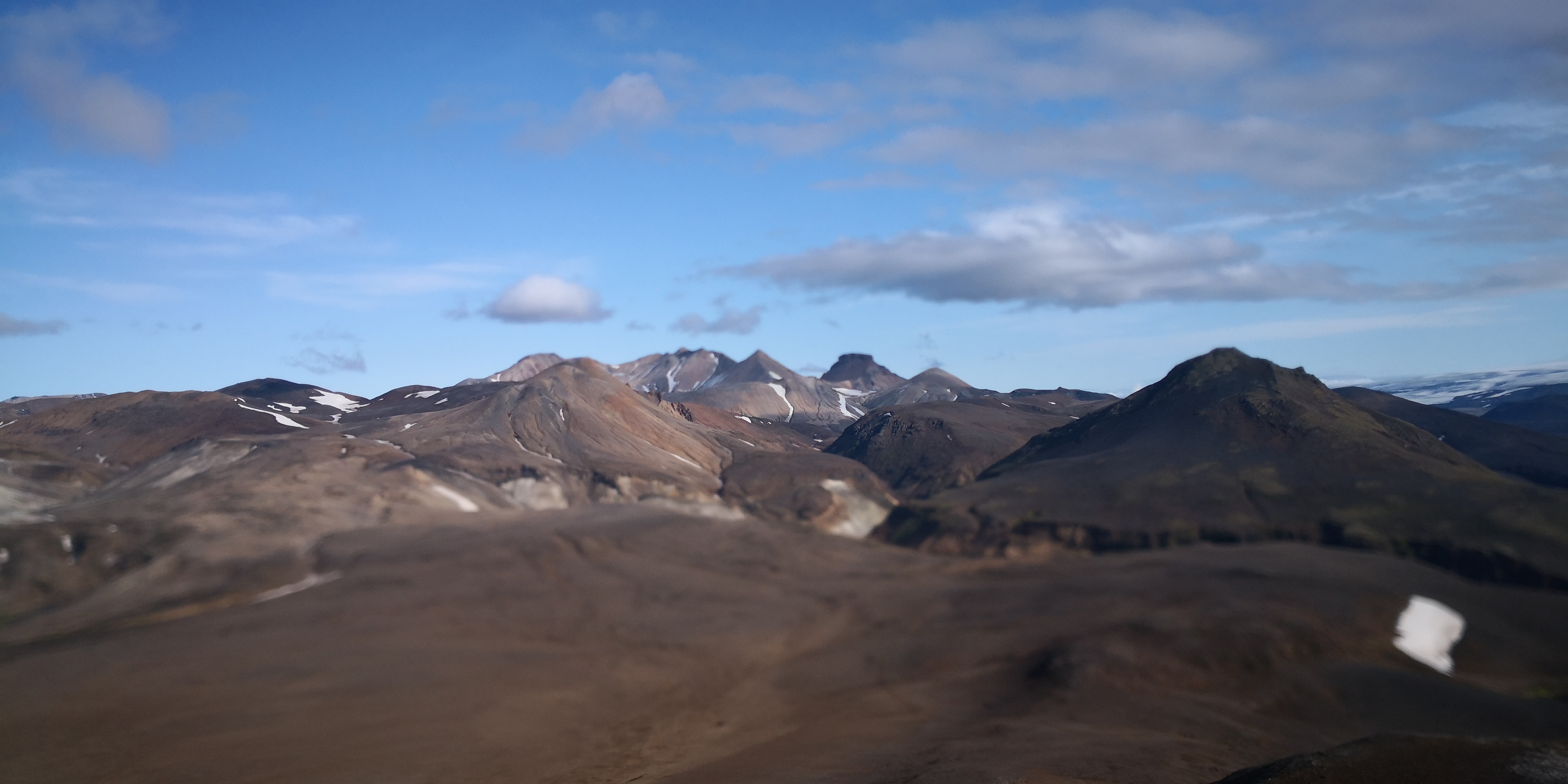
One can see the SOTA summit: Klakkur Kerlingafjöllum TF/SL-047 right behind the hut:
However, the large vertical prominence at the top is not shown on any map. This would make an activation in anything other than perfect weather a bit of a problem. Einar pulled up in his 4X4 pickup just as I got to the hut. It did not take us long to decide to go for the nearby summit: Rauðkollar TF/SL-050. It did not take me long to decide that it would be great to get a lift in Einar’s pickup to the base of the mountain. We only had about 200m of ascent to do to get to the summit:
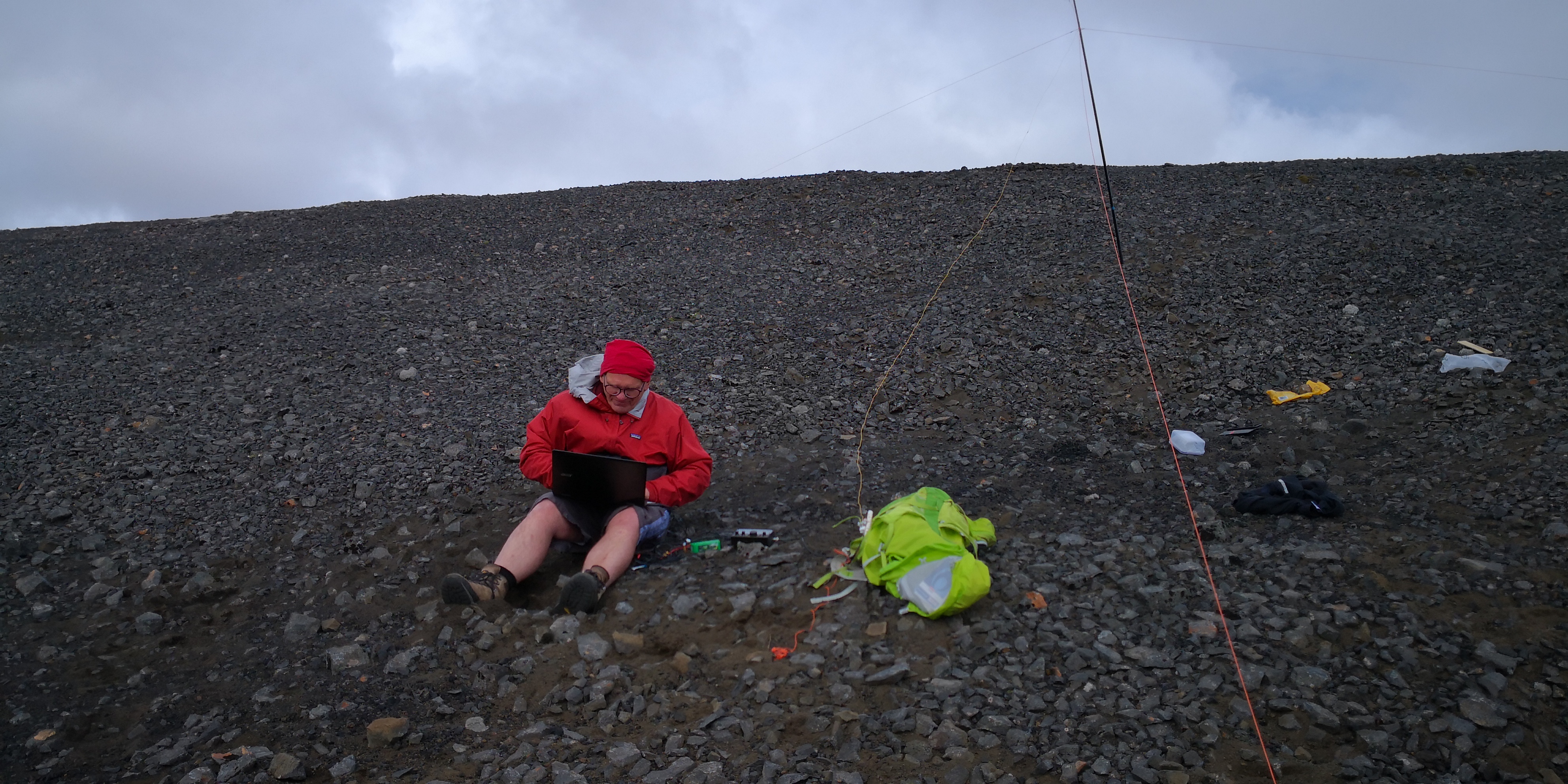
Einar was good enough to let me plug into his KX2 and the contacts were soon flowing. The KX2 made very light work of it and I will have to look at my set up when I get home. First to go will be the carbon fibre mast; it may be fine for the EU, but it’s robbing too many dB up here. Just as the chasers started to answer my call, my Bluetooth keyboard packed up and started printing 2 characters for every key I pressed. It seems the soaking it got in February has finally caught up with it. I will have to log with the on-screen keyboard from now on; at least it will save a bit of weight. When I was finished, Einar went for it on FT8:
There was a fair crop of contacts for us both, I don’t know if some sporadic E helped things along, but the activation went well. We headed down the mountain and spent the night at the hut. I wanted to see what the weather would do the next day before deciding what to do.
Day Six:
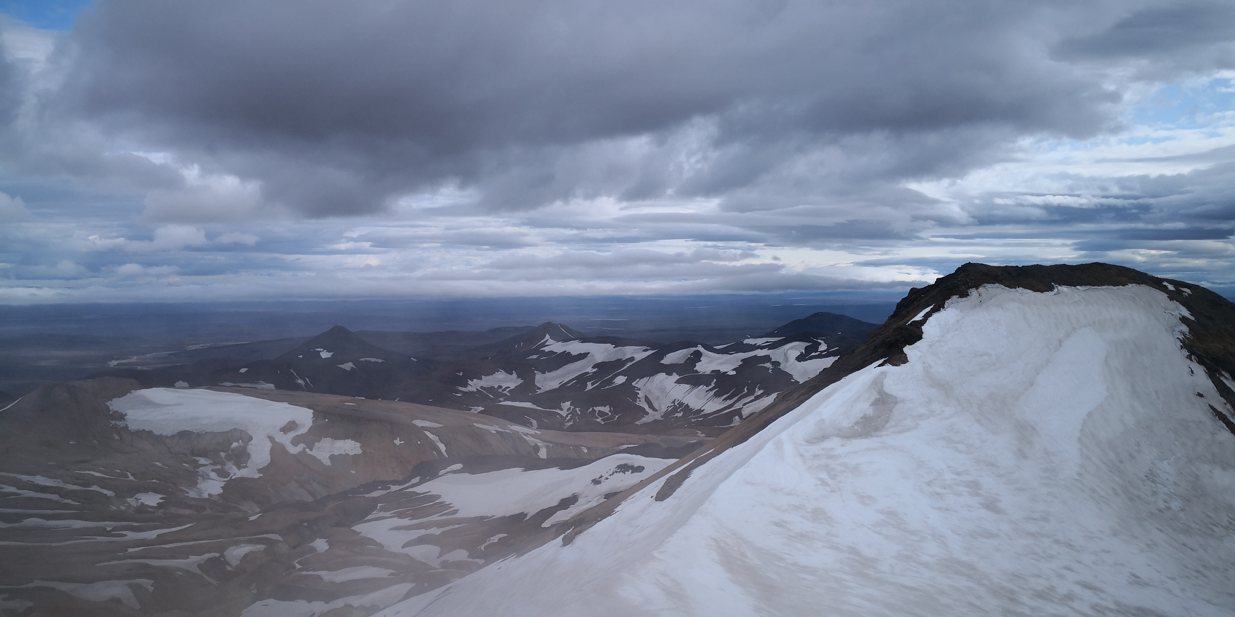
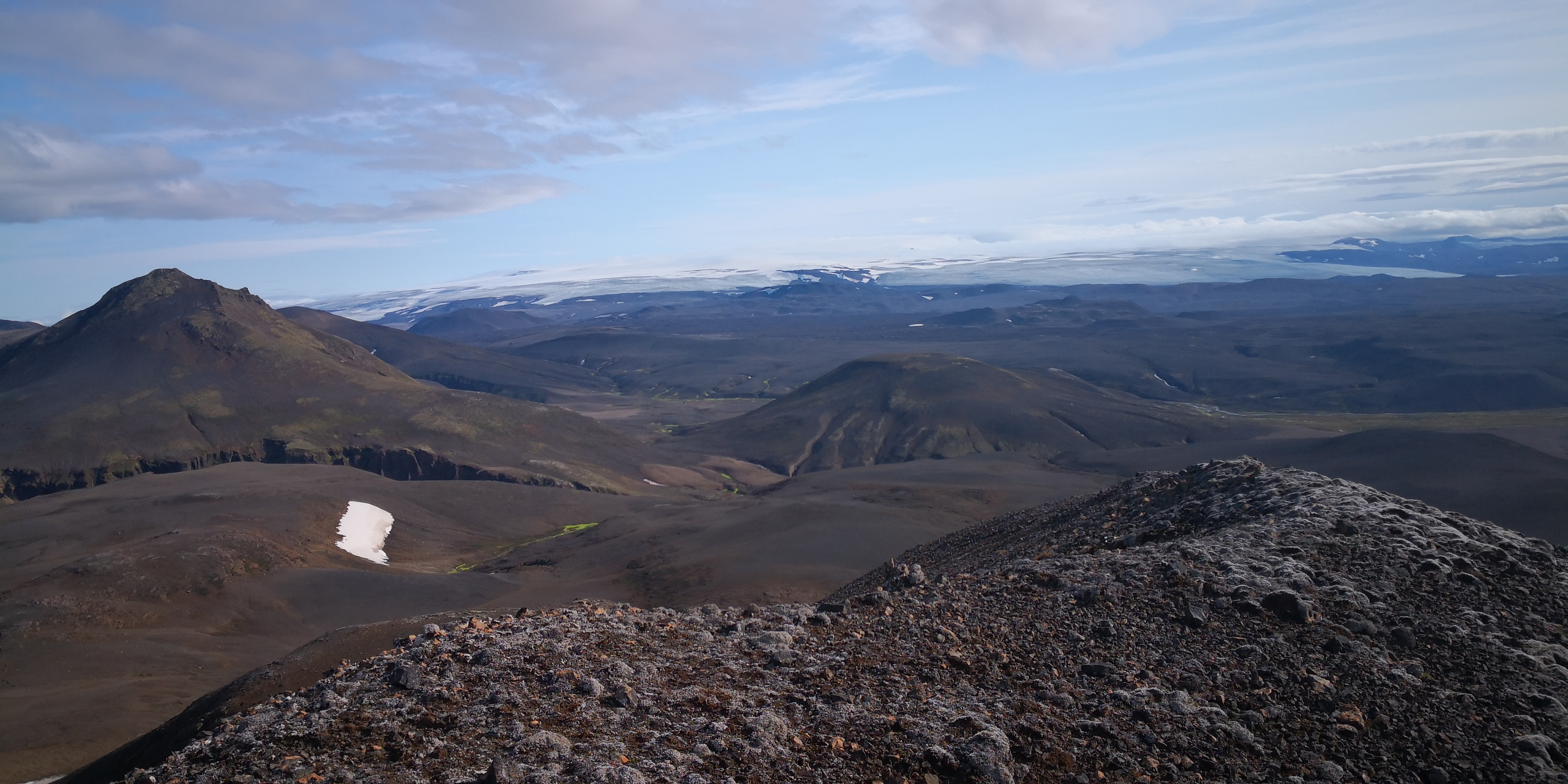
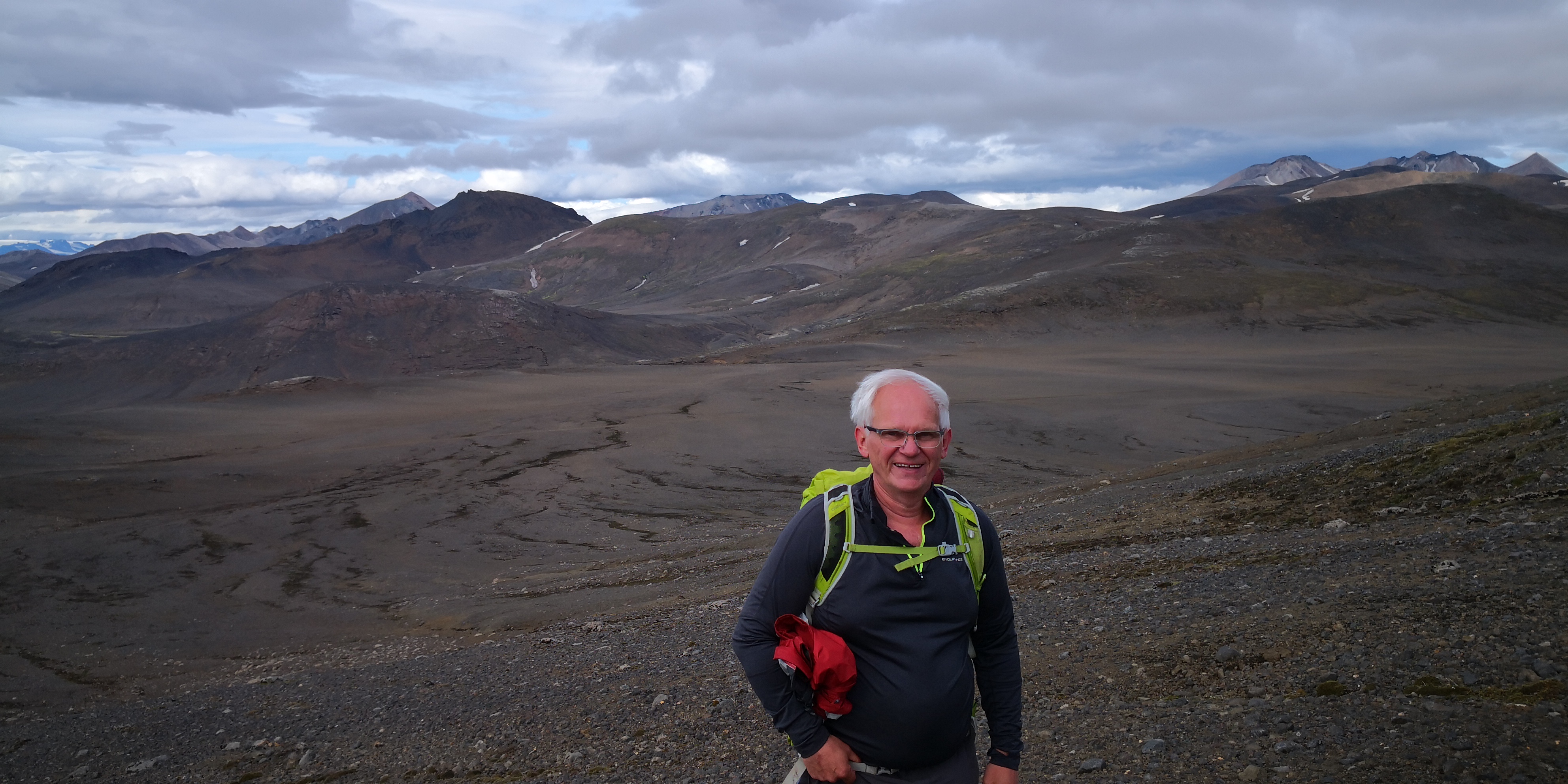
Einar decided to drive north east and try some summits in that direction. As it was raining lightly, I decided to head straight back to Asgarður and see what the weather was like on Tuesday. I passed another SOTA summit, but was really too tired to go up and activate. The scenery was jaw-dropping, as it has been for the whole trip:
I got to Asgarður quite early, had a shower and some food and am now thinking about what to do tomorrow. The weather forecast is about as good as it gets 

 .
.
12 Likes
Hi Guru,
sorry I missed your post 10 days ago and I am back at home now. I was using my KX2 so 10 watts output with inverted V dipoles for 20m and 40m.
Working Manuel EA2DT in Iceland was typically a very weak signal.
I agree with Einar, I think that there was a good cell phone signal on every summit.
It was a great trip and I then sailed back on a friends yacht via the Faroe Islands. Weather was not great and only a single Faroe activation attempted.
73s
Colwyn
MM0YCJ
1 Like
Of course, saying the forecast is as good as it gets is a sure-fire way to jinx it. The clouds are still well down on the tops with more wind than expected. Looks like an extra rest day instead. Oh well, there’s dozens of summits to go at in Landmannalaugar. Now the challenge is staying away from the sandwiches: they’re only €10.50 a pop 

 .
.
73 de TF/OE6FEG/P
Matt
I remember seeing a US tourist doing a “holiday in Iceland” review on Youtube. He loved the place, the people and the country but did have issues with the costs of food especially coming from the US where fast food is cheap. I think his main issue was a Big Mac & Fries plus Milkshake was about $30 and that was a few years back.
But it’s simple really… remote country with not much agriculture where everything has to come by boat or plane… things are not going to be cheap. Apart from virtual machines in datacentres!
I still want to visit the country and do some summits despite the cost.
Yeah, I get why it’s expensive. That said, it’s not too bad in the supermarkets. If you shop smart, a trip here doesn’t have to break the bank. Out here in Kerlingafjöll, you have to consider the additional remoteness of the area: everything comes in via dirt tracks, no grid connections etc. There is even a noticeable paucity on the free food shelf:
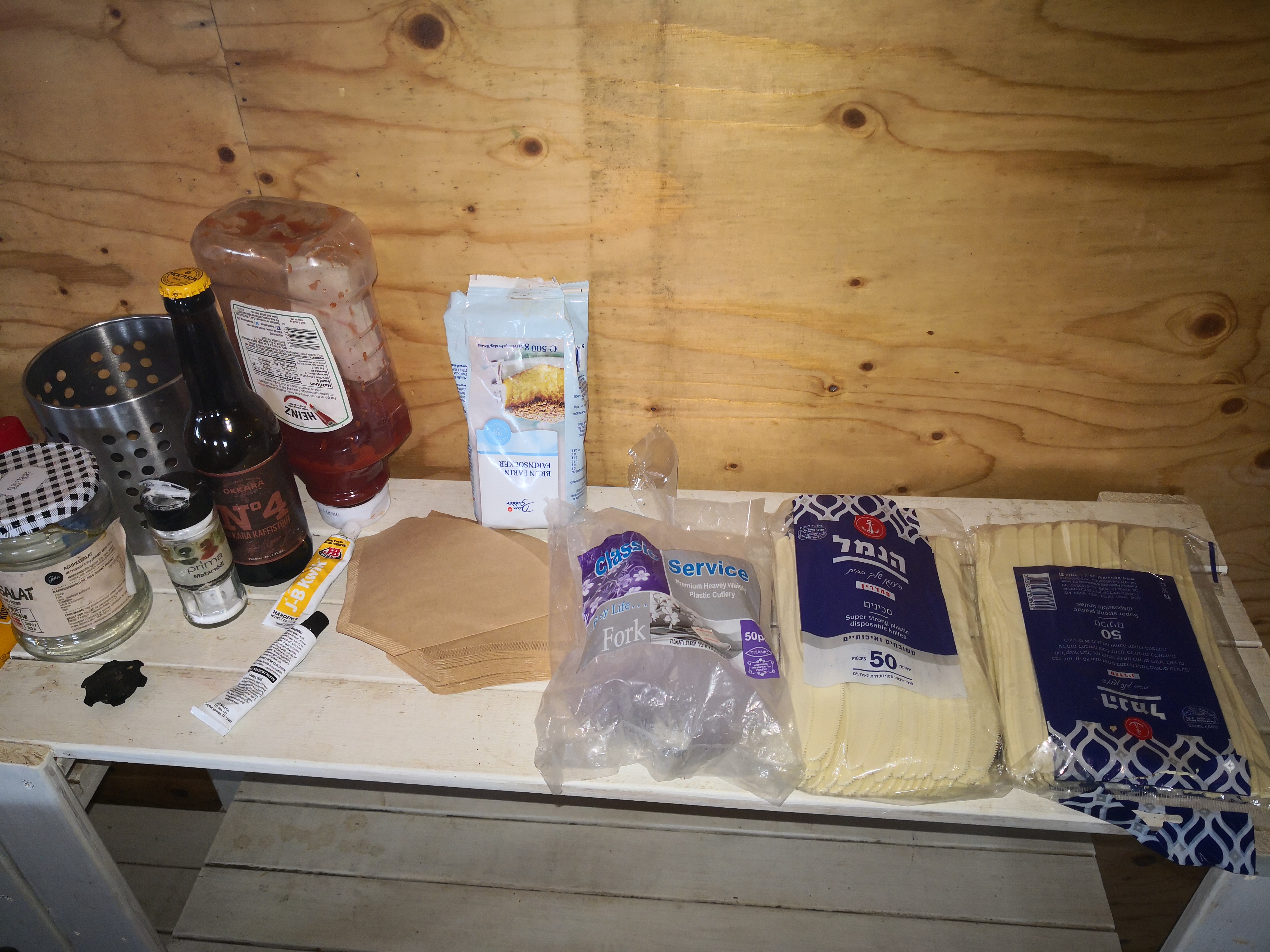
Plenty of disposable cutlery, but nothing to use it on. The JB Weld might come in handy.
I would still recommend this country very very highly to any activator looking for a real adventure.
Matt
2 Likes
Day Eight:
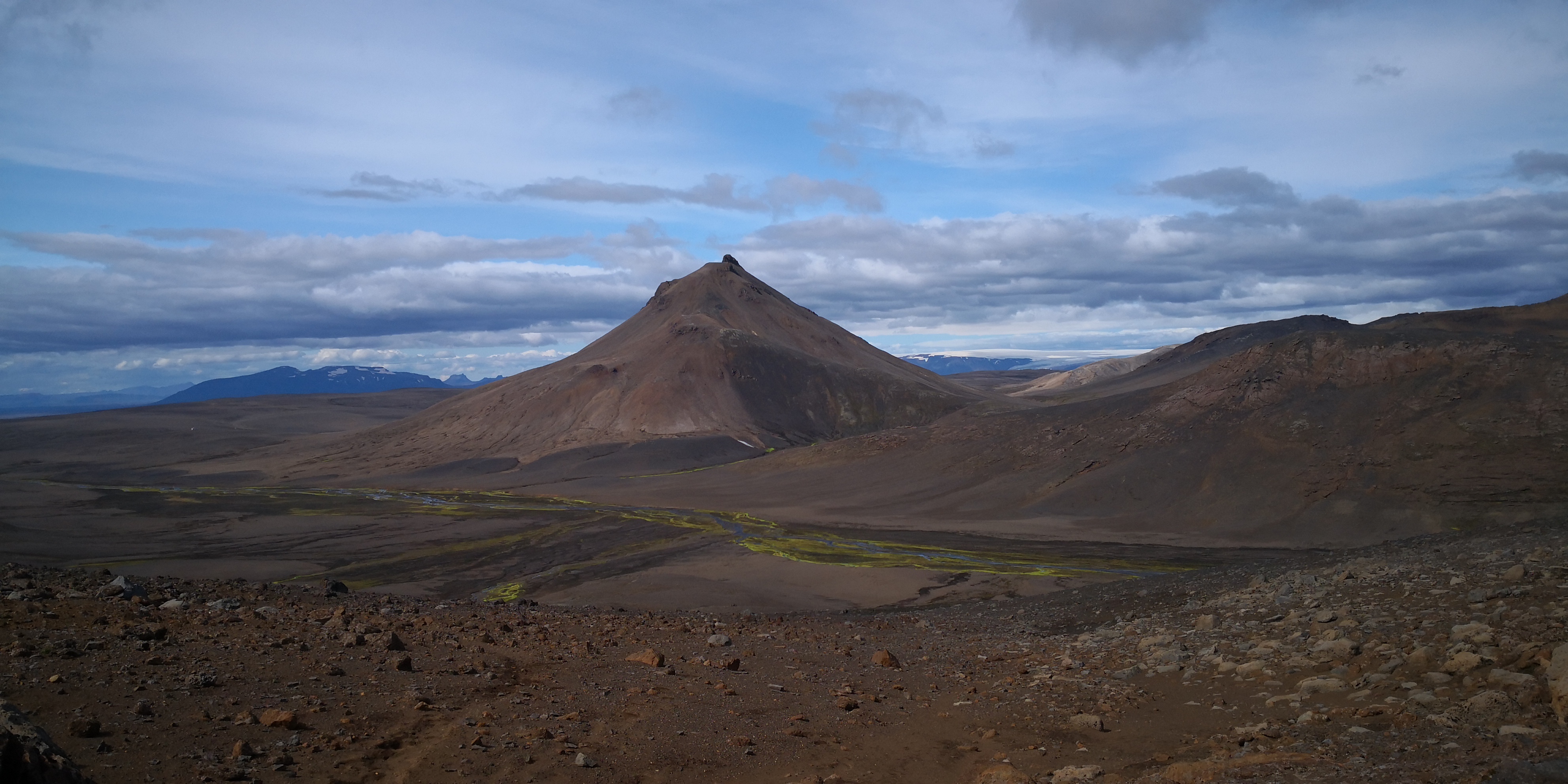
I looked at my tickets yesterday and realised I had an extra day here in Kerlingafjöll. I will get the bus back to Reykjavik tomorrow. The forecast was for reasonable weather: no rain and light winds. I got up early and decided to try Loðmundur (pronounced lothmundur) TF/SL-014. Loðmundur is special because the summit consists of a Rhyolite prominence that is harder than the surrounding material. Such prominences are apparently very rare. It looks very steep, see photo below, but there is a way up the south side. The walk up was fine, the wind was light but very cold. When you get to the carpark for the geothermal hot springs you have two options: go over both Fanbourg and Snækoller, or traverse east below the glaciers. I knew people had done the traverse east, so stayed low and worked my way round. No technical difficulties to speak of, my snow chains came in handy. Unfortunately, to gain access to the col one must cross a small glacier:
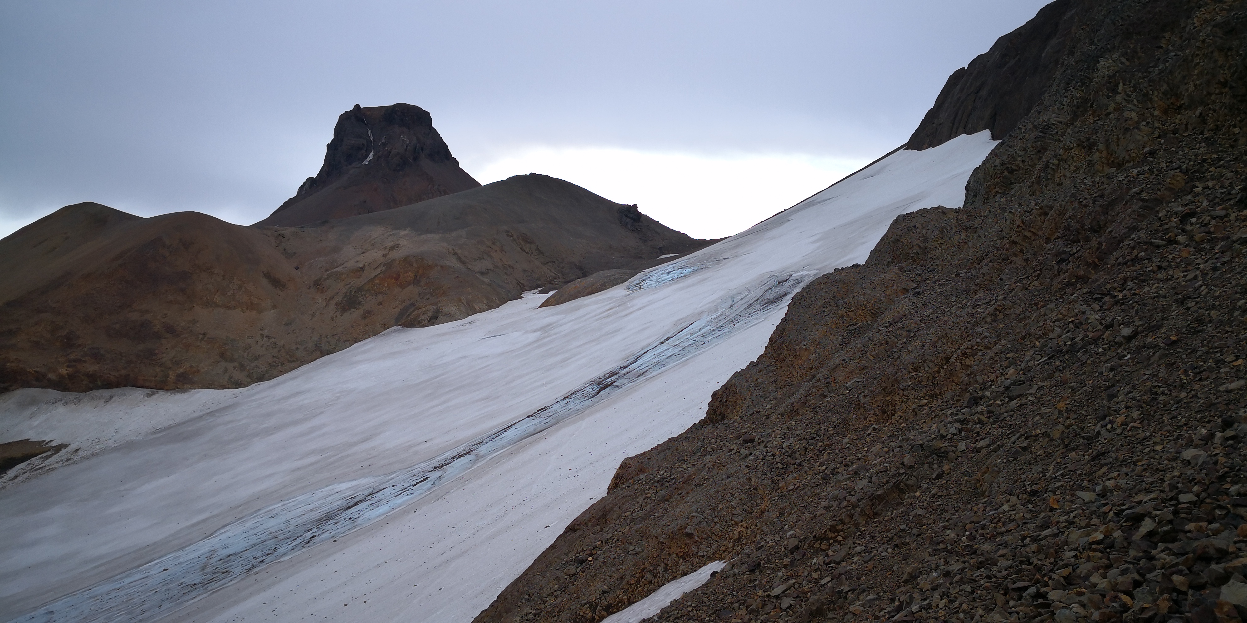
I could see crevasses exposed where the snow had melted. I surmised that there were probably more hidden under the snow. I descended a short way to where the glacier was at its narrowest:
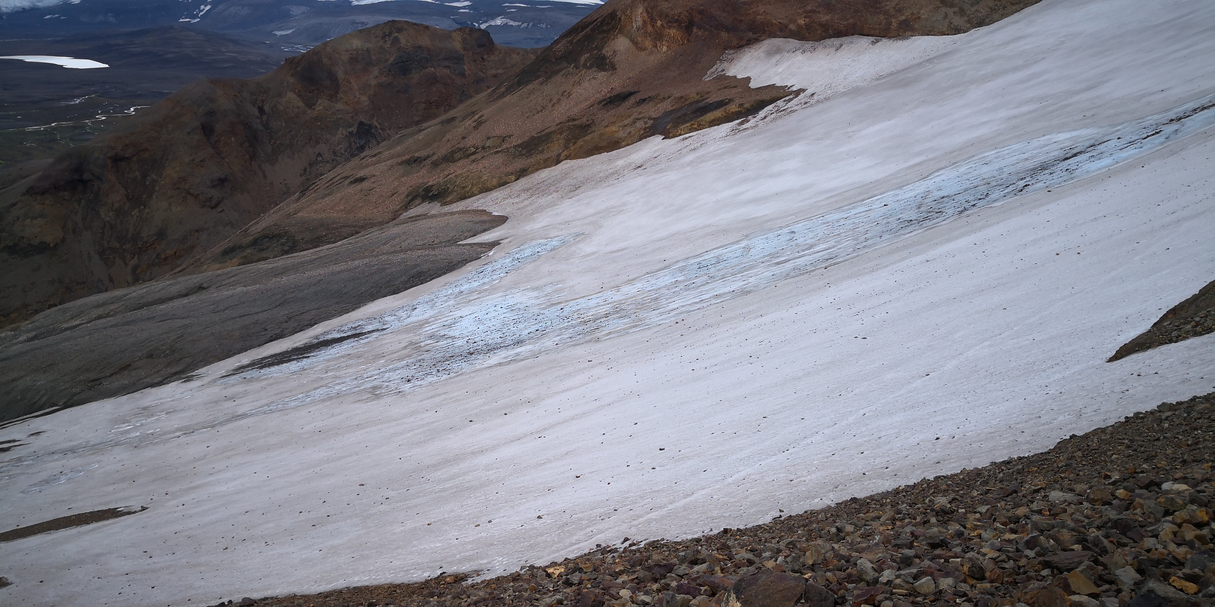
Unfortunately, I passed more hidden crevasses and what’s more, could hear water flowing underneath the glacier. If I’d had a partner, a rope, ice axe and crampons, then it would have been a non event. However, having almost fallen down a couple of crevasses in my time, I decided to pass on this occasion. Maybe the glacier is very benign, I don’t know, but no summit will ever induce me to take that risk. So instead, I went to see the geothermal hot springs:
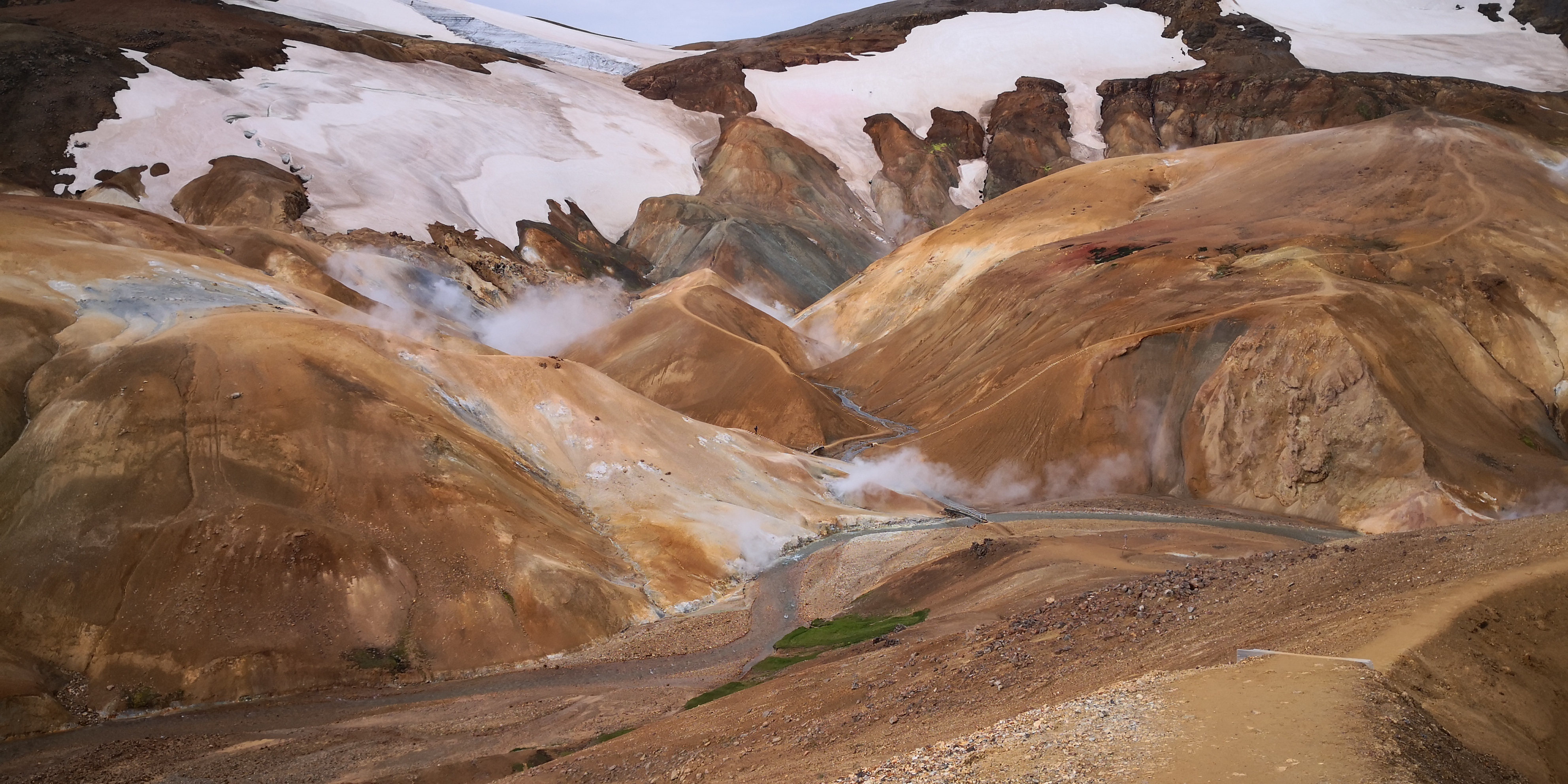
A very interesting area and well worth a visit in its own right. The air absolutely reeks of sulphur, but it’s fascinating to walk round with the ground hissing and bubbling under your feet.
73 de TF/OE6FEG/P
Matt
13 Likes
Have been enjoying your photos and travel log Matt, some amazing scenery there, what type of camera were you using?
We were in Iceland last November and was prepared with a KX2, but the weather was crazy.
Cheers,
Glenn VK3YY.
Believe it or not, the camera is actually my Huawei Mate 10 pro smartphone. The Leica camera module is one of the reasons I bought it. Unfortunately, I forgot my mini tripod, so a couple of photos are not as sharp as they could be. Add in a tripod (particularly for videos) and the results are even better. I also use the phone for logging, and it’s waterproof, unlike my Bluetooth keyboard, RIP. I think the KX2 is a great radio to take to Iceland if you are doing day trips or using the huts. In a few years time, when the solar cycle picks up, it will be awesome.
73 de TF/OE6FEG/P
Matt
I really enjoyed following your adventure. Smart to avoid the crevasses. XYL and myself explored Iceland’s Solheimajokull Glacier last year and our trek was cancelled when the group ahead of us had several trekkers blown into a crevass. Fortunately no one was injured badly. Gale force winds were blowing trekkers off their feet. Be safe.
73s, Gene KC3RT
I’m glad to hear people are enjoying the travelogue. I’m currently on the bus back to Reykjavik where I will take a 3 day break to reorganize my gear; make few running repairs and, most importantly of all, consume as many vitamins as possible. The trail food has made me feel a bit  . On Monday I’ll get the bus out to Landmannalaugar and hike a loop in the area for about 8 days. I may do the one pointer close to the centre of Reykjavik while I’m there.
73 de OE6FEG
Matt
DAY Nine
On the Thursday evening I got back to the hostel in Reykjavik at about 19:25. Einar TF3EK had agreed to pick me up at 19:45 to go to the local club evening in Reykjavik. I had to quickly rush down to the luggage room and grab my normal clothes whilst dumping my hiking gear. Einar picked me up from right outside the hostel and we drove to the south west of Reykjavik just next to the airport. They have a fantastic building for the club station TF3IRA here in Reykjavik:
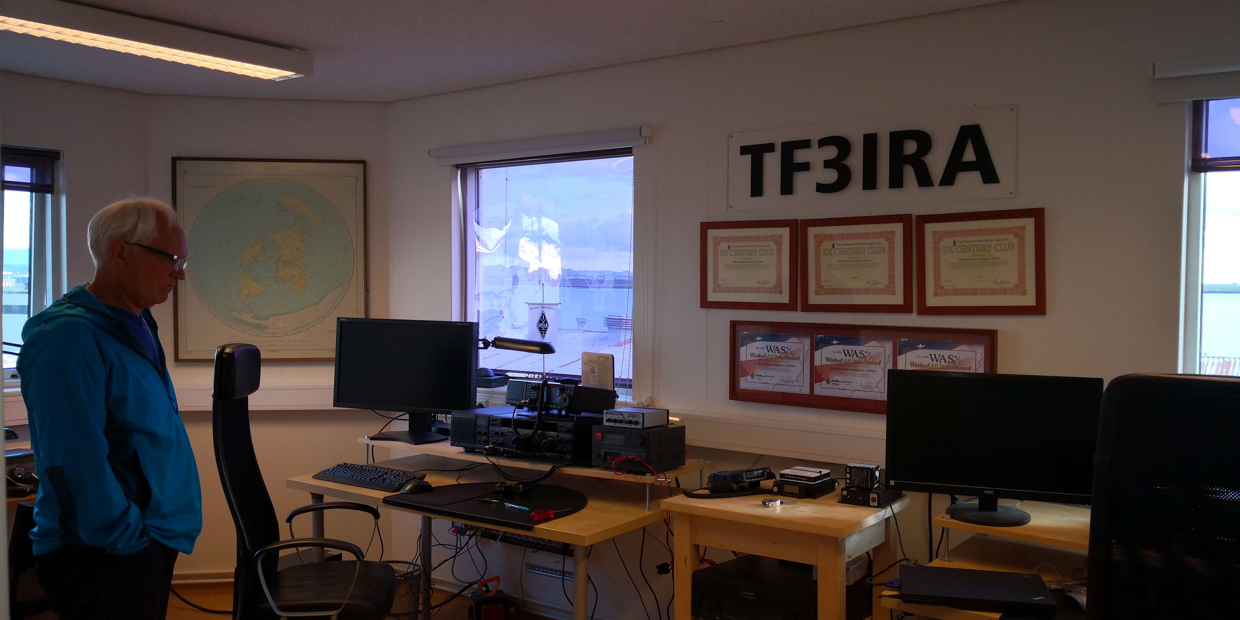
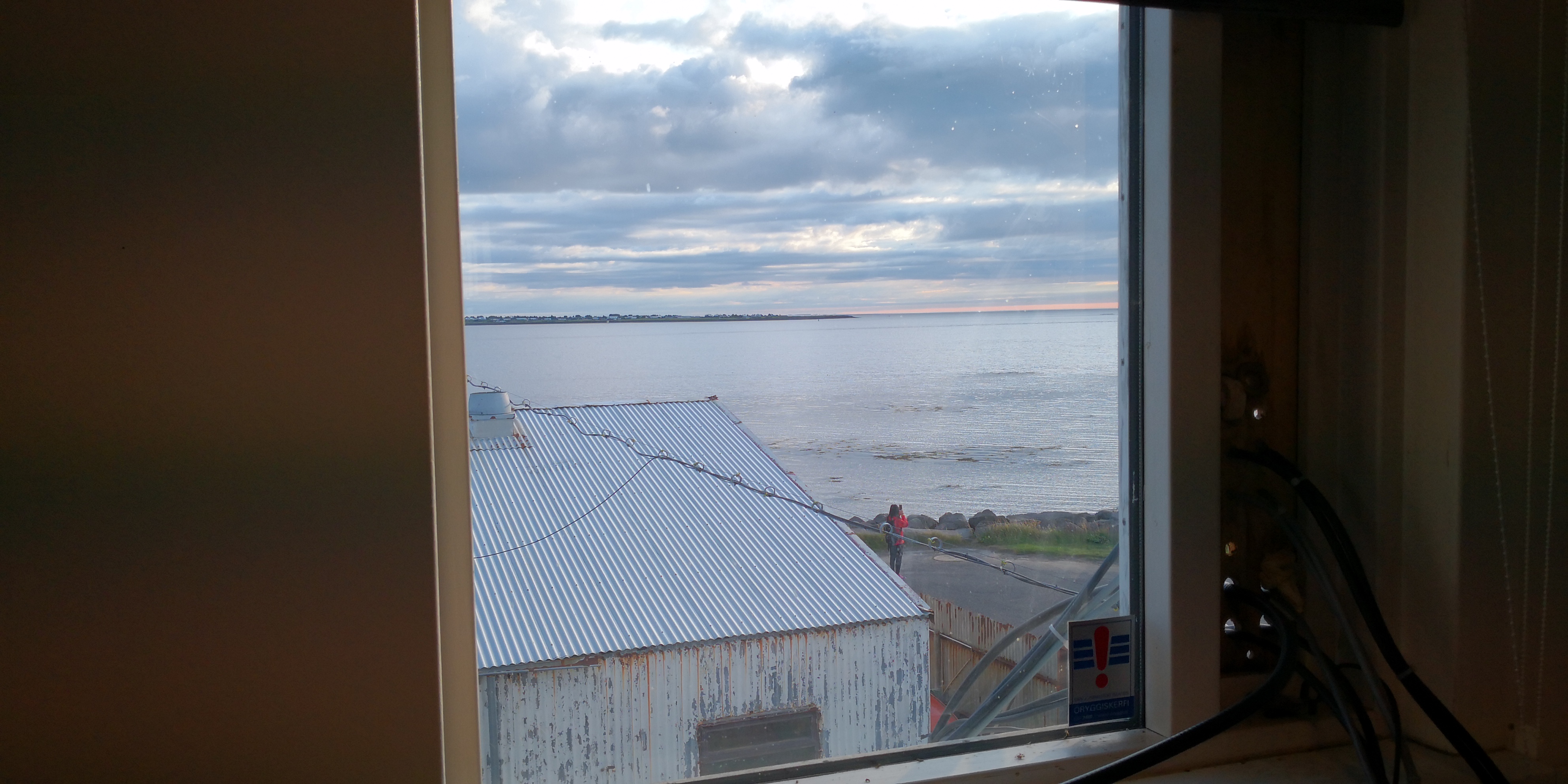
You get magnificent views out over the Atlantic ocean whilst you operate:
There was a soldering iron on sight, which allowed me to do a quick repair on my Fuchskreis tuner. Getting blown off a mountainside had damaged one of the connections. It was still making an electrical contact, but the solder was not fast in the joint. Anyway, that was remedied in a jiffy and the tuner is good to go. Downstairs I had a nice conversation with Wilhelm (whose mother is German) and a delicious slice of lemon cheesecake. By the time I got back to the hostel it was 23:30, and I still had to cook dinner. I woke up at 10am the next morning, thoroughly rested and enjoying having a whole dormitory to myself. Many thanks to the Reykjavik Amateurs for allowing me to visit their club for the evening.
73 de TF/OE6FEG/P
Matt
7 Likes
Day 13
The bus to Landmannalaugar leaves from right outside the hostel, which is very convenient. Of course, the moment the bus set off I realised that
in my haste to pack up and dump my charger in long term storage, I had left my charger cable plugged into it and would be unable to recharge the phone from my external power packs. Luckily, there was one available from a garage on the way, phew! We got to Landmannalaugar in good time and when I got off the bus it was 20°C and blazing sunshine. Unfortunately, I had decided that I would probably not need my sun hat and left it in Reykjavik. I had to improvise a kind of bandana with my SOTA flag and an ear band. The lack of sun tan lotion would prove a bigger mistake in a few days time.
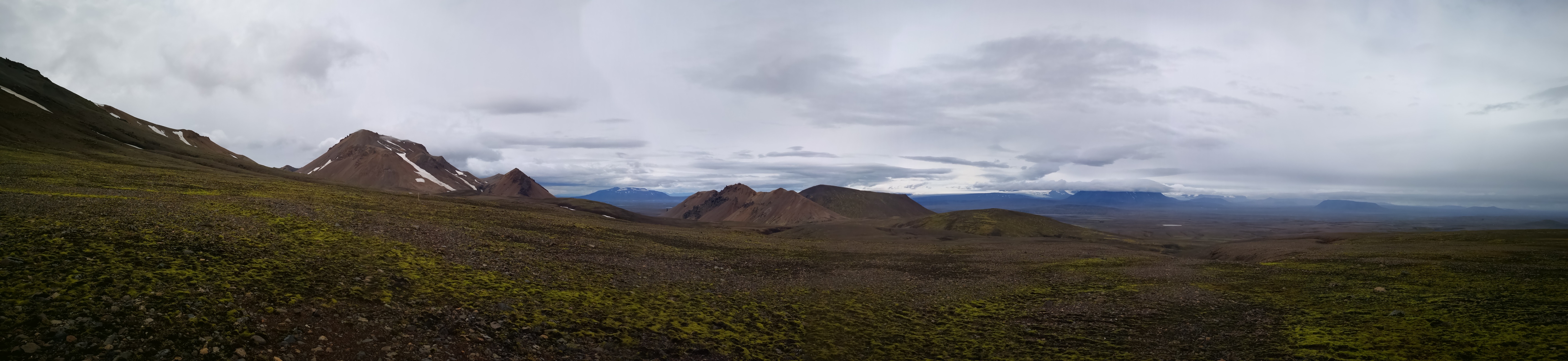
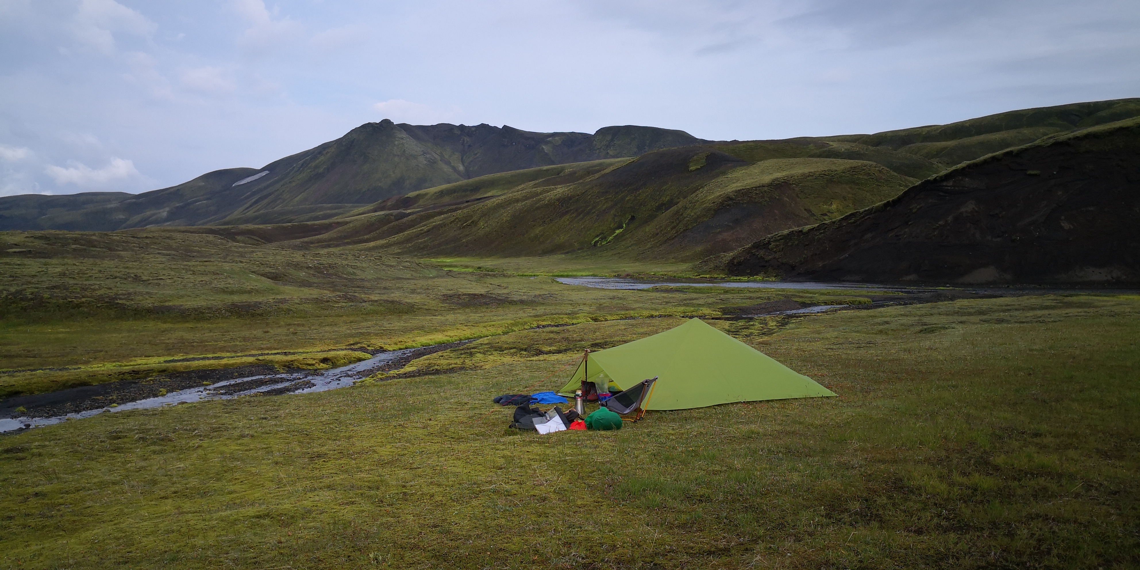
I had hoped that the river at Landmannalaugar would be shallow, so that I could wade across and save myself a lengthy detour north. Alas, that was not to be either. At least the weather was on my side. I passed a few SOTA summits on the way, but access to the activation zones was much more complicated than the maps suggested. One, for instance, was completely surrounded by a lake that is not shown at all in Open Topo maps. Also, I was carrying 8 days food and fuel, so I decided to push as far as possible towards the Vatnajökul National Park while the weather was good. There was a relatively easy 6 pointer right next to where I intended to camp: Grænafjall TF/SL-118. I could climb it first thing in the morning while I was still fresh. I found a wonderful pitch right next to a stream with a perfect view of tomorrow’s first SOTA target:
Day 14
I was woken up quite early by a sharp shower drumming on the tent. It passed quickly, but I got up and had breakfast anyway. A look outside the tent revealed thickening cloud to the east; a very unfavorable outlook for the day. I decided to go to the hut on the lake shore and see if it was open. If the weather was really bad, I could wait it out in relative comfort. It turned out that the hut was privately owned: no chance of respite there. There was no option to push on and the rain seemed to be holding off for the time being. I set off up the mountain, perhaps I could squeeze in an activation before the bad weather really set in. The way up was dead simple, but of course, just as I got to the summit, it started to rain, hard. The activation had to be abandoned, although I made a mental note to come back this way and tackle the summit on the way back. I descended the other side and started heading north towards Vatnajökul. I had barely gone a kilometre or so, when it became apparent that I would get soaked to the skin in a few minutes if I kept going. A small patch of moss by a pond lay 200m away, so I quickly put the tent up and spent the next 20 hours looking at this:
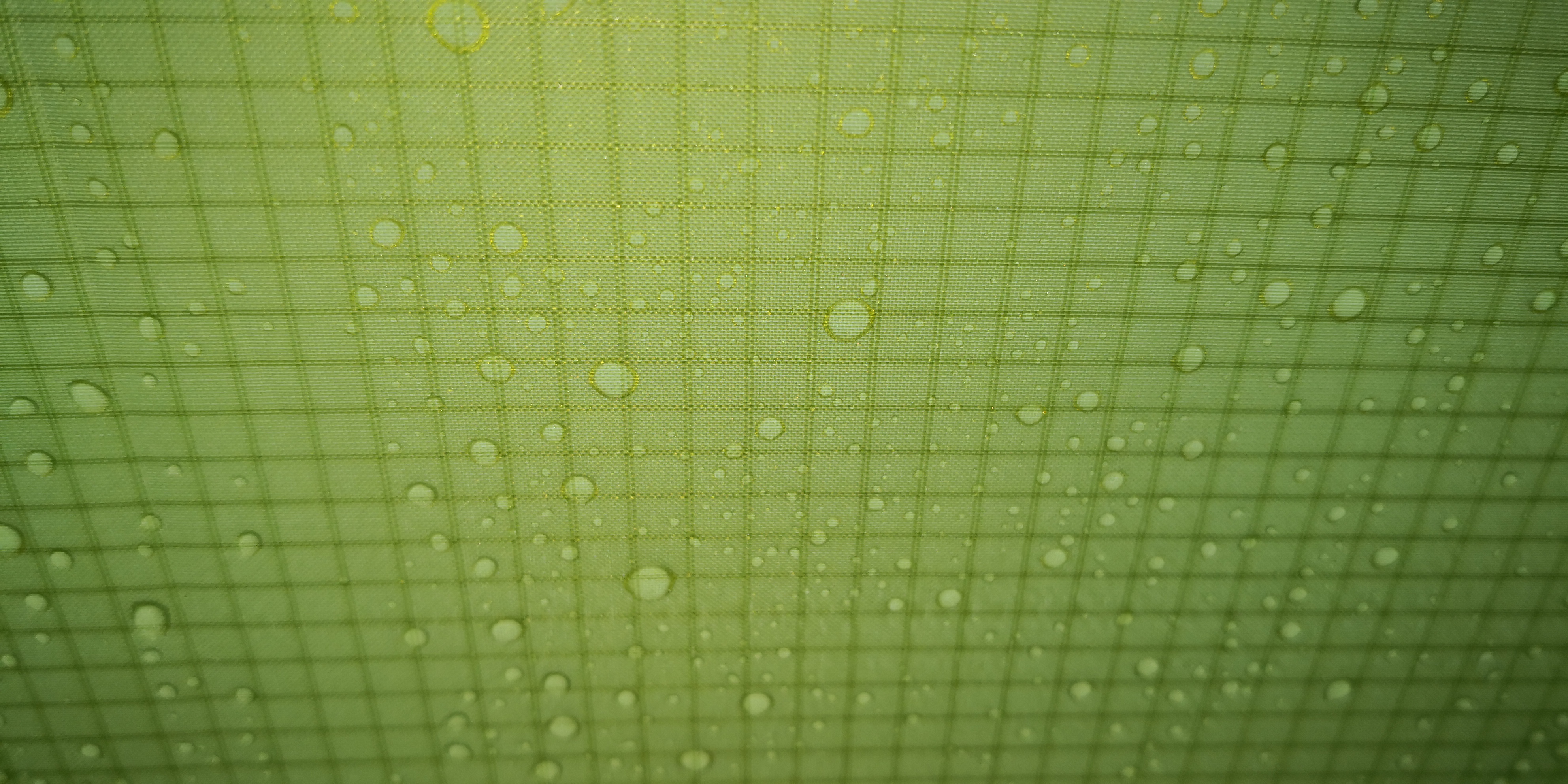
This was definitely a low point for the tour, and as I lay shivering under my quilt trying to dry out, I wondered just what I had let myself in for in the coming days. By 19:00 the rain had abated and I decided to check the weather using my Garmin inReach, which includes a free basic weather messaging service with my tariff. It was good news: the day after would be much better with sunny spells and no rain.
2 Likes