Southern Scotland Raid

Hello Andy

On Thursday I am almost due west from you on Arranmore Island Co. Donegal. VHF will be no good as shielded by a mountain range to my east, best change may be 40m. Will also be on 60m SSB (WRC-15 segment, 5354kHz).

Having activated Knockdolian and Grey Hill myself I am keen to make a QSO and will check the band at around your announced time. Good luck with the activation.

73, Phil ON4TA

GM/SS-201.

That,s was a hard one bands poor again.
But great to work you and after i did, you became lot louder 2 two minutes, then gone again.
PS was you near the trig pse ( TP-1317 )

PPS next please LoL

karl

Since you did it them little trees have become then much bigger trees. They donā€™t seem to have built any firebreaks either.

I was leaning against it to keep out of the wind and rain showers.

1 Like

I think that was mission accomplished.

8 activations planned, + 2 bonus summits
10 uniques
15 S2S QSOs

Iā€™ll write up some notes and post some pictures later. Meanwhile Iā€™ve had my last indulgent meal for a while after a week of full cooked breakfasts and pub grub. There does seem something decadent or more likely itā€™s throwing caution to the wind in taking you diabetic pills with a mouthful from your 2nd Vodka Martini of the day.

Iā€™ve entered all my logs so you can check you are included. If you donā€™t find your QSO then itā€™s maybe because Ishouldnā€™t enter logs and drink at the same, let me know and Iā€™ll check if I missed entering it. However, I did hear a few people who though they were working me when sadly not. All genuine mistakes from poor band conditions and lots of people of the frequency.

2 Likes

#Hightown Hill SS-273

This was a bonus summit I was able to bag as I was now staying near Blackpool in a B&B rather than with Geoff G6MZX (where we were going to use his workshop to do some drilling, milling, filing and fettling on a 3cms PA).

Normally you park at Hightown Farm and follow your nose up the hill. Parking at the farm is difficult to ensure you donā€™t block anything. Iā€™m reluctant to park if thereā€™s nobody to ask. Anyway I had read the farmer had started asking people to go up the hill from the other side and so I parked near Bankhead of Tinwald Farm. I stumbled on the farmer who told me ā€œNo problem going up the hill but men with guns were hunting foxes in and around it so make yourself obvious.ā€ Seemed fair to me and you are unlikely to miss a tubby bloke with a face as red as a tomato, huffing and puffing.

I followed the track up and looked for the path marked on the 1:25k map. Nothing! So I went straight across the meadow up to the gate. This is by a small reservoir and the ground is veyr boggy. From there I made for the woods. Again no path, so I crossed the fence at a low point and sauntered through the sparse mixed woodland. It was great day but a bit cool in the breeze. I came out on the back of Black Hill and followed animal tracks up and over to the summit of Hightown Hill. Took about 30mins.

A 3 band session followed on 60/40 & 30m including an S2S with Jack GM4COX. However, I forgot my camera so the photos are from my phone. Return was the reverse and then I was back on the road heading towards SOTA President G3WGVā€™s QTH. He had a number of YOTA 2017 supporter badges for everyone on the stand to wear. After leaving Johnā€™s it was down to the B&B at Forton, a nice 35min drive from Blackpool.

1 Like

#See Morris HILL GM/SS-274

After another hearty full breakfast I set off for this summit which is just on the outskirts of Dumfries. Depending on your luck you may be able to drive to within metres of the summit or not. Some people park at the start of the drive to Riddingshhill Farm and itā€™s a 25-30min walk up the good tarmaced road. However, you can park by the farm buildings, thereā€™s a place where many people park along with a sign saying ā€œThis gate can be locked at any time without warning.ā€ which suggests that you can drive up to the top but donā€™t moan if you get locked in. (Anyone who regularly drives onto private roads with lockable gates knows the risks they take and probably has a portable angle grinder with them :grin:)

I was booted up in a few minutes and commenced the short walk to the top. It was quite a lovely and sunny but very breezy. It took a stunning 15mins to reach the trig point! I used the trig to support the pole and spent longer using this free pole support to get set up than if I had used my normal guy wires. Grr! Another 3 band operation followed and there were plenty of people about chasing for a Monday morning. Highlight was an S2S with Paul GM4MD on GM/NS-088. There didnā€™t seem to be any interference from the commercial masts on 60/40/30m but Baofeng owners should bring a real radio if they want to do VHF from here.

Iā€™d already had one piece of equipment failure, the glass fell out of the driverā€™s door mirror making my car nigh on impossible to park. Here car faults persisted including the intermittent dashboard driver info display returning and then getting a stone stuck between my new front driverā€™s side front disc and the backing plate. I was not best pleased with the LCD fault (4th time now in 3years) but the noise from the disc was horrible. A number repeated high speed sprints and stamping on the brakes both forward and backwards dislodged the stone. Oh, and the satellite spotter was crashing after a spot although I found the cause later. Poo!

1 Like

Woodhead Hill GM/SS-269

===================================

I made a serious error in my route from See Morris Hill to Woodhead Hill. The best way is back to Dumfries and then out from there. Instead I took a spirited drive down quite back roads which seemed to take forever even with 245BHP available! Parking for this summit is often by a Post Box on the Dumfries bound side of the A711 at Lochanhead. But this was part of someoneā€™s access road to their cottage so I parked about 200m further up the A711 where there is a large layby. This adds an extra 3mins walking, i.e. nothing.

Now Woodhead Hill is famous for being densely wooded and awkward. Well now the top has been harvested (last 5 years) and itā€™s much easier but you still have to get to the harvested area and avoid all the brash. I got a 100% certified route from another mountain climbing website. What a load of cobblers it was!

It said you turn before Lochaber Cottage. Well my GPS went ping but there was only dense woods. I wandered back and forth sensitive I was late already and nothing. I went back to where the GPS pinged and found the least dense part and went into full Sherman tank mode. Gordon Bennett! I struggled through the trees getting whipped and lashed by springy branches and after teaching the trees a whole new set of bad words, stumbled out onto the track. Along as directed and there was the obvious MTB track. Following that was easy as the woods were much less dense. In fact it was a fine walk as it was now warm but breezy. Fairly soon I was out into the harvested area and the track runs to the top. I donā€™t know if I found the true top but wandered about a bit talking photos. I also saw a common lizard scurry under some brash to hide.

Setup used the remains of an old tree and again 3 bands were included in the activation, 60/40/30m. Activity was pleasantly rewarding justifying the blundering throw woods.

I returned slightly differently. When I got to the end of the MTB trail coming down, the forrest looked less dense in front of me rather than where I had come up. So I went that way and it was trivial. I emerged by the entrance to Lochaber Cottage and I would suggest that anyone doing this should walk as far as the cottage and then turn up hill.

Some old hippy looking like a refugee from Woodstock.

Looking over the remains of the old trees. The big hill on the horizon is Bainloch Hill, the next target.

This could be the summit.

Or maybe this is the summit.

Now it was time for the rearranged schedule, I was only expecting to be arriving from driving up from Geoffā€™s QTH around now so I was able to fit in Bainloch Hill today. Just as well as the WX was very pleasant, breezes excepted.

2 Likes

So thatā€™s the view from See Morris Hill! When Caroline and I did it in 2006 we hardly saw a thing:

But the trig point was freshly painted. Very fresh - there was a white ring on the grass where the paint pot had stood. The paint doesnā€™t seem to have lastedā€¦

Martyn M1MAJ

#Bainloch Hill GM/SS-261

This is another well wooded summit but there is another well known path through forest rides etc. Once more I was prepared and had the GPS loaded with the track and after the nonsense at Woodhead Hill I was prepared and ready. Sometime back I bought one these to take on any ascent through woods / forest rides.

Mine has 180mm locking blade and cost a fiver. Iā€™ve used it on Turner Cleuch Law to remove branches blocking the ride. Of course I forgot it for Woodhead Hill but honestly didnā€™t think it would be needed. So I got it out of the box ready now and promptly forgot to put it in to the cargo pocket on my pants :frowning:

There are several places to park when you take the route that avoids the deer farm on this site. NX881572 where there is a farm equipement store, rude to park without asking and there was nobody here to ask when I turned up and NX880568 on grass bank by the cottage at Doonside. Well Google StreetView is out of date, the cottage has been demolished and something big is being built there. The grass bank has goneā€¦ thereā€™s some fine hardstanding now. Job done!

From here itā€™s up the hill to the obvious track that leads into the woods. Most of it is not marked on the map. It looks like you will be walking in a wide and open forest ride but the track has been massively extended and is new. In fact there are bits of equipment left up here as it looks like work is still ongoing and that the trees are due for harvesting soon. So it was trivially easy to make good progress on the trail and at every twist and turn my GPS beeped away. Iā€™d check the GPS and see whether it was time to turn up the ride to the summit.

Can you guess what happened? Yup, the GPS beeped and I was by an obvious looking break in the trees. ā€œWeā€™re here!ā€ I said and turned into the break. I expected it to be soft and wet ground and it was. I expected it to maybe narrow as I climbed as the trees will have grown a lot. I didnā€™t expect to end up in some impenetrable, dense wall of Pine with knee deep bogs. Aha, reach for the pruning sawā€¦ ā€œOh dear! Itā€™s back in the car still. What a shameā€ is sort of what I screamed at the top of my voice. After 10mins of valiant struggle I made the last 30m out into the heathery hillside.

Now itā€™s about 30m ascent and 100-150m to the summit from the break. Well it looked a hell of a lot more than that to my eyes. I checked the GPS. Iā€™d come up the wrong break. The GPS had beeped at another waypoint that happened to be by a break and I hadnā€™t checked if I should turn. Iā€™d turned off the track about 200-250m too soon. Anyway I was soon at the true summit where it was blowing very strongly. Much more cloudier but still not bad apart from the now cold wind.

Setting was like watching a silent comedy as the antenna was up and down about 10 times. It wasnā€™t silent as there was lots of swearing. Finally up and on the air. Just 60&40m on this one. When the antenna fell down during a lull I called it quits and packed up and set off for the correct firebreak.

Coming down the correct one was trivial compared to the way up and I have a photo of what the real break in the trees looks like and you could easily walk past it if you were not paying close attention.

Back to the car in no time at all and off to my next B&B where I was going to spend some debugging time on the satellite spotter.

Looking back at (hopefully) Woodhead Hill

Auchencairn Bay along the coast. Still a nice day, wind excepted.

A view of how densely wooded the lower slopes of Bainloch Hill can be.

Back at the B&B after consuming an indecently large portion of Fish&Chips, I spent some time on the satellite spotter. This a Raspberry Pi acting as a WifI access point and driving an Iridium satellite modem. You connect your phone via Wifi to the Pi, access a local webpage and type in the spot. Click the button and 25secs later your spot is being posted to SOTAwatch. The Pi was working fine and I could do tests and dummy runs using my W10 laptop. The only issue was when the phone was used. Iā€™d noticed the phone was burning through the battery quicker than normal and Iā€™m blaming some Android and Firefox updates I applied a few days before leaving. I tried it with an old Blackberry and the spotter worked every time. Back in business on the satellite, still no driver info display.

3 Likes

Thanks for the reports: useful information for the ones we havenā€™t done and memories stirred for those we have.

Hi Andy,

Was very chuffed to get the S2S which also gave me a complete :grinning:

My hope was for a goodly crop of completes from your other activations, but sadly my availability to listen for you never seemed to coincide with propagation that allowed me to work you :slight_frown:

Nice expedition, Iā€™m looking forward to your reports and pictures for the rest of the hills theyā€™ll stir up some good memories.

73 de Paul G4MD

#Bengairn GM/SS-229

This hill has lots of tales of difficulty finding and following the path and tales of boggy nastiness. I didnā€™t find it too hard at all but I think when the Bracken is out it may be a bit more tricky.

I parked at NX790523 at the start of the track to Foresthill. Thereā€™s space for a few cars here and a good track up into the woods. Thereā€™s even a sign welcoming walkers. Result! It had been raining earlier and was very overcast but it didnā€™t feel like it would rain. The wind was strong and cool but out of the wind it was quite mild.

You follow the good track to the abandoned farm and then the path does get less obvious. But there is a boggy ATV track leading to the higher ground. The descriptions of the route all say to aim for the col between Bengairn and Screel Hill. Looking that way I could see an obvious track climbing up a ridge that leads around the back of Bengairn. From there you are meant to follow the ridge to the top.

I stopped just past Foresthill for a breather and some pictures whilst assessing the ground and route.

Looking down in to Auchencairn Bay, you can see the dead Bracken and overall rough moorland grazing here.

Looking back along the route, you can make out the ruins at Foresthill. The path back down to the road is in the break in the Pine trees. The path was great to the sheep and a bit boggy from there to where I was standing.

The path continues up that ridge in the right of centre, you can make out the black stripe of the path.

The wind was annoying but the whole walk was surprisingly easy. This was the fifth summit in 4 days and whilst my legs were a bit stiff at the start having bagged three summits yesterday, by the time Iā€™d got to the ruins, I didnā€™t even notice I was walking. It was probably another 25mins to the summit from here. The path is actually boggier higher up as it rounds the back of the hill. But fairly soon the large cairn and trig comes into view.

I setup just down from the trig trying to keep out of the wind and put the satellite spotter into use. Using an old Blackberry to drive the spotter got me perfect results unlike my nice shiny phone was giving me. Grr! This was a three band activation but 60/40/2m this time. I was called by Helen MD0YHB/P from GD/GD-002 and we arranged for Carolyn GD6WRW/P to call me on 2m. She did that later on and was rock crushingly loud. Itā€™s only 80kms and is a LOS path so I turned the power down to 0.5W and Carolyn noticed no change. 59+++ both ways as it should be. After the QSO I tuned about on 2m and could hear John G4YSS on GW/NW-001 at 55 peaking 57. Thatā€™s a 200km path thatā€™s almost LOS as the route grazes the sea and Elidir Fawr. I continued working HF and calling John on 2m but he couldnā€™t hear me. Baofeng quality in action there. Though thereā€™ll be plenty who say they work fine and what do you expect for Ā£25, probably someone will say they regularly use their Baofeng to monitor Voyager as it speeds out of the Solar System on its mission into the stars. But readers, we know they are a fine example of the Emporerā€™s New Clothes.

At this point I was now 1/2 a day ahead of my schedule due to arriving early so it was off to bag another bonus summit. This was a novelty as normally I have plenty of summits but find my legs are weak or the WX conspires against me. Luckily I had planned routes for some more and it was to be Mochrum Fell next.

A splendid cairn on the top of Bengairn.

Trig point and shelter:

A view back to the East, the near hill is Screel with Criffel the big hill in the far distance and Bainloch Hill on the right. The WX was murkey but was slowly clearing.

Return was the reverse and by the time I was back at the car there was a fair bit of blue in the sky. Now to find the tiny roads to Mochrum Fell.

1 Like

Exclude all periods following heavy rain from that statement. Even with 4WD capability I decided not to park on the quaking bog that we found in December 2013 - we scuttled off to Pibble Hill instead. When Paul and I returned in February 2014 we ascended from the east, parking easily in the woods near Chapelyard. The ascent was very pleasant as well and access across Troutdale Gill easy with a clear path beyond to the summit. Some reports suggest a round trip from the east taking in Screel Hill which is only a lowly TuMP despite its prominent shape.

Like Paul, I am enjoying your reports. Keep on bringing back those memories.

73, Gerald G4OIG

Well I had that worry later on parking for Knockdolian, the spaces by the gate there were exceptionally soft and even though I have permanent AWD and all sorts of magic traction options on the car, it has Summer tyres designed for road grip (255/35R19-Y) and the grip on squishy stuff is lacking.

It looked like there was a major track not show on the maps running at the boundary between the moorland for Bengairn and the forest on Screel. It looked to have a surface (maybe old road scrapings) and not just bulldozed. Iā€™ve had a butchers on Bing (itā€™s got more modern imagery than Google has at present) and you can see that track goes back to the car park for Screel. Maybe it was the track you used? Itā€™s outlined in yellow with the ruins at Foresthill in pink. Probably put in when the Screel trees were harvested and replanted.

Argh, more harvesting! Rape of the countryside. Yes, that is the track - from the car park it went through trees, then into and open area, back into more trees and terminated at a gate in the wall. I had a look back through my photos:

Just beyond the gate, it dropped down to the gill and there was a decent track to the summit.

I think you got the SOTA reference wrong here Andy, Bengairnā€™s reference is GM/SS-229, GM/SS-201 is Beneraird.

Jimmy M0HGY

Cheers Jim, that one is coming up soon :wink:

1 Like

#Mochrum Fell GM/SS-250

This is another bonus summit. Again another heavily wooded summit that has been harvested and replanted. Again there are suggested routes and I had them download for the GPS. Again I have a folding pruning saw to help get you through places where growth needs trimming. Again I forgot it. (Memo to shelf, get brain fixed when getting intermittent dash fixed).

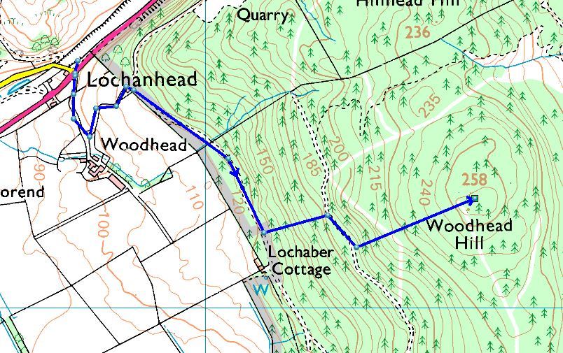
There are various approaches but most go up from near Mochrum House. Mochrum is a private estate so I was reluctant to drive on private property without permission. Well you wouldnā€™t like someone driving on your tracks and land without asking. As I got nearer, I started looking for my pre-check parking places. At one farm there were plenty of people in the farmyard, so I drove in, pulled up and asked about parking either in their yard or nearer. At this point it would add 20mins to a 40min walk but as I had nothing to do but eat and drink on return it didnā€™t bother me. With all Iā€™d eaten for breakfasts the walk would be useful.
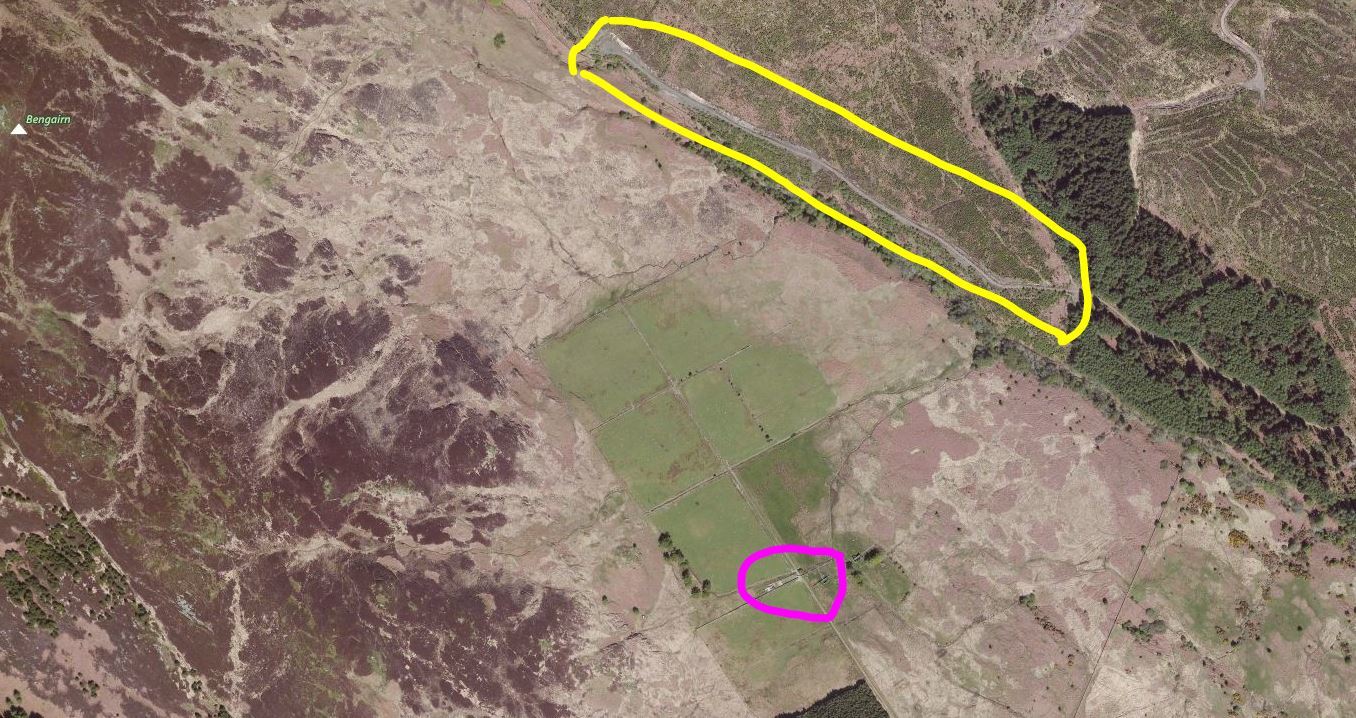
An exceptionally pleasant farmerā€™s wife listened and told me I had no need to park here but I could if I wanted. She said you can drive up onto the estate with no problems and even looking at my low slung car, she pronounced it more than enough for the track. Hmmmm! I have a dent in a silencer after similar advice. We chatted about Mochrum Fell and she wished me luck as the seedlings were now starting to become trees! I drove off and thatā€™s when I noticed there were enough guns to start a small war with the other people in the yard. In the end I drove onto the private track and parked up in an off-track area with a large pile of road gravel in it just before the turning for Little Mochrum Cottage around NX731745. From here I followed the track till I was behind the house and then looked for a like path through the harvesting and new plantings.

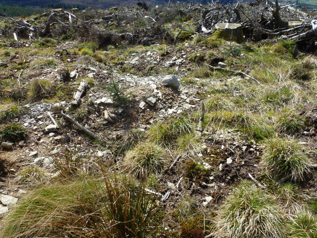
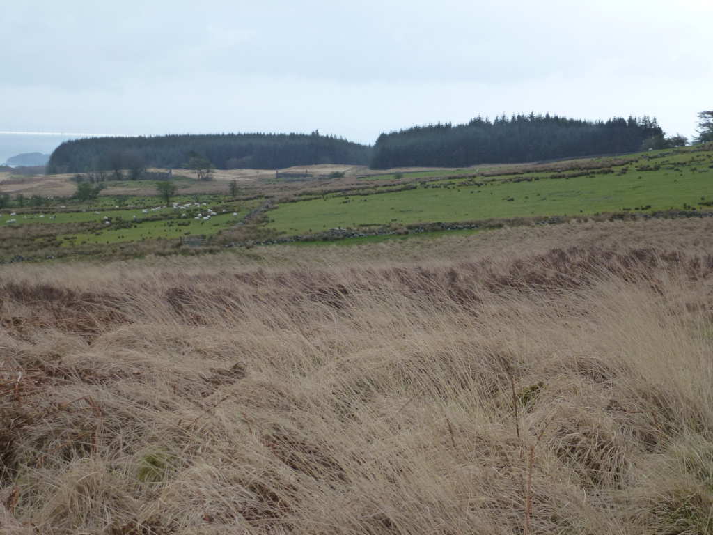
So there was significant amounts of brash on the ground and this must have been harvested a while back from the amount of moss and grass etc. that covered it. Then there was last years briars and brambles. Plus this years fresh brambles which were more of an issue. Oh, it was steep-ish too. So I struggled up trying to not get tripped by brambles or cut. Fail. Lots of cuts and lots of tripping. I tried not to collapse through rotten branches on the ground. Fail, they collapsed even with my dainty figure standing on them. Grr! Much swearing and grumbling got me from the track to the start of the proper planted trees, everything else was self-seeded or deciduous trees or bushes or just Scottish Jungle. Oh and it was still windy and the wind was cold but the sky was 33% blue and it was quite warm out of the wind.

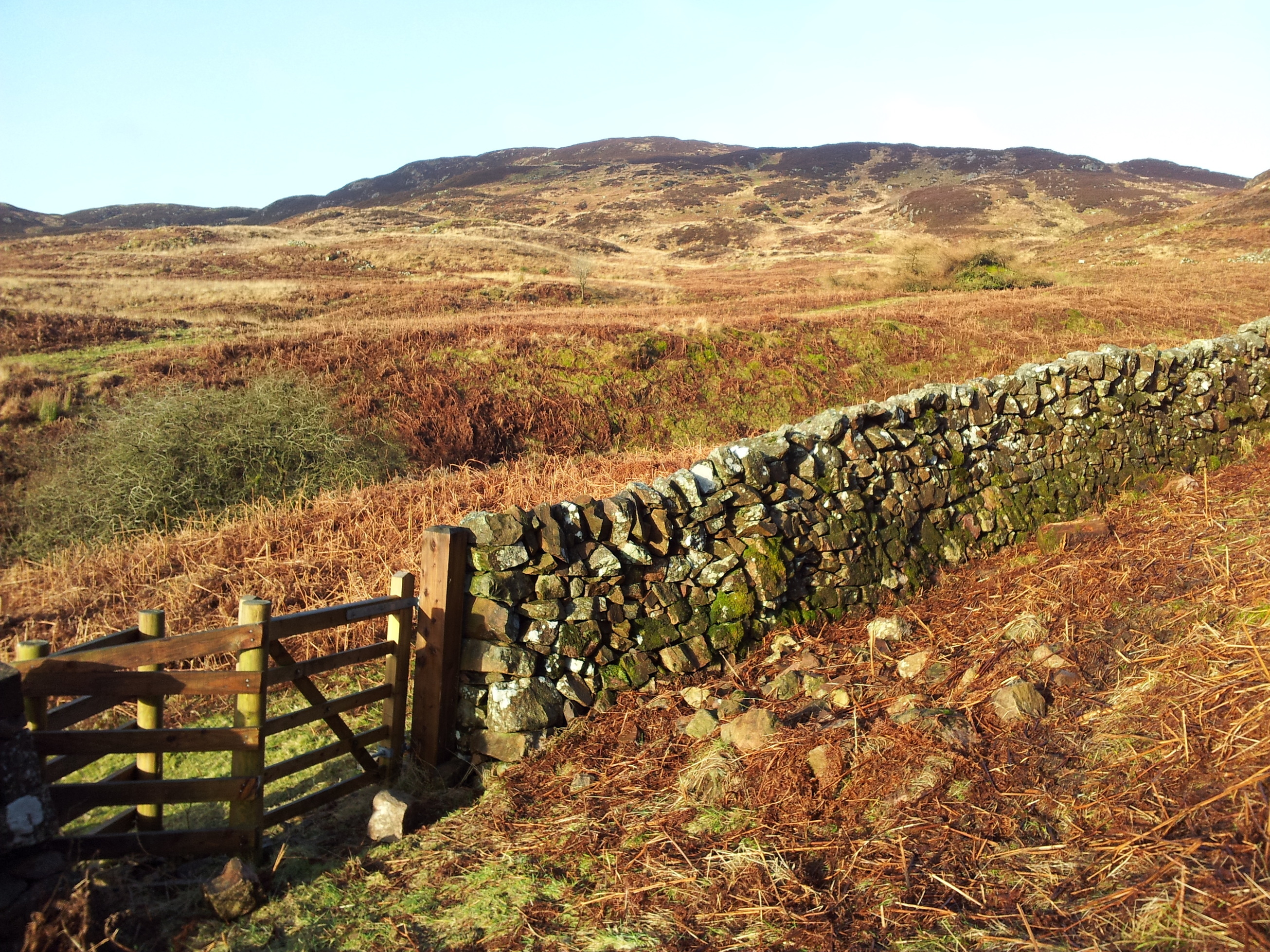
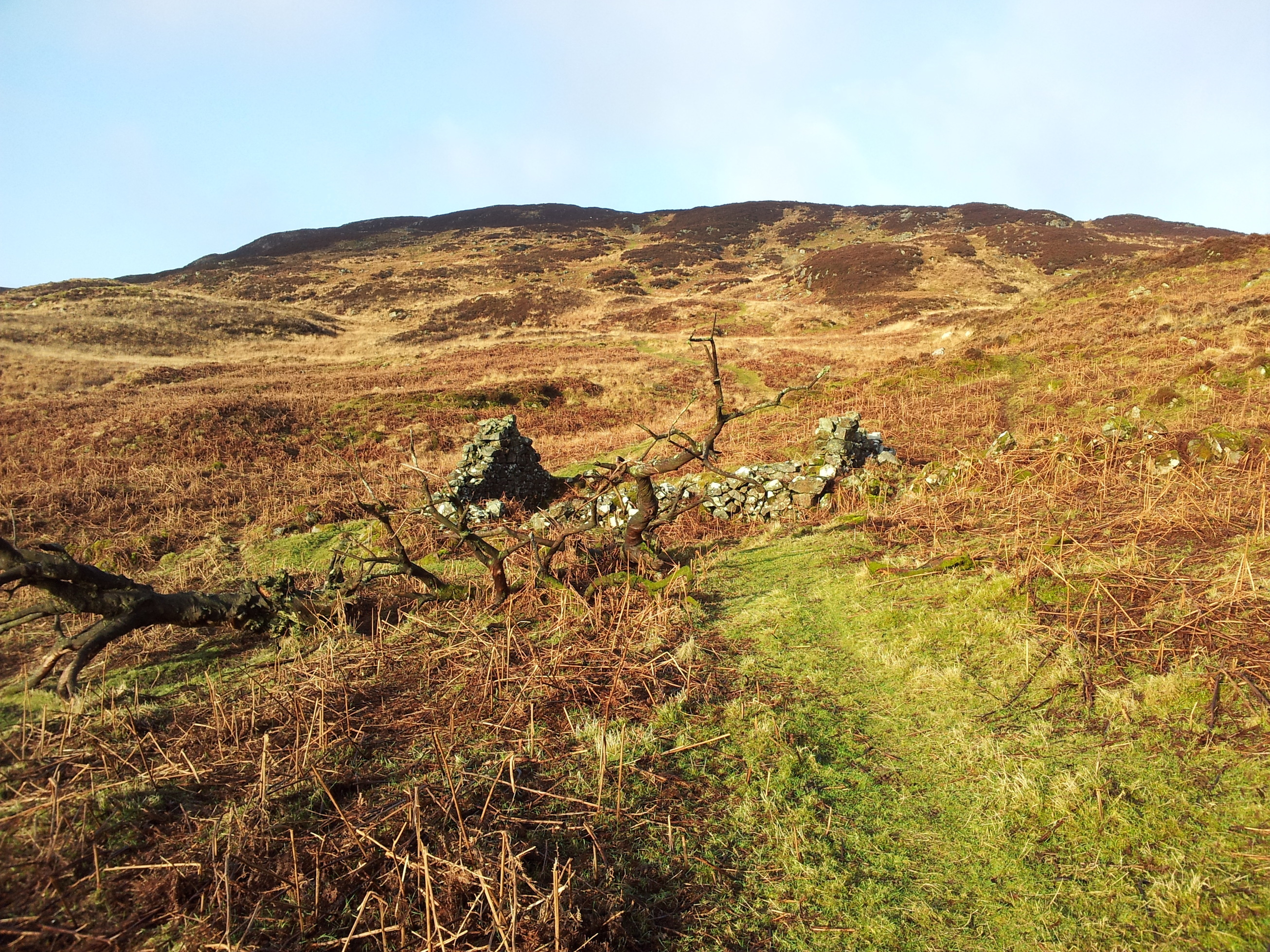
You get a bit of a breather when you get to the wall. The air here is very clean hence the masses of moss and lichens growing everywhere.

But you are faced with fewer brambles and more trees.

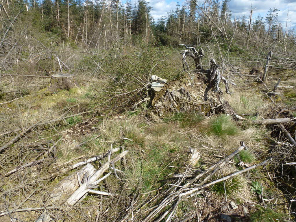
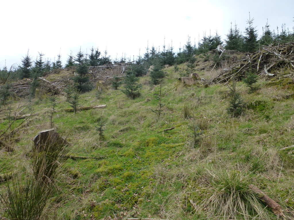
Getting to the trees is easy. Getting through the tress is hard work. Recent baggers will tell you they didnā€™t find it much of an issue but Pines grow quickly. Those trees are all 6ft minimum now with some nearer 8-9ft. The lower branches tend to be touching the branches of their neighbours and when you add in that you are walking over the brash from the harvesting plus brambles to trip you it becomes fun. Well I was laughing a lot as I crashed through finding old stump holes full of water and falling over into brambles.

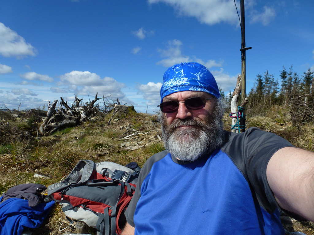
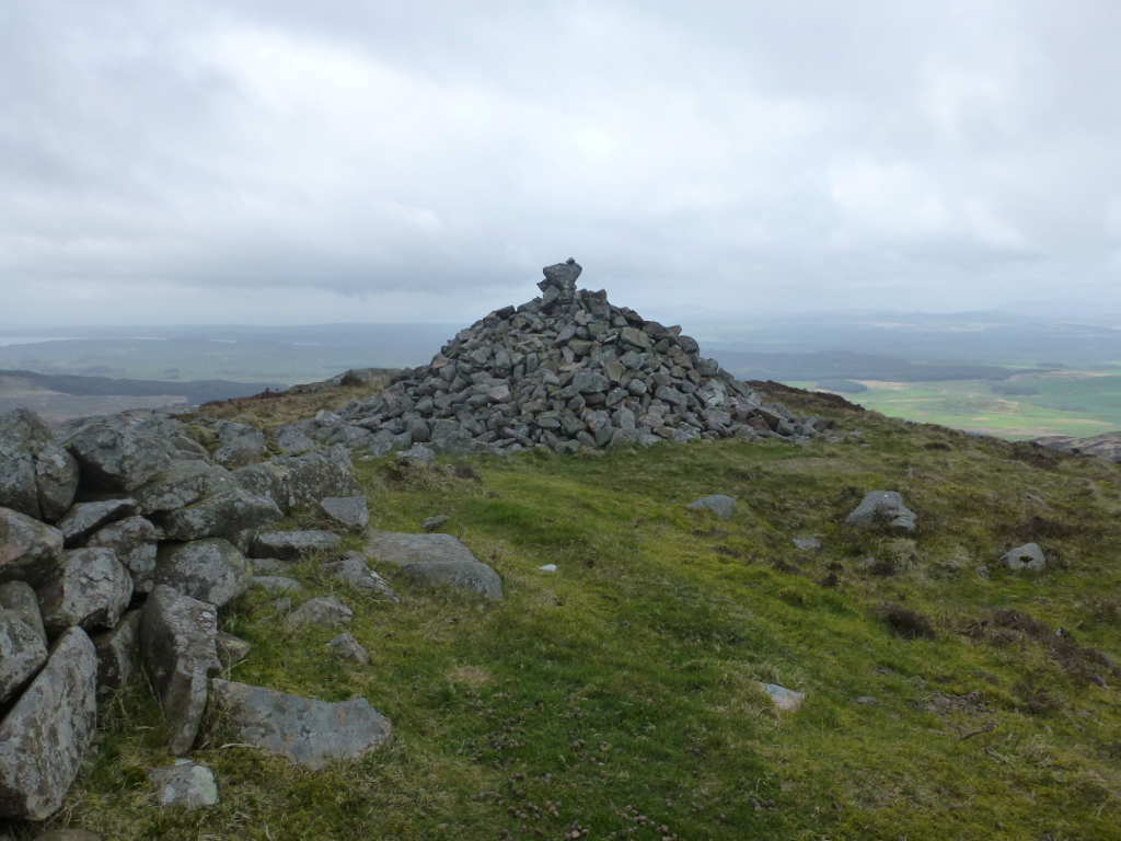
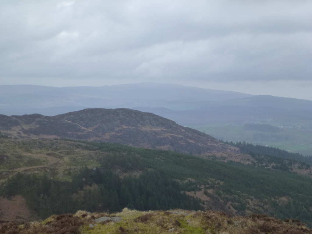
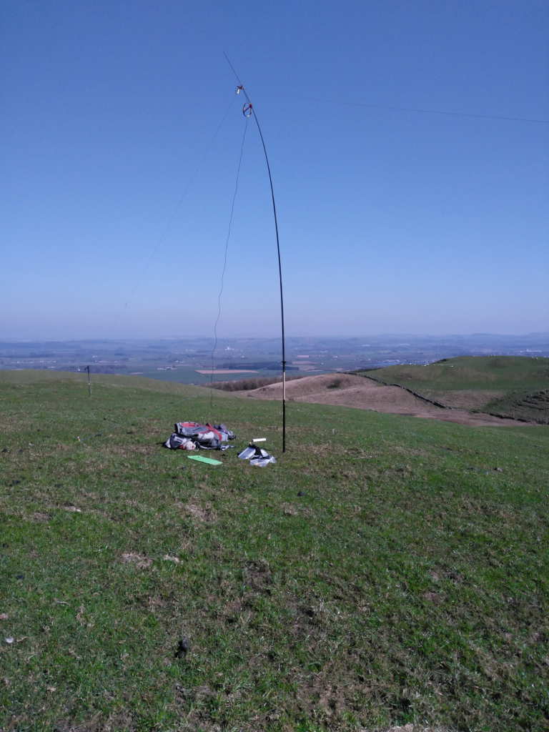
TBH, it was probably just 15-20mins of effort but it was made more tantalising by the trig being visible in the distance through much junior forest. At the top I found some young trees to lash the antenna to and I was back in business in no time with the Blackberry and satellite spotter doing sterling service. Just 60/30m on this one but midweek mid-afternoon and 35 QSOs in the log sounds good to me. I spent the time operating looking back at the plantation to see if there was an obvious way off I had missed. I couldnā€™t see anything that screamed ā€œWalk this wayā€.

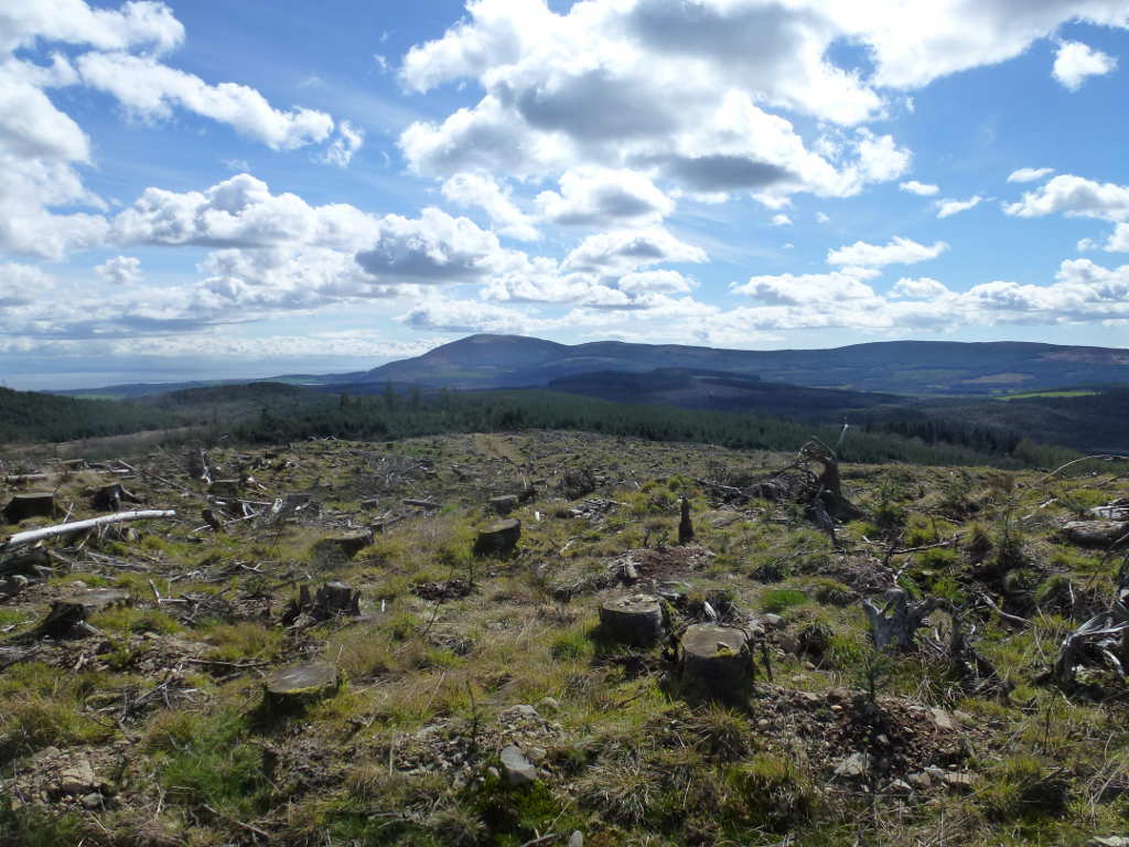
The WX was quite nice in that it was now T-shirt weather. Bengairn was too cold and windy to it in a fleece unless you were out of the wind. There was enough blue sky and sun to make this enjoyable. I was looking North trying to get some idea where I was in relation to bits of Scotland I know well. I was able to make out Fell Hill SS-217 which I bagged last Summer. There were the start of Windfarm works there when I was there and much activity on the neighbouring hill. Well they were now installing the masts and turbines on Fell Hill. Another SOTA summit spoilt especially as these green devices emit lots of RF noise. Bah! In fact I have never seen so many turbines as down here. The last time I was down to do Shalloch on Minnoch I passed some massive installation projects and I check that as of Sumer 2016 there were still 1200 turbines with planning approval waiting to being installed in Dumfries and Galloway. Mochrum Fell now is to have a windfarm installed despite massive local objections. Hey ho.
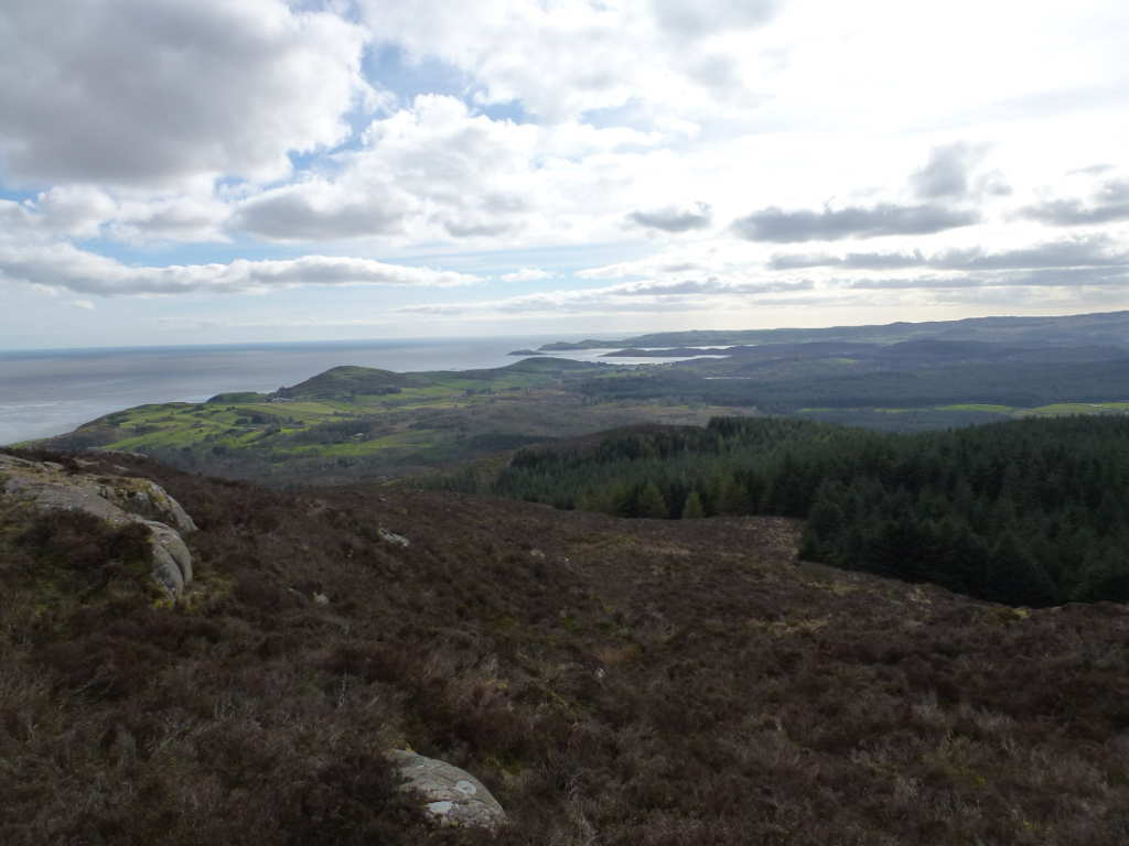
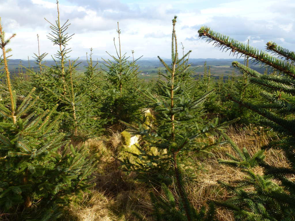
The view from my shack, doesnā€™t look to hard to walk through that does it?

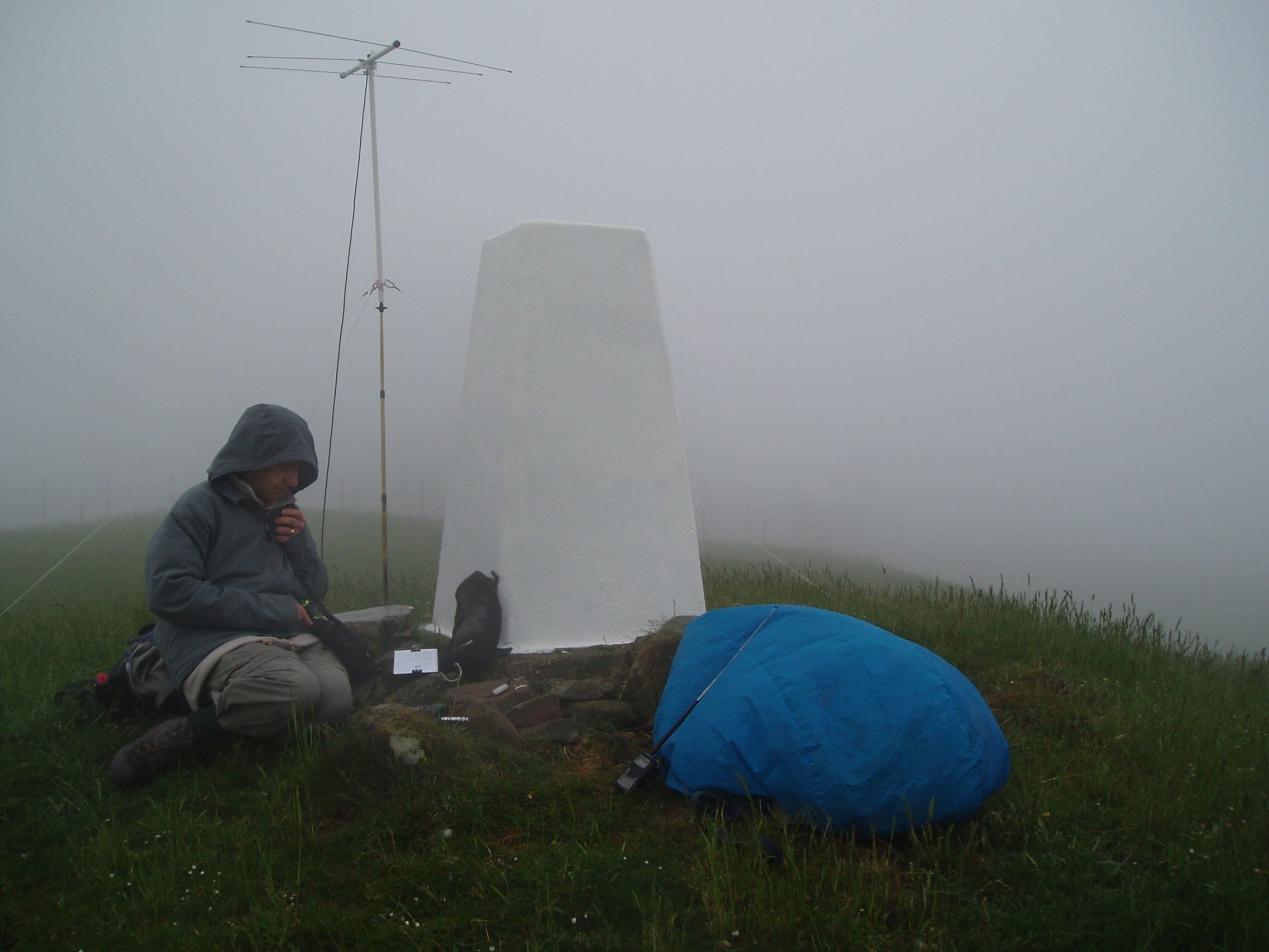
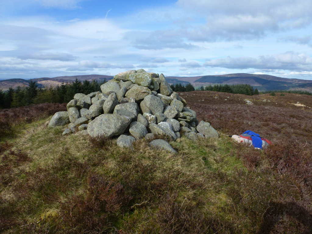
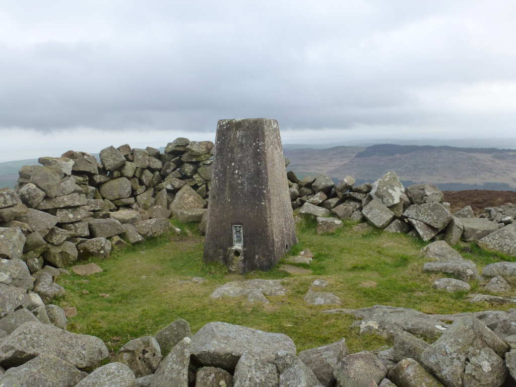
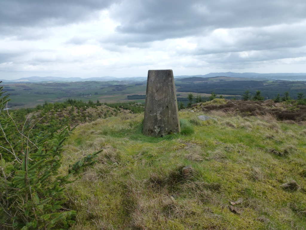
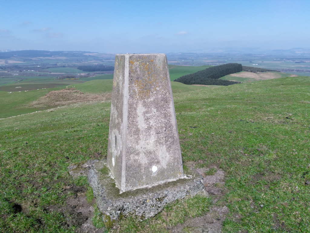
The trig with my camera autoexposure making the sky look a lot worse than it was.
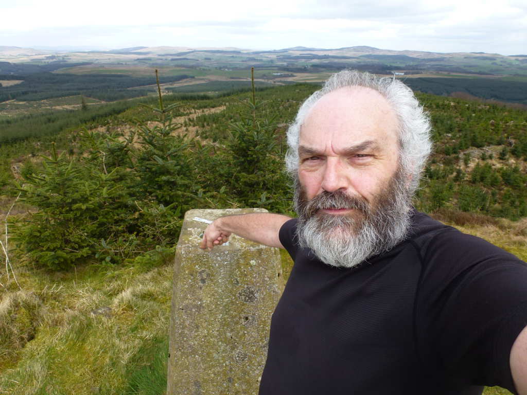
Hereā€™s something you may not know, OS trigpoints are massive sources of static electricity, You should always ground them before operating by them. You can tell this the way touching an ungrounded trig is making all the hair on my face and head stand on end! :wink:

The route back was the reverse. But I tried for easier paths and think I found them. Hard to see on the way up but easier on the way down. Once I got back to the wall I went down much further to right of Mochrum House. There was signifcantly fewer brambles this way. I got back to the track about 200m along from the house. If you go this way, when you get to the house keep going to the high point of the track then go about 150-200m more and then go up.
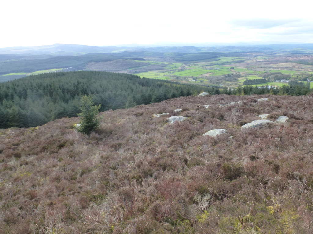
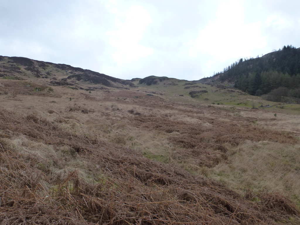
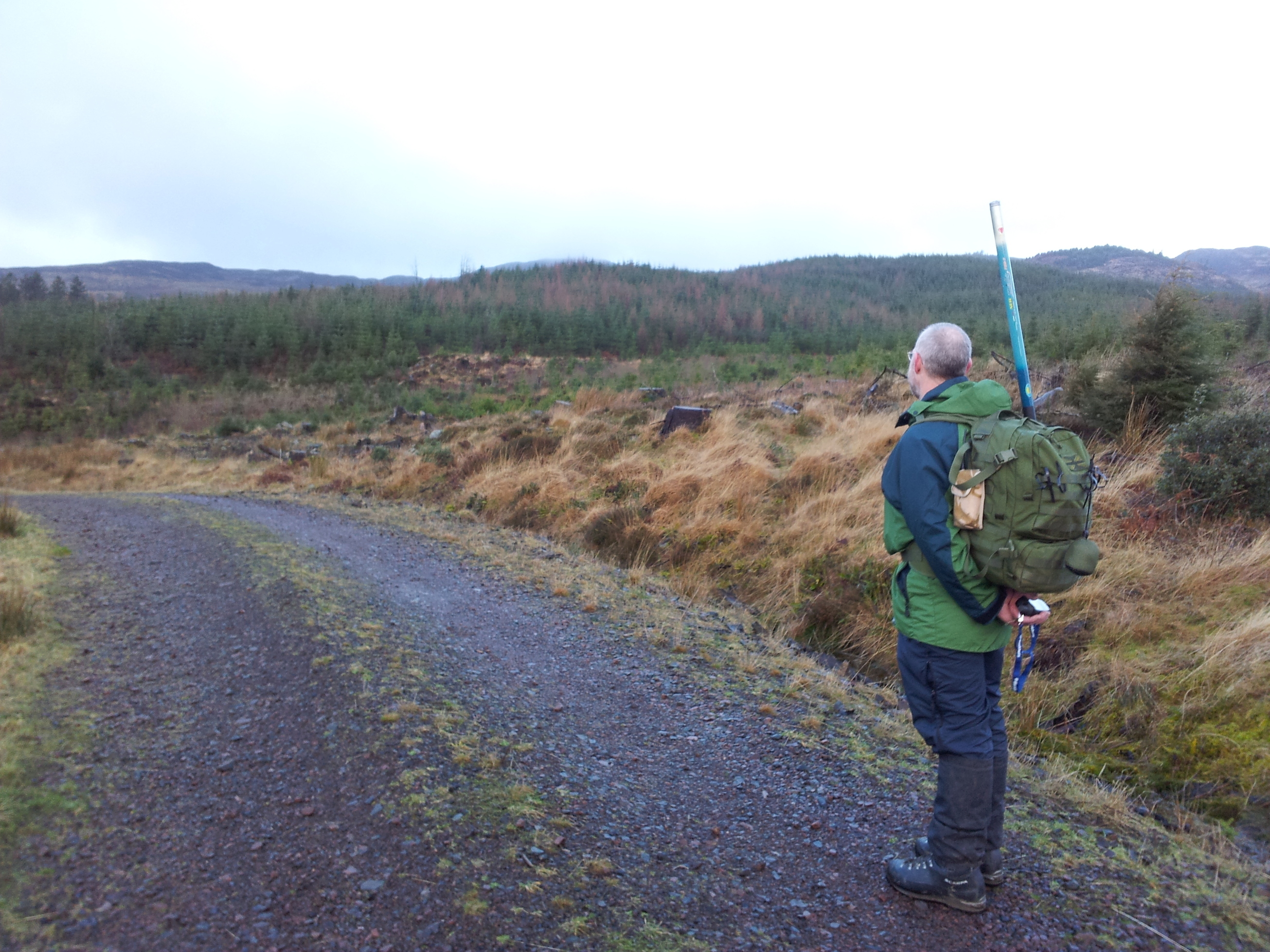
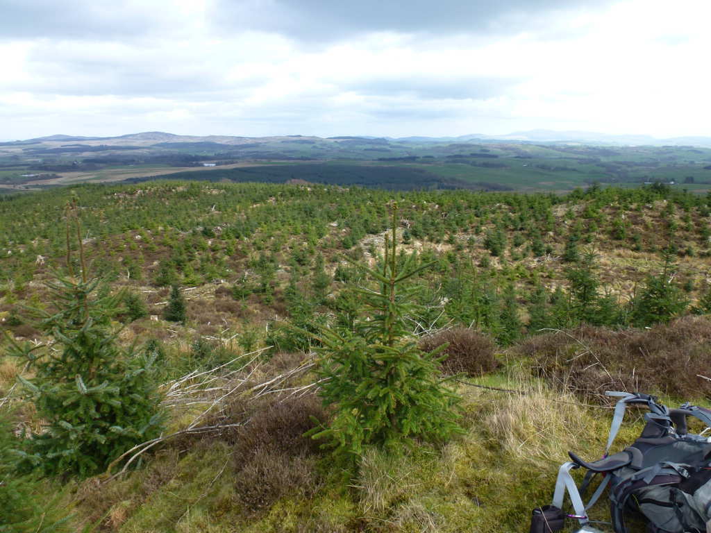
Think itā€™s easy to walk through those young trees, think again.

1 Like

Yep certainly was thanks again good few new ones and squares and trigs chalked up.
Thanks again Andy shame, prop good not bee bit better.

karl