Indeed, still rather wet up there. I’m travelling north later and will hopefully be on a summit near Killin tomorrow around midday. The forecast is for sun and cloud, so I’m getting the SOTA deckchair out of storage… will probably sink into the mire! Cloudier on Saturday, but probably still dry. I’m just wondering what will derail my efforts this time. ![]()
2 Likes
Hi Gerald,
Killin had a lovely rainbow above it as I drove past on the way back from Oban last night, but that does mean that it was raining !
It is much colder today in Edinburgh, Moxie the dog was keen to hurry the walk and get to the scrambled egg roll this morning !
Andy
MM7MOX
4 Likes
Today started dry but the forecast was for rain, some heavy, on and off for most of the day so not promising for SOTA. We contemplated various museums but the most interesting ones were either not open today or needed pre-booked tickets (I have noticed that various places you could just turn up to pre-Covid, now require pre-booking, which doesn’t suit our more spontaneous visiting).
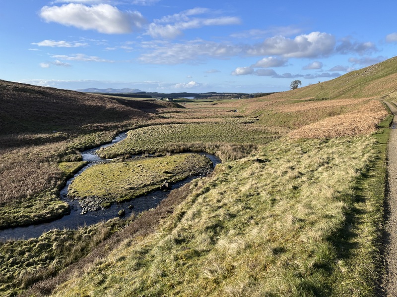
The rain at the cottage seemed reasonably light and the call of the hills overrode desire to stay dry, so we put on waterproof trousers and headed off. Our target was Wether Hill, SOTA GM/SS-177, the highest point of the Cloich Hills. I had two possible routes: a probably more interesting one from there southwest and a shorter one from the north. Given the weather we went for the shorter one. It was raining most of the way to the parking at the end of the public road to Cloich Forest.
We sat in the car contemplating getting out in loading up in the rain when we noticed it had almost stopped. So we loaded up and set off on the forest track towards an Outdoor Centre. There is more parking near the Outdoor Centre but the forest track is very rough and a 4x4 which passed us was going barely more than walking pace.
We turned left along another track which slowly ascended. Having dressed for rain we got rather warm walking in what was little more than intermittent drizzle. Having read other routes we were looking for a forest ride to take us out of forest and initially overshot as it looked overgrown. Howver on going back we found the path up a rocky bit, and once located it was pleasant walking, although boggy in places: a theme of this week’s walks! The wind was getting up and the trees offered shelter. Having gone over a sub-summit of West Side the path dropped down to a wall and fence. There was a wooden section between the barbed wire either side which was a little awkward and I managed to let my mapcase blow against barb. Once over it was tufty and boggy grassy and mossy with some heather as we made our way to the top. We were now in mist and rain was falling and we were now exposed to the wind: it was becoming unpleasant and we were glad to see the trig point.
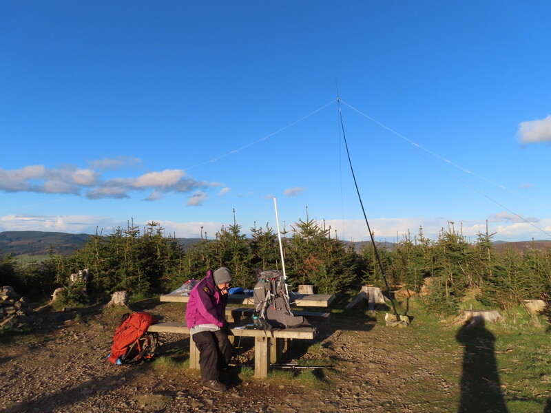
It was too windy and wet at the trig point so we dropped down to get a less windy area. Martyn set up the HF antenna while I remained with my rucksack on calling on 2m on the handheld. I didn’t expect to get many 2m contacts being slightly off the summit of a relatively low hill, but 0 was disappointing.
With HF up Martyn tried 60m but struggled and only got one contact. So we decided we would have to share 40m. Thankfully it was working, and thanks to the chasers who worked both of us we gad it qualified. Martyn then took a few contacts taking his total to 11 before handing back to me for a few more taking me to 16. We briefly considered other bands, but being cold, wet and niw hungry decided to call it a day. I didn’t tske my rucksack off on the summit!
We returned over the awkward fence and through the trees where we found a nice sheltered spot under the trees to sit to eat our belated lunch. We took sn alternative route back to the car that had been suggested by OS Walks which was rougher and boggier: it worked but wasn’t ideal. The walk back had some light rain, some drizzle and some dry. The worst of the rain was when we were at the summit!
Back at the cottage we have atuff drying out. We went into Biggar to fetch some good fish and chips: a traditional end of holiday meal if there’s a shop close enough.
Hoping to do Goseland Hill tomorrow before heading down to Lancashire for the Blackpool rally.
5 Likes
Many congratulations to both of you for persevering in what sounds like pretty challenging (ie ****y awful) weather almost all the time. I hope the fish and chips in Biggar (one of our favourite stops) made it all seem a lot better. Good luck with Goseland Hill GM/SS-203 tomorrow and hope you find the quad track which G4OBK recommends. Sorry we won’t meet up at the Blackpool Rally but it didn’t fit with the timing for our Scottish trip - and our vegetable gardening plans!!
73 Viki
2 Likes
We were moving from the holiday cottage near Biggar, but wanted to fit in an activation of the closest little summit, GM/SS-203 before heading south.
We parked in the little quarry near the track to Gosland, it was warm in the sun but with a chilly wind and we got out our sun hats for the first time this holiday. We still needed plenty of layers. We initially followed the drive to Gosland, leaving it to strike up towards a steep ATV track which led up to a col between the main summit and a sub-summit. Intermittent narrow tracks took us to the summit trig point and a wonderful set of views all round: Tinto, Culter Fells, The Broughtons and in the distance The Pentlands.
It was breezy at the top, but not too bad, so I set up the dipole attached to the trig point, while Martyn dropped down slightly to set up HF. Despite being surrounded by bigger hills there were enough gaps for me to qualify on both 2m and 70cms with 6 and 5 contacts respectively. Meanwhile Martyn had got 10 contacts on 60m. I then moved to 40m and when my initial frequency dried up went chasing S2S get contacts with GM4BML and GM5OLD which Martyn also grabbed. Finding a better 40m frequency I ended up with 23 40m contacts. Handing HF back to Martyn he struggled slightly on 20m but got 5 contacts.
The wind was getting up and we got some light rain, so with lunch eaten it was time to descend and resume our journey south. Before we had gone look far we heard Gerald Peck GM4OIG calling from CS-017 so stopped and worked him from the car.
5 Likes
Pleased to work you both from GM/CS-017. When I activated Goseland Hill I walked up in the dark and enjoyed a lovely view down into Biggar. Quite magical looking down on a town waking to a new day.
It was so breezy on my summit that I was almost blown over at the top. I saw 4 people on the hill during the day and none stayed. Thankfully I found some shelter lower down, but even then was unable to get the HF antenna up in the air. The 2m beam was only at 2m above ground, but really does that matter at over 1,000m above sea level?
3 Likes
Much later here’s a report on both hills with photos.
The weather forecast wasn’t promising with heavy rain forecast for lunchtime, but we decided to try to get an activation of Mendick Hill GM/SS-195 in before the rain. We had two possible routes but chose the route from the south as there was parking near Kippit cottages. It was windy as we took the path past the old sand quarries. The wind increased as we left the gently rising track to start ascending the hill proper.
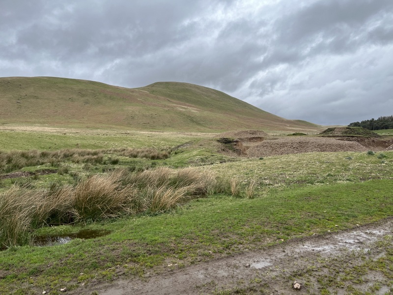
About to start the ascent
On the way up.
Having chased Andy MM7MOX on White Meldon we headed up buffeted by the increasing wind. It was worth the climb for the views from the trig point, but we needed to find what shelter we could to operate. There is even a bench at the summit, which Caroline used to set up by and provide some antenna support with Martyn setting up HF a little lower. It was too windy for the dipole, so Caroline operated the rucksack antenna on a short extension pole for VHF and an RH770 on the handheld for UHF. Starting with an S2S with Andy it took half an hour to get 4 qualifying contacts on a mixture of VHF & UHF. Martyn struggled on 60m but qualified easily on 40m, after which Caroline tried 20m which turned out to be an S2S fest with 5 out of 11 contacts, 4 of which Martyn also got. Just asking for S2S contacts only doesn’t thin them out much when 5 are calling at once!


Mendick Hill
We had had a short shower just after we arrived at the summit, and a slightly longer one with added hail which caused us to pause activity for a while. It started raining as we packed up and was more persistent as we walked out. It had been too windy to eat lunch at the summit, so we ended up eating it in the shelter of the car.
The rain was easing by the time we had had lunch and the forecast looked not too have too much more rain due, so we decided to attempt Broomy Law GM/SS-209. We drove to the little settlement of Candy Mill, hoping to approach the hill from the south, but there was no parking available, so we instead drove north to the small parking area on the A721 around NT100444. There’s room for a couple of cars and we fitted in behind the one already there. A little way west of the parking a track leaves the road heading SW which comes round to a gate giving access to the heathery ground beyond with a faint path running roughly parallel to the fence. It was boggy in places and passed through an area with scattered Scots pines before coming to a crossing fence on a very windy subsummit. We crossed over and decided to stay on the west side of the fence as a grassy area took us towards the transmitter mast bedecked summit.
Ascending Broomy Law

Ascending Broomy Law

Ascending Broomy Law
It was extremely windy at the summit, so we crossed the fence to drop down on the slightly more sheltered eastern side. It was again too windy for the VHF dipole, so Caroline just propped up the rucksack antenna to try to get contacts, while Martyn set up the HF dipole. 60m only yielded a single contact for Martyn which he followed up with 9 on 40m. Meanwhile Caroline had managed to qualify the hill with 4 on 2m FM but could only raise one 70cms contact. Caroline switched to 20m getting 12 contacts. It was now a bright sunny evening, but the wind was still strong as we retraced our steps getting good views of the Pentlands on the way.


Windblown antenna on Broomy Law

Transmitter station on Broomy Law (no obvious interference)
4 Likes
14 April 2024: Sunday
The forecast was for sunshine and showers followed by a rain band late afternoon, so we headed for East Cairn Hill GM/SS-282, intending to be back at the car before the rain became heavy. It didn’t quite work out!
Many years ago we activated its neighbour West Cairn Hill, having approached from the south starting in West Linton. West Cairn was subsequently demoted as East Cairn is higher, and this time we decided to take the shorter walk in from the north. We parked at the little car park on the A70 at Little Vantage, loaded up in sunshine and set off south on the Cross Border Drove Road. We hadn’t gone far before we needed to stop and apply waterproofs and rucksack covers. The path was very boggy. Old railway sleepers had been laid over some of the wettest sections, but they often fell short, and we needed to hone our bog hopping skills. A section through the edge of a wooded section was particularly tricky and in places we needed to clamber over the remains of a broken wall to avoid flooded areas. It was slightly easier once clear of the trees, but still muddy and boggy: progress was painfully slow at times and we were running well behind any sort of schedule.

East Cairn on left, West Cairn on the right, Cauldstane Slap between them.
Drove Road and Harperrig Reservoir
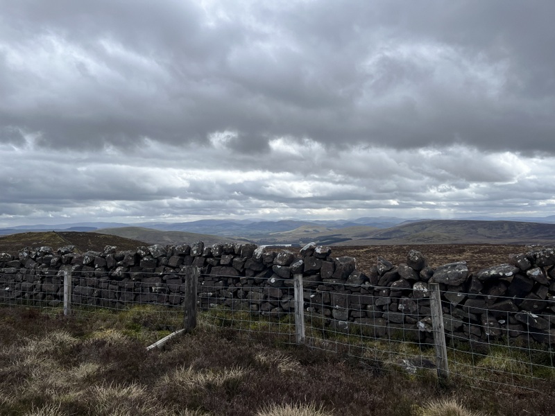
Approaching Cauldstane Slap we looked for the path to ascend East Cairn hill, but a passing fell runner suggested that it went off by a post some way back: we had noted the post but not seen any signs of a path from it. Assuming we had missed the path, we struck up through the heather which was deep and hard work. Eventually we found a slightly less muddy path running up the fence line, which is where the wind really hit us. We were in the activation area once by the northern sub summit but carried on to the true summit marked by a tiny cairn where a wall provided a little protection from the wind.
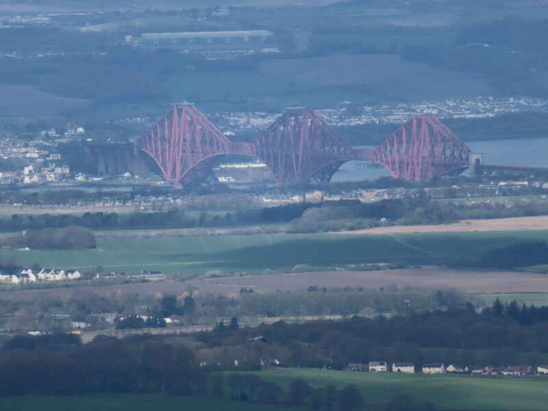
Forth Rail Bridge from East Cairn Hill

Tiny Summit Marker on East Cairn Hill
East Cairn Hill
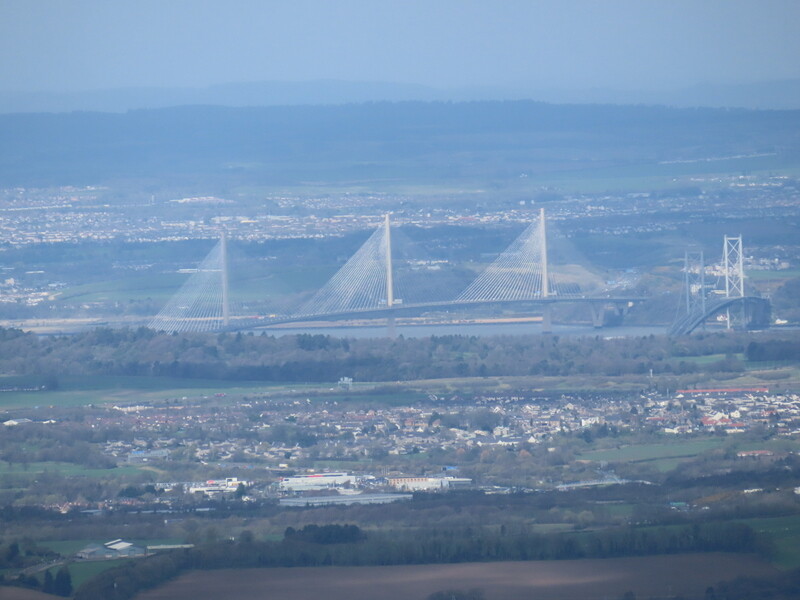
Queensferry Crossing and Forth Road Bridge from East Cairn Hill
Much later than expected we set up our stations. A fence ran parallel to the wall but a few feet from it, but someone had helpfully cut a hole in the fence near the summit, allowing Caroline to set up her station by the wall. It was again too windy to use the MFD, so she propped the end fed 2m halfwave rucksack antenna on an extension pole against the wall. The antenna fell over during her first contact, but she then wedged it more securely though the end was swaying in the wind. Martyn set up HF on the flat top a little way away and started on 40m which was slow but qualified the hill. Caroline was mixing 2m and 70cms FM and got 3 70cms and 8 2m contacts before breaking to eat lunch. Final calls after lunch yielded another 4 70cms contacts and 5 2m. Martyn tried 60m and got 4 contacts, so we qualified the hill on 4 different bands between us.

VHF/UHF station

VHF/UHF station

HF station

HF antenna
It was then time to pack up, but it was clear that we weren’t going to get down before the forecast rain. There was a shower as we were leaving the summit which soon passed. On the descent we followed the path by the fence all the way to the col of Cauldstane Slap which was much better than ploughing through the heather. We checked the post the runner had mentioned and still saw no sign of a path, so should have stuck to the drove road all the way to Cauldstane Slap. More serious rain and wind arrived as we returned along the boggy drove road path. We had a lot of wet outer wear back at the car. Somehow, we managed to not get wet feet despite the terrain!

The path by the fence up East Cairn Hill from Cauldstane Slap

Cauldstane Slap
6 Likes
I’ve always known the path from Cauldstane Slap to the slopes of East Cairn to be a place where Rocket Shorts and Hover Boots are essential. It seemed to be nearly ankle deep in water and gloop even after dry periods ![]()
2 Likes
15 April 2024: Monday
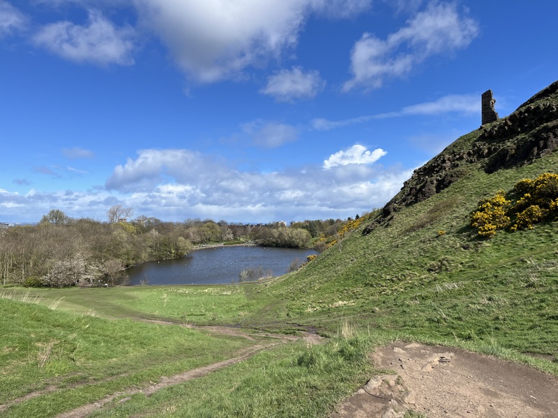
The forecast for the local area didn’t look promising for doing SOTA with alternating bands of rain and non-rain during the day. However closer inspection suggested that heading north to Edinburgh would avoid the worst of the rain, so we decided to take advantage of having obtained permission to operate from Arthur’s Seat GM/SS-272.
The weather brightened a bit as we drove north aiming for the free parking by St Margaret’s Loch in Holyrood Park. Slow Edinburgh traffic delayed us, and we feared the car park would be full but as we turned in, we spotted a single free space near the entrance. Result! We don’t normally have that sort of luck, so no need to deploy plan B of roadside parking further away.
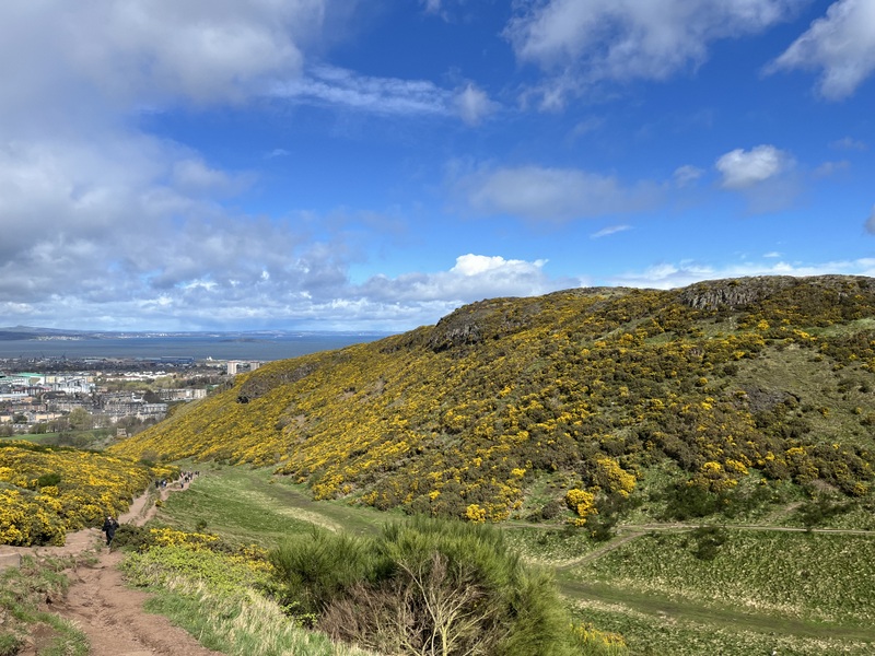
The sun was shining as we set off round St Margaret’s Loch with herons, swans and other waterfowl. We headed to the toilets on the northern edge of the park, finding them open but with a note they closed at 15:00 - a bit early so they wouldn’t be useful after the activation. We then made our way up the main path from the north which was busy with lots of others going up and down. The wind increased as we got higher, being hard to make progress at times as it gusted round the crags. At the summit it was hard to stand up, so after a few photos we dropped down to the south to find a little shelter from the wind.
St Anthony’s Chapel from St Margaret’s Loch

Ascending Arthur’s Seat
Ascending Arthur’s Seat
Ascending Arthur’s Seat
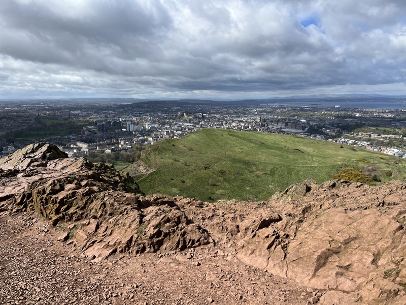
Edinburgh from Arthur’s Seat
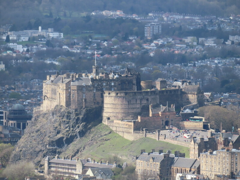
Edinburgh Castle from Arthur’s Seat

Arthur’s Seat Trig point
It was tricky finding somewhere to set up that wasn’t on a path, wasn’t too steep and wasn’t too windy and wasn’t in a gorse bush. The result was bound to be a compromise and we ended up sitting one each side of a gorse bush. Our position was going to limit contacts as many would be blocked by the granite behind us.
We started off doing VHF only and both worked the same 4 callers to qualify the summit. Caroline then moved to UHF getting 3 contacts before it went quiet. Meanwhile Martyn was setting up the HF vertical at the other end of a gorse bush, partially supported on its tripod and partly strapped to the gorse bush. It is a compromise antenna, but he managed to get enough contacts to qualify on both 40m and 20m. Meanwhile Caroline had managed to raise another VHF and UHF contact so had it qualified on both 2m and 70cms. With her late lunch eaten, Caroline tried 15m on the vertical but only got 1 contact.
Caroline operating HF
VHF/UHF station

Martyn operating HF

View from VHF operating position.
We then packed up and found descending in the wind tricky and Caroline ended up bashing her left knee trying to negotiate an awkward step without being blown over: no lasting damage but some blood! We descended south which seemed trickier as we needed hand on rock in several places on what was clearly an official route as it ended in wooden steps.
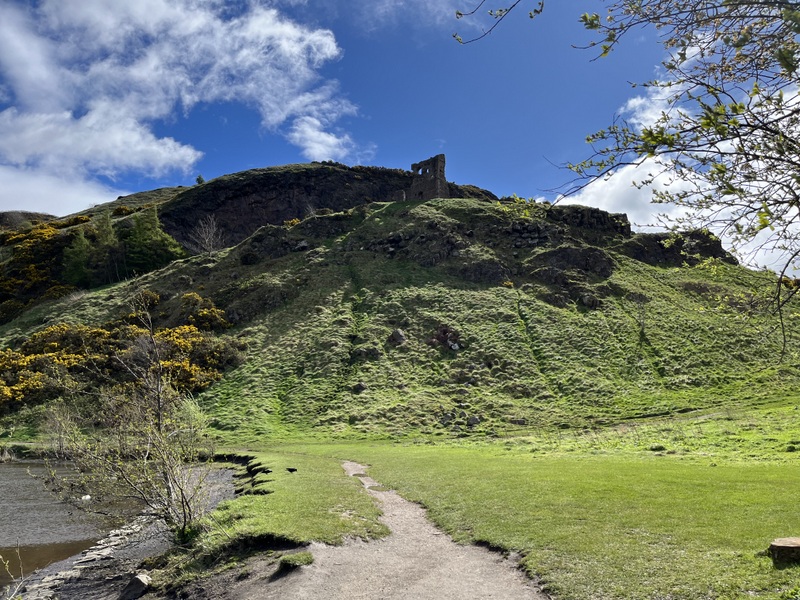
We headed towards the Meadows recreation ground to find some toilets: they were in a state of disrepair but served a need. As cities go, Edinburgh is pretty good, but it could do with more public toilets! We wandered back to Holyrood Park, going over The Hause and along a nice gentle descending path before climbing briefly to the ruined St Anthony’s Chapel.

Descent view

Looking back to the summit
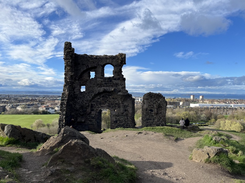
St Anthony’s chapel.
In terms of weather we made the right choice. Apart from a few spots of rain early on and a hail shower soon after we started operating it remained dry and we needed neither waterproofs nor rucksack covers. The main problem was the wind.
8 Likes
It was the drove road we found the worst. Once we had found the right path up East Cairn Hill from Cauldstane Slap it was relatively less boggy (but that’s probably more a reflection of how bad the drove road was!).
2 Likes
Hi Caroline, thanks for your great report with photos.A terrific read; a good effort. Well done ![]()
Geoff vk3sq
2 Likes
16 April 2024: Tuesday
The forecast was for a mostly dry day but again windy, but perhaps not as windy as the previous day. We drove east through Peebles and Innerleithen to our first target of Windlestraw Law GM/SS-087, the highest point of the Moorfoot Hills. There were reports of parking by the sheep pens at Blackhopebyre but it looked too narrow to us, but we found a small layby a little further north at NT345422.
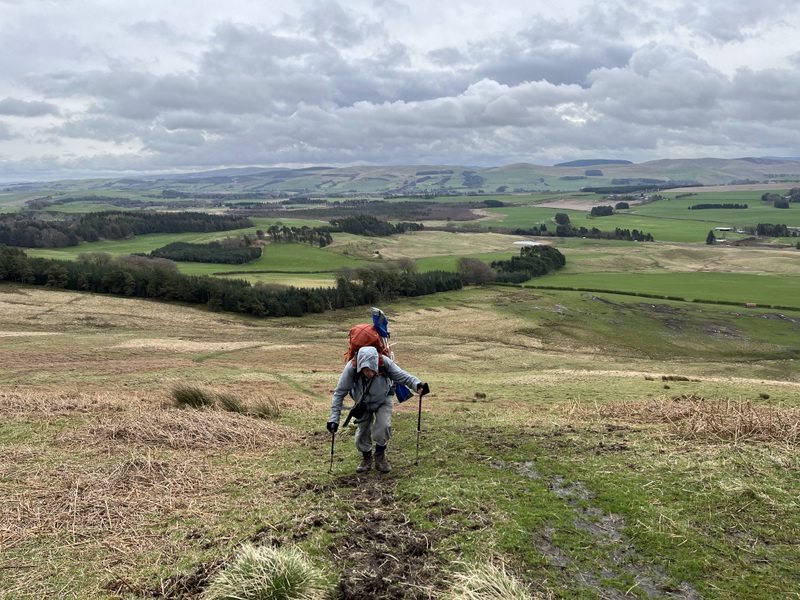
We set off back down the road, and a slight misreading of the map meant we took the track heading along the Blackhopebyre burn rather than the one up Glentress Rig. We soon realised our mistake but having heard reports of the main track being rather boggy, and the track we were on being good, we decided to stick with it, as it looked to provide an alternative. It led to a track which crossed the North Burn at its confluence with the Blackhopebyre burn. Here we needed to leave the track and cross the Blackhopebyre burn, and a fence to head steeply up to Wallet Knowe: pathless and heathery but not too bad. We were aiming towards where the map showed a line of grouse butts, and they soon appeared with a bit of a sometimes boggy path by them, which eventually led to the main Glentress Rig path on Wallet Knowe. This is where the path bogginess really started, though there were some easier sections as the path headed up past more grouse butts towards a fence. We then followed the fence to the summit at a junction of fences. We crossed over to the trig point.

Blackhopebyre burn valley

Bridge where we left the track and crossed second stream to ascend by fence and then cross it.

Ascending Windlestraw Law

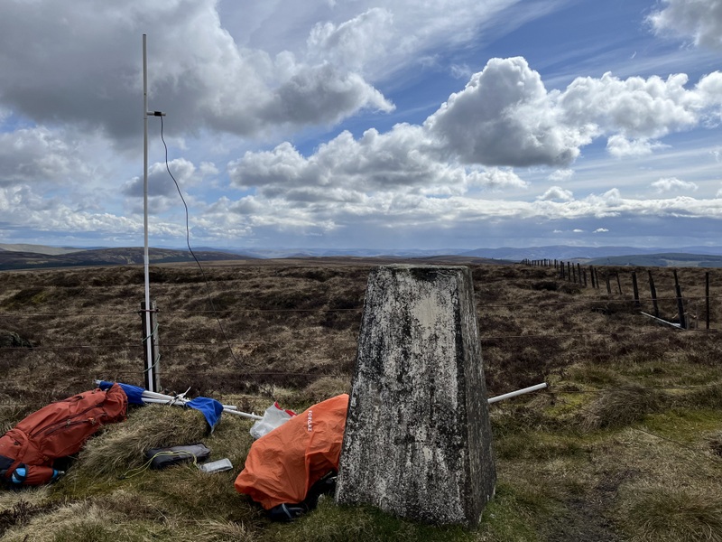
Windlestraw Law
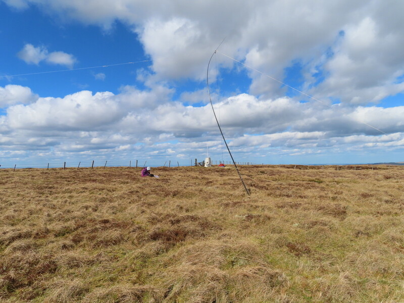
The trig point was on a patch of drier ground but surrounded by boggier and wet areas. It had a suitable hole in the top allowing Caroline to set up the MFD for the first time this week. She put out calls on 2m and 70cms FM, and unusually qualified it on 70cms (4 contacts) but not 2m (3 contacts). Martyn needed to negotiate the boggier ground to set up the HF dipole, which again was bending in the wind. He started off on 5 MHz and qualified with 6 contacts. A move to 40m brought a S2S with Andy MM7MOX on GM/SW-336 Beinn Lora for both of us (making it a complete for Caroline – Martyn had chased it previously). Martyn briefly continued on 40m for another 4 contacts while Caroline finished her lunch, after which she took over while Martyn had his lunch. After 9 more 40m contacts a move to 20m brought 8 more.
Windlestraw Law
Windlestraw Law

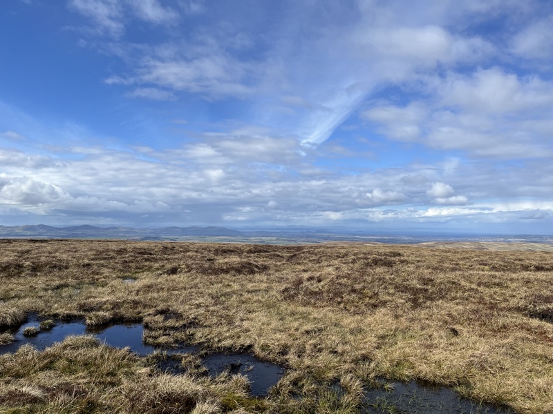
Windlestraw Law views

Windlestraw Law summit fence junction
Descending Windlestraw Law over Glentress Rig
Descending Windlestraw Law over Glentress Rig
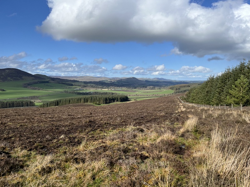
With lunch eaten and the calls having dried up we packed up in the hope we could fit another hill in. On the descent we stuck to the main Glentress Rig path, which became less boggy beyond Wallet Knowe, and provided a good return route. Back at the car we contemplated whether we had time to also fit in Cademuir Hill GM/SS-219. It was a lovely afternoon, and too nice to go straight back to the holiday cottage, so we decided to give it a go, driving to the Tweed Valley Forest Park parking on the NE of the summit.
A noticeboard in the car park suggested that the suggested route to the summit was over two hours, which was much longer than Caroline had estimated, but we loaded up and set off on the “red” route anyway. After a while we spotted a path going steeply up the trees that looked to cut off a loop of the official route, and it nicely brought us up to rejoin the official route on a higher forest track. We then followed the main path to the summit around and up the hill, to find a picnic table at the summit, but also a lot of both felled and replanted trees. It had taken around half an hour for the ascent.

Cademuir Hill
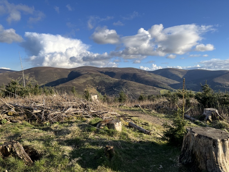
Cademuir Hill
Cademuir Hill

Cademuir Hill
There was only a small cleared area, and the summit was crossed by several mountain bike tracks. And there were mountain bikers around too. We chatted to one who told us that bikers were likely to use all the visible tracks, but also asked if we had a cable tie he could have, as he had broken part of the brake arrangement on the bike and was trying to fix it: Martyn rummaged in his bag of bits and offered him a choice of three lengths: shortest one will do the job! Martyn eventually contrived a way to get up the HF antenna so that the wires only crossed paths at high level, and we needed HF. Caroline got just one VHF contact from this relatively low hill surrounded by bigger hills. Either HF conditions were poor, or all the chasers had given up for the day by the time we had HF on the air around 17:30 UTC. Given the late hour we took it in turns to work the first 4 40m chasers alternately, so now with 5 contacts Caroline left 40m to Martyn but he got only one more 40m contacts. We did manage to get the antenna down enough to change the links for him to try 20m but he got just one contact there – disappointing but we had both qualified the hill. On the descent we retraced our steps on the forest road to where we saw a different path descending through the trees. A nice little hill for a lovely late afternoon / early evening walk, but likely to be harder to activate once the new trees have grown more.
7 Likes
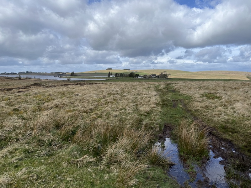
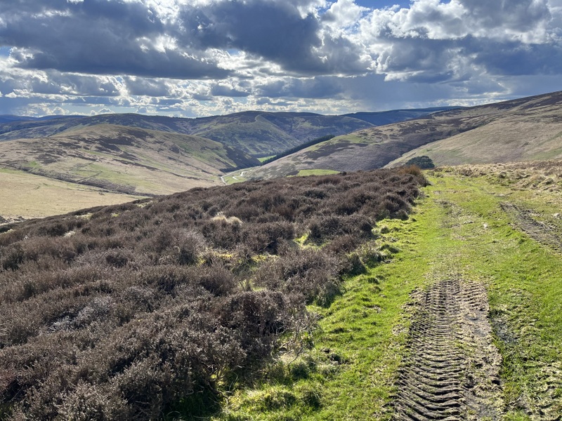
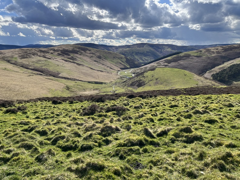
17 April 2024: Wednesday’s target was Blackhope Scar GM/SS-094, which we intended approaching from the north and aimed for parking south of the Gladhouse Reservoir. However when we turned into the road leading to Moorfoot Grange there were discouraging notices about no parking on verges or grass, and our research had led us to believe we were looking for a grassy parking area. We continued anyway and found a little car park with earth and grass. However a notice said Private Car Park, but having initially been discouraged realised that underneath was a note saying parking for hikers only and not reservoir visitors. So, being hikers, we found a parking spot between the muddy patches and set off.
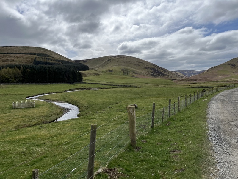
The walk goes down to the road and, through the farm and then along an estate track following the river South Esk. The morning had been forecast as better than a showery afternoon, but it was generally cloudy. The track was generally good with a few flooded sections that were avoidable. By a little building and a sheepfold we left the valley track for one which climbed out of the valley to The Kipps. We were now getting glimpses of sun.
River South Esk valley

Ascending The Kipps.
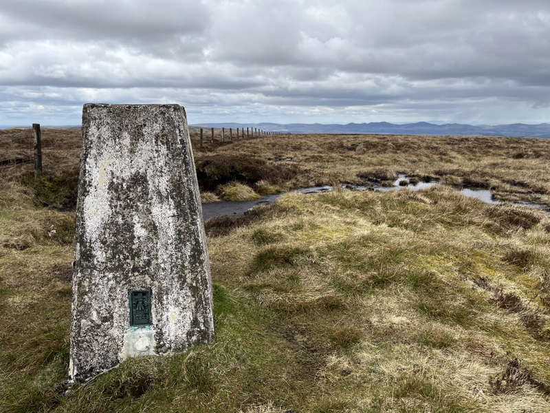
Reaching a high point we left the track to make our way over boggy heathery ground to a fence which we followed all the way to the summit. It was generally boggy with some drier sections, and some ATV tracks to ease through the heather. Eventually the trig point appeared near a fence junction. We made our base near the trig which wasn’t too wet but was surrounding by wet sections. We had some light hail on the ascent and a more significant shower soon after arrival, and there was cold wind but not as strong as on some previous hills.
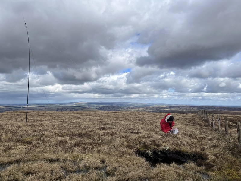
Caroline was able to set up the VHF dipole supported by one of the fence posts, while Martyn set up a bit further way the other side of a boggy bit. Contacts were initially slow, but Caroline ended up with 12 on 2m, and 4 on 70cms. Martyn got just 4 60m contacts before moving to 40m where his run of 32 contacts included 3 S2S contacts which I grabbed between the VHF and UHF contacts. We finished off the activation with a run of 18 contacts on 20m for Caroline.
Blackhope Scar
Blackhope Scar
Blackhope Scar
Blackhope Scar
Blackhope Scar
Arthur’s Seat from Blackhope Scar
Following other brief showers the weather improved and we had lovely blue skies on the descent. On the way back we stopped to have a look at a couple of sheepfolds and the remains of the ruins of Hirendean castle just above the track.

Looking back at Blackhope Scar on descent
South Esk River

Hirendean castle

Hirendean castle
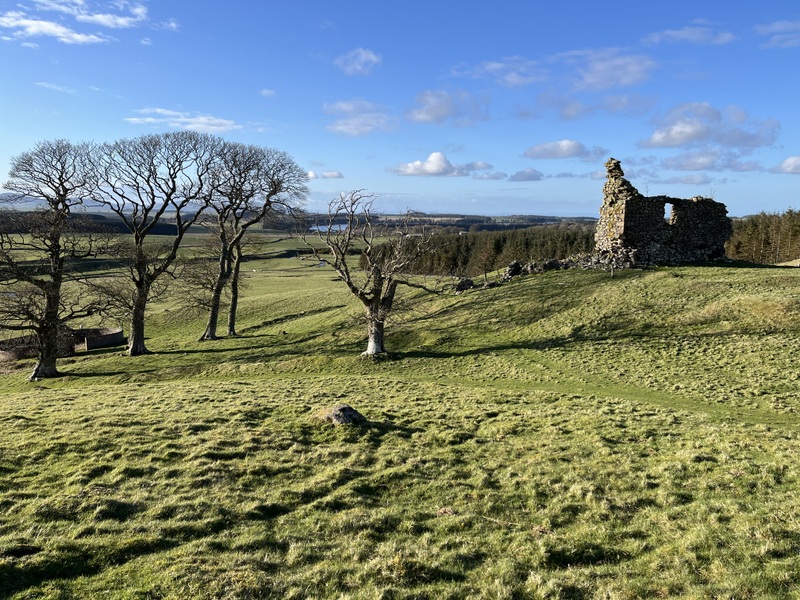
Hirendean castle
5 Likes
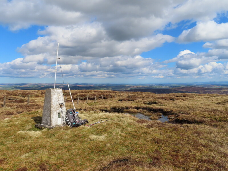
18 April 2024: Thursday Wether Hill, SOTA GM/SS-177
Today started dry but the forecast was for rain, some heavy, on and off for most of the day so not promising for SOTA. We contemplated various museums, but the most interesting ones were either not open today or needed pre-booked tickets (it seems that various places you could just turn up to pre-Covid, now require pre-booking, which doesn’t suit our more spontaneous visiting).
The rain at the cottage seemed reasonably light and the call of the hills overrode our desire to stay dry, so we put on waterproof trousers and headed off. Our target was Wether Hill, SOTA GM/SS-177, the highest point of the Cloich Hills. Caroline had researched two possible routes: a probably more interesting one from the southwest and a shorter one from the north. Given the weather we went for the shorter one. It was raining most of the way to the parking at the end of the public road to Cloich Forest at NT222499. We sat in the car contemplating getting out and loading up in the rain when we noticed it had almost stopped. So we loaded up and set off on the forest track towards an Outdoor Centre. There is more parking near the Outdoor Centre at NT213502 but the forest track is very rough and a 4x4 which passed us was going barely more than walking pace.
We turned left along another track which slowly ascended. Having dressed for rain we got rather warm walking in what was little more than intermittent drizzle. Having read other activation reports we were looking for a forest ride to take us out of forest and initially overshot as it looked overgrown. However on going back we found the path up a small rocky area, and once located it was pleasant walking, although boggy in places: a theme of this week’s walks! The wind was getting up and the trees offered shelter. Having gone over a sub-summit of West Side the path dropped down to a wall and fence. There was a wooden section between the barbed wire either side which was a little awkward and Caroline managed to let her map case blow against barb. Once over it was tufty and boggy grass and moss with some heather as we made our way to the top. We were now in mist and rain was falling and were also exposed to the wind: it was becoming unpleasant, and we were glad to see the trig point.
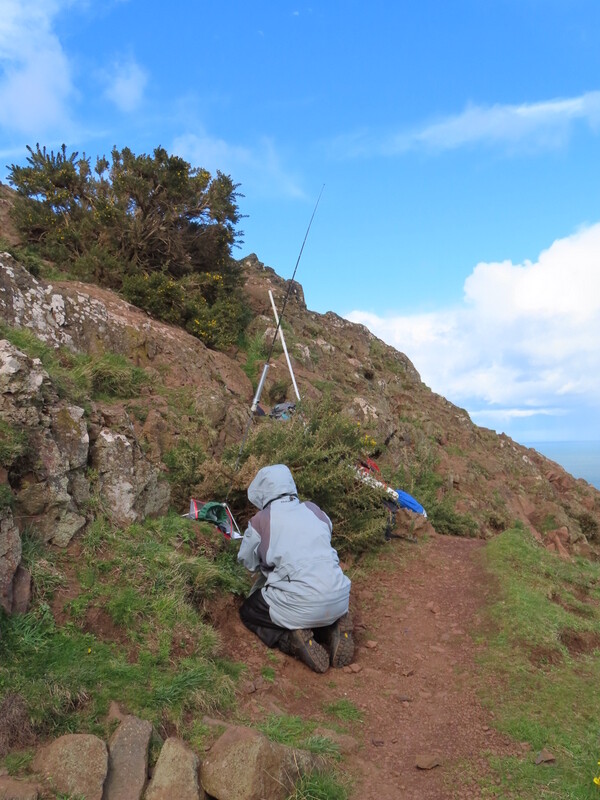
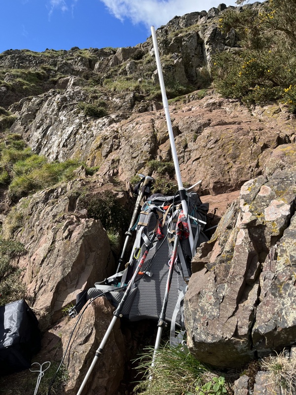
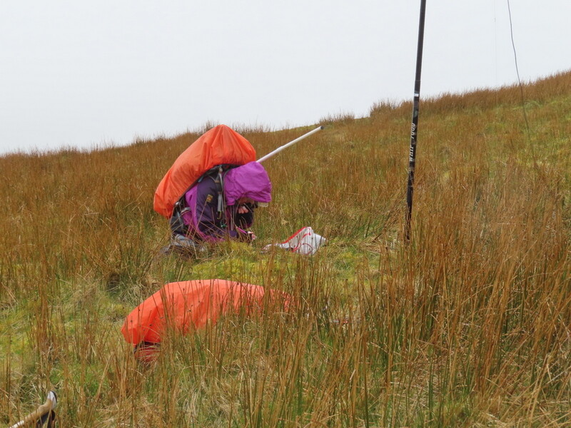
It was too windy and wet at the trig point, so we dropped down to get a less windy area. Martyn set up the HF antenna while Caroline remained with my rucksack on calling on 2m on the handheld. Caroline didn’t expect to get many 2m contacts being slightly off the summit of a relatively low hill, but 0 was disappointing.
With HF up Martyn tried 60m but struggled and only got one contact. So we decided we would have to share 40m. Thankfully it was working, and thanks to the chasers who worked both of us we got it qualified. Martyn then took a few contacts taking his total to 11 before handing back to me for a few more taking me to 16. We briefly considered other bands, but being cold, wet and now hungry (it was well past lunchtime) decided to call it a day. Caroline didn’t take her rucksack off at all on the summit!
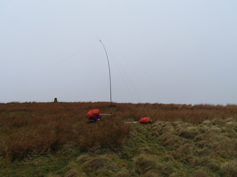
Wether Hill
Wether Hill
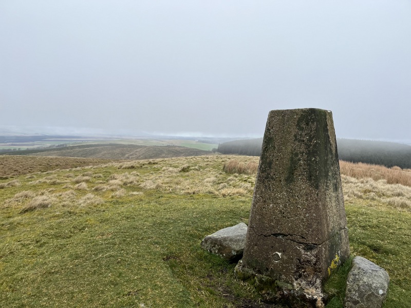
Wether Hill when the mist lifted and the rain eased as we were about to leave the summit.
We returned over the awkward fence and through the trees where we found a nice sheltered spot under the trees to sit to eat our belated lunch. Once back on the forest track we took an alternative route back to the car that had been suggested by OS Walks. It started well on a forest track and also ended in a forest track (having seen the other end on the ascent), but in between was less good on a rough and sometimes boggy path through a felled area: it worked but wasn’t ideal. The walk back had some light rain, some drizzle and some dry. The worst of the rain was when we were at the summit!
Back at the cottage we left stuff drying out and drove into Biggar to fetch some good fish and chips: our traditional end of holiday meal if there’s a shop close enough. We can recommend Frydays in Biggar.

Hartree Lodge, our base for the week. Recommended.
5 Likes
19 April 2024: Friday GM/SS-203 Goseland Hill
We still wanted to fit in Goseland Hill, the little summit closest to the cottage before we headed south to our next cottage in Trawden. The short drive along the single track road to the parking ended up getting the left side of the car mud splattered as we pulled on a muddy verge on a hill to pass another car and then struggled to get traction.
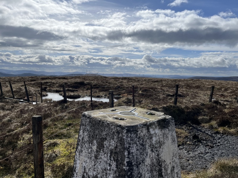
Safely parked in the little quarry near the track to Gosland, it was warm in the sun, and we got out sun hats for the first time this holiday. We still needed plenty of layers and at the summit put on thermal hats under the sunhats! We initially followed the drive to Gosland, leaving it to strike up towards a steep ATV track which led up to a col between the main summit and a sub-summit. Intermittent narrow tracks took us to the summit trig point and a wonderful set of views all round: Tinto, Culter Fells, The Broughtons and in the distance The Pentlands.

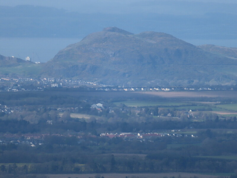
West towards Tinto

Zoomed into Tinto
South towards Culter Fells

NE towards Broughtons
North towards Pentlands.
It was breezy at the top, but not too bad, so Caroline set up the dipole attached to the trig point, while Martyn dropped down slightly to set up HF. Despite being surrounded by bigger hills there were enough gaps for Caroline to qualify on both 2m and 70cms with 6 and 5 contacts respectively. Meanwhile Martyn had got 10 contacts on 60m. Caroline then moved to 40m and when my initial frequency dried up went chasing S2S get contacts with GM4BML and GM5OLD which Martyn also grabbed. Finding a better 40m frequency Caroline ended up with 23 40m contacts. Handing HF back to Martyn to try 20m, he struggled slightly but got 5 contacts.

HF station
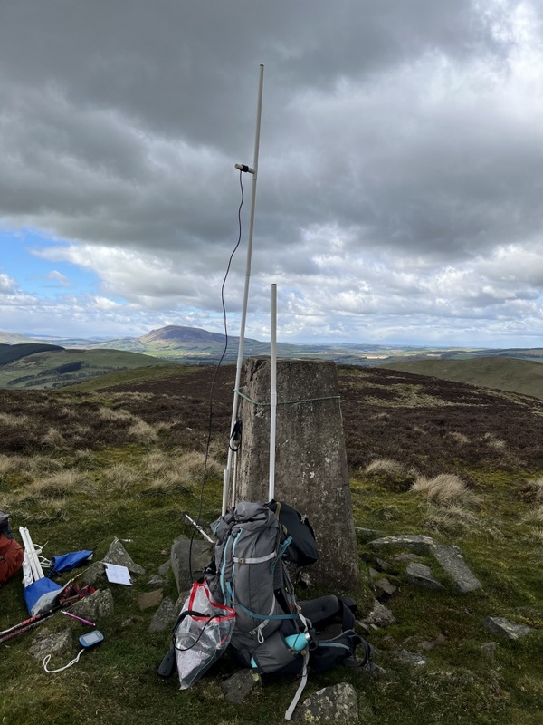
VHF/UHF station

Trig point
The wind was getting up and we got some light rain, so with lunch eaten we descended and resumed our journey south.
6 Likes
Logs finally typed up, checked and uploaded.
For the whole trip (including Pennines summits on return):
M(M)3ZCB 432 QSOs, 37 S2S,
M(M)1MAJ 237 QSOs, 37 S2S
No significant milestones, but it has taken me to 251 points for summits qualified on 70 cms. I’ll be looking for more 70cms contacts on our next trip (North Wales).
4 Likes
From M6BWA
Glad to see you are working on 70cm and piling on the points. I found it was quite difficult to discover how many hills I had successfully activated on 70cm (4 contacts) as the 70cm SOTA list credits you for every hill you got at least 1 contacts! I gather it is easy for a member of the MT team to check this (and probably anyone who is lot more tech-savvy than me - I’m at the flat earth end!)
Sorry your weather was so miserable, I don’t think I dare mention that we found it almost too hot to walk yesterday and fled to a castle in the afternoon where it was even hotter but the rhododendrons were super. Better luck next time. 73 Viki
1 Like
It’s easy if you can execute arbitrary SQL queries on the database.
We keep our logs in an MS Access database so I can do the equivalent. That being said, it’s also quite easy to get it wrong. Caroline is actually on 250 70cm points, not 251. I forgot to exclude incomplete contacts (which were not uploaded to the real SOTA database) from the query.
Martyn M1MAJ
1 Like
Interesting. I’ve used Excel from the start of my SOTA escapades, migrating to Google Sheets a couple of years ago for my ‘Master’ log.
And following on from our GM13 launch in 2017 I can extract the following for 13cms:
Activations - 137 points
Chases - 495 points
S2S - 408 points
As I understand it the SOTA Database cannot extract this sort of information easily? For an example, if you initially have your first QSO from the SOTA Summit on 2M (say checking talkback for 13cms) and log it it will credit you with the points for a 2M Activation only. This is why we (13cms’ers) log 13cms first then follow-on with other bands.
Cheers
(;>J
2 Likes