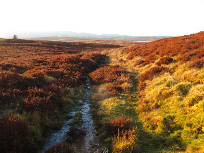
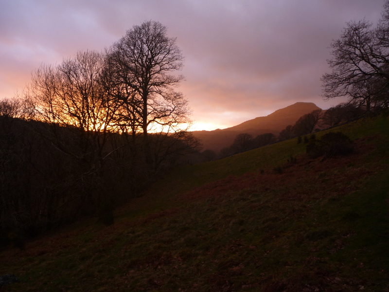
We should be on our next SOTA trip now, but since we are stuck in the flat lands, I’ve made a few reports on what could end up as our only SOTA expedition this year. The original intention was for it to be a winter-bonus collecting holiday, but the weather wasn’t ideal, with high winds and some rain. However we were thankful to get it in before lockdown.
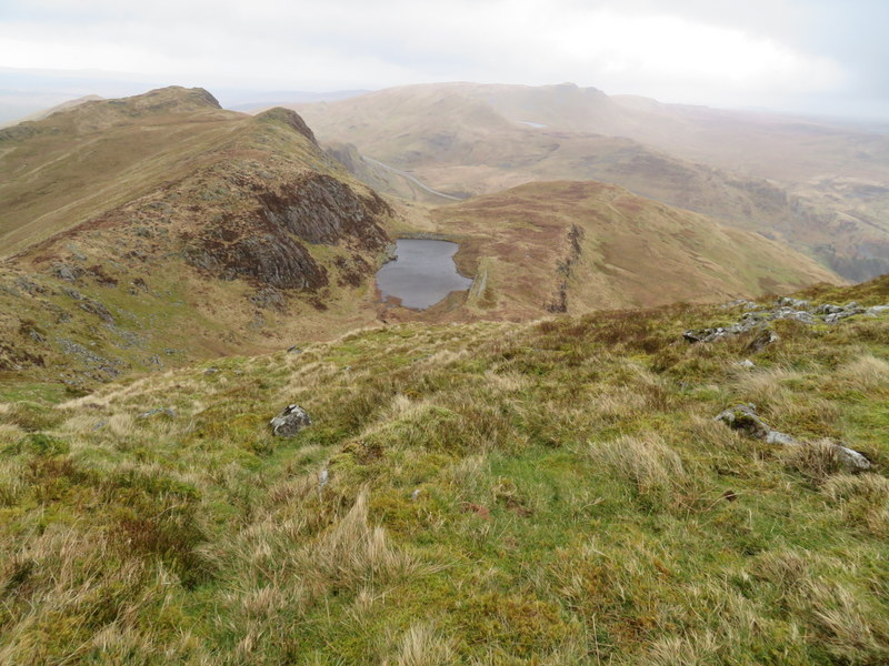
Sunday 8th March 2020 GW/NW-047 Mwdwl-eithin
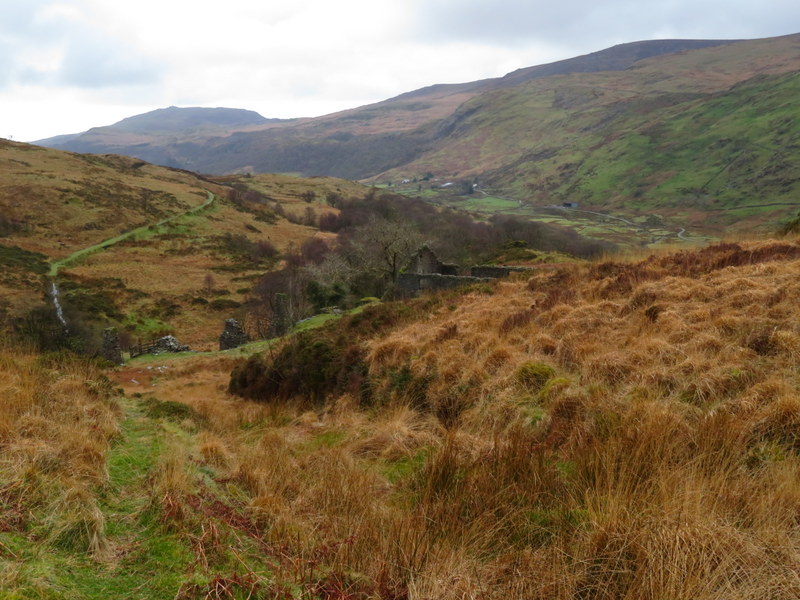
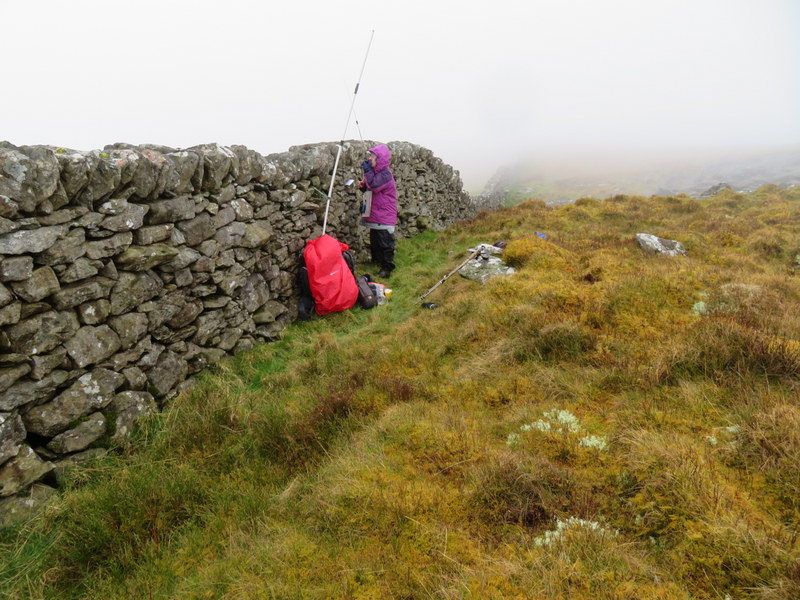
We were traveling to North Wales but wanted to get a summit on on the way. The forecast was for scattered showers, but we decided to risk Mwdwl-eithen , but passing through heavy rain we were wondering if we had made the right decision. It was extremely windy when we arrived at the quarry where the track for Mwdwl-eithen starts, and we decided that we couldn’t fit our car into the quarry to park. However we had noticed some hard-standing to the west of the road just north of the quarry so we turned round and parked there. We fought our way round the car to get our lunch and ate it in the car. We struggled to get our boots on and load up rucksacks without having things blow out of the car: not letting doors be open on both sides at the same time helped!
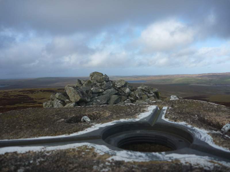
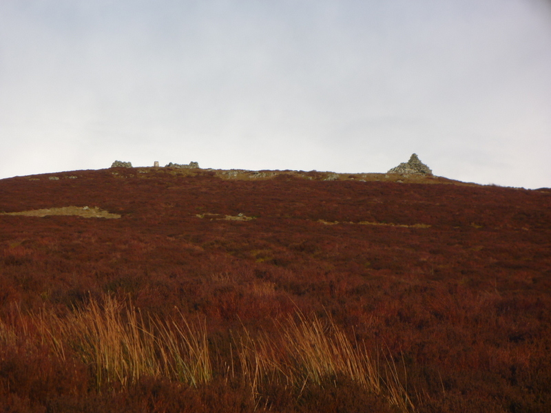
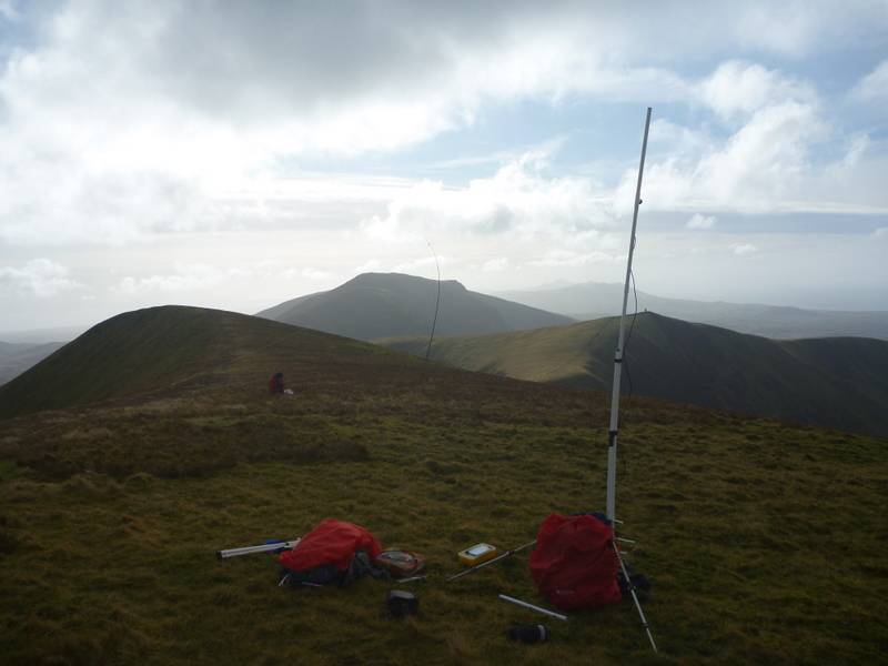
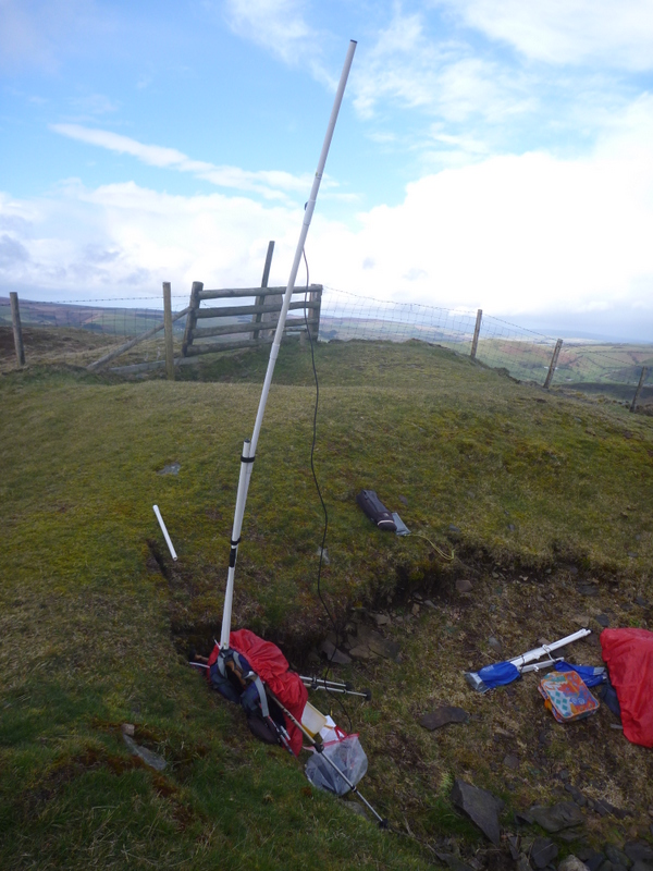
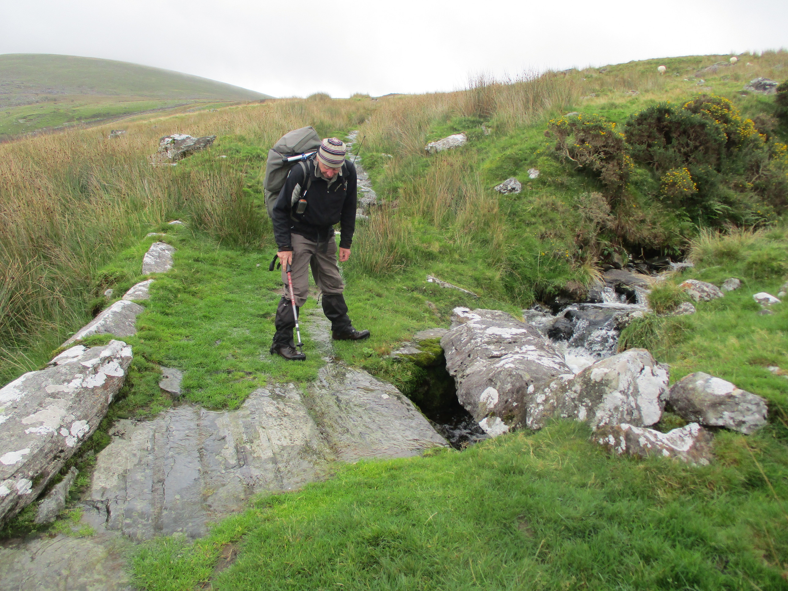
We weren’t sure the summit was feasible but set out anyway passing the quarry and following a track until it ended. There was then rough ground, which was reported to lead to an ancient trackway, but the trackway was almost invisible on the ground. We were supposed to follow it to a gate but having lost the track we ended up far too high up and ended up crossing a fence to regain the right line. There were various places where we found tracks, and then lost them again, picking up a track which took us to a point where we needed to climb through heather to reach the summit, which had various structures on the top. It was extremely windy at the top, but there was an excellent sturdy shelter as well as a trig point and a couple of cairns.
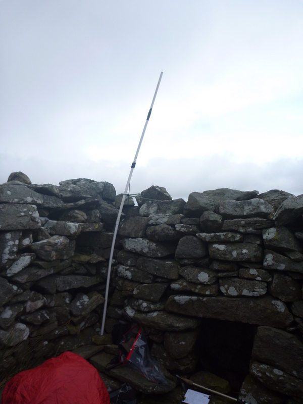
Having struggled to stand up near the trig point to take photos, Caroline retreated into the shelter, while Martyn decided that he could find some relief from the wind by setting up HF on the far side of the hill. Caroline tried using the MFD but it bent too much, so she resorted to using the rucksack antenna on extension pole propped in the corner of the shelter. Caroline got 11 VHF contacts while Martyn got 15 on 5MHz including 2 cadet stations on for a special event. Having had it dry all the way up and for most of the time at the top Caroline noted incoming rain and advised packing up. Unfortunately not soon enough and we were soon subject to even stronger winds with some rain and hail. It had almost stopped by the time we had packed up, and the sun came out as we descended giving some nice views. On the way down we even found a sufficiently sheltered spot in the sun to stop and eat apples. It was almost dark as we got back to the car.
Monday 9th March 2020 GW/NW-035 Manod Mawr
The forecast was for a dry morning but with a band of rain coming later, turning heavy by 15:00. We packed lunch and started the ascent from Manod.
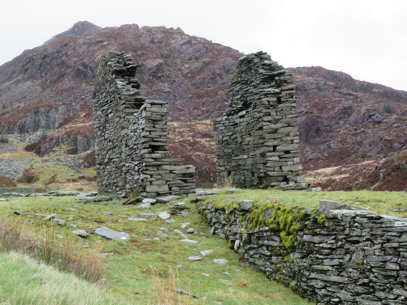
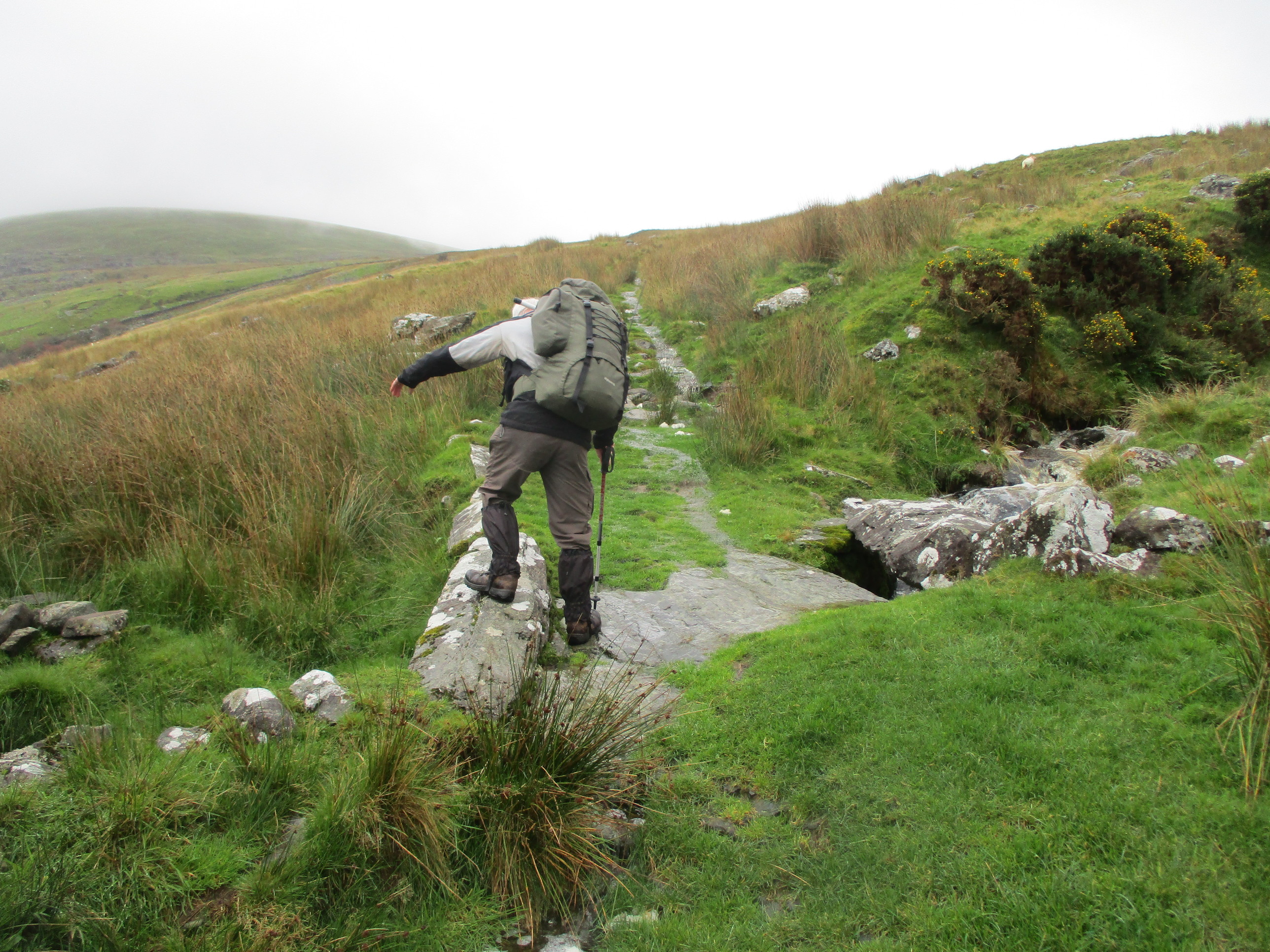
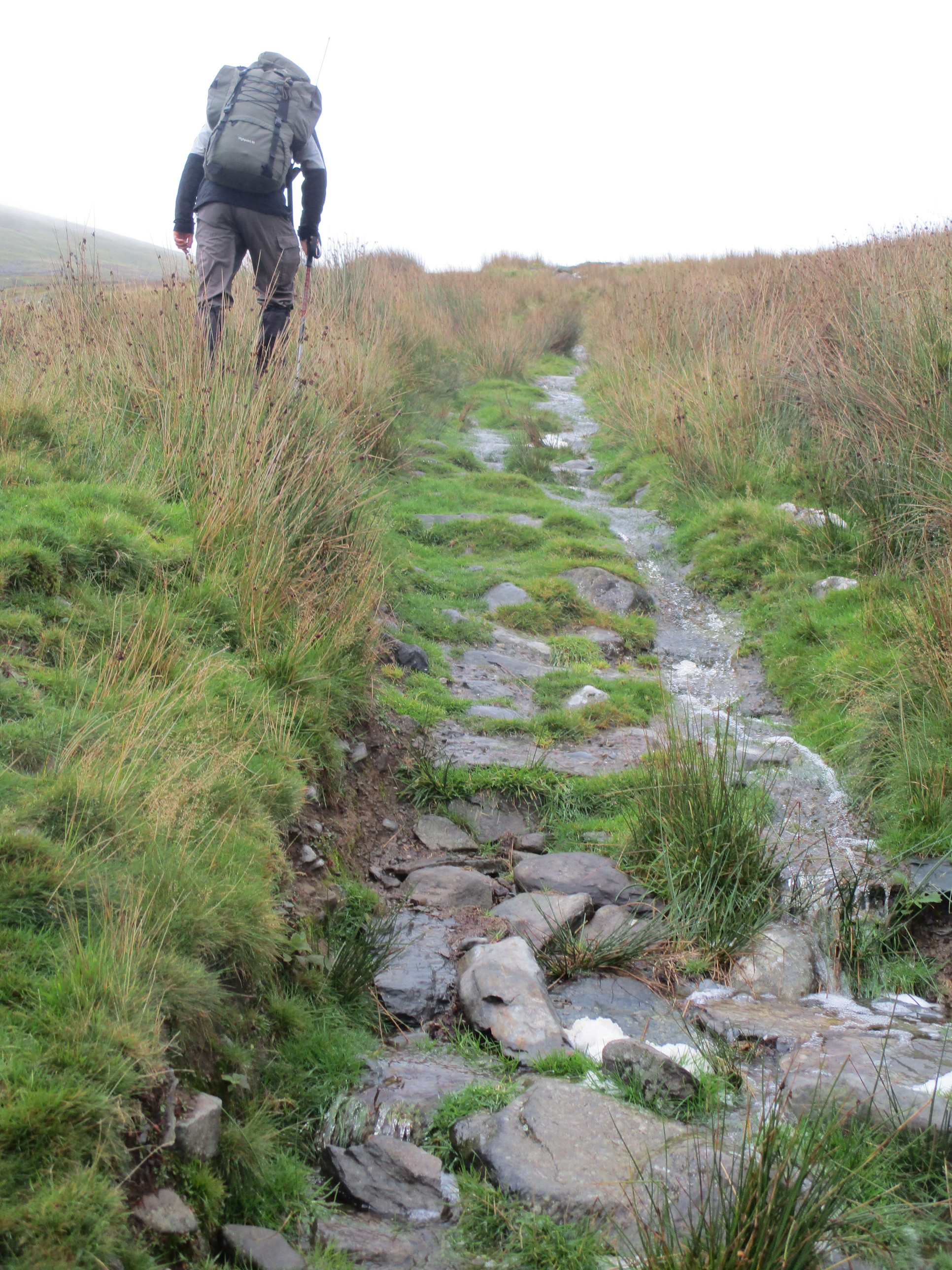
It was fine but cloudy as we headed up the minor road through Cae Clyd, passing a football ground. At the end of the road the road turned to a track and then a path passing through some interesting gates, joining another path and bending round NNW to enter the access area. We were now on what looked like a quarry track but knew we wanted the inclined plane we could see ascending the flank of Manod Mawr on the other side of the valley, so crossed rough ground to reach it before reaching Llyn y Manod. Manod Mawr’s top was still in the clouds, but we had views of the lake and Manod Bach on the other side. The inclined plain made good walking, but as we turned the corner to head east, we needed to leave the track to ascend rough ground to the summit. We occasionally found signs of a path but were now in the clouds so just made our way upwards. Having left the slightly more sheltered inclined plane we were now fighting increasing wind as well.
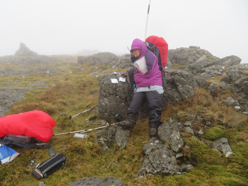
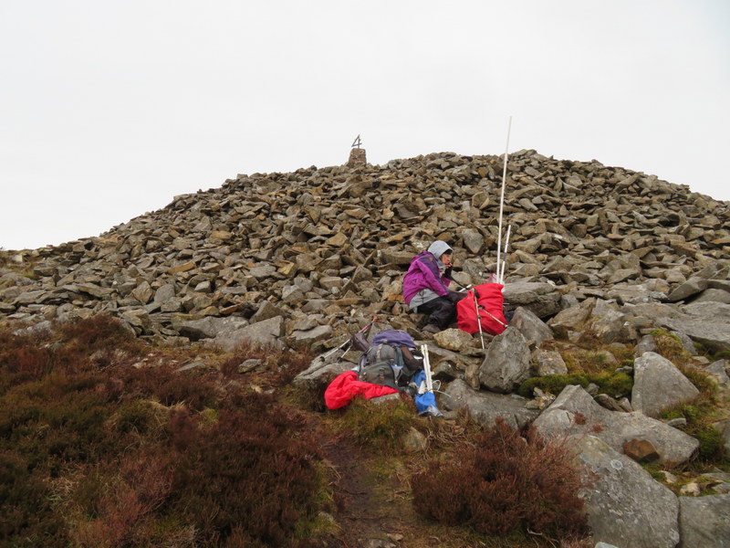
The summit itself was very windy and we wandered around looking for both the trig point and some shelter, eventually finding the base of the destroyed trig point in the middle of a somewhat inadequate shelter. By now it was beginning to rain, and we soon abandoned hope of finding any proper shelter to activate from. So propping ourselves on a rock we went for a handheld and rucksack antenna hit and run – 5 contacts each in 15 minutes. Abandoning all thoughts of eating lunch we were then on our way back down again. There were points on the way down when it was slightly less rainy, but we were very wet by the time we got back to Manod just before 3pm.
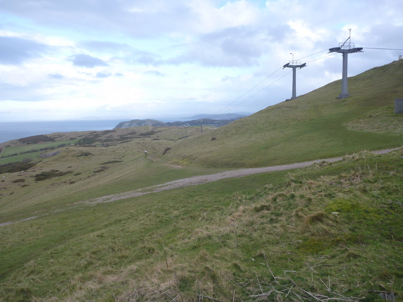
Tuesday 10th March 2020 GW/NW-050 Gyrn Ddu & GW/NW-075 Yr Eifl
The forecast suggested that the Lleyn would be reasonably dry but it rained heavily as we drove the starting point for Gryn Ddu, parking on the section of old road at SH386468. The rain then stopped, but started again soon after we had passed a cottage. We stopped to add waterproofs, but before long the rain stopped and we started overheating. Apart from some brief drizzle it stayed dry for the rest of our walk.
We made our way up the zigzag incline plane and carried along the track, continuing where it levelled out until reaching a gate in the wall to the left just before the access land ends. We followed the wall upwards and then the rough path as it headed uphill. The wind became increasingly difficult as we continued upwards. We tried to find a way round to a more sheltered side of the very rocky top, but eventually found that we had got to a point where there was no way up that didn’t involve emerging into impossible wind. We found a point within the activation area among the rocks which gave some shelter, but also blocked radio signals. We tried to do a rucksack antenna and FT-817 activation and succeeded with 6 VHF contacts each, despite Caroline’s rucksack antenna developing a fault: we tried operating with one of us trying to hold the antenna where it was making contact, but eventually gave up and used the Diamond whip on the FT-817
It was too windy and steep and confined at the summit to eat so we descended. On the way down we found a former sheepfold near the metal gate in the track wall which provided enough shelter to eat lunch in comfort. Back at the car we quickly unloaded stuff into the car and headed to the parking for Yr Eifl.
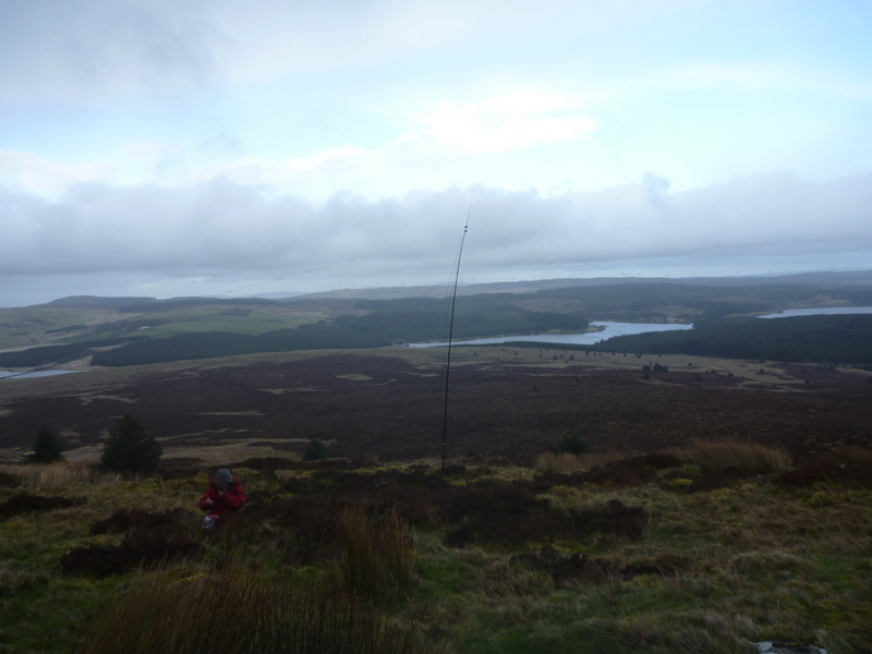
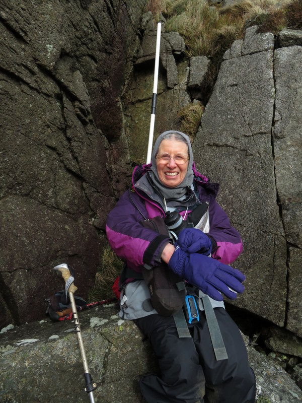
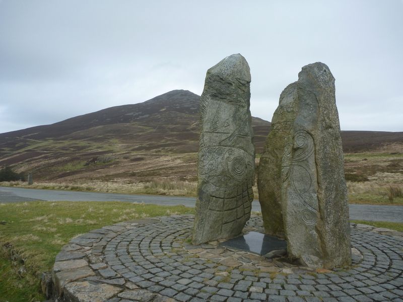
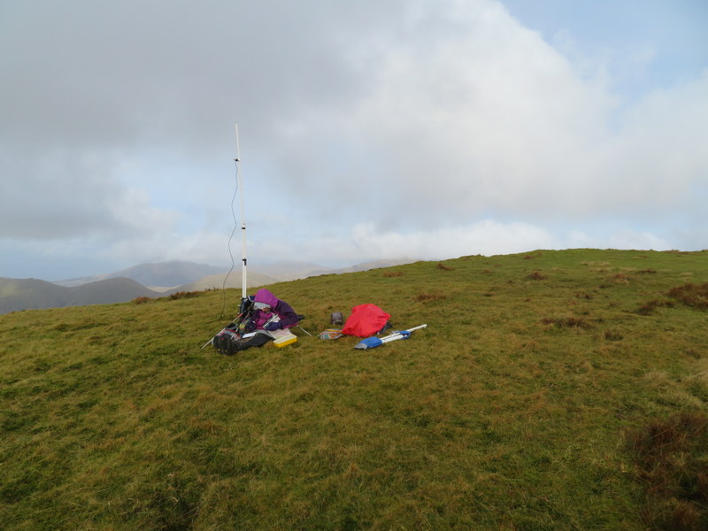
It was still windy, but not as bad as earlier. Caroline took Martyn’s normally unused rucksack antenna given the problems with her own. After taking photos of the sculptures we made our way up, starting off on wide paths which narrowed as we ascended to the rocky top. It was too windy to set up by the trig point with its unusual attachment on top, but in this case the shape of the hill was such as to give reasonable shelter from the wind. Caroline had to set up with the hill shielding her from the sea to the northeast, finding enough shelter to be able to use the MFD. Martyn set up HF a little lower down and got 14 5MHz contacts, though he had first grabbed 4 2m FM contacts as security. Caroline ended up with 7 2m FM contacts and 6 on 70cms FM. We didn’t have time for any more, and it was getting dark by the time we were packing up back at the car.
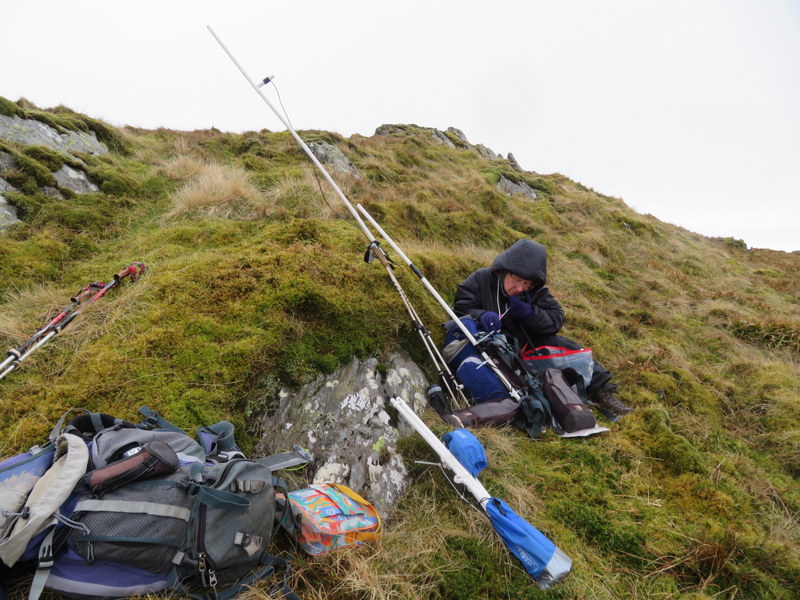
Thanks very much Caroline for giving us something to read and for persevering in such horrible conditions. The shelter on Manod Mawr isn’t very useful is it? I decided it was the worst place to try and get 2m fm contacts as well! Looking at the picture of you activating there did bring back so many memories - and made me wonder why we miss the chance to get out on the hills so much…! Has anyone done a study on the mental state of SOTA Goats - or even half or quarter goats when the addiction may be even worse???
I look forward to further instalments.
73 Viki M6BWA
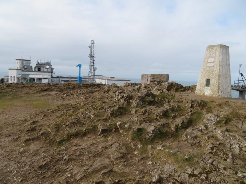
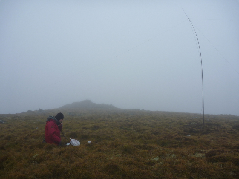
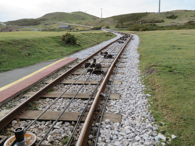
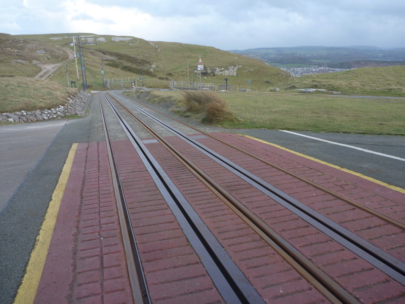
Wednesday 11th March 2020 GW/NW-070 Great Orme
This was a day of frustrations, but we did manage to activate a new unique and complete for both of us without getting seriously wet. The forecast was for high winds and bands of heavy rain but it looked like the north coast would be less wet so we made our first target Great Orme with possibly Tal-y-fan later. Heavy rain accompanied our drive which was delayed by queues at multiple roadworks.
We planned to walk up from sea level, and were relieved when we finally got to our starting point on Llandudno’s south promenade, However as we set off, we found the path we wanted to use closed so returned to the road with the intention of walking along Marine Drive to pick up another path further west but found Marine Drive also closed. We then tried another path which soon had “to summit” signs so we followed them. It meandered upwards, and was very windy, but thankfully the wind was blowing us onto the hill rather than off of it. Apart from a few spots of rain the ascent was dry.
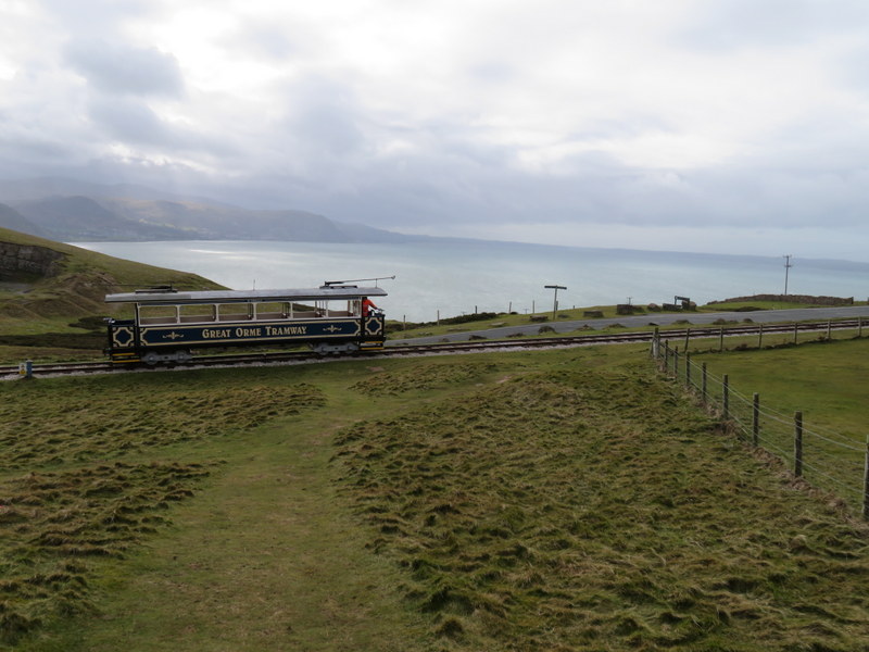
We made our way to the trig point but had trouble standing up and even more trouble moving without being blown over. Caroline eventually ended up on the ground, but eventually managed to stand up again. We dropped back down and searched for somewhere with some shelter. While doing this a tram came along the tramway: it must have been a maintenance tram since it wasn’t running passenger services and the visitor centre and other summit facilities were all shut. Since it was quiet we found a slightly sheltered corner of a garden near the visitor centre to sit; it wouldn’t have been a good place if it had been busy but there were only a few people around.
We set up the MFD and FT-817 and struggled to make contacts taking over an hour to get our 4. We were not seeing any breakthrough but guess there must have been some desensing. Having packed up Caroline put on the handheld which was getting some breakthrough but was also hearing activity on frequencies the FT-817 hadn’t. We might have done better with the handheld, but by then we were cold and wanted to get moving so didn’t try any more radio.
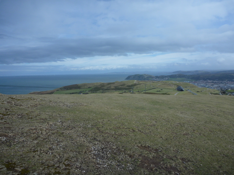
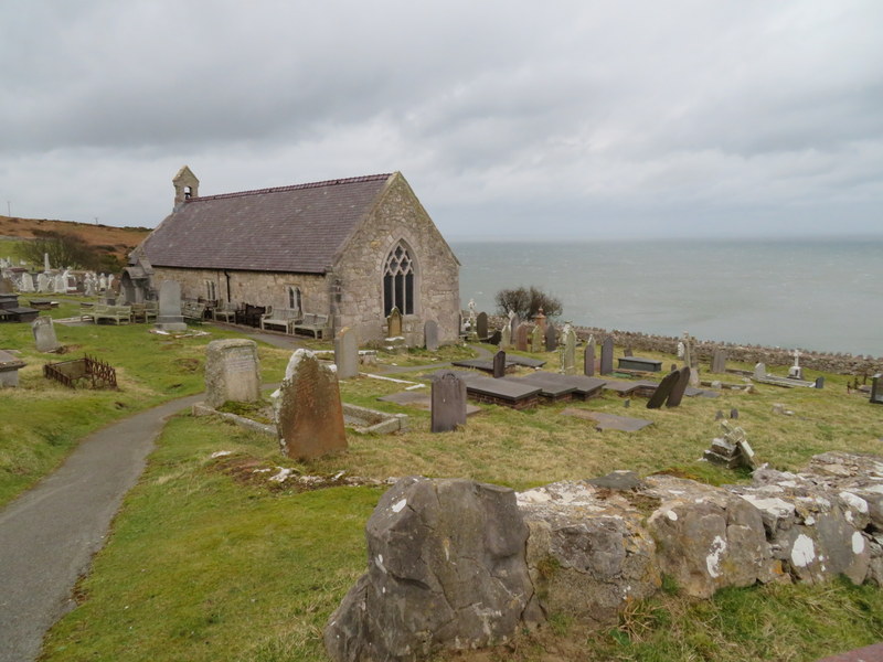
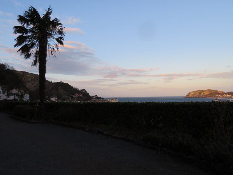
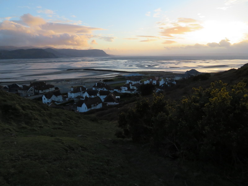
We took a circuitous return getting some varied views, visiting St Tudno’s Church, passing the halfway tram station and finding a pleasant zigzag path through terraces to a wider terrace with palm trees. Returning to the car the wind had become very strong at sea level and was whipping up the sand: painful against any exposed skin! We tried to pack away things in the car with minimal door opening, but the sand beat us and we ended up with fine sand in the boot and in the main body of the car: it seemed to penetrate every crack. We were packed up in the dry, but on the drive back we encountered more heavy rain, so were lucky that we had a mostly dry walk.
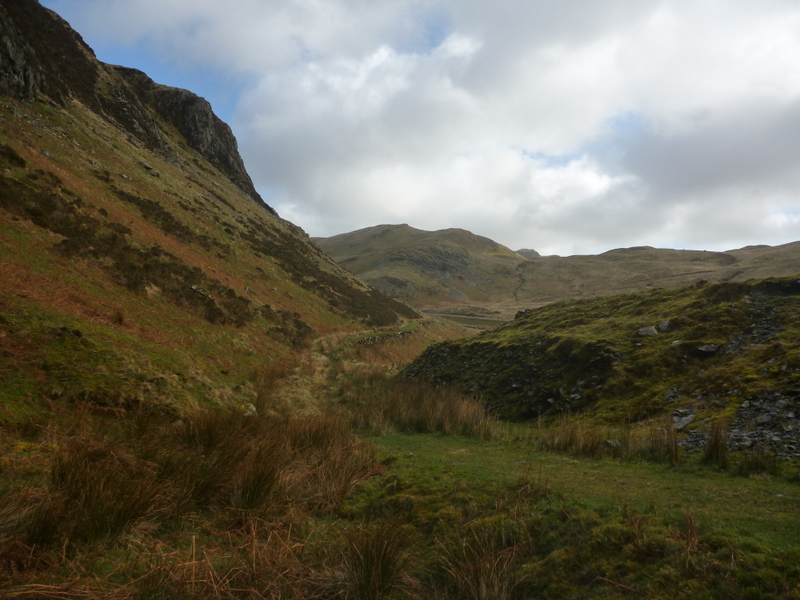
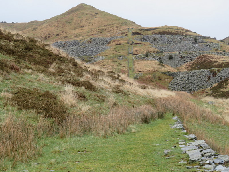
Thursday 12th March 2020 GW/NW-025 Allt Fawr
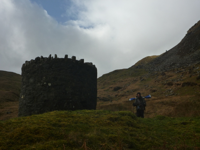
The forecast was for another very windy day, with some occasional precipitation. We still wanted to try a hill, so we decided to try the medium sized Allt Fawr, because it was not too long a walk. We parked in a layby forming a part of old road at SH699485 and headed off along the old quarry track which roughly contoured along the edge of the hill.
The shape of the hill gave some relief from the wind as we curved round to reach the end of the track by an airshaft serving a tunnel below. Beyond the air shaft a faint path headed up the valley, but we soon lost it and just made our way over the rough ground, eventually picking up another path which led to the dam of Llyn Iwerddon. It became very windy as we headed south of the lake on a high path over another bit of dam. Beyond the lake the ground ascended more steeply around a corrie with a bit of shelter, but as we got higher with wind got worse, and by the time we had located the true summit it was hard to stand.
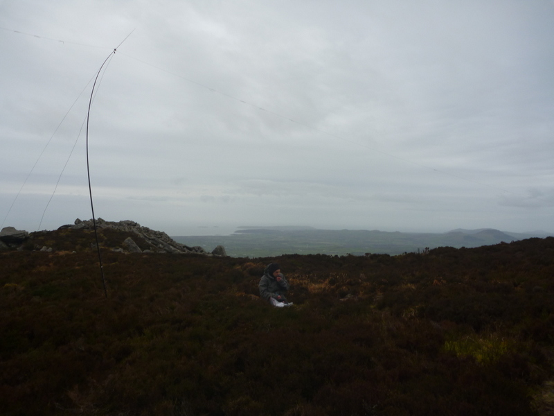
We needed to find some shelter to be able to operate and found a little on the leeward side. Caroline found it had to find anywhere to support the antenna and ended up threading the MFD support through vegetation. It started off slightly tilted and ended up at even more of an angle and was sheltered from some directions by the rocks. It seemed surprisingly effective yielding 12 2m contacts and 5 on 70cms. Martyn managed to get the HF antenna in the air and even more surprisingly it stayed up yielding 10 5MHz contacts to add to 3 he grabbed on 2m. It was mostly dry but some light snow and stinging hail joined the cold wind so once lunch was eaten, we packed up and descended.
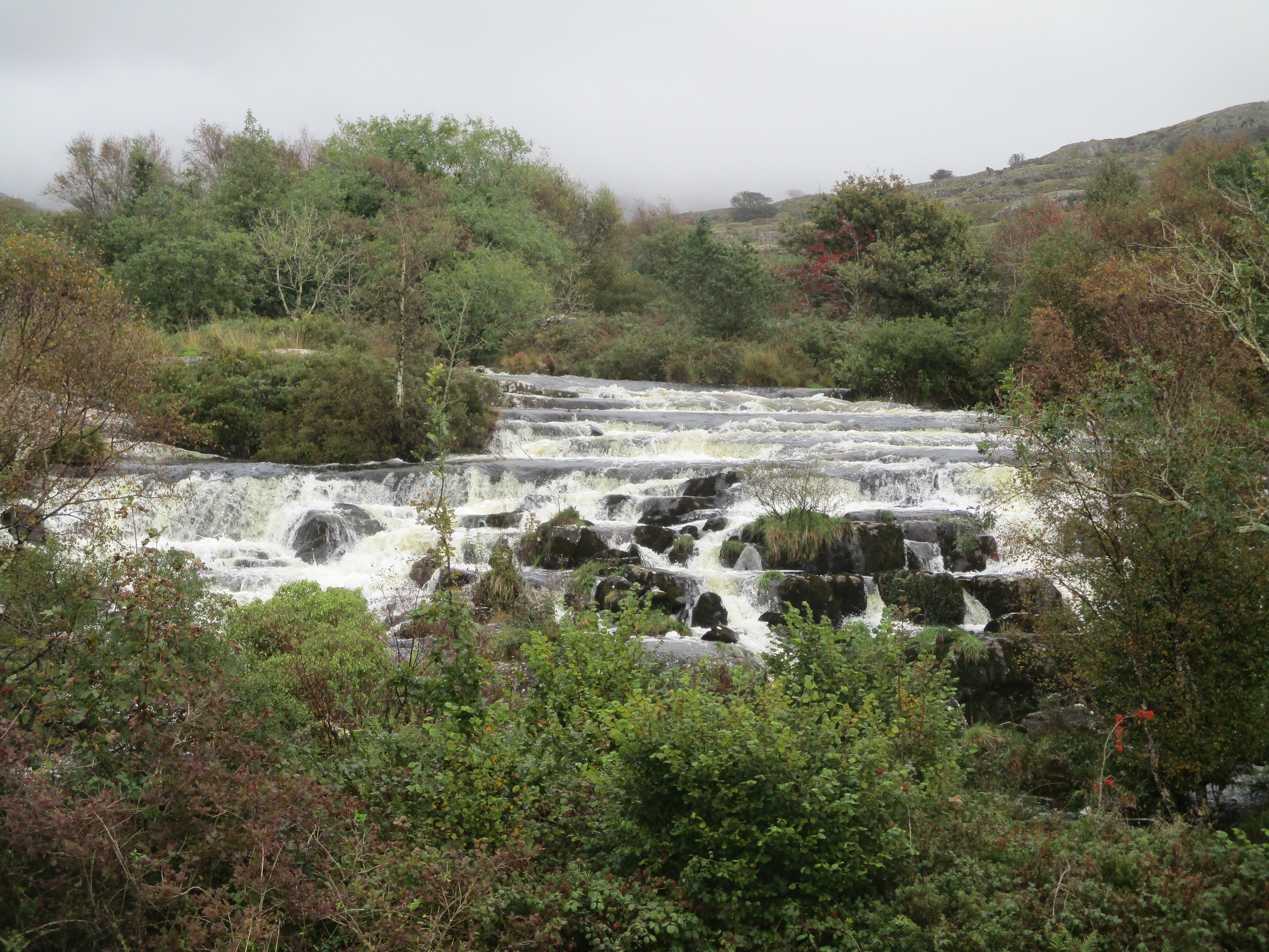
We didn’t have time for another summit but since the weather was now dry, we wanted another walk, and found a pleasant low level walk along Ceunant Cynfal: waterfalls, wooded gorge and fields with lovely low light views of Moelwyn Mawr as we returned.
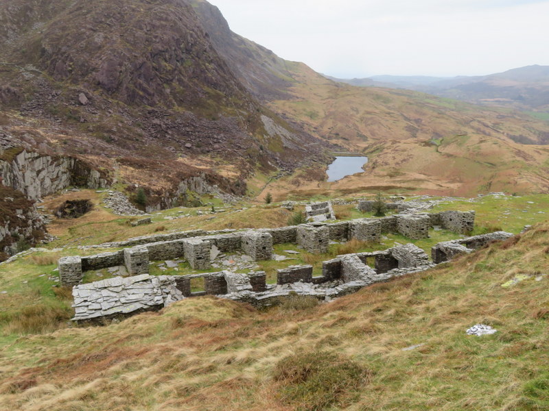
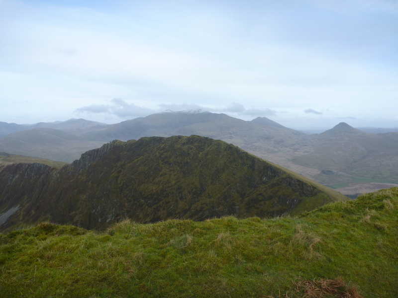
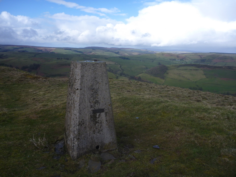
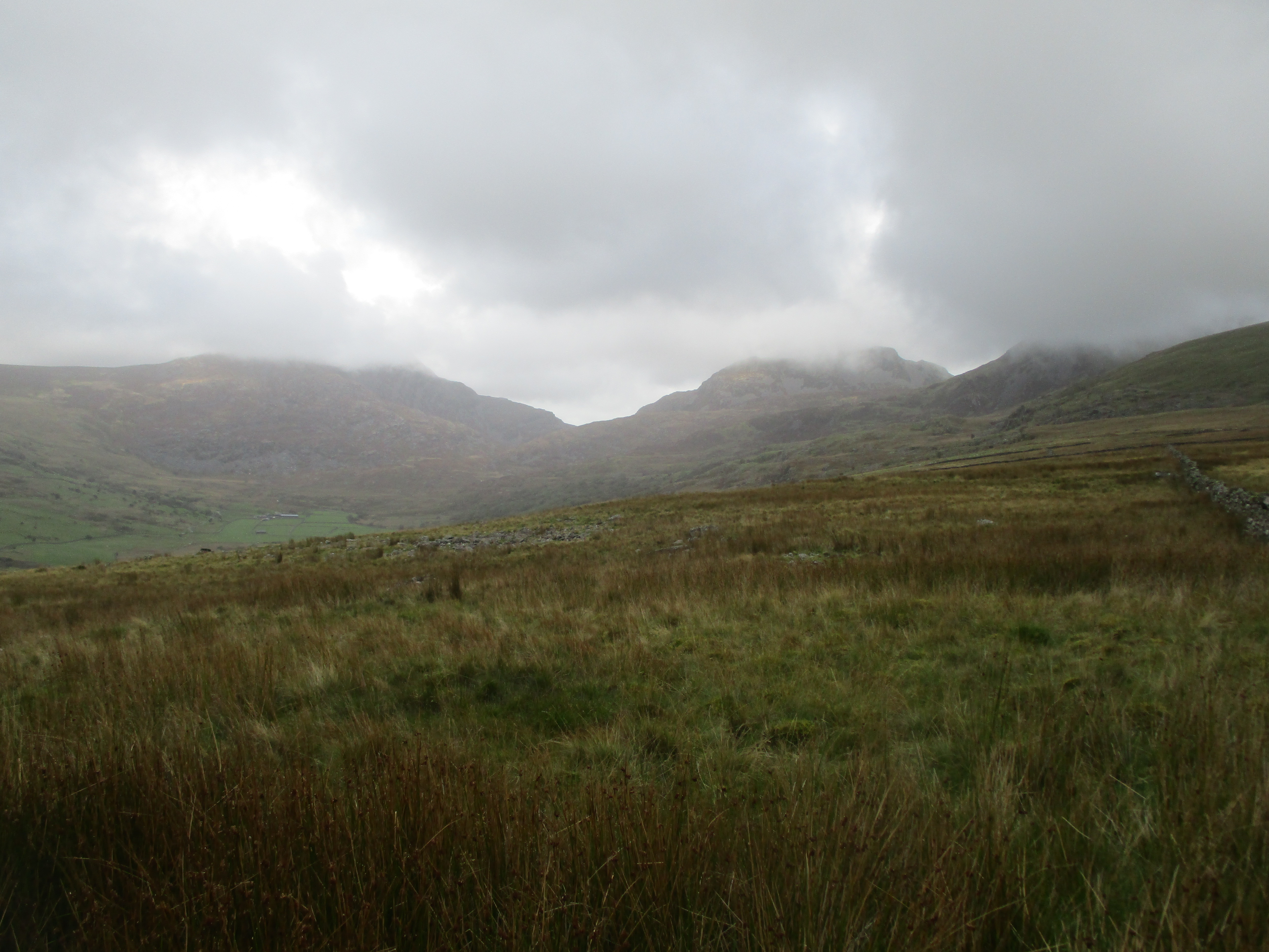
The forecast was for a less windy day with low amounts of rain, so we risked the highest of the summits attempted over the week. Our target was Trum y Ddysgl: an activation unique and complete for both of us. We drove up the awkward Cwm Pennant road to the parking at the far end: narrow with stretches with few passing places, and a poor surface with appeared to be degenerating into a gravel track in places! The parking was better than the road, and we had it to ourselves when we arrived.
The initial navigation was slightly tricky through wet fields to ruined quarry buildings and then via various quarry tracks and inclined planes to a wall with Beddgelert Forest beyond. It was then an upward slog along a ridge with limited views as we were now in the clouds.
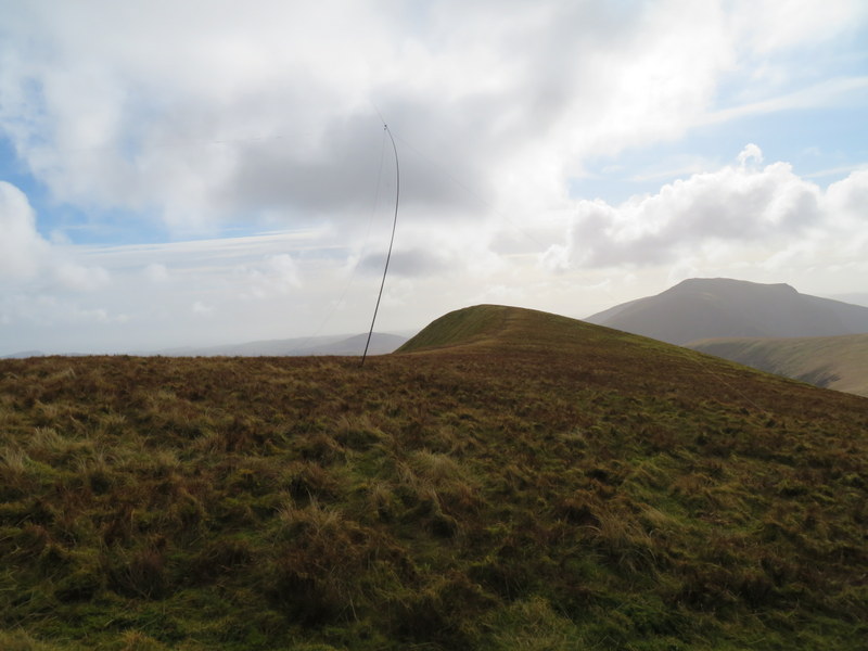
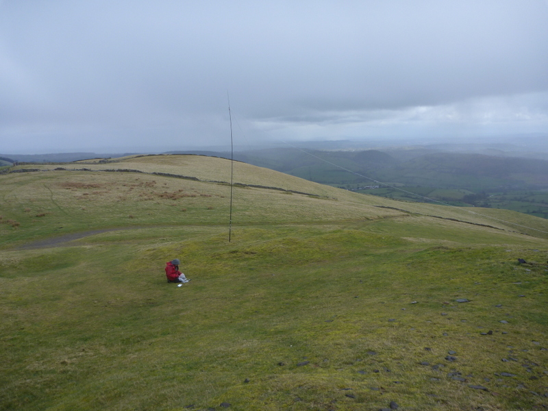
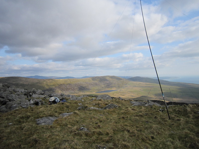
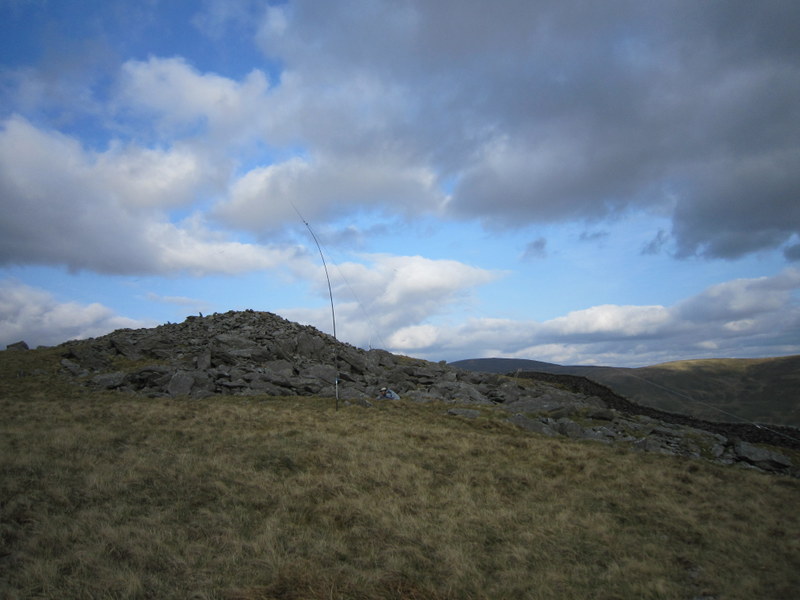
The summit is long flattish and grassy with a steep drop off to the north. There was no shelter, so we moved a bit away from the high point and edge to set up and wrapped up warm to protect against the cool breeze. It was calm enough for Caroline to get the MFD up supported on the propped rucksack, and Martyn had plenty of space for the HF antenna. It was our most successful activation of the trip so far with 5 bands qualified between us: 80, 60 and 40m for Martyn and 2m and 70cms for Caroline plus a 40m S2S for both of us.
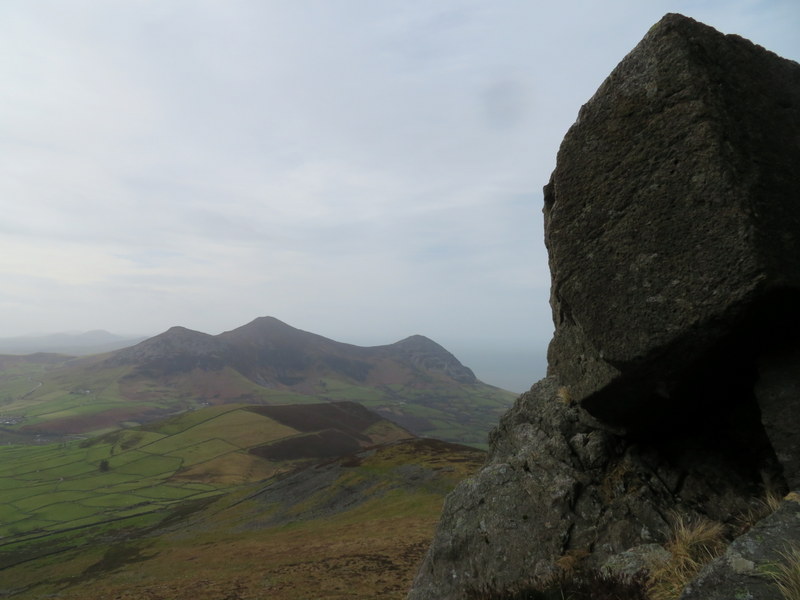
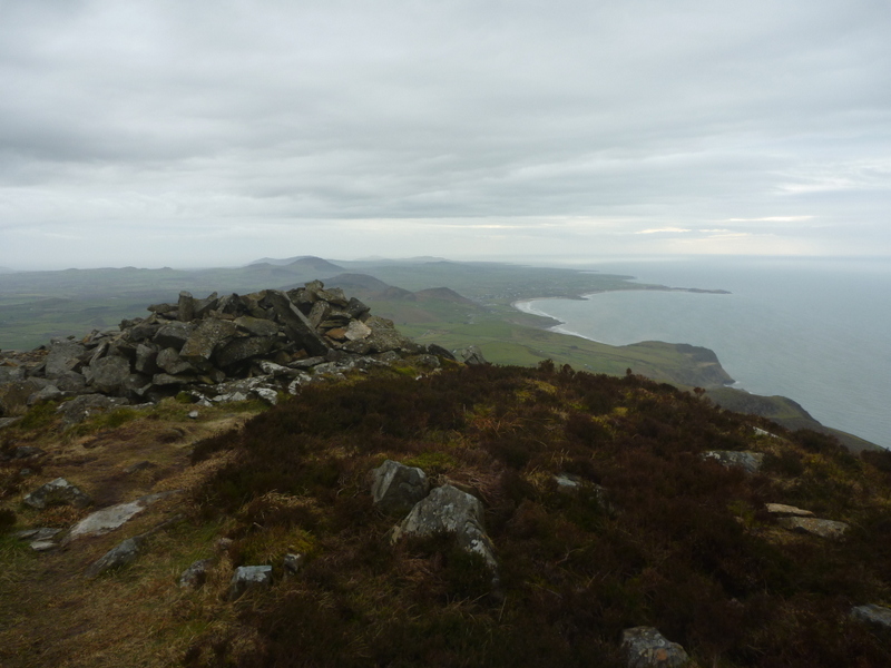
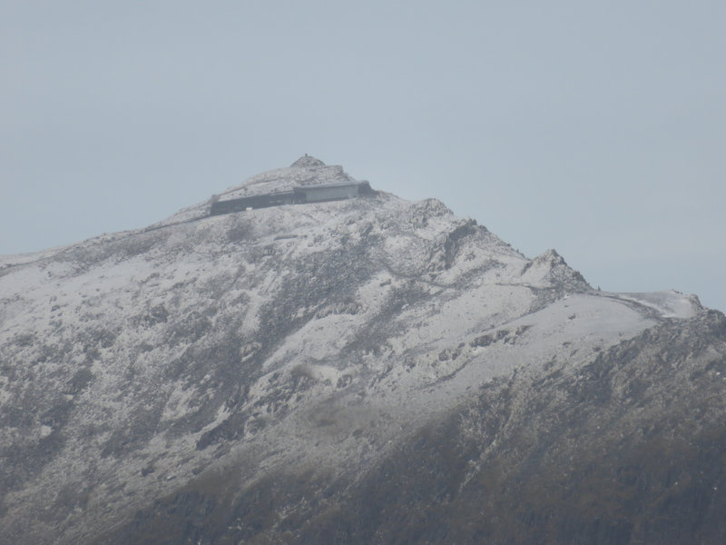
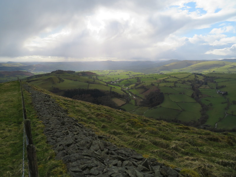
While we were there the clouds lifted giving extensive views, and it cleared even more as we descended. The clouds even lifted off snow topped Snowdon allowing Martyn to get zoomed in photos of the top and closed summit complex. We found a slightly different route through the quarry on the way back getting better views of the ruined buildings. It turned out to be a good day with only a little dampness early on.
The forecast wasn’t good, with bands of rain, which looked to be more spaced out and less intense further south, where it was suggested that there might be a brief sunny spell. So we headed south expecting a break between one batch of rain and the next and although there was a period when it didn’t rain it stayed cloudy. We drove to Cwm Nantcol, parking on the grassy edge of a wide passing place just beyond the cattle grid which is just beyond the bridleway which heads south to the ridge that joins Y Llethr and Moelfre. Given the short days we didn’t have time to do both summits (we had previously done them as a pair in May a few years ago), and with heavier rain forecast for later we limited our ambitions to the lower and nearer Moelfre.
The clouds were down on the hill, and soon after leaving the road we were in low visibility, but thankfully had a reasonably defined, albeit wet track to follow up to the ridge line. In the low visibility we managed to turn right one wall too soon, but soon realised our error and headed back to find the gate in the wall that runs roughly along the ridge. By now the clouds had been joined by a strong wind. We took a faint path heading roughly west: it wandered away from the wall for a bit, but we knew we wanted to end up on the north side of the wall, and made our move back towards it a little early and ended up with some awkward rock hopping. It was unpleasant fighting the wind as we made our way along the wall, finally locating the stile which gave access to the summit on the other side.
Thankfully the ascent had been mostly dry despite the wind and low visibility. The wind was such at the summit, that we decided to operate by the wall a little to the south of the summit as it gave some much needed shelter from the wind. Since it was dry Martyn risked setting up the HF antenna a little way from the wall, while Caroline propped up the rucksack antenna on the extension pole next to the wall. She also attached the Diamond whip to the handheld to try 70cms. Martyn took a 2m contact but Caroline found 2m quite hard work, but then she found Rod and Viki on Waun Fach whose weather didn’t sound any better than ours. Martyn grabbed the S2S and went back to 5 MHz. Caroline persisted with 2m and ended up with 7 contacts, including two more S2S which Martyn also came over for. Caroline also persisted with 70cms, ending up with 4 contacts including an S2S with Viki: pleasing but hard work. By the time Martyn had 10 5MHz contacts the rain had started and got heavier as we packed up.
It was raining heavily as we descended finding a slightly better route through the rocks and then retracing our steps. Despite the unpleasant conditions there was some attraction in being on the hills, since we could see the Covid-19 lockdown coming and expected that we may not get out on the hills for some time. Despite the rain easing slightly enabling us to see slightly more of the valley, we were very wet by the time we got back to the car.
Sunday 15th March 2020 GW/NW-049 Gyrn Moelfre
We wanted to get one more summit in on the way home, and chose to get some winter bonus on a hill we had previously activated, rather than adding to our uniques by activating a less inspiring looking one pointer.
We headed across country and down narrow lanes to park by Moelfre Hall. It was some years since we had first activated Gyrn Moelfre. We couldn’t find anyone at the Hall to ask for permission to park and go up the hill, but someone appeared as we were togging up. He was friendly (from an appropriate distance) and said we could park in a better area, but since we had booted up, we stayed where we were.
The sun came out as we ascended up the sheltered valley, and we got quite warm before emerging into the more exposed hillside and moderate wind. We could see areas of rain in the distance, but it stayed dry while we were setting up. We chose the side of the hill with some shelter from the wind, Caroline making use of a small dip near the summit where she could prop the dipole against the rucksack, with Martyn a little further down the hill. There were good views from the summit but what we could see varied as we were subject to rapidly changing weather: cloud, sun, rain repeat times three or four, thankfully the rain showers passed reasonably quickly.
Despite the showers it was a good activation, with radio conditions being the best of the week. Caroline made 39 contacts: 5 on 70cms, one S2S on 40m and the rest on 2m including 2 S2S with Tom M1EYP on Gun and The Cloud and S2Ses with another husband and wife pair on Pegwn Mawr. Martyn made 37 contacts including all the 2m S2S and qualified the hill on all of 80, 60 and 40m with a first for him of an S2S on 60m with a Swiss summit. Unfortunately he only got 2 20m contacts before time and the approach of the next batch of rain caused us to pack up and descend.
Well we did reasonably well with 2m getting the necessary 4 contacts each in under 10 minutes, and raised a 5th while I carried on calling as Martyn took photos. We don’t like only getting 4, but sometimes conditions don’t allow more.
It’s slightly galling that the weather has been lovely this week when we were due to be in Scotland, but we’re fortunate to live where we don’t have to go too far to get out into countryside for daily walks or cycle rides from home.
Caroline, Thank you for the photos and the comments regarding your trip to the Great Orme. I lived in the UK (Crewe) for a few years and visited and stayed in Liandudno a few times. Never went to the top. Viewed it from the bottom. Its only hearty ramblers and SOTA HAM activators would venture into the cold and winds. I always thought the Great Orme would be a good place for DX. I live in Arizona . Lots of chasing here. (CW) All the best 73, Richard. N6PKT — (Former UK call M0BWX)
Aaah! Moelfre GW/NW-041 in wet weather - I remember it well. In September 2019 we were wanting to go up Moel Hebog (from the back) but the weather forecast was too awful so we decided another visit to Moelfre in the southern Rhinogs might be squeezed in but not the second summit. We parked on the lonely road and started up the bridleway which was rather wetter than our previous visit and even the flagged bridge wasn’t very welcoming so Rod M0JLA decided not the trust the wet stones
This was at about 1030 and we then went up to the col and, in thick mist, went right round the back to skirt the rocky summit of Moelfre and aim for the plantation (anyone who has been there in good weather will realise where I mean). After some difficulty finding the correct faint path, we reached the trees and then went straight up to the wall, avoiding all the rocks. I did say I’d been there before and didn’t enjoy the obvious route from the col which was to basically follow the wall, hence the long detour. We hit the wall only a few yards from the stile which was ascended with care in the stiff wind. I foolishly decided I had to be as high as possible with VHF so went to the trig point and ‘shelter’ which wasn’t adequate in the conditions. Eventually the dipole was up and anchored and I got a pleasing 6 on 2m and 5 on 70cm (including Fishguard and Lampeter) and then had a battle to take down the mast and pack away in very nasty conditions. M0JLA was opearating HF from just behind the wall (as you did) but realised something was wrong (there might have been a small shriek as I had to hang on to a rock to stay almost upright…) and came round the rocks to help me down onto calmer (but not dry) land!
He took down while I rested and once more over the stile (hanging on dearly), and back down the grass to the plantation (I was leading and I was very relieved to see the image of the trees arriving through the mist), we turned left on the path which is easy from that end and had a quite pleasant stroll back to the col. We were NOT staying up there any longer so it was left through the walls and back down towards the car and when we looked back we knew we had taken the right decision to descend.
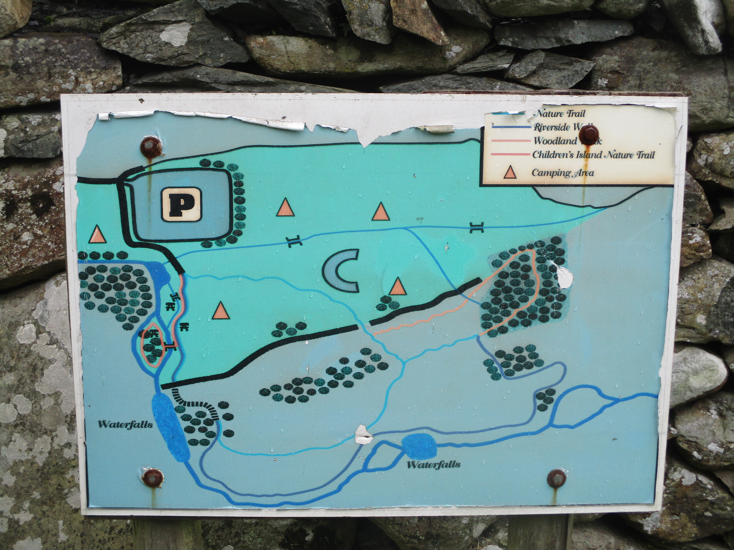
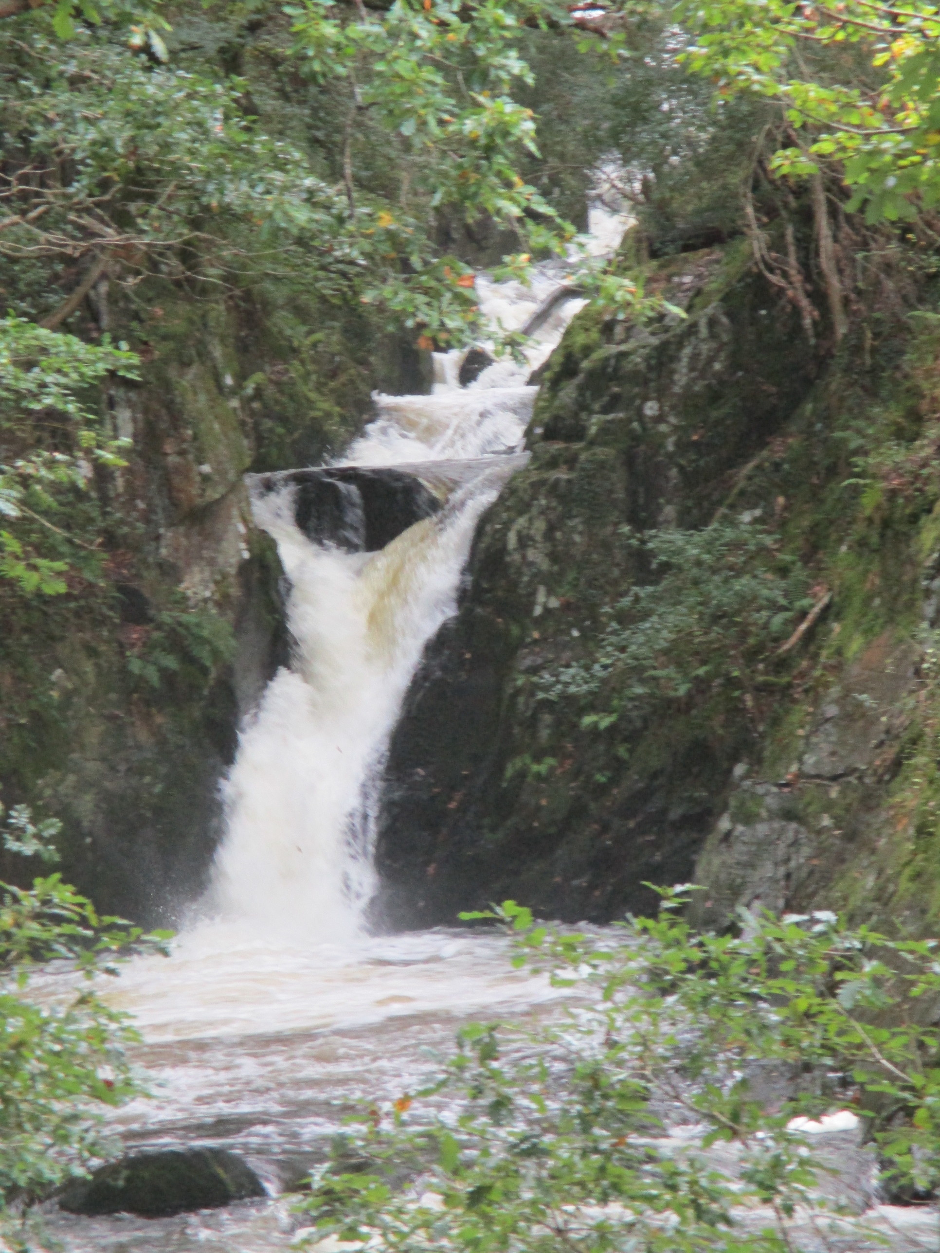
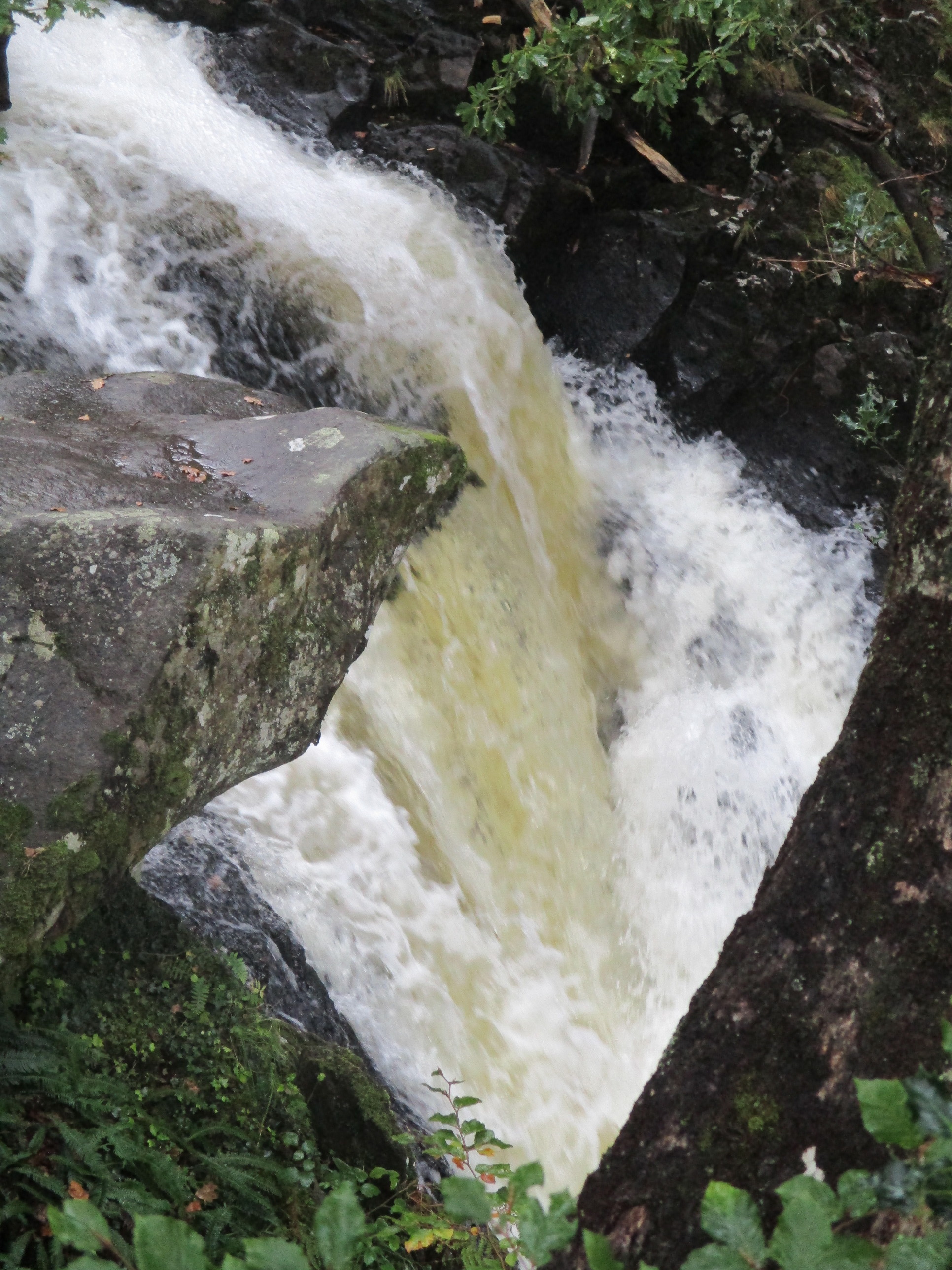
On the way down the valley I remembered we’d passed a campsite with waterfalls and thought it was suitable weather so we stopped and Rod had his lunch in the car while I tried (hastily) the waterfall route
It is possible that, in weather like we all had, it would be much wiser to forget the SOTA and just visit the waterfalls - and the little cafe might then be open! Thanks for the write up and for bringing back the memories!! This lovely weather we are now getting is good for gardening but (gnashing of teeth) it would have been even better on the hills!! Stay safe.
73 Viki M6BWA
Your experience sounds to have similar features to ours. I was pleased with our 70cms S2S even though it was hard work: I was just trying to poke the handheld antenna over the wall without the wind taking it away!
Our first visit to Moelfre in 2010 was much nicer (we had some views) but I recall it was also windy.
Caroline,
Thanks again. Memories abound. Beautiful photos. Taken from the angle and side I’ve never seen . I can’t forget the cold and the wind in winter. It was the first time I had ever driven a vehicle (Golf GTI) out on a beach to view the ocean, windows rolled up, heater on max. Port Merion was just as windy. One hill, near my place where I lived in Wistaston, (Crewe area) I use to hike, is just outside of the village of Beeston.(Cheshire) Its just off the A49. On top are the ruins of Beeston Castle. Might be an easy SOTA hiking adventure. - - - -(?) 38.8C at my place today near Tucson Az. Cheers and All the best 73’s - - - Richard N6PKT