One week ago I had the opportunity to visit Lake Come in Lombardia, Northern Italy. Unfortunately time was a little bit limited so I could only walk on Monte Bolettone east of the city of Como. As always I woke up too late in the morning and the walk had to be done in under the hot sun during noon time - no the bist time of the day. I would recommend to everyone to do this as early in the morning as possible, not only due to temperature, but also due to the fact that beginning in the late morning hours moist and dust content in the air is increasing strongly making the panoramic view from the summit less impressive.
The walk started after crossing the village of Erba by car to reach a parking place between this village and the summit. If you leave the main road in this village some interesting experiences concerning extremely narrow roads in coincidence with heavy traffic of all kind are to be expected. Enjoy, everything will be fine after a few kilometers!
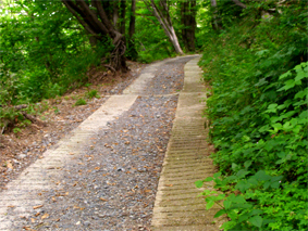
Starting the walk some 450 m below the summit should start the fun also, and it did. Italians are masters in constructing roads for vehicles crossing the roughest mountains, but unfortunately they forgot some of this knowledge in building trails for pedestrians. In this case here they forgot almost totally the use of U-curves to prevent the trail from being too step. Most of the trail is a “straight line” pointing more or less directly upwards. With some water in backpack it is ok. Don’t forget two pro’s here: the lowermost part of the trail crosses a dense and very nice shady wood and the distance between starting point an summit is reduced, but don’t let us talk about the steep angle of the track.
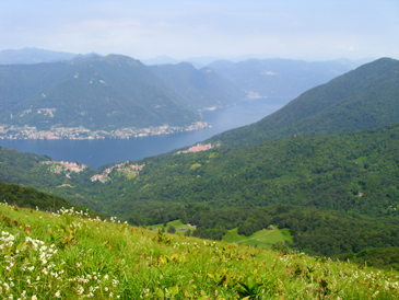
Reaching the summit after approx. 2,5 km was great. It has 2 peaks. The lower on is covered completely with grass and the panorama is fantastic from here. The northern half of the view shows the Alps and the Lake Como in the depth remembering a Norwegian fjord. To the south the flat Po basin shows an remarkable an impressive contrast to the mountains.
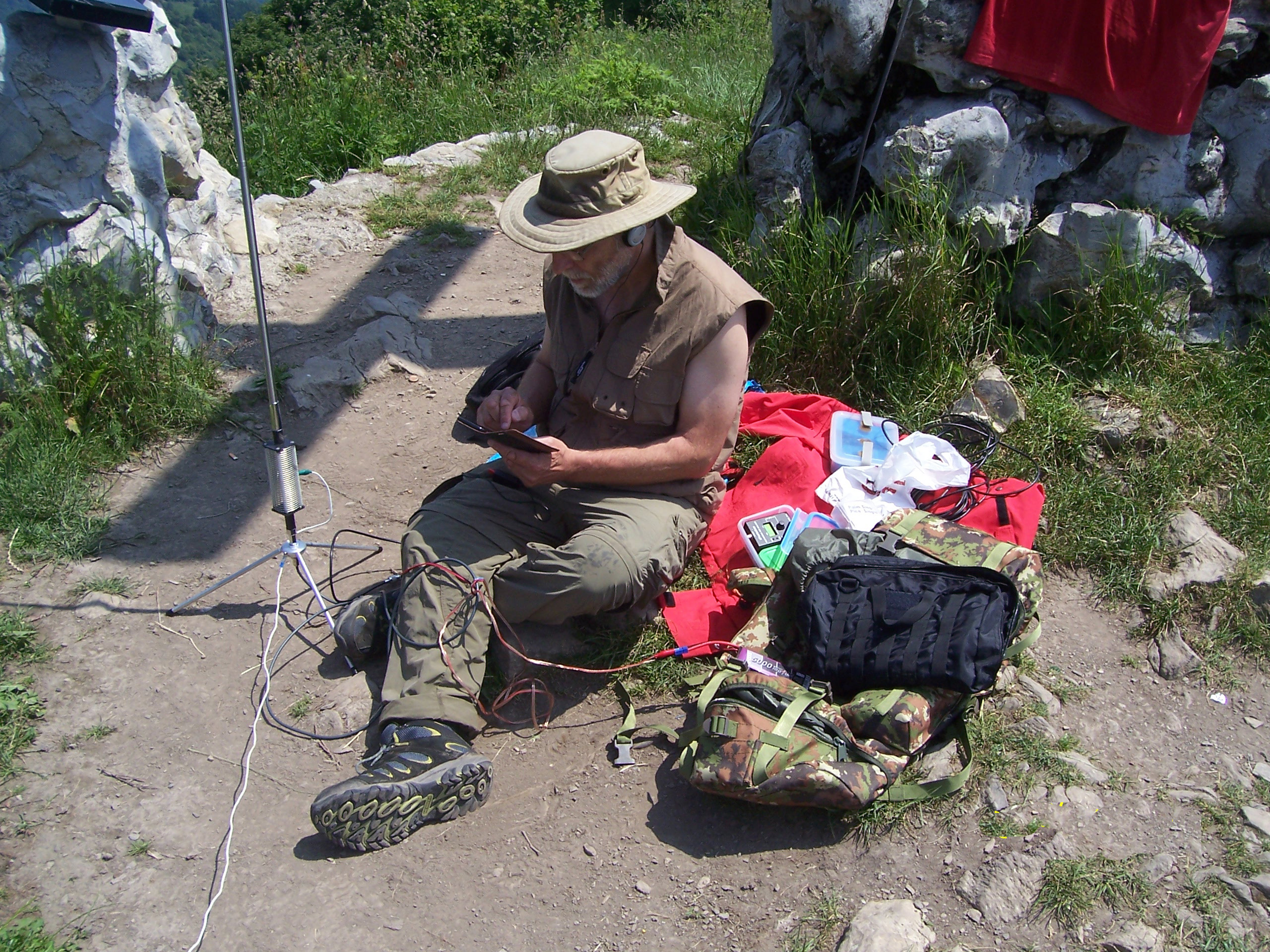
The 2nd summit is a little bit higher and one can sit in the shadow. It ist the right place being qrv from here.
It took only a short time to hoist up the antenna and start to cq on 40 m (as always in CW) using 5 watts. I only had some 45 minutes so I condentrated on 7 MHz with 13 qso’s. Few minutes of cq-ing on 14 MHz resulted in only one qso, but it was surprisingly across the Atlantic with a US station showing again what is possible with limited power and antennas being far from optimized.
<img src="/uploads/db9433/original/2X/9/9e2c3149c6affa2a1c276096647b092a2ca3da44.jpg"
Thanks to G3RDQ, DL6UNF, OE1WIU/p, DL8DXL, F6EWB, OE7PHI, DJ9BX, S58MU, DL1FU, SP9AMH, ON4FI, YU1FB, OK1BVM and K4DY.
Equipment was MFJ 9200 trx, ZM4 tuner, 5 m vertical on tripod with loading coil for 7 MHz and one single elevated +/- resonant radial. That’s what I mostly use if I’m not active on 144 MHz.
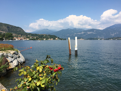
The decent took me quickly down to Lenno at the Lake Como. One of the nicest places here and an excellent location for a coffee break including ice cream!
Hope to meet you next time in a few weeks from Vorarlberg, Austria.
73 de Alexander, DL1AIW.