I’m off to the Mull of Kintyre for some work so I will be activating a few hills on 2m SSB and 80m SSB/CW. I will do some activations as I meander my way up and then I hope to pick off all seven of the Kintyre summits (mostly mountain biking). Getting there could be a challenge in itself as the main road is closed due to a landslide.
3 Likes
You must be one very fit guy Richard. Good luck with your activations
I envy you. Its a lovely area, I stayed at Ardrishaig to explore it. If it was spring I would recommend popping into Crarae Gardens for a dose of Himalayan splendour! Do you intend to use the Kintyre Way?
One day they will have to put some serious work into the slopes around “The Rest and be Thankful” it’s a regular thing. The detour must drive the locals and businesses demented.
I look forward to seeing the reports and maybe even working you Richard. I stayed there in Feb with a friend, I took the MTB with me then and was planning to return later this year with the XYL and do some SOTA’s. But obviously things changed.
Nick G0HIK
1 Like
Stopped somewhere with 4G tonight so a quick report.
Day 1 Hutton Roof Crags. First QSO was s2s with G1ZJQ on The Cheviot. I missed the tropo but easily made 9 QSOs including Don G0RQL. Overnight at Forest of Ae.
Day 2 Common Hill. My first choice hill was inaccessible so I changed my plan to Common Hill. Easy ascent on mountain bike. 7 contacts and for the first time in ages - no sign of Don G0RQL. Great to participate in the Eu day with three countries contacted. s2s with Mark M0NOM. Overnight at Bridge of Orchy.
If all goes well I might be able to start my Kintyre campaign tomorrow with Cnoc a’Bhaile-shios. I am hoping that no-one asks me to spell it. It all depends on how easy it is to cycle up it from Tarbet.
No sign of G8ADD so far.
2 Likes
Fine I don’t copy you on HF ![]()
![]()
I was thinking what a bizarre route to Kintyre till I remembered about the latest landslip on the Rest and Be Thankful road.
Day 3 Cnoc a Bhaile Cios. After an initial false start from Tarbert I found a better (if longer) route up. Just over 15 miles - most of which were on the mountain bike. The final ascent was unpleasant with heather pits installed carefully to trap the English. On the summits I had a slow start but then the band opened and I worked several German and Dutch stations. They were as surprised as I was - and they were grateful for the locator. No sign of Don G0RQL or G8ADD on this one.
Day 4 Beinn an Tuirc. This summit is within a massive wind farm. A new section is being constructed so the whole area was very busy with diggers, minibuses etc. The final approach to the summit was mercifully easy. A good haul of QSOs and I am pretty certain that I heard Don G0RQL briefly but no QSO unfortunately. This was a 20 mile return trip. It would have been horrible on foot.
Tomorrow I plan on trying The Slate. It gets bad reviews so I am trying a route that no-one else has mentioned. This could go badly wrong. Anyway I will have to set off early as rain is forecast in the afternoon.
2 Likes
Day 5. I’m ready to set off for the torture that is “The Slate”. Just listening to the news and wondering if an early return will be necessary. I see that some campsites are now closing voluntarily to reduce the transmission risk of CV19. Apparently the First Minister (FM) will outline the Scottish approach today. This Silly SOTA Bloke (SSB) will be listening.
1 Like
I’m getting in first, this time!  I hung around for a quarter hour hoping for at least a whiff of aircraft reflection, but no dice, so I took the dog for a three mile walk!
2 Likes
Day 5 The Slate. This little hill fully lived up to expectations. I expected little and it gave just that. My alternative route was to cycle to Killypole and investigate the routes from there. Having a bike does make this type of more general exploration possible (or at least much easier). On arrival at Killypole I noted that there seemed to be some forestry roads that were not shown on the maps. A path to the right of Killypole allowed access to these roads. From there I was able to cycle to a point about 800 metres from the summit (and to its east). I cycled about a bit to see if there was some better access to the summit but all I saw was warning signs for two Scots; Deep Peat (the philosophical one) and Soft Peat, his slightly more amiable friend. I set off into the woods on foot - mast and antenna in hand. There were no clear tracks and it was hard going. Soft Peat was ever present and on two or three occasions I ran across Deep Peat. I don’t like like him one bit. It was 912 metres of hard slog to get to the summit clearing.
It was breezy on the top so I rigged the antenna carefully to avoid embarrassment. QSOs were easy to come by including a nice contact with Nick G0HIK. The high point though was a contact with Don G0RQL (300 miles). That was particularly welcome and lifted my mood slightly for the exit route. The trip out was slightly less bad than the walk in - although it was still bad. A nice cycle ride down cheered me up even more. It was dry throughout but rain is forecast later today.
The First Minister has now spoken and while she announced more restrictions, they do not impinge on my activities so tomorrow my target is Cnoc Moy. I’m intending to try that from Gartnacopaig. We shall see…
2 Likes
It’s easy from there. I arranged permission to drive to and park at Glenahanty. Simple bimble along the track past Gartnacopaig about 1km then follow the wire fence to the trig. Gartnacopaig was being rebuilt when I was there so it may be a fine building now and not a pile of rubble.
1 Like
Day 6. I’m up a bit later than normal, the sun is out but I’m feeling strangely tired - quite possibly due to the previous 5 days of activity. I’m going to take today off and cycle into Campbeltown for a look around. Normal service should resume tomorrow.
It was great to catch you yesterday Richard, I just had my little portable Yagi setup on the drive.
Enjoy your rest day, you might enjoy a cycle across to Davaar island in Cambletown harbour and look at the cave paintings if the tide is out.
Hopefully work you tomorrow.
Nick G0HIK
1 Like
That’ll teach me - needed this one for a Complete. Was 30 mins too late to catch you. Called 300, 310, 320 (before Robert GM4GUF was using for his chat to the Utter Hebrides) on CW but I guess I missed you? 
Last year, when I Activated it in conjunction with SS-200; came in from Ballygroggan NR62401910. Following the edge of the forrest, then struck in at NR63121648 via a Deep Peat path to the summit. Back out via Deep (er) Peat, over Creag nan Cuilean, down over the bealach and up SS-200. Return to Ballygorggan via the Kintyre Way Path (long day - though lovely wx).
So the moral of the this sorry tale - check the Alerts b****y sooner!
Looking forward catching you on Cnoc Moy (SS-200)
(;>J
1 Like
Interesting I’ve just checked the Summit Listing and it does have me down as having activated it? I’ll check this out??
(;>J
And indeed GM/SS-230?? But when I use SOTAMaps I’m there on SS-230 but not SS-200???
(;>J
The database does not see any activation of Cnoc Moy GM/SS-200 for you Jack. Have you forgotten to upload your log at some point?
EDIT:
There is one chase of you on Cnoc Moy by DL3HXX at 1120 7th June 2019 on 40m CW.
According to the BBC 15 mins ago " Rest and Be Thankful in Argyll has reopened under traffic-light control."
1 Like
Splendid rest day with treats. The Large “Wee Toon” breakfast. Eaten outside in the sunshine. 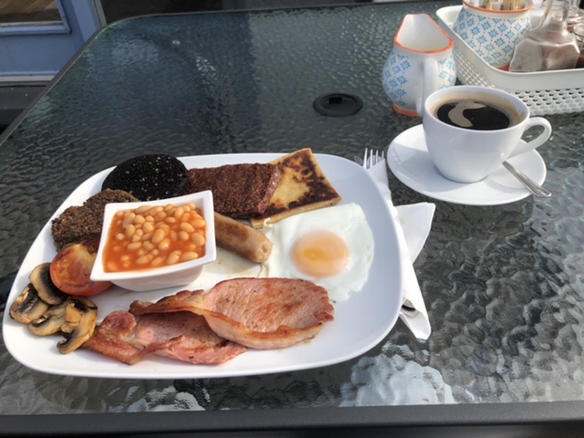
3 Likes