An idea that is really worth considering, in the spirit of our shared hobby and taking into account that our years of life are limited.
It could be THE compromise solution between wise people who have gained a lot of experience in their long (professional) lives.
If it were that simple, we would have done it years ago. I don’t particularly enjoy map checking 10,000 summit associations, which is why I try to find quicker ways. But when I do end up map checking, it’s immediately apparent the issues that will occur.
The issue is not P150 or P200 or P8848. The issue is determining which of two (or more) summits which have similar heights and the same parent is the correct one, when the underlying surface model (all to Ron’s points) is inaccurate.
Remember, prominence is a relative measure - it compares surrounding terrain against higher terrain, resulting in some interesting second order effects. It is not an absolute measure. Imagine an island with 5 summits on it. The highest points of each summit measured by SRTM or GLO30 is respectively, 201, 203, 200, 204 and 207m. All of these have an accuracy of +/- 10m. Each summit requires slogging through jungle to get to, and the island is surrounded by cliffs 30m high (so the key saddle between each is at most 177m below). Only 1 summit can qualify in this (P200) situation. Which one?
Well, it’s obvious, it must be the 207m summit. Except, according to government mapping that some poor person had to head up with his survey-grade GPS, that summit is actually 199m high. So, it’s not that one, it must be the 204m summit. That has a comms tower and building on it which is affecting the radar, it’s only 170m from the ground as determined by our survey sherpa. Can’t be that then. 203m? It’s a jungle, so the tree cover can also impact things, that’s 198m as per the government mapping. The 201m summit is measured at 206m as per mapping and the 200m summit is, surprise, surprise, 200m exactly.
Now this is a contrived example, but imagine that happens in ~5% of cases (a ridgeline instead of an island, usually), across a 10,000 candidate association. That’s 500 summits that would absolutely need manually checking and possibly correcting later. Note that none of that has anything to do with P200 or P150. I could easily contrive the same slightly smaller island with the same problems at P150. It’s because prominence is relative to itself and other surrounding terrain.
Better data like LIDAR does make this possible. Centimetric vertical accuracy is near enough for our kind of work, and it’s usually spot on, although I recall even Simon finding issues in EA with LIDAR data getting confused with the trig points they have there and finding the wrong summit. SRTM is not the dataset to be searching through for this sort of information.
The good news is there’s a lot of operators launching SAR based satellites for digital terrain modelling and this may change in coming years, but we’re not there yet.
A clear summary that clarifies the situation from a technical perspective, thank you, Ron.
What could be the argument against first omitting all summit candidates whose prominence is not entirely clear, i.e. the ~500 candidates in your example above?
Mainly identifying which of the potential summits is in that 5%.
That would leave just the highest one - if it IS the highest one!
The proposition seems to be that a half-assed job is better than no job at all, and to heck with the subsequent complications!
The MT has been through all this before, and learned by bitter experience that having to correct a summit list and withdraw many non-compliant summits leads to violent condemnation and tantrums from people deprived of their favourite summits. In one association fully a third of all participants left SOTA in anger over the losses. We don’t want this to ever happen again!
That wasn’t quite what I meant, because this group of neighboring peaks would all be part of the group of ~500 summits that are not clearly defined and would therefore not be taken into account in the first step.
I understand the arguments mentioned well, but if a prominence of 150 m was set at the start of a new association, binding for both sides, the unpleasant story mentioned above would never be repeated, because what’s learned is learned, hi.
73 tks, Heinz
That wasn’t quite what I meant, because this group of neighboring peaks would all be part of the group of ~500 summits that are not clearly defined and would therefore not be taken into account in the first step.
Well first you have to determine which summits are in that group of 500, remembering that it is not just the summit height that has to be determined, but also the col has to be identified and its height measured, probably by interpolation of the contours, then the inaccuracies that apply to the summits also apply to the cols, so is that col really the right one? Another col that is higher on the map may actually be lower. Ron puts it more technically, but either way, with unreliable mapping (for a given value of reliability) we are dancing on quicksand.
It seems to me that it makes better sense to listen to the opinions of our experts and not go off half-cocked with a botch job that will have to be re-done when the data arrives…and after all, it is not as if our summits people are sitting on their hands while waiting for better data on Turkey, as always the work continues on other Associations, both new ones and updates.
It seems to me that it makes better sense to listen to the opinions of our experts and not go off half-cocked with a botch job that will have to be re-done when the data arrives…and after all, it is not as if our summits people are sitting on their hands while waiting for better data on Turkey, as always the work continues on other Associations, both new ones and updates.
Yes, exactly, and as an engineer and long-time SOTA enthusiast, I understood Ron’s clarification from a technical point of view just as precisely.
It is what it is, but every now and then some outsiders allow themselves to think “out loud” about possible compromise solutions.
So thank you, that was all I had to contribute to this topic.
Hello, dear summit enthusiasts,
The discussion environment here has positively impacted us and provided preliminary information for the correct progress of the participation process. Given Turkey’s geographical location and topography, it has a rather rugged terrain, which might mean more summits compared to other participating countries in SOTA. While understanding the technicalities and the difficulty of verifiable summit activities is not hard, I would like to mention that I have made an official “individual application” to share the best technical data we can provide.
For the past few days, many “TA” radio amateurs who are knowledgeable about the subject have been very excited. However, due to technical glitches in mapping, we keep hearing “I think it’s very difficult for us to be included.” Previous attempts or incompatible technical data seem to be complicating the process. If I can obtain a map, whether official or publicly available data, we will work together to see if it meets the criteria.
Lastly, we have a philosophy: “Even if it’s just one person, no matter what amateur radio activity it is, we will be there as TA for a single QSO.” This may seem like a small sentiment from the outside, but with the joy of being devoted to amateur radio, I hope we can achieve this together.
73 Kaya
Your’s arguments are objective and logical.
Properly defining a summit is a big challenge.
I have a lot of respect for Your’s social work.
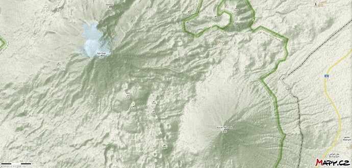
But … why, in exceptional situations, not being against the rules, despite everything, guided by the purpose of SOTA, such summits as Ağrı (Ararat) or Küçük Ağrı (Little Ararat), when it is known that directly around the summit in every direction is >200m, cannot be in SOTA and is a fully defined KeyCol really necessary.
Only in obvious cases, maybe it’s worth giving it a chance
BTW. I recently activated SOTA and at the same time POTA, and how happy I was when P2P from TA called.
I think you’re doing P2P with Professor Dr. Ismail (TA9J) in that area. Among ourselves, we call him a true peak performer and a grand master. He is one of the rare Old Timers (OT) who has truly dedicated himself to amateur radio in TA.
Oh, if only we could join this program, we have so many hidden gems waiting in the wings. ![]()
Sticking my oar in with great trepidation, I’ve just found a list of ‘Turkish Mountain Ultra Prominences’ shown here Turkey Mountain Ultra-Prominence - peaklist.org
I hope it is of interest-it was on the Wikipedia entry for Mount Erciyes in Cappadocia, which I remember from my visit to Cappadocia in 2011, a beautiful mountain. 73 John G0MHF.
Here’s how Peaklist classifies their confidence in Turkey
Summits are map-checked, but there are multiple problems and contradictions within published data sources. Saddles are almost entirely derived from raw SRTM data.Elliott, K6EL
Hi,
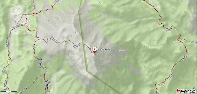
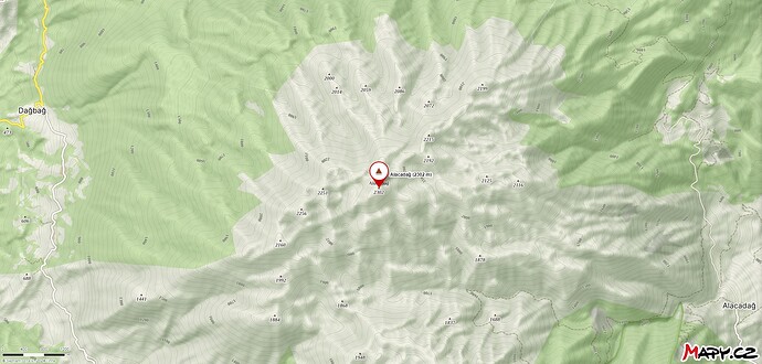
until I got an official reply, I found a map data like this. It contains 12.5m contours.
Constantly up-to-date data is provided by the Sentinel-1 satellite. if appropriate, is it in a structure that we can adapt to the SOTA map?
John,
While interesting in a way, that ultra peak list uses SRTM data so is no more than a guide for candidate summits as far as a SOTA mapper would be concerned. To illustrate this point I decided to look at the famous Mt Ararat
The UP list claims it has a height of 5,137 m.
The spot height shown on other maps is 5,165 m.
OSM Toppo shows this spot height of 5,165 m but using the contour lines we would find it between 5,100 and 5,110 m.
Google Terrain shows the same spot height, 5,165 m, but the contour lines suggest it is between 5,100 and 5,120 m.
ESRI Toppo boldly declares a spot height of 5,101 m.
A Google search for Mt Ararat’s height gives 5,137 m.
So here is perhaps the second most famous mountain in the World and the height given isn’t completely certain and all the free available contour maps give a summit height that is over 40 m too low if the common spot height is to be believed.
I would be wary of accepting any SRTM derived height.
Now if the height of this peak is uncertain by maybe 50 m the heights of other peaks are likely to be in similar error. Maybe worse?
And the saddle heights are not going to be better. Even though this is a relative measurement the variability of contour lines between maps does not support the notion that anyone of them would yield good results.
So the choice is to try and obtain an authoritative (government survey) map or to accept an association which is based on one declared mapping scheme which is known to be in error.
At the moment I think the MT will not countenance accepting any mapping with more than 10 m uncertainty.
How do you tell if a mapping scheme is adequate?
Check it’s ancestory. If it is from high quality 1 m contour mapping with ground truthing then you are on solid ground and can proceed.
Otherwise you are likely using a rehash of the old NASA data from the shuttle radar mapping and its inherent uncertainties.
Check all the available spot heights against your map. Not all might agree as some will be from old classic surveys and not updated to GPS co ordinates. But it’s a start.
Good luck.
73
Ron
VK3AFW.
Hi Ron
Thanks for your copious comments, I’ve now found out what SRTM stands for!
However, I’ve no real interest in this, I was merely passing on the list I happened to come across.
It would good if Turkey one day entered the realms of SOTA, given the topography of the country.
73
John
@EA3GNU Hi Alberto,
Your feedback is very important to us. We will do our best to speed up this process and encourage more participation. We agree with you that strict criteria are essential to maintain the quality and reliability of the program. This demonstrates the quality of the SOTA program.
However, there are indeed very technical and detailed maps. If my official request to the mapping agency is denied, I will be very disappointed. Nevertheless, I will continue to come here and follow the activities regularly. After all, our hearts are with SOTA and the summits ![]()
Best regards,
TA1ODM 73
However, in my humble opinion, it’s crucial that we don’t let bureaucratic details prevent new countries from being included
Bureaucratic? As in we’re being deliberately obstructive?
If we could add Turkey tomorrow in a way that didn’t mean we spent longer having to fix all the problems we would. In the past 20 plus years of SOTA there have been many attempts to rush the process.
If you start with poor mapping, locations near no reality to what is on the ground (eg, early ZS).
If you try to automate the summit selection you run into second order effects (see my post higher up)
If you only add half an association, the points distribution is messed up when you add the other half so you have to reband (eg, early ZS, VE7)
If you don’t have a local AM you run into issues dealing with other local hams, language issues and maybe mislabeling summits or not understanding the cultural (or military) significance of a particular summit.
Now I am not suggesting all these apply in this circumstance but let’s be clear: we all want Turkey to join as soon as is possible.
But if anyone is thinking we’re sitting around putting artificial barriers in place then you are grossly mistaken and I personally find it borderline offensive.
Our process is based on twenty plus years of experience learning from the mistakes we’ve made along the way: I have personally surveyed over 10,000 summits, map checking each and every one, and written software to speed that process up. When we speak, we speak from a position of experience of working to grow SOTA as quickly as possible.
And that is why I keep myself out of twitter and forums, there is nothing you can say that will not offend someone. I will wait for the outcome, good luck!
Hello esteemed SOTA activators and MT,
I would like to inform you that today we received a negative response from the official mapping authority regarding TA, which has been following the SOTA activity with interest for years. I will work on the best scenario I can for the inclusion of TA in the program, and we will eagerly wait until it meets the current mapping criteria in the future (or we will wait for a surprise from MT).
Sometimes, the absence of something can mean the beginning of more beautiful things. I thank all the valuable hobbyists who constantly discuss within the framework of SOTA rules and express their desire for TA to be included in the system as soon as possible.
When that time comes, I hope to meet on a summit in TA.
Hope to see you at the summit ![]()
On behalf of all ![]() 73,
73,
TA1ODM.


