Simon,
I agree with your findings having undertaken a study evaluating OS data using AutoCAD. I also made a site visit on Saturday 18th February 2017 and reported to the MT through the G Association Manager, Jimmy M0HGY.
For the benefit of all interested in this summit, below is a transcript of my findings:
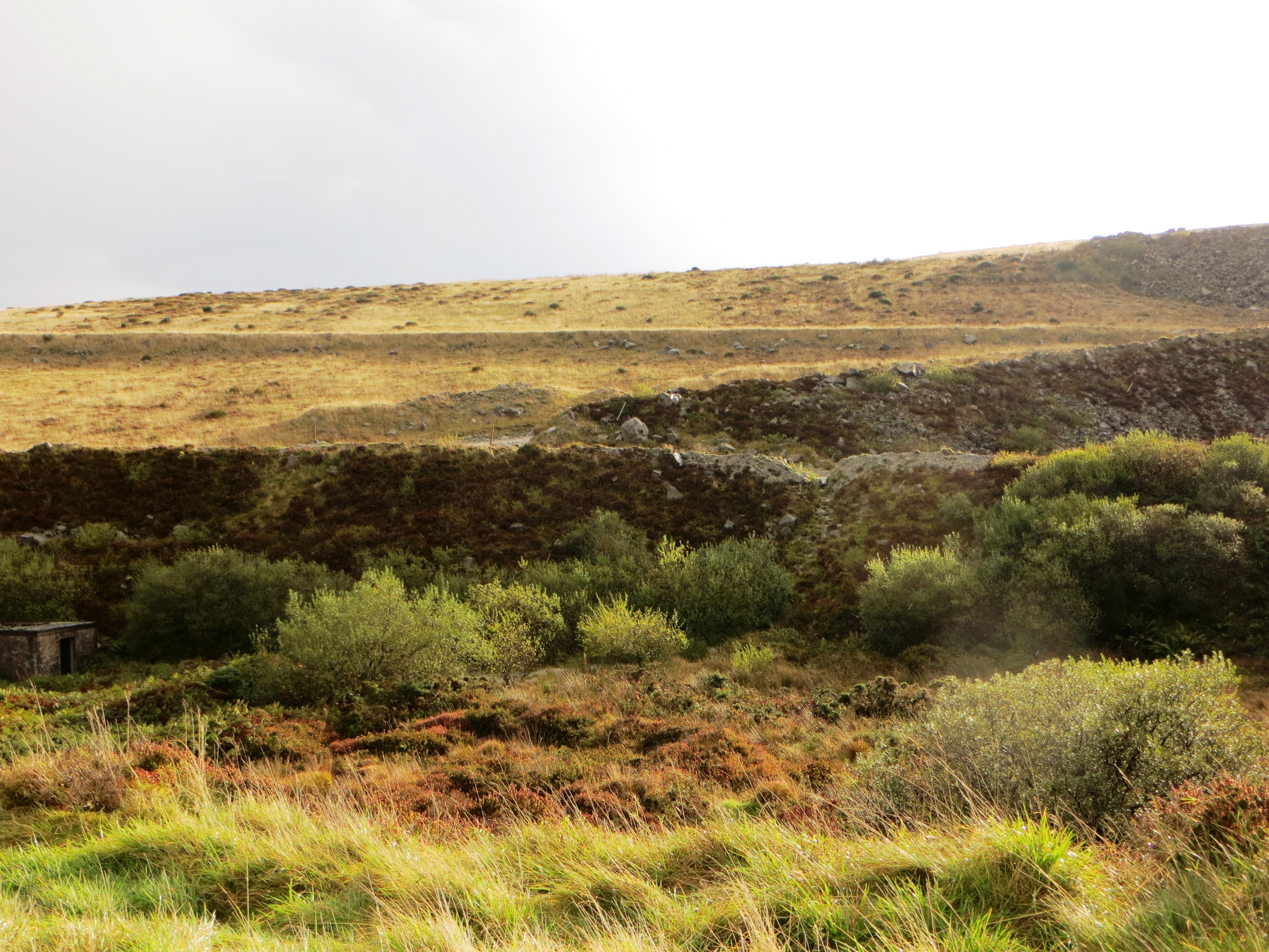
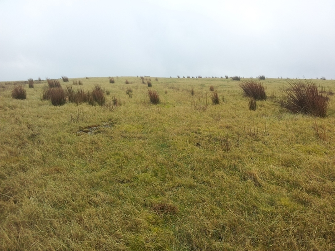
"I went to Hensbarrow Downs on Saturday and checked out the new summit area. After a brief visit to Hensbarrow Beacon to check the GPS was more or less set (the reading taken was 313m), I climbed up to the new summit. There I located the flat rock that RHB indicate is the highest point, though there are several flat rocks around the area. I checked the reading and it gave me 365m which equates well to the 364.6m RHB figure. I took a couple of photos to show the maturity of the vegetation, which is well established and although it appears to have been accessed (quad bike tracks), there was no evidence of recent landscaping work. The summit area is a mixture of grass and moss with clumps of reeds. It is quite damp with a few small shallow pools, but the ground is generally firm.
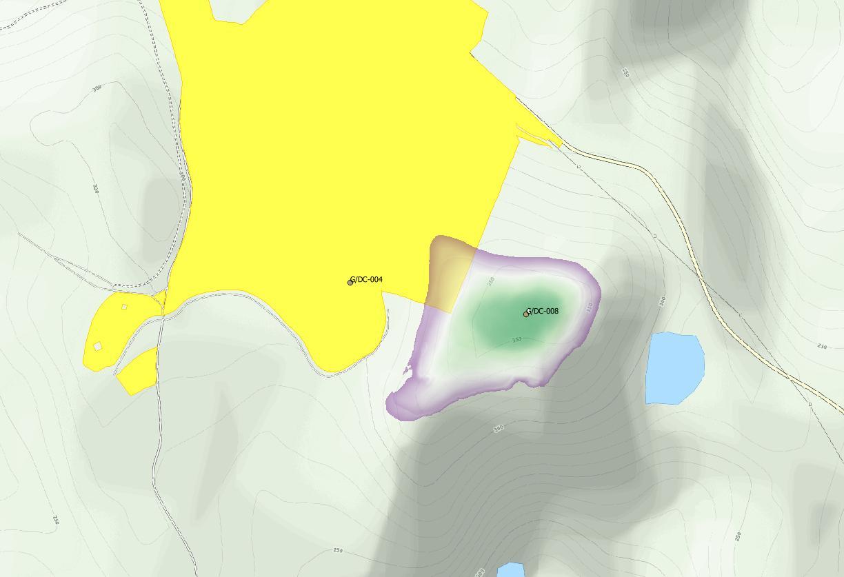
To try to establish the edge of the OA land, I inserted the 1:25000 OS map image into my CAD software and set it up against a 1000 metre x 1000 metre grid. This gave me an approximate point where the OA land boundary turns at a right angle and a line heading east of north along the boundary stones indicated on the 1:25000 OS map. I took this line even though the OS appears to suggest the actual boundary is slightly further east (closer to the summit) so that I had a small amount of leeway built in. I checked this against the best OS data that is generally available - the standard that I use for producing site plans, location plans and conveyance plans at scales of up to 1:500. The correlation was quite good. However, I have found such data to be out on many occasions, so bear that in mind when you draw your conclusions on this matter. The CAD software gave me grid references for the corner of the OA land and points along the boundary at 25m intervals towards grid north.
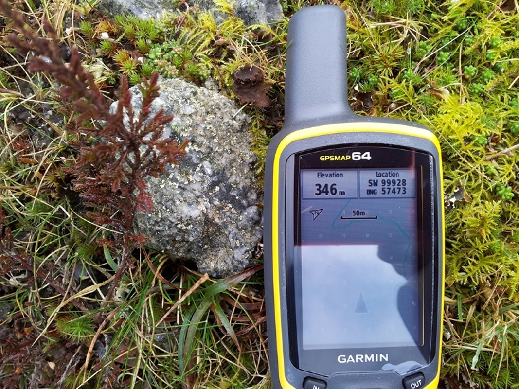
Referring to the information that I had marked up on a plan, I walked down the hill to locate the point where the OA land boundary returns (SW99928 57473) where the height reading was 346m. Close to this point at SW99948 57470 there are two large boulders which may indicate the actual OA boundary on the ground. I cannot see any other purpose for them and they have obviously been placed there. The height varied a little along the boundary line around 346m, until it began to fall off. After crossing a track the GPS reading was 332m, so I did not take any readings north of that point.
After this I returned back up the hill to take a random series of readings along the 340m and 345m contours. I also took some at 350m, though the heights taken on the boundary indicated that these were outside the OA land. Above 350m the gradient reduces and the summit is a flat expanse several hundred metres across. At SX00000 57552 outside of the OA land there are a quantity of boulders. I would speculate that these may have been intended for marking the boundary, but if the OA land is due to expand (again speculation), then they would not be required. Before leaving the site I returned to the summit and checked the GPS reading. You will note that my £250 GPS does not quite make the grade against RHB’s £8,000 piece of kit. It did however give me 312m back on Hensbarrow Beacon when I returned to the car.
I attach the marked up plan showing the survey results. The three curved lines close to the angle in the boundary of the OA land are the 340m, 345m and 350m contours. Again, bear in mind the consumer grade equipment used to obtain these lines.
[Acknowledgement to Ordnance Survey for the map layer]
A few further observations.
-
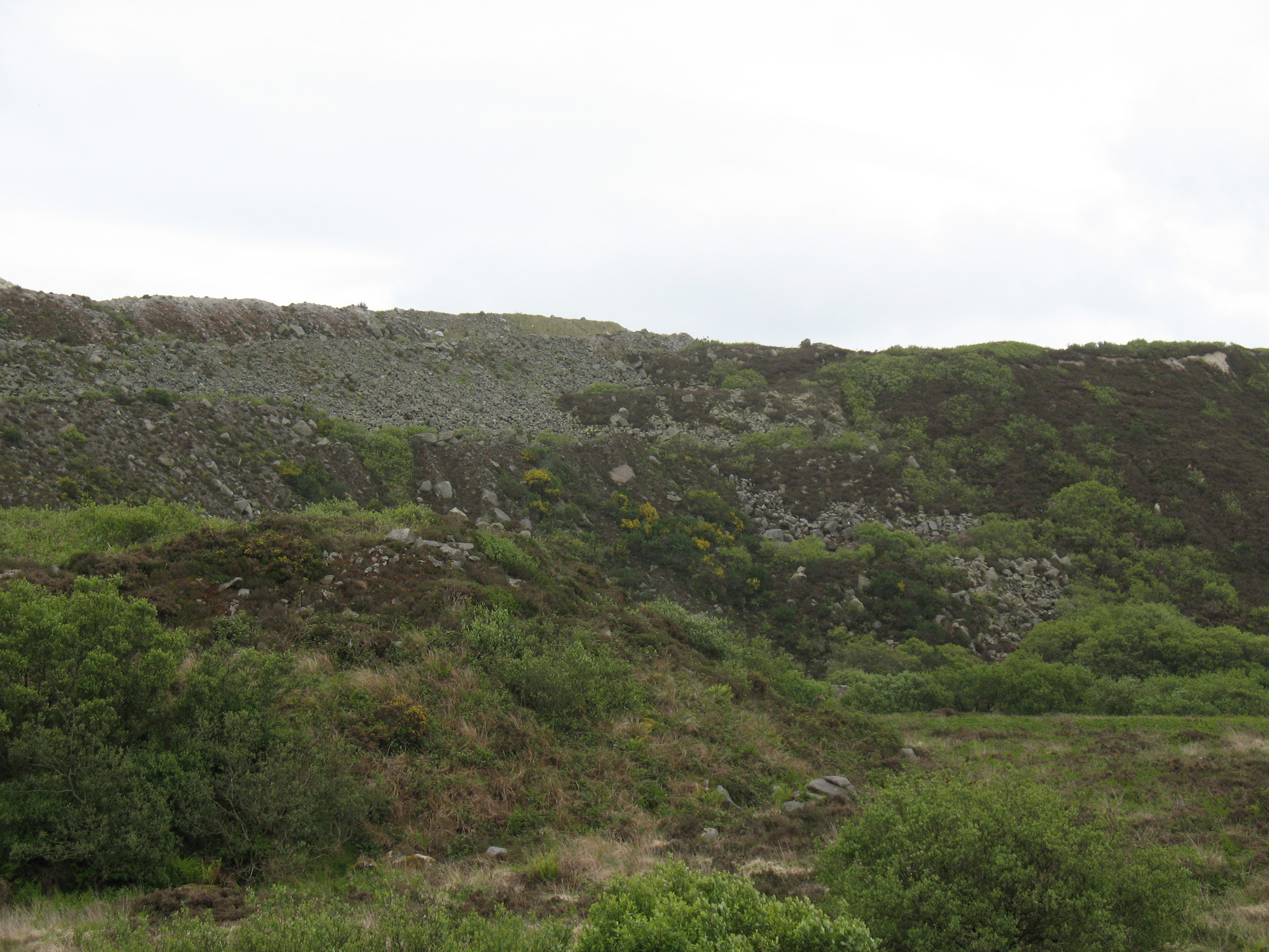
I would draw everyone’s attention to the lack of any notable landscape features on the north-west / west side of the hill. In mist it would be extremely easy to become disorientated and a GPS would therefore be invaluable. Work is continuing some distance south of the new summit, but in poor visibility it would be possible to wander off in completely the wrong direction, so it must be considered a hazard under such conditions. Furthermore, to the south-west of the summit the ground is still terraced and quite steep, as can be seen from the photo taken from Hensbarrow Beacon. I did not investigate the east side of the hill.
-
Given that the crossover between the OA land and the AZ is quite small (some 32m deep at most along a boundary length of around 110m) and the lack of features, I would suggest that using a GPS is the only way to ensure compliance with the SOTA General Rules.
-
The weather cleared while I was on the hill and I was in full view of the road for well over an hour. A couple of workers were seen walking down to the road on the access track to the works west of the road. However, no-one came up the hill to enquire as to what I was doing.
-
The vehicular access tracks are still in regular use. To get to the summit easily, I used the footpath running north from Hensbarrow Beacon keeping to the east side of the fence. After some 300m the path dropped down and turned right through a low rocky outcrop. This brought me immediately to a wire fence where I turned right, passing by the side of a metal road gate to continue on the track beyond. This track then joins the wider track that runs along the south side of the OA land. Here the track is within the OA land up to the next track off left, which is the one to take before striking off right and up the hill. Evidence of very recent use was noted."
Photos:
General View of the new summit area
Reading at the return on the OA boundary
Boulders close to the return on the OA boundary
Reading at the summit
I hope this helps on the issue of Hensbarrow Downs. Take the information as you feel to be appropriate.
73, Gerald G4OIG