GM/NS Expedition 2015

Day 3:

I had spent a night of fitful sleep, punctuated by wakefulness occasioned by the rain drumming on the tin roof and the wind howling in the chimney. By the time the first tinges of morning began to lighten the small square of window opposite my bed I was glad of the excuse to get up and start the day.

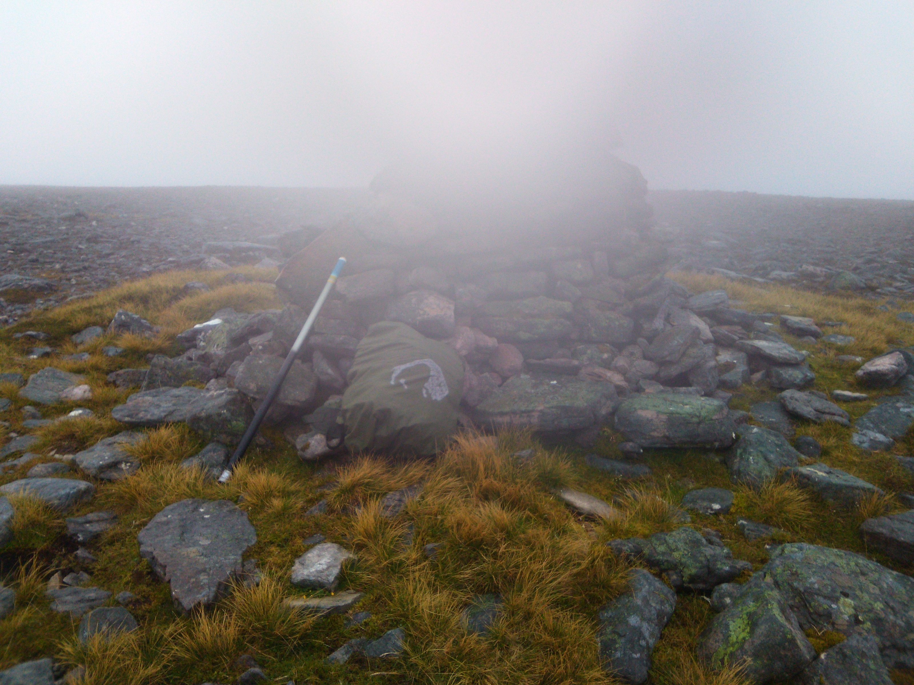
After a quick breakfast of cereal bars and coffee I packed the minimum I needed to carry for the days’ outing into my rucksack, the rest being left in the bothy to be picked up on the return journey; then ventured out into the clag and rain. I took the faint path that led from behind the bothy towards the steep slope of Sron a Ghobhair, and into the flatter but extremely wet hinterland that took me past the foot of An Grianan and on to the col between it and my first target, Creag Riabhach NS-115. With incessant wind-blown rain from above and ankle deep water below this was a miserable experience, and I was very glad to eventually cross the burn at the valley bottom and start the final ascent. After the drudgery of the last stage I laid on with a will and soon achieved the summit. As is often the case the “door” to the summit shelter faced the wind, so I quickly set up in the lee of the shelter, bungeeing my pole to the shelter wall. I deployed the rig in “protected” mode, buried deep within the rucksack.

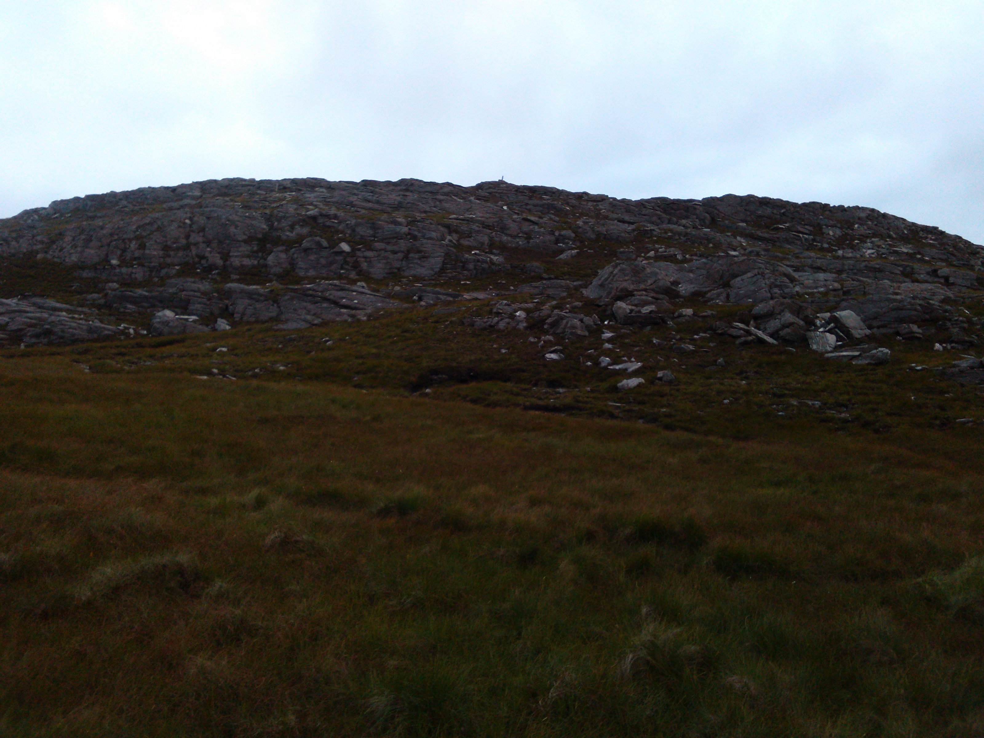
Set up on a wet and glowering Creag Riabhach NS-115

Conditions on 60m were as dire as the weather, and only G0RQL,G8MIA and G3YPQ made it into the log. A change to 40m brought in Andy and Don again, followed by another nine of the “usuals” finishing with Rod M0JLA. This wasn’t the weather to be hanging around on an exposed hilltop, so after five minutes of responseless calling I went QRT, packed up, and prepared for the short journey across to An Grianan, NS-121.

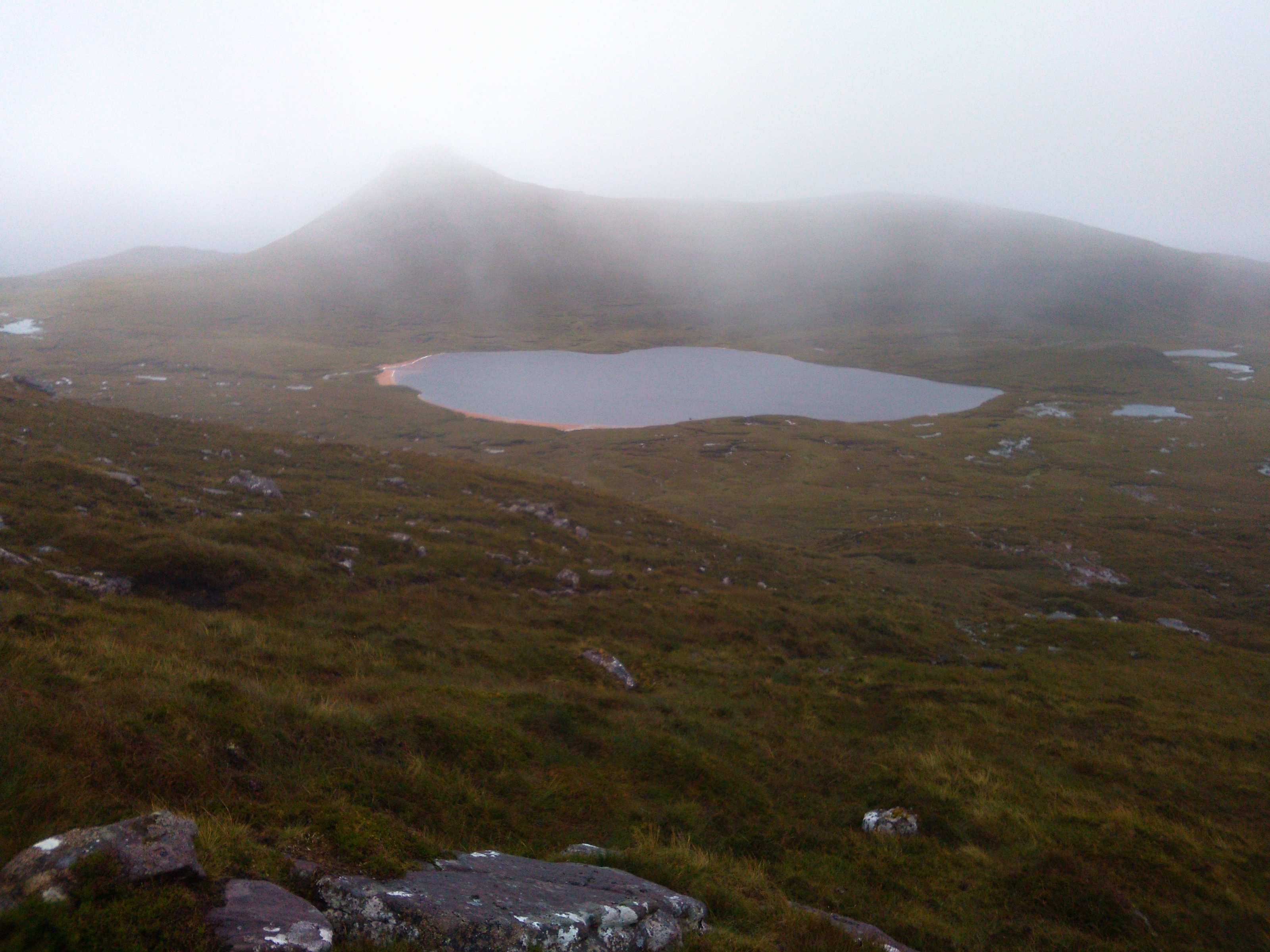
Sheets of rain blowing across the valley between Creag Riabhach and An Grianan. Note the sandy beaches!

The walk down off Creag Riabhach was easy, but trying to be clever rather than head for my previous crossing point I tried to shorten the route and made for the lake shore, only to find the ground to consist of gloopy bog into which I sank up to my knees. My feet which had miraculously to this point been warm and dry were now cold and sodden, which added a new dynamic to being out in the foul weather. Having eventually negotiated the bog and found my way to the imposingly precipitous North East face of An Grianan, a steep but feasible route presented itself on the right hand flank of the hill which I climbed then looped round to achieve the summit itself.

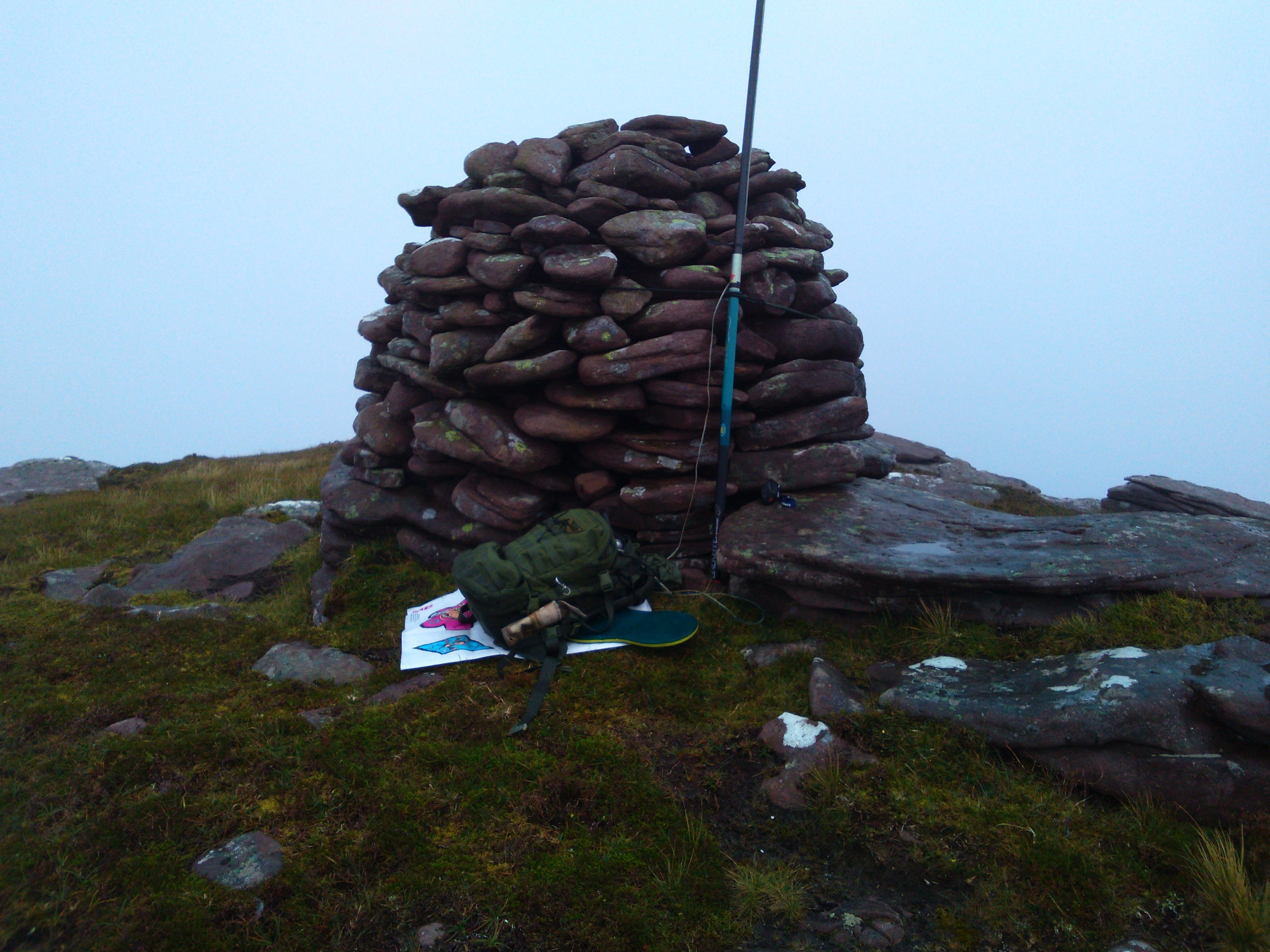
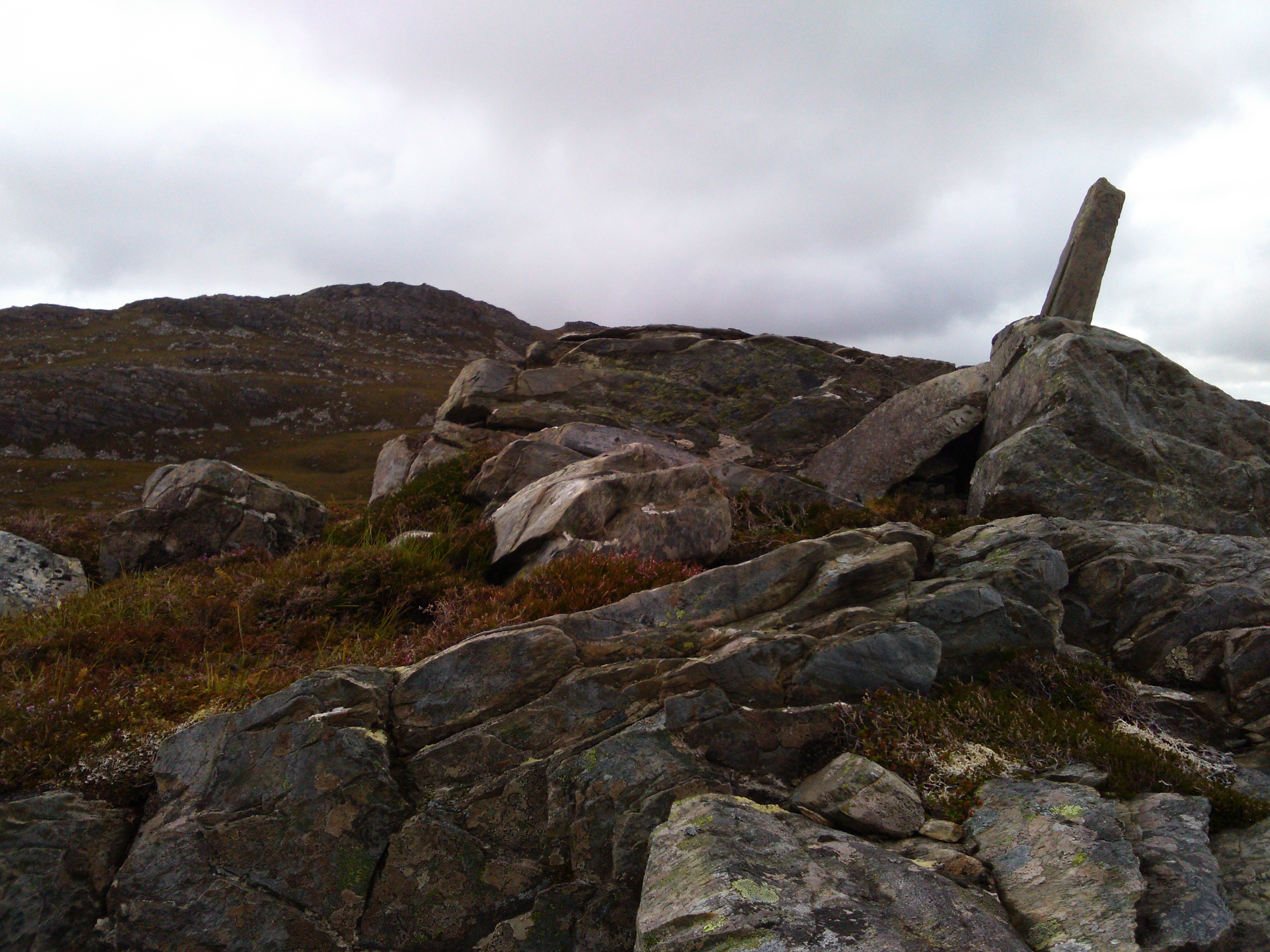
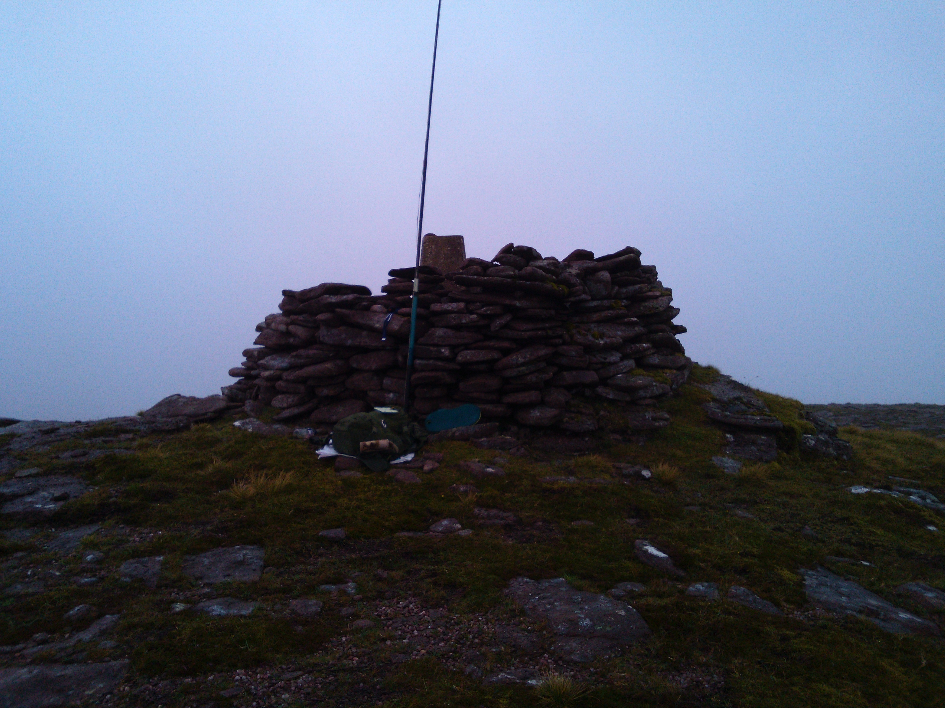
“Beehive” cairn on An Grianan, NS-121 - pole again attached with bungees

As I set up, the rain abated somewhat which made life a little more comfortable. Radio conditions took a turn for the worse however, only Don G0RQL making it into the log on 60m with 33 reports both ways. 40m fared a little better, with eight calls logged. Despite the disappointment of the poor show on this summit, I was glad when the five minutes’ calling failed to produce any further contacts and I packed up with only slight regret at the low number of chasers worked from this rare summit.

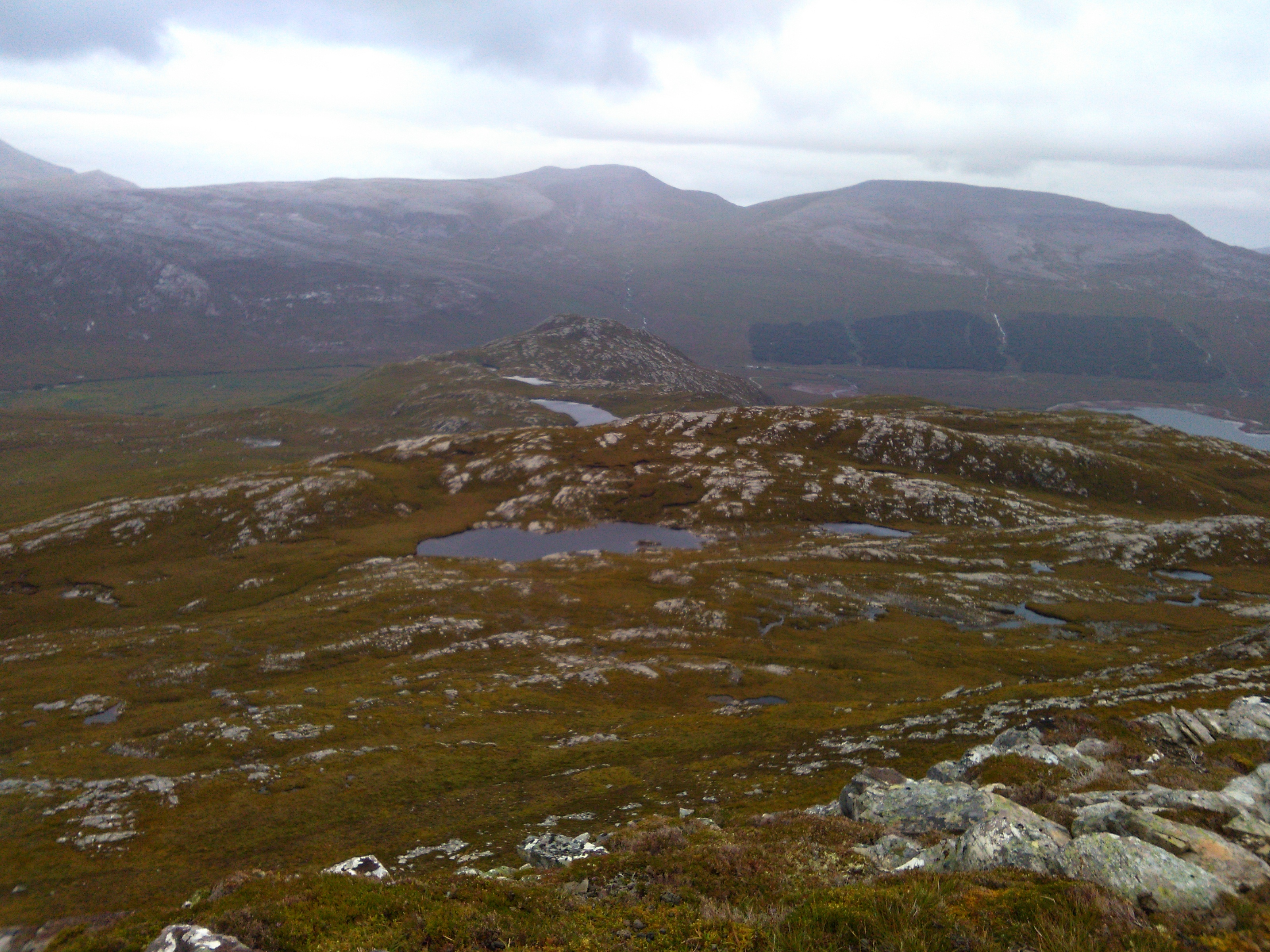
I kept to the higher ground on the way off An Grianan, and soon the bothy hove into view again.

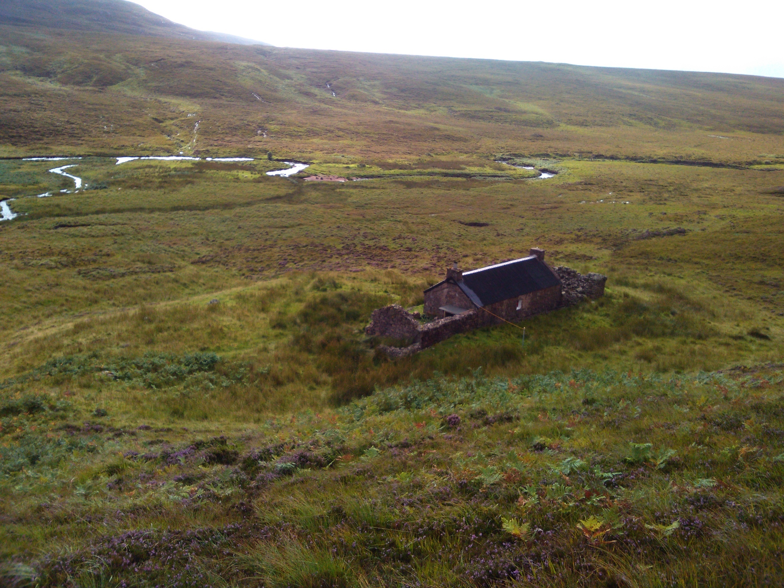
Strathan Bothy from the back - hot coffee and dry socks beckoning

After a brief refuelling stop, I repacked the rest of my kit and bade the bothy a fond farewell. Perhaps predictably, with the heavy rain over the last 24 hours the previously benign river which I had forded with impunity on the way in was now a raging torrent, and I abandoned any hope of crossing with dry feet choosing instead to wade straight across, using my SOTApole to steady myself on the slippery rocks against the strong current. After a quick stop on the other side to wring out my socks (should’ve anticipated this and waited to change them…) I set off at a brisk pace up the slope that would take me out of Strath Shinary. The 5.5km walk seemed a lot longer on the way back, but eventually I arrived at the car and changed footwear for the journey back to Durness Youth Hostel, a hot shower and another microwaved curry :yum:

1 Like

Day 4:

With Friday arrived another band of rain. I had no definite plan for today, just a list of possible summits so a good start seemed to be to tackle a fairly simple local one in the hope that conditions would improve later. Farrmheall GM/NS-108 fitted the bill, so I took the short drive down the A838 to the disused quarry at NC304572. After waiting for half an hour I decided that the rain wasn’t going to stop in the foreseeable future, so kitted up for another wet activation and made my way under the power cables and straight up the shoulder of the hill above the quarry. At least it was fairly easy going on short grass and 45 minutes of brisk walking brought me to the wide summit plateau though locating the cairn in the clag required use of the GPS!

Farrmheall GM/NS-108 - summit cairn in the clag

Again the cairn provided support for the pole and I set up the radio inside my rucksack against the still-falling rain. Radio conditions reached a new low, and only Victor GI4ONL and Phil G4OBK made it into the log on 60m. 40m wasn’t much better, with Gerald G4OIG finding me to head the run and Don G0RQL ending it six contacts later. I gave this summit a further ten minutes of calling, but when nothing further was heard I packed up in disgust and made my way quickly back to the car. Given the dire radio conditions and with the rain still lashing down I made an executive decision to knock it on the head for the day and retreated to the Youth Hostel to dry the kit and prepare for my last day in NS.

1 Like

I remember Farrmheall. I had some fabulous views of the strath on the way up. I too had fun finding the right cairn and I wasn’t in the clag. It didn’t feel right and I had to use the GPS to check I was at the top… I wasn’t! My selfie at the summit is slightly less claggy and wet than yours, but boy it rained as I descended to the col for Ghlass-beinn. It doesn’t seem 6 years ago.

I wondered how you were going to approach some of the more remote peaks there, I didn’t think of the Bothy. You have an advantage that I have to lug a bag of drugs and syringes with me that adds to the stuff carried. I can live without the injections for a few days but it’s better not to miss them. This means back to a B&B/Hotel at night is required and that clamps your style on some summits in places like the far NW of Scotland.

Still I’m most envious even though the WX was not the best. The countryside there is simplly stunning. You may as well be on the moon for remoteness compared to the rest of the UK. You may well think you’re under the sea considering how wet the ground is too!

Day 5:

Saturday morning dawned bright with a fresh breeze :slight_smile: 
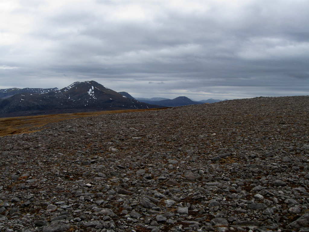
I rose early to get a good start for my last NS summit which was to be another previously-unactivated hill, An Lean-Charn GM/NS-109. I parked up at the start of the track up Strath Beag, at the head of Loch Eriboll and followed the track till I got past the cliffs of Creag na Faoilinn to the left hand side; then turned East towards the summit on a fairly well defined path.

The Eastern approach to the summit is guarded by rocky outcrops, but I had read on a walk report about a pointer that marked an accessible route up.

“Finger Post” - can you see it on the horizon?

Sure enough, there it was and by heading for it I found an easy path up through the outcrops.


“Finger Post” - close up, summit of An Lean-Charn GM/NS-109 in the background

From here, the way across a small depression with lochan is fairly obvious and the summit easily gained.

It was a joy setting up in the dry, radio conditions though better than yesterday were still not of the best. 60m produced 8 contacts, with much QSB and widely varying reports; Brian G8ADD being “the one that got away”. Given the early hour I thought 80m worth a try, but although I heard G3RMD and GM4COX on the band they could not copy me well enough to get reports. 40m brought another 9 contacts, starting with Gerald G4OIG, to give a reasonable total. G3VWJ finished the run, and after another five minutes of fruitless calling I went QRT and set about the business of getting to Inverness in time to meet the family for Part Two of the expedition :smile:

View down the ascent route - “Finger Post” is on the rocky outcrop above the nearest lochan, small hill in the middle distance is Creag na Faoilinn, Cranstackie NS-038 and Beinn Spionnaidh NS-046 behind

So a final belated Thanks to all the chasers who took the trouble to look for me despite the grim radio conditions, hope things will be better for the next expedition - which looks like being a joint one with Gerald to explore some more Scottish Islands :smile:

73 de Paul G4MD

2 Likes

Hi Andy,

Glad I’m not the only one to have had trouble on Farrmheall. Moonscape is a good description for the summit plateau! And rain is definitely something this part of the world does well…

Certainly is a wild and remote area, there is plenty of opportunity for “alternative” approaches to some of the more remote summits and I’m looking forward to getting back to do some more. Wild camping has a particular appeal! If only I didn’t need to work for a living :confused:

Can’t begin to imagine the constraints your medical condition puts on your activating, respect to you for your can-do approach :smile:

73 de Paul G4MD

Approaching the lower cairn on Farrmheall Mar 2010 and looking South. You can see the shattered rocks that cover the upper surface. The big hill is Foinaven, peaking around the side is Arkle. The dark hill in the centre middle distance is Ben Stack and to the right of that before the shattered rock is Quinag (Coo-nya-ck), 30km away.

Now normally spelled Arcuil. Arcuil and Foinaven (Foinne Bhein) are in a state of advanced decomposition, on a quiet day you can sit on the summit and listen to bits dropping off!

Great pictures to dream over whilst listening to yet another contest wiping out SOTA!

Brian

That name is taking time to stick, it’s not made the 2014 OS maps yet, see below, and they’re normally quick on renaming or rejuvenating lost names. You have to push Google with a lot of hints before it accepts you want Arkle.


Apparently it means flat topped moor and is based on a Norse name. Lots of the names are obviously not of Gaelic origin up there, Farrmheall for one.

Well, its obviously anglicised or the “e” would be pronounced! Don’t you think it looks a little strange surrounded by gaelic names, Coire Uairidh, An Garbh-choire, Meall Aonghais etc? Have the OS changed Mam Soul yet? :grinning:

PS I just looked out my old Bartholomew half-inch sheet 58, where it is shown as Arcuil with Arkle bracketed in smaller print and Foinne Bhein with Foinaven also in brackets, as this edition came out in 1968 it seems that the OS is dragging its feet!

I’ve found the Norse reference, “Flat-topped hill (ark fjell)” was on a wiki page.

The names distribution is interesting because as you move around the far North there are lots of Norse derived names which stand out amongst the Gaelic/Scottish names. Of course as you move to Orkney and Shetland the Norse origins are very obvious.

Must get to Unst, Shetland and see where my great-grandfather was born

Back to Farrmheall, of all the summits I’ve visited in GM, only 2 begin with F, Farrmheall (Norse origin) and Faragon Hill which is obviously an English name.

Mixed origin, I would say, with mheall a lump, mound or knoll in Gaelic, often denoting a rounded hill. Farragon Hill is mixed, Gaelic and English, (Saint) Fergan’s Hill.

A good set of reports, of an area I’ve been saying I must revisit since doing a cycle tour of the west and north coasts of Scotland, ermm, nearly 40 years ago - revisit definitely overdue.

However you seem to have been activating in even worse conditions then Martyn and I often end up in (and I don’t think we could cope with not having a warm bed to sleep in!).

Caroline.

Thanks Caroline. I only discovered the far north west a couple of years ago when we took a trip over that way from where we were staying at Dunnet Head, but I’ve been hankering to return ever since. Scary how time passes, my youngest (nor my eldest for that matter) can’t believe that the 1960’s are just the other day :confused: Hope you get back soon!

When so much travel is involved you weigh very carefully the weather issues when deciding whether or not to go out. I know you and Martyn have been there too! Still annoyed at myself for wimping out on the Friday, but it seemed very sensible at the time :-s

Good luck with your next expedition, wherever it is. Hope the sky smiles on you in both senses! I look forward to reading all about it :smile:

73 de Paul G4MD

An excellent set of reports Paul. Really pleased to read the details and see the summits and in particular the bothy shack. It was worth going out to a local quiet spot that evening to ensure that I made contact. I was very fortunate that the owner of my local interference source chose the same week to go on holiday. The week after, the noise on 40m jumped back to its usual level which would have made the going very difficult.

Of course you realise that that is 2 significant outings I have let you loose on without my company… and some challenging summits to do as well if I am to bag them as Completes. :smile:

73 Gerald G4OIG

Hi Gerald

Yes the bothy was quite an experience. Looking for more hills where we may be able to make use of one! Thanks again to you and Don 'RQL for keeping me company that night.

For anyone interested, more info here:

Your working me on every summit I tackled despite the poor conditions was much appreciated - a feat only equalled by Don :slight_smile:

I would heartily encourage you to follow in my footsteps, may be the only chance in my lifetime to get the completes myself :wink:

73 de Paul G4MD